ASOR Seeks Volunteer Photographer for 2025 Annual Meeting
ASOR is seeking a volunteer photographer to help capture our upcoming 2025 Annual Meeting at the Hilton Boston Park Plaza from November 19–22, 2025, including our 125th Anniversary Celebrationon Saturday evening. We hope to document the special occasion with high-quality photos that will be shared on our website, social media, and future publications.
Volunteer Responsibilities:
Photograph guests, speakers, and program highlights during the Annual Meeting and 125th Anniversary Celebration
Provide ASOR with digital copies of the photographs after the event
Ideal Candidate:
Has experience photographing conferences and/or events
Owns and can bring personal photography equipment
Is comfortable engaging with attendees and taking both posed and candid shots
Located in the Greater Boston area or attending the Annual Meeting
This is an uncompensated position, but reimbursements and hotel nights are negotiable. To apply, please email programs@asor.org with a brief letter of interest and a sample or link to your work. Applications due October 15th.
2025 Harris Grant Report: CraftLand Project, Kurdistan Region of Iraq
Dr. Claire Padovani, CNRS Archéorient
The launch of the Crafting Landscape Project (CraftLand) in May 2025 in the Chamchamal region was made possible through the generous support of ASOR’s Charles Harris Project Grant. This pilot mission enabled the finalization and validation of a survey contract with the General Directorate of Antiquities in Erbil and the Directorate of Antiquities in Slimani, as well as the establishment of a partnership with Ashur Brick, a Kurdish company producing clay bricks in the region. In addition, we were able to test several methodological components of the project and to initiate the work in our three fields of investigation.
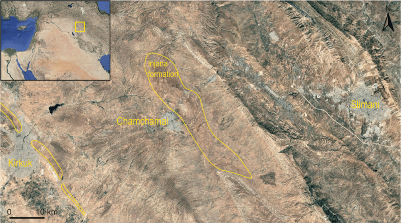
The objective of CraftLand is to investigate the strategies of natural resources exploitation and organisation of pottery manufacture–in relation to other economic productions–in a clay-rich environment in the Chamchamal region. This geological context, known as the Injana formation, extends over approximately 380 km² (figure 1). It is composed of sandstone, siltstone, and high quality claystone, a favourable combination for ceramic production. In Iraq, outcrops of this formation are also found near Kirkuk and the Mosul lake. The study spans from the beginnings of ceramic production to the present day, with particular emphasis on periods of major economic transformations, such as urbanisation and state formation.
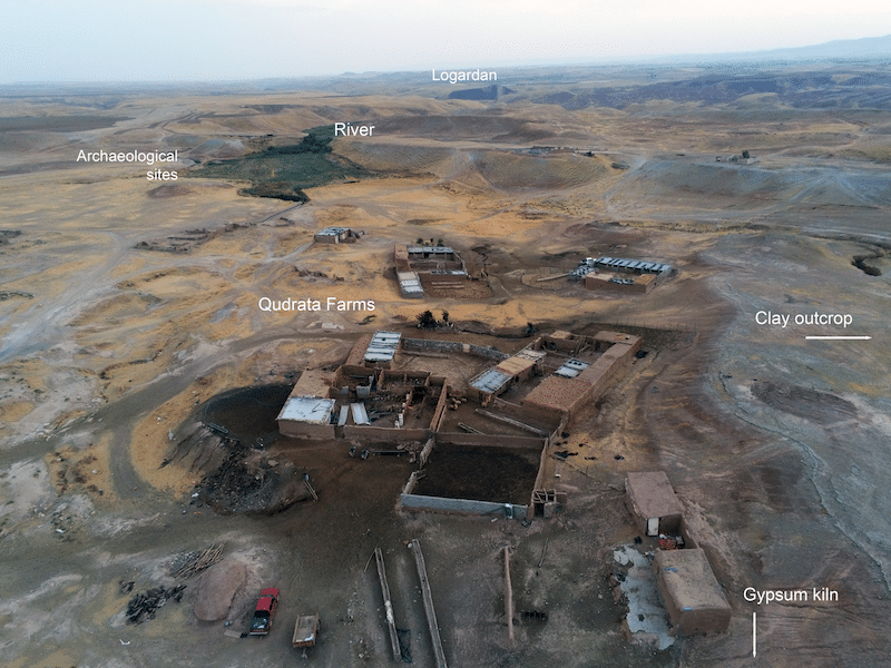
A distinctive feature of the Chamchamal’s Injana formation is its location within a zone close to cultivable lands, mineral and organic resources, formerly adjacent to woodlands, and easily connected to the Bazian Pass, a strategic route through the Qara Dagh piedmonts of the Zagros mountains. The establishment of large-scale ceramic workshops comprising dozens of kilns in the region–such as Logardan in the Early and Middle Bronze Age and Girdi Qala during the Chalcolithic and the Islamic period–suggests that the high quality of these clay resources was already recognised. Today, the Chamchamal region hosts four major brick factories supplying construction materials across Iraq, alongside traditional potters, as well as numerous farmers and pastoralists (figure 2). However, it is unlikely that raw material quality alone accounts for the recurrent and sustainable development of large-scale production in this area.
Pottery was one of the most widely used materials in ancient societies. Its production required raw materials, fuel, workforce, and access routes. CraftLand examines pottery production in its landscape and seeks to reconstruct spatial relationships between production facilities and the natural environment (raw material sources; water; topography), as well as the social and economic contexts (settlement pattern; roads; agricultural, pastoral, and other artisanal activities). Reconstructing these networks provides a valuable framework for understanding the evolution of the production organisation on a regional scale and assessing its impact on the landscape depending on the period.
To address its research questions, CraftLand employs an integrated, interdisciplinary approach organised into three complementary fields of research, with all data consolidated within a single Geographic Information System (GIS). This pilot season has already seen significant progress in the three research areas:
a) Archaeological survey
A GIS with a standardized recording protocol was implemented in collaboration with Jonathan Lisein (Gembloux Agro-Bio Tech Liege University). Thirty sites were identified through satellite imagery and have begun to be surveyed by pedestrian prospection.
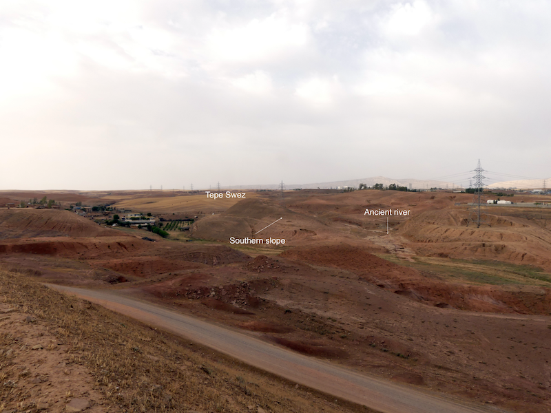
The initial priority was to test a hypothesis regarding the location of large-scale ceramic workshops in order to assess the potential for predicting their spatial distribution. Based on the conditions documented at Logardan, we hypothesized that the establishment of major pottery workshops was contingent upon specific criteria: proximity of less than 5 kilometres to a large settlement occupied at the same period, direct access to a river, and the availability of nearby clay sources. Using the GIS, Tepe Swez, a site meeting these conditions was identified and subsequently surveyed. The site is situated 3.3 kilometers from Chamchamal (ancient Azuhinum), with a river flowing at its base, and in proximity to a clay source (Gurgay Chawsur) that is used by present-day potters. On the gentler southern slope, numerous greenish fragments of large ceramic vessels were documented, together with circular alignments of burned stones organised in terraces interpreted as kiln bottoms (figure 3). Based on the pottery typology, the possible pottery production area most likely functioned during the Middle Bronze Age.
The project’s landscape analyses integrate geomorphology, geology, and vegetation reconstruction to identify natural raw material sources (clay, stone, and bitumen), as well as anthropogenic features (such as basins, clay pits, roads, and field terraces).
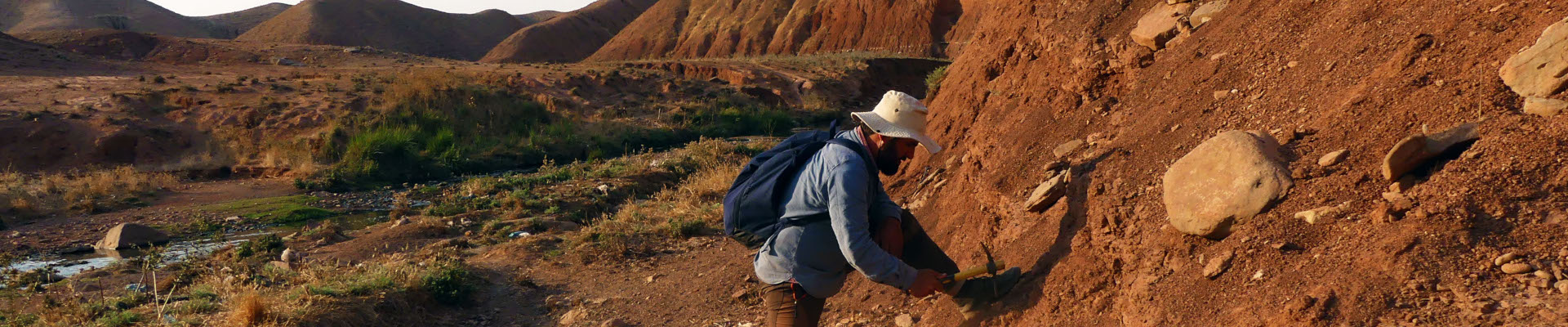
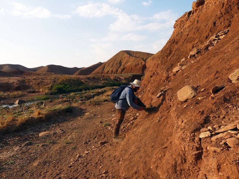
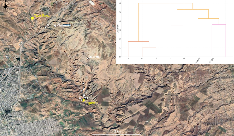
Part of this work began with the investigation of ancient clay extraction sites in the region. During the ethnographic survey (see below), we identified clay outcrops that are currently exploited by traditional potters. These extraction sites are located in close proximity to archaeological sites with important pottery production facilities (Gurgay Chawsur close to Tepe Swez and Qudrata close to Logardan). Samples were collected from these sources. A geological survey was conducted between Qudrata and Logardan in collaboration with Zirak T. Yaseen, geologist at Salahaddin University, in order to to assess whether the clay composition varies or is homogeneous within the Injana formation (figure 4).
The survey documented the accessibility between sites and included sampling of multiple clay outcrops along the way. XRF analyses, conducted by Zirak T. Yaseen at the Salahaddin University in Erbil, provided preliminary results indicating that clay outcrops within the Injana Formation present various geochemical signatures. This suggests the potential to discriminate clay sources (figure 5). In collaboration with the French Archaeological Mission in the Qara Dagh directed by Johnny S. Baldi, ongoing analyses are comparing the composition of a selection of sherds from different stratigraphic levels of Logardan workshop with sampled clays. Ultimately, the possible extraction sites identified through geomorphological analyses by Luca Forti (University of Milan) will be systematically surveyed and sampled to characterize their geochemical composition. The overarching goal is to provide an open-access map of ancient clay extraction sites, including their geochemical profile, to support clay provenance studies in the region.
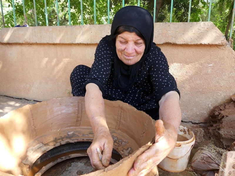
Documentation of the actual clay production system (traditional and industrial) started with interviews using structured questionnaires and observations of practice. The survey seeks to assess the vitality of traditional pottery in relation to local industry, and to investigate sensory-based clay selection and the mechanisms of clay craft knowledge transmission.
Clay products are currently in demand (tannurs, water jars, and even living-rooms faced with unfired bricks) as people want to ‘live as in ancient times’ and maintain cultural traditions. However, local clay products remain relatively expensive–with a tannur costing around 20 dollars–and most pottery sold in local shops is imported from Iran by truck. Despite the renewed interest in ceramics, traditional potters are at risk of disappearing, as many are old and no longer pass on their craft.
The survey enabled the identification of a network of traditional clay artisans. Interviews were conducted in collaboration with Rawa Karim (Directorate of Antiquities of Slimani) and Brwa Raza (Charmo University). Preliminary results suggest that pottery and brick making may have been transmitted vertically, from one generation to the next within the same family, whereas tannur making may be more commonly transmitted horizontally, between neighbours (figure 6).
The decline of traditional pottery production is not only related to economic changes but might also be linked to the region’s recent history of political violence, notably the Anfal campaigns of the late 1980s that killed and displaced thousands of people. Although a potter’s clay source may change–often based on the reputation of the source–potters remain closely tied to their place of birth and initial apprenticeship. Beyond family ties, this connection is probably based on access to other essential ingredients for the clay matrix, such as straw used as a temper, as well as to spaces suitable for firing. Consequently, it is not uncommon for potters to return to their birthplaces to collect straw from family fields, or to stop producing pottery when these fields or firing areas are no longer accessible in their new village. This practice illustrates the deep interconnection between clay production and other economic activities, such as agriculture, as well as the critical role of spatial organisation in sustaining craft traditions. Therefore, the violent disruption of these socio-spatial networks during the Anfal probably contributed to the decline of traditional craft practices.
The results obtained in each research area are highly promising for the regional development of the project. This pilot mission strengthened ties with local communities and enterprises and initiated the survey of archaeological sites. The preliminary results also pointed to possible ways of reconstructing and interpreting production networks through spatial analysis and the recurrence of patterns, as well as through the socio-economic logics observed among present-day potter communities. The backbone of the project is to consider the social ecology of pottery production in its spatial dimension in order to understand long-term transformations in regional organisation. Subsequently, the production patterns documented in the Chamchamal region will provide points of comparison with those of other regions, helping to determine the processes and impacts of social transformations (like urbanisation and state emergence) in contrasting environments. In addition, by emphasizing the long-standing tradition of clay crafts and their influence on the landscape and the regional identity, CraftLand will leverage heritage to foster community empowerment and reinforce connections to the environment.
Joshua Micallef, 2025 P.E. MacAllister Fieldwork Scholarship Recipient. [/vc_column_text][mk_divider margin_top=”10″ margin_bottom=”10″][vc_wp_text]I was part of the TERRSOC ‘Reading’ Ancient Landscapes: Peasant Decision-Making and Terraced Agriculture in Central Palestine over la Longue Duree project. This year’s excavation took place in Jordan, specifically at Tell Hesban and the nearby wadi. Seeing my interest in landscape archaeology, I was assigned to the Wadi Hesban team.
The first week started with a survey of a section of the south side of Wadi Hesban. To say the vistas were breathtaking is an understatement. The landscape is dramatic, with agricultural terraces, both in use and relict, dotting the landscape. The barking of dogs and bleating of sheep and goats is an ever constant companion, and the trickle of fresh water from the local spring is a refreshing contrast to the Jordanian sun. The locals were truly friendly, as is to be expected in this region of the world. We would continue to make local connections, and be offered copious amounts of tea, throughout our time at the wadi.[/vc_wp_text][vc_single_image image=”105402″ img_size=”large” add_caption=”yes” alignment=”center” onclick=”img_link_large” img_link_target=”_blank” css=”.vc_custom_1757089224675{padding-right: 10px !important;}”][mk_padding_divider size=”20″][vc_wp_text]Shunat Dhiab, mentioned in the 1889 traveller’s account of Major C. R. Connor, was identified atop the high grounds, with two water-driven mills of possible Ottoman date located further down the slope of the wadi. During the survey, a number of possible terrace sites for excavation and sampling were identified. After the day’s trek, preliminary Optically Stimulated Luminescence (OSL) dates from the 2024 campaign awaited us at the hotel, and these supported what is known of the occupation of the area.
The second day commenced early, as would all subsequent days. Two trenches, S3 and S4, were opened behind a terrace wall located close to Shunat Dhiab. The work was hard, but always rewarding, and the vistas made the daily trek up to the site worth the effort. The trenches would continue to be excavated in the next three days, reaching depths of around two metres. Sampling commenced on trench S3 on day four. Samples for various analyses, such as soil biomarkers, OSL dating, soil texture, and microbotanical analysis, were collected. On day five, due to the absence of two of the team members, it was decided to postpone sampling of trench S4 to the second week of excavations. Thus, day five saw the opening of trench S5 lower down the slope of the wadi, below a terrace wall located close to the presumed older of the two water-driven mills. By the end of the day, the trench had reached over a meter in depth.[/vc_wp_text][vc_single_image image=”105403″ img_size=”large” add_caption=”yes” alignment=”center”][mk_padding_divider size=”20″][vc_wp_text]Week two continued in much the same vein. The first day commenced with the sampling of trench S4, with another OSL sample being taken from trench S3. At trench S5, the first OSL sample was taken from under the terraced wall. Day two saw the continuation of sampling in trench S5. One of the team members also commenced a survey of the high ground of the wadi around Shunat Dhiab. Several other structural remains, architectural fragments, and rock cut features had been observed in the area during the first week, and these were mapped via GPS points. The day ended with a search for a possible location for trench S6. Two potential sites were identified further down the wadi slope in an area that is actively cultivated. Day three commenced with photogrammetry of trench S5, which was eventually followed by drone flights to photograph the area of the wadi under investigation, creating an orthophotograph. Trench S6 was also opened after discussions with the landowner, who was more than willing to allow us to investigate and dig along the terraced walls of his field. On day 4, the final day at the wadi, trench S6 was completed, documented, and sampled.
It was undoubtedly a rewarding two weeks, though the rugged terrain and steep slopes did make the going quite tough at times. The views at the wadi were a reward in themselves, and few things could beat the sight of the sun still rising over the wadi at 6 am. The hospitable and helpful nature of the locals was also without measure, and in part, the successful completion of these two weeks could not have been possible without the Jordanian locals.[/vc_wp_text][vc_single_image image=”105270″ img_size=”large” add_caption=”yes” alignment=”center” onclick=”img_link_large” img_link_target=”_blank” css=”.vc_custom_1756908305317{padding-right: 10px !important;}”][mk_padding_divider size=”20″][vc_wp_text]The experience was undoubtedly illuminating and fulfilling. It gave me the opportunity to work closely with individuals from different countries and experience Jordanian culture and hospitality. The multi-cultural aspect of the team was truly an experience I will hold dear to me. I have also gained further hands-on experience, and especially important to me was the landscape element and the sampling of soil for various scientific tests. Sampling for OSL was particularly illuminating, with the need to ensure the sample was not exposed to light.[/vc_wp_text][mk_padding_divider size=”20″][vc_single_image image=”105404″ img_size=”medium” add_caption=”yes” alignment=”center” onclick=”img_link_large” img_link_target=”_blank” css=”.vc_custom_1757089432627{padding-right: 10px !important;}”][mk_padding_divider size=”20″][vc_wp_text]
Joshua Micallef has pursued various careers, including in the financial services sector and software testing. As of 2020, he studied at the University of Malta, attaining a BA in Archaeology (Hons) with Geography, and is currently reading for an MA Asian Studies: Islamic Archaeology at the University of Bonn. His main area of interest lies in the Medieval period of the Central Mediterranean.
[/vc_wp_text][mk_divider][vc_wp_text]
Want to help more students and early career archaeologists get into the field? Donate to the cause today by selecting “Fieldwork Scholarships” as your gift purpose!
In the bustling center of metropolitan Athens, the sounds of city life blend with those of pickaxes striking the earth, brushes revealing beautiful artifacts, and—of course—ceaseless debate as to whether the soil is indeed greyish-brown or brownish-grey. For nearly 100 years, the American School of Classical Studies at Athens has helmed the excavations of the Athenian Agora. Each year, students and professionals from across the world flock to Athens to excavate one of the most important sites in the Greek world. This year, I had the opportunity to work at the Agora as an assistant supervisor and take an important step in my career as an archaeologist.
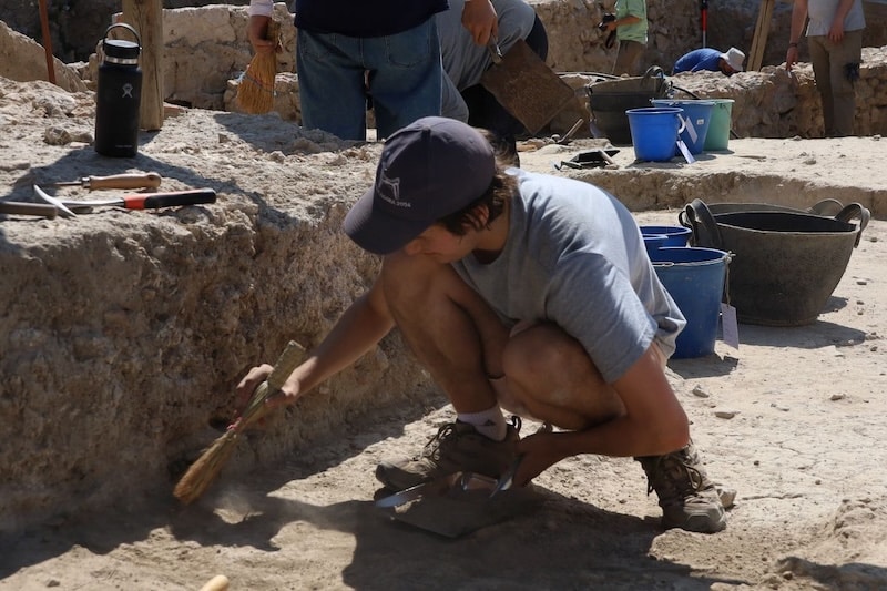
The most important part of excavation is sweeping... though perhaps not the most exciting. Photo by Luis Rodriguez-Perez (UCLA).
I excavated at the Agora for the first time as a volunteer in the summer of 2024, just before beginning the final year of my undergraduate education. While I had prior excavation experience, I could never imagine how impactful it would be on my development as an archaeologist. As a site that practices total collection of material—even plastic—I gained a breadth of archaeological experience. In addition to dry sieving all of the excavated material, we took samples for archaeobotanical flotation. We placed the soil we collected in a basin of water, so we can keep even the smallest seeds. The emphasis on professional skill development and intellectual growth at the Agora made me fall in love with the site, the project, and the people. But the most important lesson came this year, when I learned to be a leader.
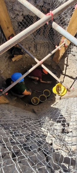
My supervisor, Katrina Kuxhausen-DeRose (UCLA), and I excavate in a pit deep beneath the surface. Photo by Luis Rodriguez-Perez.
When I was invited to return to the Athenian Agora as an assistant supervisor, I knew there was nothing I would rather do with my summer. As excited as I was, I was also quite nervous to enter a leadership position like this for the first time. I was younger and had less field experience than many of the volunteers. For the first few weeks, I maintained a perpetual state of anxiety about making a mistake or revealing to others that I was unsure of myself. In the field, we have to pay close attention to changes in the soil to determine whether the deposit we are excavating has changed. In the particular Ottoman context we were excavating, we battled these soil changes ferociously, having to remain eagle-eyed for even the slightest change in color or texture—not an easy task. For the first time, I found myself in a position where people around me asked what I thought was happening; often, I had no clue. As a born perfectionist and someone deeply invested in the work I do, this was frequently anxiety-inducing—as I’m sure anyone starting a new job has experienced. But, as is often the case, this discomfort provided an outlet for growth.
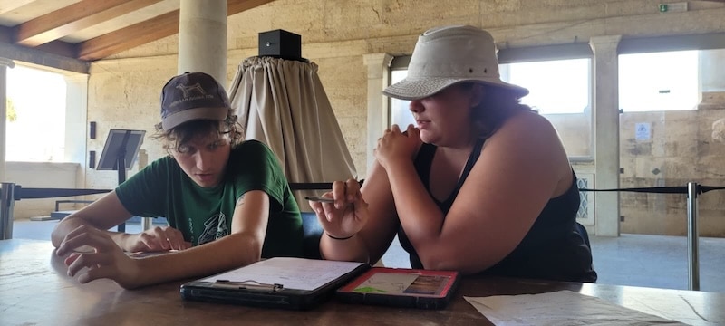
Katrina shows me the logistics of processing finds at the end of the season. Photo by Luis Rodriguez-Perez.
Perhaps the most important thing I learned was to be comfortable being wrong, not knowing the answers, and owning mistakes. In turn, letting go of the need to be right and the fear of making a mistake allowed others at every level of experience and every age the space to be wrong too; it allowed us all to be able to learn from each other. At the Agora, our field director, Dr. Debby Sneed, consistently emphasized to us that mistakes are an opportunity to grow, not a source of shame. This summer, learning to be wrong made me more confident in myself, more able to learn from others, and a better archaeologist altogether.
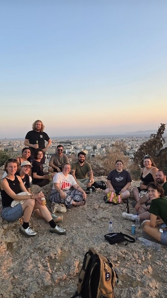
My friends and I celebrate our last night in Athens atop Philopappos Hill, or the Hill of the Muses. Photo by Daisy Wang.
Anyone who has participated in archaeological fieldwork knows that it is an opportunity for personal discovery just as much as it is for professional growth. Over two short months, I grew like a wild herb nurtured by the Greek sun, soil, and incredible archaeologists around me. I am forever grateful for my time at the Athenian Agora, and look forward to what comes next.
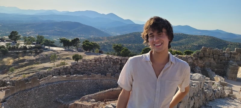
Next to Grave Circle A at Mycenae, I am reminded of why I love what I do so much. Photo by Luis Rodriguez-Perez.
Aidan Gregg is a first-year PhD student in Classical Archaeology at the University of California, Berkeley, and a graduate of Butler University. He is interested in the archaeology of burial, gender, and archaeological theory in the Aegean Bronze Age. He has participated in excavations at Ancient Nemea and the Athenian Agora and worked on material from Petsas House at Mycenae, the Bronze Age cemetery at Aidonia, and the Northeastern cemetery of Thebes.
Want to help more students and early career archaeologists get into the field? Donate to the cause today by selecting “Fieldwork Scholarships” as your gift purpose!
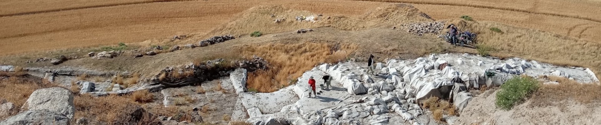
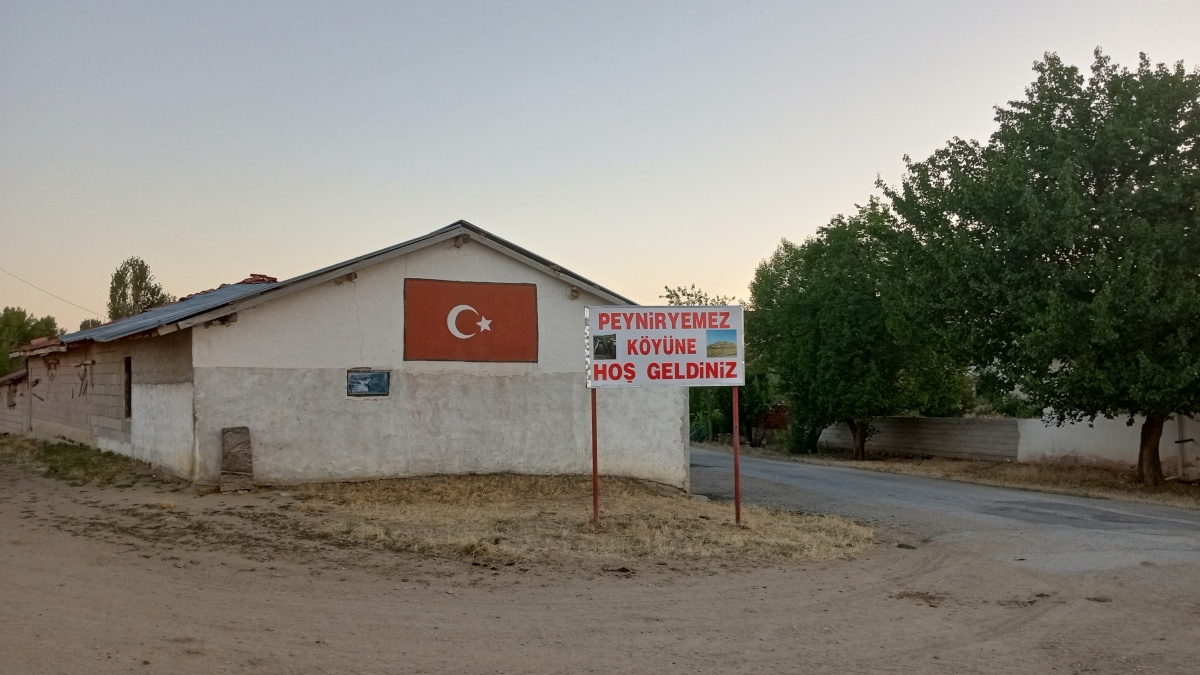
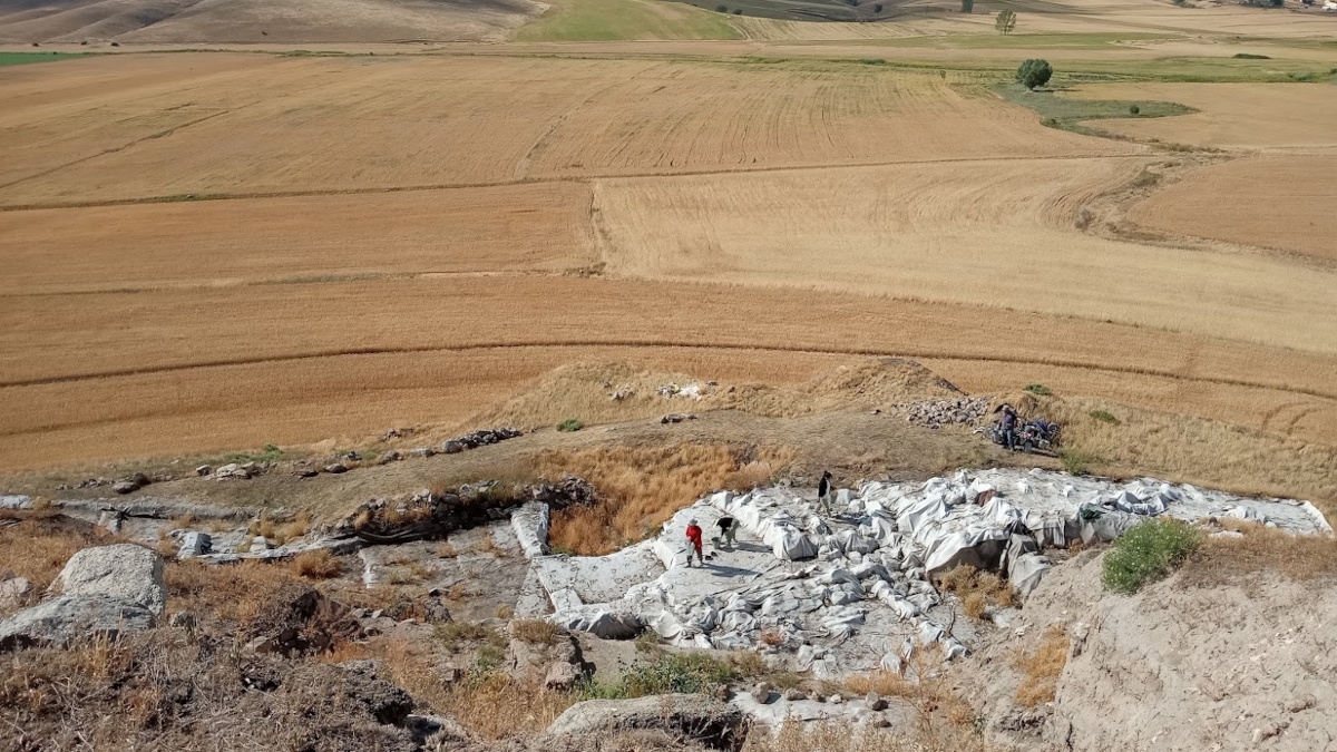
Within the village of PeynirYemez in Türkiye is an archaeological excavation site named ÇadırHöyük – an artificial mound that boasts roughly 7,000 years of human history. Evidence of human occupation on the mound comes in many forms. From pottery sherds, burials,and stone walls to glass beads and lithics, this site was once full of human activity. Yet themound was populated by more than just homo sapiens. Animals of a wide variety were present, and their bones help tell us the human story.
During the summer of 2025, I had the privilege of working at ÇadırHöyük with Dr. Sharon R. Steadman (my professor, advisor, and the Project Director of ÇadırHöyük) and a wonderful team of specialists, professors, researchers, students,andTurksfor aboutsixweeks. We worked six days a week and had Thursdays off – although many of us still found ourselves seated at our lab stations attempting to make the most of our fleeting time there. The days were long and hot.I spent my mornings in the field excavating and my afternoons in the lab analyzing faunal remains.For the season, I would be working by myself with faunal remains. I had spent the beginning of the year teaching myself about animal anatomy and specifically researching the species of animals that have been previously recorded at the sitein preparation for this project.
Excavating at ÇadırHöyük was a unique experience. I was there with three other students from SUNY Cortland,and we were some of the first people to arrive. We opened many of the trenches for the season and I learned a greatmany skills and techniques.For instance, we took elevations from the trenches using an auto level on a tripod with a level rod and we learned to avoid bug bites by tucking our pants into our socks. Sometimes, it was the not-so-technical training that would prove most useful. There were, in fact, a lot of large bugs and spiders.
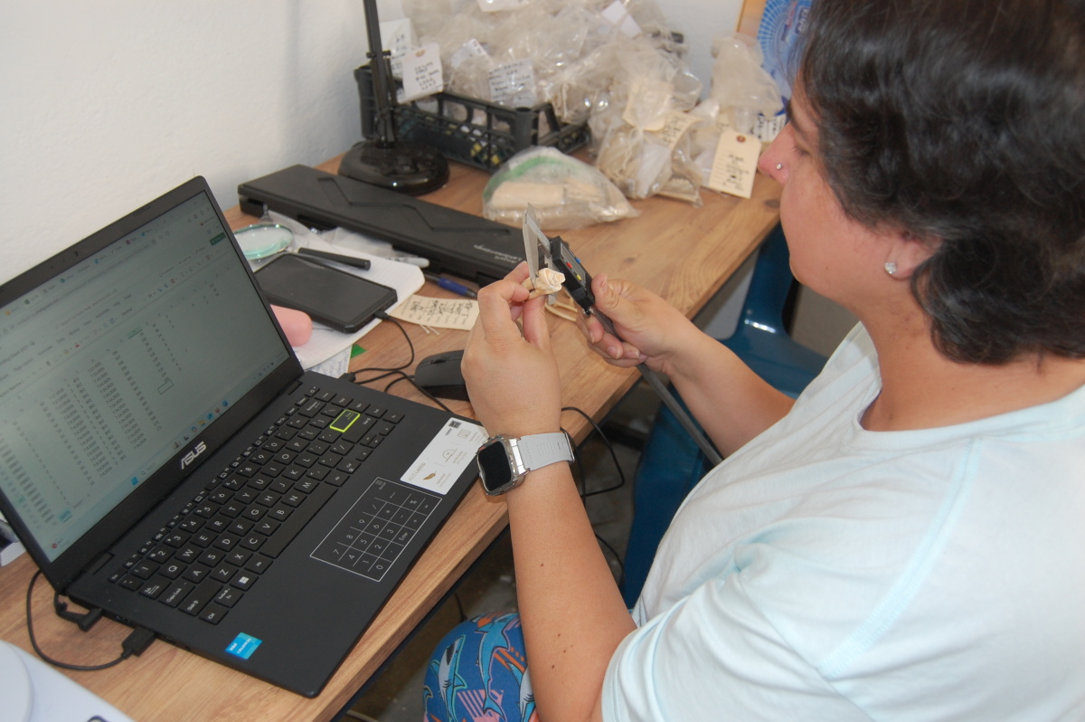
Not long after arriving at the site, a database and its recording protocol was sent to me created by Dr. Benjamin Arbuckle who published several works regarding faunal analyses at ÇadırHöyük. Dr. Arbuckle has been an integral part of the project as the Assistant Director since 2009. His publications and the recording sheets he sent were extremely helpfulbecause I did not even know where to start or what to look for in terms of documenting. My education has been solely focused on human bones – identifying, classifying, measuring, determining pathology and trauma, and so forth. This summer, I excavated and evaluated hundreds of bones, but the vast majority of them were from animals. The exciting thing about animal bones is that not only are they all so incredibly different from kingdoms down to specific species, but even within speciesso much variation still exists. I honestly do not know how zooarchaeologists are able to store allthatinformationin their heads. It is quite impressive! Taking on Dr. Arbuckle’s database was challenging, important work for which I have great respect.
Animal bones differ from human bones in many ways. To give you an idea, animals tend to have many of the same bones that humans have but the shapes of those bones vary. This is in part because some become fused together, like a radius and ulna. Also, some animal bones are more curved or twisted because their muscles attach differently. Bird bones are mostly hollow, making them light enough to take flight. There are caudal vertebrae which make up animal tails, phalanges of hoofed animals, tusks, and a wide array of tooth types. Then there are horns or antlers or carapaces and plastrons to consider – because when you study the nonliving EVERY remnant is an important clue. All these unique traits are actually little hints that zooarchaeologists find and put together to create a complete picture of the animals that were present.
Identifying the animal is only the first step. From this information, we can find MNI, NISP, look for age, sex, signs of trauma, and pathology. Then we can infer much more, such as butchering methods, husbandry, and timelines of domestication and agriculture. All of this informs archaeologists of the people of the past. Much of my time in the lab was spent interpreting the remains and recording the data. Despite my best efforts, there are still a lot of bones to be identified and recorded. So, next summer, the work will continue.
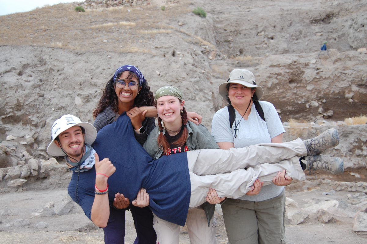
Team members at Çadır Höyük, Turkey.
From beginning to end, I had the opportunity to work with a wide range of peoplefrom all over the world, each driven bydifferent motivations. All hadgravitatedto this same small spot on our planet to come together for a season in a small village in central Türkiye to dig. And though I hope to meet and network with many of these professionals in the future, the Turkish people hold a special place in my heart.My time in PeynirYemezwas certainly a unique experience and I will cherish the friends and memories I have made. I will take with me the lessons I learned both in the field and the lab and use them in my next excavation experience. Understanding animal remains and being able to identify them will prove useful in my future endeavors by allowing me to understand relationships between persons and pets and sacrifices.It is my hope that the work I completed at the site proves useful in the future.I am grateful to have played a part in the research at ÇadırHöyük in the summer of 2025.
Anjuli Latchmansingh is a senior at SUNY Cortland majoring in archaeology with a minor in forensic anthropology. Her focus is on bioarchaeology with a special interest in mortuary archaeology. Anjuli has served as Archaeology Club president at Cortland, has been inducted into three national honor societies, and is currently working on her honors thesis.
Want to help more students and early career archaeologists get into the field? Donate to the cause today by selecting “Fieldwork Scholarships” as your gift purpose!
The Trustee Nominations Committee announces an open call for (self) nominations for the ASOR Board of Trustees (Class of 2028). Trustees will serve a three-year term, starting January 1, 2026. There are three primary responsibilities of the members of the Board of Trustees:
Governance: Being aware of issues brought forward to the Board, attending two meetings per year (at your own expense), and bringing issues of concern to the Board.
Fundraising and financial management: Leading in development by thinking of new opportunities, leading in giving, and providing oversight on the audited financial statements. We ask that individual trustees aspire to contribute $500 or more annually.
Strategic planning and policy development: Leading especially in measures that accord with ASOR’s mission.
We anticipate two openings for Membership-Elected Trustees. Any full ASOR member may be considered for nomination as an Membership-Elected Trustee. If there is someone that you would like the committee to consider—including yourself—please send the person’s name and email address to Marta Ostovich in the ASOR office. Please check with the nominee as to whether they are interested in serving on the ASOR Board of Trustees before sending in their name. If you have any questions about the responsibilities and satisfactions of being a board member, please email Kathryn Grossman, Chair of the Trustee Nominations Committee.
The ASOR office, or a representative from the Nominations Committee, will contact all nominees to describe the responsibilities in greater detail, and to make sure that the nominee is willing to have his or her name discussed by the Trustee Nominations Committee. Please note that nominees will need to submit a brief biography and a mission (or vision) statement for what they would like to accomplish as a trustee to be considered by the Nominations Committee. A sample of these statements can be found in last year’s “Meet Your Board Nominees” webpage. Brief biographies and mission statements should be ca. 200 words each and submitted via e-mail to Marta Ostovich by noon EDT on Monday, September 22, 2025.
After the Committee selects individuals for nomination, the election will take place by electronic ballot during October. ASOR is once again conducting online voting to ensure that more of our members are able to participate in this important process. The ASOR office will work with any person who is not able to complete an electronic ballot to ensure that everyone is included.
In order to receive full consideration by the committee, nominations (including supporting documents) should be submitted to programs@asor.org by noon EDT on September 22, 2025.
2025 Shepard Urgent Action Grant: The Al Haniyah Emergency Documentation Project
Julia Nikolaus (Ulster University), Nick Ray (Ulster University), Ahmad Emrage (University of Benghazi)
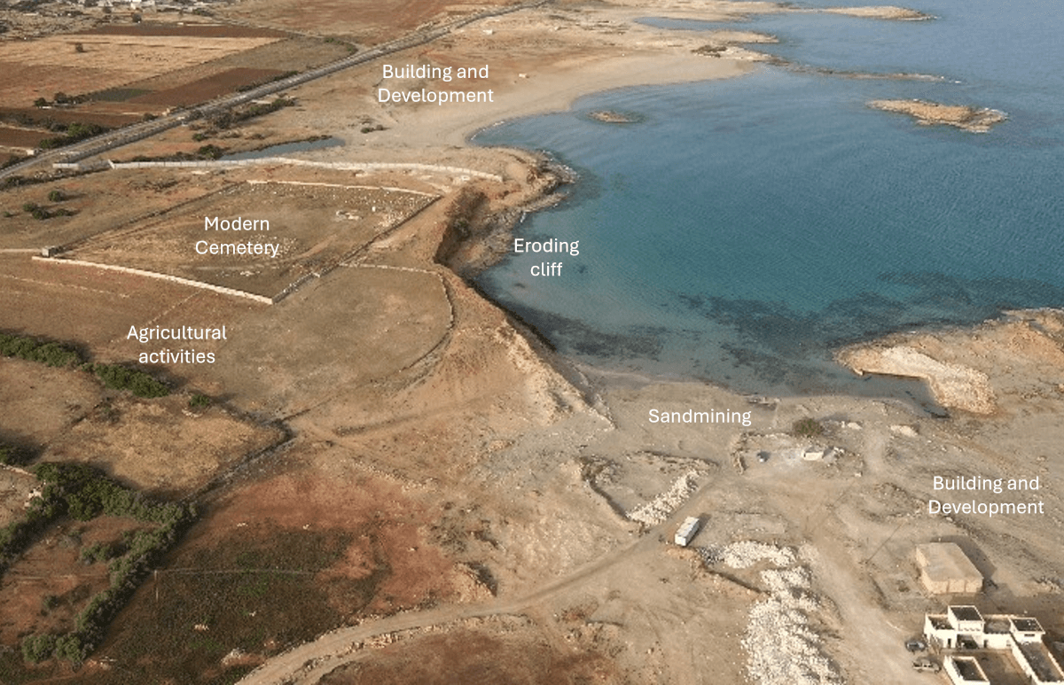
In 2025, with the support of the Shepard Urgent Action Grant, an international team of archaeologists completed a critical emergency documentation project at the endangered site of Al Haniyah (ancient Aptouchus), on the Cyrenaican coast of Libya. This urgent initiative responded to escalating threats from coastal erosion, unregulated agricultural development, and expanding infrastructure—pressures that have already caused widespread and irreversible damage to the site(Figure 1).
Figure 1: Drone image of Aptouchus showing threats and damages to the site.
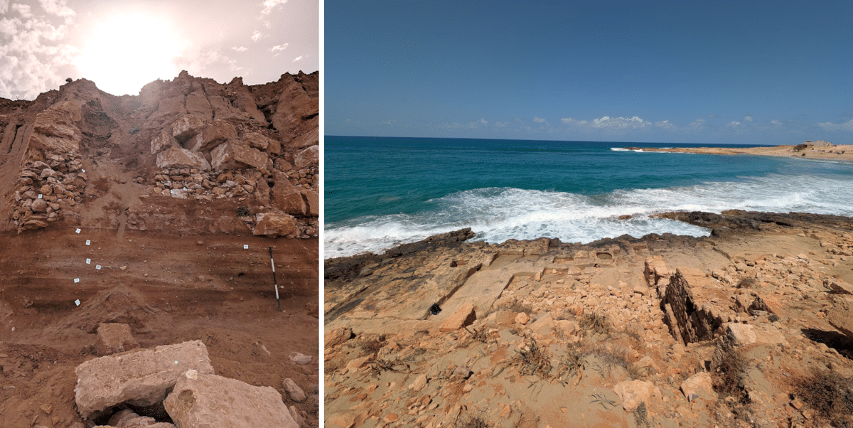
Aptouchus is a coastal harboursettlement dating to the Greek,Roman, and Late Antique periods. Though modest in size, covering approximately four hectares, the site played an important role in regional maritime activity and trade. Archaeological remains include Roman-period industrial features such as vats, tanks, and large building foundations, as well as domestic structures with plastered walls and finely worked stone masonry. These are now visible along an actively eroding cliff edge (Figure 2). Ceramic finds, including fragments of black-glazed pottery, point to activity as early as the Archaic period. In antiquity, the harbour was naturally sheltered by a rocky outcrop connected to a central islet, creating a protected anchorage for vessels. Today, parts of the ancient settlement lie beneath modern buildings and an Islamic cemetery, adding further complexity to the site’s preservation.
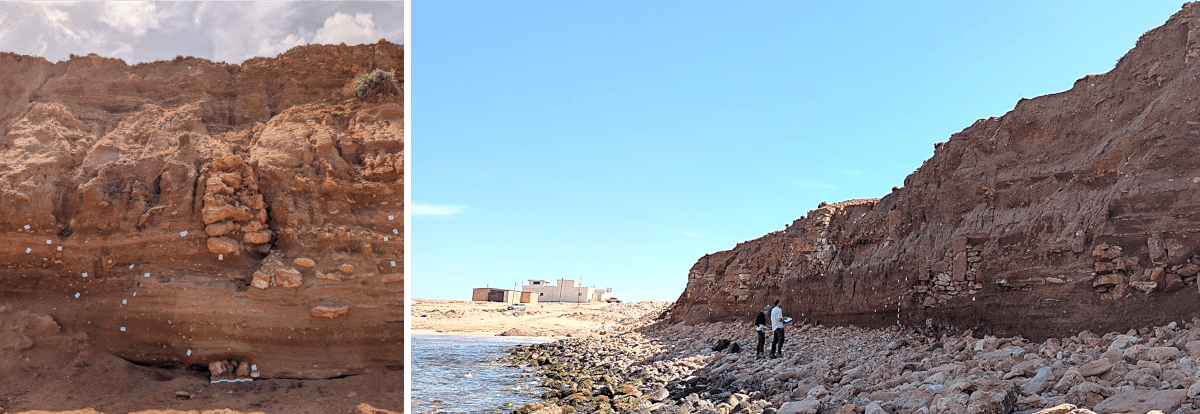
Figure 2: Left - walls protruding from the eroding cliff face; Right - industrial installations and buildings.
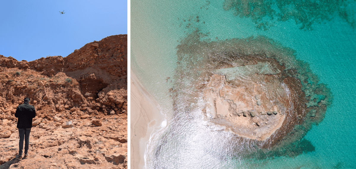
During the 2025 field season, a team of specialists from Ulster University (UK), the University of Benghazi (Libya), the Libyan Department of Antiquities, and the Alexandria Centre for Maritime Archaeology & Underwater Cultural Heritage (Egypt),undertook a multi-faceted programme of recording and documentation. The team began with a detailed site survey, identifying and mapping architectural features as well as recently disturbedareas. High-resolution drone photography was used to create 3D digital models of the site and surrounding terrain, including the vulnerable cliff face (Figure 3). These models will serve both as an archival record and as a baseline for monitoring ongoing change.
Figure 3: Left - our drone pilot at work; Right: drone shot of one of the islets with industrial features that formed part of the harbour.
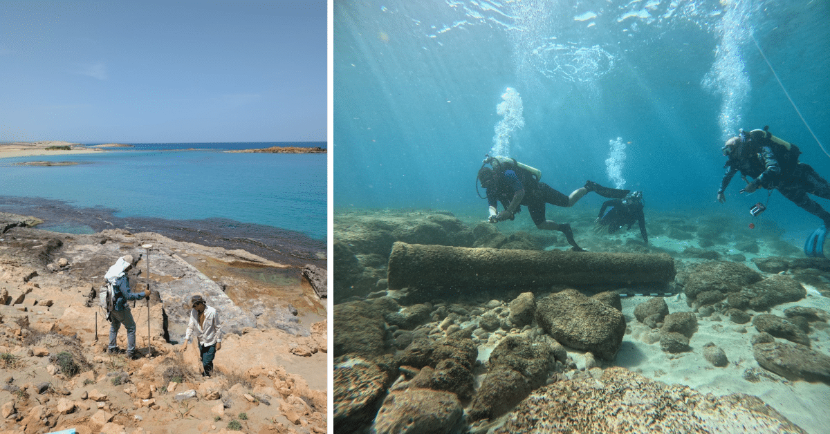
Terrestrial documentationfocused on areas under the most immediate threat, especially where bulldozing had exposed ancient structures. These were recorded using differential GPS and photogrammetry, ensuring accurate spatial documentation. In parallel, a preliminary underwater survey examined submerged archaeological features of the harbour(Figure 4). Several stone blocks and cut features were identified, consistent with ancient maritime use.
Figure 4: Left - DGPS recording of visible architectural features; Right - Underwater survey of harbour area with submerged broken granite column.
A key component of the work involved recording the exposed stratigraphy of the eroding cliff. Here, archaeological layers are visibly collapsing into the sea at an alarming rate. Detailed photographic and written records were made of these sections before they are lost (Figure 5). Pottery recovered from these layers will contribute to establishinga more precise understanding of the site’s chronology.
Figure 5: Recording the visible stratigraphic layer of the 120 m long cliff face.
This emergency project represents a crucial step in preserving the cultural heritage of Aptouchus. It has produced a lasting record of a site under immediate threat and drawn attention to the broader challenges facing Libya’s coastal archaeology. The documentation gathered will not only support future research into the economic and social dynamics of smaller ancient harbours but also underline the importance of protecting vulnerable heritage landscapes across the region.
The Officers Nominations Committee of ASOR announces a general call for nominations and applications for individuals to be considered for the position of Vice President of the Corporation. This is a three-year term of office beginning on January 1, 2026 and ending on December 31, 2028. A general description of the Office of Vice President and its responsibilities is in the ASOR Bylaws, available on the ASOR website (see Article IV, Section 4.7). Nominating an officer is an important way for members to participate in the governance of their organization, and we encourage you to self-nominate or nominate others. All ASOR Members in good standing are eligible for nomination as Vice President.
The Vice President’s primary responsibilities are to chair the Chairs Coordinating Council and serve on ASOR’s Executive Committee. The Vice President will also perform additional duties as the Board of Trustees, the Executive Committee, the President, or the Board Chair may prescribe from time to time. In the event that both the President and Chair of the Board are unable to be present to discharge the duties of the President, the Vice President shall perform the duties of the President until a new President can be elected. The Vice President agrees to attend three meetings each year at his/her own expense: the ASOR Board of Trustees meetings in November and May, and the Executive Committee retreat in January or February. General information on ASOR’s mission statement, bylaws, and strategic plan can be found on the ASOR website.
Submit inquiries and nominations via Google Form to Bob Mullins (ramullins@apu.edu), Chair of the Officers Nominations Committee. Review of applications and nominations will begin on August 15, 2025 and continue until the position is filled. The Officers Nominations Committee expects to present a nominee for Vice President to the ASOR Board of Trustees for a vote during the November 23, 2025 Board meeting in Boston, MA. Nominations should include the candidate’s name, a one-paragraph academic biography – including membership and activities in ASOR, a brief statement as to why the candidate would be appropriate for the position, and the candidate’s contact information. Self-nominations including the same information are encouraged. The Officers Nominations Committee will ask semi-finalists to submit a CV and vision statement.
ASOR is an Equal Opportunity Employer. ASOR affirms its commitment to equality of opportunity and pledges that it will not practice or permit discrimination in employment on the basis of race, color, gender, national origin, age, religion, creed, disability, veteran’s status, sexual orientation, or gender identity. The Board actively seeks candidates who represent the diversity within its membership for positions of leadership.
As you embark on fieldwork and research this summer, ASOR invites you to make Dig Diaries and submit them to our Virtual Archaeology Initiative.
Dig Diaries can be any of the following (coordinate with your project director(s) to ensure their permission):
1) a short teaching video that explains a specific process or element of an excavation/survey, how that element fits within the overall objective of the project, and/or how it fulfills some responsibility that we as archaeologists have to study, preserve, document, and make accessible the materials we excavate;
2) a video field diary recording in which you discuss research questions for your given project/season along with progress reports throughout the season to show how those research questions are met and/or how they change; 3) a digital image with explanation of the pictured stratigraphy/object/etc.
Check out our current submissions on YouTube or TikTok for examples. We are also open to other kinds of virtual assets, so if you have a great idea, please feel free to share it with us. We hope that you choose to join us in developing Virtual Archaeology at ASOR. Submissions and any questions can be directed to info@asor.org.
Developed by ASOR’s Membership & Outreach Committee, the Virtual Archaeology Initiative is a growing collection of digital resources that illustrate or teach various steps involved in the archaeological process. In addition to creating teaching tools that will benefit students/educators and generate interest in archaeology, this will allow people who cannot or would not participate in actual excavations to feel as if they still can. Read more about the Virtual Archaeology Initiative here.
Aayush Umesh, 2025 Eric and Carol Meyers Fieldwork Scholarship Recipient
A year ago today, I had no idea that I would become an Islamic archaeologist. My path has been full of twists and turns. In the last four years at the University of Georgia, I have completed a bachelor’s degree with double majors in theatre and communication studies and a minor in Arabic. I entered college with ambitions to attend law school. Eventually, however, I found archaeology, and tried my hand at excavation last summer at Antiochia ad Cragum, Türkiye. I fell in love and attended both the ASOR and AIA Annual Meetings in 2024 and 2025, respectively. At the ASOR Annual Meeting, I met Professor Bethany Walker, the head of the Islamic Archaeology Research Unit at the University of Bonn. Upon meeting her and listening to the work of her graduate students, the next segment of my path had been illuminated. I decided to pursue the MA in Islamic Archaeology at the University of Bonn and to accompany the university for fieldwork at Tall Hisban, Jordan, from May 18-29, 2025.
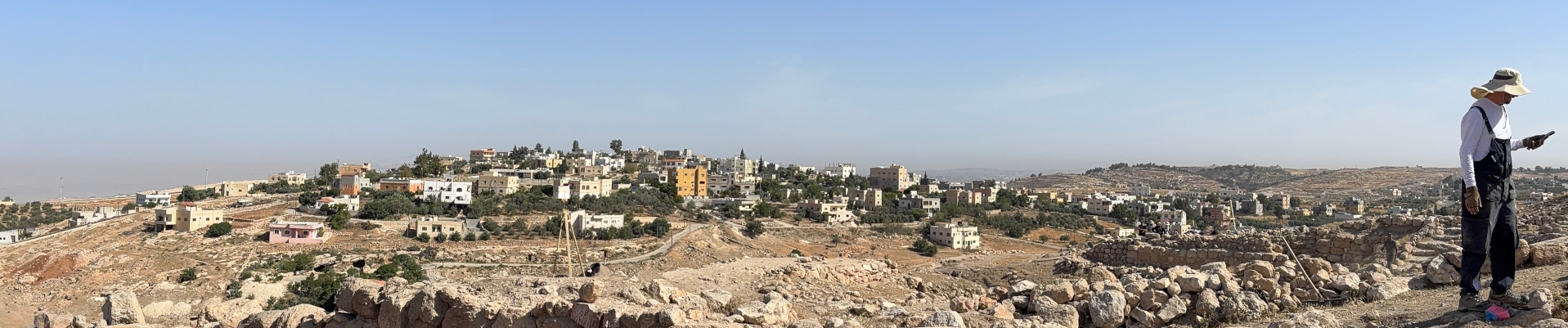
A panoramic view from Tall Hisban.
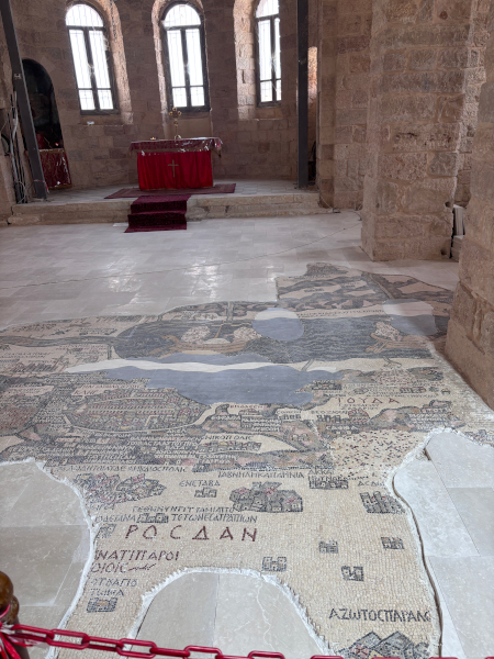
Madaba Map on the floor of the St. George Greek Orthodox Church.
Tall Hisban is around a 30-minute drive from Madaba, the “City of Mosaics” that houses the Madaba Map (the oldest surviving cartographic depiction of the Holy Land as a large floor mosaic on the floor of the St. George Greek Orthodox Church). Madaba today is a vibrant city boasting harmonious Christian and Muslim communities, spectacular archaeology, delicious Jordanian cuisine, talented mosaic artisans, and proximity to the capital city of Amman (which is less than an hour’s drive). Our team stayed at Salome Hotel, a gorgeous accommodation for guests in Madaba with simple yet beautiful amenities and a kind, hospitable staff.
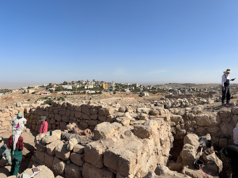
Tall Hisban is a breathtaking site with millennia of occupation, with excavated material culture representing periods from Paleolithic to Late Islamic. A stroll through the site takes one up Roman stairs to Byzantine houses, through Islamic bathhouses reusing Christian baptismal basins to the entrances of previously settled underground cave systems. Old and new are engaged in a remarkable dance at Tall Hisban, best captured by the abundant spolia utilized in its diverse features’ constructions as well as in the tell’s modern residential surroundings.
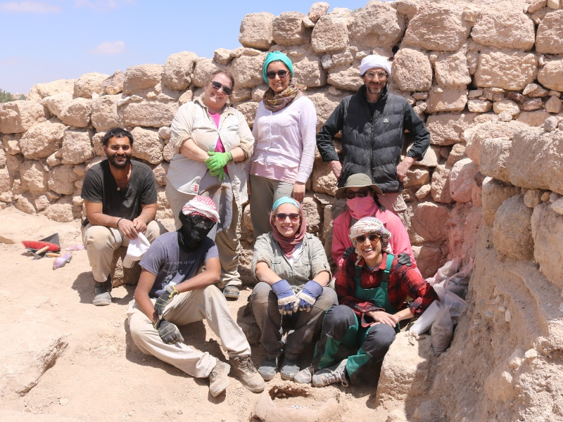
Me and some teammates in our square.
I was assigned to a square which had been identified in a previous season as an Ayyubid-era kitchen. Our goal was to continue excavating this square, passing the Ayyubid layer and investigating those beneath to determine the usage of the space in earlier Islamic eras. Our objective this excavation season was to gain a better understanding of the dietary practices of the inhabitants of Tall Hisban by comparing data procured at the tell to data procured at a nearby wadi (valley) that had been historically used for agricultural purposes. As such, many soil samples were taken during excavation for botanical analysis, particularly in areas high in charcoal or surrounding excavated cookwares. Some of the most outstanding discoveries were tabuns, or traditional clay ovens, which contain a multitude of data.
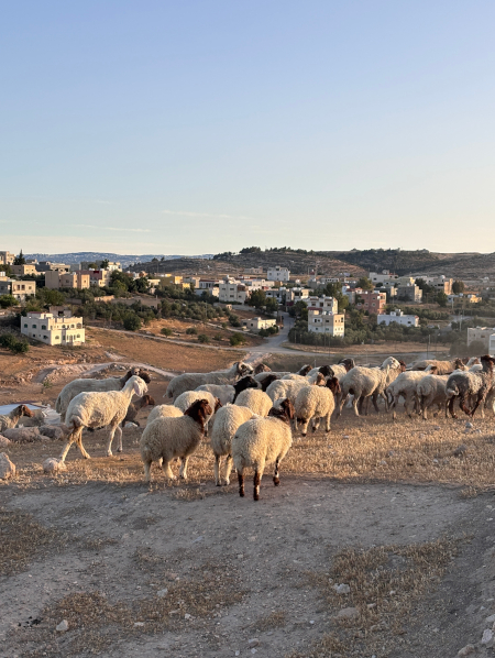
Sheep would greet us each morning at the site.
Upon returning to the hotel each afternoon, the group would reconvene for pottery washing and counting after a nap. It was inspiring watching Prof. Walker identify the period or region of any given sherd in seconds! Pottery washing was a great educational experience because I was able to acquaint myself with many types and periods of wares including Byzantine, Umayyad, Abbasid, Ayyubid, Mamluk, and Fatimid.
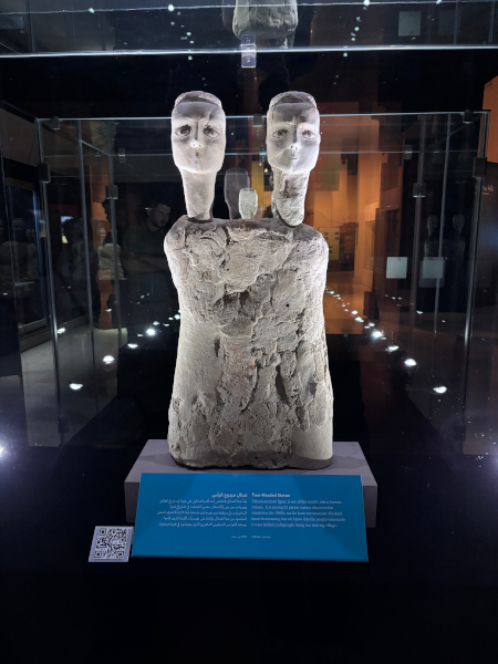
Having completed a minor in Arabic at UGA, I was thrilled to have this opportunity to develop my skills in spoken Arabic, particularly in the Jordanian dialect. I learned many helpful field vocabulary words from Jordanian workmen onsite including the words for trowel, pottery, shovel, dustpan, glass, pickaxe, and more! The team had one free weekend, and while most used this time to visit Petra, I decided to visit Amman instead with Prof. Walker and another teammate. We spent some time at the Jordan Museum, where I was able to stand just inches away from both the Dead Sea Scrolls and the Ain Ghazal statues. We then visited the Amman Citadel as well. The Jordan Archaeological Museum is located on the citadel, and features excavated artefacts from Tall Hisban and many other sites in Jordan.
The Ain Ghazal statues at the Jordan Museum.
My time at Tall Hisban was nothing short of life-changing. Through this experience, I made over a dozen friends at the University of Bonn, which will make my transition far easier as I relocate to Germany this fall. I am thrilled that I have found my path—Islamic archaeology—and have been given the opportunity to study with one of the world’s leading Islamic archaeologists. I look forward to returning to Tall Hisban in future excavation seasons and continuing the work that we did this summer.
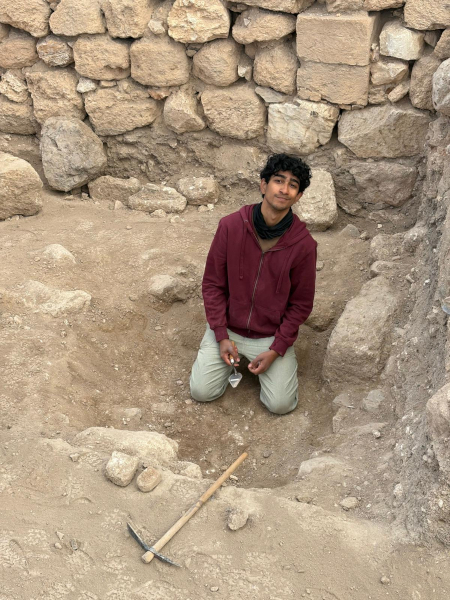
Me in the field!
Aayush Umesh is a recent graduate of the University of Georgia with a Bachelor of Arts in Theatre and Communication Studies. He hopes to become a professor in Islamic archaeology at a major research university, focusing in the Levant and/or South Asia. He will soon begin a Master of Arts degree in Islamic Archaeology at the University of Bonn, supervised by Prof. Bethany Walker.
Want to help more students and early career archaeologists get into the field? Donate to the cause today by selecting “Fieldwork Scholarships” as your gift purpose!






 The Trustee Nominations Committee announces an open call for (self) nominations for the ASOR Board of Trustees (Class of 2028). Trustees will serve a three-year term, starting January 1, 2026. There are three primary responsibilities of the members of the Board of Trustees: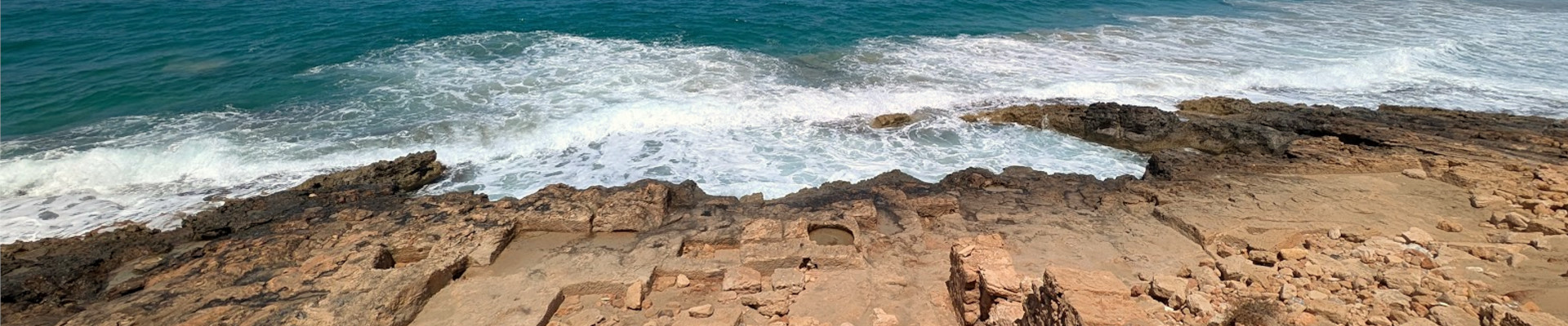
 As you embark on fieldwork and research this summer, ASOR invites you to make Dig Diaries and submit them to our