Mapping it Out: Geo-Referencing Data from the Erbil Plain
Sebastian Millien, 2021 Strange/Midkiff Families Summer Stipend Recipient
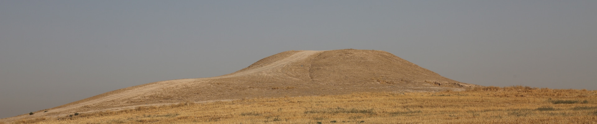
Aliawa (Site 246). Photo courtesy of the Erbil Plain Archaeological Survey.
This summer, I worked with Dr. Jason Ur on the Erbil Plain Archaeological Survey Project. The project was focused on the Kurdistan region of Iraq, particularly the Erbil Plain. An archaeological survey was done on large mounds and the surrounding environment, and the landscape was captured was drone and satellite imaging. As a result of the surveys, a large amount of data has been collected thus far. These include images of different artifacts collected from the location (mainly pottery shards from the mounds) as well as drone images of the various sites and lots surveyed in the region. Dr. Ur’s goal following this large collection of data was to build an interactive and collaborative web dashboard where the drone and satellite images could be geo-referenced on a GIS map. These images would be linked to the sites they came from, as well as the photos of the pottery shards from that respective site. In other words, the objective was a massive processing of the archaeological finds to make the data more accessible to everyone involved in the project and correlate the data to physical location on the site.
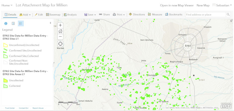
My role in the project was to categorize and label the different data so that I could then input it into the dashboard. The images of the pottery shards had to be re-named to correspond with the site and lot they were collected from. Additionally, the images of the sites from the drones needed to be matched with the locations on the GIS map. Once I had all the renamed and categorized, I then uploaded them into the lot attachment map. This data would then appear on the interactive dashboard. On the dashboard, the different sites are labeled, and selecting a particular site would make all the data correlating for that site immediately available.
Shown above is the lot attachment map dashboard that I used to georeference the data for the interactive dashboard.
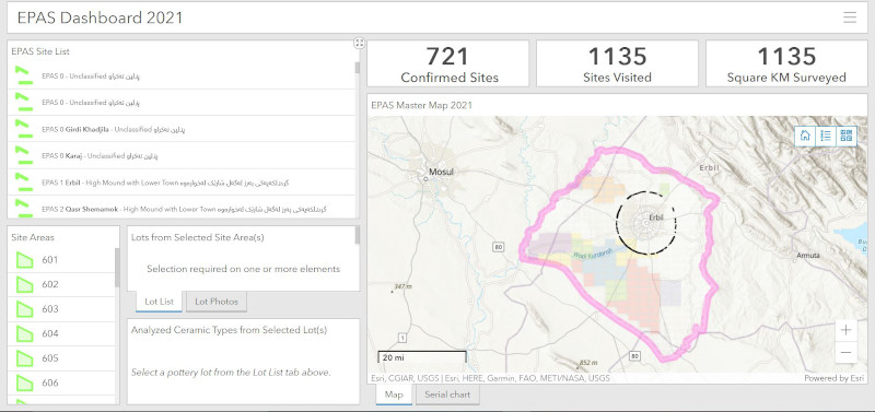
Shown above is the interactive dashboard when first opened. The options for all the sites are shown and the map of the general survey region is also shown.
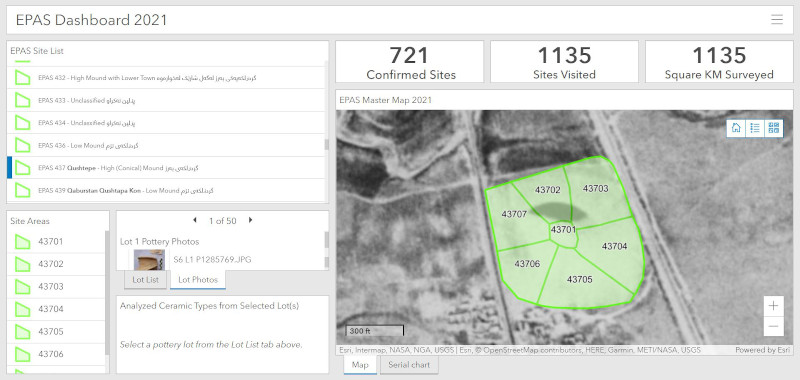
Shown above is the interactive map in action- a site (437) was selected. The map immediately zooms in onto the site and the different lots associated with the site are highlighted. The images of the different artifacts (pottery, bones, etc.) are made available in the bottom left as well as a description of the type of artifact.
My name is Sebastian Millien, and I am currently and undergraduate at Harvard university studying Chemical and Physical Biology and Archaeology. I was born and raised in Brooklyn, but my family is from Haiti. In the future, I hope to combine biochemistry and archaeology to discover even more about the past.
During the summer of 2021, ASOR supported 27 undergraduate and graduate students through the Summer Stipend Program. These students undertook non-fieldwork archaeological research projects led by ASOR-affiliated project directors. They also took part in monthly cohort group meetings hosted via zoom. Read a summary of these cohort meetings here.
Stay tuned for more updates from the 2021 Summer Stipend recipients!
ASOR BOARD OF TRUSTEES APPROVES NEW 2021-2025 STRAGETIC PLAN
At its November 21, 2021 meeting in Chicago the ASOR Board of Trustees unanimously approved the adoption of a strategic plan for 2021-2025. Periodic strategic planning is a valuable exercise that promotes reflection on and reevaluation of an organization’s goals and priorities. Until this year ASOR had been working successfully under a 2016-2020 strategic plan crafted in a committee led by former President Susan Ackerman. The new plan represents a revision of that plan and a rebalance of our priorities in light of changing circumstances. At its center is a recommitment to ASOR’s core missions “to initiate, encourage, and support research into, and public understanding of, the history and cultures of the Near East and wider Mediterranean from the earliest times…”, with an expansion of our areas of research to “Western Asia and the wider Mediterranean”.
The plan has been under development since January of 2020 under the supervision of the current President, Sharon Herbert. All ASOR’s standing committees contributed to the new plan, and it was discussed and revised by the Chairs Coordinating Committee under the leadership of Vice President Chuck Jones from the summer of 2020 through fall 2021, when it was approved by them in October. The version voted on by the Board also profited from discussion in the Executive Committee.
This new plan focuses on six areas of ASOR’s activities: Area 1: The Annual Meeting; Area 2: Cultural Heritage; Area 3: Diversity, Equity, and Inclusion; Area 4: Publications; Area 5: Public Outreach; Area 6: Supporting the Work of Our Members. It also considers how ASOR’s new offices at the James Strange Center in Alexandria, VA can be best used to to facilitate the sorts of community engagements and interactions with governmental agencies and other relevant agencies and organizations that we foresaw at the time we purchased the building.
This plan is the result of careful thought and input from all areas of the ASOR community. Although we will certainly face unpredictable changes, challenges, and opportunities in the coming years, we are confident that it will prove an inspiring road map for progress.
Pp. 1–22: “The Making of a Script: Cretan Hieroglyphic and the Quest for Its Origins,” by Silvia Ferrara, Barbara Montecchi, and Miguel Valério
What is the origin of the earliest script in Europe? Is it invented locally or borrowed from an external template? How can we go about addressing this problem? A common view is that the script in question, Cretan Hieroglyphic, is locally created but externally inspired, probably through an influence from Egypt. But this appreciation should be the result of a full examination of the evidence, rather than a superficial appraisal of the script signs. This article reframes this approach, starting with generic assessments on origin and stimulus, and so opens a new avenue that takes into account the following aspects: 1) the establishment of a methodology for cross-comparisons between the Egyptian and Cretan scripts; 2) the situated context of the Egyptian and Cretan scripts in the mid-3rd to late 3rd millennium b.c.e.; 3) the local Cretan seal imagery; and 4) case studies of sign shapes, representing physical and immaterial referents across the Egyptian Hieroglyphic and Cretan repertoires. Only from this broad, multicentric framework, which has input from archaeology, epigraphy, iconography, and paleography, can we establish a solid method to address the origin of Cretan Hieroglyphic.
ASOR Members with online access: navigate to the token link email sent to you before attempting to read this article. Once you have activated your member token, click here to access the above article on The University of Chicago Press Journals’ website.
Pp. 23–46: “Judean Pillar Figurines and “Bed Models” from Tell en-Naṣbeh: Typology and Petrographic Analysis,” by David Ben-Shlomo and Lauren K. McCormick
This article discusses the Judean Pillar Figurines found in Tell en-Naṣbeh. The site yielded the highest number of these Iron Age II figurines after Jerusalem. Our study focuses on the significance of this distribution, the contexts in which the figurines were found at the site, as well as a compositional (petrographic) analysis of their clay. Fifteen anthropomorphic figurines as well as five “bed models” were analyzed by thin section petrography. The results indicate these objects were not made of the commonly used local clay and were probably not locally produced at Tell en-Naṣbeh, though other types of clay objects were. The possibility that the figurines were produced in Jerusalem is discussed, as well as the implications of these results.
ASOR Members with online access: navigate to the token link email sent to you before attempting to read this article. Once you have activated your member token, click here to access the above article on The University of Chicago Press Journals’ website.
Pp. 47–76: “Recent Early Bronze Age Glyptic Finds from Lebanon: The Evidence from Tell Fadous-Kfarabida,” by Hermann Genz and Alexander Ahrens
While Early Bronze Age glyptic finds from the southern Levant as well as from Syria have received considerable attention in the scholarly literature, unfortunately the same cannot be said about the glyptic material from Lebanon. For a long time, Byblos was the only site with a considerable number of Early Bronze Age glyptic finds, but the often unclear stratigraphic and contextual situation of the material hugely diminished its scientific value. Fortunately, in recent years more clearly stratified material has emerged from Sidon, Tell Arqa, and Tell Fadous-Kfarabida, which for the first time enables us to better define the glyptic styles in use in the central Levant during the 4th and 3rd millennia b.c.e. The paper presents the glyptic finds from Tell Fadous-Kfarabida, located on the Lebanese coast just 12 km north of Byblos, with a special emphasis on the iconography of the seals and seal impressions, as well as their contribution towards the external relations of the site.
ASOR Members with online access: navigate to the token link email sent to you before attempting to read this article. Once you have activated your member token, click here to access the above article on The University of Chicago Press Journals’ website.
Pp. 77–93: “A Radiocarbon Sequence for the Late Bronze to Iron Age Transition at Ashkelon: Timing Early Philistine Pottery,” by Yotam Asscher, Mario A. S. Martin, Daniel Master, and Elisabetta Boaretto
From 1985–2014, the Leon Levy Expedition to Ashkelon excavated a trench on the north side of Ashkelon’s central mound (Grid 38) exposing a Bronze and Iron Age sequence over an area of some 450 m2. By combining different radiocarbon sampling strategies used over the years of excavation, an absolute chrono-cultural scheme is constructed for the latter half of the 2nd millennium b.c.e. with a focus on the transition to the Iron Age. This chronology is then synchronized with several nearby sites.
ASOR Members with online access: navigate to the token link email sent to you before attempting to read this article. Once you have activated your member token, click here to access the above article on The University of Chicago Press Journals’ website.
Pp. 95–112: “Performance Frozen in Time: A New Iron Age II Female Ceramic Figurine from Jneneh, North Central Jordan,” by Regine Hunziker-Rodewald and Khaled A. Douglas
To date, about 470 female ceramic figurines are known to originate from Iron Age sites across Jordan. This article sheds light on a distinct type by studying a recently discovered figurine from a newly excavated settlement at Jneneh, Wadi az-Zarqa, in north central Jordan.
ASOR Members with online access: navigate to the token link email sent to you before attempting to read this article. Once you have activated your member token, click here to access the above article on The University of Chicago Press Journals’ website.
Pp. 113–132: “Cybele, Atargatis, or Allāt? A Surprising Tomb Artifact from Petra’s North Ridge,” by Robert Wenning and Megan A. Perry
The complex Nabataean “Götterwelt” incorporates deities from both their own tradition as well as imports from the larger Mediterranean and peninsular Arabian context. In 2014, a small naiskos depicting a possible imported deity was discovered in a tomb containing at minimum eight individuals, located on the northern edge of the ancient city of Petra. Geochemical investigation of the individuals buried in the tomb using strontium (87Sr/86Sr) and oxygen (δ18O) isotopes indicated only locally born individuals were interred within the tomb. The goddess depicted in the bas-relief sculpture is wearing a tunic and covered by a cloak and is flanked by two lions. Comparanda from the eastern Mediterranean showing similar iconography of the naiskos point to the goddess’s identity as Cybele, Atargatis, or Allāt, with most evidence suggesting Allāt. However, the emic perceptions of and ritual praxis involving this object and the goddess beyond its mortuary inclusion remain unclear. Therefore, regardless of the identification of the goddess it venerates, this portable naiskos served an important mortuary purpose for an individual locally born in the Petra region.
ASOR Members with online access: navigate to the token link email sent to you before attempting to read this article. Once you have activated your member token, click here to access the above article on The University of Chicago Press Journals’ website.
Pp. 133–175: “Islamic and Pre-Islamic Glass from Nippur,” by Carol Meyer
Excavation of Area WG at Nippur in 1989 yielded a large corpus of glass ranging in date from late Parthian to Islamic, mainly Abbasid. Islamic glass from Iraq is poorly studied and scrappily published, often concentrating on fancy, luxury vessels. This makes the large group of excavated, datable, domestic glassware from Nippur important for archaeologists dealing with the early Islamic period in Iraq and for those researching Abbasid glass. Further, I propose that Abbasid Levels III and II run later than suggested in the preliminary report, with Level II extending most likely into the early 10th century. This means that at least part of the site of Nippur remained occupied into the period when almost all of southern Iraq was severely depopulated. Finally, I raise the question of what can be gleaned from old, partial field records from a country devastated by decades of sanctions and war.
ASOR Members with online access: navigate to the token link email sent to you before attempting to read this article. Once you have activated your member token, click here to access the above article on The University of Chicago Press Journals’ website.
Pp. 177–207: “Sifting Through: The Characteristics and Significance of Ceramic Strainer-Vessels in the Chalcolithic Period of the Southern Levant,” by Edwin Cornelis Martinus van den Brink, Rivka Chasan, and Danny Rosenberg
A strainer is an autonomous utensil (sieve or colander) or an integral part (filter) of a utensil designed to separate mixtures based on grain size. In the southern Levant, strainer vessels made of clay are known since the Early Chalcolithic period, albeit few in number. The onset of the Late Chalcolithic period reflects a significant increase in the numbers and distribution of these particular vessels even though their numbers per site remain relatively low. This paper surveys foremost Late Chalcolithic strainer vessels from the southern Levant, discussing their morphology, significance and possible role as straining and sifting devices for liquids (e.g., olive or other oils, herbal or botanical mixtures, and alcoholic beverages) and solid substances (e.g., fats and flour). While results from our ongoing organic residue analysis concerning this and other types of Late Chalcolithic vessels are yet to come, we can already suggest that these vessels entail a variety of tasks and that they were used in a number of different contexts based on the variability of strainer vessel types and the strainer morphology.
ASOR Members with online access: navigate to the token link email sent to you before attempting to read this article. Once you have activated your member token, click here to access the above article on The University of Chicago Press Journals’ website.
Pp. 209–220: “Identity Creation and Resource Controlling Strategies: Thoughts on Edomite Ethnogenesis and Development,” by Aren M. Maeir
In this paper I suggest that the evolution of the control of natural resources and trade routes in the Arabah Valley and its environs was the basis for the formation of Edomite identity in the early Iron Age. Building on insights on ethnogenesis in Southeast Asia in the studies of Joseph Scott and James Warren, I attempt to align this with recent discussions on early Edom, and the role that this group played in the regional economic web of the Iron Age.
ASOR Members with online access: navigate to the token link email sent to you before attempting to read this article. Once you have activated your member token, click here to access the above article on The University of Chicago Press Journals’ website.
Pp. 221–236: “The Origin of Imported Jars from 6th Dynasty Abusir: New Light on Early Bronze Age Egyptian-Levantine Relations,” by Karin Sowada, Mary Ownby, and Miroslav Bárta
Thin-section petrography on imported Combed jars from the 6th Dynasty Abusir tomb complex of Qar and his family identified the central Levant, between Beirut and Tripoli, as the production zone of the vessels. Dating to the reign of 6th Dynasty king Pepy II (ca. 2278–2184 b.c.), the jars were made of the same mixed Cretaceous clay type used for imports of the early Old Kingdom. None of the Abusir material was an Egyptian imitation, contrary to previous assessments. The petrography demonstrates the long continuity of exchange networks with a specific area of the central Levant for over 350 years. During the Old Kingdom from the early 4th Dynasty to the late 6th Dynasty, exchange networks with the region intensified, confirming long-held understandings based on fragmentary archaeological data and the slender textual record.
ASOR Members with online access: navigate to the token link email sent to you before attempting to read this article. Once you have activated your member token, click here to access the above article on The University of Chicago Press Journals’ website.
Pp. 237–282: “The Archaeology of Regional Muslim Pilgrimage Reevaluated: The Site of Nabi Rubin (Israel) as a Case Study,” by Itamar Taxel, Avraham (Avi) Sasson, Moshe Fischer, and Nitzan Amitai-Preiss
This research constitutes a first attempt to discuss a Muslim pilgrimage site from a holistic, in-depth archaeological perspective. Our case study is Nabi Rubin, on the southern coastal plain of Israel, which was active from at least the early 15th century until the late British Mandate period and was one of the major foci of Muslim pilgrimage in historical Palestine. Pilgrimage to Nabi Rubin was characterized by a one-month-long organized celebration that took place every summer and attracted masses of pilgrims from Jaffa in the north to Gaza in the south. The research uses the site’s architectural and other human-created and natural landscape features—including historical trees and the rich material culture remnants left behind by pilgrims and other visitors, in addition to the written and photographic historical evidence related to Nabi Rubin—in order to draw additional information that can assist in interpreting the mute physical elements. The study provides a synthesis and interpretation of the site’s chronology, material culture, the activities and behaviors that took place there during festival periods, and methodological aspects of the interpretation of historical trees. The results highlight the uniqueness of Nabi Rubin compared to other Muslim pilgrimage sites in Palestine, and its significant potential for an archaeological research of Muslim pilgrimage in the region.
ASOR Members with online access: navigate to the token link email sent to you before attempting to read this article. Once you have activated your member token, click here to access the above article on The University of Chicago Press Journals’ website.
Doing unto others as we would have others do unto ourselves: A Report on ASOR’s Lawrence T. Geraty Endowment for Community Archaeology
An inconvenient truth about most archaeological excavations is that more often than not, they do serious damage to the landscape and scenery in the areas where they work. In their wake, archaeological expeditions leave not only wall-sections of houses, barnyards, streets and fortifications, but also unsafe and unsightly excavation trenches and scatters of stones and spolia. This raises the question: Do organizers and sponsors of archaeological excavations have a duty to restore the landscape and scenery they impact with their excavations?
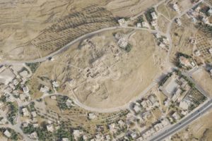
Summit of Tall Hisban. APAAME_20191024_DS-0007. (Photographer: Dana Salameen, courtesy of APAAME)
Back in the day, under the old expeditionary model, the default answer to this question—as it was rarely asked–was no. Under this, now obsolete orientalist mindset, the excavator’s duty was to dig and record well and publish results in peer-reviewed venues in a timely manner. This is where her responsibility ended. How things were left in the field was not a concern as the prevailing assumption was that responsibility for maintenance and preservation of abandoned sites was in the hands of local authorities[1]. After all, in many cases, funds were collected by local permitting authorities ostensibly for precisely this purpose. Such funds, collected at the end of each excavation season, are not a sustainable solution to long-term maintenance of archaeological sites (especially minor sites not associated to ticket-generated income).
As the previous century came to an end, a prominent casualty of this situation was Tall Hisban, located in Jordan along the road linking Amman and Madaba and widely assumed to be biblical Heshbon [2]. Visitors to the site would have found an ascent to its summit to be a most arduous undertaking, as it required stepping warily through clusters of camel shock, tumbled stones and spolia of all shapes and sizes. For all but the most persistent, an ascent to its summit was not an appealing prospect.
A major reason why a team from Andrews University decided to return to work at Tall Hisban in 1996 under my leadership was to find a remedy for this situation. By then, the site had been abandoned for over two decades, the original Heshbon Expedition having ran its course from 1968 to 1976. A second reason was my desire to deepen understanding of already well documented long-term cycles of food system intensification and abatement at the site. A third reason was a consensus among the original Heshbon Expedition leaders that the site’s Islamic archaeology and history deserved to be re-visited with someone on-board with state-of-the-art qualifications for the task at hand. To this end, Bethany Walker was recruited to join our team, and her studies and publications since have proven to be ground-breaking on many levels where Islamic archaeology in Jordan and beyond is concerned. I would note, for example, her editorship of the Oxford Handbook of Islamic Archaeology and a new Journal of Islamic Archaeology (Equinox Publishing).
Group photograph from 2018 field season at Tall Hisban including international team (20 different nationalities) and local workmen.
In the course of over two decades of the second phase of excavations at Tall Hisban—now renamed the Hisban Cultural Heritage Project–a new vision and model of archaeological fieldwork crystallized that today is becoming standard archaeological practice in Jordan and beyond, namely community archaeology. What led to this model emerging in our particular case were three factors: first, the already mentioned situation of neglect at the site; second, a long tradition of ethnographic inquiries in the local community; and last but not least, the friendships and sentiments of mutual trust and understanding already fostered during the original Heshbon Expedition that could be built on as our team returned.
The goal of community archaeology at Tall Hisban since its onset in 1996 has been to partner with the local community in transforming the site and the town into a place of pride and economic opportunity for its residents even as it also would develop into a destination for visitors from elsewhere in Jordan and beyond. Construction of footpaths and viewing platforms was begun in 1997, followed in subsequent seasons with over three dozen in-situ exhibits, each accompanied by explanatory signage. Partners in these endeavors included workmen and their families from the village, the office of the local mayor and his staff; and personnel from the local and national headquarters of the Department of Antiquities.
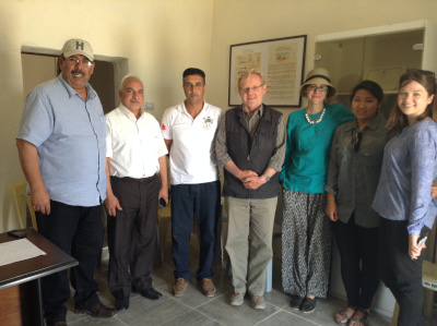
From the left to the right, Mansour Sheehan (Tall Hisban Cultural Association), Saoud Albarari (Tall Hisban Cultural Association), Amer Awawdeh (Tall Hisban Tourist Development Project), Øystein LaBianca (Andrews University), Maria Trogolo (USAID-SCHEP), Anna Kim and Noel Harris (Andrews University interns).
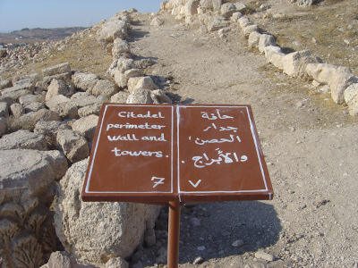
One of the signs painted by Amer Awawdeh, local school teacher.
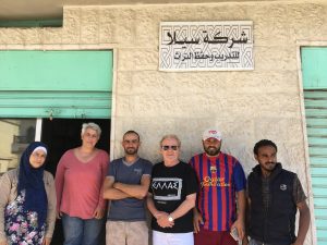
Sela’s founders with Øystein LaBianca. From left to right, Eman Abdassalam, Maria Elena Ronza, Ahmad Almousah, Øystein LaBianca, Shaker Alfuqara and Bassam Alfaqeer.
Maria Elena Ronza, a young archaeology student from Italy who joined our team in 2001, has been particularly responsible for the success of these undertakings. Having taken up residence in Jordan, she was in a good position to follow up on projects that could not be completed during our short field season. A good example is her work with local stakeholders to establish the Hisban Cultural Association as an official non-governmental organization, thus giving agency to local entrepreneurs from Hisban to develop Hisban into a touristic destination. Elena was subsequently hired by ACOR to assist with the Temple of the Winged Lion project [3] to which she brought the community archaeology experience acquired at Hisban. She has since gone on to incubate together with Ahmad Almousah two all-Jordanian organizations aimed at building local capacity to benefit from protecting nearby cultural heritage sites. They are Sela for Vocational Training and Protection of Heritage (Sela Facebook Page) and Al Raqeem for Logistics & Training (Al Raqeem Facebook Page).
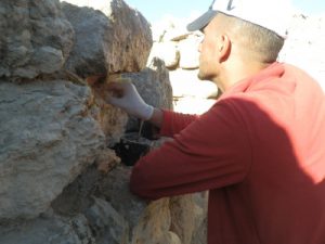
Ahmad Almousah at work in Hisban applying lime mortar.
The Lawrence T. Geraty Community Archaeology Endowment was launched in 2020, in cooperation with the American Society of Overseas Research (ASOR) as a fitting capstone to almost three decades of community outreach by our project. The purpose of this endowment is to support innovation and experimentation by archaeology teams such as ours to build toward sustainable local solutions for preserving and caring for archaeological sites. At the present writing, the fund stands at about $110,000, which has allowed a first distribution of interest earned to occur [4]. That first award was used this summer to leverage funds from antiquities authorities in Jordan to undertake a site-wide cleaning operation that has resulted in the site itself and all of its primary exhibits, signage and paths looking better than I have ever found on my many returns to Jordan. As important was discovering Yasmeen Al Ajarmah, an archaeology graduate from University of Jordan, who led this entire operation and whom I could offer a part-time job as a team-leader for site maintenance operations on an on-goingh basis. She, and a team of three local workmen, will also be assisted by Al Raqeem for Logistics and Training in working with the local community to develop various micro-enterprise activities that can generate income not only to pay for their own salaries, but also for other community entrepreneurs.
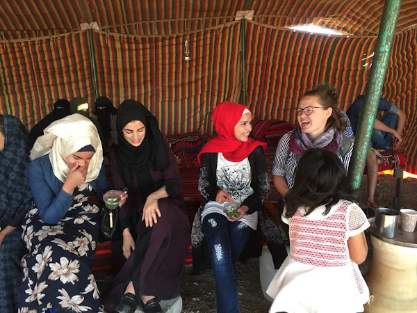
Among the micro-enterprises already underway that also generate funds to support protection of the site are a women’s cooperative providing locally made meals for our excavation teams, tour groups and other visitors; a program of educational activities for local school children that includes sale of a children’s book about Hisban in Arabic. Efforts are also underway to provide visitors with an on-line guided tour of the site which will include announcements of various micro-enterprises and an invitation to donate toward maintenance of the site.
Sela implemented 4 archaeological themed days with hands-on activities for children thanks to support of the Geraty Fund and in cooperation with Princess Basma Center in Hisban.
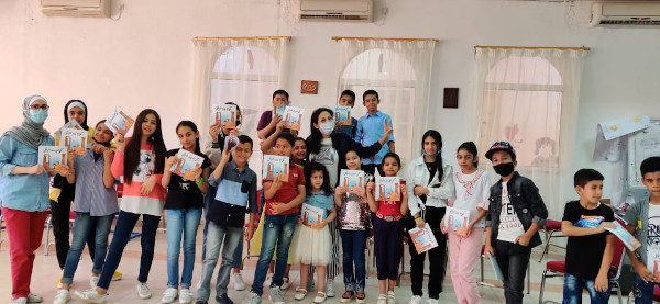
Book reading at Princess Basma Center in Hisban. In preparation for the launch of a children book about Hisban, the writer, Rasha Dababneh, standing in the middle wearing a mask, hosted a book reading for the children from the community. Children were invited to suggest ideas for the forthcoming children’s book.
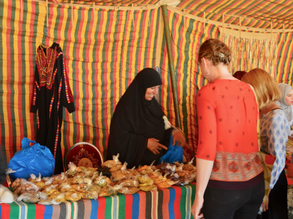
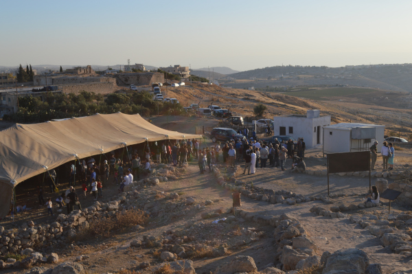
On the occasion of the 50th anniversary of the project, Princess Basma Center in Hisban organized an on-site bazaar so women from the local community could showcase and sell their products.
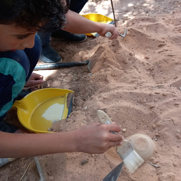
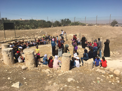
On the occasion of the 50th anniversary of the Hisban digs, school children and their teachers visited the site and participated in hands-on archaeology-themed activities.
Stanley Beikmann, a professor landscape design from Andrews University who served as a faculty member on our project, shared a vision of a botanical garden at Hisban with me some years ago. The Al Raqeem team, Yasmeen Ajarmah and her co-workers are helping this vision to be realized. Such a place includes well-tended and signed exhibits, interpretive paths and platforms, and places for groups of visitors to gather for purposes of orientation and education. An aspirational addition to this vision is a visitor center complete with rest-room facilities, a small shop/cafe, a physical model of the site and a small theatre for screening a short film about the site in different languages.[5]
Welcome event in the amphitheater at the entrance to Hisban.
My answer to the question posed about archaeologists’ responsibility at the beginning of this article is: We can no longer avoid responsibility for how sites are left once our fieldwork is ended. The community archaeology model developed at Hisban is obviously not appropriate for all excavations, but for larger projects involving multi-period tell sites, I believe our experience and approach has relevance [6] . For smaller projects involving only a few trenches or probes, the responsible solution is to simply fill in the excavated areas at the conclusion of the project. The days of the old expeditionary model are over. As archaeologists, we have a responsibility to do unto others as we would have others do unto ourselves.
-Øystein LaBianca, Andrews University
Women's Association Tent Bazaar.
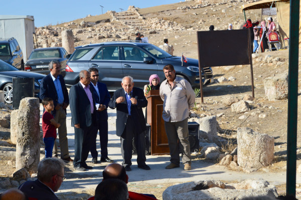
Speech by H.R.H. Prince Raad bin Zeid at the Hisban 50th Anniversary event.
[1] For local communities abandoned excavation sites often leave unanswered questions and expectations: Does this mean the team will be back to ‘look after’ their site? Does leaving it open mean they can expect tourism? Furthermore, abandoned sites mean no ‘closure’ for communities and are often unsatisfactory from their point of view – ugly scars in their landscapes which fill with trash and slowly decay, potentially souring positive relationships established with dig teams originally. [2] For the record, it should be noted that when the first phase of excavation was finished in 1976, the expedition leadership did not altogether neglect the concerns addressed here. Larry Geraty, then director of the project, and Bert de Vries, project architect, teamed up to prepare a plan for visitors to the site, including viewing platforms along the path that circled the site, etc. Detailed maps and plans were left at the Department of Antiquities along with the portion of the dig fees that were to go to the implementation of the plan. What did not happen was the sort of follow-up with the local community and with the department that became an integral part of the second phase of work at the site. [3]https://www.jordantimes.com/news/local/italian-jordanian-architect-pushes-community-archaeology [4] Seed funding for the endowment was provided by Ronald and Sheila Geraty. Andrews University and La Sierra University each contributed $10,000. Other major contributors ($1000+) to the endowment fund include Lawrence and Gillian Geraty, Oystein and Asta LaBianca, Carolyn Waldron, Joy Fehr, Doug and Carmen Clark, Susan Ackerman, Tim Harrison and Andy Vaughn. Help the Grant grow by selecting “Geraty Endowment Fund” from the drop-down menu in the link. [5] See for example https://www.youtube.com/watch?v=u2kUMkjmRF8\ [6] For more about the Hisban Community Archaeology model, see https://digitalcommons.andrews.edu/auss/vol55/iss1/4/
What is data literacy and why is it important for archaeologists to be data literate? Participants in this workshop will examine these questions and learn about some useful tools and resources to help them hone these important skills.
How do we find, produce, curate, and analyze data? What sorts of questions can we ask of our data, and where can we go for data support? In this workshop, participants will consider the fundamentals of archaeological data analysis.
How do we share data-driven narratives of our research with diverse, public audiences? Participants in this workshop will think critically about the role of public scholarship in our discipline and begin to develop a plan for their own public-facing projects.
Digging Up Data at ASOR 2022
More to come on a proposed session for the 2022 Annual Meeting.
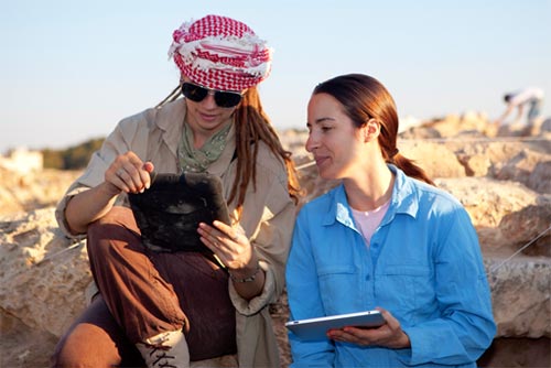
Digital data retrieval with tablets at Tall al-'Umayri, Jordan (photo credit Jillian Logee in D. Clark and K. Bramlett, "Tall al-Umayri" ASOR Blog 2012).
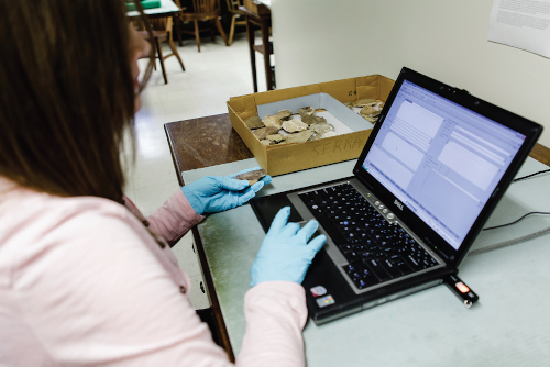
Assistant Registrar Susan Allison enters data on recently registered objects from the Oriental Institute’s collections directly into the new Integrated Database (photo by Anna Ressman in S. Branting, J. Green, and S. Foy "Digging through Data at the Oriental Institute" ANE Today 2013.)
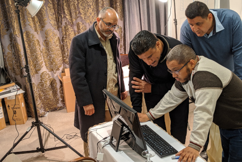
The team from Ghadames, Libya trains on the digitization system developed by the Hill Museum & Manuscript Library (T. Bariun and W. Raynolds, "Digitizing Manuscripts of the Trans-Saharan Trade" 2020).

 My name is Sebastian Millien, and I am currently and undergraduate at Harvard university studying Chemical and Physical Biology and Archaeology. I was born and raised in Brooklyn, but my family is from Haiti. In the future, I hope to combine biochemistry and archaeology to discover even more about the past.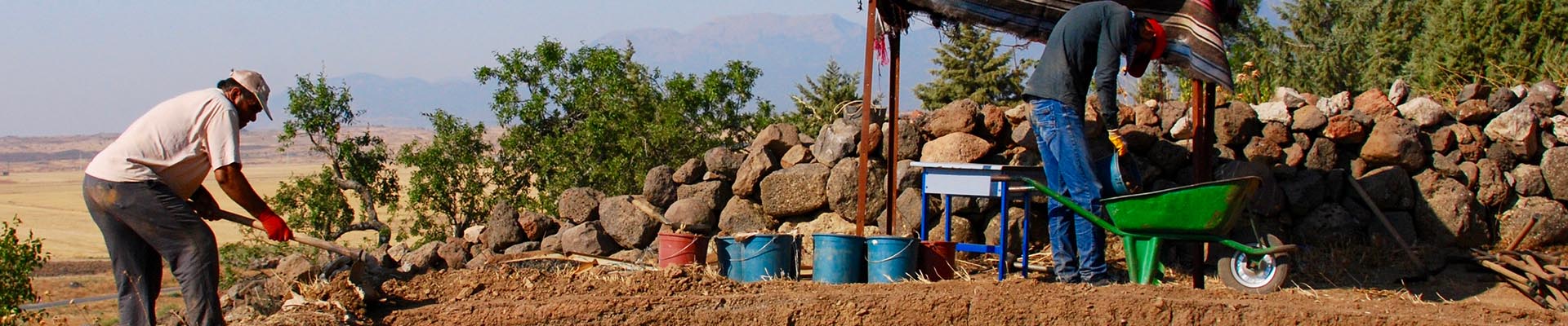
 At its November 21, 2021 meeting in Chicago the ASOR Board of Trustees unanimously approved the adoption of a



 Organized by