Who Were the Thracians? Exploring an Enigmatic Ancient Culture at the Getty Villa Museum
Friends of ASOR present the next webinar of the 2024-2025 season on December 4, 2024, at 7:00 pm EST, presented by Dr. Sara E. Cole. This webinar will be free and open to the public. Registration through Zoom (with a valid email address) is required. Please note that this webinar will not be recorded.
The land of ancient Thrace comprised present-day Bulgaria, much of Romania, and parts of Greece and Turkey, and the tribal peoples who inhabited these territories of the North Aegean region were the Thracians. They were renowned for their skill as warriors and horsemen, as well as for their wealth in precious metals, but they left few written records, and knowledge of their history and customs has long been dependent on brief accounts from ancient Greek authors, particularly Herodotus and Thucydides. Thracians appeared in Greek myth as formidable adversaries in the Trojan War, cruel kings, and followers of the god of spiritual ecstasy, Dionysos. Spectacular archaeological discoveries made in Thracian lands during modern times, however, have provided firsthand evidence of this remarkable culture, illuminating Thrace’s interactions with Greece, Persia, and Rome.
This rich history is the subject of the current special exhibition at the Getty Villa Museum in Los Angeles, Ancient Thrace and the Classical World: Treasures from Bulgaria, Romania, and Greece (on view November 4, 2024 – March 3, 2025). The exhibition, which is organized by the J. Paul Getty Museum in collaboration with the Ministry of Culture, Republic of Bulgaria, and the National Archaeological Institute with Museum at the Bulgarian Academy of Sciences (NAIM-BAS), is part of the Getty’s ongoing series The Classical World in Context, which includes major international loan exhibitions, related publications, and programming that feature the diverse cultures and civilizations that interacted with and influenced Greece and Rome. In this lecture, Sara E. Cole, associate curator of antiquities at the J. Paul Getty Museum and one of the exhibition’s co-curators, will discuss the Getty’s presentation of Thracian history, culture, and art.
Dr. Sara E. Cole holds a PhD in Ancient History from Yale University and is an associate curator of antiquities at the Getty Villa Museum in Los Angeles, CA. Before joining the Getty in 2016, she served as the graduate curatorial intern in the antiquities department of the Yale University Art Gallery, where she worked with the YUAG’s collection of ancient glass and curated the 2017 exhibition “Drink That You May Live”: Ancient Glass from the Yale University Art Gallery.
Sara is managing curator of the Getty’s ongoing initiative The Classical World in Context and she has curated or co-curated multiple Getty exhibitions exploring the ancient cultures of Egypt, Mesopotamia, Nubia, Persia, and Thrace. She co-edited the 2022 Getty exhibition catalogue Persia: Ancient Iran and the Classical World, which won the Association of American Publishers PROSE Award in the category “Art Exhibitions.” The 2018 Getty exhibition catalogue Beyond the Nile: Egypt and the Classical World, which she also co-edited, was a finalist for the College Art Association Alfred H. Barr Jr. Award and the Association of American Publishers PROSE award in the category “Art Exhibitions.”
SPONSOR A WEBINAR!
Several levels of support from $50-$1,000 are available. Proceeds go towards membership scholarships and towards increasing ASOR’s virtual resources. Each sponsorship is tax-deductible and includes benefits! Sponsor a webinar here.
With the generous award of the Strange–Midkiff Fieldwork Scholarship from ASOR this summer, I was able to return for a second year of excavation with the Menorca Archaeological Project (MAP) at Torre d’en Galmés, Menorca, Spain. The MAP project is directed by Dr. Amalia Pérez-Juez (Boston University), Dr. Alexander Smith (SUNY Brockport), and Dr. Kathleen Forste (Boston University), and involves the work of a team of truly spectacular people. Last summer, I received a Summer Undergraduate Research grant from SUNY Brockport to travel to Menorca and work with the MAP team for one month from June 15th to July 15th. During the following fall and spring semesters, I did independent research for an Honors College thesis based on an object found by the MAP team in 2021. I was thrilled to be invited back to excavate for another month this summer, and this fieldwork scholarship made that possible.
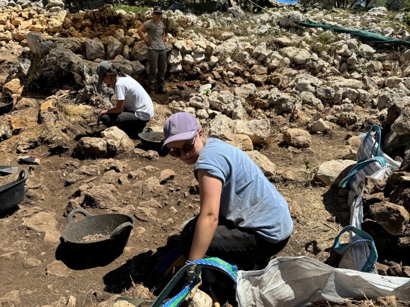
Image 1: Evelyn excavating in the patio of SPU 7. Photo by A. Smith.
The Menorca Archaeological Project is primarily concerned with the investigation of the multi-temporal remains of Torre d’en Galmés, the largest preserved prehistoric site in the Spanish Balearic Islands. This site displays evidence of multiple periods of occupation and interaction, with an array of megalithic indigenous domestic structures dating to the Post-Talayotic or Late Iron Age (550-123 B.C.E.) and a series of later structures built during the Medieval Islamic period of occupation in the 12th and 13th centuries C.E. The stark contrast and interactions of the structures is fascinating and raises an interest in understanding the use and re-use of spaces and materials over time, and the shifting social structures of the populations that used them, both within the communities of Menorca itself and within the greater Mediterranean context.
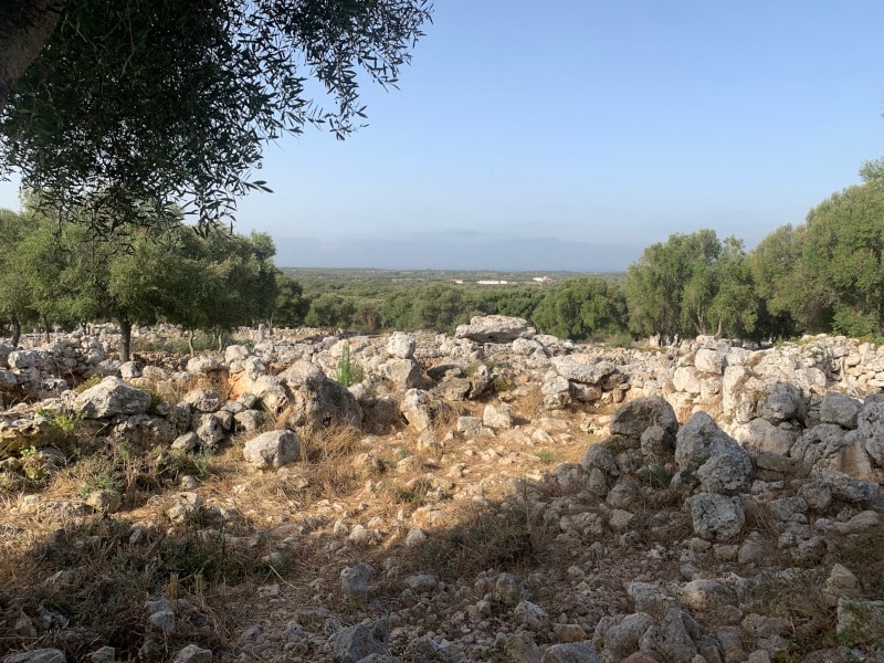
Image 2: View of the site of Torre d’en Galmés. Looking to the south of SPU 7.
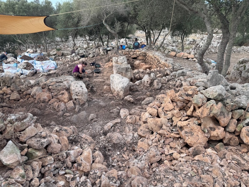
Torre d’en Galmés, along with other sites around Menorca, is absolutely covered with the remains of limestone rubble from collapsed structures. This was the primary building material of the megalithic domestic and ritual spaces of the Bronze and Iron Age, and in the Medieval Period. The presence of all this stone means that excavation involves an incredible amount of rock-moving and trained eyes to see the remains of walls or features. This summer, the MAP team focused heavily on the task of clearing up the central patio and surrounding walls of Spatial Unit 7, a series of later Medieval period rooms which were constructed with the incorporation of rubble and remaining megalithic limestone rocks used in an earlier Post-Talayotic structure.
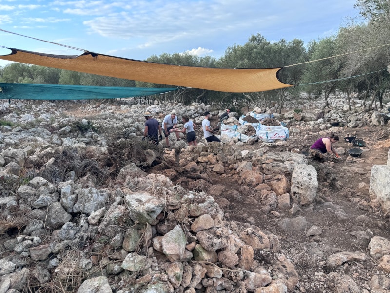
Image 3A
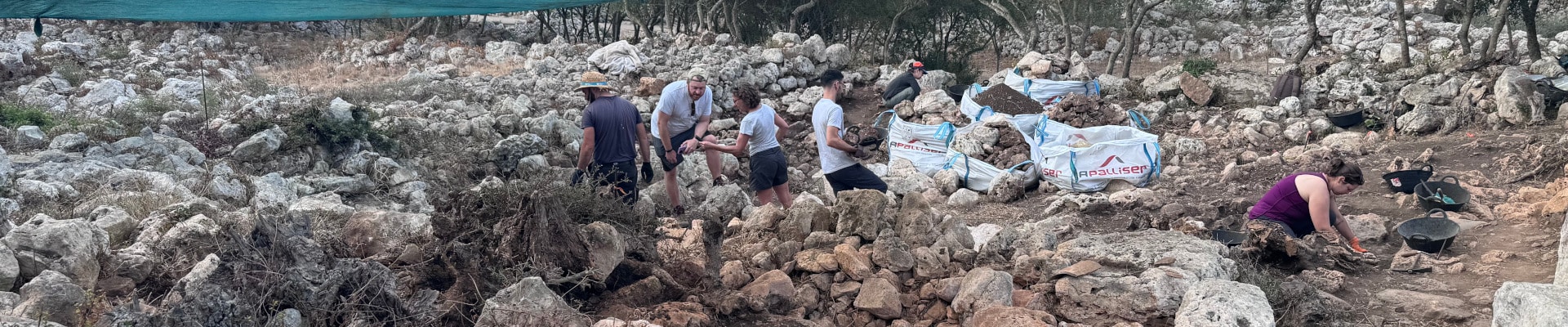
MAP team members excavating in SPU 7. Looking to the south.
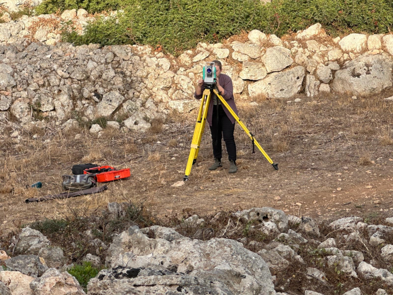
Even with a focus on defining the architecture, plenty of ceramic sherds were found as well, a substantial portion of which consisted of the remains of ceramic roof tiles, with some areas of preserved tile-falls and mortar. Other ceramic sherds appeared as repio, the fill used in the construction of the stone walls, and consisted of a mix of Post-Talayotic, Roman, Punic, Islamic, and other typologies of ceramics. In addition to excavation, our work this summer was concerned with lab work and data collection. I practiced taking spatial data points using a total station to outline features and interesting in situ finds, mark spots for phytolith and archaeobotanical sampling, set up new areas to excavate, and track the depth of our excavations. This is a skill I continued to use at another project, the Frost Town Archaeology field school, later in the summer, where I got to supervise students and teach them about archaeological techniques and collecting data. We also used this season to organize all the old finds from past seasons and input the information into an updated database. This was an insight into the reality of the meticulous process of documenting and photographing the collection to decide what needs to be kept physically, and what only needs to be kept digitally.
Image 4: Evelyn taking points of SPU 7 at the total station.
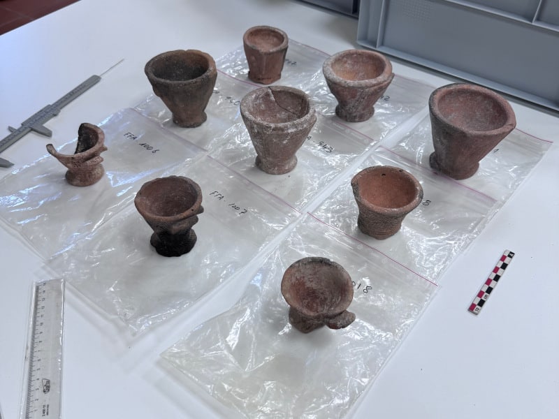
Returning to Menorca this summer also gave me a chance to revisit the basis of my thesis that I wrote for the SUNY Brockport Honors College, which was advised by Dr. Alexander Smith. Last summer in 2023, I was incredibly lucky to have left Menorca with an idea for my thesis, investigating interpretations of indigenous Post-Talayotic ritual objects. I spent both semesters of my senior year preparing my research and I was proudly able to present it at SUNY Brockport’s’ Scholars Day on April 15th and at the Summer Undergraduate Research Conference at Suffolk Community College on April 26th. This summer I went back to the Museu de Menorca with clearer goals in mind of what objects and documents I wanted to see in order to further expand on my research in the future.
Image 5: Array of Post-Talayotic ceramic “high-bottomed cups” from the Museu de Menorca.
My involvement with the MAP team these past two summers has given me numerous insights and hands-on opportunities to explore my interests in the field. I am so grateful to the team for welcoming me and helping me to build my professional network in the field. I look forward to continuing my work with the team in future excavation seasons, and to exploring other projects. I extend my thanks to Mrs. Carolyn Midkiff-Strange and the Midkiff-Strange Fieldwork Scholarship, ASOR, the entire Menorca Archaeological Project team, the Museu de Menorca, and SUNY Brockport.
Evelyn Patterson graduated in May of 2024 from SUNY Brockport with a BS in Anthropology and a minor in Museum Studies and Public History. In addition to working with the Menorca Archaeological Project in Spain, Evelyn has also excavated with the Frost Town Archaeology Project in the Finger Lakes region of New York. She has assisted in laboratory research internships, created project signage and academic posters, and has presented a completed independent research thesis.
Want to help more students and early career archaeologists get into the field? Donate to the cause today by selecting “Fieldwork Scholarships” as your gift purpose!
Please e-mail the Membership office if you have any questions.
Pp. 1-20: “Terra-cotta Roof Tiles in the Ancient Synagogues of Judaea/Palaestina,” by Mechael Osband
Terra-cotta roof tiles are some of the most common and volume-intensive finds in the excavation of ancient synagogues, but their significance has received only minor consideration. This article reviews the evidence for terra-cotta roof tiles, which were the preferred roofing used in ancient synagogues in the Late Roman and Byzantine periods. A change took place from non-tiled roofs in Early Roman synagogues to the common use of terra-cotta roof tiles in the later synagogues. It will be suggested that this shift in roofing style was not merely a functional one, but part of the broader developments in synagogue-building, from a place of gathering in the Early Roman period, with an unassuming flat roof, to a more ornate and monumental structure (both internally and externally) with a prominent high tiled roof in plain view.
ASOR Members with online access: log into ASOR’s Online Portal here. Once logged in, click the JOURNALS tab in the top navigation bar. Tutorials for how to log in to the Online Portal as well as how to navigate to the Portal Journals page can be found here.
Pp. 21-54: “Reconstructing Late Prehistoric Occupation in the Southern Levant: Irbid as a Case Study for Settlements and Funerary Patterns,” by Antoine Caminada, Tara Steimer-Herbet, Lamia Al-Khoury, and Marie Besse
The region of Irbid (Jordan) in the southern Levant has been known for its megalithic structures since the end of the 19th century. But despite hundreds of dolmens inventoried, it has never been the subject of an in-depth study. This article contributes to a better understanding of human occupation in the area during the 4th and 3rd millennium B.C.E., based on unpublished data collected in September 2005 by a co-directed Jordanian and French mission (University of Yarmouk and the French Institute of the Middle East–Institut français du Proche-Orient Damascus). Data acquisition analysis was realized thanks to a Geographic Information System (GIS) allowing the authors to map and study the spatial relationships between the various elements, with an emphasis on the relationship between the funerary and domestic spheres. By placing the dolmen necropoleis and settlement sites (both double-apsed and rectangular houses) of the north Jordanian Plateau within the general context of the southern Levant, the authors question the “classic” model linking nomadism and megalithism, and bring forward a more sedentary perspective.
ASOR Members with online access: log into ASOR’s Online Portal here. Once logged in, click the JOURNALS tab in the top navigation bar. Tutorials for how to log in to the Online Portal as well as how to navigate to the Portal Journals page can be found here.
Pp. 55-82: “The Tepe Gawra Lower Town Survey 2022,” by Khaled Abu Jayyab, Ira Schwartz, Abbas Al-Hussainy, Stephen Batiuk, Arno Glasser, and Hossam Hadi
Tepe Gawra has long been seen as an essential site for late prehistoric and early historic periods, not only in Iraq but for the entirety of northern Mesopotamia. This importance stems from its long sequence, and its implications for understanding the development of societal complexity. Despite its small size, Tepe Gawra has produced evidence of highly specialized practices that overshadowed farming. This has led to the suggestion that the site was a “center” at the top of an administered network. Some scholars have challenged this assertion and suggested that the site had a lower town, which acted as the source of agriculture goods for the site. Since the area had been closed off to archaeological work this debate has not been resolved. Through recent survey work around Tepe Gawra, the authors show that there was an extensive lower town dating to the Late Chalcolithic and Early Bronze Age stages of occupation. These findings show that Tepe Gawra was a large self-sustaining settlement exploiting its own agricultural hinterland.
ASOR Members with online access: log into ASOR’s Online Portal here. Once logged in, click the JOURNALS tab in the top navigation bar. Tutorials for how to log in to the Online Portal as well as how to navigate to the Portal Journals page can be found here.
Pp. 83-110: “Biography of a Neo-Assyrian Relief Fragment from Nineveh,” by Irene Bald Romano, Kelly Ann Moss, and Gina Watkinson
This article presents the biography of a Neo-Assyrian gypsum relief fragment from Ashurbanipal’s 7th century b.c.e. North Palace at Nineveh, now in the Arizona State Museum, University of Arizona. Its discovery by British explorers in late 1853 or early 1854, its journey to the United States, probably in the mid-19th century through missionaries in Ottoman Mesopotamia, its connection with the circus impresario P. T. Barnum and Tufts College, and its acquisition in 1959 by the Arizona State Museum are discussed, along with the changing uses and meaning of the object in its various contexts. The fragment depicts fat-tailed sheep being led in procession by a royal eunuch. It is related to a larger relief fragment in the British Museum that was positioned to the right of this fragment, allowing some conclusions about its probable location within the North Palace and interpretations concerning its iconography.
ASOR Members with online access: log into ASOR’s Online Portal here. Once logged in, click the JOURNALS tab in the top navigation bar. Tutorials for how to log in to the Online Portal as well as how to navigate to the Portal Journals page can be found here.
Pp. 111-137: “The Parthian Manor House of Sarab-e Murt in the Context of the Iranian Architectural Tradition,” by Yousef Moradi
This article presents the results of archaeological field excavations at the site of Sarab-e Murt, located on the outskirts of the town of Gilan-e Gharb in the Kermanshah province of Iran. The investigations, conducted in 2007 and 2008, brought to light an extraordinary royal residence dating back to the Late Parthian period. The aim of this article is to contextualize the architectural design and layout of the Sarab-e Murt building within the broader landscape of palatial architecture in the Iranian world, with historical roots extending as far back as the Achaemenid period. By examining the development of the plans of palatial houses, we gain valuable insights into the dynamics of change across both time and space. Furthermore, this article seeks to advance hypotheses concerning the origins of Parthian ayvan-style houses plans within the larger context of the Iranian cultural sphere.
ASOR Members with online access: log into ASOR’s Online Portal here. Once logged in, click the JOURNALS tab in the top navigation bar. Tutorials for how to log in to the Online Portal as well as how to navigate to the Portal Journals page can be found here.
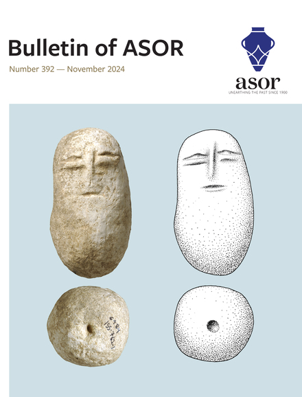
Pp. 139-149: “The Lost Look: A Human Neolithic Figurine from Horbat Sasay (Israel),” by Ianir Milevski and Alla Nagorsky
A human figurine carved on a large limestone cobble was found in the excavations of Horbat Sasay, conducted on behalf of the Israel Antiquities Authority. It schematically portrays eyes and a mouth and, like other types of human head representations found in the region, it is suggested that it belongs to the southern Levantine Neolithic period. Together with the description of the figurine, comparisons are presented to other known figurines depicting the human face from the Levant and other nearby regions, as well as an interpretation of these human faces and their expressions in relation to the drastic changes that occurred in these regions during the so-called Neolithic revolution and the social organization of the late prehistoric communities of the Levant.
ASOR Members with online access: log into ASOR’s Online Portal here. Once logged in, click the JOURNALS tab in the top navigation bar. Tutorials for how to log in to the Online Portal as well as how to navigate to the Portal Journals page can be found here.
Pp. 151-177: “Defending the Vedi River Valley of Armenia: The Fortification and Refortification of a Flatland-Mountain Interface,” by Peter J. Cobb, Elvan Cobb, Hayk Azizbekyan, Artur Petrosyan, and Boris Gasparyan
The mountainous topography of the Armenian Highlands and the South Caucasus accentuates the importance of valleys as areas of habitation and as conduits among these interspersed settlement areas. The Vedi River Valley of Armenia, located along the southeastern edge of the Ararat Plateau (Plain), serves as one such important transportation route in and through these highland areas. At the center of the mouth of this valley sits the prominent Vedi Fortress, ideally situated for defense of this route and landscape. The site was first fortified during the Late Bronze Age, perhaps during the centralization of power by a local polity contained within the valley. Burned down and abandoned at the end of the Iron Age I, the fortress would then see varied reuse through several later periods given its prominent location and proximity to other local power centers. Of particular importance is its refortification during the Early Medieval (Late Antique) period, when Armenia was under Sasanian Persian suzerainty. This article presents the results of archaeological fieldwork in this valley and at the fortress, followed by a discussion of the landscape’s fortification and refortification during these two periods. The Vedi River Valley provides a case study for examining control, mobility, and the negotiation of local and remote power within the specific contained landscape of a river valley in mountainous terrain.
ASOR Members with online access: log into ASOR’s Online Portal here. Once logged in, click the JOURNALS tab in the top navigation bar. Tutorials for how to log in to the Online Portal as well as how to navigate to the Portal Journals page can be found here.
Pp. 179-205: “Revisiting Late Iron Age En-Gedi: A Stratigraphic Reassessment of Stratum V at Tel Goren,” by Avraham Mashiach and Uri Davidovich
The oasis of En-Gedi, on the western shore of the Dead Sea, served during the late Iron Age as a regional hub for the Judahite activity in the Judean Desert. The main Iron Age site in En-Gedi is Tel Goren, a small mound in the oasis plain, excavated in the 1960s by Benjamin Mazar and Immanuel Dunayevsky. The exposed Iron Age remains, attributed to the lowermost occupation (Stratum V), yielded substantial material assemblages associated with a thick destruction layer dated to the early 6th century b.c.e. The excavators interpreted the site as an unfortified, short-lived agricultural estate dedicated to the production of high-valued commodities. Drawing on a critical reassessment of past excavations, coupled with new evidence gathered in small-scale excavations conducted in 2020, it is suggested that the development of late Iron Age Tel Goren was a gradual process that involved at least two major phases, as well as the construction of a fortified compound on the summit of the hill. The implications of this suggestion are further examined within the broader regional and historical context, shedding new light on the multiphase trajectory of Judah’s expansion into its eastern fringe during the late monarchic period.
ASOR Members with online access: log into ASOR’s Online Portal here. Once logged in, click the JOURNALS tab in the top navigation bar. Tutorials for how to log in to the Online Portal as well as how to navigate to the Portal Journals page can be found here.
Pp. 207-237: “Dine and Worship: The Roman Complex in Front of the Pan Grotto in Paneas/Caesarea Philippi,” by Adi Erlich and Ron Lavi
Paneas, situated at the foot of mount Hermon, is where the Hermon River emerges from a spring at the foot of a cliff with a natural cave. In the Hellenistic and Roman periods, the cave and nearby terrace served mainly for the cult of Pan. Herod the Great built in Paneas a temple to Augustus, and his son erected there his capital, Caesarea Philippi. A salvage excavation was recently conducted in front of the cave in the area that formerly was identified as Herod’s Augusteum. The new excavations have proven that during the Roman period, the place was unroofed and open to the cave, which was full of water. The water flowed out through a large aqueduct, water installations were constructed in the courtyard, and niches flanked on the west and east. The complex is dated to the last third of the 1st century c.e. and is attributed to Agrippa II, who built there a nymphaeum-triclinium facing a grotto in Italian style. Afterward, the courtyard was used as a cult place to Pan, and hydromantic rituals were performed in the cave. The sources for this complex will be discussed, as well as the changes that took place there through time.
ASOR Members with online access: log into ASOR’s Online Portal here. Once logged in, click the JOURNALS tab in the top navigation bar. Tutorials for how to log in to the Online Portal as well as how to navigate to the Portal Journals page can be found here.
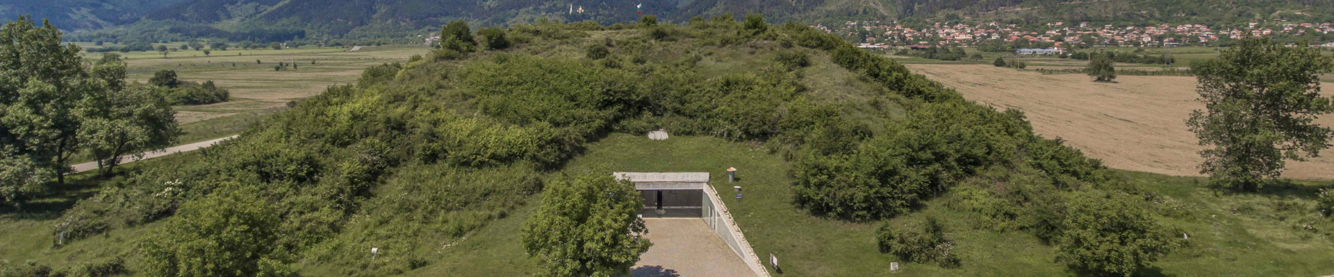

 The land of ancient Thrace comprised present-day Bulgaria, much of Romania, and parts of Greece and Turkey, and the tribal peoples who inhabited these territories of the North Aegean region were the Thracians. They were renowned for their skill as warriors and horsemen, as well as for their wealth in precious metals, but they left few written records, and knowledge of their history and customs has long been dependent on brief accounts from ancient Greek authors, particularly Herodotus and Thucydides. Thracians appeared in Greek myth as formidable adversaries in the Trojan War, cruel kings, and followers of the god of spiritual ecstasy, Dionysos. Spectacular archaeological discoveries made in Thracian lands during modern times, however, have provided firsthand evidence of this remarkable culture, illuminating Thrace’s interactions with Greece, Persia, and Rome.
 Dr. Sara E. Cole holds a PhD in Ancient History from Yale University and is an associate curator of antiquities at the Getty Villa Museum in Los Angeles, CA. Before joining the Getty in 2016, she served as the graduate curatorial intern in the antiquities department of the Yale University Art Gallery, where she worked with the YUAG’s collection of ancient glass and curated the 2017 exhibition “Drink That You May Live”: Ancient Glass from the Yale University Art Gallery.