Join ASOR’s Board of Trustees

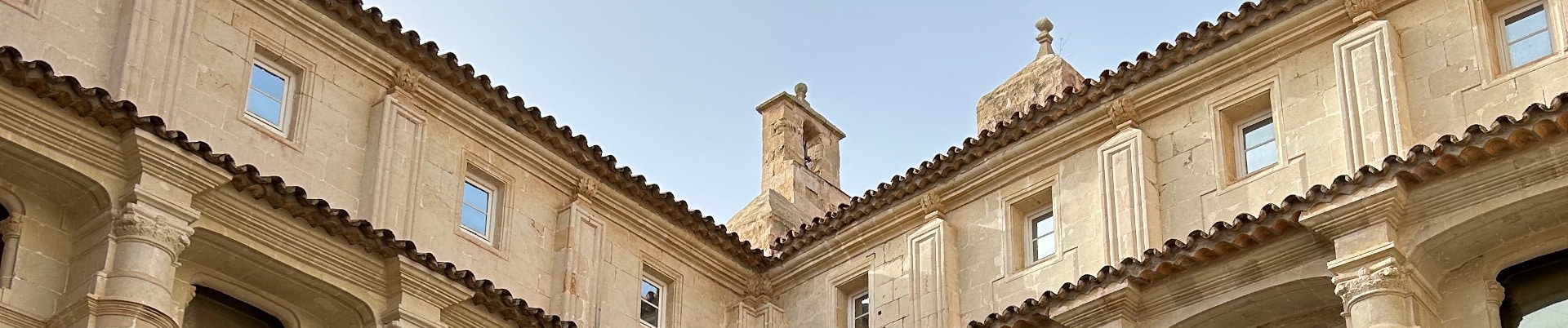
Interior courtyard of the Museum of Menorca, Spain.

CALL FOR TRUSTEE NOMINATIONS

The Trustee Nominations Committee announces an open call for (self) nominations for the ASOR Board of Trustees (Class of 2028). Trustees will serve a three-year term, starting January 1, 2026. There are three primary responsibilities of the members of the Board of Trustees:

  • Governance: Being aware of issues brought forward to the Board, attending two meetings per year (at your own expense), and bringing issues of concern to the Board.
  • Fundraising and financial management: Leading in development by thinking of new opportunities, leading in giving, and providing oversight on the audited financial statements. We ask that individual trustees aspire to contribute $500 or more annually.
  • Strategic planning and policy development: Leading especially in measures that accord with ASOR’s mission.


We anticipate two openings for Membership-Elected Trustees. Any full ASOR member may be considered for nomination as an Membership-Elected Trustee. If there is someone that you would like the committee to consider—including yourself—please send the person’s name and email address to Marta Ostovich in the ASOR office. Please check with the nominee as to whether they are interested in serving on the ASOR Board of Trustees before sending in their name. If you have any questions about the responsibilities and satisfactions of being a board member, please email Kathryn Grossman, Chair of the Trustee Nominations Committee.

The ASOR office, or a representative from the Nominations Committee, will contact all nominees to describe the responsibilities in greater detail, and to make sure that the nominee is willing to have his or her name discussed by the Trustee Nominations Committee. Please note that nominees will need to submit a brief biography and a mission (or vision) statement for what they would like to accomplish as a trustee to be considered by the Nominations Committee. A sample of these statements can be found in last year’s “Meet Your Board Nominees” webpage. Brief biographies and mission statements should be ca. 200 words each and submitted via e-mail to Marta Ostovich by noon EDT on Monday, September 22, 2025.

After the Committee selects individuals for nomination, the election will take place by electronic ballot during October. ASOR is once again conducting online voting to ensure that more of our members are able to participate in this important process. The ASOR office will work with any person who is not able to complete an electronic ballot to ensure that everyone is included.

In order to receive full consideration by the committee, nominations (including supporting documents) should be submitted to programs@asor.org by noon EDT on September 22, 2025.
Fieldwork Report: Lonnie Reid

Banner photo for Lonnie Reid.

Magnetometry in the Erbil Plain

Lonnie Reid, 2024 Fieldwork Scholarship Recipient. 

My name is Lonnie Reid and thanks to ASOR’s scholarship, I had the opportunity to go to the Kurdistan Region of Iraq as a part of the Rural Landscapes of Iron Age Mesopotamia Project (RLIIM), run by Dr. Petra Creamer. For my report, instead focusing just on a specific trench, as we had multiple open this season, I will talk mainly about our main survey method, magnetometry.

But before we jump in, Qach Rresh is a Neo-Assyrian site in the Erbil plain that appears to be a transition center for goods going in and out of the major nearby city. Due to this, there are items of everyday transport on site such as pottery and arrowheads, and some things that you wouldn’t see everyday, but that’s a topic for another time.

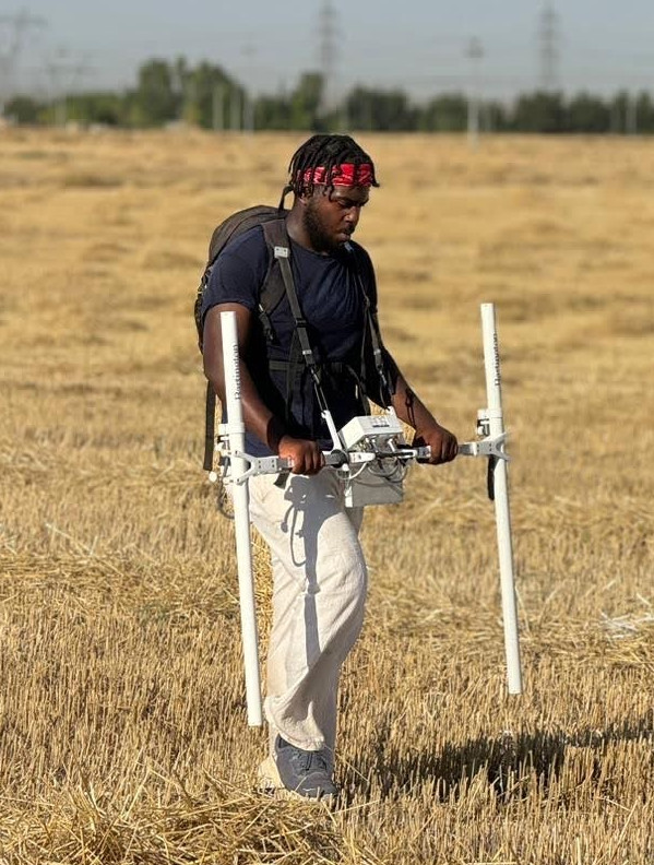
A magnetometer is a survey device that senses the slight magnetic changes in the atmosphere using the poles on either side of the device. The poles sense magnetic fields for about a meter in every direction. The device is so sensitive that the person operating it cannot wear any amount of magnetic clothing or have electronic devices on them. So sadly, while we were marching up and down rows of wheat for an hour or two at a time, we couldn’t have music or a podcast going.

A magnetometer works by taking a reading of the magnetic field every second. So to keep the readings from overlapping, we would have to walk at a constant pace of a meter per second, up and down a tape measure grid, so that we would know we are walking straight and at pace at all times. Funnily enough, the technology for magnetometers has remained fairly consistent over the years, meaning it’s old, so there’s a bit of manual adjusting we had to do before every use. The poles that measure magnetism can come off for easier transportation, meaning that we had to level them before each use to make sure that the poles were reading at the same height. Also to make sure the readings are stable, we had to hold the magnetometer out in front of us, which was also just as draining as walking. It appears light as parts are made of PVC material, but I promise, balancing those sensors on the sides is no joke.

Photo of Lonnie Reid operating a magnetometer.

The magnetometry team was always comprised of three people, one person holding the device and walking, and the other two would set up and move the grid system, so that as soon as one twenty by twenty square block was done, another could immediately start. I think the record for the most blocks done in a day was 16. Once you get into a groove, it’s pretty zen. But as I mentioned before, the lack of music does make it a long endeavor.

But why is magnetometry important? It’s a non-destructive survey method that allows archaeologists to plan out where they want to set up trenches, without needing to make an initial trench. This allows for areas with potential interest to be found sooner than just by choosing a spot based on the topsoil or by location near previous trenches.

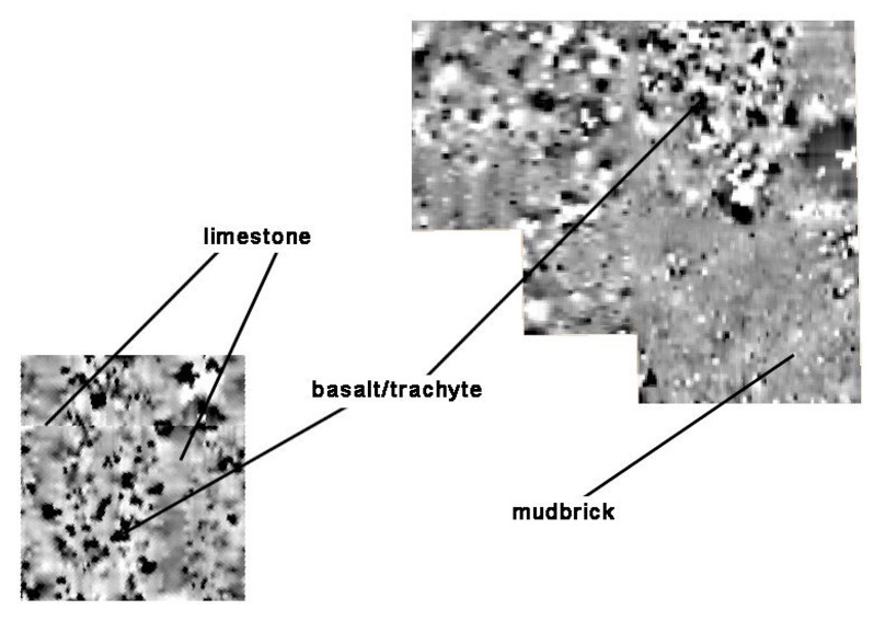
Magnetometer reading of limestone, basalt/trachyte, and mud brick.

Finally, I mentioned that the magnetometer has not really had a technological update in a few decades, so how do we process the data? Well the magnetometer itself does not know where it is within space, so that’s why we have to time out our steps at a meter per second. The machine does know that we walk up and down a grid in a zigzag pattern and whichever direction we face to begin with, must be the same direction for all of the squares to keep the data consistent. When uploading the raw data to the computer, it comes out as pixels, some shade of grey between black and white. The more white an area is, the more magnetic it is and the darker an area is, the less magnetic it is. Different types of stones and other materials will have their own magnetic signature. For example, basalt shows up black as it has little magnetism, whereas limestone is a medium gray, but mudbrick appears white. So eventually, you get a magnetic map of the area that shows where potential buildings used to lie due to the magnetic presence of the building materials.

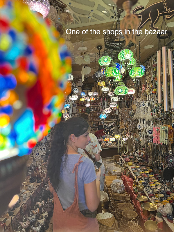
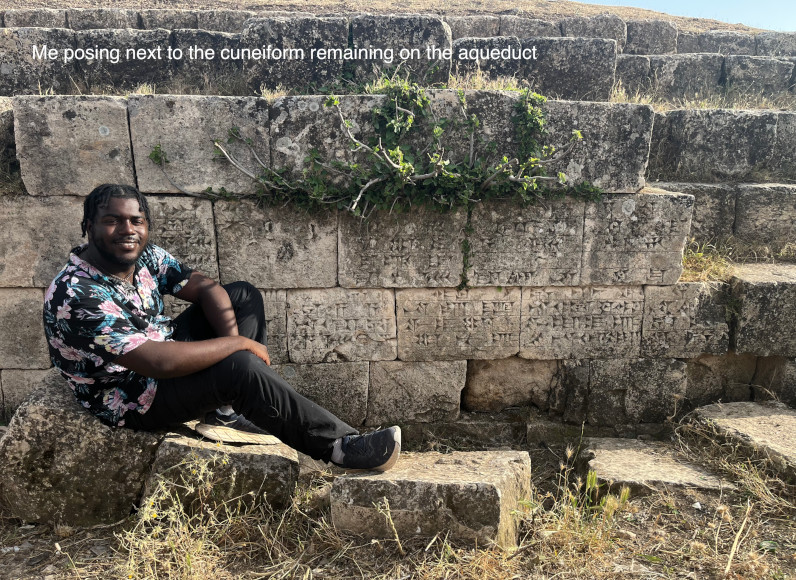
Magnetometry might have been the most intensive yet fun part of my fieldwork this past summer. But the trip wasn’t just all digging and marching. On the weekends we would make day trips to other archaeological sites in the greater Erbil area, and mingle with some of the locals and friends of the project. Our adventures included visiting Shanidar Cave, the bazaar, and a still standing aqueduct in Jerwan.

A shop in the bazaar.
Photo of Lonnie Reid sitting next to cuneiform remains on the aqueduct.

Lonnie Reid is a recent graduate of Emory University who studied math and art history. Currently a high school math teacher at Rabun Gap-Nacoochee School, Lonnie enjoys using both sides of his brain, and hopes to be able to discover more in the field for years to come.

Want to help more students and early career archaeologists get into the field? Donate to the cause today by selecting “Fieldwork Scholarships” as your gift purpose!

Fieldwork Report: Dominique Langis-Barsetti

Banner Image for Dominique Langis-Barsetti Post

The Joys of Thinking on Your Feet

Dominique Langis-Barsetti, 2024 Katherine Barton Platt Fieldwork Scholarship

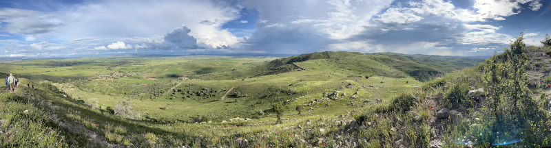
For many, archaeology is either an epic tale of breathtaking ruins, jaw-dropping finds, and exciting adventures in faraway lands, or a story of trowels, brushes, and dirt, and the delicate fragments of the past they reveal. For students coming to the field for the first time or joining a new project, the awe and wonderment associated with those visions of archaeology are very well in the cards. For those of us helping to run those projects and involved in making the archaeology happen, a field season is more often than not an exercise on thinking on your feet and embracing the chaos. A chaos that you must somehow harness, tame, control, and put to good use. This is all the more true when you work at one of the largest archaeological sites in Türkiye (fig.1), on a topographically-complex mountaintop, with a large team of local and international collaborators. But without the challenges, archaeology would not be nearly as much fun.

Fig. 1: Panoramic view of the southeastern section of the site, with the village of Şahmuratlı in the distance, on the left. Photo taken from the Kale, the Byzantine fortress built atop the most prominent point of the Iron Age city.

The 2024 season of the Kerkenes Project started with an eight-week delay, as we arrived in the field in mid-June. Despite this setback, we were determined to make as much of our time abroad as we could, both for the sake of our research agenda and for the field school students who had accompanied us. As the ground of our ancient 271-hectare city was now dry and sunbaked, we had to (mostly) put aside the extensive program of electrical resistance we usually carry out every year and jump straight into excavations.

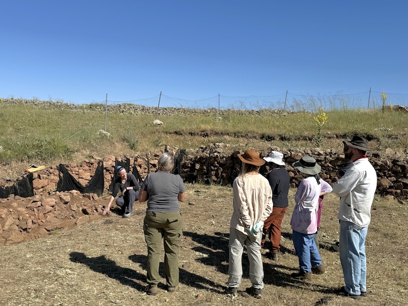
The original plan for the season involved dismantling a section of an unstable wall. Despite our best efforts to preserve it, the western wall of one of the city’s large columned halls had been crumbling away since it had first been exposed a decade ago. Unlike most walls at Kerkenes, which are composed of large facing stones holding in a core of rubble fill, this wall was part of a large room that had been built without facing stones. Originally, the stabilizing role of the missing facing stones had likely been fulfilled by wooden planks used a cladding, but with the wood now entirely gone, the rubble core was spilling out. The goal of the season’s excavations was thus to remove the rubble core down to the wall’s foundations (fig. 2). Documenting any evidence of construction techniques encountered in the process was a priority, particularly the placement and arrangement of wooden beams and posts incorporated into the structure. A small section of the same wall taken apart nearly a decade ago suggested that we might find the remains of large wooden posts at somewhat regular intervals within the fill. We were pleasantly surprised to discover that the wall’s structure was in fact much more complex. Since a portion of my doctoral research focuses on Iron Age construction techniques at the site, I was grinning much more widely than the students who had to spend several sweltering summer days carefully articulating the carbonized wooden remains. In the end, we discovered a series of half-round tie beams placed within the foundations of the wall, with pairs of posts placed atop them. Unfortunately, most of the wood had been reduced to ash by the devastating fire that destroyed the city over 2500 years ago, but some carbonized fragments are just large enough to let us hope for dendrochronological dates.

Fig. 2: Showing students and supervisors what to expect as they prepare to dismantle an unusual wall.

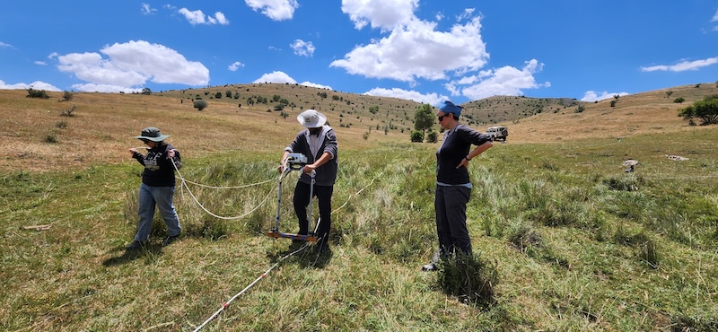
Amid one of the hottest summers on record, weeks after rains had stopped softening the soil of the central Anatolian plateau, we therefore had to come up with a plan to survey at least one 20 m by 20 m grid using electrical resistance. Although curtailed, the geophysical survey season could not be entirely cancelled since it represented an integral part of the field school. While in Türkiye, students learn about geophysical surveying, gain firsthand excavation experience, spend time with a variety of archaeological specialists, and are immersed in the life of a small central Anatolian village. With a much-shortened 2024 season, we had to come up with ways to make sure our students would still get the opportunity to learn the skills they had travelled halfway across the world to explore. This led to a rather intensive program, where lectures taking place during some of our off time replaced some of the hands-on experience that could not be accommodated. Despite the less-than-optimal conditions, students still spent two days learning geophysical survey techniques. After an intensive round of lectures, they gained practical experience through a survey of the excavation compound’s yard. In doing so, they learned about surveying in different environmental conditions, how to adapt to non-ideal ones, and what happens when equipment breaks. But surveying a small grid sandwiched between a dorm, a tractor, and a garden can only teach you so much. As the geophysical instructor, it was up to me to find a portion of the site where electrical resistance could still be carried out. We were now more than a month after the typical end of the geophysics season, at a time of the year when most of the clay-rich ground of the site is barely softer than the granite bedrock. Under those conditions, the logical solution was to survey a portion of the site that is normally too wet for electrical resistance. This meant driving around the site following the path of the ancient city’s water management system until I found a patch large enough and moist enough for a proper survey. In the spring, the different streams and reservoirs are usually too full of water to be surveyed. As we were now nearing the height of summer, much of those had dried up, revealing ground we usually could not access. To their credit, the students got through an entire grid by themselves, quickly learning the main aspects and challenges of geophysics as we collected new – and useable! – data (fig. 3).

Fig. 3: Teaching field school students how to survey in one of the few remaining soft patches of ground.

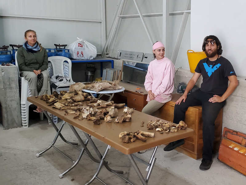
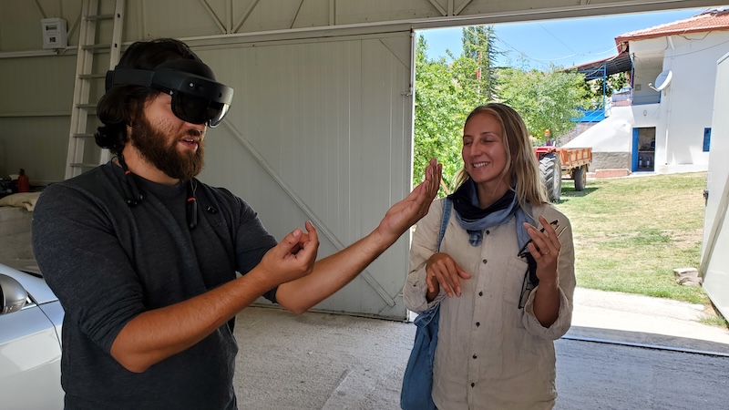
To make up for the absence of some of our specialists, the senior staff present in the field shared some of their own skills with the students in small workshops that do not normally take place. As the peculiarities of this season’s excavation plan meant very little osteological material was recovered, the students instead participated in the exhumation and preparation of new additions to our animal reference collection. Under the guidance of a specialist post-doctoral student, they excavated and cleaned modern remains, probably learning more than they wanted about cow and turtle anatomy and the decomposition process (fig. 4). To replace weeks and weeks of repetitive trench recording, the students were initiated to photogrammetry by making their own 3D model of a rubber duck and recorded artefacts with our handheld structured light scanner. They got a taste of the cutting-edge tendencies at Kerkenes when robots came for a test drive at the site, and everyone got to try the latest version of the DATCH heritage recording application for the HoloLens 2 mixed-reality headset (fig. 5).

Fig. 4: The freshly excavated remains of a butchered cow and drowned turtle, used to familiarise students with animal anatomy.
Fig. 5: Students donning a HoloLens 2 mixed-reality headset to try out the DATCH heritage recording program designed by members and collaborators of the Kerkenes Project.

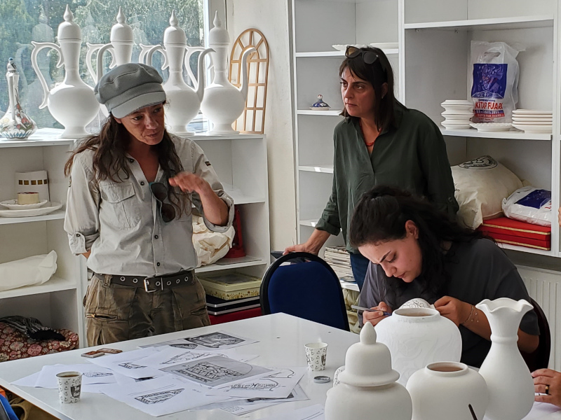
In addition to teaching activities within the team, the Kerkenes Project also partakes in several educational and outreach activities every year, teaching the local community and visitors to the site about the archaeology of Kerkenes. Less time in the field meant fewer chances to carry out those activities, so we got creative. Literally. In conjunction with the team from Uşaklı Höyük—a mounded site located 7 km from Kerkenes—we visited a women cooperative in the nearby town of Sorgun that paints ceramic vessels according to different decorative traditions. Archaeologists and ceramicists discussed ornamental techniques and motifs, comparing ancient and modern approaches. We introduced the participating cooperative members to decorative styles common in the region during the Iron Age, and they in return shared their knowledge of pigments and painting methods. We hope this leads to a revival and reinterpretation of ancient local motifs in the future (fig. 6).

Fig. 6: Sharing knowledge at Sorgun’s women-led ceramic cooperative.

Another of Sorgun’s women-led cooperatives specializes in the crafting of glass beads and figurines. One of the artists at the heart of this initiative visited the Kerkenes dig house and shared with us their process, their techniques, the materials they use, and the crafting challenges they face. We participated in the discussion by sharing images of ancient beads recovered at the site and elsewhere in the area, discussed local glass traditions going back millennia, and offered to provide them with all our empty glass bottles next season, to be melted down and remade into recycled glass beads. The enthusiasm from all participants was energizing and we hope this discussion leads to further collaborations and a melding of local crafts and archaeology.

Arriving so late in the field also meant we had a few surprise visitors. Among them was a group of professional painters and mosaicists on a week-long stay in the region. The goal of their artistic sojourn was for them to each produce two new artworks inspired by the area. We only caught them at the end of their stay, but they kindly invited us to their pop-up exhibit. Further discussion during the event led to a preliminary artistic plan for next year. We hope this collaboration comes to fruition, especially since we strive to include more local interpretations and impressions of the site into the narrative surrounding Kerkenes, which is currently mostly focused on the archaeology.

Overall, the 2024 Kerkenes field season was a success, despite the many challenges we faced. As an associate director on the project, many of those challenges land squarely on my desk, often with very little notice. Solving them usually comes down to a happy marriage of archaeological knowledge, logistical creativity, out-of-the-box thinking, and an open mind. And just a touch of crazy. For flavour. Some days this means driving the steep slopes of the sites for an “adventure” with students who did not get to spend as much time exploring those slopes themselves while also being on the lookout for that darker green hue indicative of retained moisture and softer soil. Sometimes it means making make-shift lanterns so the team can have some fun playing boardgames while the storm that knocked out our power blows past. And sometimes it means converting excavation equipment into firefighting gear when the dead tree next door catches fire in the middle of the night. We do archaeology for a chance to learn about the past, solve ancient mysteries – however mundane – and explore the unknown, so we have to be ready – and willing – when the unknown finds us.


Dominique Langis-Barsetti is a doctoral graduate from the University of Toronto and a member of the Kerkenes Project since 2010. On top of her duties as Associate Director, she teaches geophysical surveying, photogrammetry, excavation techniques, and archaeological illustration to students on the Project.

Want to help more students and early career archaeologists get into the field? Donate to the cause today by selecting “Fieldwork Scholarships” as your gift purpose!