2025 Fieldwork Updates

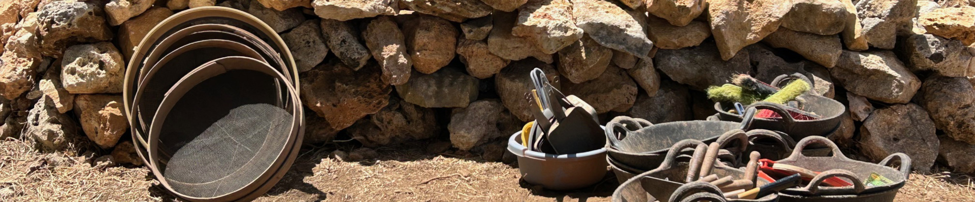
image of sifters, buckets, and other tools on the Menorca Archaeological Project

2025 UPDATES FROM THE FIELD

It is a busy and exciting time of year for many ASOR-affiliated projects. Below are some links to updates and stories from the field on social media. Click to read the latest edge-of-the-trowel news from the field. Survey, excavation, processing artifacts, conservation, visiting other sites, talking to the public, hosting outreach events—these accounts offer a slice-of-life picture of archaeology in action.
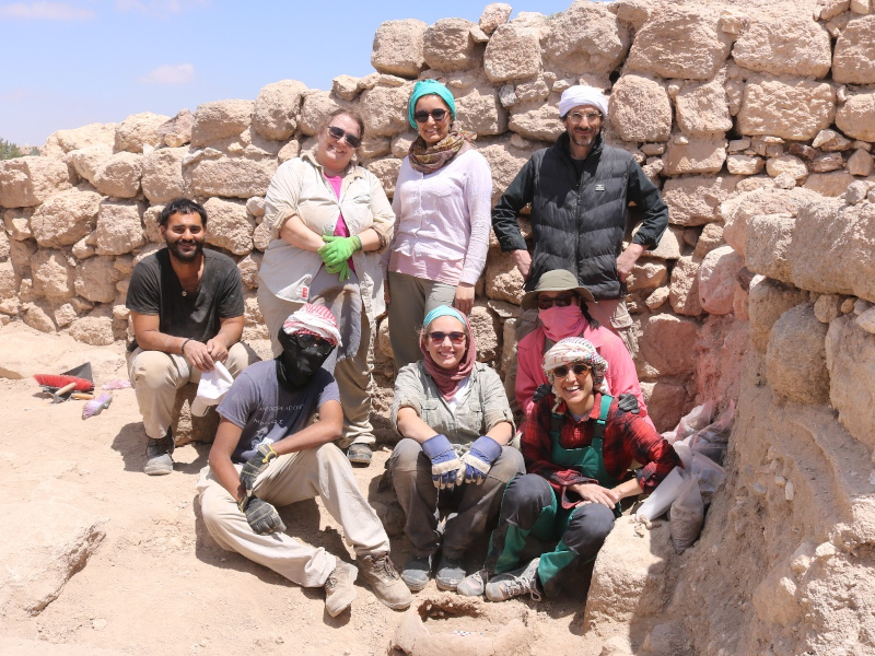
Photo from Aayush Umesh in Tall Hisban
Aayush Umesh, 2025 Eric and Carol Meyers fieldwork scholarship recipient, and team members excavating at Tall Hisban, Jordan.

Projects with Upcoming Fieldwork

Stay tuned from more news from students and researchers later this summer and fall both on the ASOR website and social media.

If you’d like to include updates from your ASOR-affiliated project on this list, email Marta Ostovich at programs@asor.org.

Interested in affiliating your project with ASOR? Learn more here.  
Fieldwork Report: Lonnie Reid

Banner photo for Lonnie Reid.

Magnetometry in the Erbil Plain

Lonnie Reid, 2024 Fieldwork Scholarship Recipient. 

My name is Lonnie Reid and thanks to ASOR’s scholarship, I had the opportunity to go to the Kurdistan Region of Iraq as a part of the Rural Landscapes of Iron Age Mesopotamia Project (RLIIM), run by Dr. Petra Creamer. For my report, instead focusing just on a specific trench, as we had multiple open this season, I will talk mainly about our main survey method, magnetometry.

But before we jump in, Qach Rresh is a Neo-Assyrian site in the Erbil plain that appears to be a transition center for goods going in and out of the major nearby city. Due to this, there are items of everyday transport on site such as pottery and arrowheads, and some things that you wouldn’t see everyday, but that’s a topic for another time.

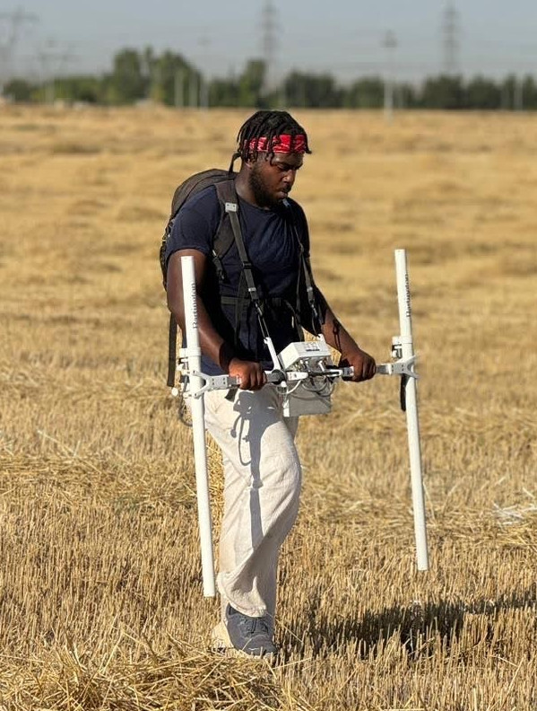
A magnetometer is a survey device that senses the slight magnetic changes in the atmosphere using the poles on either side of the device. The poles sense magnetic fields for about a meter in every direction. The device is so sensitive that the person operating it cannot wear any amount of magnetic clothing or have electronic devices on them. So sadly, while we were marching up and down rows of wheat for an hour or two at a time, we couldn’t have music or a podcast going.

A magnetometer works by taking a reading of the magnetic field every second. So to keep the readings from overlapping, we would have to walk at a constant pace of a meter per second, up and down a tape measure grid, so that we would know we are walking straight and at pace at all times. Funnily enough, the technology for magnetometers has remained fairly consistent over the years, meaning it’s old, so there’s a bit of manual adjusting we had to do before every use. The poles that measure magnetism can come off for easier transportation, meaning that we had to level them before each use to make sure that the poles were reading at the same height. Also to make sure the readings are stable, we had to hold the magnetometer out in front of us, which was also just as draining as walking. It appears light as parts are made of PVC material, but I promise, balancing those sensors on the sides is no joke.

Photo of Lonnie Reid operating a magnetometer.

The magnetometry team was always comprised of three people, one person holding the device and walking, and the other two would set up and move the grid system, so that as soon as one twenty by twenty square block was done, another could immediately start. I think the record for the most blocks done in a day was 16. Once you get into a groove, it’s pretty zen. But as I mentioned before, the lack of music does make it a long endeavor.

But why is magnetometry important? It’s a non-destructive survey method that allows archaeologists to plan out where they want to set up trenches, without needing to make an initial trench. This allows for areas with potential interest to be found sooner than just by choosing a spot based on the topsoil or by location near previous trenches.

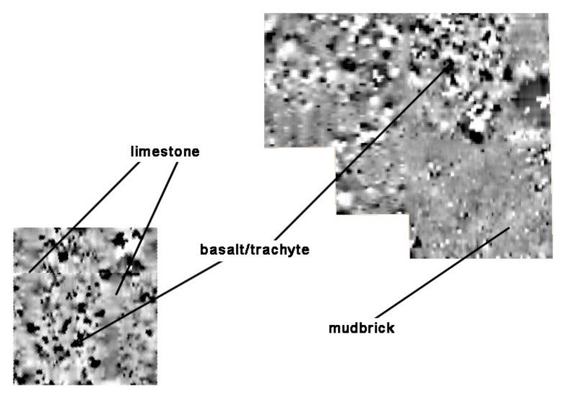
Magnetometer reading of limestone, basalt/trachyte, and mud brick.

Finally, I mentioned that the magnetometer has not really had a technological update in a few decades, so how do we process the data? Well the magnetometer itself does not know where it is within space, so that’s why we have to time out our steps at a meter per second. The machine does know that we walk up and down a grid in a zigzag pattern and whichever direction we face to begin with, must be the same direction for all of the squares to keep the data consistent. When uploading the raw data to the computer, it comes out as pixels, some shade of grey between black and white. The more white an area is, the more magnetic it is and the darker an area is, the less magnetic it is. Different types of stones and other materials will have their own magnetic signature. For example, basalt shows up black as it has little magnetism, whereas limestone is a medium gray, but mudbrick appears white. So eventually, you get a magnetic map of the area that shows where potential buildings used to lie due to the magnetic presence of the building materials.

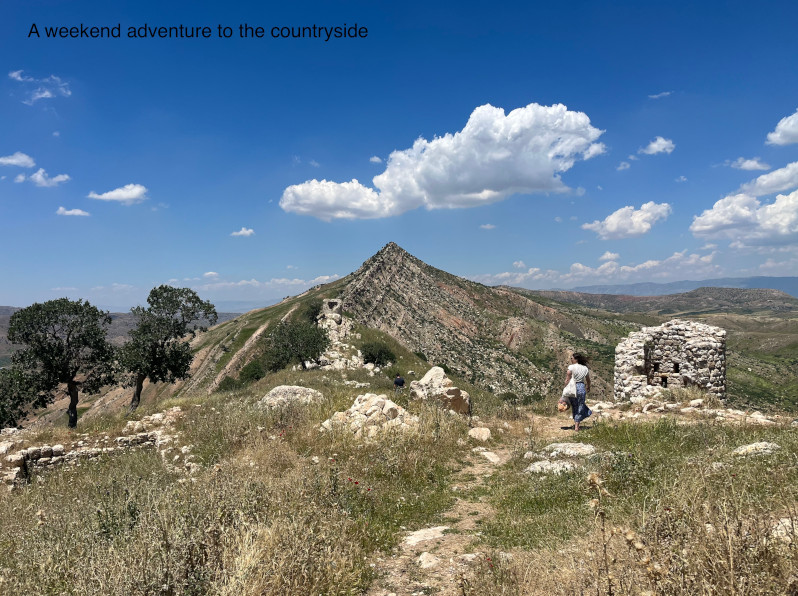
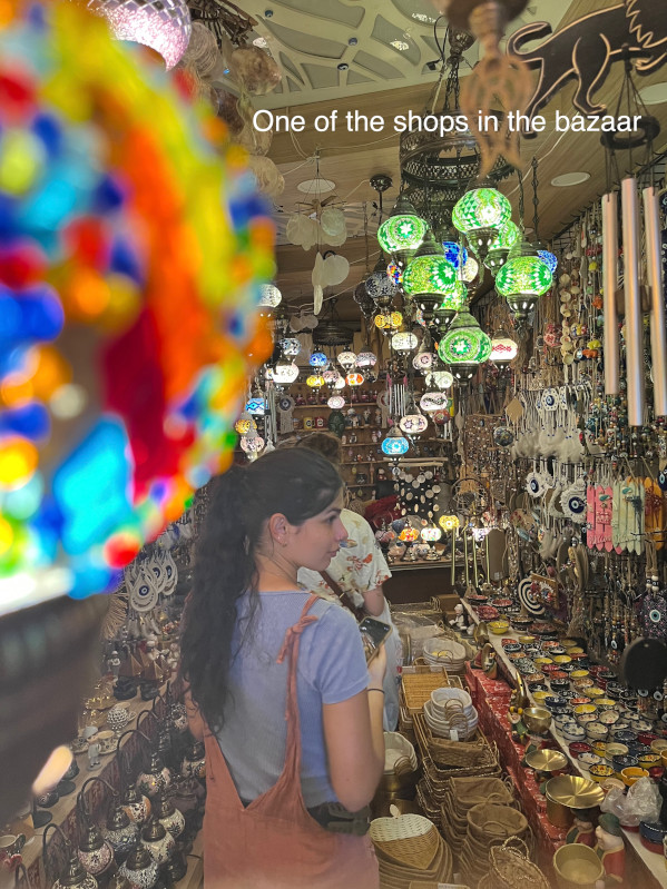
Magnetometry might have been the most intensive yet fun part of my fieldwork this past summer. But the trip wasn’t just all digging and marching. On the weekends we would make day trips to other archaeological sites in the greater Erbil area, and mingle with some of the locals and friends of the project. Our adventures included visiting Shanidar Cave, the bazaar, and a still standing aqueduct in Jerwan.

A shop in the bazaar.
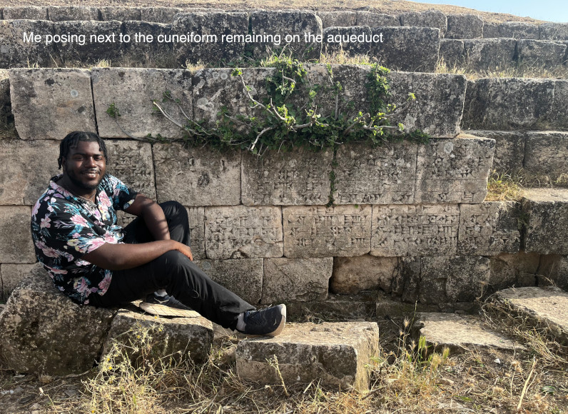
Photo of Lonnie Reid sitting next to cuneiform remains on the aqueduct.

Lonnie Reid is a recent graduate of Emory University who studied math and art history. Currently a high school math teacher at Rabun Gap-Nacoochee School, Lonnie enjoys using both sides of his brain, and hopes to be able to discover more in the field for years to come.

Want to help more students and early career archaeologists get into the field? Donate to the cause today by selecting “Fieldwork Scholarships” as your gift purpose!

Thank You Fiscal Year 2025 Donors

Banner Image for Dominique Langis-Barsetti Post

Thank You Fiscal Year 2025 Donors

We did it (once again)!
This fiscal year (July 1, 2024–June 30, 2025) was a resounding success for ASOR. The reason? You, our members and donors!

While participation has always been high with ASOR members, the percentage of members who have donated $5 or more above their membership dues sharply increased during the past two years. This is in part thanks to a new membership module that makes it easier to include a “add-on” gift or credit card fee contribution when making any ASOR purchase. Because membership dues and subscription fees account for only about 25% of ASOR’s annual revenue, these additional gifts are transformative.

This year, a record 924 people made a gift of $5 or more! Another 211 people made a gift of less than $5 (primarily donations to help with credit card fees), making for a total of 1135 donors. Moreover, the total of all donations in FY 2025 was more than $500,000. Please click on the FY 2025 Honor Roll of Donors to see a list of people who gave at all levels. We are in the process of updating the Lifetime Honor Roll of Donors, so please check it now (and next month) to see the amazing list of lifetime supporters. We are updating and checking these lists, so please contact us with any corrections or comments (info@asor.org).

Benefactor ($20k+) – 8
Patron ($10,000–19,999) – 8
Friend ($5,000–9,999) – 12
Sponsor ($1,000–4,999) – 33
Sustainer ($500–999) – 27
Supporter ($250–499) – 34
Contributor ($100–249) – 196
Donor ($25–99.99) – 107
Ally ($5–24.99) – 499
Gifts under $5 – 211

Donor Participation Since 2016

0 200 400 600 800 1000
405
402
457
461
377
509
363
456
905
924
FY16 FY17 FY18 FY19 FY20 FY21 FY22 FY23 FY24 FY25

Number of Donors

Why does high donor participation matter?

Nearly half of ASOR’s membership contributed this year—an achievement that sets ASOR apart from nearly every other learned society. Moreover, the high level of donor participation from our membership is viewed positively by foundations and major donors outside ASOR and helps ASOR attract support from them.

Your donations also enable ASOR to carry out our mission. Subscriptions and memberships only account for about a quarter of our annual budget, so we rely on grants and donations from our members and friends. Every contribution, no matter the size, helps sustain our work. Thank you again for your support. Truly, every donor is important, and every gift is meaningful.


Fiscal Year 2025 Honor Roll

ASOR Legacy Circle Members

OTHER WAYS TO DONATE

DONATE BY PHONEDONATE BY MAILMAKE A PLEDGE
(DONATE LATER)
Call ASOR:
(703) 789-9229
ASOR
209 Commerce Street
Alexandria, VA 22314
E-mail ASOR

Fieldwork Report: Gabbi Graber

Photo of Tel Burna, Israel

Memorized Movement

Gabbi Graber, 2024 Stevan B. Dana Fieldwork Scholarship Recipient

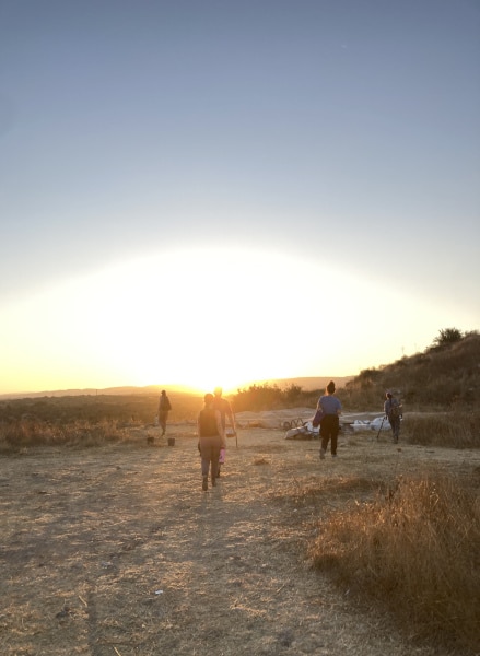
My alarm goes off at 4:50 a.m. and in a blur of confusion it takes a moment to remember that I am not in my bed in Alabama but instead am in a kibbutz in Israel. It’s day four and I have learned and practiced the exact time I need to make sure my bag is packed, coffee is made, and my water bottles are filled. In this flurry of well-practiced movement, everyone silently packs into the same car we’ve ridden in all week to arrive at Tel Burna before 6:00. The Shephelah hills roll around us as we listen to a dramatic Disney soundtrack calling forth nostalgia and lyrics long since memorized. We make the final ascent up to the site as the sun rises behind Tel Burna.

Photo of Tel Burna, Israel

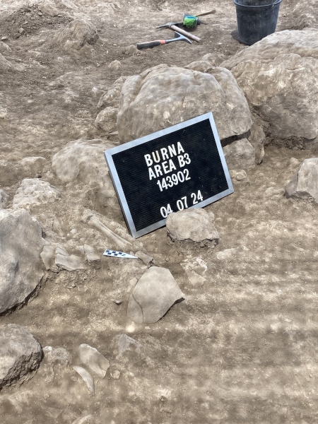
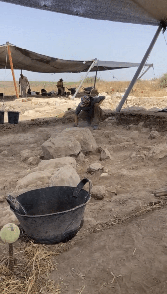
It feels almost instinctual that the first order of business, before the sun even begins to beat down, is to lift and place shade cloths over the open squares. People begin to scatter to their respective spaces as the area supervisor, makes the necessary adjustments for the day and communicates with the square supervisors. Seamless rotations of who is picking and who is cleaning allow for needed water breaks as the level of ground slowly lowers. As we dig, our eyes become better at spotting the indicative sherds from the body sherds. A sharp jar goes up my elbow as I hit the stone that will be the first evidence of a wall cutting straight through our square. A loud voice breaks us from the focus, and everyone grabs their preferred breakfast items knowing what will sit well with still four more hours of digging. As I work with a patishe, I listen to the conversation of the Dig Director, area supervisor, and my square supervisor about the pattern of the walls and where we will need to open a new square. I check my watch and with not much time left to dig in the day I swiftly switch to sweeping the square starting in a corner to move cohesively with the others in my unit. What I thought was bedrock on day one I now know to be the packed dirt we will remove tomorrow. Many hands make the end of the day move faster as we organize tools, lower shade cloths, and pack up the cars. The drive back to the kibbutz involves more singing of childhood songs, laughing at inside jokes, and wistful longings of a post-dig ice cream.

Photo of Tel Burna, Israel

We each grab a brush and bucket of pottery, and I am always drawn to a bucket that was from the square I dug. Pottery washing clumps us back together as we recall different sherds and the squares they came from. Every ear is bent towards the main table where the experts sit examining and reading pottery as the square supervisors talk through their square. They casually lift a sherd and quickly place it in its period. This leaves volunteers and students alike astounded at the practiced eye of a well-seasoned archaeologist able to date a sherd by touch and sight alone.

Photo of Tel Burna, Israel

Dirt washed down the drain and feeling slightly more human, we again hop in the cars and hike up a new tell with new site lines that help explain the importance of the geographical placement of Tel Burna within its valley system. The day has been long and full, and dinner can switch quickly between laughter and silent, tired camaraderie. Dirt mustaches, sweat stains, repeat outfits, and tired conversations bond a group that is half repeat diggers and brand-new strangers.

Photo of Tel Burna, Israel

To think that I knew none of this a mere four days ago is astounding. There is still much to learn and as I heard well-experienced archaeologists in the field say “we’ve never seen this before” or I think about potentially being a square supervisor in the future. A mere four days ago I did not know what a tag was, and now I have the license number memorized. And while the pick does not feel comfortable in my hand it feels more natural that it did on Monday. I knew as soon as my first day in the field was over that I wanted to spend more days, months, summers, and years becoming seasoned and trained in this profession, for each day on site becomes a day of new discoveries in the art of what becomes practiced and perfected memorized movement.

Photo of Tel Burna, Israel

Gabbi Graber is a recent M.A. graduate from Jerusalem University College studying Biblical History and Geography and will begin her Ph.D. in Ancient Near Eastern Archaeology at Lipscomb University this fall.

Want to help more students and early career archaeologists get into the field? Donate to the cause today by selecting “Fieldwork Scholarships” as your gift purpose!

Fieldwork Report: Dominique Langis-Barsetti

Banner Image for Dominique Langis-Barsetti Post

The Joys of Thinking on Your Feet

Dominique Langis-Barsetti, 2024 Katherine Barton Platt Fieldwork Scholarship

For many, archaeology is either an epic tale of breathtaking ruins, jaw-dropping finds, and exciting adventures in faraway lands, or a story of trowels, brushes, and dirt, and the delicate fragments of the past they reveal. For students coming to the field for the first time or joining a new project, the awe and wonderment associated with those visions of archaeology are very well in the cards. For those of us helping to run those projects and involved in making the archaeology happen, a field season is more often than not an exercise on thinking on your feet and embracing the chaos. A chaos that you must somehow harness, tame, control, and put to good use. This is all the more true when you work at one of the largest archaeological sites in Türkiye (fig.1), on a topographically-complex mountaintop, with a large team of local and international collaborators. But without the challenges, archaeology would not be nearly as much fun.

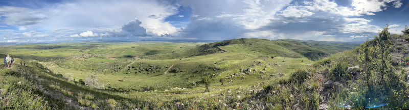
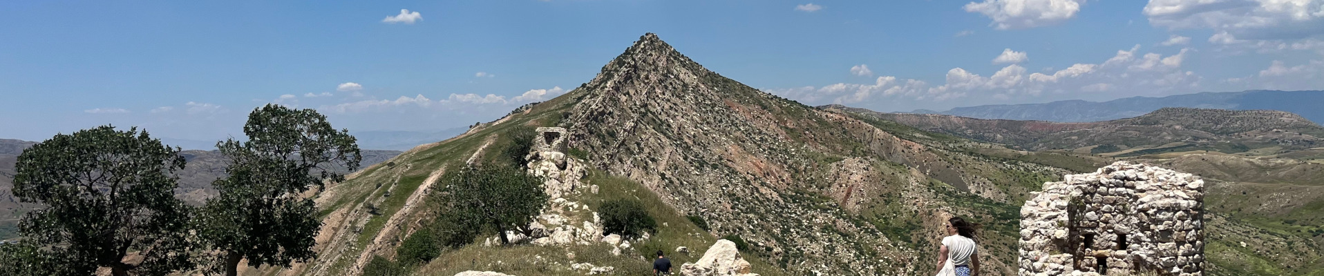
Fig. 1: Panoramic view of the southeastern section of the site, with the village of Şahmuratlı in the distance, on the left. Photo taken from the Kale, the Byzantine fortress built atop the most prominent point of the Iron Age city.

The 2024 season of the Kerkenes Project started with an eight-week delay, as we arrived in the field in mid-June. Despite this setback, we were determined to make as much of our time abroad as we could, both for the sake of our research agenda and for the field school students who had accompanied us. As the ground of our ancient 271-hectare city was now dry and sunbaked, we had to (mostly) put aside the extensive program of electrical resistance we usually carry out every year and jump straight into excavations.

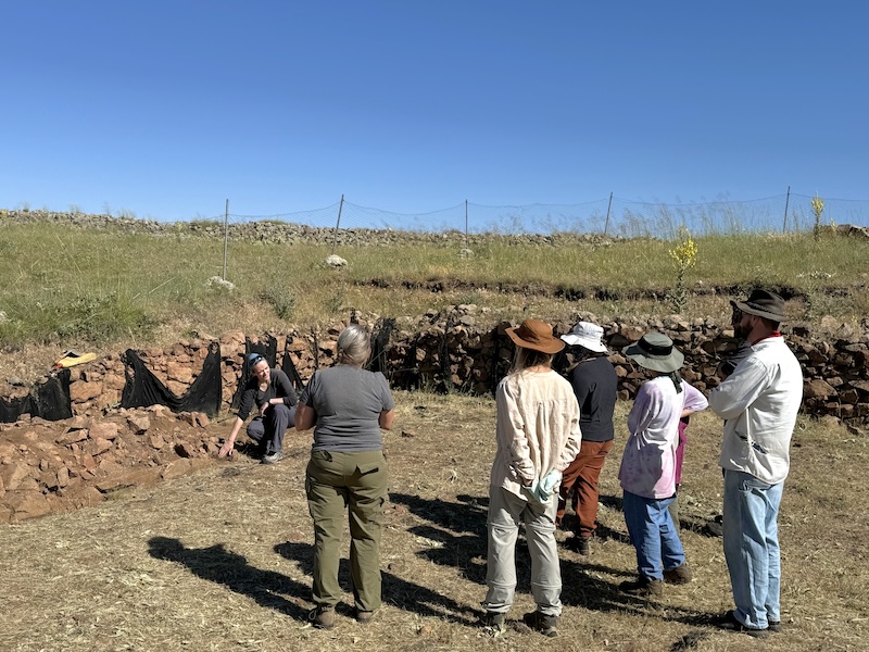
The original plan for the season involved dismantling a section of an unstable wall. Despite our best efforts to preserve it, the western wall of one of the city’s large columned halls had been crumbling away since it had first been exposed a decade ago. Unlike most walls at Kerkenes, which are composed of large facing stones holding in a core of rubble fill, this wall was part of a large room that had been built without facing stones. Originally, the stabilizing role of the missing facing stones had likely been fulfilled by wooden planks used a cladding, but with the wood now entirely gone, the rubble core was spilling out. The goal of the season’s excavations was thus to remove the rubble core down to the wall’s foundations (fig. 2). Documenting any evidence of construction techniques encountered in the process was a priority, particularly the placement and arrangement of wooden beams and posts incorporated into the structure. A small section of the same wall taken apart nearly a decade ago suggested that we might find the remains of large wooden posts at somewhat regular intervals within the fill. We were pleasantly surprised to discover that the wall’s structure was in fact much more complex. Since a portion of my doctoral research focuses on Iron Age construction techniques at the site, I was grinning much more widely than the students who had to spend several sweltering summer days carefully articulating the carbonized wooden remains. In the end, we discovered a series of half-round tie beams placed within the foundations of the wall, with pairs of posts placed atop them. Unfortunately, most of the wood had been reduced to ash by the devastating fire that destroyed the city over 2500 years ago, but some carbonized fragments are just large enough to let us hope for dendrochronological dates.

Fig. 2: Showing students and supervisors what to expect as they prepare to dismantle an unusual wall.

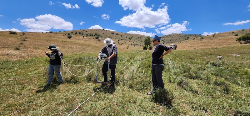
Amid one of the hottest summers on record, weeks after rains had stopped softening the soil of the central Anatolian plateau, we therefore had to come up with a plan to survey at least one 20 m by 20 m grid using electrical resistance. Although curtailed, the geophysical survey season could not be entirely cancelled since it represented an integral part of the field school. While in Türkiye, students learn about geophysical surveying, gain firsthand excavation experience, spend time with a variety of archaeological specialists, and are immersed in the life of a small central Anatolian village. With a much-shortened 2024 season, we had to come up with ways to make sure our students would still get the opportunity to learn the skills they had travelled halfway across the world to explore. This led to a rather intensive program, where lectures taking place during some of our off time replaced some of the hands-on experience that could not be accommodated. Despite the less-than-optimal conditions, students still spent two days learning geophysical survey techniques. After an intensive round of lectures, they gained practical experience through a survey of the excavation compound’s yard. In doing so, they learned about surveying in different environmental conditions, how to adapt to non-ideal ones, and what happens when equipment breaks. But surveying a small grid sandwiched between a dorm, a tractor, and a garden can only teach you so much. As the geophysical instructor, it was up to me to find a portion of the site where electrical resistance could still be carried out. We were now more than a month after the typical end of the geophysics season, at a time of the year when most of the clay-rich ground of the site is barely softer than the granite bedrock. Under those conditions, the logical solution was to survey a portion of the site that is normally too wet for electrical resistance. This meant driving around the site following the path of the ancient city’s water management system until I found a patch large enough and moist enough for a proper survey. In the spring, the different streams and reservoirs are usually too full of water to be surveyed. As we were now nearing the height of summer, much of those had dried up, revealing ground we usually could not access. To their credit, the students got through an entire grid by themselves, quickly learning the main aspects and challenges of geophysics as we collected new – and useable! – data (fig. 3).

Fig. 3: Teaching field school students how to survey in one of the few remaining soft patches of ground.

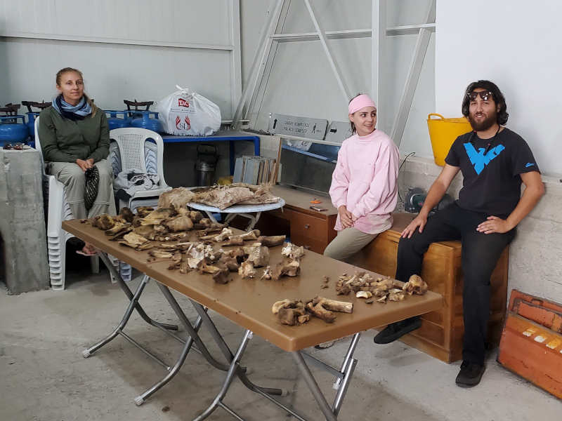
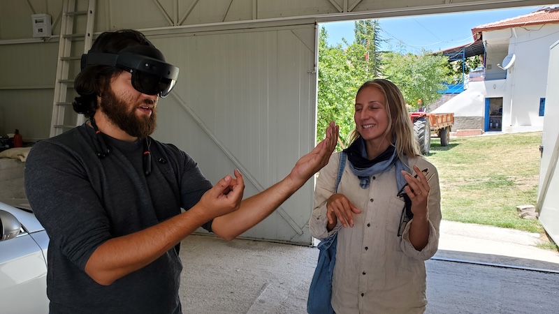
To make up for the absence of some of our specialists, the senior staff present in the field shared some of their own skills with the students in small workshops that do not normally take place. As the peculiarities of this season’s excavation plan meant very little osteological material was recovered, the students instead participated in the exhumation and preparation of new additions to our animal reference collection. Under the guidance of a specialist post-doctoral student, they excavated and cleaned modern remains, probably learning more than they wanted about cow and turtle anatomy and the decomposition process (fig. 4). To replace weeks and weeks of repetitive trench recording, the students were initiated to photogrammetry by making their own 3D model of a rubber duck and recorded artefacts with our handheld structured light scanner. They got a taste of the cutting-edge tendencies at Kerkenes when robots came for a test drive at the site, and everyone got to try the latest version of the DATCH heritage recording application for the HoloLens 2 mixed-reality headset (fig. 5).

Fig. 4: The freshly excavated remains of a butchered cow and drowned turtle, used to familiarise students with animal anatomy.
Fig. 5: Students donning a HoloLens 2 mixed-reality headset to try out the DATCH heritage recording program designed by members and collaborators of the Kerkenes Project.

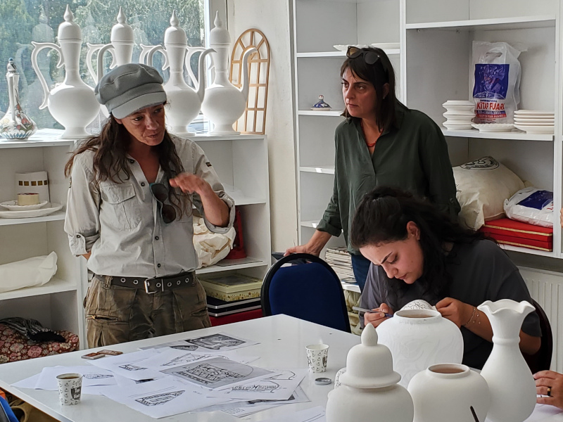
In addition to teaching activities within the team, the Kerkenes Project also partakes in several educational and outreach activities every year, teaching the local community and visitors to the site about the archaeology of Kerkenes. Less time in the field meant fewer chances to carry out those activities, so we got creative. Literally. In conjunction with the team from Uşaklı Höyük—a mounded site located 7 km from Kerkenes—we visited a women cooperative in the nearby town of Sorgun that paints ceramic vessels according to different decorative traditions. Archaeologists and ceramicists discussed ornamental techniques and motifs, comparing ancient and modern approaches. We introduced the participating cooperative members to decorative styles common in the region during the Iron Age, and they in return shared their knowledge of pigments and painting methods. We hope this leads to a revival and reinterpretation of ancient local motifs in the future (fig. 6).

Fig. 6: Sharing knowledge at Sorgun’s women-led ceramic cooperative.

Another of Sorgun’s women-led cooperatives specializes in the crafting of glass beads and figurines. One of the artists at the heart of this initiative visited the Kerkenes dig house and shared with us their process, their techniques, the materials they use, and the crafting challenges they face. We participated in the discussion by sharing images of ancient beads recovered at the site and elsewhere in the area, discussed local glass traditions going back millennia, and offered to provide them with all our empty glass bottles next season, to be melted down and remade into recycled glass beads. The enthusiasm from all participants was energizing and we hope this discussion leads to further collaborations and a melding of local crafts and archaeology.

Arriving so late in the field also meant we had a few surprise visitors. Among them was a group of professional painters and mosaicists on a week-long stay in the region. The goal of their artistic sojourn was for them to each produce two new artworks inspired by the area. We only caught them at the end of their stay, but they kindly invited us to their pop-up exhibit. Further discussion during the event led to a preliminary artistic plan for next year. We hope this collaboration comes to fruition, especially since we strive to include more local interpretations and impressions of the site into the narrative surrounding Kerkenes, which is currently mostly focused on the archaeology.

Overall, the 2024 Kerkenes field season was a success, despite the many challenges we faced. As an associate director on the project, many of those challenges land squarely on my desk, often with very little notice. Solving them usually comes down to a happy marriage of archaeological knowledge, logistical creativity, out-of-the-box thinking, and an open mind. And just a touch of crazy. For flavour. Some days this means driving the steep slopes of the sites for an “adventure” with students who did not get to spend as much time exploring those slopes themselves while also being on the lookout for that darker green hue indicative of retained moisture and softer soil. Sometimes it means making make-shift lanterns so the team can have some fun playing boardgames while the storm that knocked out our power blows past. And sometimes it means converting excavation equipment into firefighting gear when the dead tree next door catches fire in the middle of the night. We do archaeology for a chance to learn about the past, solve ancient mysteries – however mundane – and explore the unknown, so we have to be ready – and willing – when the unknown finds us.


Dominique Langis-Barsetti is a doctoral graduate from the University of Toronto and a member of the Kerkenes Project since 2010. On top of her duties as Associate Director, she teaches geophysical surveying, photogrammetry, excavation techniques, and archaeological illustration to students on the Project.

Want to help more students and early career archaeologists get into the field? Donate to the cause today by selecting “Fieldwork Scholarships” as your gift purpose!

Fieldwork Report: Christos Theodorou

Ash the World Turns or How I Learned to Stop Worrying and Love the Heat in a Bronze Age Oven: Excavations at Kissonerga-Skalia, Cyprus

Christos Theodorou, 2024 Meyers/Wright Fieldwork Scholarship Recipient

When exploring areas around the coastal southwestern Cypriot village of Kissonerga, one is struck by the abundance of prehistoric settlements in the region amidst the hotels, tavernas, and banana fields. A cursory look at the academic literature or a quick online search reveals even more ancient activity, from the Neolithic to the Late Bronze Age periods, that are obscured by modern development. It is in this setting that I had the privilege of returning this summer to continue my studies of Cypriot archaeology — back to the Bronze Age site of Kissonerga-Skalia for my second non-consecutive season.

I’m at the top left in the oven removing some charcoal

Skalia is wildly interesting, with Chalcolithic tombs and signs of settlement from the Early Cypriot period (c. 2400 BCE) to the beginning of the Late Cypriot period, after which the site was abandoned (c. 1600 BCE). About two generations before abandonment, a large complex was constructed over the older habitations. This features monumental walls (including a unique ‘S’ shaped wall), a considerable courtyard, numerous pyrotechnic installations, and areas with signs of intensive production. It is this complex from the final phase of occupation where the current excavations at Skalia are focused.

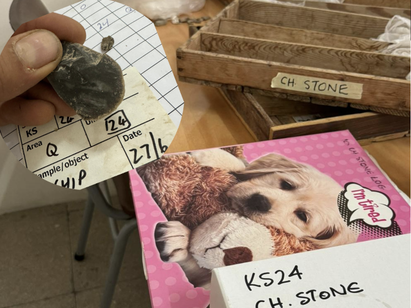
My tasks at Skalia in 2022 concentrated on excavating through the collapsed material of a plaster-lined oven (one of two in our trench), defining the extent of the oven and nearby basins, and identifying the surface level. Ultimately, it was discovered that the two pyrotechnic features were actually one massive four-meter-wide oven underlying the final phase floor. I would spend the 2024 excavation season on-site within this oven: hot, covered in ash, and contented. Additionally, I underwent supervisor training and managed the log of accumulated chipped stone on site.

The trench B2 gang

Work in the half-sectioned oven was relatively straightforward. The idea posited by our trench supervisor was that after the oven fell out of use, it was filled with debris during a dumping and leveling episode, and the final phase floor was constructed over the feature — placing the oven into a timeframe referred to as Early Final Phase. Amidst the infill of large stones, blocky chunks of oven material, crumbly orange and brown soil, thick layers of white lime plaster, and — ash, ash, ash — we found a bit of bronze (likely from tweezers), large chunks of really nice charcoal (a rarity on site, despite the number of pyrotechnic features. Also, significant for dating and identifying the type of fuel used in the oven), an abundance of discarded ground stone tools, and Skalia’s very first coprolite (!).

Charcoal and an intact juglet

All the removed fill from the oven was collected for floatation, and I eagerly anticipate what archaeobotanical remains turn up. Keep an eye out for the final report from this season to the Cypriot Department of Antiquities, as some novel features associated with our giant oven will undoubtedly be revealed, as well as thoughts on its possible functionality. In the end, it will be interesting to see how this Early Final Phase feature relates to the larger context of the nearby Late Final Phase courtyard, oven (identified as a malting kiln for beer production), and the unique adjoining room recognized for its deposition of modified bovid skulls located under one of the many benches which lined the walls (a potential foundation deposit).

Logging chipped stone

At its earliest levels, Kissonerga-Skalia will be integral in studying the changes on the island during the transition from the Chalcolithic into the Early Bronze Age. Additionally, current work in the commercial production complex that supplanted the older village settlement, investigations into its subsequent abandonment, and regional interconnectivity throughout Cyprus and abroad will bring many vexing questions to focus.

So, until next year…

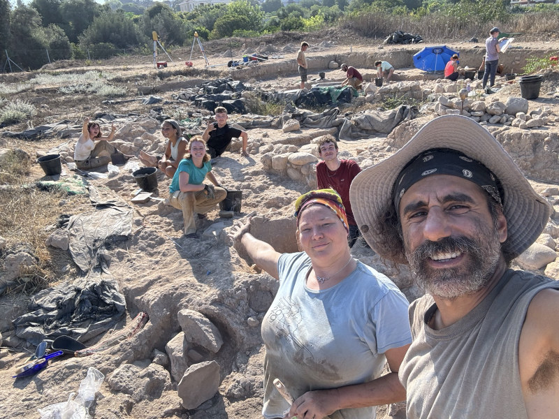
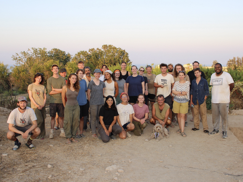
Most of the team that was on-site on the last day

I am indebted to Skalia’s director, Dr. Lindy Crewe (Cyprus American Archaeological Research Institute), Ian Hill (Heritage Archaeological Research Practice), our trench supervisor, Dr. Ellon Souter (είμαστε ντισκοτέκ), and the rest of the staff for their invaluable guidance. My sincerest thanks and appreciation go out to Drs. Carol and Eric Meyers, for their generosity in providing the financial resources that have enabled me to return and continue my studies in prehistoric Cypriot archaeology, and ASOR for providing generations of archaeologists with incalculable scholarships, grants, fellowships, and support.


Christos Theodorou is a dual citizen from New York living in his family’s village in Cyprus. He splits his time between tending to his grandfather’s fields, exploring the island, and pursuing a postgraduate degree in archaeology at the University of Cyprus. Though his academic interests span the pre- and proto-historic Cypriot periods, the Bronze Age seems to live rent-free in his head. He has yet to cut himself too severely trying to knap chert.

Want to help more students and early career archaeologists get into the field? Donate to the cause today by selecting “Fieldwork Scholarships” as your gift purpose!

Message from ASOR’s Board Chair

Message from ASOR’s Board Chair

Dear ASOR friends:

In about 6 weeks, we will conclude another successful ASOR fiscal year (June 30). This year, by working together, we have made substantial progress in increasing ASOR’s capacity to fulfill our mission in the face of unexpected headwinds.

You, as an ASOR member and friend, support our solid foundation—strong publications, an engaging annual meeting, enhanced support for fieldwork, and careful stewardship of funds. Conflicts around the world continue to impact our annual meeting attendance and will affect summer fieldwork opportunities. Nevertheless, your membership and gifts advance our shared goals.

This year, 2025, marks the conclusion of one major initiative and the beginning of another.

On Saturday evening of the Annual Meeting in Boston, we will celebrate ASOR’s 125th anniversary and the successful completion of the $5 million ASOR 2025 campaign. So far, you have helped us raise $4.6 million. We’re nearly there! Your support of this fundraising initiative enables ASOR to thrive and innovate despite challenges to the humanities and threats to cultural heritage around the world. Discounted tickets for the anniversary celebration are available, and we encourage all friends, members and supporters to join us.

As the ASOR 2025 fundraising effort winds down, we have already begun another key initiative: to update our strategic plan for the years 2026 – 2030. Our President, Sharon Herbert, and President-Elect, Jane DeRose Evans, are leading a task force to consult members, develop the plan, and send it to the Board of Trustees.

As we near the end of the fiscal year (June 30), I ask you to consider an unrestricted gift to ASOR. We are currently about $40,000 short of our Annual Fund goal of $140,000. The Annual Fund allows ASOR to deliver its programs effectively. Changes to federal grants impact staff support and our cultural heritage work, so your participation is even more important this year.

If you have already contributed this fiscal year, thank you. If you haven’t yet made a gift (or if you have contributed but can make another gift to help at this challenging time), I hope you will join me in giving before June 30. I deeply appreciate your support.

Best regards,


Sheldon M. Fox
Chairman, Board of Trustees


Fieldwork Report: Ofelia Tychon

Banner Image for Ogelia Tychon Post

Getting to Know Rural Assyrians

Ofelia Tychon, 2024 Katherine Barton Platt Fieldwork Scholarship Recipient 

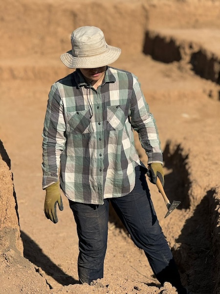
Photo of Ofelia Tychon on the RLIIM projec.

This spring, I got a chance to be part of the excavation team for the Rural Landscapes of Iron Age Imperial Mesopotamia (RLIIM) Project, now in its third season. The project, run by Prof. Petra Creamer of Emory University, brought together international scholars from Cambridge University, J.W. Goethe University-Frankfurt am Main, Johns Hopkins University, Montana State University, University of California, Los Angeles, University College London, University of Chicago, University of Pennsylvania, and Utah State University, in addition to the local professionals from the Directorate General of Antiquities and Heritage of the Kurdistan Region.

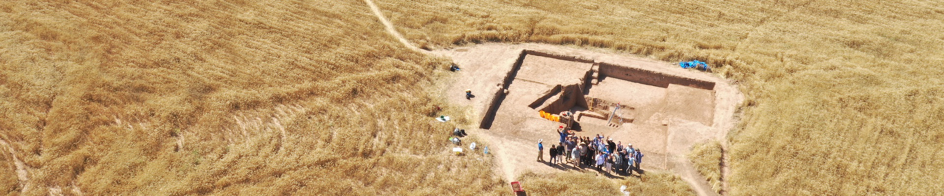
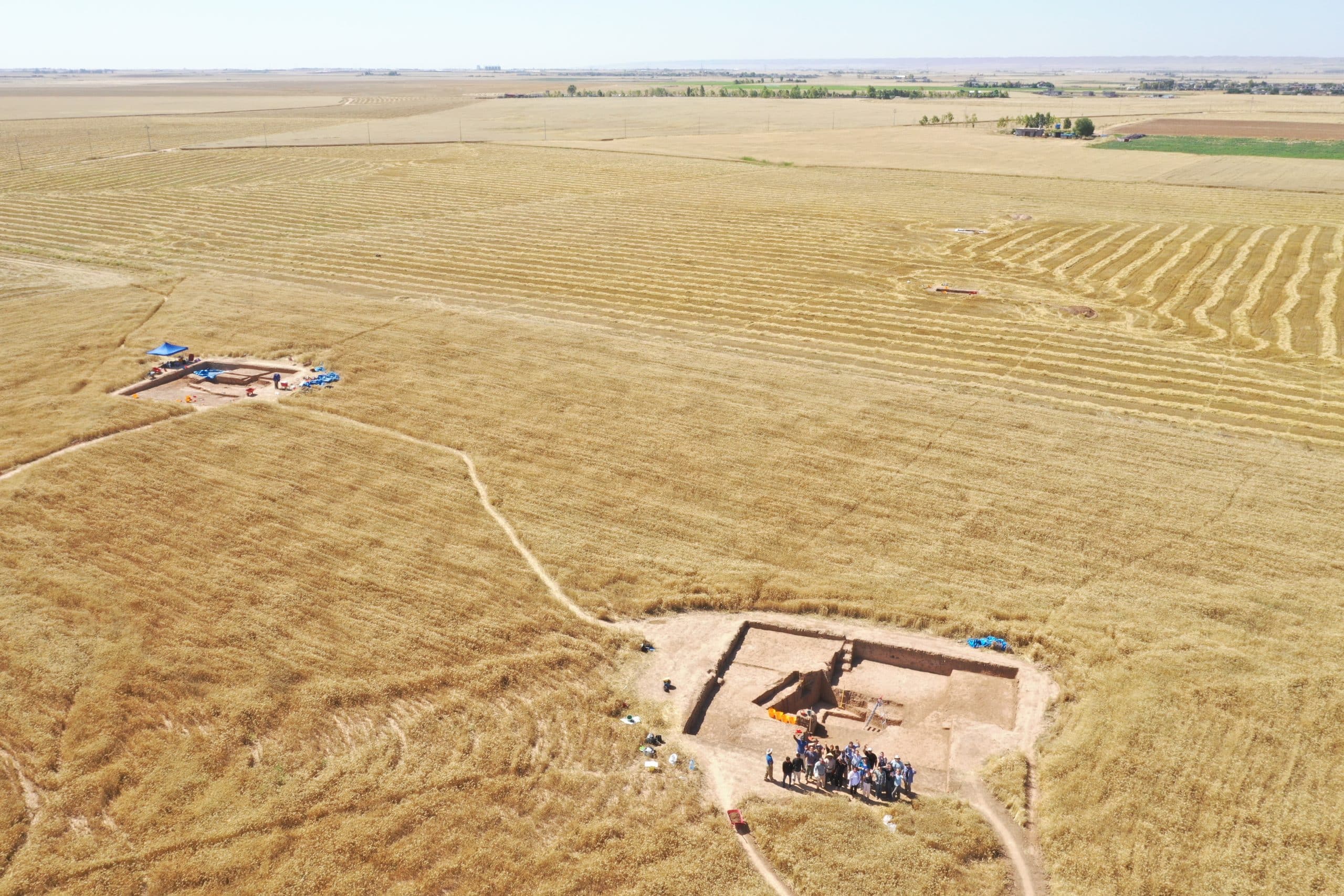
Drone Photo of RLIIM Site

The RLIIM site is located near Erbil, Iraqi Kurdistan, which is part of the area usually referred to as the ‘Assyrian Heartland’. The Neo-Assyrian Empire expanded from its heartland to reach from the Arabian Gulf to the Mediterranean, including Egypt, between the 9th and 7th centuries BCE, and is often seen primarily as an aggressively expansionist empire, fuelled by conquests and associated booty, tributes and deportations, which has driven the sort of scholarship that is produced about Assyria.

Historically, most excavations in the Iraqi Kurdistan, where the Assyrian heartland was located, have focused on major urban sites, and particularly monumental architecture, with even urban living quarters rarely excavated. While this is slowly changing, as surveys that uncover rural sites have been and still are being undertaken, excavations of small, rural Iron Age sites continue to be extremely rare, and RLIIM is proudly one of the few. RLIIM seeks to reconstruct how Imperial Assyria impacted rural landscapes and its rural populations, particularly why this site (and others like it) existed in a relatively marginal agricultural area, which populations settled in these rural areas and how they organized, as well determining the extent (or lack thereof) of continuity between the late Assyrian and post-Assyrian periods.

During the 7-week 2024 season, the RLIIM team was able to significantly expand its three existing trenches and opened up a fourth one. Trech A, where I spent most of my time during the season, houses a large mudbrick building with a courtyard. The nature of the soil in the area means that distinguishing mudbrick is a challenge and requires great concentration from the excavators (and perfect morning light!).

Photo of Ofelia in Trenches at RLIIM

The choice to expand and open up new trenches was greatly aided by magnetometry survey results from the first two seasons. Further magnetometry surveying was accomplished this season as well. I was personally able to participate in gathering magnetometry data and get “hands-on” magnetometry survey techniques instruction.

An important part of the RLIIM project is the analysis of the faunal and archaeobotanical remains. Numerous samples were collected and sent for analysis at the end of the season, and we eagerly await the results. As with most archaeological projects, pottery processing is an integral element of the efforts. Thousands of sherds were processed on site, and the analysis thereof is helping in creating an updated late Assyrian vs post-Assyrian pottery typology, something that is particularly helpful when analysing surface survey results, which are vital in order to understand the settlement pattern change that took place after the collapse of the Neo-Assyrian Empire.

Photo of Drawn Pottery

The team did not just spend their time at the site. We were able to travel to key locations in the region on our days off, including the Neo-Assyrian period Jerwan Aqueduct, Faida Canal, Khinis reliefs and Bastora Dam sites, as well as visiting the Cambridge University’s Shanidar Cave project famous for its Neanderthal remains.

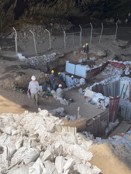
Photo of Shanidar Cave

The 2024 season concluded just as the weather in Kurdistan was heating up well into the 100s, but the work continues on the analysis of the data gathered by the team. I look forward to coming back next spring armed with more knowledge acquired via this analysis.


Ofelia is a PhD candidate at the Institute of Archaeology, University College London. She holds a Master’s Degree in Ancient Near Eastern Studies from the University of Toronto. Her research interests lie within the economic and social aspects of history and archaeology of the Near East during the first millennium BCE, particularly the Neo-Assyrian and Neo-Babylonian Empires.

Twitter/X @ofeliatweets

RLIIM Project: https://rliim.weebly.com/

Want to help more students and early career archaeologists get into the field? Donate to the cause today by selecting “Fieldwork Scholarships” as your gift purpose!

2025 Grant & Fellowship Awardees

2025 PROJECT GRANT AND RESEARCH FELLOWSHIP AWARDEES

Grants for Archaeological Projects: $61,650 awarded

Stevan B. Dana Project Grants: $15,000 awarded
  • Silvia Amicone (University of Tübingen) Rediscovering Ancient Clay Landscapes: Geological Prospection for Pottery Making in the Mosul Dam Region
  • Kathryn Grossman (North Carolina State University) Makounta-Voules Archaeological Project
  • Elise Laugier (Utah State University) Erbil Plain Archaeological Survey
Stevan B. Dana Project Grants for Israel: $15,000 awarded
  • Zachary Dunseth (University of California San Diego) Early Desert Cities: An Investigation into 3rd Millennium BCE Urbanism at the Macro- and Microscales
  • Gregg Gardner (University of British Columbia) and Orit Peleg-Barkat (Hebrew University of Jerusalem) The Horvat Midras (Israel) Archaeological Project
  • Kathryn Gleason (Cornell University) and Barbara Burrell (University of Cincinnati) Promonotory Palace Project at Caesarea Maritima
Charles Harris Project Grants: $10,000 awarded
  • Jacob Lauinger and Zeynep Türker (Johns Hopkins University) Tell Atchana/Alalakh Excavations
  • Claire Padovani (CNRS Archéorient) Crafting Landscape: Resources Exploitation and Production Strategies in Iraqi Kurdistan during Urbanisation and State Formation (CraftLand)
Joe D. Seger Grant: $2,500 awarded
  • Hanna Erfetnbeck (Colgate University) and Natalia Handziuk (University of Notre Dame) Tall al-Handaquq South Archaeological Project
Shepard Urgent Action Grants: $11,150 awarded
  • Khaled Abu Jayyab (University of Toronto) The Tell ‘Arna Site Preservation Initiative
  • Tiffany Earley-Spadoni (University of Central Florida) Conservation of Middle Bronze Age Cuneiform Tablets from Kurd Qaburstan
  • Julia Nikolaus, Nick Ray (Ulster University), and Ahmad Emrage (University of Benghazi)  The Al Haniyah Emergency Documentation Project
Lawrence T. Geraty Community Archaeological Grants: $8,000 awarded
  • Madaba Regional Archaeological Museum Project
  • Tourism Development at Tall Hisban

Research Fellowships: $22,000 awarded in 2025

Study of Collections Fellowships: $4,000 awarded
  • Laura Alvarez (University of Cambridge) Me and We in the Mirror. A Study of Self and Other from Mesopotamia to the Levantine Coast during the Fourth and Second Millennia BCE
  • Erin Darby (University of Tennessee) Missing Ritual Objects from the Nelson Glueck Excavations of Kheleifeh
Herbert Warren Mason Fellowship: $5,000 awarded
  • Nicholas Gill (Università Ca’ Foscari Venezia) The Celestial Scorpion: A Renegade Constellation in Early Mesopotamia
Mesopotamian Fellowship: $13,000 awarded
  • Ella Egberts (Vrije Universiteit Brussel) The Iraqi Western Desert PLACES Project: Pleistocene LAndsCapes and Early human behavior in the Shbicha region
  • Anonymous

New ASOR-Affiliated Projects 2025

New ASOR-Affiliated Projects: May 2025

Currently, 152 projects are affiliated with ASOR. This includes 122 field projects and 30 publication projects. Twelve new projects have received ASOR affiliation since last summer. Read more about these new ASOR-affiliated projects below!

ASOR-affiliated projects adhere to ASOR policies, most notably the Non-Discrimination Policy, Policy on Professional Conduct, and Code of Conduct for the ASOR Annual Meeting and Other ASOR Sponsored Events. These policies affirm ASOR’s commitment to high standards for research integrity, academic mentoring and ethical professional behavior. Project Principal Investigators may apply for ASOR affiliation for their projects through the Committee for Archaeological Research and Policy (CAP).  Principal Investigators of ASOR-affiliated projects are eligible to apply for ASOR Project Grants and Shepard Urgent Action Grants. Students working on ASOR-affiliated projects are eligible to apply for Scholarships for Fieldwork Participation.

Fieldwork at S'Urachi in 2017

Fieldwork at S’Urachi in 2017

The S’Urachi Project investigates how the Indigenous Nuragic inhabitants of Iron Age Sardinia coped with Phoenician and subsequent Carthaginian influence, trade and colonization across the first millennium BCE. Long-term excavation at nuraghe S’Urachi on the central west coast of Sardinia offers detailed insights into how Indigenous communities and local households coped with these changes and adapted innovations to their own preferences.

The S’Urachi Project operates with a renewable three-year permit of the Italian Ministry of Culture and in close coordination with its regional office (Soprintendenza archeologica) in Cagliari (Sardinia, Italy). The project works closely with the town of San Vero Milis, who hold the project’s permit and appoint the project’s co-directors, Dr. Alfonso Stiglitz (director of the local Museo Civico) and Prof. Peter van Dommelen as the academic directors (direttori scientifici). The project is committed to prompt publication and public dissemination in multiple languages. The project website is bi-lingual and hosts (under ‘reports’) both yearly annual reports in Italian and a full list of its publications since 2012; the latter are mostly in Italian and Spanish and open access.

Crafting Landscape: Resources Exploitation and Production Strategies in Iraqi Kurdistan during Urbanisation and State Formation (CraftLand), Iraq (Claire Padovani)

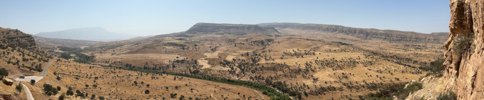
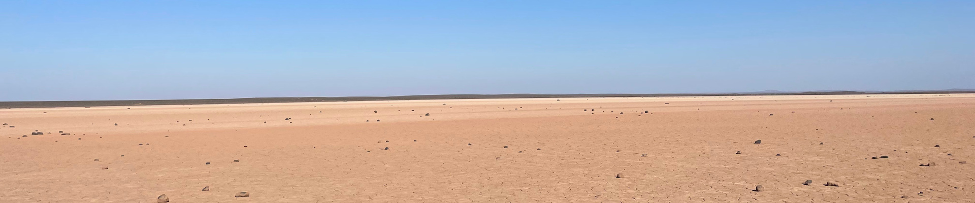
Landscape of the Qara Dagh foothills (Iraqi Kurdistan) © CraftLand

Landscape of the Qara Dagh foothills (Iraqi Kurdistan) © CraftLand

The CraftLand project investigates resource exploitation and production networks in the Kurdistan Region of Iraq, focusing on a clay-rich area between Sulaymaniyah, Chamchamal and Sangaw. Recent excavations in this area revealed large-scale pottery workshops dating to the 4th and 3rd millennia BCE. Moreover, the region has witnessed recurrent developments of intensive ceramic productions up to the present day, suggesting the presence of natural and social conditions favorable to the establishment and sustainability of a pottery-based economy.

The project adopts a bottom-up approach to the study of early economies in a “rural” region, offering a fresh perspective on local impacts of Mesopotamian urbanisation and State formation. It will reconstruct production networks and resource exploitation strategies, in order to assess patterns of landscape use that supported the operation of extensive pottery production. Craftland integrates multiple disciplinary perspectives, combining environmental, archaeological, and ethnographic studies. The research methodology includes geomorphological and geological surveys, satellite imagery, targeted field interventions (micro-surveys and test excavations), archaeometric analyses, and interviews with local potters. In addition, CraftLand contributes to cultural heritage preservation by documenting endangered artisanal traditions and fostering local engagement in the study and conservation of ancient craftsmanship.

Humayma Excavation Project, Jordan (Craig A. Harvey, Sarah E. Wenner)

Aerial view of Humayma. Photo by Jane Taylor.

Aerial view of Humayma. Photo by Jane Taylor

The archaeological site of Humayma is located in southern Jordan, approximately equidistant between Petra and Aqaba. Founded by the Nabataean peoples in the 1st century BCE to control communication and trade in the heartland of the Nabataean Kingdom, Humayma became home to the earliest Roman fort in the region following the kingdom’s annexation in 106 CE. The site thrived economically throughout the Roman and early Byzantine periods, as demonstrated by the presence of no less than five churches from this time. In the early Islamic period, Humayma rose to global significance as home to the Abbasid dynasty before its overthrow of the Umayyad Caliphate in the 8th century. The sustained prosperity of this site throughout its occupation demonstrates the proficiency of local inhabitants to effectively exploit their surrounding landscape and leverage the strategic location of Humayma as a nexus of regional and long-distance trade and communication.

This project represents a renewal of archaeological investigation at Humayma, which will build on the success of previous work at the site. Preliminary goals of the first three seasons will be the creation of a high-resolution map of the site and investigation of its economic development from the Nabataean to Islamic periods, particularly regarding local resource extraction and use at the site.

Bioarchaeology of Syedra: Reconstructing lived experiences through human skeletal remains at Syedra Antik Kenti (Syedra Archaeological Site), Alanya Province, Turkey (Kathryn Marklein, Ertug Ergurer)

An overview of Syedra

An overview of Syedra

What happens to people and communities when empires “fall”? The “Bioarchaeology of Syedra” project seeks to understand how the political transition from the Roman to Byzantine Empires impacted the sociobiological, cultural, and epidemiological landscape of ancient Syedra, Turkiye. A vital coastal economy in the Roman period (2nd-4th c. CE), this city transformed during the Byzantine period (11th-12th c. CE). Current excavations of the site have revealed multiple Byzantine burial grounds as well as extramural Roman tombs. Implementing methods and datasets from ancient DNA, paleopathology, and mortuary archaeology, the broader bioarchaeological research project aims to identify: 1) (dis)continuity in population structure between periods, as assessed through genetic diversity and kinship; 2) analyze transitions in cultural beliefs, as assessed spatially and materially in Roman and Byzantine period cemeteries; and 3) contextualize biological stress and resilience, as assessed through demographic and paleopathological data. Bioarchaeological fieldwork will include the excavation of Roman and Byzantine graves, processing of human skeletal remains post-excavation, and preliminary osteobiographical analyses of skeletons. The “Bioarchaeology of Syedra” is part of the larger Syedra Antik Kenti Archaeological Site, under the auspices of the Turkish Ministry of Culture and Tourism. This excavation seeks to 1) uncover the Roman period city to better understand its place in the Roman and later Byzantine Empires; 2) increase local and international interest in archaeology and history; and 3) preserve the site for local and global cultural heritage.

Athenian Agora Excavations, Greece (John Papadopoulos)


Overview of the current excavation area in the northern section of the Agora


Students excavating in the field

The Agora of Athens, located immediately north of the Athenian Acropolis, was the central marketplace of the ancient city. In addition to its commercial activities, the Agora was also a major religious, political, administrative, and legal center for Athens, and the site of the world’s first democracy. Excavations at the site have been conducted by the American School of Classical Studies at Athens (ASCSA) since 1931. Since then, workmen and volunteers have uncovered a history that spans from the Late Neolithic period (ca. 4000 BCE) to the modern period.

Most recently, the Agora excavations are focused in the northern area of the site, directly above part of a Middle Byzantine neighborhood, as well as the central portion of the Classical Stoa Poikile, or Painted Stoa. In addition to continuing the traditional program of field excavations, we have implemented new collection strategies related to material artifacts and faunal and archaeobotanical remains, as well as programs of geophysical survey, LiDAR modeling, and photogrammetry. Work in the field is conducted by a team of volunteers that are selected annually after an open call for applications, as well as supervisors and specialists who typically return for multiple seasons. Volunteers are typically undergraduate or graduate students of archaeology and while many have experience already, for some this is their first experience in the field.

Nineveh East Project, Iraq (Timothy Harrison, Khaled Abu Jayyab)

An overview of eastern Nineveh


An overview of eastern Nineveh

The Nineveh East Project, a collaboration between the Iraqi State Board of Antiquities and Heritage (SBAH) and the Institute for the Study of Ancient Cultures (ISAC), University of Chicago, focuses on assessing damage, restoration, and scientific excavations at Nineveh following extensive destruction during ISIS’s occupation of Mosul (2014-2017). Efforts are centered on eastern Nineveh, which includes the city’s expansion under King Sennacherib (705-681 BCE). The project began work at the Shamash Gate in 2020 under the Joint Iraqi-Italian Expedition to Nineveh. One of the largest gates along Nineveh’s eastern wall, the Shamash Gate sustained severe damage due to tunneling by ISIS, which destabilized its structure. While the core structure of the gate remained largely intact, ISIS tunneling within the gate has led to its destabilization.

Between 2021-2024, operations that encompassed stabilization, excavation, and restoration took placed led by Dr. Timothy Harrison and field director Dr. Khaled Abu Jayyab. The primary objectives included stabilizing the gate by reinforcing and filling the tunnels, the systematic removal of debris from the 612 BCE destruction of Nineveh, and the delineation of tower chambers within the gate. Starting in 2025, work will expand across eastern Nineveh to investigate post-Sennacherib urban development while continuing restoration efforts. This new phase includes collaboration with the local municipality to develop public spaces, reinforcing Nineveh’s significance as a landmark in East Mosul. Additionally, these efforts aim to support tourism infrastructure by integrating archaeological heritage into the city’s cultural and economic future.

The Promontory Palace Project at Caesarea Maritima, Israel (Barbara Burrell, Kathryn Gleason)

The Promontory Palace. Photo by Barbara Burrell

The Promontory Palace. Photo by Barbara Burrell

The Promontory Palace, first identified by Ehud Netzer as that of Herod the Great, is built out into the Mediterranean Sea, just west of the theater in the SE area of Caesarea Maritima. Initially, the lower palace was constructed for Herod to plan and supervise the great harbor, and the palace was extended later in his reign to provide reception space for guests at spectacles and official functions. On his death, the palace served as the official praetorium of his heirs and subsequent Roman officials for centuries. Lower Promontory Excavations in the 1970s by Netzer and Lee I. Levine in the lower area of the palace revealed a series of luxurious reception rooms and heated chambers centering on a large (35 x 18 m.) rock-cut swimming pool enclosed by a colonnade. Cuttings in the bedrock between the columns suggested to Netzer that planters had been built between the columns, offering a pluteus around the pool, as well as the effect of a garden for swimmers in the pool. The Upper Palace Excavations were undertaken by K. Gleason and B. Burrell for the University of Pennsylvania Museum (1990-1996), in collaboration with Netzer and Hebrew University.

The project is now in the final stages of publication by Burrell and Gleason for the University of Cincinnati and Cornell University, respectively, together with Lisa Kahn, co-editing the Finds Volume. Although the building was thoroughly looted over the centuries, the project is providing an exceptional insight into the transition of an official residence from Hellenistic basilaea to Roman praetorium in terms of architecture and material culture. The project has also made contributions to the environmental archaeology of maritime villas, to the study of ceramic building materials, to the corpus of defixiones (curse tablets). The publication will comprise two volumes and an open access database of the excavation’s stratigraphy and finds.

American Expedition to Idalion, Cyprus (Pamela Gaber)

Fieldwork in the Lower City of ancient Idalion

Fieldwork in the Lower City of ancient Idalion

Idalion was the first in the ancient Assyrian lists of Copper trading cities in Cyprus. Help us apply the latest digital methods to piece together the history of this fascinating and important ancient metropolis. The 2025 season of the American Expedition to Idalion will be a short season focused on removing baulks in two of the previously excavated fields not dug since Covid. There will be much orientation, and strict stratigraphic attention to aligning visible soil changes with legacy data, while employing digital recording techniques in the field using OCHRE, the University of Chicago’s platform for digital research. Associate Director Andrew Wright will oversee this aspect of the work. Associate Director Valerie Woelfel will conduct the GIS aspects of the project. All volunteers and students will be introduced to all techniques. Director Pamela Gaber will be overall excavation coordinator and presenter of Idalion’s place in history.

The Casa della Regina Carolina (CRC) Project, Pompeii, Italy (Caitie Barrett, Kathryn Gleason, Annalisa Marzano)

This excavation and survey of a large house and garden at Pompeii investigates relationships between domestic material culture, social performance, and historical change. Pompeii is central to any account of Roman daily life, but much of its archaeological record results from early excavations conducted before modern field practices. This project combines innovative archaeological and environmental field methods with a rigorous approach to legacy data, applying new detection and recording techniques while also salvaging and synthesizing information from early excavations to investigate the relationship between the “macro-scale” of ancient historical change and the “micro-scale” of daily domestic experience. Scholars have historically treated changes in household material culture as a reaction to developments that “really” took place in other spheres, such as the political or military events that dominate traditional historical narratives. However, recent research questions such assumptions, suggesting that domestic material culture wielded an agency of its own. The Casa della Regina Carolina site spans multiple periods of occupation, with at least two pre-Roman (2nd/1st century BCE) houses underlying the Roman-period standing architecture. By investigating change over time in the material conditions of life at this site, we explore relationships between domestic material culture, social performance, and historical change.

Tall al-Handaquq South Archaeological Project, Jordan (Hanna Erftenbeck, Natalia M. Handziuk)

Tall al-Handaquq South Archaeological Project (HAP) is investigating the earliest cities in Jordan, dating to the Early Bronze Age (EBA, 3800–2000 BCE). As one of the larger EBA sites in the Levant, Tall al-Handaquq South (THS) offers significant insights into the earliest urban phenomenon in the Near East and Eastern Mediterranean. Our research project engages with key transformations brought on by the first cities, including how people fed, organized, and housed a rapidly growing community.

Understanding the visibility of archaeological sites in satellite imagery through the analysis of soils and their reflectance, Jordan Valley (Sayantani Neogi)

The potential of satellite imagery as a technique of archaeological site prospection, particularly in the Middle East, has been widely recognised since the beginning of the 21st century (e.g., Donoghue, 2001; Donoghue et al., 2002; Philip, Donoghue, et al., 2002; Pournelle, 2003). However, while traditional extensive desk-based survey methods have proved effective in locating the morphologically distinctive nucleated tell sites characteristic of settlement in the Bronze and Iron Ages, they have been less successful in recognising the smaller, dispersed settlements common during prehistoric and Graeco-Roman and Medieval occupation – especially in landscapes where mudbrick was the main building material and/or where topographic features have been reduced by ploughing. Many such sites can only be distinguished from background soils by differences in soil reflectance (colour, texture). While multispectral satellite imagery can reveal areas of differential reflectance, not all such features are sites, and the relationship between surface reflectance and the composition of archaeological deposits indifferent environments is poorly understood.

This project seeks to address this gap by investigating and comparing the field-observed and image-derived reflectance properties of the soils/sediments from a sample of archaeological sites, of different types, located in several geomorphological units within Jordan, thus increasing the ability of researchers to identify anthropogenic despots when reliant upon satellite imagery.

Türkmen-Karahöyük Archaeological Project (TKAP), Turkey (Michele Massa, James Osborne)

The Türkmen-Karahöyük Archaeological Project excavates a Bronze Age, Iron Age, and Hellenistic urban center in the Konya Plain, Türkiye.