
Fieldwork Report: Sheldon Harmacy

A Triumphant Return to the Field

Sheldon Harmacy, 2024 Strange/Midkiff Families Fieldwork Scholarship

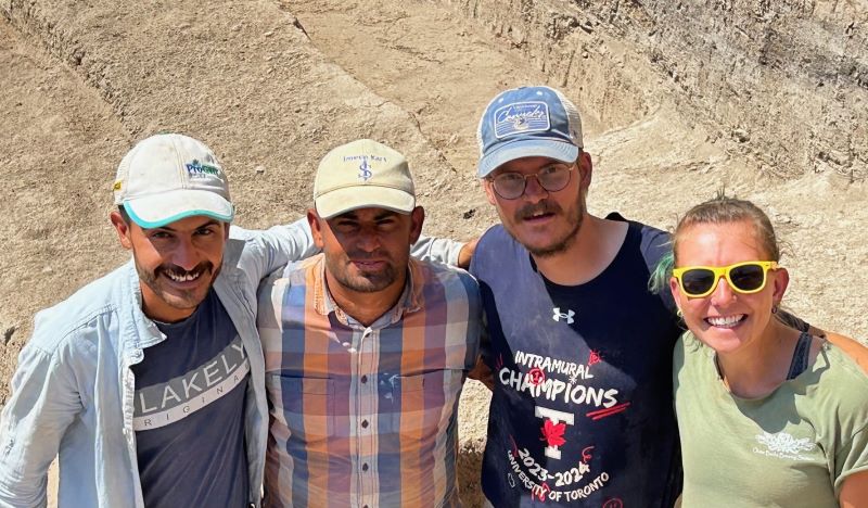
Photo 1: The crew for Square G4. 65 this season, from left to right, Cafir, Abas, Sheldon (me), and Rose
Photo 1: The crew for Square G4. 65 this season, from left to right, Cafir, Abas, Sheldon (me), and Rose.

This summer I excitedly returned to fieldwork as part of the University of Toronto’s team working with the Tayinat Archaeological Project (TAP). The site is integral to my proposed thesis research which aims to explore the role and place of chipped stone technologies following the proliferation of metal technologies in the region. I previously participated in the excavations of Tell Tayinat during the 2022 season, following the completion of my master’s degree. Unfortunately, due to the devastating earthquake that occurred in the region during the spring of 2023, I did not return to the site for the 2023 season. Coming back for this season, I came prepared to both continue to grow and learn as a scholar but also deal with new challenges and resets afforded to the project via the events of 2023. I am incredibly thankful to ASOR and the Strange/Midkiff Families Fellowship for their financial support which allowed me to participate in this season’s investigations.

The damage from 2023 affected much of the region including the major city of Antakya which included the dig house and depot for the TAP project. As such, this year they had to reset and start again from the ground up. Ahead of the field season, the TAP Senior Staff worked feverishly to acquire land and construct a new home for the project as well as set up the various administrative and laboratory spaces and paperwork needed to run the field season. As we were the first to experience this new set up, it was not without its bumps and bruises, but many of us came in ready for the challenge, banding together as a team to work hard and turn our new space into the project’s home.

The site of Tell Tayinat itself, is a large archaeological mound located within the Amuq Valley of Southern Türkiye. The site has a long history of archaeological investigations, beginning with the Braidwood Survey in the 1930s and more recently with the Amuq  Valley Regional Project and associated excavations headed by Dr. Timothy Harrison and the University of Toronto in the late 1990s and early 2000s. The archaeological explorations of the mound itself have focused on the upper mound and identified two major occupational layers, one dated to the Iron Age, and another dated to the Early Bronze Age.

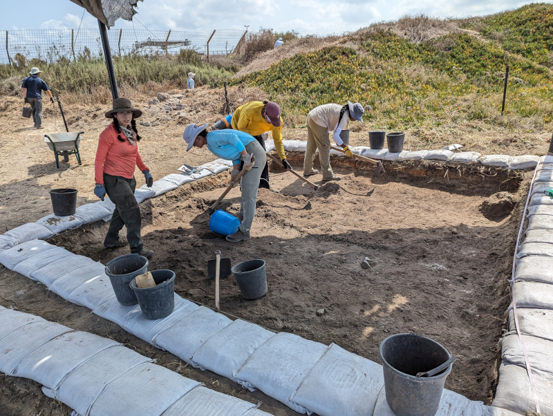
My role in the investigations of the site were as a Square Supervisor within the Early Bronze Area of the site (Field 1). I oversaw both the day-to-day excavation of a specific square but also the various forms of paperwork and digital recording as well as a detailed season report related to the square itself. This was all performed in dialogue with an Area Supervisor, who in my case was Dr. Lynn Welton, a Tayinat veteran and one of the senior staff. Working and learning from Dr. Welton, I continued to hone my skills and approach to the archaeological methods used in the region, in particular dealing with mudbrick, as well as utilizing the OCHRE program for digital recording.

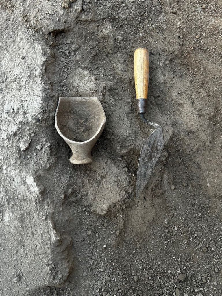
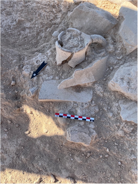
Photo 2: A near complete goblet found within some fill early in the season
Photo 2: A near complete goblet found within some fill early in the season.

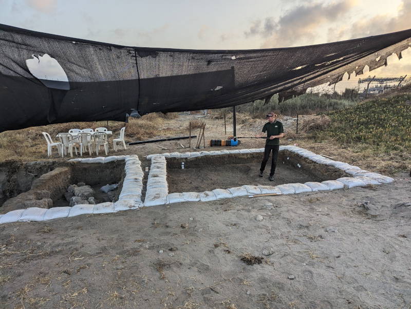
My particular square for this season was the same square that I had worked in during the 2022 season. In 2022, we identified a primary phase of architecture for the square and a later ephemeral occupation which was composed of a series of cooking installations cut into the architecture of the primary phase. Our goals for this season were to completely expose and delineate the architecture of the primary phase and attempt to ascertain the function of the various rooms therein. Across the various weeks of excavation, we were ultimately successful in this goal. We were able to delineate the southwestern boundaries of a large building within which were seven relatively small rooms. Curiously similar to the later phase consisting of ephemeral cooking installations, the major elements found within the main phase in the square also pertained to cooking. This included large volumes of coarse ware pottery and a series of ovens, some of which were quite large and possessed associated storage bins.

Returning to the field as part of the TAP project this summer allotted me an exciting field season that provided me with many challenges and opportunities to continue to grow as a field archaeologist and scholar. I look forward to participating in the project in the future—indeed towards the end of the season we uncovered a lower phase of architecture beneath this season’s, which will be an exciting facet of exploration for next season!

Photo 3: A hazelnut (?), one of many charred remains found alongside the coarse wares and cooking instillations this season.
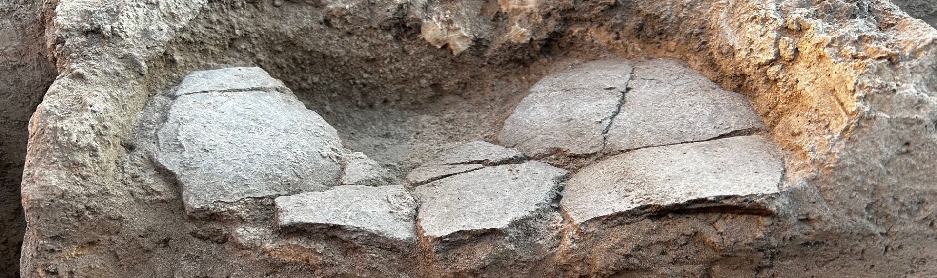
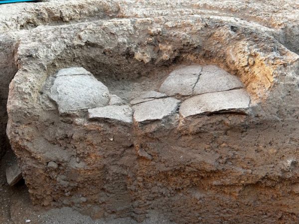
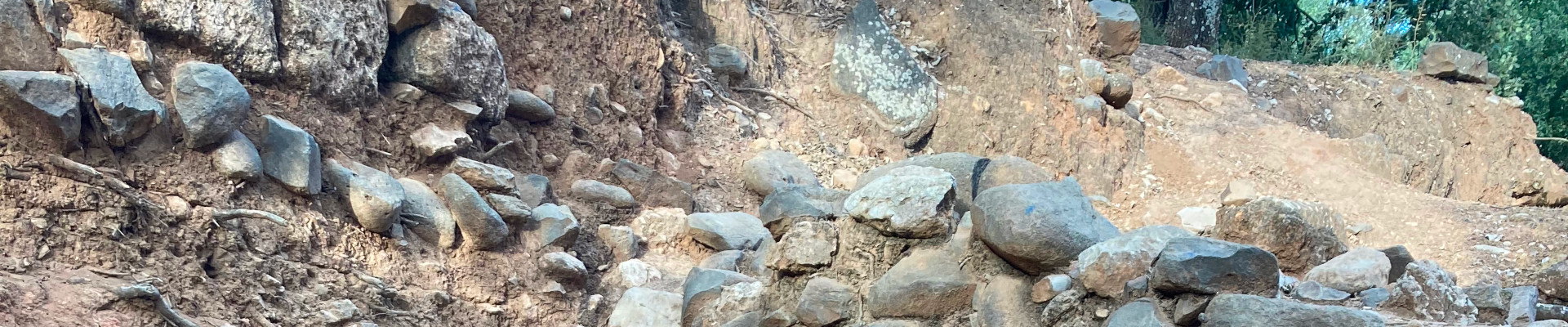
Photo 4: A cross section of one of the various cooking instillations excavated this year.

Sheldon Harmacy is a PhD student at the University of Toronto where he explores the relationship between changing materiality and technological progress in the context of the Early Brone Age of the Ancient Near East. He is a proud alumni of both the University of Lethbridge and University of Toronto receiving both a BA in Archaeology and Geography (2019) and an MA in Near and Middle Eastern Civilizations (2022). He has participated in the last two field seasons at Tell Tayinat and aims to utilize the lithic (chipped stone) assemblage from the site for his thesis research.

Tayinat Archaeological Project Website: https://tayinat.artsci.utoronto.ca/

Photo 5: Myself and my partner Mariah (another member of the excavation) on a weekend excursion to the Titus Tunnel Aquaduct in Hatay.

Want to help more students and early career archaeologists get into the field? Donate to the cause today by selecting “Fieldwork Scholarships” as your gift purpose!

Fieldwork Report: Suzanne Gilles

A Month on the Island

Suzanne Gilles, 2024 Katherine Barton Platt Fieldwork Scholarship Recipient

On 7th of May 2024, I received an email from ASOR telling me that I had been awarded a scholarship to excavate at the site of Kissonerga-Skalia, in Cyprus. This email gave a whole new perspective on what my summer was going to be.

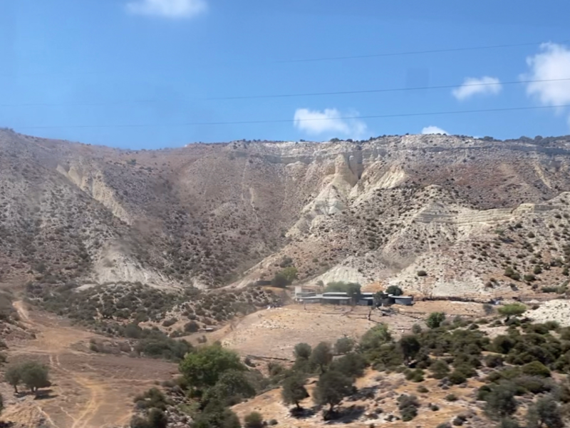
The dig lasted a month, under the Mediterranean sun, with the island’s humidity, and with a light breeze during the afternoons. I was surrounded by this amazing scenery of the Troodos mountains, the blue waters of the sea, and so many archaeological sites to visit.

I have always been curious to understand what Cyprus was like during Antiquity and more precisely during the Bronze Age. I want to specialize in Levantine archaeology and the link between the island and the mainland is something that I wanted to explore in my research. The excavation at Kissonerga-Skalia was the perfect opportunity for me to learn more about it.

View from the Troodos mountains (Image credit: Suzanne Gilles)

This site is located in the south-western part of the island and was occupied continuously from the beginning of the Early Bronze Age (c.2600) until the beginning of the Late Bronze Age (c.1600). It also has an earlier Chalcolithic occupation that is connected to the nearby site of Kissonerga-Mosfilia.

The excavation is focused on uncovering the industrial area of the site, where a number of features have already been identified, including an oven-like installation, probably used to produce beer! The installations were very diverse, as were the finds, that were a great sample to understand what Cyprus looked like during this period of history.

For the first time, I saw Cyprus as an independent and innovative island, and not as a region whose material culture is merely the product of continental influence. By observing the shapes of the pottery, artifacts, the architectural features and the organization of the settlements, I began slowly to understand the regional specificities.

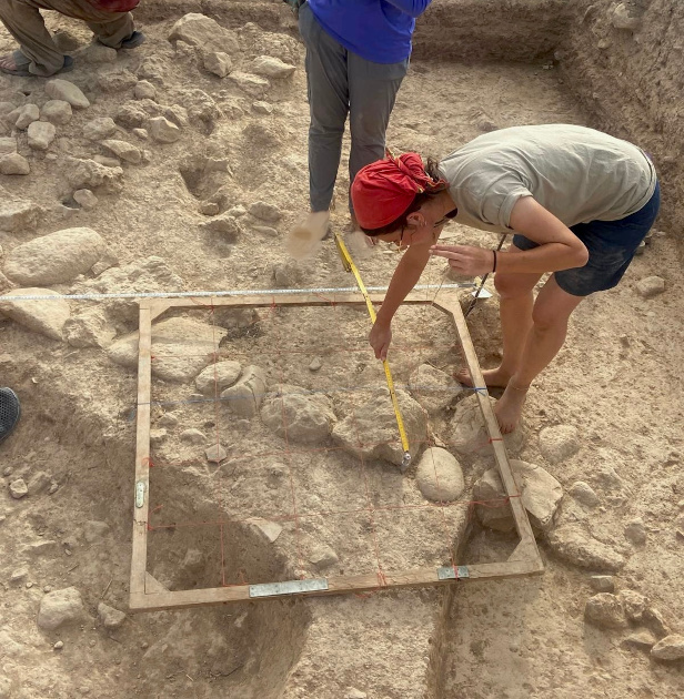
Plan drawings on site (Image credit: Talia Neelis)

I’ve learned so much from this experience. The excavation being a field school, we were not only trained to excavate, but also to do pottery dating, drawing plans, photography. There was a real desire to show us as much as possible and to share a common passion for Cypriot archaeology.

For four weeks, we lived as a community with a very strict routine: waking up at 4:30am, walking to the site at 5am, working until 12:30 to avoid the afternoon heat and then coming back from the site to do some post-excavation work. I will cherish the little moments that made this intense schedule so enjoyable: eating the delicious chocolate cookies during the breaks, swimming in the sea after a long day, washing the pottery with fresh water.

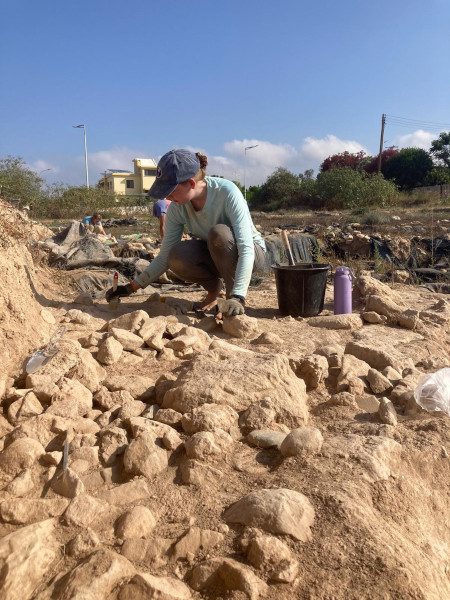
Amanda, Suzanne’s coworker defining rocks (Image credit: Suzanne Gilles)

On the site, I was assigned to articulate stones, a plaster surface and all the small finds that could be found in these areas, such as pottery, bones, stone tools, and two amazing beads that were my highlights of the season!

However, as all the archaeology students know, even if you are going on an excavation to learn about new methods and cultures, you discover and come back with much more than that. The people that you meet on this little journey shape you as a human being and a future archaeologist. I am so grateful for all the memories and life lessons that I am taking back to France, which are bringing me a bit closer to my dream career.

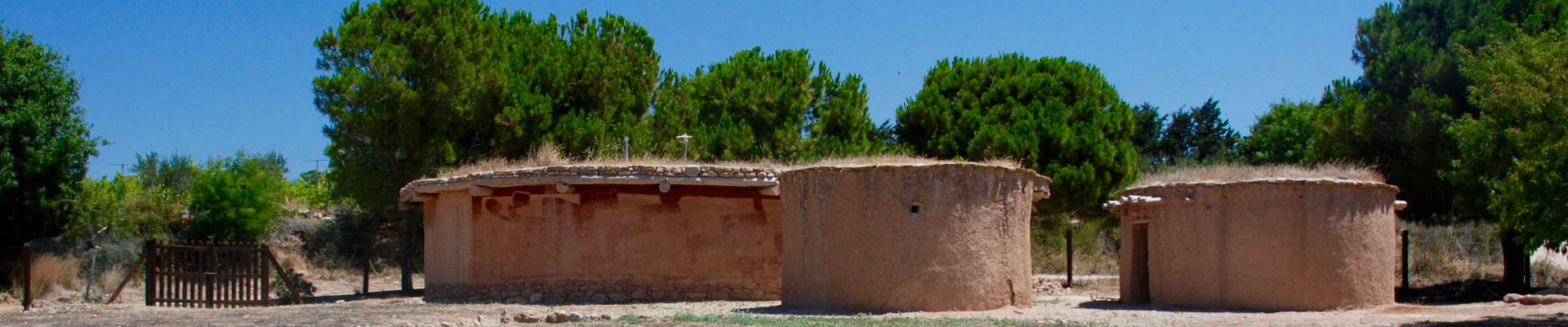
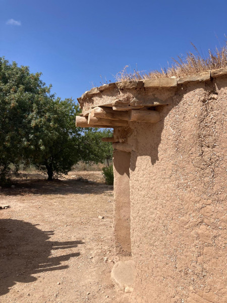
Reconstruction of a Late Chalcolithic house in Lemba, a neighboring site (Image credit: Suzanne Gilles)
Team from Suzanne’s area (Image credit: Ian Hill)

Suzanne Gilles is a 20-year-old graduate student in the Near Eastern Studies specialty in the School of the Louvre, Paris (France). She wants to specialize in Levantine archaeology during the Bronze Age.

Want to help more students and early career archaeologists get into the field? Donate to the cause today by selecting “Fieldwork Scholarships” as your gift purpose!

Fieldwork Report: Madeline Conigliaro-Nguyen

Sun, Sweat, and Sheep Bones: Zooarchaeology at Gird-I Matrab

Madeline Conigliaro-Nguyen, 2024 Eric and Carol Meyers Scholarship for Fieldwork Participation

My second season at the Gird-I Matrab project from May to June 2024 was an opportunity to continue to develop my in-field experience and zooarchaeology-related skills, thanks to the wonderful support of Dr. Eric and Dr. Carol Meyers, ASOR, director Prof. Rocco Palermo (Bryn Mawr College) and co-director Prof. Nathalie Brusgaard (Leiden University). My primary responsibility on the team for the 2024 season was to continue as the zooarchaeology assistant. Under the instruction and mentorship of Prof. Brusgaard (who was remote this year), I cared for and managed the faunal remains collected on-site. This included processing and cataloging the faunal material for later study seasons.

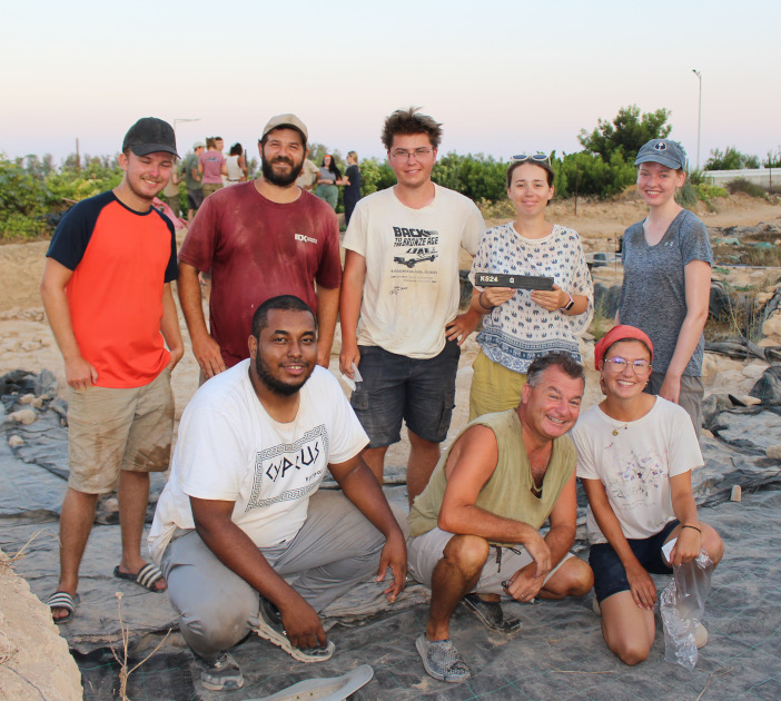
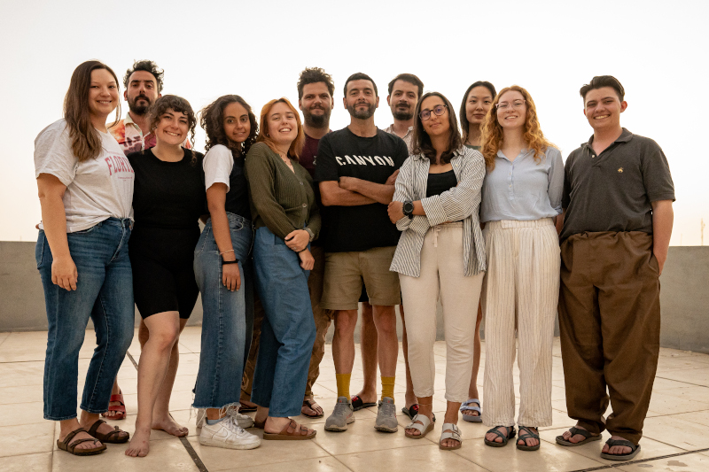
Fig. 1. GMAP 2024 project team in Ankawa, Erbil. (©Federico Dalla Battista)

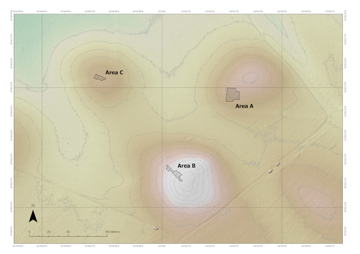
Gird-I Matrab, located in the Erbil Plains of Kurdistan Region of Iraq, is a site consisting of multiple low mounds with two major phases of occupation, the Late Chalcolithic period and the Seleucid period. Excavation in areas A and B, begun during the previous two seasons, continued in 2024. This season Gird-I Matrab also expanded operations with the goal of doing a sounding and determining the stratigraphic sequence at Area C. Early subsurface findings changed our plans, resulting in more intense excavation of Area C than originally intended.

Fig. 2. GMAP 2024 site topographic map. (©GMAP)

The saying ‘The early bird gets the worm’ rings true for both our avian friends and archaeologists in the heat of Southwest Asia. Everything begins bright and early, with a 3:30 am wake-up for breakfast, and a 4:30 am departure to reach the field within the hour. Most of my time was spent in Area A as a trench assistant. When needed I would assist in extracting particularly fragile remains, identification, and updating in-field bone logs. Generally, I worked per the direction of trench supervisors excavating, cleaning, bagging, and tagging, and discussing stratigraphic context. One thing no one prepares you for is the challenge of distinguishing crumbling mudbricks from dirt, especially with the sun’s glare making it feel nearly impossible most days. Thanks to the patience of my trench supervisors and a good pair of sunglasses, however, I ended this season feeling much more confident in identifying features, a goal I had set for myself this year.

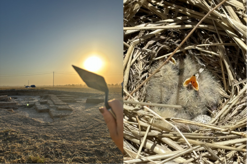
Fig. 3 . Sunrise photo at area A (Left) Baby birds nested on project site between areas (Right)
Fig. 3. Sunrise photo at Area A (Left). Baby birds nested on project site between areas (Right).

I processed the faunal remains for all three areas once they were brought back to the field house. Though a bit tedious, it is incredibly rewarding to understand human history one fragment at a time. Bones were cleaned carefully and laid out to dry over a minimum of 24 hours. Identifiable bones were recorded with species, bone type, side, and taphonomic markings when applicable. The common animals identified remained consistent with previous seasons’ findings, including sheep (Ovis aries), goat (Capra hircus), pig (Sus scrofa domesticus), equids (Equus sp.), and cattle (Bos taurus). After a unit was closed, all faunal materials were counted, weighed, and photographed as necessary. Bone samples for carbon-14 dating were selected by collaborative effort between directors and trench supervisors. At the end of the season, I wrote the preliminary faunal findings for the 2024 season field report.

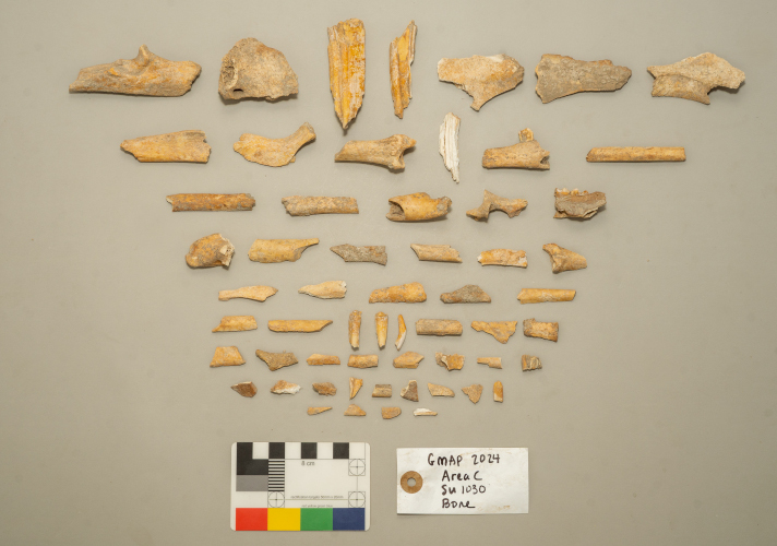
Fig. 4 . Selection o f faunal remains from Area C ( SU 1030 ). (©GMAP)
Fig. 4. Selection of faunal remains from Area C (SU 1030). (©GMAP)

This year, I wanted to explore 3-D modeling during my free time as I felt it would be worthwhile to create an accessible and digitized reference collection of diagnostic pieces that were best preserved or particularly notable. Using Polycam, a photogrammetry modeling mobile application, I took detailed photos from all angles which were stitched together using the program to create 3-D models. This process was a lot of trial and error from figuring out how to make sure the background wasn’t incorporated in the result, to finding proper lighting for the bone details to show. I hope to continue building this digitized reference collection for future teaching and project-related applications. I also would like to use this newfound skill to continue creating bone models for zooarchaeological purposes. I am incredibly passionate about accessible and open-access resources, and I believe the digitization of collections is one of the most attainable ways to do so.

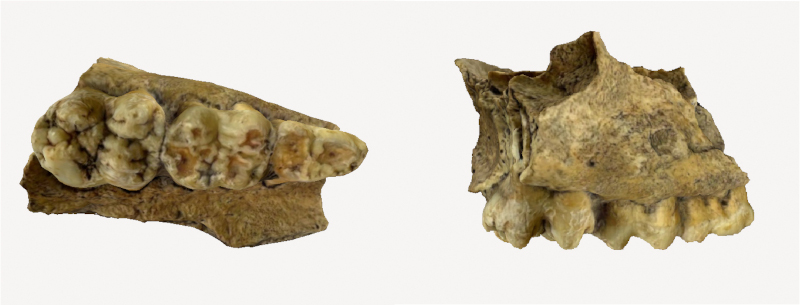
Fig. 5 . 3D model of right maxilla with DP3 - M1 dentition of a sub - adult pig ( Sus scrofa domesticus ), from Area A ( SU 1221 ).
Fig. 5. 3D model of right maxilla with DP3-M1 dentition of a sub-adult pig (Sus scrofa domesticus), from Area A (SU 1221).

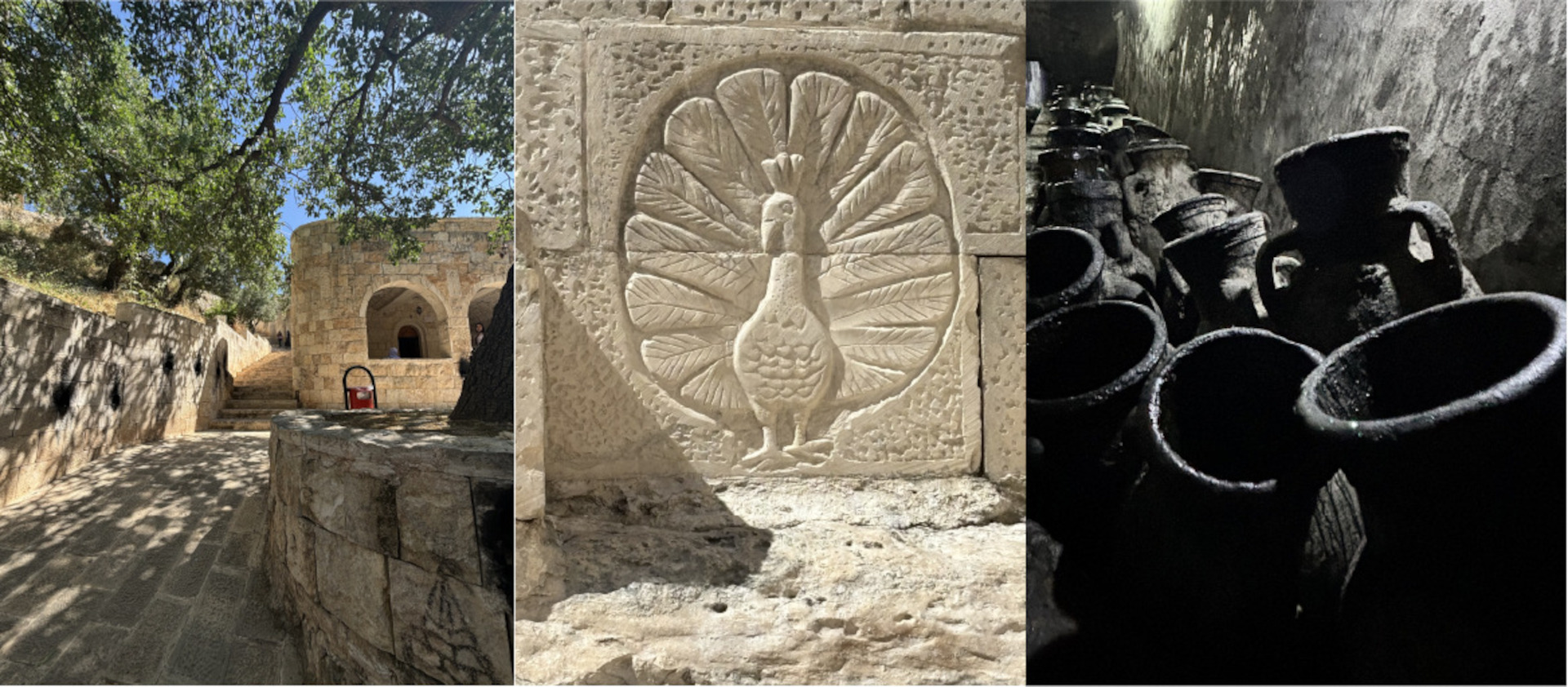
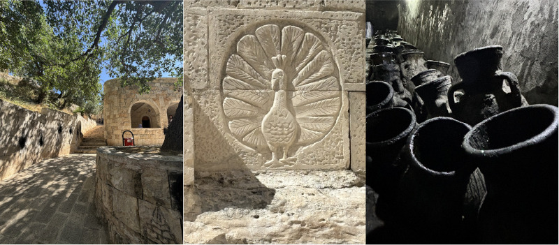
Of course, as hard as this team worked on-site, we equally had fun off-site! We explored an assortment of different places including spending a night in Duhok, visiting the Faida rock reliefs, exploring the bazaar, and a special tour inside the Erbil citadel. My favorite place to date that I visited is the Lalish Temple. Located in a mountain valley in the Nineveh province, the Lalish temple has a sacred significance and is an important pilgrimage site for the Yazidi religion. I felt a sense of peace while walking through the village, along with the kindness of the devotees who had come to worship. We got the opportunity to sit for chai and tour parts of the temple, taking time to experience the diversity of religion and culture.

Fig. 6 . General photo of Lalish (Left) Depiction of peacock angel Tawûsî Melek (Middle) Olive Oil Jars (Right) .
Fig. 6 . General photo of Lalish (Left). Depiction of peacock angel Tawûsî Melek (Middle). Olive Oil Jars (Right).

My time spent with the Gird-I Matrab project over the past two seasons has been essential in my development as an archaeologist and for my excavation skills. I have been able to learn so much about the Northern Mesopotamian region and participate in an excavation project that has supported my developing interest in zooarchaeology. Thanks to our incredible international collaborative group of researchers, the 2024 season had another year of successful excavation. I am committed to utilizing all I have learned while on-site for my future academic pursuits in archaeology and want to extend a final thank you to all those who have supported and shaped my journey during the 2024 season at Gird-I Matrab.

Fig. 7 . Photo of Madeline Conigliaro - Nguyen on Area A. (©Federico Dalla Battista)
Fig. 7. Photo of Madeline Conigliaro-Nguyen on Area A. (©Federico Dalla Battista)

Madeline Conigliaro-Nguyen graduated with her MA from the University of Chicago in 2023. She continues to participate in several archaeology projects in the Kurdistan Region with the intention of applying for graduate school this year. Her primary research interest is in zooarchaeology in Southwest Asia, with a focus on human-animal relationships, particularly as they pertain to ancient ontologies, subsistence strategies, and the social and ritual roles of animals. To learn more about the project, follow @gmap_erbil on Instagram!

Want to help more students and early career archaeologists get into the field? Donate to the cause today by selecting “Excavation Scholarships” as your gift purpose!

Mesopotamian Fellowship Report: Agnese Vacca

“Crafting Complexity”. Pottery Production and Consumption at Helawa (Erbil Plain) between the Ubaid and Late Chalcolithic Periods

Agnese Vacca, University of Milan, Mesopotamian Fellowship Recipient

Aims of the “Crafting Complexity” Project

The project aims at studying pottery production and consumption at Helawa (Erbil Plain) in a diachronic perspective–from the Ubaid to the Late Chalcolithic period (5th-4th millennium BC) – by means of technological and archaeometric analyses to ultimately explore the process of craft specialization and standardization, and their major implications for our understanding of complex societies in this crucial area of Northern Mesopotamia. Several studies focusing on ceramics have, in fact, pointed out that major changes in pottery production and distribution occurred in Mesopotamia in connection with the process of 4th millennium BCE urbanization, resulting in a highly specialized and intensified production performed at an extra-household level, reflected in the emergence of a standardized and mass-produced repertoire.

The project targets encompass the realization of mineralogical and petrographic characterization (thin sections, XRD, XRF, Raman Spectroscopy) on a selected sample of vessels (ca. 100 sherds) to reconstruct pottery traditions within the Helawa assemblage, understood as the result of different systems of production and consumption, passed down within a group or society. Furthermore, compositional analyses (INAA) are also envisaged to investigate ceramic production and circulation at an extra-site level, facilitating the comparison with the results already obtained for the pottery assemblage of nearby Chalcolithic sites such as Surezha, investigated by an American expedition of the Oriental Institute of Chicago (Stein 2018; Minc et al. 2019).

As a major output, the project aims at producing a database encompassing qualitative (drawings and photos) and quantitative (metric, petrographic, chemical) data intertwined with a solid stratigraphic and typo-chronological ceramic sequence, anchored to C14 dates. This dataset has the potential to carry out multivariate analyses to investigate in a diachronic perspective the relationship between the technical dimension of ceramic production, the degree of specialization, the transmission of knowledge between potters, and the socio-economic organization of prehistoric communities at Helawa, providing a frame of reference from a key-site to be compared with neighboring settlements in the Erbil Plain and more broadly in the Trans-Tigridian region.


The site of Helawa and the MAIPE Expedition in the Erbil Plain

During the last decades, dozens of international projects were launched in the Kurdistan Region of Iraq contributing to the definition of a new theoretical framework for this key area located in the Trans-Tigridian region, between the well-known Jazirah region and Southern Mesopotamia (Kopanias et al. 2015).

Tell/Gird Helawa (ca. 10ha) is situated about 28 km south-west from the modern city of Erbil, in the fertile Erbil plain, and has been investigated since 2013 – together with the site of Aliawa – by the MAIPE Expedition (Missione Archeologica Italiana nella Piana di Erbil) of the University of Milan under the direction of Luca Peyronel, with Agnese Vacca as Vice-director (Fig.1). Archaeological investigations at the sites of Helawa and Aliawa, with their multi-period occupation, allow an integrated reconstruction of the history of the region from the first Neolithic villages (ca. 7th millennium BC) to the fortified centers of the Parthian and Sasanian periods down to the early Islamic Age (3rd century BC-8th century AD). The MAIPE project carries out archaeological excavations, geo-archaeological and geophysical research, bio-archaeological studies and archaeometric analyses in agreement with the Iraqi State Board of Antiquities and Heritage and the Directorate of Antiquities of the Iraqi Kurdistan Region, promoting activities to enhance the local historical-archaeological heritage and disseminating the project’s results.

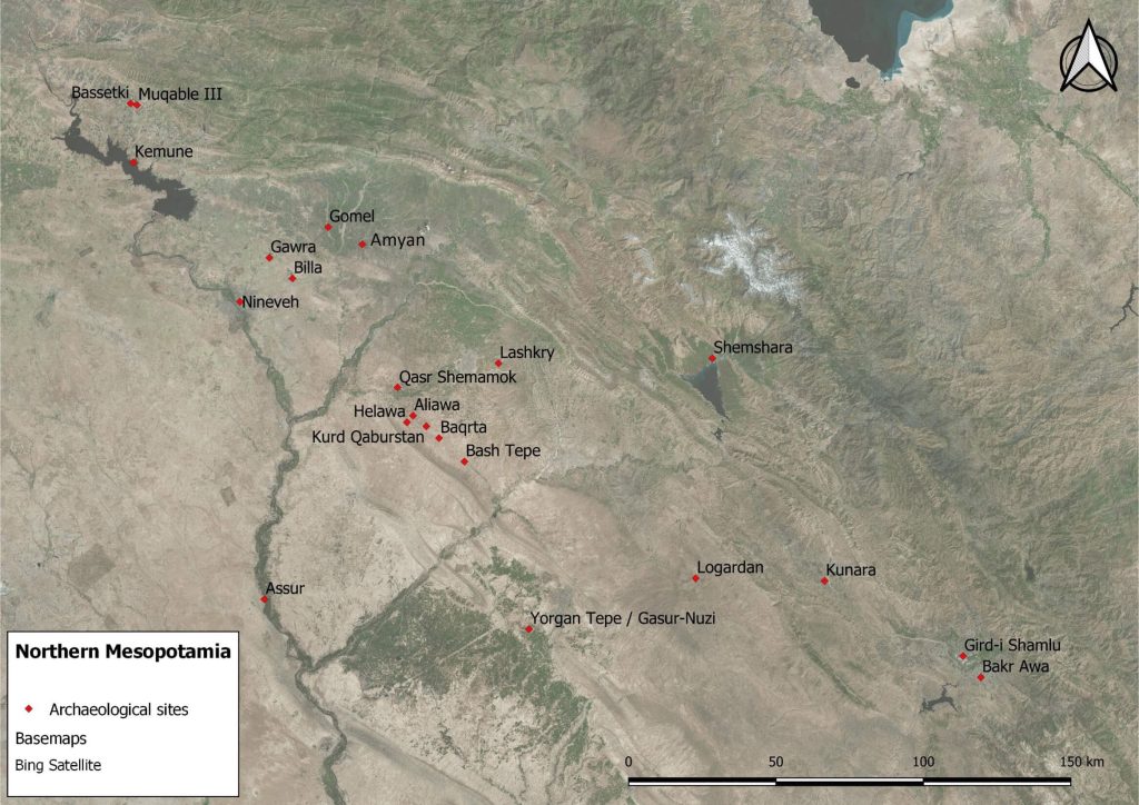
Fig. 1. Map of the Trans-Tigridian region with the location of Helawa and Aliawa in the Erbil Plain.

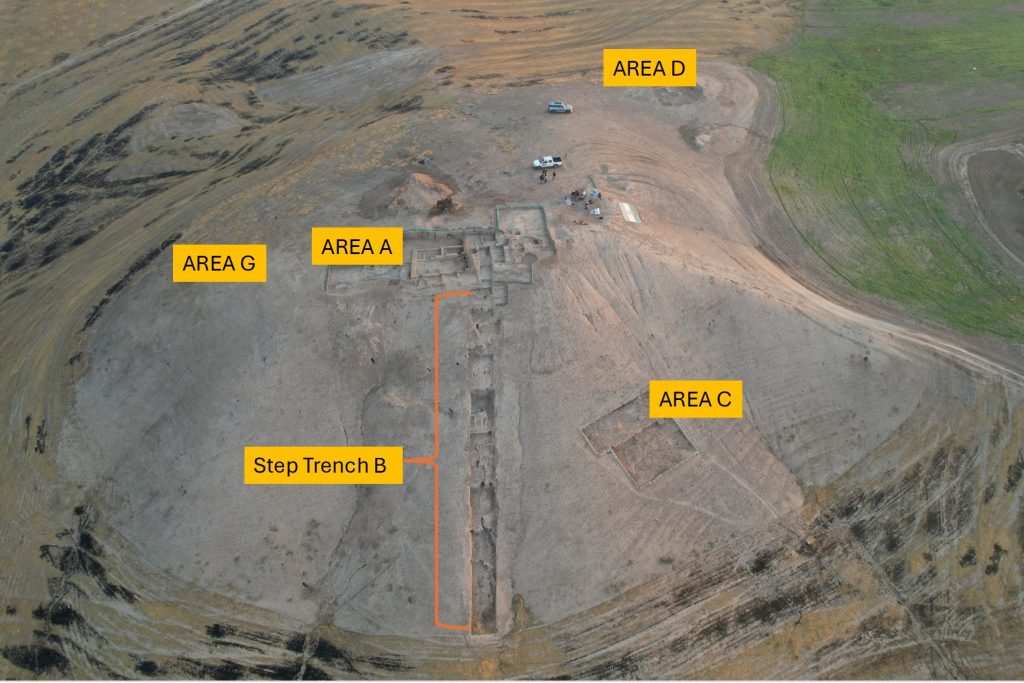
The 2016-2023 archaeological investigations carried out on the top of the Helawa mound (Area A) and along its southern slopes (Step Trench B) brought to light a seamless Halaf to Late Chalcolithic 3 (LC) sequence featuring an exceptional state of preservation of the structures, with rich in situ inventories encompassing complete and restorable vessels (Peyronel et al. 2019; Peyronel, Vacca 2020; Vacca et al. 2020). Moreover, two pottery workshops dating to the Ubaid and LC1 were excavated, allowing the analysis of both direct evidence of ceramic manufacture (furnaces and installations), and indirect variables inferred from the products themselves (Fig. 2).

Fig. 2. Tell Helawa with excavated areas 2016-2023. Viewed from the drone. ©MAIPE.

The last phase of occupation of the prehistoric mound dates to the early LC 3 (ca. 3850-3600 BC), and encompasses domestic structures excavated on the lower mounded area to the north-east (Area D)and one large tripartite building with adjoined rooms to the east and a courtyard paved with pebbles and sherds to the west (Area A, Step Trench B; Figs 2-3). After the LC 3 period, the site was abandoned and reoccupied a few centuries later, during the mid-2nd millennium BC.

Fig. 3. Helawa, schematic plan of excavated levels in Step Trench B and Area A. ©MAIPE.

A large number of vessels has been collected from the Ubaid and Late Chalcolithic contexts excavated thus far and sorted out for chrono-typological studies (ca. 3042 diagnostic sherds). Pottery finds have been classified in relation to the detailed stratigraphic and architectural sequence allowing the reconstruction of a relative ceramic periodization, that has been then anchored to a series of radiocarbon dating obtained for the Ubaid and Late Chalcolithic levels (Vacca, Peyronel 2022). This preliminary typological and functional classification of the pottery assemblage from stratified contexts represents a solid base to carry out targeted analyses on techno-morphological and techno-petrographic feature.

Materials and Method

The available dataset consists of 3042 sherds from the 2016-2022 excavations at Helawa, which have been already drawn, filed, and arranged in the MAIPE GIS platform. The whole assemblage has been sorted out in major ceramic classes, or ware groups (e.g., Simple Ware, Painted Simple Ware, Gray Ware, Cooking Ware), based on observable macroscopic characteristics, such as paste colour, hardness, inclusions, and surface treatment. Within each ware group, vessels have been then sorted out according to specific shape classes (open/closed) and morpho-functional types previously defined based on the statistical occurrence of formal and stylistic attributes (Fig. 4).

Fig. 4. Helawa, Late Chalcolithic 1-3 ceramic types. ©MAIPE.

Out of 3042 sherds, 100 diagnostic fragments (25 dating to the Ubaid, 25 to the LC1, 25 to the LC2 and 25 to the LC3) have been selected and imported in Italy in agreement with the Directorate of Antiquities to carry out archaeometric analyses. Selected sherds are being analysed according to two main interrelated tasks:

1) Technological analyses: the different types of vessels classified according to morphological criteria, have been also studied and described based on recognizable diagnostic features related to specific techniques, methods, and tools, making use of digital high-resolution images obtained with a portable microscope (Dino-lite®) and experimental reference material (Roux and Courty 1998). Different manufacturing techniques (e.g., slab modelling, moulding, coiling, and throwing) have been identified, considering that each method produces characteristic surface features or macro-traces that can be interpreted as distinct manufacturing modes or potter’s gestures. Information about the formation and shaping process, including the use of rotative kinetic energy (RKE), has thus been described through the observation of macro traces recognised on the surface of the vessels and in cross-section. These descriptions have then been compared with information on the distribution and alignment of voids gathered through the analysis of thin sections. 

2) Mineralogical-petrographic investigations: a selection of 100 sherds has already been sampled and submitted to petrographic analyses at the Department of Earth Science of the University of Milan (G.D. Gatta, G. Morabito, D. Comboni). Pottery samples are being analysed in thin section under polarizing optical microscope, using SEM with attached X-ray spectrometer and EMP, to define petrographic groups homogeneous in the microstructure and groundmass, and to obtain a detailed characterisation of inclusions, matrix, porosity, and slip. Moreover, the mineral composition is being determined by X-ray diffraction of the selected ceramics (XRF) at the Department of Geosciences, University of Padova (L. Maritan). The ware groups, previously defined through macroscopic observations of sherds, are thus being reassessed according to petrographic groups suggesting a reduced number of fabric types identified through petrographic analysis compared with those recognized by the excavators.

Moreover, a selection of 50 sherds that have been previously thin sectioned in Milan have been shipped to the USA to perform multielement bulk compositional analyses (INAA) at the Oregon State University Archaeometric Laboratory (L. Minc). Instrumental Neutron Activation Analysis is aimed to explore compositional variation in ceramics in the Erbil Plain, comparing the results of the Helawa assemblage with that obtained for the site of Surezha (Minc et al. 2019) and more broadly with analyses of ceramics from the northernmost site of Tepe Gawra (Rothman and Blackman 2003). Furthermore, the chemical composition of pottery will be compared with geomorphological samples collected in the area around the site and already processed by the Department of Earth Science of the University of Milan (A. Zerboni, L. Forti).

Preliminary Results 

While archaeometric analyses are still ongoing some preliminary results can be described in terms of petrofabrics and manufacture of vessels in a diachronic perspective, from the Ubaid to the Late Chalcolithic period. Overall, the mineralogical association of the analyzed samples is very similar, suggesting the use of comparable raw material sources through time, with a difference in the composition of the fabrics mainly related to the addition of aggregates as well as to firing temperature, the latter resulting in newly formed phases such pyroxene and gehlenite (Morabito et al. in press). The composition and mineralogy of pottery is compatible with clay sediments found in the surrounding area suggesting that the use of local clay is highly probable. 

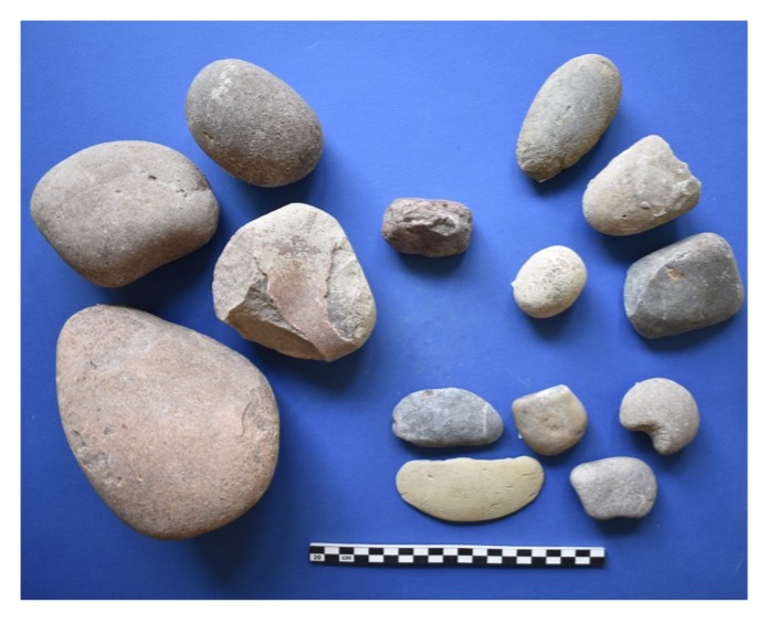
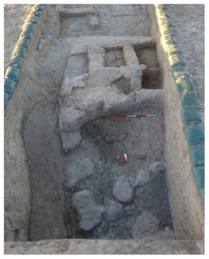
Local production is also envisaged by the discovery of firing structures dating to the Ubaid and Late Chalcolithic 1 respectively. In fact, excavations in Step Trench B, brought to light an Ubaid pottery production area with a large rectangular-shaped kiln (nearly cut through toward the east by a later pit), standing over 0.50 m high, with the firing chamber filled with ashy layers and overfired vessels. Immediately to the south of the kiln were a series of small rectangular mudbrick rooms that have been interpreted as pottery manufacturing installations and bins for clay preparation (Fig. 5). The small finds retrieved in association with the pottery workshop mainly consist of few ring scrapers, grinding stones, mortars, and lithic implements that could relate to the preparation of clay and the grinding of pigments (Peyronel et al. 2019). A parallel for the Helawa pottery workshop is represented by the Late Ubaid/LC 1 complex excavated at Tell Kosak Shamali on the Euphrates Rier, where similar small rooms made of mudbricks connected to kilns were brought to light (Nishiaki et al. 1999). 

In the next LC 1 phase the function of the area is maintained, as documented by the occurrence of numerous kiln wasters, overfired vessels and ring scrapers collected from dumping layers associated with pits and a probable kiln laying beyond the excavation area to the north-west.  

Fig. 5. Helawa, Ubaid pottery kiln K.119 (to the right); stone tools and ring scrapers for pottery manufacture (to the left). ©MAIPE.

Fig. 5. Helawa, Ubaid pottery kiln K.119 (to the right); stone tools and ring scrapers for pottery manufacture (to the left). ©MAIPE.

Even through the centuries and down to modern times, the area of Helawa/Aliawa seems to have been strictly related to pottery production as suggested by the presence of clay quarries identified by geomorphological investigations in the surroundings of Tell Aliawa, and the identification at the same site of an industrial area for pottery production dating to the Akkadian period (mid-late mid-3rd millennium BC), with mudbrick platforms and installations for clay preparation and vessels shaping, and fifty large kilns, some of which reaching 2 m in diameter, organized in clusters and connected each other through a sophisticated system of underground ducts. Pottery production is documented also in later periods, in the 2nd millennium BC, as well as in the Islamic age. Nowadays, traditional brick factories are still operational around Mastawa/Aliawa, extracting clay from local quarries, which is mixed with chaff, water and tempered with straw, shaped through rectangular molds, sun dried and ultimately fired in modern kilns.  

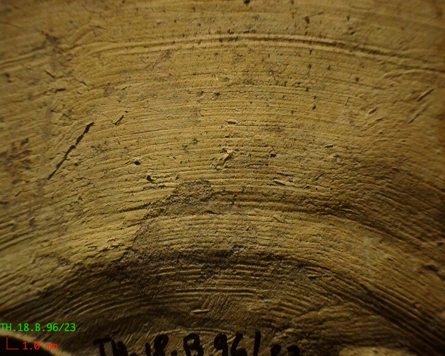
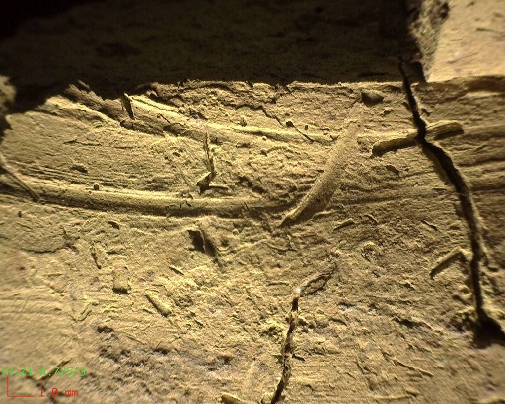
Analyses on the mineralogical composition of sherds (XRD, polarized-light optical microscopy) suggest high firing temperatures during the Ubaid period compared to the Late Chalcolithic, when medium-low firing conditions prevail (Morabito et al in press). The clay composition and recipes employed from one period to the next in the manufacturing of clay vessels indicates a shift from the use of mainly mineral-tempered (Fig. 6a) to coarser chaff-tempered pastes (Fig. 6b) that facilitate to the one hand the shaping of vessels and, to the other, their drying and firing, avoiding shrinkage cracks and thermal shock (Skibo, Schiffer and Reid 1989).  

Finally, the observation of both thin sections under polarized microscope and vessel’s surfaces with a Dino-Light digital microscope (Fig. 6) provides information about the shaping techniques and the tools employed by the potters. In particular, diagnostic elements derived by the microscopic observation of the shape and orientation of voids, as well as the presence of surface features (e.g., concentric parallel striations, fissures and ridges) are being noted to identify the shaping techniques employed and the possible use of rotative devices (Baldi and Roux 2016). Data collected for both the Ubaid and Late Chalcolithic periods will be tested against experimental replica.

Fig. 6a) Ubaid (TH.18.B.96/23) and 6b) LC3 (TH.21.A.725/3) sherds from Helawa. Photo taken with Dino-Light digital microscope (©MAIPE).

Fig. 6a) Ubaid (TH.18.B.96/23) and 6b) LC3 (TH.21.A.725/3) sherds from Helawa. Photo taken with Dino-lite® digital microscope (©MAIPE).

References 

Baldi, J.S., Roux, V. 
2016 The innovation of the potter’s wheel: a comparative perspective between Mesopotamia and the southern Levant, Levant 48(3): 236–253, https://doi.org/10.1080/00758914.2016.1230379.

Kopanias, K., MacGinnis, J., Ur, J. 
2015 Archaeological Projects in the Kurdistan Region in Iraq, The Directorate of Antiquities of Kurdistan, Erbil. 

Minc, L., Alden, J., Stein, G.J. 
2019 A preliminary assessment of ceramic style and chemical composition during the Chalcolithic era at Surezha, Iraqi Kurdistan, Paléorient 45(2): 121–136. 

Morabito, G., Comboni, D., Gatta, G.D. 
in press Mineralogical-petrographic investigation of the sherds from the Helawa archaeological site, in L. Peyronel, A. Vacca (eds), Helawa Excavations I – The Southern Stratigraphic Trench (Step Trench B), Milano University Press, Milan. 

Nishiaki, Y., Koizumi, T., Le Mière, M., Oguchi, T. 
1999 Prehistoric Occupations at Tell Kosak Shamali, the Upper Euphrates, Syria, Akkadica 113: 13–68. 

Peyronel, L., Minniti, C., Moscone, D., Naime, Y., Oselini, V., Perego, R., Vacca, A. 
2019 The Italian archaeological expedition in the Erbil Plain, Kurdistan Region of Iraq. Preliminary report on the 2016-2018 excavations at Helawa, Mesopotamia 54: 1–104.  

Peyronel, L., Vacca, A. 
2020 Socio-economic complexity at the Late Chalcolithic site of Tell Helawa, Kurdistan Region of Iraq, Paléorient 46(1-2): 83–107. 

Roux, V., Courty, M.-A.
1998 Identification of wheel-fashioning methods: technological analysis of 4th–3rd millennium BC oriental ceramics, Journal of Archaeological Science 25: 747–763. 

Rothman M., Blackman, J. 
2003 Late fifth and early fourth millennium exchange systems in Northern Mesopotamia: chemical characterization of Sprig and Impressed Wares, Al-Rāfidān: Journal of Western Asiatic Studies 24: 1–21. 

Skibo, J.M., Schiffer, M.B., Reid, K.C. 
1989 Organic-tempered pottery: An experimental study, American Antiquity 54(1): 122–146. 

Stein, G.J. 
2018 Excavations at Surezha (Erbil Plain, Kurdistan Region, Iraq) 2017, in C. Woods (ed.), Oriental Institute Annual Report 2017-2018, Chicago: 29–43. 

Vacca, A., Moscone, D., Rosati, P.  
2020 Managing Survey Data from Helawa, Erbil Plain (Kurdistan Region of Iraq), in M. Iamoni (ed.), From the Prehistory of Upper Mesopotamia to the Bronze and Iron Age Societies of the Levant. Proceedings of the Broadening Horizon 5, Udine, Vol. 1 (West & East Monograph 2), Udine: 107–124.   

Vacca, A., Peyronel, L. 
2022 Towards a definition of the Late Chalcolithic Period in the Erbil Plain: The contribution of the Helawa pottery sequence, in J.S. Baldi, M. Iamoni, L. Peyronel, P. Sconzo (eds), Late Chalcolithic Northern Mesopotamia in Context: Papers from a Workshop Held at the 11th ICAANE in Munich, April 5th 2018 (Subartu 48), Turnhout: 85–103.

Collections Fellowship Report: Jon Paul Heyne

2024 Collections Fellowship Report: Social Mobility of the Medieval Mediterranean: The Case of the Franciscan Custody

Jon Paul Heyne, Assistant Professor of History at the University of Dallas

Shortly after the collapse of the Crusader States in the late thirteenth century, small bands of Franciscan friars traveled to Jerusalem to undertake a daunting task: the renewal of a Latin Christian presence in the Holy Land. Courting patronage from the monarchs and pontiffs of Europe and cooperation from the Mamluk sultans of Egypt, the friars succeeded in their project. Forming the Franciscan Custody of the Holy Land c.1333, they gained not only important rights at many of the Holy City’s Christian shrines but also ownership of plots of property—with gardens, cisterns, and residences—first on Mt. Sion in Jerusalem but then later in Bethlehem and Ramla.

Beyond significantly marking a new phase in Latin Christian relations with the Levant, this establishment of the Franciscan Custody demonstrates the social fluidity of the Late Medieval Mediterranean. In uprooting themselves from the Latin West to reside in the Islamic world of the Eastern Mediterranean, the Franciscans dramatically altered their social dynamics with numerous parties—rising in standing in the eyes of some, falling to a minority status in the eyes of others, and taking on social relations with many whom they would never have encountered without making the transit across the sea.

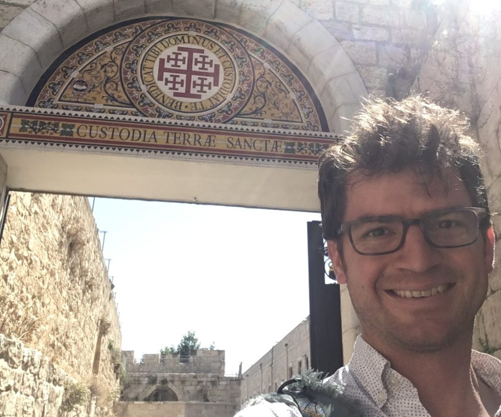
In front of the Franciscan Archivio Storico della Custodia di Terra Santa in Jerusalem. Photo courtesy of author.

With generous funding from ASOR’s Collections Fellowship and the assistance of archivist Fr. Narcyz Klimas, I returned to the Franciscan Archivio Storico della Custodia di Terra Santa to hunt down several unedited purchase deeds related to the history of the Custody. Seemingly dull and overly formulaic, these deeds recount the friars’ acquisition of properties throughout the Holy Land and thus offer some of the most concrete evidence for the development and expansion of their presence in the region in the fourteenth and fifteenth centuries. Additionally, these records provide fascinating details on the Franciscans’ relationships with others in the area, illustrating how the friars negotiated with local Muslim authorities, Italian laywomen, merchants in Ramla, and Armenian archbishops (to name just a few). As I continue the work of transcribing and translating these documents, I offer my sincerest thanks to ASOR and its donors for this opportunity to advance my research.

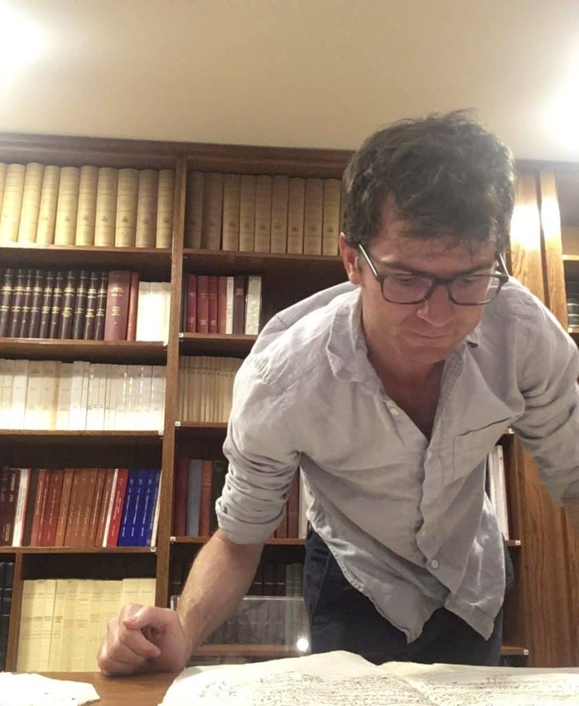
Examining one of the records related to the history of the Custody. Photo courtesy of author.

Fieldwork Report: Emilie Nordhues

The Other Side of Fieldwork

Emilie Nordhues, 2023 G. E. Wright Scholarship Recipient

This past summer I had the opportunity to participate in a study season for the Tel Dan excavation, a site at which I excavated in 2022. The aim of most study seasons is to work toward the publication of excavated material; a study season also provides time to re-examine the finds and stratigraphy from excavation and so test the interpretation of the data which was formed during excavation.

One of the main tasks of this study season was laying out all pottery from the same stratum (material of roughly the same time period at the site) and checking if any of the loci (a stratigraphic excavation unit, like a floor or a pit) contained unexpected material. Certain forms of pottery change more quickly, making them good indicators of date. Since we were working with material from the Late Bronze Age-Iron 1 transition we paid close attention to the cooking pots – in the Late Bronze Age these have an everted rim and in the Iron 1 they have a vertical rim. Thus, cooking pots were a good type of pottery to watch for anything unexpected within a locus or stratum. In an ideal world, all the pottery from the same stratum should reflect the same date.

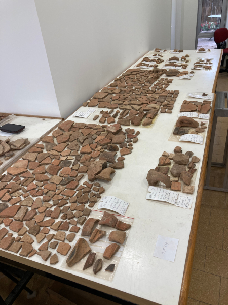
Some of the pottery which we laid out – it frequently covered more than one table!

There were many instances where the information gained from laying out the pottery matched our initial interpretations. In this case, it was good to have confirmation and it provided a great opportunity for me to grow more familiar with pottery forms. Other times we needed to adjust our interpretation when we reexamined the data. For example, we realized that part of one locus was mixed with later material from a pit which had been missed in excavation. When we returned to the field notes, this also matched observations about an area with a slightly different soil composition. While the pottery was out, several pieces were also selected for illustration.

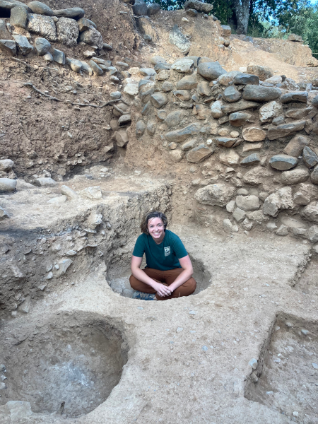
A picture of me from the 2022 excavation season, featuring some of the pits which we did not miss. Photo credit: Sarah Harrington.

Although much of the study season was spent looking over tables filled with pottery, this did not account for the entire study season. One of the more fun and satisfying things we got to do after laying out the pottery was restoration. Sometimes, excavations will recover a large portion of a vessel; if it is broken when it is discovered (which is very often the case), you do not always know how much of it was preserved. Restoration, then, is a three-dimensional puzzle to fit together pieces that belong to the same vessel. Depending on how many pieces the item was in, this can also clarify the original shape of the object.

Finally, work was also done to lay out other artifacts – excavations may also uncover figurines, tools, beads, and many other items that people used in the past. These can frequently reveal a lot about daily life. During the study season, we made sure that all these artifacts were accounted for and took photographs and measurements of many of them. Decisions were also made about whether the Tel Dan team would be able to adequately research and publish this material or if an expert (e.g., in metalworking) would need to be called in to work with the material.

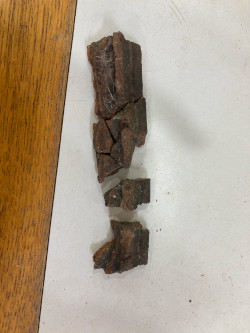
Partway through the restoration of a cooking pot rim – one of the first steps was always to figure out which pieces connected to each other; the color of the rim is due to char from the use of the cooking pot.
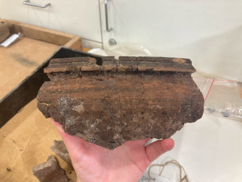
The same cooking pot, with restoration completed, representing all of the pieces which were found during excavation.
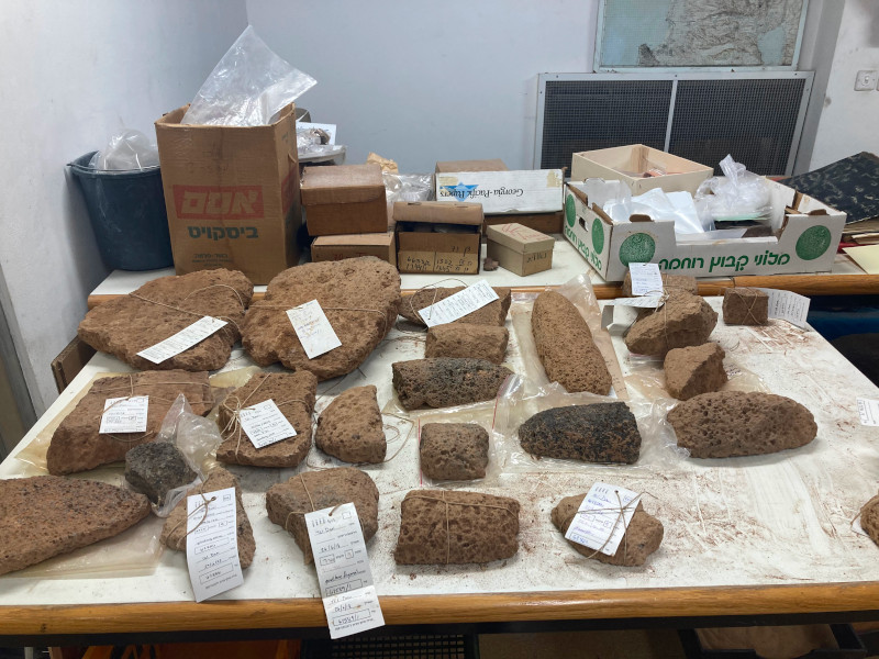
An example of other objects we looked at this summer – these are some of the grinding stone pieces from Tel Dan, which would have been used to grind grain.

All this work has helped move some of the Tel Dan material toward publication. After all, without a solid understanding of the stratigraphy and the artifacts from the site, it is very challenging to write a final report. I look forward to the eventual publication of this material! It will be very cool to see the next stage of the process when I know something of its excavation and study season work.


Emilie Nordhues is a graduate student in the Near Eastern Languages & Cultures Department at UCLA. Her research interests lie in the Achaemenid period and include dealing with identity formation, the impact of empire on daily life and religious practices, and the mobility and impact of various communities of practice (such as craftsmen).


Want to help more students and early career archaeologists get into the field? Donate to the cause today by selecting “Excavation Scholarships” as your gift purpose!

Fieldwork Report: Danielle Tutak

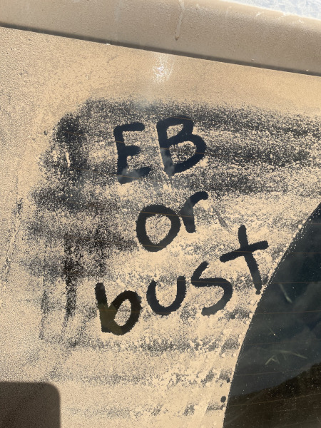
EBA Or Bust! A Student’s Summer at Tell el-Hesi and Khirbet Summeily

Danielle Tutak, 2023 Katherine Barton Platt Fieldwork Scholarship Recipient

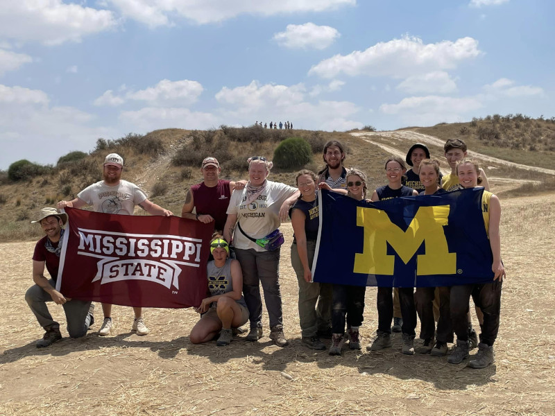
This past summer afforded me the extraordinary privilege of participating in fieldwork at Tell el-Hesi, collaborating with University of Michigan PhD candidate Kara Larson in her research for her doctoral dissertation, as well as joining the Mississippi State University Field School to conclude excavations at Khirbet Summeily. During the initial phase of the field season, we broke ground with the first excavations at Tell el-Hesi since the 1970s, with plans for continued excavation over multiple seasons. This archaeological site had undergone extensive previous excavations, with projects dating back to 1890-1892 and another in 1970-1977 conducted by the Joint Archaeological Expedition to Tell el-Hesi with these prior endeavors primarily concentrated on the Tell and the upper city of the site; however, the 1970 expedition conducted a probe off the Tell in field IV, delving into the site’s broader stratigraphy to achieve a holistic understanding of the ancient city. It was the findings from this probe that influenced our selection of the excavation site for our work.

The Tell el-Hesi team!

In the latter part of my field season, I participated in excavations at Khirbet Summeily, an Iron Age administrative and trade outpost. Collaborating with the Mississippi State University crew provided not only invaluable archaeological experience but also the opportunity to establish meaningful connections within our shared field of study and a collective camaraderie forged beneath the blazing sun.

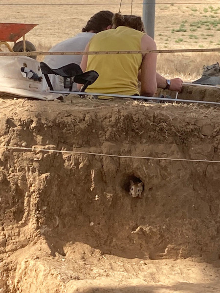
An unexpected excavation volunteer.

A typical field day began by aiming to beat the scorching heat. Ideally, we woke at 4 a.m., prepared breakfast, and ensured we had enough water before heading to the site by 5 a.m. More often than not, the allure of the snooze button prevailed, leading to a rush to get ready and make it to the vehicles on time. Upon arrival at the site, our initial tasks included setting up shade cloths, unloading tools, and beginning excavation. Throughout the day, we took short breaks for morning coffee, a mid-morning breakfast, and a refreshing fruit break toward the end, vital after long hours when it was beginning to heat up. Around 12:15 p.m., as the temperature climbed, we finished our excavation activities, cleaned up, and left the site by 12:30 p.m., eagerly returning for lunch and a much-needed shower. The midday break allowed for short naps which many of our crew took frequent advantage of. After this afternoon break, while most other students washed pottery, I had the privilege of illustrating notable sherds found during excavation. As an interdisciplinary art and archaeology student, this role allowed me to refine my skills and define my niche.

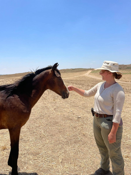
Saying hello to a visitor to the site.
Words of motivation!

Weekends provided a welcome respite with trips to explore renowned archaeological sites, culturally significant locations, and the region’s must-see attractions. Among the memorable highlights were the experience of floating in the Dead Sea (a word of caution – avoid getting the water in your eyes, trust me, it’s not pleasant), visiting Masada, where some of our team braved climbing the snake path while others took in views from the gondola, swimming in the Mediterranean Sea, and my personal favorite was the opportunity to explore Jerusalem’s Old City.

In summary, my journey of working and learning at Tell el-Hesi and Khirbet Summeily during the summer has been profoundly transformative. The experiences, knowledge, and friendships I acquired have enriched both my academic and personal growth. As I reflect upon the early mornings, sweltering days, and the discoveries we unearthed together, I am deeply moved by the generosity of ASOR and the donors to the Katherine Barton Platt Fellowships for making this journey possible. The opportunity to collaborate with fellow scholars and engage in interdisciplinary research that fuses art and archaeology has solidified my love for this field. I am unwavering in my commitment to carry forward the knowledge and experiences from this fieldwork season in my academic pursuits, aspiring to make meaningful contributions to the field of archaeology. I extend my heartfelt gratitude once more for this extraordinary opportunity, which has unquestionably shaped my future aspirations and goals.

Danielle TutakDanielle (Dani) Tutak is a senior pursuing dual degrees in art and design and anthropological archaeology at the University of Michigan. She is passionate about the potential of interdisciplinary research using insights and methods from diverse fields of study and experimenting with unexpected methods of science communication and documentation. Her upcoming projects and goals include finishing her anthropology honors thesis in archaeological research, completing her senior art thesis exploring historical and modern approaches to understanding the past, and graduating and moving on to the next adventure.

For more information about the Tell el-Hesi Archaeological Project, visit their Facebook page: https://www.facebook.com/profile.php?id=100093520164451

Want to help more students and early career archaeologists get into the field? Donate to the cause today by selecting “Excavation Scholarships” as your gift purpose!

Mesopotamian Fellowship Report: Jaafar Jotheri

An Archaeological Survey of the Iraqi Western Desert

Dr. Jaafar Jotheri, Department of Archaeology, University of Al-Qadisiyah

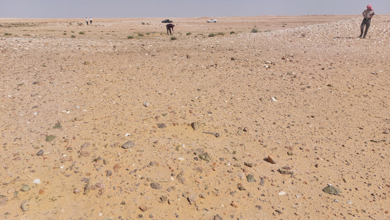
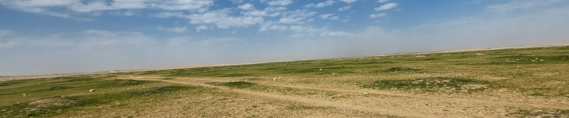
The Iraqi Western Desert has finally been archaeologically surveyed. For decades, this part of Iraq was ignored by both local and international archaeologists. Most Iraqi and international projects focus on Mesopotamia’s floodplain, steppe, and mountains, but not its western desert. One side effect of this project, funded by an ASOR Mesopotamian Fellowship, is that the Iraqi Western Desert is now attracting more local and international researchers. Local postgraduate students have started to take archaeological projects in this area for their theses, and scholars have begun visiting the desert for potential future research projects. More importantly, the Iraqi Official Heritage Authorities have started to create new records and databases for the archaeological sites in this part of Iraq. This project has put the archaeology of this desert in the spotlight and sparked much interest in future research. The dissemination of every step of this project has helped other stakeholders follow its progress and wait with interest for its outcome.

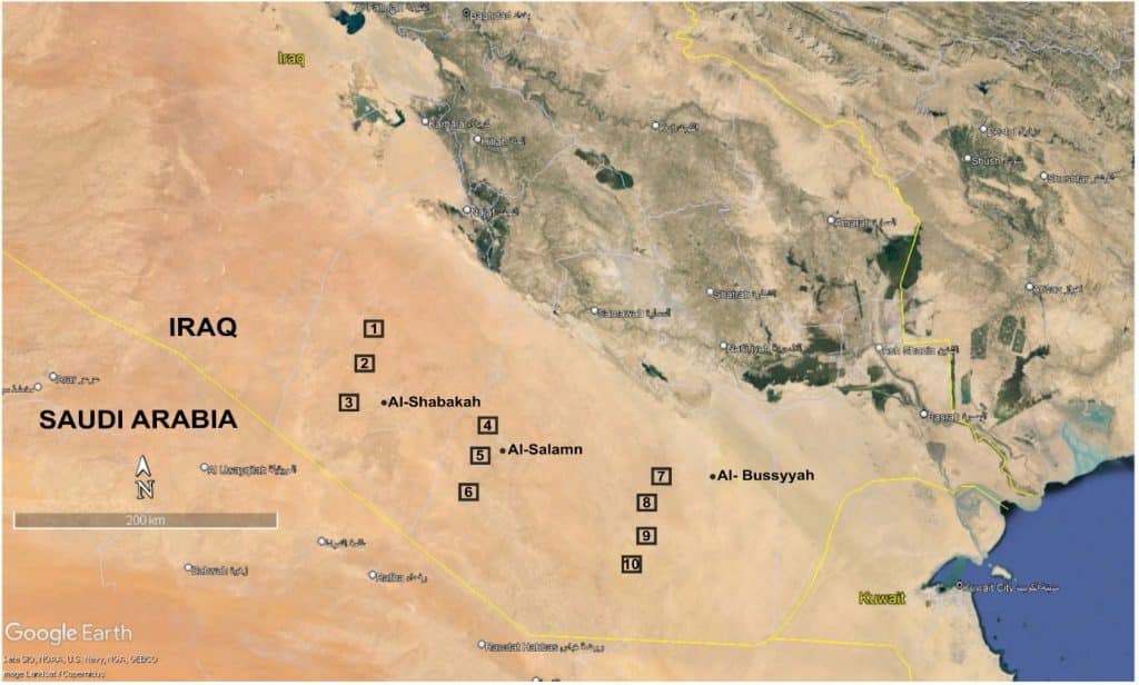
Figure 1: Location map of the ten field trip locations.

The combination of research methods this project followed has benefited the Iraqi university students and staff. For example, 16 Iraqi students (from Al-Qadisiyah, Kufa, and ThiQar Universities) have been trained in the techniques of remote sensing and GIS to identify more archaeological sites in the desert. We managed to locate and map more than 300 potential sites (enclosures, pendants, and tombs-graves-burials) in the desert using systematic and inclusive remote-sensing surveys.

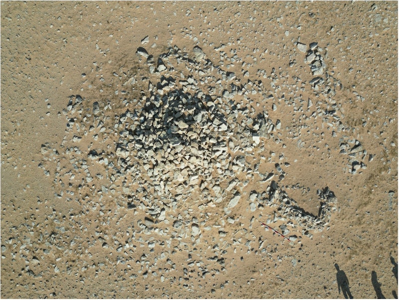
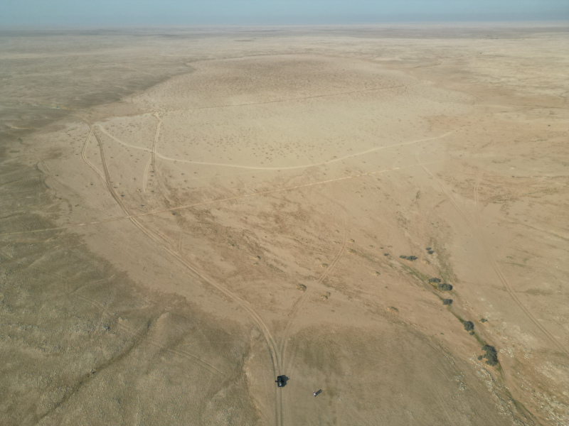
Figure 2: A drone image shows a tomb-grave-burial in the Iraqi Western Desert in December 2023.
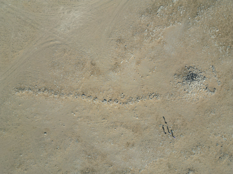
Figure 3: A drone image shows a pendant in the Iraqi Western Desert in December 2023.
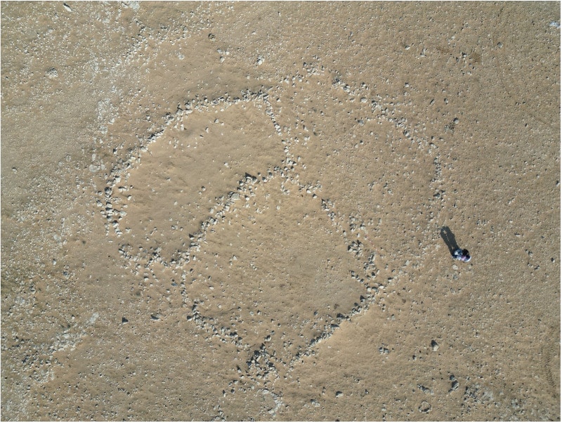
Figure 4: A drone image shows Jaafar Jotheri standing close to an enclosure feature in the Iraqi Western Desert in December 2023.
Figure 5: A drone image shows a palaeolake in the Iraqi Western Desert in December 2023.

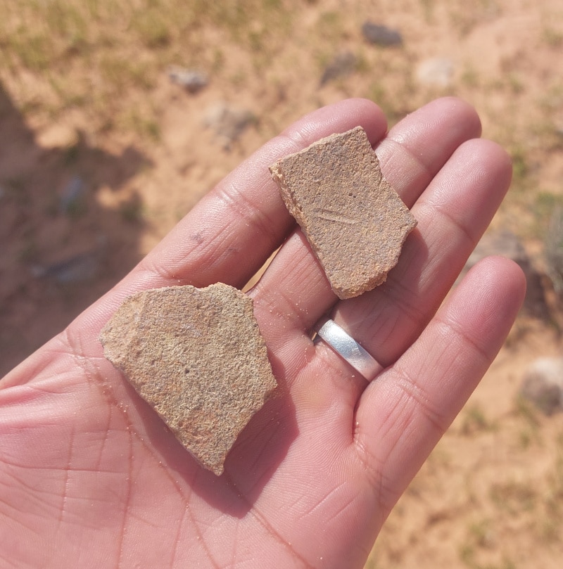
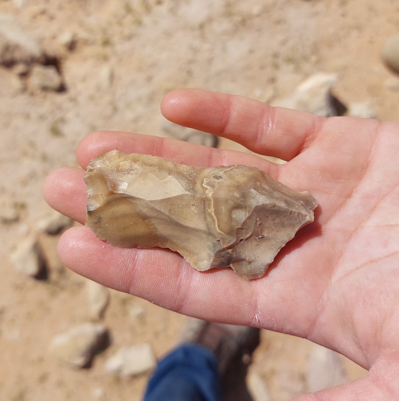
After completing the office work, we conducted fieldwork, which consisted of ten trips, each to a different part of the desert. Locations were selected based on the remote sensing results. We took five students for fieldwork training that involved identifying the sites that had already been mapped, drawing sketches of the sites, collecting lithics, taking photos, and using drone images. More than 500 lithic samples have been collected, classified, and photographed. These samples will be studied more in the university lab as they show a mix of ages from Palaeolithic to Neolithic. We used two 4×4 cars to travel in the desert, and we were accompanied by guides from the local Bedouin people who knew the roads well. Optically Stimulated Luminescence (OSL) samples were collected from the sediments under the rocks of clusters of enclosures to determine the age of construction of these features. These samples are on their way to the OSL lab. We were lucky to have Dr. Stefan Smith from the University of Helsinki and Dr. Ella Egberts from the University of Leicester with us on two field trips to the desert.

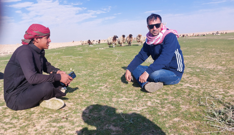
Figure 6: Jaafar Jotheri interviewed some local bedouins about their interpretation of the archaeological features in the Iraqi Western Desert in December 2023.
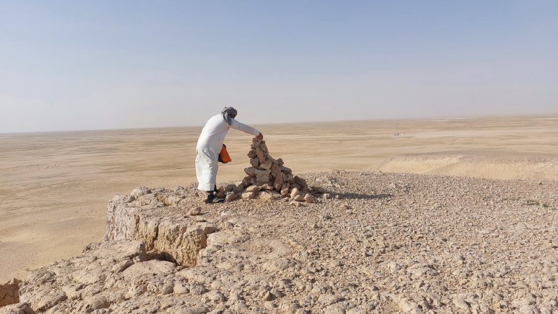
Figure 7: A local bedouin volunteered to repair a tomb-grave-burial feature in the Iraqi Western Desert in December 2023.
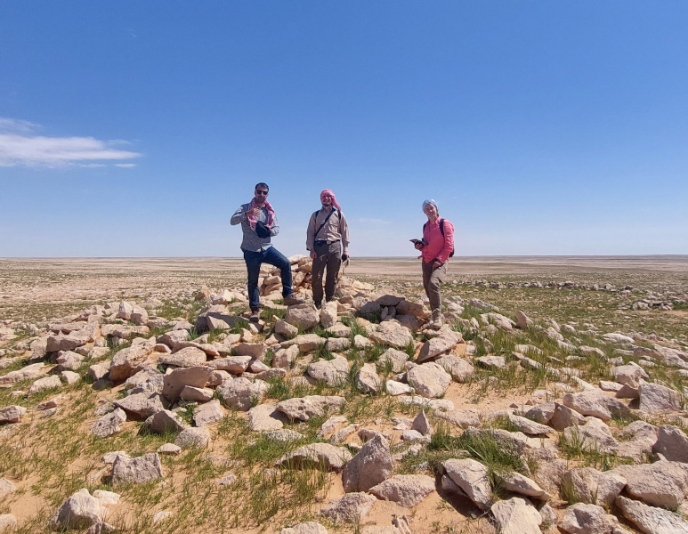
Figure 8: Jaafar Jotheri, Stefan Smith and Ella Egberts in one of the field trips in the Iraqi Western Desert in March 2024.
Jaafar Jotheri (recipient of a Mesopotamian Fellowship),, Stefan Smith and Ella Egberts in one of the field trips in the Iraqi Western Desert in March 2024.
Figure 9: Collecting lithics in the Iraqi Western Desert in March 2024.

Figures 10 and 11: Some ceramics and lithics collected during fieldwork.

Although the results have not been finalized yet, I delivered three talks about the preliminary findings of this project at international conferences. The first was entitled “What Archaeology and Heritage do we have in the Iraqi Western Desert?” at the British Association of the Near Eastern Archaeology conference January 3–5 in Glasgow. The second paper, “The Natural and Cultural Heritage of the Water Springs in the Iraqi Desert,” was part of an online workshop on bioarchaeology in Mesopotamia at Kiel University, Germany. The third was “Archaeological Features from the Iraqi Western Desert,” which was delivered in person at the 5th International Scientific Conference of the Mesopotamian Archaeology held on March 6th at the University of Al-Qadisiyah. A portion of the results are being prepared for publication in an international journal, and more will be published in a local Iraqi journal. I also submitted an abstract to the ASOR annual conference that will be held this November, which I plan to attend in person.

Fieldwork Report: Veronica Morriss

CCAP 2023: Searching for the Islamic History of Herod’s Great City

Veronica Morriss, 2023 Eric and Carol Meyers Fieldwork Scholarship Recipient

Caesarea is one of the best known and most researched sites in Israel. It’s famous for Herod the Great’s imposing harbor, the Roman hippodrome and theater, the grand Byzantine octagonal church, and its massive Crusader walls. Caesarea has an extensive history of groundbreaking archaeological research, and numerous excavation teams are usually working at the site at once, uncovering the ancient city, one meter at a time.

While the extensive Roman, Byzantine, and Crusader remains at the site have captured popular imagination and been the primary target for most excavations, the city’s role during the early Islamic era is not well understood—and the port played a more important role in Islamic history than it is given credit for.

First day on site.
First day on site.

The situation at Caesarea mirrors that of research throughout the Levantine coast. The archaeology of the early Islamic period is often neglected due to a combination of factors, including a bias in site selection and a predilection for Classical sites. These biases and gaps in the data have led to debates about the nature of settlement and trade along the coastal region and whether they declined following the Islamic conquest in the 7th century CE. However, over the last several decades, scholars working throughout the region have begun to question the evidence underlying decline narratives and have produced new evidence that creates a more nuanced and dynamic picture of the era.

In part, this reimagining of the Byzantine-Islamic tradition has inspired our research at Caesarea. According to historical sources, Caesarea played an important role during the Islamic conquest and was targeted by the early caliphs and their forces due to the city’s port and its prominent role in Byzantine trade and logistics. Though Caesarea lost its role as capital of the Byzantine province Palaestina Prima after its capture in 640/1 CE, it continued to be inhabited and was tied into the eastern Mediterranean trade networks and the defense of the coast.

First day of digging.

As part of the Caesarea Coastal Archaeology Project, our team has been exploring several regions of the ancient city, with a primary focus on those that might have Islamic-era remains. My work has been focused on the area south of the Roman theater, just outside of the park. We chose this area (Area FZ) to get a stratigraphic record of the southernmost end of the city near the Byzantine wall. We were also hoping to find traces of the Byzantine-Islamic fortress that was identified during the mid-20th century Italian excavation in the defunct theater.

Gaming dice.


Gaming dice.

Last year, we uncovered structural remains and material culture that attest to a complex history of mixed use for the area. While we cannot discuss everything that we discovered prior to publication and reporting to the Israel Antiquities Authority, the finds this year point to significant Crusader-era use of this section of the city, as well as Byzantine-Islamic transitional layers, and a thick deposit of amphorae and storage jars. Tantalizing finds from earlier periods include six-sided gaming dice, carved bone hair pins, spindle whorls, dozens of coins, and even a horse skeleton—which many of the students were excited to uncover, having taken zooarchaeology courses at their universities.
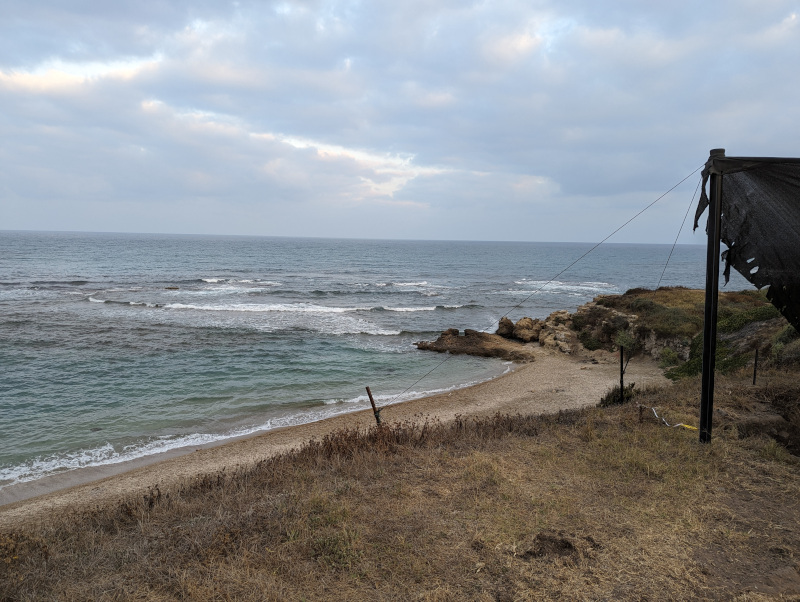
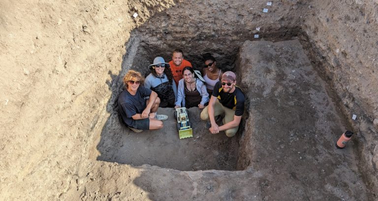
In addition to searching for evidence of an under-represented portion of Israel’s history, our project is focused on training the next generation of archaeologists. Students had a chance to practice careful excavation methods in the field, tagging and recording artifacts, making section drawings, creating 3D models using photogrammetry, and conducting off-shore underwater surveys—which for many of the students was the highlight of the season. Considering it was hot and humid, it was a luxury to be digging a stone’s throw from the Mediterranean!

View from the trenches.
End of field shot.

It was a great season, and we look forward to returning with our team next year to further explore Caesarea’s lost history.


Veronica Morriss.Veronica Morriss earned a PhD in Islamic Archaeology from the Department of Near Eastern Studies at the University of Chicago. She is a maritime archaeologist, and her research focuses on the development of the Islamic/Byzantine maritime frontier of Syria-Palestine and the cross-cultural interactions that characterized the Eastern Mediterranean and its shores during the Early Islamic Period. She co-manages a digital archaeology company with her husband in Hawaii, and when she is not in the field, she writes fantasy romance novels.
Want to help more students and early career archaeologists get into the field? Donate to the cause today by selecting “Excavation Scholarships�? as your gift purpose!

Fieldwork Report: Isabelle Sauvé

Wall Brackets, Deer Bones, and Sling Bullets Oh My! Excavating the Built Environment of Kalavasos-Ayios Dhimitrios

Isabelle Sauvé, 2023 Eric and Carol Meyers Fieldwork Scholarship Recipient

This report describes my participation in the fieldwork led by Dr. Kevin Fisher at the site of Kalavasos-Ayios Dhimitrios on the island of Cyprus during the 2023 summer season. Kalavasos-Ayios Dhimitrios is an urban center dating to the Late Cypriot (LC) II period (c. 1450-1200 BCE), reaching its peak in the Late Cypriot IIC before being abandoned. Previous investigations by Alison South from 1979-1998 revealed that this urban center was used for a multitude of both ritual and economic activities. The fieldwork undertaken this past summer was a continuation of excavations conducted by Dr. Kevin Fisher to the south-west of South’s original site.

A view of the Neolithic site of Tenta from our dig site.

A view of the Neolithic site of Tenta from our dig site.

Kalavasos-Ayios Dhimitrios is one of the two main sites that are part of the Kalavasos and Maroni Built Environment Project (KAMBE). This project is an interdisciplinary investigation of the relationships between urban landscapes, social interaction, and social change on Cyprus during the Late Bronze Age. As a collaboration between the University of British Columbia, Cornell University, the University of Chicago, and the University of Southhampton, I had the opportunity to meet a number of scholars and students from these different institutions and make meaningful connections.

I was very grateful for the opportunity to join Dr. Kevin Fisher on this project since my research interests include the study of built environments in the Mediterranean Bronze Age. I was also especially thankful to join this dig as it was my first time excavating in the Mediterranean. Needless to say, I was super excited to start this new adventure!


During the field season, we stayed in the beautiful village of Kalavasos. Only a 10-minute drive away from the site, this little town was nestled in the hills and had amazing views of the surrounding scenery. Our team was fortunate enough to stay in tourist apartments that were so cozy and comfortable. Each night we would have dinner together at one of the local tavernas and get to try a variety of authentic Greek-Cypriot dishes. Everyone in Kalavasos was so friendly and welcoming, making my stay that much more special. It definitely helped me settle into my new surroundings for the month and ease my anxieties about being in a foreign place.

A picture from the streets of Kalavasos.


A picture from the streets of Kalavasos.

Even though we got to stay in luxurious accommodations, working in the field was not always so luxurious. We worked long hours in the dust and heat. A typical day included a 6:30 a.m. start, working until 9:30-10:00 a.m. and then having a 30-minute breakfast break. We then continued working until lunch time which was around 12:45-1:00 p.m. Luckily, we were spoiled by our directors and were given a 3-hour siesta period in the afternoon. Many of us would nap and lounge by the pool before going back into the field around 3:00 p.m. The day ended around 6:00-6:30 p.m. and we would come back to the village and have a nice dinner in the plateia.

Despite the long hours in the heat, I loved working in the field and had a chance to uncover so many interesting artifacts. I was working in Unit 7, which was a trench that had been opened in previous seasons. Here, another structure was uncovered and seemed to have been used for ritual activities. This trench yielded elite fine-ware pottery, large pithoi, and inscribed pottery. However, the most interesting finds this season were a wall bracket, deer bones, and hundreds of sling bullets. According to Dr. Fisher and colleagues, all these artifacts suggest ritual activity. Wall brackets are objects that consist of a long vertical shaft with a rounded top that is pierced by a suspension hole and a bowl at the bottom. These objects were likely used for lighting or burning incense and are found in cult, mortuary, and domestic contexts (Fisher et al. 2019). Likewise, the large deposit of deer bones points to ritual feasting as deer is rare in Late Cypriot diets and therefore points to a “luxury commodity” (Fisher et al. 2019: 487). The sling bullet deposit was the most interesting find in my opinion, where I spent hours carefully extracting hundreds of these ovoid, unfired clay objects from the ground. It is still unclear what their purpose in this context was, but they may have been deposited in this building as part of a ritual practice. Although I was tired, dirty, and hot at the end of the day, I was so happy to have gotten to dig and feel accomplished after each bucket of dirt that I filled.
Isabelle Sauvé.
Isabelle Sauvé.
Artifacts from the field: A juglet and a wall bracket.
Aphrodite’s Rock.


Aphrodite’s Rock.

Yet, my time in Cyprus did not just involve dirt and trowels. I had the chance to see so many parts of the island thanks to the field trips that the directors organized. I got to lounge by the Mediterranean on the beach, go shopping in Nicosia, see Taming of the Shrew in the ancient amphitheatre at Kourion, and tour so many ancient and historic sites. My favorite memory is picnicking with new friends at Aphrodite’s Rock and listening to waves hit the shore.

Overall, this was an unforgettable experience where I got to learn new skills in the field, make meaningful connections, and see new things. I am grateful to Dr. Kevin Fisher and Sheri Pak for organizing this trip and to Dr. Eric and Dr. Carol Meyers for their generous scholarship. Without all your support, my participation in this project would not have been possible!


Isabelle Sauvé is a graduate of the M.A. Classical and Near Eastern Archaeology program from the University of British Columbia, Canada. Her research focuses on architectural analysis and gender theory in the European and Mediterranean Bronze Age. Isabelle has previously excavated at Horvat Midras in Israel, making this her second archaeological excavation during her graduate studies. She hopes to get her PhD and continue conducting excavations of Bronze Age built environments.

For more information about the Kalavasos and Maroni Built Environment Project visit the project website: https://kambe.cnrs.ubc.ca/

Bibliography:

Fisher, K.D., S.W. Manning and T.F. Urban. 2019. New approaches to Late Bronze Age urban landscapes on Cyprus: Investigations at Kalavasos-Ayios Dhimitrios, 2012–2016. American Journal of Archaeology 123(3): 473-507.

Want to help more students and early career archaeologists get into the field? Donate to the cause today by selecting “Excavation Scholarships” as your gift purpose!