Hania Kantzer, 2023 Stevan B. Dana Fieldwork Scholarship Recipient
If you had asked me a year ago if I’d be up for working eight hours a day, six days a week, in the summer heat, starting at around 5 am every morning, I probably wouldn’t have been as enthusiastic as I am now. However, almost as soon as I began, I realized what an honor, what an unforgettable experience, and what an education it was!
Huqoq, an ancient Jewish village nestled about three miles to the west of Capernaum and Migdal (Magdala) in the Galilee region of Israel, has been the site of ongoing excavations since 2011. Dr. Jodi Magness of the University of North Carolina at Chapel Hill, leading the excavation, has unearthed a remarkable Late Roman synagogue dating back to the early fifth century C.E. This synagogue is adorned with mosaics which not only depict a range of biblical scenes but also mark the very first instance of a non-biblical narrative ever discovered in an ancient synagogue. When I was working for the Center for Jewish Studies on campus at my school, I presented to many classrooms (once, even to Professor Magness’ class) about this excavation as a possible research opportunity. Whether I persuaded others very well, I don’t know, but I definitely convinced myself! I ended up applying to join her team for Summer 2023.
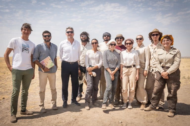
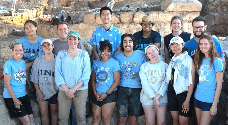
Professor Jodi Magness with current and former UNC students at the Huqoq excavations (Photo credit: Jim Haberman).
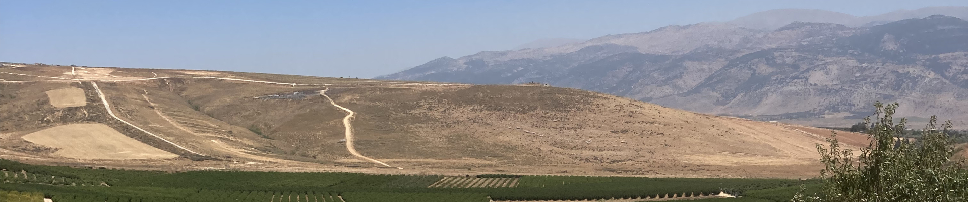
Sunrise at the kibbutz.
On the first day of the dig, right after getting introduced to our fellow team members, we dove straight into work. That routine carried us through the next five weeks. My alarm was always set for 4:11, which gave me precisely 19 minutes to change into my work clothes, splash my face with cold water, fill my water bottle, apply sunscreen, have a quick bite of a cracker, and catch the bus. During the bus ride, we’d all exchange groggy glances, then trek down a dusty road to reach our excavation site. We’d hurriedly set up our shade cloths just as the sun started to rise. Witnessing the sunrises every morning became one of my most cherished memories of the excavation. Orange light from the east and the cool morning air made me forget any reluctance I had about getting up early. It was during this time that our area supervisor would brief us on the day’s tasks.
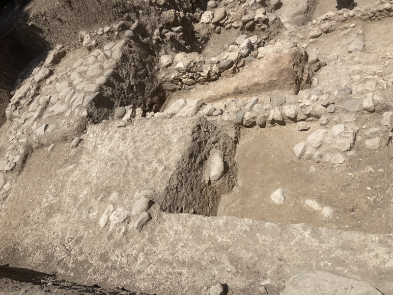
In the beginning, I started with relatively simpler tasks like carrying buckets or sweeping exposed pavement. Gradually, I progressed to more complex responsibilities, such as sifting for artifacts. After a minor hand injury, I was temporarily assigned breakfast duty. However, I soon returned to the field, where I tackled tasks like articulating walls and revealing plaster. I even learned how to take elevations and document our finds. The variety of assignments the area supervisors had for us ensured that we kept gaining experience and improving our archaeological skills. Boredom was certainly never an issue! We worked closely with professors and experts in different materials who patiently explained concepts as we advanced.
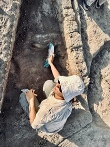
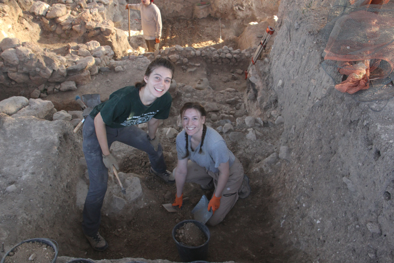
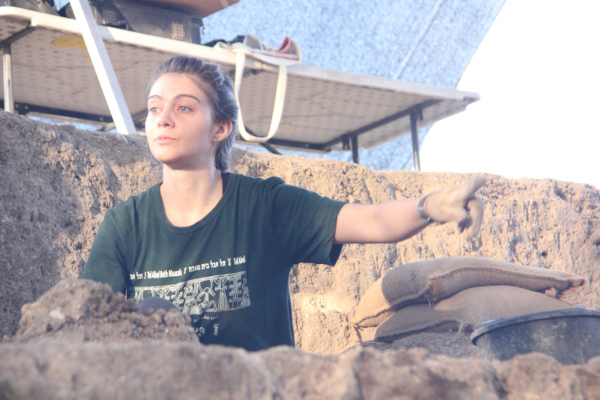
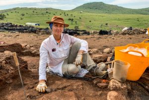
Me working on site (Photo credit: Jim Haberman).
Following our 8 a.m. breakfast and a refreshing watermelon break around 11 a.m., with plenty of water breaks in between to stay hydrated, we would dismantle the shade cloths and make our way back for a lengthy, comprehensive shower, followed by an even more lengthy and comprehensive lunch. Postlunch, our tasks typically involved cleaning potsherds and organizing our finds. Often, later in the afternoon, we were able to attend lectures delivered by experts specializing in conservation, pottery, mosaics, plasters, and glass. They had already been invaluable resources during our working hours, but listening to them delve deeper into their expertise was truly fascinating. After supper, we were free to play pickup basketball games on the kibbutz’s court, hike up a nearby mountain to watch the sun set, or simply enjoy card games in the courtyard. Our evenings usually wrapped up around 8 p.m., as I prepared to turn in for the night, knowing that come the next morning, the familiar schedule would resume.
Once or twice a week, we had the opportunity to visit other excavation sites, both ongoing and completed. This was such a cool way to contextualize our own work! Halfway through our dig, we embarked on a weekend trip to Jordan, with stops at remarkable sites like Machaerus and the Madaba map. It was a fantastic chance for us to unwind for a couple of days, be tourists, and immerse ourselves in the local culture of the region we had been diligently working in for an extended period.
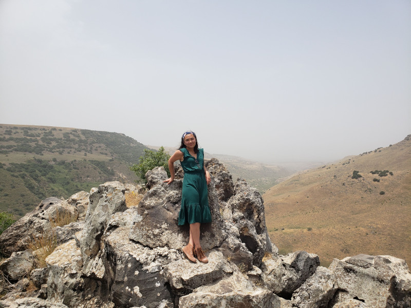
On one of our field trips to visit Gamla.
I can’t say that I didn’t expect how talented, hardworking, and experienced the professors I worked under were; the knowledge they imparted to us students was extraordinary just like their CVs would tell you. What I did not expect was the level of personal support and kindness they extended. I will never forget how these experts at the top of their field still made time to guide me, an undergraduate fresh out of my first year in college. They didn’t just lead by example; they also provided invaluable mentorship. Months later, I am still brushing off the dust from my work clothes, yet what remains even more vividly from this experience than the dust on my belongings or the treasured trowel displayed on my shelf are the wonderful memories of my first adventure in archaeology!
Hania Kantzer is a sophomore at the University of North Carolina at Chapel Hill studying chemistry and Asian studies. This past summer, she was a grateful recipient of the Stevan B. Dana Fieldwork Scholarship through ASOR, and was able to work as a student researcher on the Huqoq Excavation Project.
For more information about the Huqoq Excavation Project visit the project website:
Want to help more students and early career archaeologists get into the field? Donate to the cause today by selecting “Excavation Scholarships” as your gift purpose!
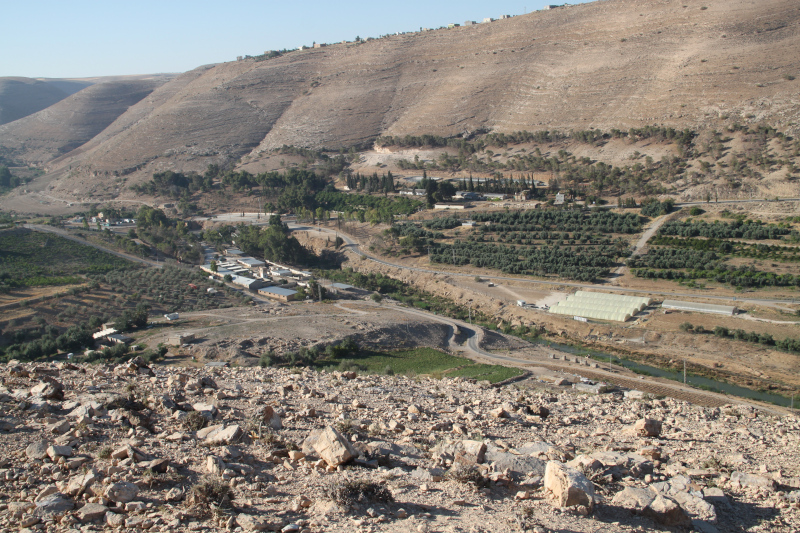
Khirbat Iskandar (translated as “ruins of Alexander”) is an archaeological site in the Madaba governorate, located on the northern bank of the Wadi al-Wala. Despite the name, the site has no proved connection with Alexander “the Great” because it is a 3ha fortified site whose occupation dates back to the Early Bronze Age (EBA). Even the term khirbat is questionable because the site is a true tell (an artificial mound in Arabic). The site is just 6 km north from Dhiban and it is located on a strategic crossing point where the slopes on the northern and southern bank of the wadi are not so steep and drop off gently until the waterway. For this reason, a modern road that connects Madaba and Dhiban runs near the site. The modern viability follows the same path of the Roman via Nova Traianathat was established on the ancient Iron Age road known as the King’s Highway.
The archaeological investigation of Khirbat Iskandar started in the 1980s, and each season produced important data about the settlement patterns and the human activities in this area of the Southern Levant where the EBA patterns of settlement are still subject to deeper investigation compared to Cisjordan. The 2023 field season at Khirbat Iskandar was different from a typical excavation season. In the current vision of archaeology, preservation and sustainable promotion of archaeological sites are added to the tasks that archaeologists must accomplish. In addition, a broader interest on the landscape surrounding the sites is another fixpoint of modern archaeological research. So, this year the team efforts were focused on the survey and conservation in three core areas: the southern and eastern roadcut sections of Khirbat Iskandar, the northern terrace along the wadi terrace to its south, and the hill of Umm el-Idham on the northwest.
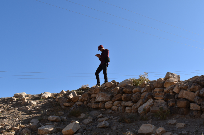
A part of the team worked at the roadcut where trimming activities were carried out on two exposed sections section to obtain new data from the stratigraphy, while conservation activities were implemented at the Early Bronze Ag fortifications at the south-east edge of the site. The same team carried out the survey of the wadi terrace nearby. The rest of the team carried out the survey and some probes on the top of the Umm el-Idam hill. As a young archaeologist specializing in landscape archaeology, this past season I was assigned a number of important tasks that required both technical skills and topographical expertise. My duties as survey leader assistant were related to organize the survey with the survey leader Tucker Deady, a PhD student at the University of Toronto, and manage the geodatabase that we had set up in the months before the fieldwork season. The organization of a complete and user friendly geodatabase is an important step for survey operations, so we dedicated a lot of time to it to prepare for the season. On the field, surveying was my main activity during a typical workday, and that is one the most interesting part of my work because it helps me to understand how archaeological features combine with the landscape.
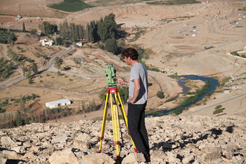
During this season, I was also in charge of producing the photogrammetric record of the probes and the road cut sections. Therefore, sometimes I also worked on the acquisition of the photographic dataset and measurements with a total station to produce a 3D model of the endangered southern and southeast sectors of the site of Khirbat Iskandar. On such days, I would join the survey team for the rest of the day after completing my work on photogrammetry. To take the photographic dataset as first operation in the morning is an important step because it allowed me to take advantage of the best light before the sun rises. In fact, direct sunlight provides uneven lighting around an object and casts hard shadows, this can lead to errors during the photo processing or produce a bad quality texture. So, it is necessary for us to take photo when the light is diffused, like cloudy days or during the sunset/sunrise.
Personally, I consider this task a necessary step of my work and I am proud of the results I obtained. The use of new technology as photogrammetry in the collection and elaboration of data is an important step, necessary in most of modern survey operations. All the 3D models we produced are scaled; this allows us to take remote measurements and have a three-dimensional point of view over the subject without being in the field and all in one file. In few words: scholars can virtually come back to the site whenever they want.
After the lunch break my work restarted in the afternoon. Usually in the second part of the day I worked on the processing of data we collected in the morning; this operation consists most of the time in the massive data entry into our geodatabase. Maybe this part of the work is a bit boring compared to the fieldwork but it is necessary and it so exciting to see the results of all our hard work summarized on maps that show us a big picture. When we took photographic data for photogrammetry, I used to work on the elaboration of the 3D model with appropriate software such as Metashape. Usually this process is mostly automatized except for the uploading of photos and coordinates collected with the total station. It can be time consuming just in case of problems, for example the presence of one or more bad photograms in the dataset, bad light or other technical issues that can be resolved with a bit of human work. When a 3D model was completed I produced some orthophotos, which will be necessary to generate floor plans or frontal elevations through the use of other software as Autocad.
The life of a young landscape archaeologist is exciting and the beauty of the Jordanian landscape makes it like a dream. Sometimes when I see the landscape of the Wadi el-Wala from the hill of Umm el-Idham, with a 360° view over Khirbat Iskandar, I feel like I’m in timeless place where the essence of the EBA is still alive in the air. Working there with this incredible international team was an amazing experience and I can’t wait to return to the site in the future to continue studying and living this astonishing place.
Nicola Lanzaro obtained his BA degree in Eastern Archaeology at L’Orientale University of Naples. He is currently a MA student at the Sapienza University of Rome. He is currently member of two missions in Levant: the Lebanese-Italian Project in the Region of Tyre, Lebanon (from 2022) and the Archaeological Expedition to Khirbet Iskander, Jordan (from 2023). Nicola’s areas of interest include landscape archaeology, GIS, and the Early Bronze Age routes of the Southern Levant.
Want to help more students and early career archaeologists get into the field? Donate to the cause today by selecting “Student Support” as your gift purpose!
Dar Ben Gacem Fellowship Report: ASOR Punic Project—3D Modeling of Stelae and Cippi from Carthage
Brien Garnand, Nederlands Instituut voor het Nabije Oosten, Leiden University
As we approach the 100th and 50th anniversaries of American excavations at the Precinct of Tinnit and Ba’l in Carthage (the so-called “tophet”), and with publication eminent for the final report from the ASOR Punic Project excavations, I have been preparing 3D models—both full-scale printed replicas of individual stelae and a scale model of the entire American sector—in anticipation of a commemorative exhibition. Although there have been dozens of excavations at “tophet” sites across the Mediterranean, we lack publication of final reports with precise contexts. My efforts during this fellowship represent early, tentative steps to remedy this deficit.
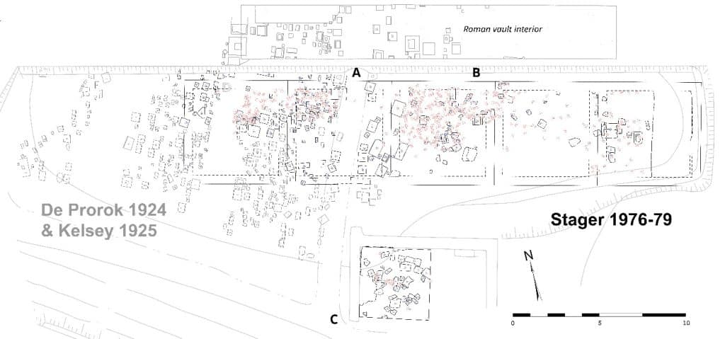
The scale model of the site will represent just the Regulus-Salammbô sector (Fig.1), the precise location of both the excavations of F. W. Kelsey / University of Michigan (1925) and of L. E. Stager / ASOR Punic Project (1975-1979). Total station readings taken in the early 2000s have allowed me to correct the Kelsey-Michigan blueprint plans and the Stager-ASOR field-note plans, but the Kelsey blueprint of stelae inside the Roman vault has yet to be corrected because they lay outside of the total station’s range.
Fig.1. Site plan combining the blueprints of Kelsey-Michigan excavations (grey) with plans from the field notes of the Stager-ASOR excavations (black, blue, red), both within the same Regulus-Salammbô sector of the precinct dedicated to Tinnit and Ba‘l in Carthage (modified from Garnand & Greene 2023: 157, map 4). Note that the alignment of the Roman vault is imprecise.
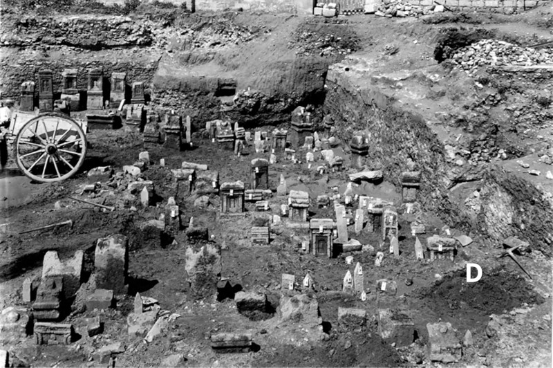
My goals during Dar Ben Gacem fellowship included initial negotiations to make hardware-based scans (Artec Spider) of limestone stelae in museum storerooms as well as actually making preliminary scans using software-based methods (Polycam) of sandstone cippi in the open-air museum at the precinct itself. You can follow the progress at our on-line workspace and on Sketchfab. The former methods will be reserved for those stelae in the Musee national de Carthage and in the Musee du Bardo, currently unavailable while they undergo inventory during museum renovations. I was able, however, to meet with museum curators and colleagues in the INP to make plans for the future. Once scanned, many stelae from American excavations can be replaced back into their precise contexts based upon the archival plans and upon annotated photographs that correspond to those plans (Fig.2).
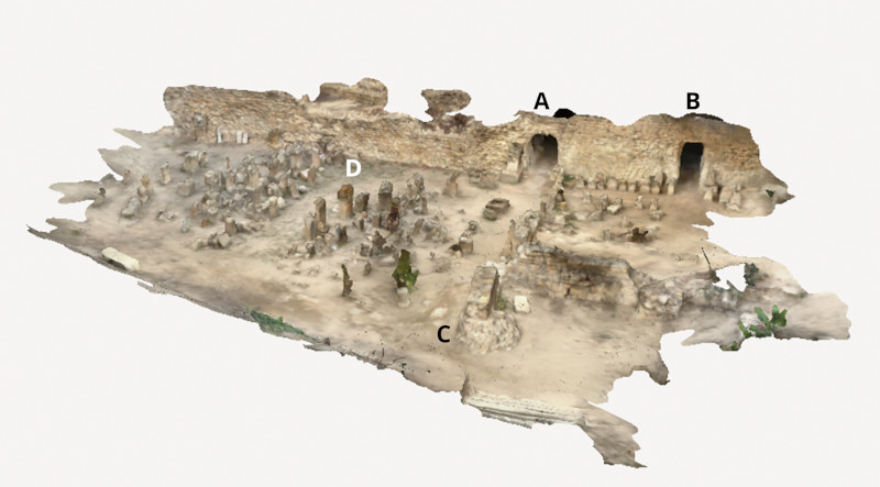
During the fellowship, I was able to stitch together a rough scan of stelae and cippi still in situ, and these stone artifacts and other landmarks will serve as reference points for alignment, e.g. point D in the archival photo (Fig.2) and point C in the plan (Fig.1) relate to key points on my stitched Polycam model (Fig.3). Since I did not have permission to scan stela imbedded inside the Roman foundation vault, for now just the openings in the vault can be roughly aligned with the site plan at points A and B in anticipation of future scanning. While hardware-based scanning can be prohibitively expensive, my preliminary software-based scans required only a LiDAR equipped iPhone 14 Pro. For the moment, however, the hardware-based system does provide higher quality results.
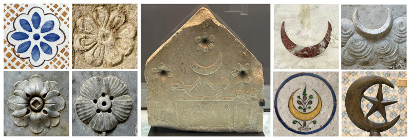
Since I held the inaugural Dar Ben Gacem fellowship, I should offer a preview for future fellows. My hosts provided multiple opportunities to network with Tunisian scholars, US Embassy attaches, and visiting artists, as well as opportunities for conversation with other guests during meals, while the well-appointed scholar apartment provided a refuge for quiet study. This carefully restored beylic official’s residence has a conference room, in nearly continual use, where I presented a hands-on workshop about Polycam. I compared the iconography of stelae that I was scanning to the decorative repertoire of the residence itself (Fig.4). The Dar Ben Gacem has served as a sort of laboratory for the restoration of buildings in the medina of Tunis, so 3D-scanning of interior spaces and architectural details offered a readily transferrable technology that allows for accurate assessment and reconstruction.
Fig.4. Punic iconography from Mactar (Bardo Cb-989) compared to the decorative repertoire of Dar Ben Gacem—the floret (left) and the lunar crescent (right).
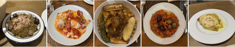
As for the food, simply note that Jamie Oliver picked up tips on Tunisian cuisine while cooking in the Dar Ben Gacem kitchen (Jamie Cooks the MediterraneanS01E02 @20:35-26:00). For an entire month, at each breakfast and dinner, I got to sample authentic fare (Fig.5).
Fig.5. Instagram-worthy fare (from L to R): mechouia, shakshuka, couscous, omek houria, lahmet thon.
Finally, the situation of the residence within the medina means that one can easily explore the UNESCO World Heritage Site just across the threshold. The INP, libraries, and other cultural resources are steps away (particularly resources for medieval and early-modern Tunis), with Carthage accessible via public transit and other archaeological sites within range of a day trip.
Mid-way through excavation, the highest point of the site can be seen in the background near where the Cappadocia Gate and the Palatial Complex are located.
Welcome to Kerkenes, a sprawling Iron Age site located in central Anatolia. This megacity is mysterious as it is vast; Kerkenes was only briefly inhabited for less than a century, before a battle and catastrophic fire caused it to become abandoned. Although the site has been suggested to be that of which Herodotus identifies as Pteria, this description is unconfirmed, and much is left to be learned about the city and its former inhabitants.
Here I joined the ASOR-affiliated Kerkenes Project with the University of Central Florida, where I started my PhD this year working with Kerkenes project director Dr. Scott Branting. Despite a sobering earthquake and busy election season in Turkey preluding our excavation, this year’s field season took place from May until July 2023. Thanks to the generous support of the P.E. MacAllister Fieldwork Scholarship, I was fortunate to participate in an advantageous initial season on the site before starting my PhD program.
[/vc_column_text][vc_wp_text]
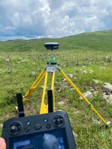
The drone (somewhere up in the sky) and GPS in action.
Kerkenes is located in central Anatolia, in the province of Yozgat. This year the Kerkenes team was lucky to be among the first to experience the opening of the new high-speed rail system that now runs from Ankara to Yozgat (yes, the same name as the province), a city within an hour of the field site. I find the Kerkenes Project unique on account of the variety of research methods and experts that collaborate on the single site. This year we conducted geophysical surveys, drone surveys, and excavation in the field, in addition to ongoing material analysis carried out by conservators, zooarchaeologists, paleobotanists, and ceramicists in the nearby compound’s facilities. Digitalization of previous years’ finds is carried out in any spare time the team has, creating a valuable archive of 3D data about the site.
The timing of the field season in Kerkenes is particularly suited to the wide range of surveys and research that is conducted there. Weather in the first few weeks of the season is typically wet and rainy, the moist ground conducive to resistivity surveys. Perhaps thanks in part to El Niño, we had an unusually rainy year that allowed for resistivity to carry on into nearly mid-June. As the spring rain cleared up, excavation began on Urban Block 8, a section of the city located along the northern edge of the city wall. This block is one of the longest-excavated sections of the site and has yielded valuable data concerning urban development and planning of the city and its perimeter defensive wall.
Over June and July, the excavation team successfully excavated new rooms of this block, providing the project with more data that will help us understand the purposes of the specific structures in Urban Block 8. Based upon the 2022 season’s excavation in adjoining rooms of the block, we anticipated the need for accompanying zooarchaeologist researchers to develop a system by which to differentiate bone fragments from ivory in the field. This system expedited the identification process of many materials and made our work in the trench more efficient.
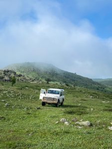
The project’s trusty all-terrain transportation.
Sure enough, this summer’s excavation yielded data which will help us understand the functionality of Urban Block 8’s structures, in addition to the potential diet, animal husbandry practices, storage systems, and art production of the urban block’s residents. Many materials found in Urban Block 8 this year showed evidence of contact with extreme temperatures, serving as further evidence of the reach and intensity of the destructive fire that enveloped the city. The team conducted wet sieving and flotation on many soil samples from this year’s trench, but due to the large volume of soil collected, work from 2023 samples will continue into next year and keep us very busy!
Finds from previous years of the Kerkenes project can be viewed by the public at the nearby Yozgat Museum, as well as in Ankara at the Museum of Anatolian Civilizations. The Kerkenes site will continue to be a source of incredible information about the central Anatolian Iron Age and ancient megacities. Recent work on the site investigates urban planning, pedestrian modeling, and shared social spaces that can be applied to cities anywhere, ancient or modern. I look forward to joining the project in the coming years during my doctoral program to help uncover more of this incredible field site.
Annalise Whalen is a PhD student at the University of Central Florida, where she focuses on digital archaeology of the Middle East. She earned her MTS from Hellenic College Holy Cross Greek Orthodox School of Theology, and received her BA from the University of Massachusetts Amherst.You can find Annalise Whalen on Twitter @AnnaliseWhalen
For more information about the Kerkenes Project visit:
[/vc_wp_text][mk_divider][vc_wp_text]Want to help more students and early career archaeologists get into the field? Donate to the cause today by selecting “Student Support” as your gift purpose!
John Rinks, 2023 Stevan B. Dana Fieldwork Scholarship Recipient
When I was a young boy, I dug holes in my parent’s backyard. I’m pretty sure I wasn’t expecting to find anything. I just liked to dig. I also read books about pirates and buried treasure. When asked, I would say my plan when I grew up was to find pirate treasure buried on remote Caribbean islands.
John holding two tourias.
Being a volunteer on an excavation in Israel is the grownup version of that young boy’s dream. Spoiler alert: the experience surpassed my expectations, and I am obsessed with it.
Going on “a dig” starts way before the long plane ride. For me, it meant going to the gym every day after work to get (and stay) in shape. I’m 63-years old, with a desk job, and didn’t want to be that “old guy”. I wanted to pull my weight and show the young grad students what hard work looks like. To wield a pickaxe and turia tirelessly for extended hours in 95-degree F heat. To “bucket-chain” over 1,000 buckets of dirt out of the excavation area every day without breaking a sweat (that’s an exaggeration – I sweated plenty).
Not everyone on the dig team started out as gung-ho as me. Some of the college kids didn’t have manual labor experience. But it didn’t take long for them to ramp up. It’s pretty awesome to see twenty-something guys and gals quickly learn how to dig. How hard can it be? Of course, anybody can “dig”. What I’m talking about is next level. Like, listening to the sound the pickaxe head makes when it hits the ground. Or feeling that difference flow up through the shaft handle to your hands. Was that soft dirt, hard dirt, mudbrick, pottery, stone, or an artifact? I’m totally serious. It’s a real thing.
One surprise is the focus of the dig director and supervisors at my site to make everyone’s experience a great one. Volunteers get training, mentoring, and meaningful assignments. First timers are not relegated to menial tasks. One of my roommates was in his thirties and has a desk job like me back in the States. He used his entire three weeks of annual vacation time to be a volunteer on the dig. He loved it.
John in his square with dig director Dr. Shlomit Bechar.
John inspecting a stone mace head he uncovered.
John standing above his
square after 6 weeks of digging.
There are side benefits too. Being on a dig isn’t just that three week or six-week session. It turns into a life experience. Not just the memory aspect of it. It can motivate you to care more about your physical condition and health. You make friends from all over the world and stay in contact on social media. It makes you more interesting to your family and friends, having unique stories to tell and pictures to share. If you read the Bible or history books it gives you “I was there” pictures in your mind of the real thing.
Did we find cool stuff? Of course. Ancient walls and plastered floors – from thousands of years ago. A 3,500-year-old bronze axe head. Ceramic jugs and bowls. A pottery sherd with an Egyptian hieroglyph. A cylinder seal. Large threshold stones leading into a temple – carved from volcanic basalt. And on and on.
One of my favorite pictures from this summer at Tel Hazor Lower City is of me standing above the “hole” I helped dig in six weeks. By itself, the picture isn’t amazing. But when I tell the people I show it to that we started at ground level in the year 2023, and six weeks and nine feet later it was the year 1750 BC more than 3,700 years ago – it becomes amazing! Lots of people like movies and books about time travel; sitting comfortably watching a movie or reading a book. I was there. I touched the stones and artifacts. I time traveled. Words cannot adequately express this phenomenon. You’ll just have to go to a dig one of these summers and see for yourself.
Today I’m writing this report back home in Colorado. When I finish it, I’ll be heading to the fitness gym to work out because the countdown app on my phone says 299 days from now I will be flying from Denver to Tel Aviv because I’m going back. I can hardly wait to see what our team is going to find next summer. Maybe I’ll see you there.
John Rinks is development director at a large Christian high school in Denver, Colorado. Prior to that he was an economics teacher for 18 years and in the defense industry for 15 years in southern California. John is married and has three children and eight grandchildren.
For more information about the Hazor Lower City Excavations visit:
The Gadachrili Gora Regional Archaeological Project Expedition (GRAPE) aims to trace Georgian cultural roots back to their Neolithic ancestors by examining cultural markers on the land. The 2023 excavation season was divided into periods and culture groups to further unravel the region’s complex history.
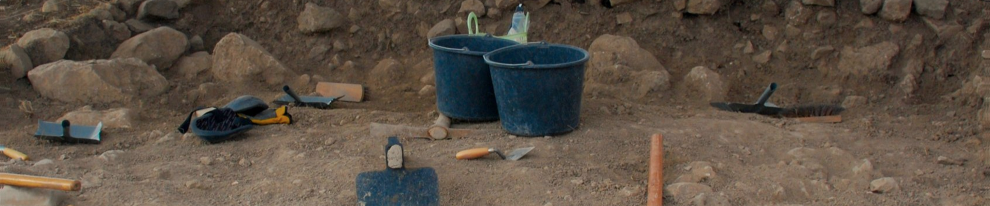
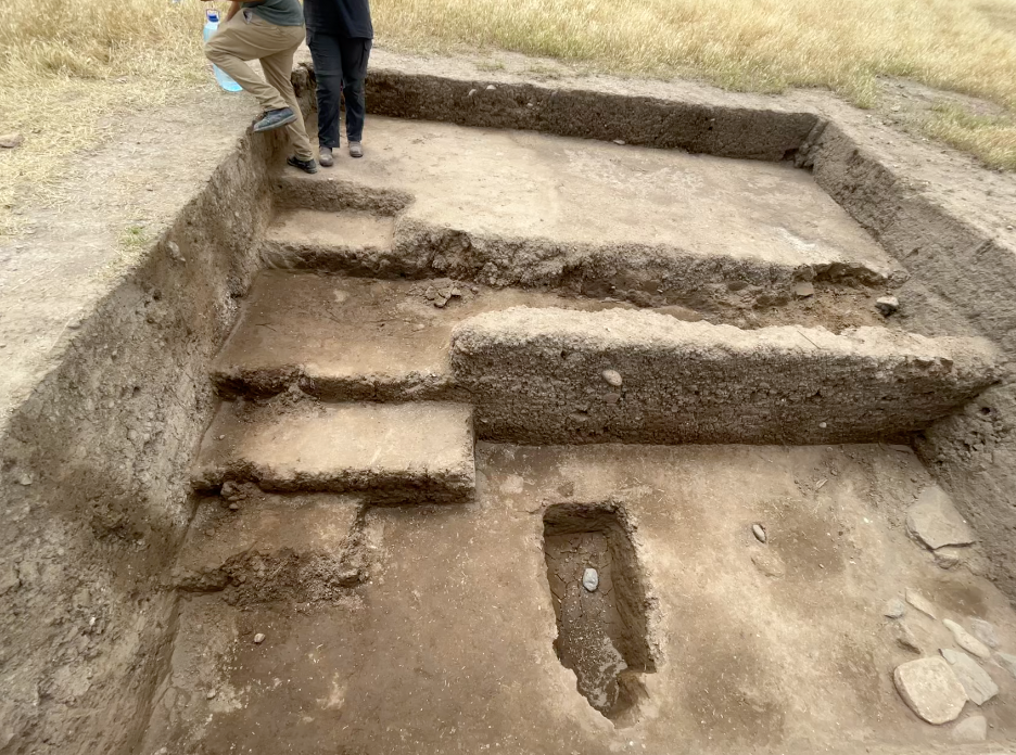
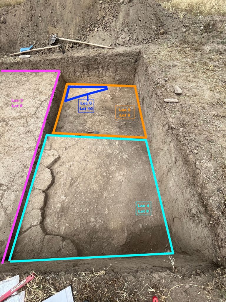
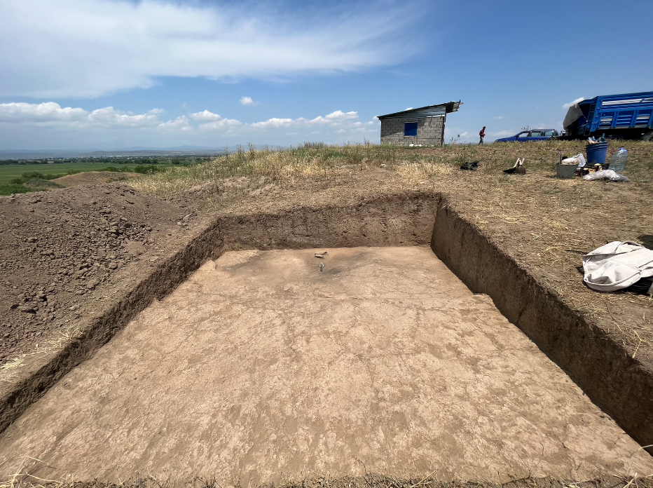
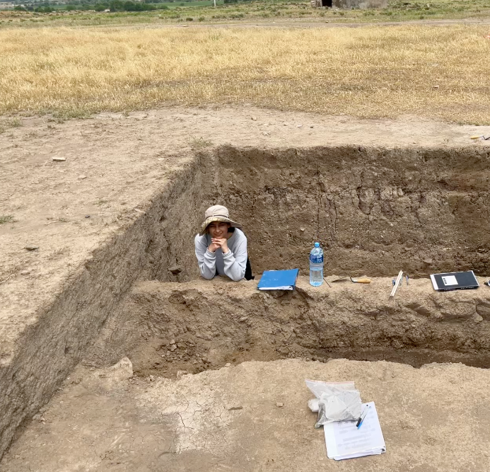
Initially, I began work with a team of 5 at the site of Khait-Maze, which dates to the Early Bronze III. Evidence from the site points to a melding of cultures at the crossing of the rivers Kura and Araxes. Cultures of Mesopotamia and the Caucuses acted as reciprocal partners, building a material and cultural kinship. The idea of grasping history literally within one’s palms is transcendent. This year, the team expected to find funerary features because of burial pits which had been revealed during prior excavations north of the site. After preliminary topsoil removal within the 5x5m trench, 5 potential feature outlines were identified, and these were inferred to be burials, similar to the previous excavation. Archaeological context was reached at about 2m depth in a 2x5m probe started in the north in the trench. The team excavated a plaster-like floor, possibly within a building, which was an exciting find. This plaster lays on top of a caramel-y clay surface and can be seen throughout the loci.
Current interpretation suggests the excavation square is on top of a building surface rather than a burial site. This is further supported by a post hole made of wood excavated within the probe, which may indicate that the team has reached the bottom surface of the Early Bronze III architecture. Ceramic evidence also points to an Early Bronze age context with the excavation of black and red ceramics that are smooth and burnished on both sides. The team encountered very dense Roman and Late Antique ceramic deposits above the archeological horizon. These deposits were very informative in cementing the continued use of the large site as both a burial ground to the far north and as a a potential domestic area, located along a transit route throughout its history. Larger ceramic finds within the possible architectural feature showcase the Khirbet Kerak cultural influence of incised patterns and motifs on black burnished ware. Overall, the finds reveal great Levantine coastal influence on the society within this region.
In the final two weeks, I began supervising excavations of a new site estimated to date to the Neolithic along with the project’s Georgian co-director. This site, newly-named Imirchala, is located on a mound about a 10-minute drive to the west of Khait-Maze at relatively higher elevation. Initial surface survey showed a high density of obsidian micro artifacts and refuse dating to the Neolithic, but excavations did not reveal any archaeological features. The team then focused on a 4x4m trench where multiple mudbrick features, possibly storage units, were revealed. This trench also contained a fire feature in the northwest corner along the wall of the trench, which was very interesting. Although we could not confirm a Neolithic archaeological context at Imirchala during the short excavation period, the ceramic finds do point to a Bronze Age domestic setting.
Evidence from these two sites could serve to indicate the social composition of Kura-Araxes societies and the layout of mortuary and domestic areas. This is only a preliminary interpretation, but as I continue to research, we can find the changes in cultural practices that emerge when these Mesopotamian and Caucasian-Levantine cultures cross-pollinate. At both sites, ceramic bases are essential in testing for wine making or preserving activities during the Bronze Age III. These finds could greatly inform Georgian cultural roots, pointing to an amalgamation of cultures which influences modern practices. Testing these ceramics can reveal not only the possible importance of wine culture, but also how dietary practices and material culture are influenced by the interaction of multiple groups.
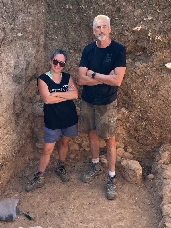
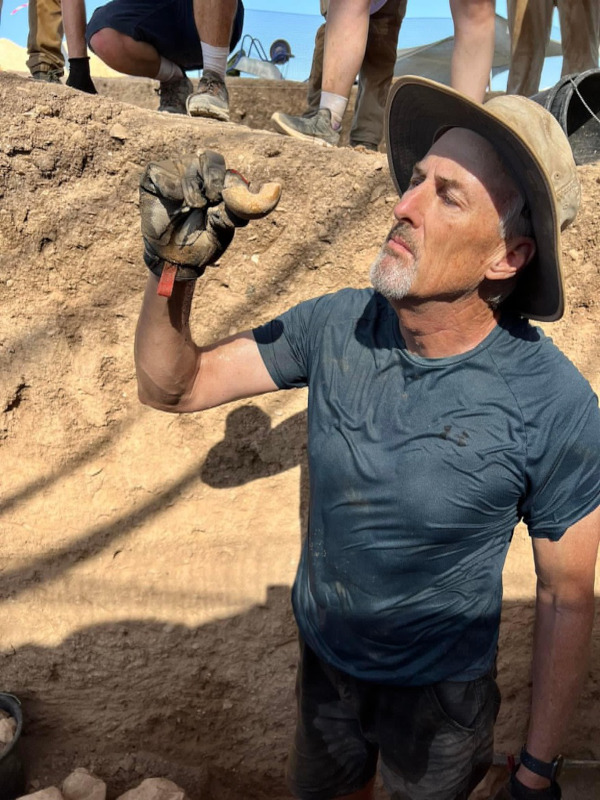
Syeda Sukena Zehra is an undergraduate student at the University of Toronto specializing in archaeology with a keen interest in South-Asian and Near and Middle Eastern civilizations. Sukena aims to explore the transnational interrelationships which build culture and politics.
Want to help more students and early career archaeologists get into the field? Donate to the cause today by selecting “Student Support” as your gift purpose!
Cultural Heritage Education and Site Conservation in Madaba, Jordan (2023): An Update on the Lawrence T. Geraty Community Archaeology Endowment
By Douglas R. Clark, Suzanne Richard, Andrea Polcaro, Marta D’Andrea, and Basem Mahamid
As part of a two-year distribution (2023 and 2024) from the ASOR/Lawrence T. Geraty Community Archaeology Endowment, the Madaba Regional Archaeological Museum Project (MRAMP–an American, Italian, and Jordanian collaboration co-directed by Doug Clark of La Sierra University in Riverside, CA; Suzanne Richard of Gannon University in Erie, Pennsylvania; Andrea Polcaro of Perugia University in Perugia, Italy; and Marta D’Andrea of Sapienza University of Rome, Italy; along with in-country coordinator Mr. Basem Mahamid of the Department of Antiquities of Jordan in Amman) set out to accomplish two objectives. These included: 1) continued maintenance of the archaeological/architectural remains in the Madaba Archaeological Park West (II) where the proposed new museum will be constructed and 2) a unique and exciting new partnership focused on the education of children about their cultural heritage and how to care for it.
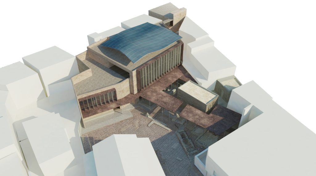
Fig 1: Architectural Concept Design
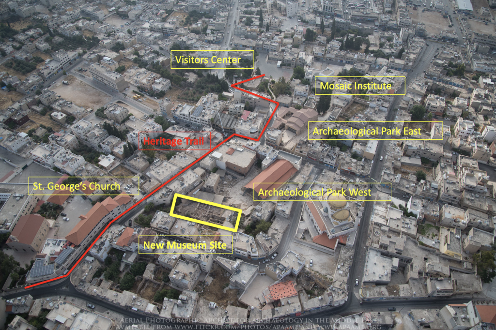
1) Nestled in the center of a city block which is adjacent to the King Hussein Mosque, Saint George’s Greek Orthodox Church, shops and businesses tied to daily life and tourism, and accessed directly from the Madaba Heritage Trail which brings hundreds of thousands of tourists annually (300,000+ in 2022) from the Visitors Center to St. George’s Church, the Madaba Archaeological Park West (II) is extremely well located to help locals and tourists learn about the preservation of cultural heritage (Fig. 1). The Park itself contains architectural remains from the 2nd century (large paved Roman street), the 6th century (the Martyrs Church and the Burnt Palace), the early Islamic Period, and the late Ottoman Period (settlement of several buildings constructed by three tribal, Christian migrant groups arriving from Karak in the 1880s).
Since the first excavation season at the site in 2016 (focused less on vertical digging and more on horizontal clearing and cleaning down to the most recent excavations 20 years earlier), a season funded in part by a Charles Harris grant managed through ASOR, MRAMP excavated again in 2017, 2018, and 2022. The project also maintained a year-round presence from 2016 to the present to facilitate various technical investigations, training workshops, and ongoing maintenance of the site; this was possible, beginning in 2017, through collaboration with SCHEP (Sustainable Cultural Heritage Engagement through Local Communities Project), implemented by ACOR, and the US Ambassador’s Fund for Cultural Heritage Preservation (AFCP) and the Cultural Antiquities Task Force (CATF), components of the US Department of State, in addition to private funding.
Fig 2: Albara
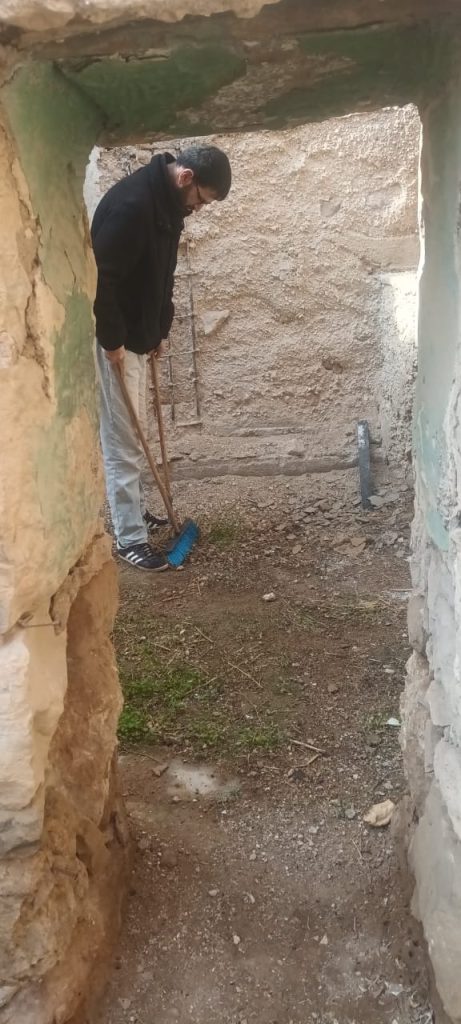
One of the first hires of the MRAMP team in 2017 (and also a laborer onsite in 2016) was Mr. Albara, whose work to maintain the site continues to this day, partially subsidized by MRAMP (Figs. 2, 3, 4). This partial support (a supplement to the limited wages he earns from the Department of Antiquities) to keep the site protected and pre
sentable to the thousands of annual visitors who see the spectacular and recently restored mosaics of the Burnt Palace and the Martyr’s Church was funded by the ASOR/Geraty grant in 2023.
Fig 3: Albara at work
Fig 4: Albara at work
2) From the early planning stages of the proposed new Madaba Regional Archaeological Museum, MRAMP initiated a collaboration with the Italian architectural firm of Studio Strati in Rome in order to create a concept design of the structure (Fig. 5). We have consistently envisioned a children’s education lab as part of the building; this has always been an integral component to the museum design and mission. In 2022 we were in conversation with the Petra National Trust (PNT) which operates under the auspices of Her Royal Highness Princess Dana and is run by a small group of highly qualified staff. The mission of PNT is primarily an educational one, education of children in treasuring, preserving, protecting, and promoting the cultural heritage of Jordan, so the resulting MOU between MRAMP and PNT was an ideal outcome. Because of this new and exciting collaboration, MRAMP and Studio Strati doubled the physical space allocated to children’s education in cultural heritage to two floors instead of one in the northern extension of the new museum.
Fig 5: Aerial photo of historic downtown Madaba, courtesy APAAME
While incredibly exciting and innovative, implementing this new development is a few years away, when the new museum will hopefully be completed. In the meantime, all partners agreed to set up a pilot program to test curricula, trainers, supplies and equipment, and organizational structure, in a space created in the current museum. In preparation for this pilot program, MRAMP had already purchased the necessary tables and chairs for 15 students, as well as a wall-mounted, 60-inch smart TV, now in place in one of the recently renovated display rooms (folklore) of the current Madaba museum.
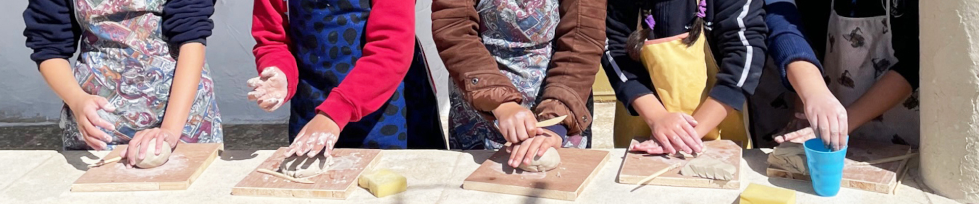
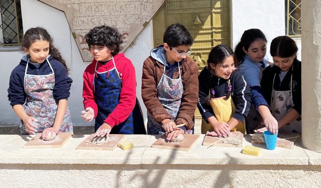
The year of 2023 witnessed four separate age-specific classes—(7-9), (10-12), (13-15), and (16-18)—each tailored to age skill sets and interests. Topics covered interactively include the following: for 7-9 year-olds—My Timeline, Once upon a Time in the Stone Age, Clay Shaping our Ancient Heritage; for 10-12 year-olds—Habitat Components, Water Management, Reflection Session; for 13-15 year-olds—Archaeology as an Avenue for Employment in Jordan, The Role of an Archaeologist in Heritage Preservation, Reflection Session; for 16-18 year-olds—Collaborative Research on Cultural Heritage, Introduction to World Heritage Sites: Children Engage in Collaborative Learning, World Heritage Sites (Diorama).
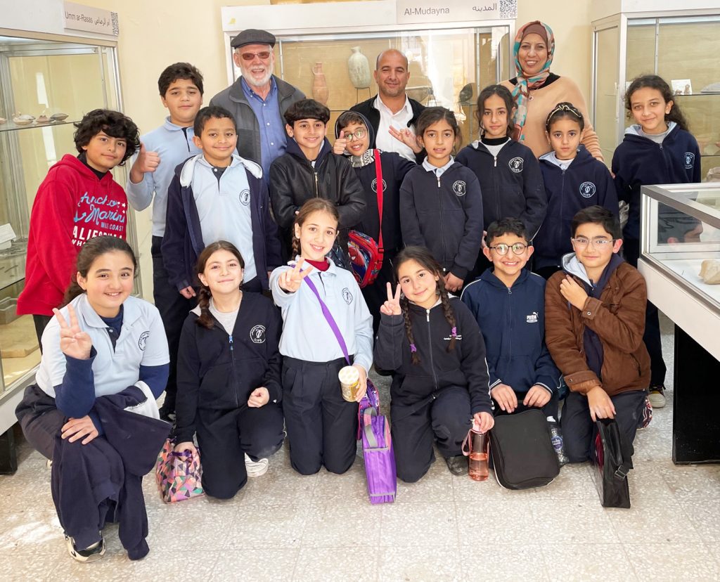
Fig 6: Class photo with, from right, Suzanne Richard, second from right; Huda Amarin, center kneeling; Doug Clark, fifth from left
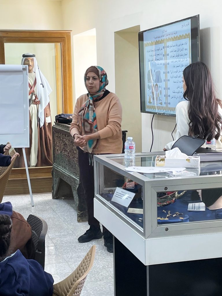
Having attended three of the four classes in person (Fig. 6), we found them engaging, exciting, high-energy, incredibly interactive, rewarding, and, in the end, entirely successful (see below). The teacher, Ms. Huda Amarin, exhibited best-practices teaching techniques across all of these age groups (Fig. 7). The program came off so well due in large part to Ms. Huda’s role, the vision of PNT for training students in cultural heritage preservation, and the envisioning, logistical, and cheerleading functions of MRAMP, all of this funded by the ASOR/Geraty grant.
Fig 7: Huda Amarin, teacher par excellence for PNT classes
What follows are italicized direct quotes (except for figure numbers) from various parts of the official PNT narrative report of the program in 2023, accompanied by illustrative charts and photos. With plans to continue the classes into the future, we are off to a grand start.
MRAM Workshops Narrative Report
Executed by: Petra National Trust
MRAM- Madaba
25 February—4 May 2023
PNT advocates and executes sustainable management approaches for heritage sites, multifaceted projects that enhance heritage sites preservation, and implements a pioneering children education program based on cultural heritage values. PNT aims to fulfil the urgent need to protect, preserve, and conserve cultural heritage sites while promoting sustainable community benefits, including job creation and specialized capacity building programs.
The multifaceted approach of PNT and its team included involvement in projects related to archaeological conservation, ecotourism development, socio-economic development, and education. Through its Education Outreach & Awareness Programs, PNT aims to build a cadre of tomorrow’s community leaders who can work towards and advocate for effective and sustainable cultural heritage management and preservation.
The Education and Engagement Program (EEP) provides a wide range of opportunities and experiences that introduce children to the rich history of different civilizations that inhabited Jordan. This approach contributes to instilling a sense of pride in their identity and heritage as the heirs of past cultures and civilizations. The EEP introduces the culture (peoples, traditions & practices) and history of Petra, specifically and Jordan. It also introduces ecology, the importance of protecting biodiversity, and tackling threats facing cultural heritage. The program is engaging and pleasurable, and employs a student-centered and hands-on learning approach for children. It guides them to realize how to contribute to and value cultural heritage preservation.
The vision for the new museum is aligned with the principles outlined by the International Councils for Museums (ICOM) that museums must play a role in the development of contemporary society and with ICOM’s definition of the museum:
“The museum is a non-profit, permanent institution in the service of society and its development, open to the public, which acquires, conserves, researches, communicates and exhibits the tangible and intangible heritage of humanity and its environment for the purposes of education, study and enjoyment.”
To that end, the whole project in terms of community archaeology; that is, as a collaborative endeavor between MRAMP (the Madaba Regional Archaeological Museum Project) and the community, with the ultimate goal of promoting local stewardship of cultural heritage, as well as providing economic benefits.
PNT Successfully implemented four half day workshops, targeting 4 different age groups (7-9), (10-12) (13-15 and (16-18) with 15 participants in each group, with a total number of 53 female and male children from the Greek Orthodox Patriarchate Schools Girls (Fig. 8).
The workshops also focused on instilling positive characteristics and embed specified skillsets within the students, with a focus on
Identity
Good citizenship
Civic-mindedness and social responsibility
Commitment
Critical thinking and learning skills
Team work
Problem solving skills
Communication skills
Fig 8: School kids lined up to enter class.
Workshops Highlights
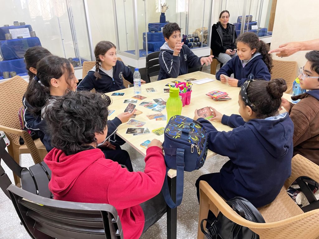
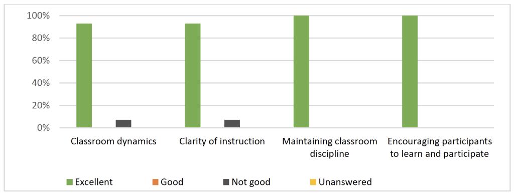
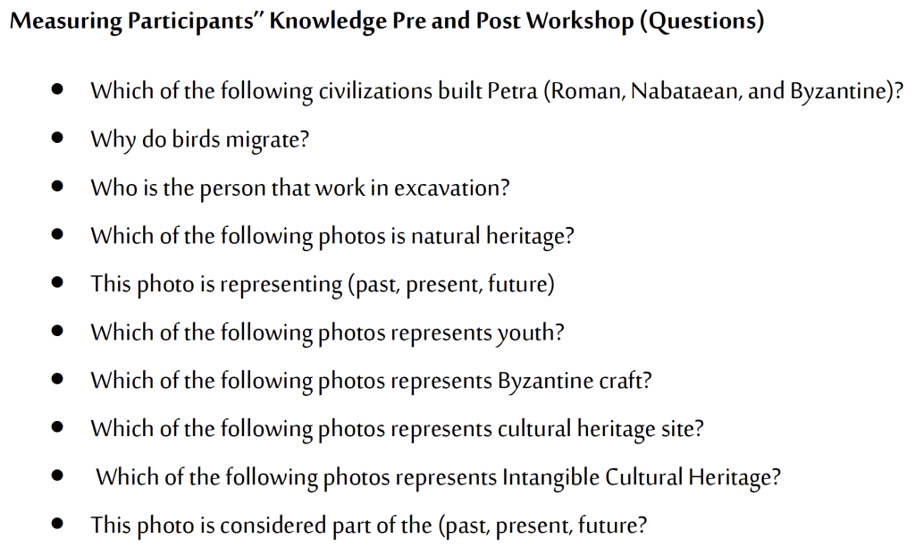
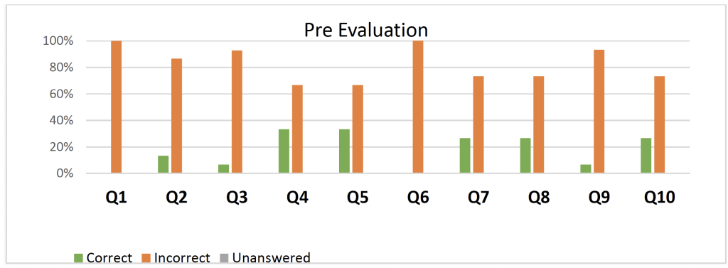
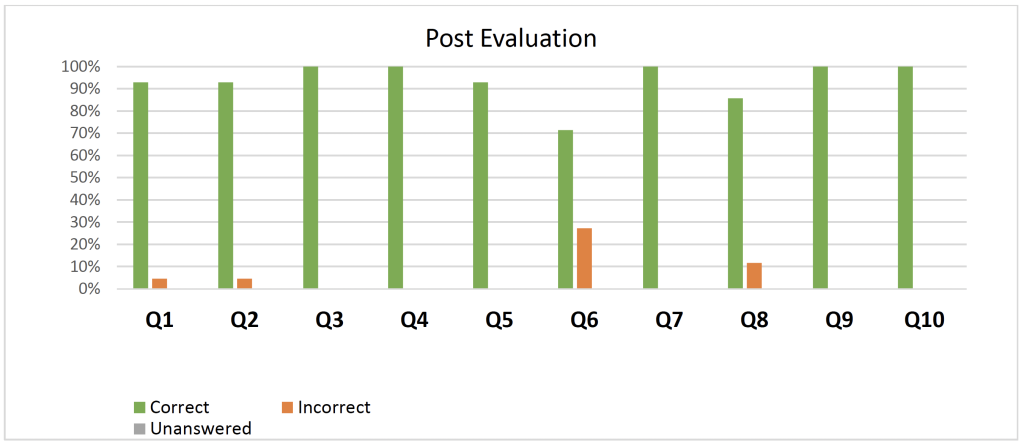
All participants were active and attentive during the workshops and had a great time participating in the activities (Figs. 9 and 10). Based on the positive responses made by participants’ post evaluation responses compared to the pre-evaluation of the workshops as indicated in the graphs below (Figs. 11, 12, 13, and 14).
The headmistress and teachers of the (Greek Orthodox Patriarchate Schools Girls —Madaba) were very cooperative.
The museum staff and their cooperation contributed to the success of the workshops.
The hands-on activities created an interactive learning environment among children.
The presence of Professor Douglas as an archaeologist had a positive impact and provided the participants’ depth understanding about cultural heritage and the importance of museums.
The venue as a museum serve as an educational tool for the participants, they learnt about the heritage that all
Fig. 9: Projects being completed for class in museum.
Fig 10: School kids working with clay in class.
Fig 11: PNT Report Teacher Eval
Fig 12: PNT course evaluation questions
Fig 13: PNT course evaluation scores before class
Fig 14: PNT course evaluation scores post class
Challenges
No male students in the school within the age group of (16-18)
The Venue capacity was limited to 15 participants only
Recommendations
PNT and MRAM will expand their outreach and will implement a 3-year program for all age groups
AS a trainer, I noticed that the educational environment in the museum stimulates students to integrate with cultural activities and encouraging them to connect with the heritage around.
Interactive learning spaces must be found in all museums, where the trainer can observe the direct impact on the participants.
Participants’ Quotes
Hiba Saidat: “It was great fun and the people who were there were very nice”
Tia Kildani: “I liked the place, had fun and learnt a lot of information.”
Noor Alfayez: “I liked the museum very much, and I enjoyed Dr. Douglas and Ms. Huda Al-Amarin”
Fig. 15: First of four classes with (in the back row from the right) Huda Amarin (teacher) Khaled Hawawreh (DoA district director) and Doug Clark.
Marta Doglio, 2023 P.E. MacAllister Fieldwork Scholarship Recipient
In 2023 I was awarded a P.E. MacAllister Scholarship that allowed me to join the Gird-I Matrab Archaeological Project (GMAP). I would like to thank the ASOR selection committee and the donors who provided this scholarship, and the director of the Gird-I Matrab project, Prof. Rocco Palermo (Bryn Mawr College), who gave me the opportunity to be part of team.
Gird-I Matrab (“the dusty mound” in Kurdish) is a multi-mound archaeological site located in the plain of Erbil, in the autonomous region of Iraqi Kurdistan. This year excavations were carried out between July and August. Iraq welcomed us with its very hot, windy and dusty weather!
At Matrab, I worked as trench supervisor of Area B, a step-trench located on the main mound (Mound 1), as well as a pottery specialist. One of the goals of the 2023 season was indeed to explore the long-lasting occupation at the site, and particularly through the excavation of Mound 1.
After the initial surface scraping, our excavation immediately showed that Mound 1 featured a massive presence of Chalcolithic structures. We found numerous pits of various sizes but also clear evidence of mudbrick domestic architectures. In the best-preserved domestic unit, I excavated a fireplace, which was located in one of its corners. Two mudbricks, placed vertically in the hearth, might have served as supports for pots and jars while on the fire. The filling of the fireplace consisted of burnt, ashy soil, in which a cluster of burnt cretulae was retrieved.
The excavation in Area B confirmed that the Late Chalcolithic occupation of Gird-I Matrab spanned on a very long time. Based on the preliminary pottery analyses, Area B shows a coherent and homogeneous chronology, almost completely dating to the Chalcolithic Period, specifically Late Chalcolithic 1-2 (LC 1-2, ca. 4500–3900/3850 BCE) and Late Chalcolithic 3-5 (LC 3-5, ca. 3900/3850–3100 BCE).
During this field season at Gird-I Matrab we did not just work hard, fun was also an integral part of the campaign. During our weekends on Thursday and Friday, we took the opportunity to visit some archeological sites and cities around Erbil and in the Kurdistan Region of Iraq.
First, we visited the city of Slemani with its wonderful archaeological museum. The week after that, we travelled to Duhok where we had the opportunity to visit two of the most important archaeological sites in the region. We first visited the Assyrian period aqueduct of Jerwan built by king Sennacherib in the 7th century BCE. Then, we had a tour of the archaeological complex of Faida, where we admired the reliefs that portray a procession of statues of seven of the main Assyrian deities, standing on podia in the shape of animals, and in the presence of the king.
My first excavation season at Gird-I Matrab was a wonderful experience, full of surprising discoveries. I had the opportunity to work with an amazing international team and to discover more about Kurdish culture. I visited places and I met people that contributed to my personal and academic growth. I really look forward to being back in Gird-I Matrab next year!
Marta Doglio graduated from University of Pisa (Italy) and she is currently working on graduate school applications. She is a member of several archaeological projects based in Turkey and Iraq. Her major scientific interest is in the investigation of the social and cultural phenomena that occurred during the 1st millennium BCE in South-West Asia, with a specific focus on both ceramic data and spatial analyses. You can find Marta Doglio on twitter @doglio_marta
For more information about the Gird-I Matrab Archaeological Project visit:
Want to help more students and early career archaeologists get into the field? Donate to the cause today by selecting “Student Support” as your gift purpose!
Sarah Harrington, 2023 Stevan B. Dana Scholarship Recipient
The “At the Crossroads: Arameans, Phoenicians and Israelites” project at Tel Abel Beth-Maacah is located in Northern Israel, just south of the Lebanese border. Like today, in ancient times, the Tel was located at an intersection of cultures. Abel Beth-Maacah, or ABM as it is affectionately called by its excavators sits at the Northern extent of the Kingdom of Ancient Israel, and seems at various periods to have been controlled by Israelites and Arameans, with clear Phoenician influences. Textual evidence at this site is limited, but in conjunction with material culture, particularly in the forms of art and pottery, the excavators are able to piece together an understanding of the systems of trade, influence, and interaction that this region of Northern Israel was experiencing in various periods.
Sarah (left) and a volunteer excavating a probe.
While written evidence for Abel Beth-Maacah is limited, it is not non-existent. The Hebrew Bible mentions the site in a story from the Davidic period. A “wise woman” tells Joab, one of David’s generals, that “long ago they used to say, ‘Get your answer at Abel,’ and that settled it” (1 Samuel 20:18) hinting at some sort of divinatory cult at the site. In support of this idea, the archaeological material has turned up a hoard of 406 knuckle bones, or astragali bones, which were commonly used in divination rituals, from the Iron IIA (Reference). The woman also refers to Abel Beth-Maacah as a “mother in Israel”, tying the city to the Israelite Kingdom (2 Sam. 20:19). Later, the Aramean king Ben-Hadad I would conquer the northern border states of Israel, including ABM and neighboring Tel Dan, a conquest confirmed by the discovery of the Tel Dan stele erected by Ben-Hadad after his victory (1 Kings 15:20). A final piece of textual evidence comes from the site itself, where a theophoric name (a personal name which includes the name of a deity) was found on a jar in a massive storage building. Theophoric names rose to prominence in the Iron II in the Southern Levant. For ancient Israel, these are called “Yahwistic names” as they include the name of the god Yahweh. The presence of such a name suggests an Israelite presence at the site during this period.
While evidence such as names and material culture can give insight into who lives at a site during a given period, archaeologists still must proceed with caution. The Iron Age Levant was interconnected. As discussed above, political boundaries shifted, especially near borders. It was not uncommon for things like personal names or pottery styles to shift in order to give the owner a social or economic advantage. To the west, Phoenicians on the Levantine coast were trading widely in the Mediterranean during the Iron II.
Sarah excavating in Area A Downtown
At Abel Beth-Maacah, evidence for Phoenician trade is seen in the Phoenican style pottery, such as a Phoenician Bi-chrome jar, as well as a seal bearing the impression of a Phoenician ship. The seal could have been used practically, but may have also been a prestige item. It is shaped like a lotus flower, a distinctly Egyptianizing art feature, again pointing to the interconnectedness of art and trade in this period. Phoenician material culture at the site is a good example of how archaeologists must be careful when interpreting data. While it is not unlikely that some Phoneincians did reside at ABM, the presence of Phoenincian pottery does not have to mean the owners were “Phoenician,” especially when knowledge of Phoenician trade patterns is considered. People and materials were moving widely through the Levant and the Ancient Near East, and it is not surprising that the material culture reflects this.
My squares (T15/A15) with the Lebanese hills in the background.
These issues are particularly relevant for a border site like Abel Beth-Maacah. Because the ancient world was interconnected and fluid, archaeologists must connect together evidence from texts, archaeology, and art, from their own excavations and others, to piece together an understanding of the past.
Sarah Harrington is a Ph.D. Student in Levantine Archaeology at UCLA. She is researching rituals of the Ancient Near East and the archaeological material associated with them. This summer she was an Assistant Area Supervisor in Area A Downtown at Tel Abel Beth-Maacah.
Want to help more students and early career archaeologists get into the field? Donate to the cause today by selecting “Student Support” as your gift purpose!
Remote Sensing Techniques to Reveal Ancient Mesopotamian Urbanism
Marc Marín Webb, 2023 Strange-Midkiff Fieldwork Scholarship Recipient
The archaeological site of al-Hiba, ancient Lagash, stands as one of the most extensive third-millennium sites in Southern Mesopotamia, situated approximately 22 km east of the modern town of Ash-Shatra in Iraq (Figure 1). Its initial exploration, spanning from 1968 to 1978, was conducted by Vaughn Emerson Crawford and Donald Hansen. In 2019, archaeological activities were resumed through the efforts of the Lagash Archaeological Project (LAP), under the direction of Professor Holly Pittman from the University of Pennsylvania. Over recent years, LAP has delved into the investigation of craft production within households and workshops across the neighborhoods of ancient Lagash, focusing on the Mesopotamian Early Dynastic Period (circa 2,900-2,350 BCE). In the coming years, LAP intends to delve deeper into the socio-economic aspects of craftspeople by analyzing the variability of utilitarian products, production debris, and their respective activity areas.
The exceptional preservation conditions at this sprawling 400-plus hectare site, primarily dating to the EDIIIb period, favor a multifaceted approach encompassing both aerial (walking surveys and remote sensing techniques like UAV photogrammetry and thermography) and subsurface methods (surface scraping, excavation, and geophysics including magnetic gradiometry and electrical resistivity tomography). Through these methods, LAP seeks to address craft production at four socio-spatial scales: the household, the neighborhood, the city, and the city-state.
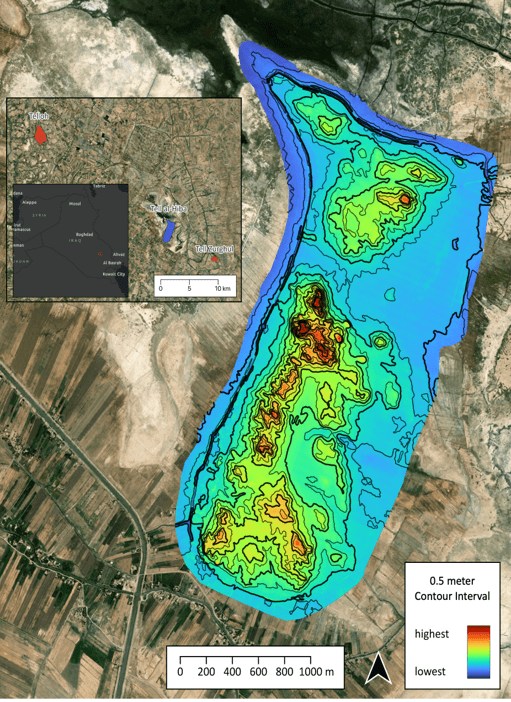
Figure 1: Contour plan for Lagash obtained through QGIS processing rectified orthomosaics, made by
Paul Zimmermann. Lagash Archaeological Project.
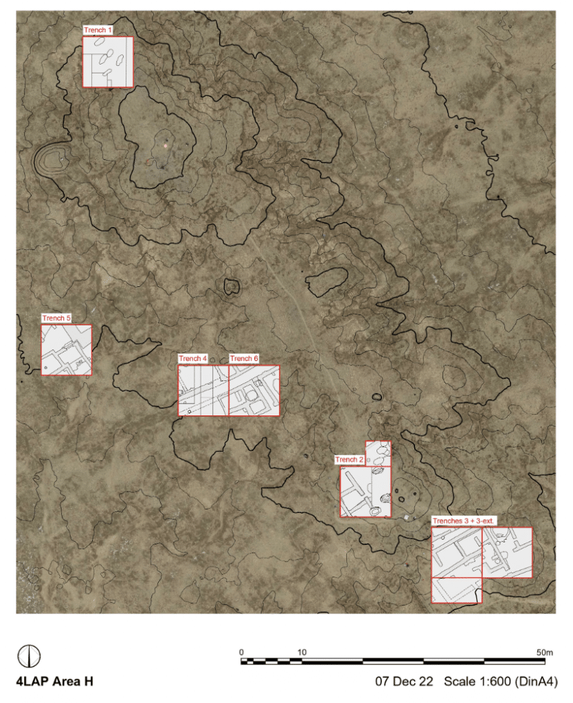
The remarkably preserved surface and subsurface architecture at Lagash, as evidenced by initial drone flights from 2019 to 2023 over Area H (Figure 2), offers a unique opportunity to test remote sensing techniques for reconstructing the urban layout of the city during the Early Dynastic period. In this project, my responsibilities include tracing this architecture through carefully planned flightpaths over selected regions of the site, leading to the creation of orthomosaic images. These flight photographs are subsequently uploaded to the DroneDeploy website for processing. The rectified orthomosaics are then downloaded into QGIS for merging into a single image and processing into the new contour plan for Lagash.
Figure 2: Tell Al-Hiba Area H. Lagash Archaeological Project
Orthomosaic images generated through DroneDeploy are compared to select those that provide clearer depictions of architectural features. We conduct regular aerial surveys on a daily basis to identify optimal weather conditions for revealing these features. Flights immediately following rainfall prove especially useful for detecting surface and subsurface walls, as differences in soil density quickly become apparent in the aerial photographs. Additionally, drone flights at different times of the day reveal distinct features.Subsequently, orthomosaics are digitized into AutoCAD and QGIS to create vector shapes and poly lines representing identified surface-level architectural elements such as walls, streets, kilns, and drains (Figure3).
Surface-level architectural features are frequently discernible in Tell al-Hiba, both through walking surveys and aerial and satellite imagery. These distinctions arise from variations in soil density, triggering differences in moisture retention levels and salt efflorescences. These variations are prominently visible in the 2022-23 aerial surveys of Area H, where surface and subsurface walls appear as darker shades of brown, and white concentrations of salt.
Figure 3: Digitized surface and subsurface architecture at Tell Al-Hiba Area H. Lagash Archaeological Project
Since 2019, we have identified hundreds of features of similar scale and orientation, yielding significant insights into the density and organization of the urban fabric. This includes the orientation of streets and buildings, room sizes, wall thickness, and types of brickwork. Among these structures, we’ve encountered both small-scale buildings and substantial constructions, including segments of the city wall and building complexes of notable size.
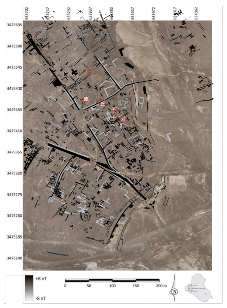
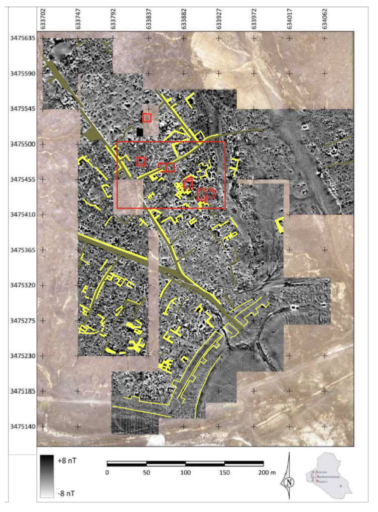
The combined use of geomagnetic surveys and aerial surveys conducted over the past four years provides a snapshot of the urban fabric in Area H (Figure 4). While the precise dating of most of these structures remains uncertain, we can begin to draw certain conclusions from the data obtained. This area of the site appears to have been densely populated, featuring both small-scale and monumental architecture, as indicated by walls of varying widths and the differing scales of rooms and courtyards between them. Most sub-surface architectural traces identified in the aerial survey consist of scattered structures, preventing the reconstruction of entire buildings. Nevertheless, they are primarily aligned and oriented in accordance with the neighborhood’s main streets.
Figure 4: Combined use of geomagnetic surveys and aerial surveys. Lagash Archaeological Project
Previous surface surveys in Tell Al-Hiba have suggested that the majority of surface remains likely belong to a single period, the Early Dynastic III B (Carter 1985, 1989-90; Goodman et al. In press). Our objective for the 2023 and upcoming seasons is to cross-reference datasets from remote sensing with excavation findings to confirm the dating of these structures. This will help determine whether they are indeed mostly contemporaneous or if we are dealing with a complex layering of structures from multiple periods, spanning broadly from the Early Dynastic I to the end of the Early Dynastic III.
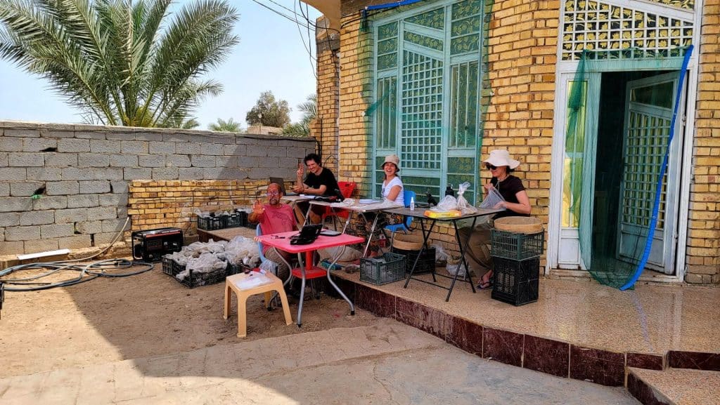
Post-excavation processing at the excavation house. Lagash Archaeological Project.
Marc Marín Webb is an architect and PhD candidate in Middle Eastern archaeology and history at the University of Pennsylvania. He has participated in archaeological and cultural heritage preservation projects in Syria, Iraqi Kurdistan, and southern Iraq. He has been collaborating in the LAP for two years now, contributing to the architectural analysis and aerial survey of the site.
Want to help more students and early career archaeologists get into the field? Donate to the cause today by selecting “Student Support” as your gift purpose!



 Hania Kantzer is a sophomore at the University of North Carolina at Chapel Hill studying chemistry and Asian studies. This past summer, she was a grateful recipient of the Stevan B. Dana Fieldwork Scholarship through ASOR, and was able to work as a student researcher on the Huqoq Excavation Project.







 Syeda Sukena Zehra is an undergraduate student at the University of Toronto specializing in archaeology with a keen interest in South-Asian and Near and Middle Eastern civilizations. Sukena aims to explore the transnational interrelationships which build culture and politics.