Studying the Ancient Inhabitants of the Ayioi Omoloyites Tombs
Krysten Cruz, 2022 Shirlee Meyers-G. Ernest Wright Fellowship Recipient
Scattered throughout the island of Cyprus are tombs both excavated and yet to be discovered.
In 2006, three rock-cut tombs were excavated by the Department of Antiquities in a salvage effort in the Ayioi Omoloyites neighborhood in Nicosia, Cyprus. Tombs 47 and 48 are smaller and date to the Hellenistic period, while Tomb 49 is much larger and dates to the Early Christian period and was likely used as an ossuary. This summer I worked with the Ayioi Omoloyites Bioarchaeological Project to analyze some of the skeletal material removed as part of that salvage effort. With our analyses, we are hoping to understand some aspects of the lives of these people.
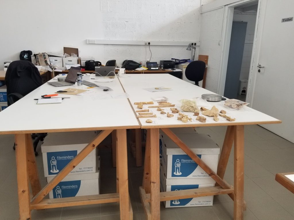
While in Nicosia for this research I stayed at the Cyprus American Archaeological Research Institute. Each day we would leave to work at a lab space provided by the Department of Antiquities where over 60 boxes of skeletal material for this project were stored.
Lab space provided by the Department of Antiquities
Analysis of skeletal material
I helped continue our search for answers by working through more of the commingled skeletal material from Tomb 49. Commingling occurs when the skeletons of two or more individuals are mixed, and currently in Tomb 49 there are over 250 individuals present. Due to the fact that there were no articulated individuals and all of this material is commingled and fragmentary, I would start an analysis by laying out the skeletal elements that were part of a specific context sorting them by the type of bone, what side of the body that element was from, and then which part of the bone it is. I would then conduct an inventory and basic analysis of this material by documenting various standard osteological observations, which also included taking measurements when possible as well as describing any trauma and diseases that may have manifested on the bones. Often there are indicators of stress or disease that can help us understand the health or habitual activities of these individuals when they were alive. We commonly see arthritis in the joints as well as pathologies of the vertebrae which can indicate that someone was likely participating in manual labor.
Although I participated in these general analyses, my main goal of the summer was to conduct research of my own by observing specific areas of the humerus (arm) and femur (thigh). I was looking for skeletal lesions that look like porous areas or spongy bone. There is substantial discussion in the literature about where these lesions are specifically located and what they are supposed to look like in order to be considered evidence of disease or just an indicator of a particular lifestyle, so I tried to take notes and detailed photos. I am attempting to assess whether these lesions are related to a common disease found on the island, or whether they are actually a sign that these individuals were participating in specific activities. This research would help us understand more about the populations during these two different time periods.
Even though we spent a lot of time in the lab working, we still had the opportunity to travel around the island and visit other archaeological sites and museums. It was great to see occupations across different periods in time, and I was particularly excited to go to the Archaeological Museum of the Larnaka District as it has been closed in previous years and contained material from some of the sites we had previously seen.
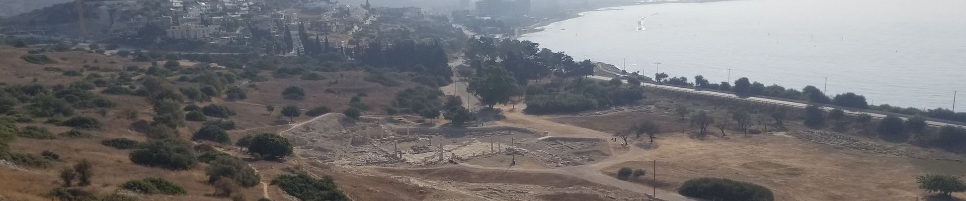
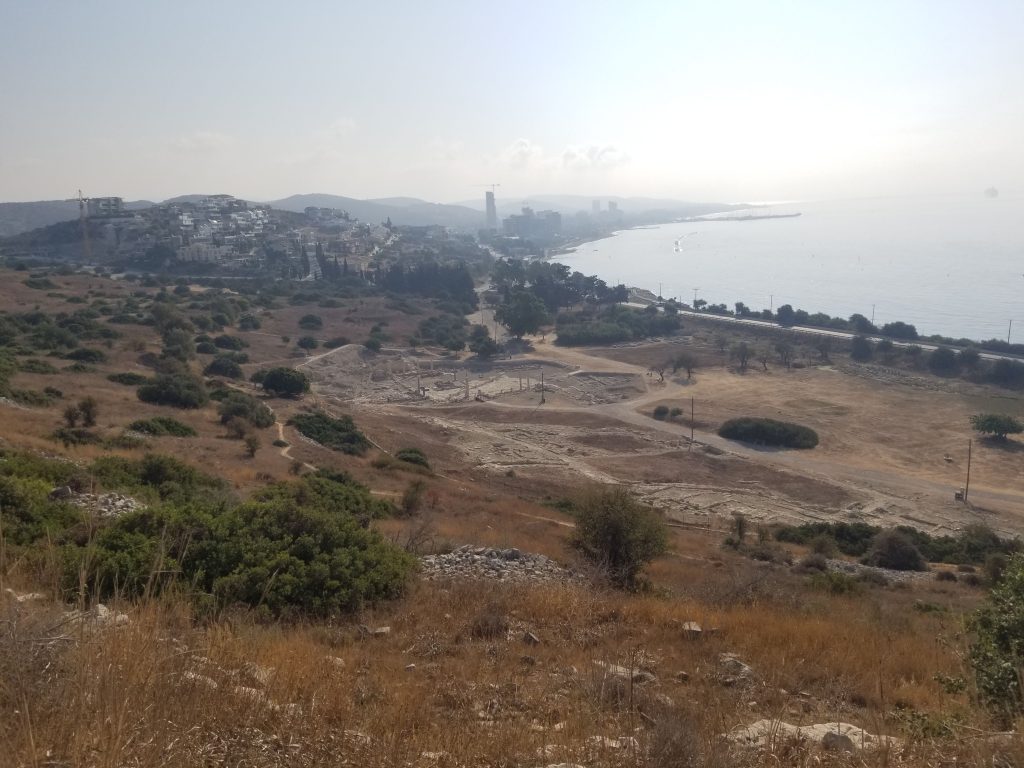
View of the coast from the archaeological site of Amathous
I am very grateful to ASOR and the scholarship’s donors who made these opportunities for research and learning possible. I would also like to thank Dr. Despina Pilides, Archaeologist Yiannis Violaris, and Dr. Nicholas Herrmann for allowing me the opportunity to participate in the Ayioi Omoloyites Bioarchaeological Project, as well as CAARI and the Department of Antiquities for hosting us and our studies.
Krysten Cruz is a PhD student in the Applied Anthropology doctoral program at Texas State University in San Marcos, Texas. Her research interests include forensic anthropology and eastern Mediterranean bioarchaeology.
Want to help more students and early career archaeologists get into the field? Donate to the cause today by selecting “Student Support” as your gift purpose!
2022/2023 Mesopotamian Fellowship Report: Preliminary Report on the Tepe Gawra Lower Town Survey
Khaled Abu Jayyab, University of Toronto
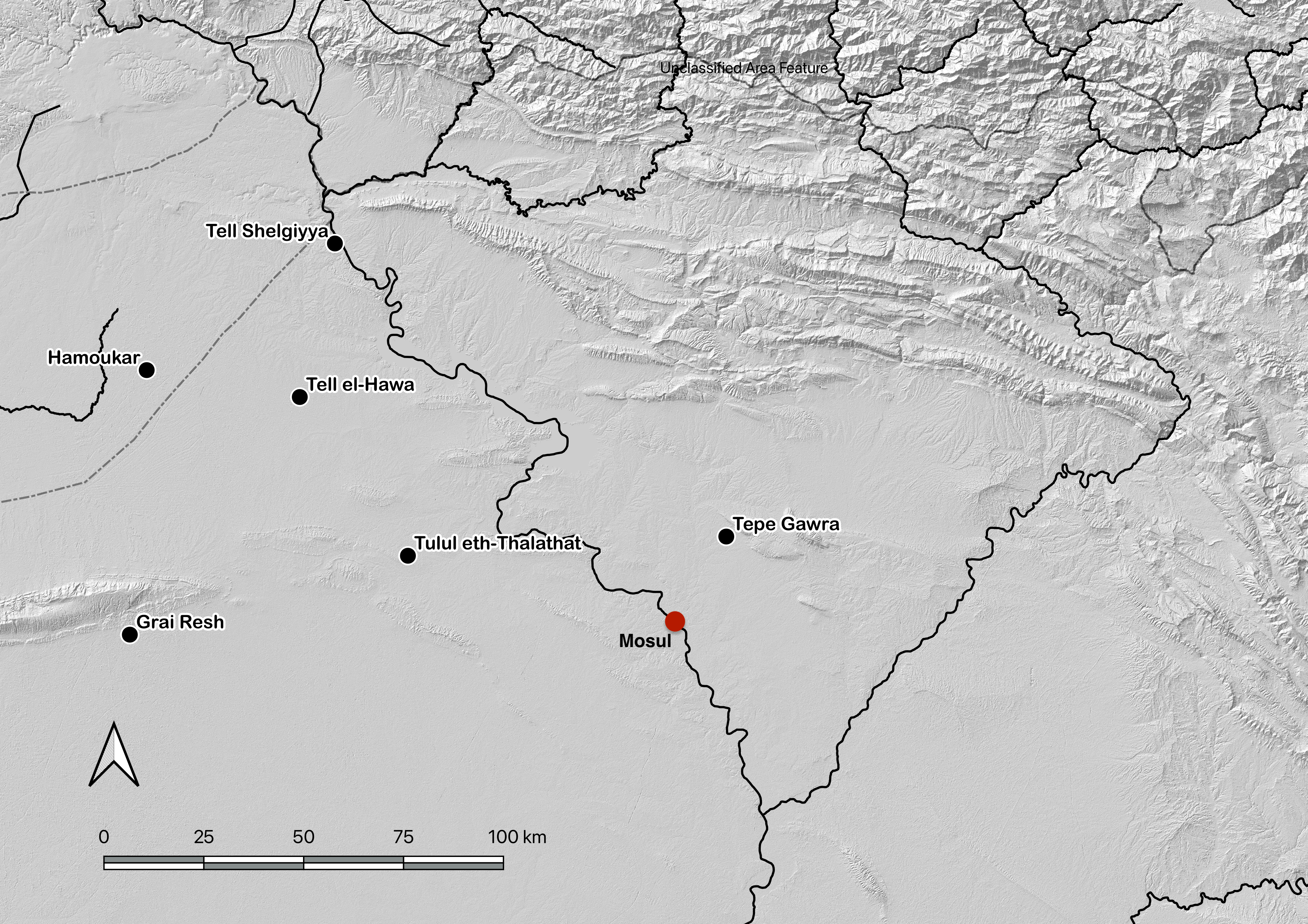
Based on the kind letter of support by the General Directorate of the State Board of Antiquities and Heritage (SBAH), Baghdad, we began the systematic survey of the lower town of Tepe Gawra (344197.14 m E, 4040351.85 m N) in the Ninawa Governate (fig.1) on the 9th of October 2022. Fieldwork at the site was concluded on the 20th of October 2022, with analysis of the recovered materials carried out in the expedition house in the Muthana neighborhood in Mosul. The work at Tepe Gawra was conducted by a Canadian research team from the University of Toronto in partnership with the SBAH office in Mosul.
Figure 1: Location of Tepe Gawra
Location of Tepe Gawra The site of Tepe Gawra is located in the in the Ninawa Plain in the piedmont of the Zagros Mountains. The site is roughly a kilometer and a half to the south of the town of Fadiliyah, and about the same distance from the ancient Assyrian city of Dur Šarukin (Khorsabad) to its east. Tepe Gawra is located in a well-watered plain with several spring fed streams running through the site or near it. This condition encouraged settlement across time resulting in a long sequence of occupation at the site. Today most of the springs that were near Fadiliyah are dry as a result of tapping into the water table with deep wells and pumps.
History of Work at the site and its Significance Tepe Gawra has long been seen as an essential site for late prehistoric and early historic periods, not only in Iraq but for the region in its entirety. Despite the significance of Tepe Gawra, there hasn’t been work carried out at the site since the 1930’s. The work conducted at the site by Speiser (1935) and Tobler (1950) has revealed a long occupational sequence dating from the Halaf period to the mid second millennium BC. The sequence has very few short-lived gaps in occupation and as such has become a chronological anchor for the region, especially for late prehistory (Halaf, Ubaid, and Uruk/LC). Analytical work carried out by Abu al-Soof (1974), and more recently, Rothman (2002), has expanded our understanding of the Northern Uruk period and has been key to developing the modern Late Chalcolithic (LC1-LC5) chronological scheme (Rothman ed. 2001; Schwartz 2001).
Despite its small size (roughly 2-3 ha. at its base extent), Tepe Gawra has been the hallmark site for the development of complexity during the Ubaid and Late Chalcolithic periods in the ancient Near East. Excavations at the site revealed a local development of a sophisticated infrastructure manifest in construction of temples, monumental architecture, and elaborate administrative practices. The site throughout its occupation shows an involvement in far flung networks connecting it with Highland Anatolia and the Zagros mountains, with connections as far afield as Afghanistan. These connections were seen in the high concentration of objects made of exotic materials such as obsidian, lapis lazuli, carnelian, copper, gold, and silver (Rothman 2002: 8), in addition to the presence of imported utilitarian and luxury ceramics (Abu Jayyab 2019; Rothman and Blackman 2003). The households at Tepe Gawra were also shown to be involved in multiple craft activities such as woodwork, textile production, elaborate administration, stone tool manufacture, and the production of high-end ceramic wares (see Rothman 2002; Rothman and Blackman 2003).
All together the main mound of the site has furnished evidence of highly specialized activities (administration, exchange, and craft production) with very little evidence of agricultural implements and farming practices. This phenomenon is unique as this degree of specialization was only attested at larger contemporary sites that combined specialized activities with extensive farming practices (e.g. Tell Brak reaches over 100 ha during this period). This situation necessitated that the inhabitants of Tepe Gawra relied on an external source for food. Rothman suggested that a functional segregation between sites existed in the piedmont or the foothills during this time (Rothman 2002: 5). He saw that the site of Tepe Gawra was a ‘center’ at the top of a specialized hierarchical network. Within this network Gawra served as an administrative, religious, and craft hub (Rothman 2002: 5-6). In support of the notion of a center, Frangipane argues that the landscape played a role in limiting urbanism in the piedmont around Tepe Gawra where the terrain may have restricted the expansion of agriculture beyond its natural limit restricting the region from producing enough agricultural surpluses to support a large conglomeration (Frangipane 2009: 135).
Research Aims There is no doubt as to the significance of Tepe Gawra within the region but was the site truly interdependent as part of a large regional network for subsistence? That is, was the site serving a special function that excluded it from food production? There remains a debate as to whether or not there was a lower Chalcolithic period town around Tepe Gawra. Algaze notes (1993: 71-72) – based on personal communication with Gibson – that the mound was surrounded by a lower town. If this was true then the high mound would have been the acropolis of a larger town that still remains systematically unexplored. Rothman did not reject the idea of the presence of a lower town, however he remained skeptical with the absence of empirical data (Rothman 2002: 19).
The absence of a lower town in the narrative histories of Tepe Gawra coupled with the complexity exhibited at the site has prompted scholars to challenge unilinear models of complexity focused on urbanism. Indeed, the presence or absence of a lower town is central to the notion that Gawra was a regional center dependent on its intra and interregional networks rather than the mobilization of an internal workforce.
Figure 2: Olive orchard around the mound of Tepe Gawra (in the background).
With the kind permission of the SBAH office in Mosul, we had the chance to visit the site on October 1st 2021. The question heading to the site was whether or not the site had a lower town. we were extremely excited to discover a dense scatter of sherds at the lower town, and from what could be observed, many seemed to date to the Late Chalcolithic period. This realization prompted us to apply for the permit to conduct surface survey around the main mound of Tepe Gawra.
The aim of this work at Tepe Gawra was, first, to document and record the full expanse of the settlement beyond the mounded tell area, and to develop a detailed understanding of the occupation history of the lower town. Second, with the expanse of olive orchards around the main mound (fig.2), field investigation of the lower town is an essential undertaking at such an important heritage site in Iraq.
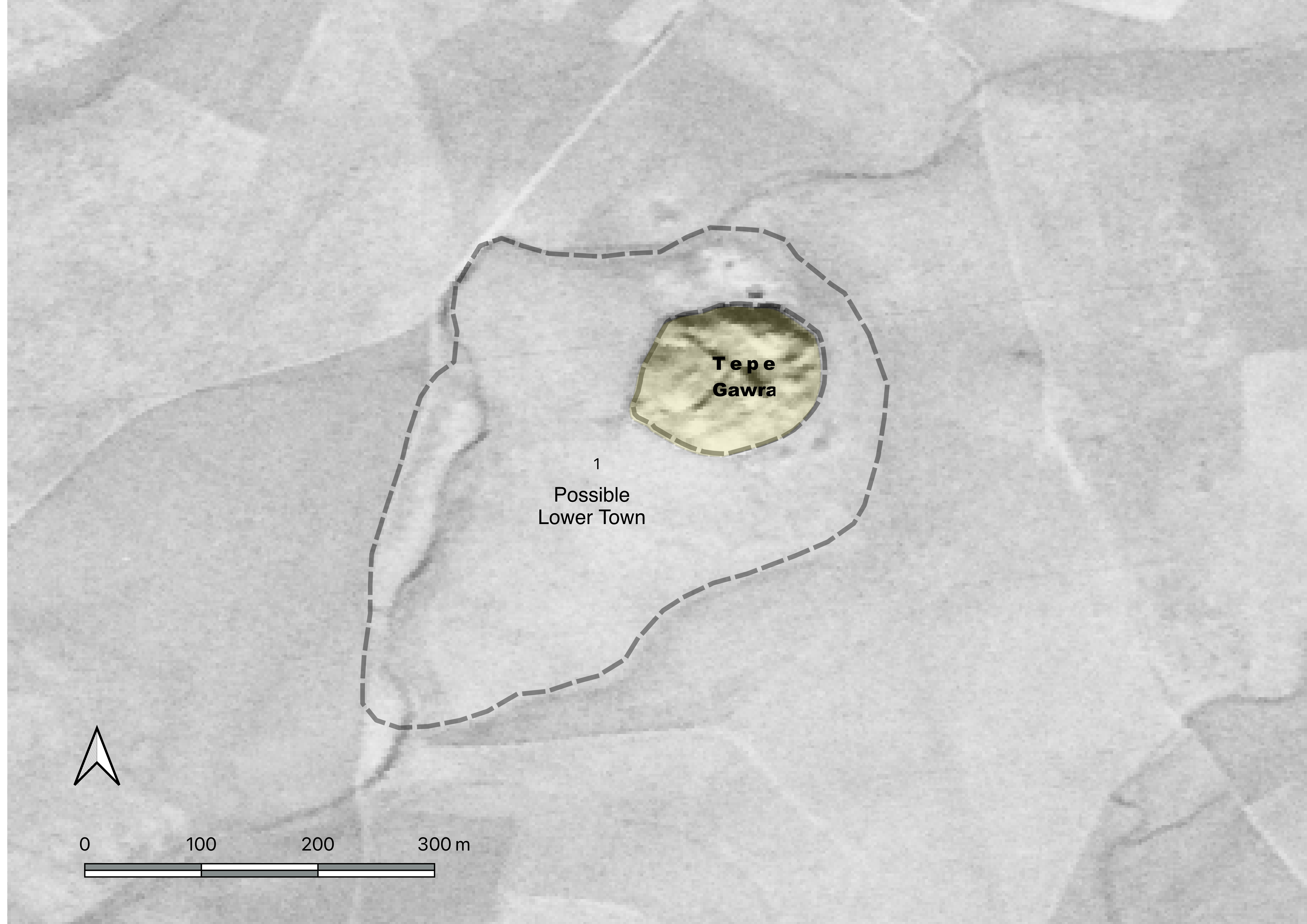
Method Our approach consisted of combining remote sensing data with field walking to obtain a clearer picture on the cultural and physical surroundings of the site and to document its current state of preservation. Prior to our work in the field, we explored the landscape around the site using satellite imagery (Corona, Keyhole, and Landsat) for two main goals. First, examining corona satellite imagery, has the potential to reveal the presence of anthropogenic soils and, in turn, the extent of human occupation around the site (fig.3). Second, exploring the changes that took place at the site between the late 1960’s and present day.
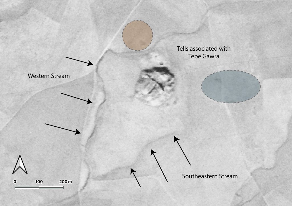
From the legacy satellite imagery, we were able to define a number of features that were otherwise invisible both on the ground and in more recent satellite imagery. From corona imagery, we were able to identify two smaller tells adjacent to the main mound of Tepe Gawra; A first northern tell (fig.4) that was separated from the main mound by a stream. This tell was already indicated in one of Speiser’s early topographic maps of the area (Speiser 1927: fig.2). A second feature was an eastern mound faintly visible only in the corona imagery. There was also a trace of a stream running east of the mound. This stream separated the main mound of Tepe Gawra from the above-mentioned eastern mound (fig.4). Corona and keyhole imagery allowed us to identify, based on soil color and relief, what we believed was the extent of the lower town, and which in turn guided our selection of survey zones (fig.3).
Figure 3: Possible extent of lower town at Tepe Gawra based on soil discoloration
(Corona satellite imagery, December 1969).
Figure 4: Traces of Streams and Sites Around Tepe Gawra, Note the Southeastern Stream is no longer visible
Figure 5: DEM of Tepe Gawra
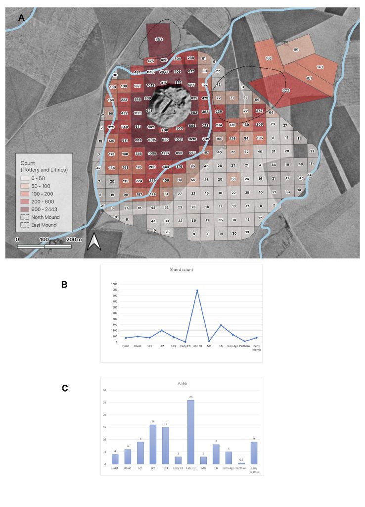
In the field, we conducted a UAV (drone) survey of the site in order to obtain a high-resolution digital elevation model (DEM) and render a 3D model of the Tell and its surroundings (fig.5). This was an important initial step that aims to create an accurate plan of the site and to document its present condition, and assess any possible future threats to it. Our second step was to lay out a collection grid around the site as a precursor to our systematic surface collection of the lower town. The grid contained collection units spaced at regular intervals (50 m) immediately around the tell (fig.6).
All diagnostic artifacts within the units were collected and taken to the expedition house for processing. Processing consists of washing the artifacts, recording and drawing them, with the aim of carrying out a typo-technological study. The typo-technological analysis entails studying the finds (e.g. ceramic sherds, stone tools) with the aim of identifying the relative age of the artifacts and the technological steps taken to produce them (another avenue that may possibly help us determine periodization). We also analyzed the obsidian stone tools with a portable x-ray florescence analyzer (PXRF). The PXRF will allow us to determine the source/s of obsidian artifacts found at the site and begin to explore new network connections that the site was involved in. The information gathered through the material studies will later be connected to the spatial data through a GIS. Through a period-by-period artifact count from each unit we were able to see the extent of occupation in the area surrounding the tell and detect changes in this occupation from one period to the next.
Figure 6: A) Grid and collection units at the in the lower town of Tepe Gawra with full artifact counts. B) Sherd count for each period, C) Estimated area occupied during each period.
Preliminary Results
1-Damage Assessment
Figure 7: Arial photo showing damages to Tepe Gawra.
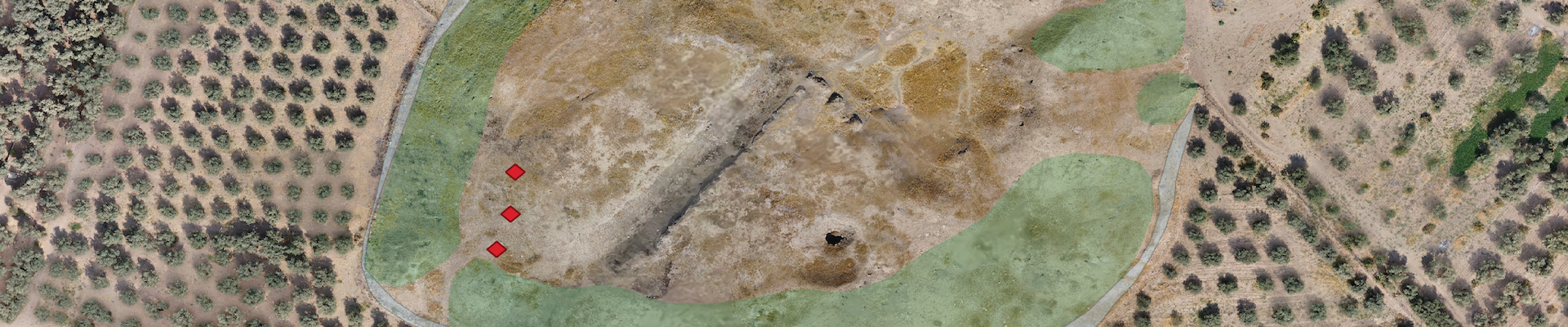
Both the main mound and the lower town at Tepe Gawra have been subject to anthropogenic disturbances. Chronologically, the initial impact on the settlement resulted from the excavations carried out in the 1930’s (Speiser 1935). The site is believed to be at least 7m higher than its current elevation with several levels completely removed (Levels I-IX). After Level X the site was divided into two parts with excavations focusing exclusively on the northeastern portion of the tell. As such, piles of dirt from the excavations were dumped along the slopes of the mound causing an artificial swelling along the edges and slopes of the mound. We were able to document these dumping piles along the different slopes of the mound (fig.7).
Figure 8: The Dirt Embankment Around the Base of the Mound.
The main mound of Tepe Gawra in addition to the lower town were also impacted by farming activities. Farming activities consisted primarily of the planting of olive orchards around the site (fig.2). According to local farmers the orchard was planted roughly 30 years ago, this coincides with the destabilization of the country and the weakening of the central authorities during the first Gulf War. The olive groves and the infrastructural developments related to them have certainly damaged the lower town extensively. First, clear bulldozing took place at the foot of the main mound in order to level that area and prepare it for agriculture. The majority of the dirt was pushed towards the mound forming a low embankment along the majority of the mound’s circumference (fig.8). Second, the act of planting the trees, and plowing the land, in addition to the irrigation systems associated with them (including lines of watering tubes buried in the ground and running between the trees) churned up large swaths of the lower town at Tepe Gawra. Finally, the construction of a number of farm houses, rest areas, and water collection basins with the orchard impacted the lower town significantly (empty squares in figure 6 were not surveyed primarily due to the presence of such features). All these factors make excavations of the lower town near impossible making this survey all the more important. A further complication to studying the lower town and its surrounding is the construction of a road between Khorsabad and Bashiqa that ran through the eastern mound, leading to its complete removal.
The most recent damage to the site was caused through its use by members of ISIS. The militant group dug an intricate network of tunnels within the mound (fig.9). These tunnels may impact the integrity of the mound and cause collapses in the near future. Besides the structural issues these tunnels caused, due to their size, the impact on the archaeological remains is equally devastating if not more.
Figure 9: ISIS Tunnel Along the Southwestern Slope of the Mound
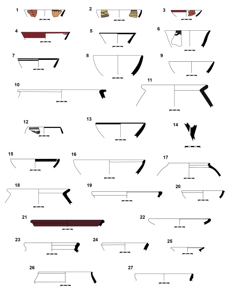
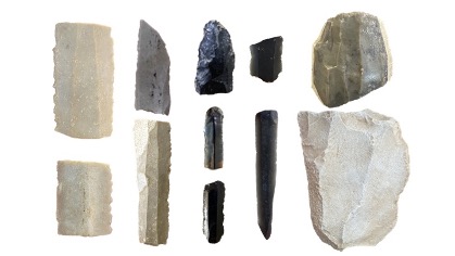
2-Lower Town Remains In total, we surveyed 187 50x50m units, in addition to 5 large external units (see fig.6). within these units we counted 43895 sherds (fig.10), and a total of 904 chipped stone artifacts (fig.11). Almost 40% of the materials were made from clear obsidian with a greenish hue, while 55% were made from flint. Of note, we documented a total of 6 Canaanean looking blades on our survey. Their distribution seems to be confined to the northeast area of the survey region, including Zone 3 East and the squares (M5, M6, and M7) adjacent to it. This is of note since Canaanean blades made from lever pressure are characteristic of Late Chalcolithic lithic assemblages and ours were all found in conjunction with Late Chalcolithic pottery.
Figure 10: examples of ceramics collected from Tepe Gawra Lower Town Survey.
Figure 11: collection of stone tools from the Tepe Gawra Lower Town Survey.
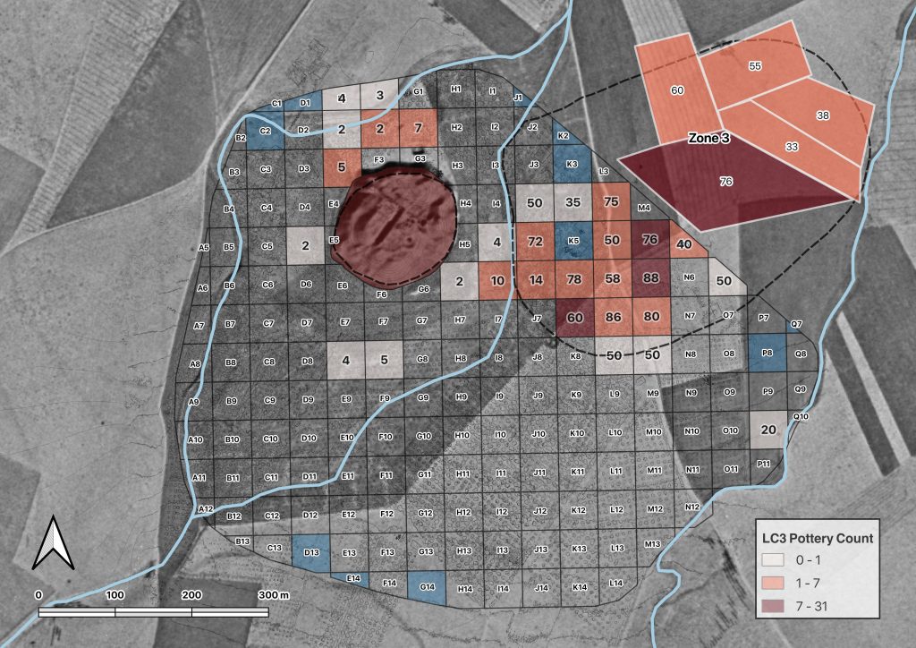
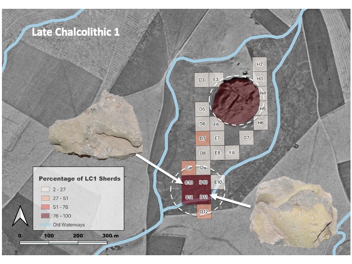
In terms of occupational history, the team was able to document the stages of development at the site where a clear expansion from the main mound clearly began during the Late Chalcolithic 1 period (4600-4200 BC) and continued through to the Late Chalcolithic 3 period (3900-3600 BC) to at which point the site was abandoned until the Ninevite 5 period (3100-2800 BC). During the late Chalcolithic the site expands from roughly 4 ha. (Ubaid Middle Chalcolithic period, 5300-4600 BC) to 9 ha. during the LC1, and later, to 15 ha. during the LC2 and 3 (fig.12). Further, the team was able to isolate a number of distinct activity areas (e.g. pottery making) dating to these periods (fig.13). All this implied that rather than being an isolated small center exclusively reliant on far-flung inter and intraregional networks, Tepe Gawra was going through similar processes of urban expansion, social differentiation, and economic specialization that were occurring at other sites in the region, albeit within its own local trajectory.
Figure 12: LC3 settlement located east of the main mound of Tepe Gawra. Note that the number in the collection unit is the percentage of late EB sherds relative to other sherds collected in the unit.
Figure 13: Extent of Late Chalcolithic 1 (LC1) settlement at Tepe Gawra. Initially the LC 1 occupation was believed to be restricted to the main mound, top dashed circle (3 ha. in extent), however, after survey we now see that the occupation was 3 times the size initially believed (9 ha.). The lower dashed circle points to an LC1 ceramic working area. This was discerned based on the heavy presence of wasters (objects in the image) and pottery slag, which are by-products of ceramic manufacture.
Occupation at the site reached its zenith during the latter part of the 3rd millennium or the Late Early Bronze Age (Akkadian/post Akkadian periods). During this period, we see the largest extent of the site reaching approximately 23 ha., or possibly 36 if we take into consideration units with a low density of sherds (fig.14). The site declines during the Middle Bronze Age, and eventually shifts slightly to the north during the Late Bronze Age and the Iron Age, where the mound of Tepe Gawra itself becomes too narrow at the summit to sustain a village. The Final occupation in the environs of the site occurs during the late Sassanian/Early Islamic period where settlement shifts to the southern edges of the survey zone.
Figure 14: Extent of the late third millennium settlement. Note that the number in the collection unit is the percentage of late EB sherds relative to other sherds collected in the unit.
3-Outreach
Figure 15: Workshop carried out at Qadisiya University by members of the Tepe Gawra Survey Project (From left): Khaled Abu Jayyab, Arno Glasser, Abbas al-Hussainy, and Ira Schwartz.
Another important aspect of the project was to foster close cooperation with local institutes and members of the community. This approach is taken as part of the steps in reforming and decolonizing excavation and survey in Iraq as outlined by Jotheri (2022). Accordingly, the project emphasized the training of members of the SBAH involved. Moreover, following the season members of the project held a workshop at Qadisiya University in Diwaniya, organized by Prof. Abbas al-Hussainy, pertaining to the work at Tepe Gawra, and analytical work on ceramics, lithics, and survey methodology. The workshop was open to faculty, students, and members of the public alike (fig.15).
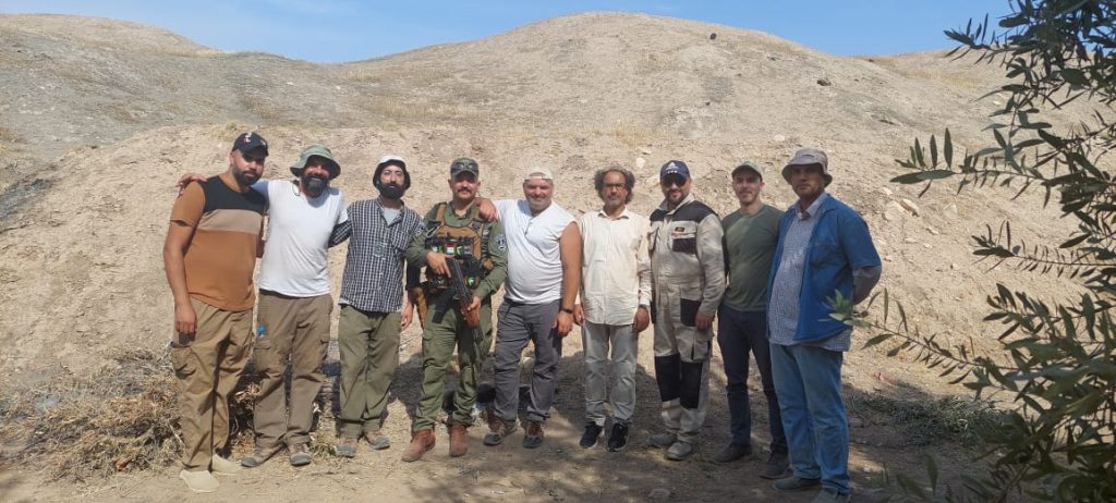
The season’s work at Tepe Gawra was a resounding success despite the tight schedule. This would not have been possible without the financial support provided by the ASOR Mesopotamia Fellowship, and the CRANE project (University of Toronto), In addition to the guidance, motivation, and logistical support provided by Prof. Timothy Harrison (NMC) and Prof. Abbas Al-Hussainy (Qadisiya University). Finally, the work would not have been possible without the monumental efforts of the Tepe Gawra survey team (fig.16), Dr. Stephen Batiuk (NMC, University of Toronto), Dr. Abbas al-Hussainy (Ira Schwartz, Arno Glasser (both U of T, Anthropology, University of Toronto), Hossam Hadi, Abdul Ghani Jbori, and Ahmad Najar (SBAH), whom all put in extra shifts to ensure the data was processed on time and in a scientific manner. The success of this work would not have been possible without them.
Figure 16: Members of the Tepe Gawra Survey team (from left to right): Hossam Hadi, Khaled Abu Jayyab, Ira Schwartz, Hikmet al-Jbouri, Stephen Batiuk, Abbas al-Hussainy, Ahmad Najar, Arno Glasser, and Abdul Ghani Jbori
Bibliography
Abu al-Soof, B. (1974). “Prehistoric Pottery from Nineveh, Gawra, and the Neighboring Sites.” Sumer 30: 1-10.
Abu Jayyab, K. (2012). “A Ceramic Chronology from Hamoukar’s Southern Extension.” In Catherine Marro (ed.) “After the Ubaid: Interpreting Change from the Caucuses to Mesopotamia at the Dawn of Urban Civilization (4500-3500 BC).” 87-128. Varia Anatolica XXVII.
Abu Jayyab, K. (2019). “Nomads in Late Chalcolithic Northern Mesopotamia: Mobility and Social Change in the 5th and 4th Millennium BC.” Unpublished PhD. Thesis, University of Toronto.
Algaze, G. (1993). “The Uruk World System: the Dynamics of Expansion of Early Mesopotamian Civilization.” University of Chicago Press.
Al-Quntar, S. & Abu Jayyab, K. (2014). “The Political Economy of the Upper Khabur in the Late Chalcolithic 1-2: Ceramic Mass-production, Standardization and Specialization.” In McMahon, A. & Crawford, H. (eds.) “Preludes to Urbanism: The Late Chalcolithic of Mesopotamia.” 89-108. McDonald Institute Monographs. Cambridge.
Frangipane, M. (2009). “Non-urban Hierarchical Patterns of Territorial and Political Organization in in Northern Regions of Greater Mesopotamia: Tepe Gawra and Arslantepe.” Subartu XXIII: 135-148.
Jotheri, J. (2022). “Reforming (and Decolonizing) Excavations and Survey in Iraq.” ANE Today X: 12.
Rothman, M. ed. (2001). “Uruk Mesopotamia and Its Neighbors: Cross-cultural Interactions in the Era of State Formation.” School of American Research Press.
Rothman, M. (2002). “Tepe Gawra: The Evolution of a Small Prehistoric Center in Northern Iraq.” Philadelphia, University of Pennsylvania, Museum of Archaeology and Anthropology Press.
Rothman, M. & Blackman, J. (2003). “Late Fifth and Early Fourth Millennium Exchange Systems in Northern Mesopotamia: Chemical Characterization of Sprig and Impressed Wares.” Al-Rafidan 24: 1-21.
Schwartz, G. (2001). “Syria and the Uruk Expansion.” In Ed. Rothman. M. “Uruk Mesopotamia and Its Neighbors: Cross-cultural Interactions in the Era of State Formation.” 233-264. School of American Research Press.
Speiser, E. (1927). “Preliminary excavations at Tepe Gawra.” Annual of theAmerican Schools of Oriental Research 9: 57-94.
Speiser, E. (1935). “Excavations at Tepe Gawra, I.” Philadelphia: University of Pennsylvania Press.
Tobler, A. J. (1950). “Excavations at Tepe Gawra II.” Philadelphia: University of Pennsylvania Press.
Roselyn A. Campbell, 2022 P. E. MacAllister Fieldwork Scholarship Recipient
In 2022 I was awarded a grant that allowed me to join the Khirbat al-Mukhayyat Archaeological Project (KMAP) near Madaba, Jordan. This project is directed by Dr. Debra Foran of Wilfred Laurier University in Ontario, Canada. Though I have worked in Egypt for many years, I had only visited Jordan as a tourist. I fell in love with the country and people immediately, and was thrilled that an ASOR grant made it possible for me to join such a wonderful project in Jordan.
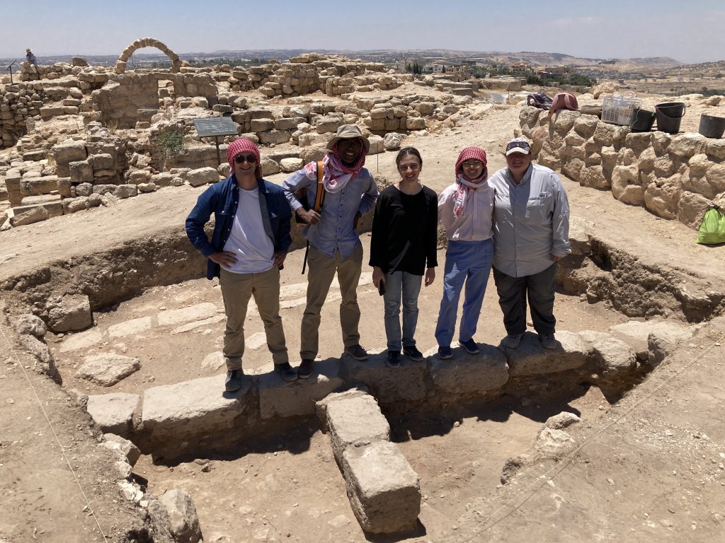
The 2022 Khirbat al-Mukhayyat team at the site of the ancient town of Nebo. From left to right: Debra Foran, Andrew Danielson, Mashoor Fshaikat, Greg Braun, the author, and Grant Ginson.
My research mainly centers on human remains, and in Egypt I typically analyze either mummies or commingled (i.e. mixed up) human remains from tombs that were previously excavated. I was very excited to join KMAP and analyze some human remains the team had found inside a shallow cave a few years before. The wadis (valleys) contain numerous caves, and a previous survey found that some of the caves contained human remains. The human remains were mixed up and contained few or no artifacts, and probably date to the Byzantine period. The focus of our work in 2022 was on surveying some of the wadis surrounding the ancient town of Nebo, another project directed by Dr. Foran. Due to the danger of looting, in 2022 the Department of Antiquities in Jordan gave us permission to collect the human remains that were visible in some of the shallow caves.
A scorpion that we discovered on our first day on site.
Sometimes people think that there isn’t much to be gained from studying sites or burials that have been looted or heavily disturbed, but actually a lot of information can still be gained by taking a close look at such sites! Even when individual skeletons get mixed up and disarticulated (i.e. the bones are not connected anatomically anymore because the ligaments and muscles holding them in place during life have decayed), it’s possible to get information about how many people are represented, how old they might have been when they died, and sometimes information about what kinds of disease or infections they suffered during life. You might even be able to tell if the people who were buried together were related!
The study of human remains can be challenging for many reasons. While I was in Jordan, the team and I battled the usual afflictions of archaeology in that part of the world: heat, scorpions, spiders, and even lost luggage. But studying human remains also provides different challenges. Sometimes, you find the remains of young children or infants who died very young, or individuals who might have suffered a great deal during life. These discoveries, in addition to constantly confronting your own mortality as a human being, can make the work mentally as well as physically taxing. But it can also be very rewarding.
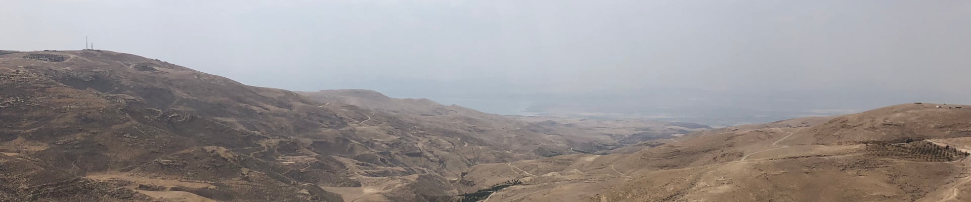
The author among the ruins of the ancient town of Nebo. The Dead Sea can be faintly seen in the background.
When you analyze human remains, you learn a lot of information that doesn’t necessarily feature in official records or histories of ancient times: what people ate, what kind of tasks and labor they were doing, what kinds of disease they suffered from, and how they might have died. Bioarchaeology is often concerned with the regular people who made up a population, rather than the rulers and elites who had the resources to make elaborate tombs, temples, or monumental inscriptions. This aspect of bioarchaeology is part of why I love it: I get to shine a light on the lives of regular people, people who otherwise might be forgotten. As much as possible, it’s the job of the bioarchaeologist to restore some level of identity to the people who lived in the past, and use that information to illuminate the lives of people now and in the future.
Working in Jordan for KMAP this year was a wonderful opportunity to learn about some of the individuals who lived in this region during the Byzantine Period, and to learn more about the archaeology, history, and landscape of Jordan. I was thrilled to join this amazing team, and can’t wait to return in the future to continue studying the lives of these individuals who were laid to rest in caves around the region.
Dr. Roselyn Campbell is a bioarchaeologist and archaeologist, primarily specializing in Egyptian archaeology. Her research focuses on evidence of trauma and violence in human remains from the past, as well as the history and antiquity of cancer. She has worked at archaeological sites in Egypt, Peru, Ethiopia, Spain, the western United States, and now Jordan. Dr. Campbell can be found on Twitter @RosesBones.
Cayden Griffith, 2022 Steven B. Dana Scholarship Recipient
Firstly, I would like to thank both ASOR and the donors who provided this scholarship; I would not have been able to have this great experience without their support.
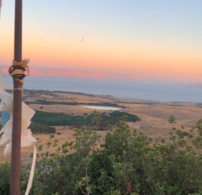
This summer I was apart of the Huqoq 2022 field season, directed by Dr. Jodi Magness from the University of North Carolina. Huqoq was a Jewish village, containing a monumental synagogue built in the 5th century CE, which sits upon a hill northwest of the Sea of Galilee. This synagogue, notable for its many well preserved floor mosaics, was the focus of the excavation.
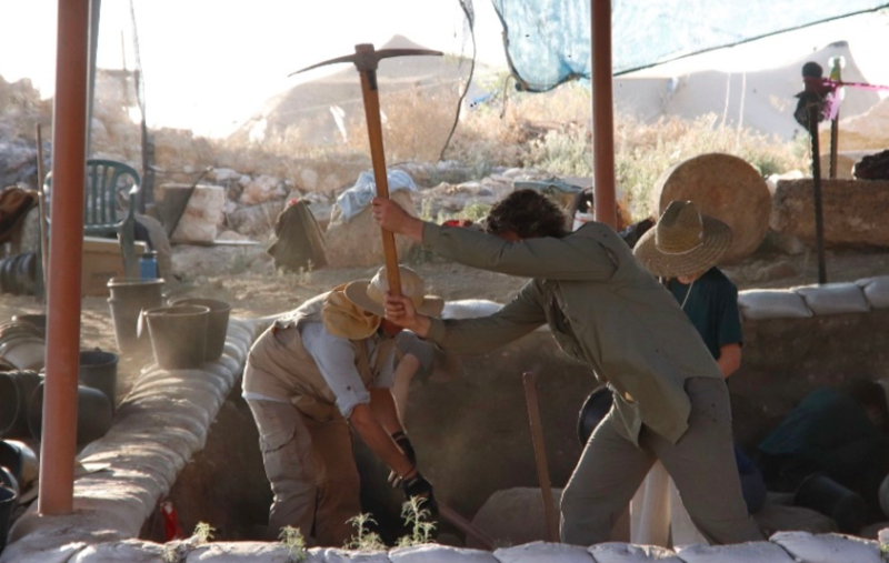
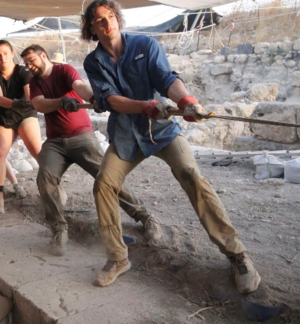
A typical day in the life at Huqoq involved waking up at 4am, taking a bus, and then finally a short hike to the excavation site. Our hike to and from the site was quite literally uphill both ways but the stary sky in the morning and the conversations on the way back always made it worthwhile. Once we set up the site we were ready to excavate until 8am. From there we would have a five-star field breakfast with eggs, pancakes, fruit, and a variety of local foods as well. With this boost from breakfast we would once again be hard at work until 11am, where we would then have a fruit break, which we called “elevensies”, before going back to work finishing up the day’s excavation and then getting ready to leave around 12:30pm. We then would then hike back uphill to the busses and have lunch at the kibbutz we were staying at.
Following this long morning, we would have an equally busy yet fun afternoon. We would start by washing or tagging pottery. We would then be able to attend a lecture by one of our site’s knowledgeable staff and specialists or we would visit a local archaeological site. After all of this we would try and get some sleep before doing the whole thing all over again the next morning.
While we were excavating, I worked in the area east of the synagogue. On our site following the destruction of the late roman synagogue, a medieval synagogue was built over the previous building using some of the walls of the previous synagogue and expanding them elsewhere. In the eastern area, where I was working, in previous seasons they had discovered a medieval vaulted structure, close to the eastern wall of the medieval synagogue.
Due to this find when excavating we expected to find further evidence of this medieval structure, and thought that this may have been a pilgrimage site for those wishing to see the tomb of the prophet Habakkuk, one of the 12 minor prophets in the Hebrew Bible. While we have not yet found any direct evidence of the Medieval vaulted structure being a pilgrimage site for the tomb of Habakkuk -we liked to joke that we would find a sarcophagus with the inscription “Here Lies Habakkuk” – while digging we made an unexpected but maybe even more exciting discovery connected to the late Roman synagogue, which is all I can mention here.
However, if you are interested, please visit the Huqoq site’s website where they will post updates when there is a publication: Huqoq Excavation Project (unc.edu).
Not only was I able to learn so much from our site’s great staff in the field but I also was able to attend lectures by our staff and specialists about a variety of other topics as well. These ranged from archaeological method, ceramics, painted plaster, architecture, local history and much more.
Additionally I was able to see many important sights within Israel including Capernaum, Sepphoris, Caesarea, Tel Dan, Banyas, and Megiddo, to name a few. Being a student of Koine Greek, it was amazing to visit and see some of the places which I had only read about. This gave me a deeper appreciation and understanding of these stories as it left me in awe, as simply looking off into the distance at our excavations there were sights of important historical events or locations of biblical stories.
Want to help more students and early career archaeologists get into the field? Donate to the cause today by selecting “Student Support” as your gift purpose!
In June of 2022, with help from ASOR and the P. E. MacAllister Scholarship I arrived in Jordan for my first archaeological field season. I would be working as a square supervisor at Tell Hisban. Tell Hisban is a site in Northwest Jordan near the capital of Amman. There are many layers of occupation left by many civilizations at Hisban, from the Assyrians all the way through to the Ottomans as well as occupation by more modern local Bedouin. However, inspired by research conducted in collaboration with Dr. Oystein LaBianca, the focus of my field would be into the Hellenistic and Roman eras. Hisban lies within the region historically occupied by the Decapolis. The Decapolis was a semi-formal political and mercantile league of cities, connected by their common Greek culture and language. As I presented in my poster presentation at the 2021 ASOR conference, we believe Hisban was part of a greater overall cultural program of the Decapolis.
The acropolis at Tell Hisban possesses a Byzantine church as well as the foundations of what has long been believed to have been a Roman public building. This public building has been hypothesized as being specifically a Roman temple. Our goal this field season was to excavate atop the acropolis and search for the floor of this public building; and to incorporate our findings into this overarching theory of Hisban within the cultural program of the Decapolis. Finally confirming that this public building was indeed a Roman temple would have gone a long way toward serving this theory.
Our excavations started, and removal of the modern topsoil revealed occupation by modern local Bedouin. However just below the topsoil we began to uncover walls. We found two non-parallel rows of walls made of repurposed Roman ashlar bricks. These came as a complete surprise to everyone on the dig and caused us to totally change our excavation plans. From here, we made the decision to excavate more closely along the northern row of walls. The sherds that were found imply heavy occupation during the Late Byzantine/Early Islamic eras. Of particular note among these sherds was a number of extremely uncommon triple-glazed, molded-relief Byzantine sherds, we believe to be imported from elsewhere in the Mediterranean.
The excavations of the loci on the northern side of the north wall revealed what we believed to be a storage jar, in situ, with its rim peeking just above the ground. We took a few days bringing the other loci into phase and then began to carefully excavate around the jar. As we dug lower the soil began to turn grey and ashy. Then as we dug flush with the bottom of the jar, we noticed the sides came down completely straight and it didn’t have a bottom. As it would turn out it was not a jar at all but a tabun cooking oven! After this revelation we decided to carefully collect and remove each of the pieces of the oven (as it was still in situ but completely shattered) and bag the soil within the oven to be floated for organic materials. The oven was made of a rough handmade ceramic, we believe to date from the Late Byzantine or Early Islamic eras. Another noteworthy find was a red bead nearby the oven. The bead is carnelian with delicate white paint design on it, as well as a bronze wire still attached to it.
The tabun saga continued however. In the days before we were about to leave for the season, another student and I went to visit a local shopkeeper and old friend of the Hisban excavations and archaeologists in Jordan. We told him about the oven we found and showed him photos of it. He instantly corrected us when we said it was a tabun, he said “no this is a zarb”. We weren’t yet aware of what a zarb was. A tabun is a round and stout oven with a large opening at the bottom, not unlike a pizza oven. A zarb is a straight round oven, generally submerged into the ground, in which food is lowered in from the top rather than the side. After we learned about this we all instantly agreed with our friend, it was a zarb after all and not a tabun. This was a really beautiful moment of local knowledge in action.
My first field season, as often happens in archaeology, did not go as planned. That being said, we made a number of very surprising discoveries. It is still unknown whether or not the building on the acropolis was indeed a temple or not, but our findings are important pieces that help put the story of Hisban together. This dig was an amazing experience for me both personally and academically and I look forward to returning to Hisban to continue our excavations on the acropolis.
Colton Hodges graduated from Andrews University in 2022. He received a Bachelors’ Degree in Behavioral Science with a concentration on Anthropological Archaeology. He plans to pursue a PhD in archaeology, and work towards his ultimate career goal of becoming a university professor and field researcher.
Want to help more students and early career archaeologists get into the field? Donate to the cause today by selecting “Student Support” as your gift purpose!
Recordings of ASOR Annual Meeting paper presentations from the 2020-2022 virtual Annual Meetings are part of the ASOR Online Library. The recordings will remain available to all members who register for the current year’s Annual Meeting for as long as ASOR has the capacity to keep the presentations available online. If you do not want your paper presentation to remain online, please fill out the ASOR Presentation Recording Form to request:
To remove the recording immediately (as soon as we are able);
To replace your paper recording with a new, updated video file that you will provide;
To edit the recording to remove a particular slide(s). This option is contingent on ASOR having staff capacity to edit the video and we will make every effort to accommodate your request.
2022/2023 Mesopotamian Fellowship Report: The Excavations of Qach Rresh (First Season)
Petra Creamer, Emory University[/vc_column_text][mk_divider][vc_column_text]
I. Goals of the Excavations at Qach Rresh
In the very first season of the Emory University excavations at the site of Qach Rresh, located just a few kilometers north of the village of Trpa Spiyan, the team was interested in investigating several questions:
identifying the exact dates of construction and occupation of Qach Rresh
understanding the function of the large buildings discovered in the magnetometry
investigations of 2022
explore why such a site existed in a relatively marginal agricultural area
With a season lasting 5 weeks (from August 31 – October 2, 2022) and supported by the ASOR Mesopotamian Fellowship, the Emory team opened two trenches over the main building remains at Qach Rresh with the intent to begin answering these questions.
Manipulating the photograph using the Digital Epigraphy’s user interface produces the best known available photograph of the inscription. Compare the previously published photograph to that made during our cataloguing efforts.
Prof. Petra Creamer, Emory University, USA (Project Director)
Dr. Kyra Kaercher, USA (Assistant Director, Ceramicist)
Dr. Nathalie Brusgaard, Groningen University, Netherlands (Zooarchaeologist)
Dr. Elise Laugier, Rutgers University, USA (Micropaleobotanist)
Dr. Lucas Proctor, Goethe University Frankfurt-am-Mainz , Germany
(Macropaleobotanist)
Ms. Glynnis Maynard, Cambridge University, UK (Excavator)
Kurdistan Region Project Staff
Kak Ahmad Jodat, Erbil Antiquities, KRG (Project Representative)
Kak Nader Babakr, Erbil Antiquities, KRG (Erbil Governate Director of Antiquities)
Figure 2: Magnetometry results from 2021, conducted by Petra Creamer as part of EPAS.
Five workmen from Trpa Spiyan
III. Prior Research at Qach Rresh
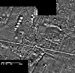
Qach Rresh was first discovered and recorded by the Erbil Plain Archaeological Survey (EPAS) in 2017 as a single-period Neo-Assyrian (Iron Age) site (EPAS Site Number 458). In 2021, EPAS returned to the site to conduct geophysical investigations with a Bartington 601-2 Gradiometer. The results showed the remains of several large buildings and smaller structures at the site (see Fig. 2).
These results showed an example of an unusual type of Iron Age site which had never been excavated before – a rural village, likely centered around agriculture. However, the presence of large buildings at the site was unexpected, raising questions of imperial involvement in agricultural production.
IV. Excavation and Recording Methodology
The scientific recording of the excavations at Qach Rresh were a combination of digital and traditional. In the field, the excavators would record all contexts and collection lots on paper worksheets, which would then later be entered into digital spreadsheets during lab time in the afternoons.
Spatial recording methods relied upon two Emlid-brand RTK GPSs (Real Time Kinematic Ground Positioning Systems). The setup of two Reach R2 systems (see Fig. 3) allows the user to record points in X-Y space with sub 2cm accuracy. The base RS2 sits stationary while the rover RS2 is moved to mark points. Using this, we were able to mark features of significant interest along the cut, as well as record the location of features within Operation A. These recorded points were then imported into ArcGIS to record the exact location of the features. GIS was a key component of the recording system, since the trenches and their related features could be recorded in real space for reference in this season and future seasons (Fig. 4).
Aerial imagery is now a standard in archaeology. The project employed a Mavic 2 DJI-brand drone to photograph excavation contexts near-daily. The resulting photographs were indispensable in both recording and reconstructing the past features of Qach Rresh. Furthermore, multiple drone photos were used to create 3D digital models of the trenches to record features of interest.
Figure 7: Photograph of A006, the ashy pit abutting Wall A013.
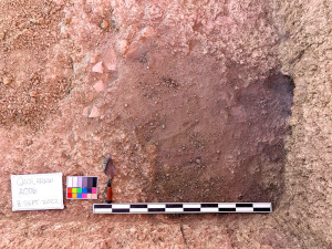
Operation A was opened on August 31st at a size of 20 x 5m. Topsoil removal showed heavy plow scars affecting the remaining features below ground, to a depth of at least 30cm. In the eastern part of the trench (9x3m), we excavated down in 20cm intervals with the intention of uncovering a large set of walls bounding the northwestern part of the courtyard in the main building identified through magnetometry. At a depth of around 50cm, the texture of the soil matrix began to harden, becoming thick and difficult to excavate. While the walls were difficult to identify due to this uniform matrix, we were able to distinguish the wall running roughly from NW-SE based on a pit that had been cut into the fill of the building. The pit itself (A006) was filled with ash, charcoal, animal bone, and broken pottery (Fig. 7). The north edge of the pit abutted the wall, creating a straight line against the south face of it that confirmed the wall’s limits.
The remaining time in Op. A was spent attempting to identify a floor surface of the building’s courtyard. While the fill of the courtyard eventually became less thick (with less collapsed mudbrick) a floor surface remained difficult to identify. We excavated to a depth of 1.83m in the SE corner of the trench in order to reach sterile soil and confirm the beginning of human habitation.
Operation B was opened on September 13 at a size of 10x10m. Like Op. A, the area was affected by plow scars up to 30cm deep underneath the topsoil. Immediately, we noticed a proliferation of broken baked bricks near the top levels, intermixed with river cobbles and sherds. We began to excavate the southern half of the trench, forming a 5x10m area. Roughly 10cm below the surface we discovered two single-course walls of river cobbles, both arranged in right-angles and adjacent to one another (Fig. 9). We theorize that these may be the remnants of pastoral activity, such as pens for livestock or field boundaries.
Figure 11: An example of soil containing calcium carbonate crystals (white nodules)
Once below these walls, we proceeded down in 20cm intervals. It quickly became evident that the western half of the trench was very similar in soil type to much of Op. A, where calcium carbonate crystals were intermingled with dark brown, thick soil. In the eastern half of the trench, however, we began to collect large amounts of sherds and animal bones beginning at a depth of 35cm. To focus our efforts, we separated the trench in half and continued to excavate in the eastern half, while also opening a 4x5m area in the northeastern corner of the trench. Based on soil color and texture, we were able to estimate the orientation and thickness of the mudbrick wall bounding the room on its western side (see Fig. 10). We designated this wall before continuing to excavate the room’s fill.
Ceramics, bones, broken baked brick, and partial mudbricks continued to be found as we excavated the room’s fill. At a depth of 82cm we began to excavate a sounding in the northern part of the room with two goals: to excavate down to the room’s floor, and to identify stratigraphic units in the resulting baulk. In total, we identified at least 130cm of fill and 55cm of mudbrick collapse before reaching what we believe to be the main floor of the building. Additionally, there was 30cm of hard-packed soil with few artifacts located just beneath the floor. Below the hard-packed layer we discovered virgin soil, identifiable by having no artifacts and many calcium carbonate crystals (see Figs. 11&12).
Both the buildings in Operation A and Operation B were difficult to identify based on excavation alone, due to significant deterioration in the mudbrick. By using the magnetometry data together with the excavation, we were able to come to several conclusions about the site after one season:
Many of the artifacts collected from the Qach Rresh excavations likely date to the post-Assyrian phase of the Iron Age (c. 600-500 BCE). This is based on the post- Assyrian forms of the ceramics and the common use of grit instead of chaff as a temper.
The rooms of Building B (in Operation B) were clearly used as a dump in the post- Assyrian period.
The room excavated in Building B this season contains at least 130cm of fill from trash deposition. Below these multiple deposition events (which can be identified in the stratigraphy of the baulk – see Fig. 12) there is what appears to be roughly 55cm of mudbrick collapse, likely from the roof of the building. Below this, there is a 30cm thick layer of hard-packed clay with very few artifacts. We interpret this layer to be the remains of the foundation trench constructed before Building B was built.
While initially we approached Qach Rresh believing it to date to the late Neo-Assyrian period (c. 750-600 BCE) we now believe it to have been mainly used in the post-Assyrian period. It is still unknown in what period the buildings were constructed, though it seems likely based on the chaff- tempered ware recovered from the building in Op. A that they may have been constructed in the Neo-Assyrian period, abandoned, and then reused in the post-Assyrian period. Overall, we are also interested in the potential to investigate the post-Assyrian occupation of the Erbil Plain, considering it has been largely underrepresented in archaeological studies.
VII. Summary and future plans
Ultimately, the 2022 season of excavations at Qach Rresh have shown that our initial expectations of the site should be reconsidered not only regarding the site’s dates of occupation, but also in its occupation use. Next season, we will continue to expand the areas of Op. A and Op. B to expose the floor levels of both buildings. Carbon samples were collected during this season, and will be C14 dated to obtain exact dates of the fill of Building B and the ash pit of Building A. Furthermore, we intend to continue applying archaeological scientific methods to the data from Qach Rresh next season, including isotopic analysis of the faunal remains, phytolith analysis, and ceramic petrography. These, combined with further seasons of excavation, will inform us greatly of Qach Rresh’s past.
David Brown, 2022 Steinmetz Scholarship for Active/Reserve Military or Veterans[/vc_column_text][mk_divider][vc_wp_text]
As one of three major settlements in the Huleh Valley, Tel Dan occupies a prominent place not only in its well-known biblical association with the settling of the tribe of Dan in Judges 18, but also in the larger regional history. Its geographic location and boast of abundant natural springs have made it an attractive place to occupy from the Early Bronze Age II to the late Roman period. The late Avraham Biran oversaw excavations there from 1966-1999, with David Ilan of Hebrew Union College leading new excavations since 2005. Over this span of time, excavators have revealed some impressive features at the site including a Middle Bronze gate, an Iron II fortification system, a cultic high place, and of course the Tel Dan Stele. The site remains a major tourist attraction for history and archaeology enthusiasts to partake in exploring the vast treasures Israel has to offer
[/vc_wp_text][vc_row_inner][vc_column_inner][vc_single_image image=”96288″ img_size=”full” add_caption=”yes” alignment=”center” onclick=”img_link_large” img_link_target=”_blank” css=”.vc_custom_1712081676195{padding-right: 10px !important;}”][/vc_column_inner][/vc_row_inner][mk_padding_divider][vc_wp_text]The 2022 season marked the final excavation for Area B—a series of rooms situated directly north of the Iron II fortification system on the southern flank. This area also juxtaposes the interior of the Bronze Age ramparts. A team of students, under the direction of Aaron Burke of the University of California Los Angeles, were assigned three squares in this area. The objectives of this season were to articulate the Iron I strata and reach the terminal Late Bronze phase. Along with students from Hebrew Union College working in Area L, a group totaling forty individuals from around the globe participated in this year’s fieldwork for four weeks covering June-July.
For my part in the excavation, I served as one of three square supervisors in Area B. My Ph.D. research centers on forced migration during the Late Bronze transition to the Iron Age where I seek to identify refugees resettling throughout the southern Levant. As such, this year’s objectives at Tel Dan were fortuitous for my research. We spent our first week removing quite a bit of wash from the area, because no work had been done at the site since 2018. Our second and third weeks were more productive in uncovering various indicators of conflagration including wall collapse, ash, and thick layers of destruction debris. We also analyzed wall interfaces and foundation trenches to better understand the sequencing of phases built up over time. By the fourth week, our area gifted us with a generous reward—pits. We identified them as refuse pits.
Many people consider it strange that archaeologists could be so interested in the garbage of past people, but it is in the trash and the refuse that we can find some of the most valuable information in our reconstruction of ancestral behavior and events. From seeds and botanical analysis to bones and an understanding of diet, from crushed jars to which strata these holes were cut into, I have developed a strong appreciation for the importance of pits and what they contain. Particularly for my research with refugees, who exhibit basic subsistence and storage practices, pits are vital to identifying where refugees settled and what they produced. Needless to say, our efforts this season satisfied a serendipitous end to the Area B excavations.
I look forward to incorporating the data we unearthed at Tel Dan this season into my research and contributing to a better understanding of forced migration, the factors that pushed and pulled people to new regions, and how they reestablished themselves and began to rebuild and rediscover their social identities. I am also grateful to ASOR and to Mr. Charles Steinmetz, the donor for this fellowship, for financially supporting me in my research this season.
David Brown is a Ph.D. candidate in the Department of Near Eastern Languages and Cultures at the University of California Los Angeles. His research is centered on forced migration in the Early Iron Age southern Levant, analyzing how to identify refugees in the material culture according to their push and pull factors as well as how they reconstituted themselves into new social identities after regional changes at the end of the Late Bronze Age transformation.
[/vc_wp_text][mk_divider][vc_wp_text]Want to help more students and early career archaeologists get into the field? Donate to the cause today by selecting “Excavation Scholarships” as your gift purpose!
Zachary Griffith, Eric and Carol Meyers Fellowship recipient
This summer I was able to attend the Huqoq Field School in Israel. I am grateful to ASOR for this scholarship, allowing me to attend this excavation. This was my first excavation outside of the United States, and by far the largest excavation that I have been a part of. During the excavation season I learned a great deal from the staff and supervisors, including Dr. Jodi Magness of the University of North Carolina at Chapel Hill and my Classics Professor at the college I attend, Austin College, the architecture specialist Dr. Martin Wells. Once again, I am thankful for the support of ASOR in making this experience possible.
I am grateful to have been a part of such an important excavation. The main focus of our excavation at Huqoq was the Late Roman synagogue and the Medieval synagogue building. The Huqoq excavation has gained much notoriety for the beautiful, well-preserved, and unique mosaics that were discovered in the Late Roman synagogue. Apart from the emphasis placed on the mosaics, there was much emphasis placed by the staff and supervisors of the significance of the material that can give a date for the Late Roman synagogue. This was especially evident when we visited various other synagogues in Northern Israel, such as those at Capernaum and Sepphoris. At lectures and hearing discussions between various professors at several of these sites, the magnitude of importance for the dating material for our excavation of the Late Roman synagogue at Huqoq was revealed. This dating material is so important to archaeology in this region due to conflicting theories over how the Christianized Roman Empire effected synagogue building and prosperity of the Jewish people under the Roman Empire, as such discussions have led scholars to give dates to synagogues that can differ by a degree of hundreds of years. It was great to be a part of an excavation that by itself is very significant, but that also could also have wide reaching implications for an entire region during the Roman Period.
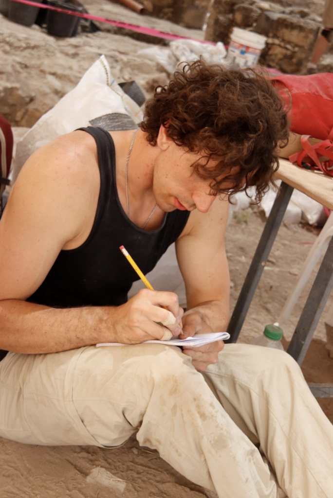
Zach taking notes at the site after a day of excavation.
As a part of the Huqoq excavation I was assigned to the area 3000 North, which was supervised by Dr. Rangar Cline of Oklahoma State University. This was the area that consisted mostly of the Northwestern sections of what was once the Late Roman synagogue and the Medieval synagogue. 3000 North was also where previously unexcavated mosaics were uncovered during this season. In 3000 North I learned a great deal about excavation techniques. Also, due to our proximity to the Late Roman mosaics, and the emphasis placed on finding material to date parts of the site, I frequently sifted the material we excavated. Sifting could be very exhilarating, such as when we would find artifacts that could possibly be used as dating evidence, but also heartbreaking, such as when tesserae was discovered, showing that sections of the Late Roman synagogue’s mosaic would not be preserved.
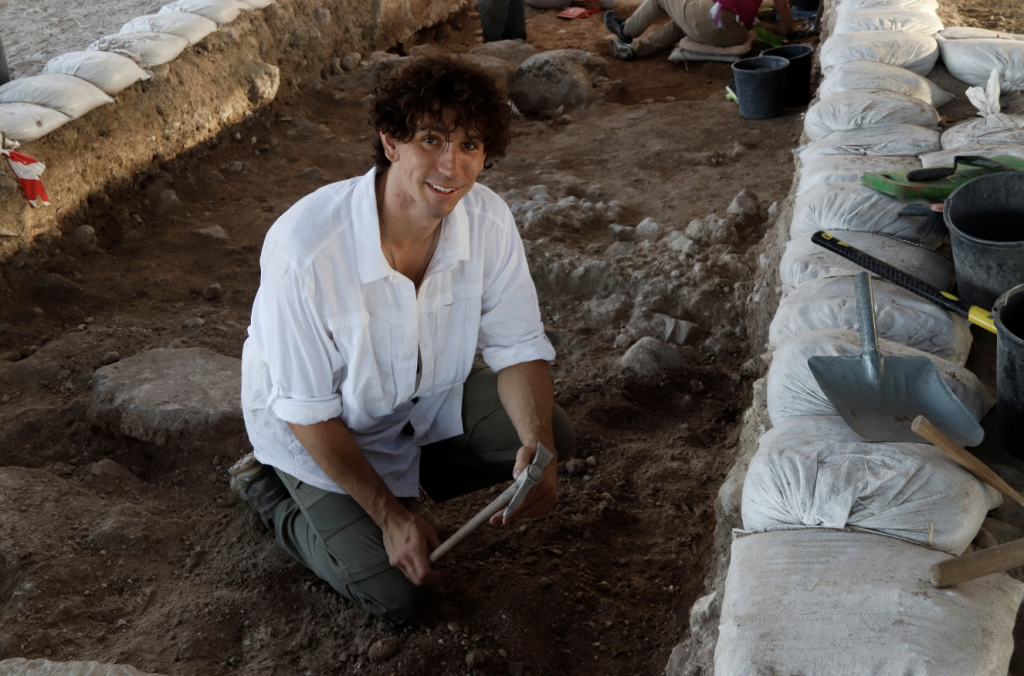
Zach excavating in 3000 North.
I greatly value the work I did under the direction of architecture specialist. Dr. Martin Wells. I assisted Dr. Wells by moving, washing, and recording various architectural fragments of significance to the excavation. Handling these pieces and gaining first-hand experience from Dr. Wells, I was able to learn a great deal more about the architecture and construction techniques in all phases of the site that we excavated. What is most memorable to me about Huqoq was how rewarding the process of reconstructing the Late Roman and Medieval synagogues could be’ even though it was a very difficult process. This can be highlighted by the way in which the builders of the Medieval synagogue reused material from the Late Roman synagogue, and it is from this reused material that we can gain more evidence of what the Late Roman synagogue may have looked like. In addition to all of the fieldwork, spending time with all of the individuals with the same passion for archaeology was amazing. I will have future colleagues and friends for life.
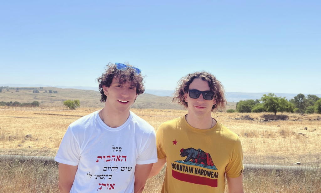
Zach (left) and his brother, Cayden (right), at the kibbutz.
Zachary Griffith is a Senior at Austin College, where he is majoring in Anthropology, Classics, and History. He also plays goalie for the water polo team at Austin College.
Want to help more students and early career archaeologists get into the field? Donate to the cause today by selecting “Excavation Scholarships” as your gift purpose!
Paul Richards, 2022 ASOR BIPOC Scholarship for Fieldwork Participation[/vc_column_text][mk_divider][vc_wp_text]Near East Archeology was a subject that, by title, I had not heard of until I started looking for a graduate degree covering ancient Israelite history. I knew archeologists went into the Middle East to do work, but I had not delved into more for the career field. After graduating from college with a BA in History I taught History in Cairo for 3 years at an American language high school. Then I taught ESL for 2 ½ years. While in Cairo I visited active dig sites. Visiting the sites sparked my interest in archeology.
When I started my Near East Archeology program at La Sierra University, I was excited for the upcoming dig. Because of the pandemic the normally scheduled dig season was canceled. I was determined to go the next season. By the time the next dig season came around the next year my finances were depleted. I applied for scholarships, and it is only due to being awarded the 2022 ASOR BIPOC Scholarship for Fieldwork Participation, that I was able to join the BRAP excavation trip.
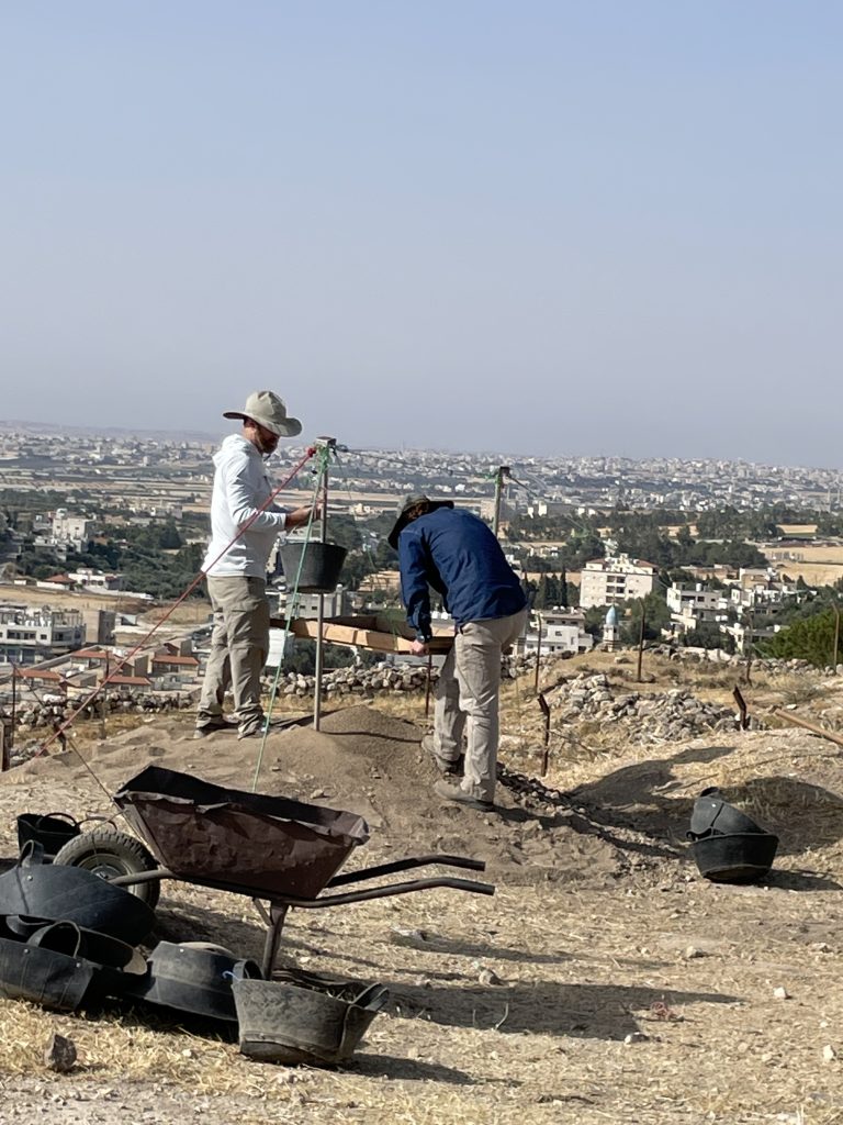
The experience was great. I had been to Jordan on a 30-hour layover before where I took the opportunity and toured around the immediate Amman area. For the excavation I signed up for the full BRAP dig season for six weeks. Being in the archeology classroom learning about archeology and working in the lab was much different than being in the field. While in the field I remembered terminology I had learned in class. It was a continual task matching the term I had learned in class with the meaning or action in the field. The work was hard but every day we dug up something significant to me as a first timer. Finding pottery was exciting. I quickly found out the dig veterans were very used to seeing pottery finds. The schedule was taxing but the finds everyday made it worth it.
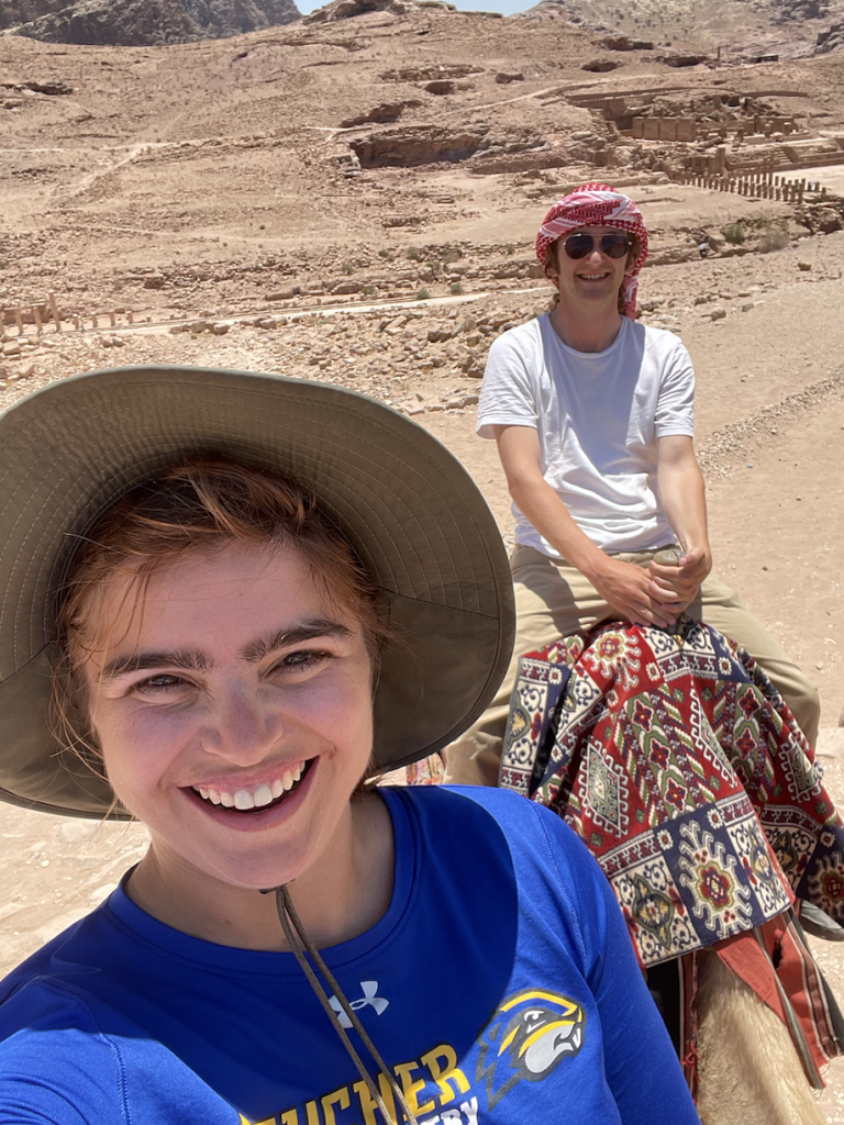
In the middle of the season, we went to Petra. I had heard of Petra for a few years and the reports from those who had visited made it sound like the ultimate travel destination for all Near East enthusiasts. Usually people exaggerate, this time the reports were accurate. It was better than going to Disneyland.[/vc_wp_text][vc_row_inner][vc_column_inner][vc_single_image image=”96209″ img_size=”full” add_caption=”yes” alignment=”center” onclick=”img_link_large” img_link_target=”_blank” css=”.vc_custom_1712002492498{padding-right: 10px !important;}”][/vc_column_inner][/vc_row_inner][mk_padding_divider][vc_wp_text]Archeology Becomes Personal
I grew up in and still am active in a distinct faith tradition. Previously my interest in ancient Israelite history had tilted my dig interest towards only going to Israel. I knew there was a lot to learn about ancient Israelite history from its ancient neighbors. Growing up myself in a culture and community where the stories of ancient Israel are accepted on a faith basis, it seemed almost automatic to gravitate towards Jerusalem. In a faith-based environment, especially for laypersons, activities of other ancient people groups are pushed aside and overlooked. It is a task of historians to help laypersons understand the study of Israel’s neighbors, and with proper archeology, enhance our academic understanding of faith-based stories.
The name Moab made a frequent appearance throughout the Old Testament of the Bible. A brief search rendered at least 18 times. The name originated, according to faith traditions, from one of the sons of Lot; Lot was Abraham’s nephew. The birth of Moab occurs in Genesis 19 along with his brother Ammon. The story includes some humiliating and salacious content. This son became the progenitor of the Moabites. The Moabites would become one of Israel’s major antagonists. King David in 2 Samuel 8:2 subjects the Moabites to servitude. Here again, a horrific scene takes place in the scripture tradition. In 2 Kings 3 Mesha King of Moab is mentioned as paying a heavy tribute to the Northern Kingdom. Mesha rebelled after the death of Ahab. The Mesha Stella, a significant find in Near East Archeology, describes a revolt against Israel.
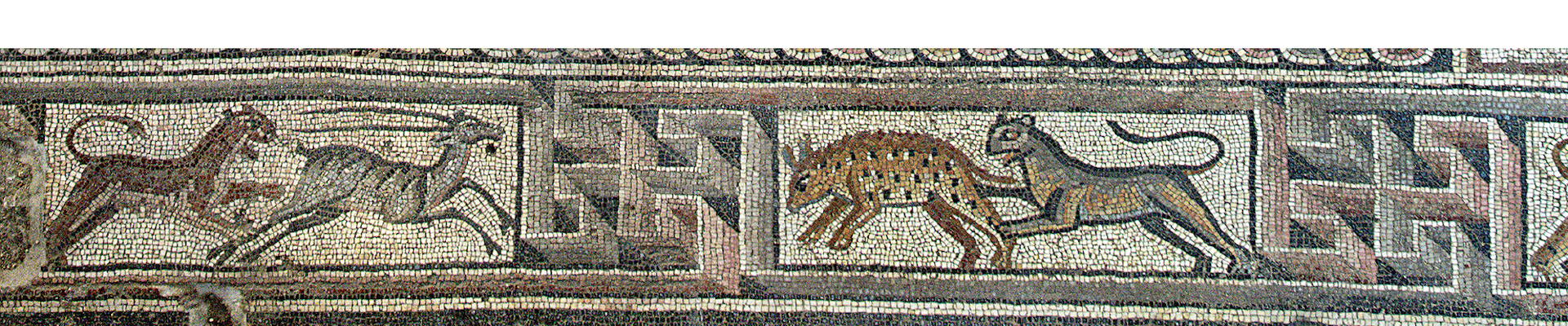
Many inscriptions describing victory may have the veracity of the victory legitimately questioned. This is due to the well-known desire of kings and nations to embellish the greatness of themselves and their people. In the case of Mesha it does appear the inscription holds weight. The Mesha Stella was found at Tell-Dibon, a site our team was able to visit.[/vc_wp_text][vc_single_image image=”96210″ img_size=”full” add_caption=”yes” alignment=”center” onclick=”img_link_large” img_link_target=”_blank” css=”.vc_custom_1712002888768{padding-right: 10px !important;}”][mk_padding_divider][vc_wp_text]Cultural Memory And The Story of Moab
Cultural memory is a topic I have delved into since the beginning of my graduate program. The reality of stories becoming exaggerated results in the need for teachers and writers to execute proper exegesis when dealing with historical topics. Exegesis is a term primarily heard of in theology. But the principal for the term is crucial for every research field.
Preconceived ideas need to be erased before proceeding in the research. During the research process the evidence must speak for itself. In a textual context, a word can be assumed to have one meaning, then with further investigation the researcher realizes the original speaker or writer had a different meaning in mind. This also applies to archeology. As taxing as the physical aspect of archeology is, it is crucial to dispel private ideas and interpretations that can result from classroom and reading work only.
The public figures inside well-known faith traditions have become known for mobilizing their base with shallow motivation. This motivation is often very loosely based on ancient text references. Many public figures use the texts blatantly out of context for private purposes. There is a dual danger in the faith community. One is those who carelessly use history to further an agenda. The other are those who are born into these agendas unawares. Both continue to propagate a false narrative. The latter falls victim to its own cultural memory.
In certain faith-based texts Ruth is the progenitor of King David, Ruth 4:22. Ruth was the daughter in-law of Naomi who became a widow and decided to follow Naomi back to her homeland. There is a parallel story line outside the traditional faith-based text, which teaches Naomi’s other daughter in-law Orpah, a Moabite went back to her people and gave birth to Goliath a Philistine. Goliath has become the stuff of legend. His bio has been stretched to create a superhuman villain that would match today’s comic books.[/vc_wp_text][vc_single_image image=”96211″ img_size=”full” add_caption=”yes” alignment=”center” onclick=”img_link_large” img_link_target=”_blank” css=”.vc_custom_1712003623857{padding-right: 10px !important;}”][mk_divider][vc_wp_text]And Finally
My time in the field has increased my interest in ancient languages. It has increased my interest in the facts of faith-based stories. While in the square my square mates and I had lively discussions over the topics presented above. By the end we were far from exhausting the matter. There will be more to debate and learn on the next excavation.[/vc_wp_text][mk_divider][vc_wp_text]Paul Richards holds a BA in History and a Minor in Communication Art from Oakwood University in Huntsville, AL. He lives in Southern California and is finishing his thesis at La Sierra University in Riverside, CA. Balu’a Regional Archaeological Project (BRAP) – Centers & Museum – La Sierra University. BRAP Jordan (@brapjordan) • Instagram photos and videos. Balu’a Regional Archaeology Project | Facebook.[/vc_wp_text][mk_divider][vc_wp_text]Want to help more students and early career archaeologists get into the field? Donate to the cause today by selecting “Excavation Scholarships” as your gift purpose!









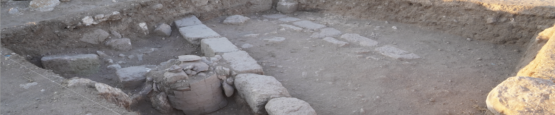
 The excavations of the loci on the northern side of the north wall revealed what we believed to be a storage jar, in situ, with its rim peeking just above the ground. We took a few days bringing the other loci into phase and then began to carefully excavate around the jar. As we dug lower the soil began to turn grey and ashy. Then as we dug flush with the bottom of the jar, we noticed the sides came down completely straight and it didn’t have a bottom. As it would turn out it was not a jar at all but a tabun cooking oven! After this revelation we decided to carefully collect and remove each of the pieces of the oven (as it was still in situ but completely shattered) and bag the soil within the oven to be floated for organic materials. The oven was made of a rough handmade ceramic, we believe to date from the Late Byzantine or Early Islamic eras. Another noteworthy find was a red bead nearby the oven. The bead is carnelian with delicate white paint design on it, as well as a bronze wire still attached to it.