Returning to Armenia: Excavations and Survey in Vayots Dzor
Aurora Camaño, G. E. Wright/Shirlee Meyers Fellowship Recipient
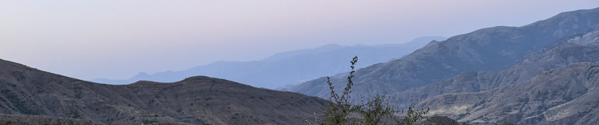
In 2010, while an archaeology undergraduate student, I participated in an archaeological field school in Vayots Dzor, Armenia at the well-known chalcolithic cave, Areni-1. That experience was my first taste of international travel and I fell in love with both Armenia and archaeology. However, it was not the chalcolithic history of the region that caught my attention, but the medieval churches and fortifications that still speckle the mountainous landscapes of Armenia. It was that trip that made me want to specialize in the medieval Near East and South Caucasus and set in motion the career path that I have since carved out for myself.
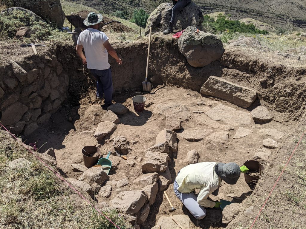
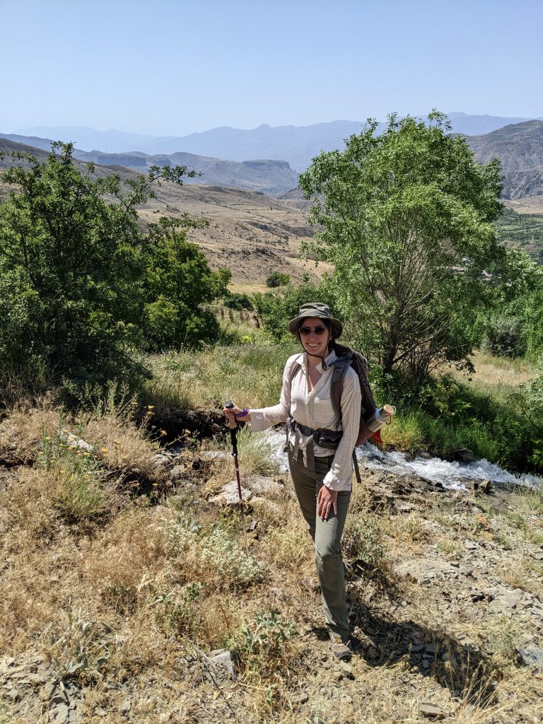
I have been fortunate to have worked in the field on a number of projects in the Near East and Mediterranean since that initial trip to Armenia in 2010, but it has always been a dream of mine to return. In 2020, I got in contact with Dr. Tiffany Earley-Spadoni regarding the Vayotz Dzor Fortress Landscape project, and we made plans for me to join the team. Shortly afterwards, the world shut down from Covid – but two years later, in the summer of 2022 we were able to make it happen. In July I flew from Canada to Armenia and returned for a summer of excavation and survey in the same small village that I worked in twelve years previous.
In the evenings, after coffee and sweets, the team had shared lab hours. I was assigned to help organize and record the pottery backlog from previous seasons, recording the details of all the diagnostic pottery finds from the site. Through this process we were able to better understand regional ceramic production, the different vessel and fabric types that frequented the site, as well as the local geology.
I was overjoyed to be able to return to Armenia, and deeply enjoyed my time in Vayotz Dzor working with the VDFLP team. Beyond the interesting archaeological work we conducted in Karaglukh, I enjoyed the many interesting conversations were had over delicious meals and homemade lavash in the village of Areni, strolls through neighbouring apricot orchards, and visits to the local 13th century church.
Aurora Camaño is a PhD Candidate in Archaeology at Simon Fraser University. She is a landscape archaeologist who specializes in built landscapes in the medieval Near East and South Caucasus. Her current dissertation studies landscapes of relocation in medieval Armenian Cilicia. She can be found on Twitter @AuroraCamano.
Want to help more students and early career archaeologists get into the field? Donate to the cause today by selecting “Student Support” as your gift purpose!
Safia S. Boutaleb, 2022 Eric & Carol Meyers Scholarship for Fieldwork Participation
I’d like to preface my report by saying that this trip was possible thanks to Dr. Eric and Dr. Carol Meyers, whose generous scholarship allows graduate students, like myself, to visit Cyprus and not only gain experience excavating but also form new, valuable connections. Thank you!
Tent on the roof of the old Peltenburg Archaeological Centre in Lemba
This report briefly describes my time in the 2022 field school led by Dr. Lindy Crewe at Kissonerga-Skalia (KS), a Bronze Age site in the Paphos region of Cyprus, dating from at least the Philia Phase (~2400 BCE) to the early Late Cypriot period (~1600 BCE). My experience in the field school was overwhelmingly positive and truly one of a kind. It complimented my previous field school experience in 2019 at Kalavasos-Ayios Dhimitrios, which sparked my love of Cypriot archaeology and the Bronze Age. I was admittedly anxious at first about my participation at Skalia due to some sudden and unexpected accommodation changes for the field school participants.
The new accommodations involved camping out in a tent on the roof of the old Peltenburg Archaeological Centre in Lemba for the month. However, after about one week in Lemba, I had adapted to my (very humid) surroundings and realized that the house in Lemba afforded us more independence and the opportunity to become better acquainted with Paul Croft, who resides at and cares for the Lemba centre. The house was beautiful and a place where generations of archaeologists have worked and stayed, making me feel like I had participated in some kind of tradition or initiation into the world of Cypriot archaeology. Moreover, the village of Lemba is an old, picturesque place in the hills overlooking the Mediterranean Sea and boasting thousands of years of human occupation (i.e., not a bad place to call home).
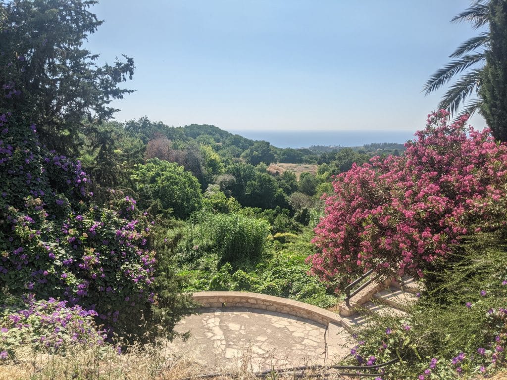
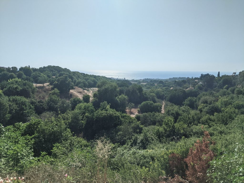
View of sea from Lemba
I was also grateful for the experience of excavating with Crewe and her team at Skalia. Crewe has assembled an eclectic group of supportive and intelligent archaeologists from all kinds of different backgrounds. Some of the supervisors and participants work in academia, others in commercial archaeology and some of them earn a living in entirely different fields. Regardless of their backgrounds, their expertise and experience at the site was invaluable and I greatly appreciated the diversity of their career paths, which can be rare in academic circles.
My own research and responsibilities at the site focused on the faunal remains at Skalia, an experience which I found to be both challenging and rewarding. My own familiarity with animal (and human) anatomy was unpractised, so I benefitted intensely from Croft’s sample collection of bones, which he allowed me to handle whenever necessary. Recognizing gaps in my anatomical knowledge, I did my best to support my team by cleaning and recording the bones, rather than making futile attempts to identify them myself. When errors were made in our records, I took initiative to stay behind and correct the mistake, a process which took two and a half days of work.
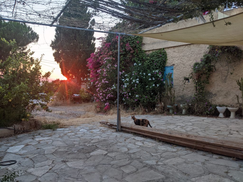
Lemba Sunset
View of sea from Lemba
Safia excavating in the field
My honest pride and joy for the season was my work on the floor of Area P/B. I genuinely love field work and I was overjoyed to have found the floor, as I recognize its significance in understanding the basic layout and stratigraphic occupation of a space. Thanks to my cautious work, Muti assigned me responsibility over the floor for about two weeks. A number of my peers came and joined me but none seemed to enjoy it as much as I did. It seems trivial to take such pride in excavating a floor but I remembered how challenging it was to find at Kalavasos-Ayios Dhimitrios and the experience of being able to differentiate tamped earth from mud plaster floor provided me with a skill that I had not anticipated I’d acquire this season. I also felt supported and recognized for my efforts, as the team awarded me the “golden trowel”, one of the many superlative awards given at the end of the field season.
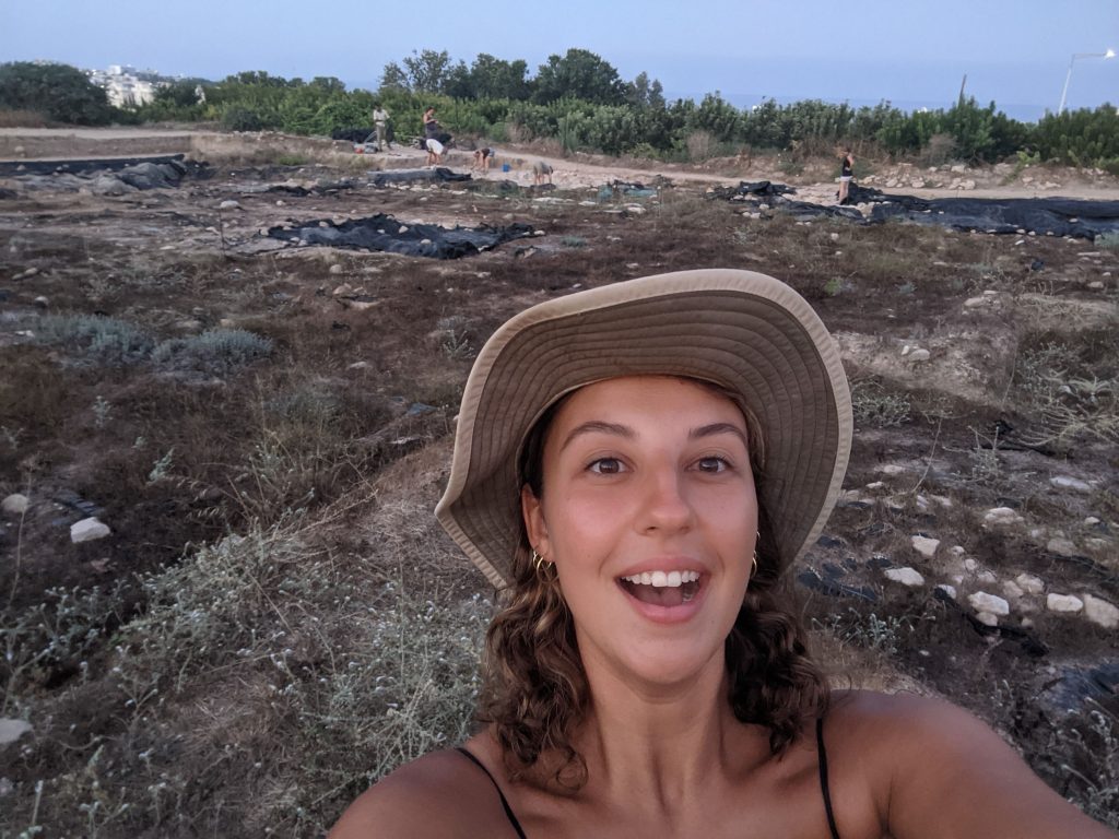
Safia's last day in field!
I would relish the opportunity to return to Kissonerga-Skalia and I am grateful for the experience of meeting and excavating with such an incredible team of professional archaeologists, who taught me not only how to excavate but also showed me that there is more than one path to becoming an archaeologist and that, when in doubt, it is possible to pave your own.
Safia Boutaleb (she/her) is a graduate student completing her Masters of Classical Archaeology at The University of British Columbia in Vancouver, Canada. Her thesis focuses on women’s economic participation in Cyprus during the Late Bronze Age and the many ways their activities in daily life remain overlooked in scholarship of ancient economy. Kissonerga-Skalia 2022 was her second field school in Cyprus she has hopes to return to the island each year to research and participate in field work.
Want to help more students and early career archaeologists get into the field? Donate to the cause today by selecting “Student Support” as your gift purpose!
2022 Study of Collections Fellowship Report: Imprints of the Past: Preserving the Largest Known and Uncatalogued Collection of Semitic Artifacts in Europe
James D. Moore, Humboldt Universität zu Berlin
For many years, I have collaborated with the French Institute’s, Cabinet du Corpus Inscriptionum Semiticarum (Cabinet-CIS) within the Académie des Inscriptions et Belles Lettres, and in 2022 an ASOR Study of Collection Fellowship provided me startup funding to seed an ambitious attempt to build the Cabinet-CIS a digital inventory database and begin the process of cataloguing and digitally preserving one of Europe’s most important collections of Semitic artifacts. At the invitation of Christian Robin and Maria Gorea, I was able to complete the build for the collection’s database during two week-long trips to the Cabinet-CIS. This database is now used by scholars and students working on the collection.
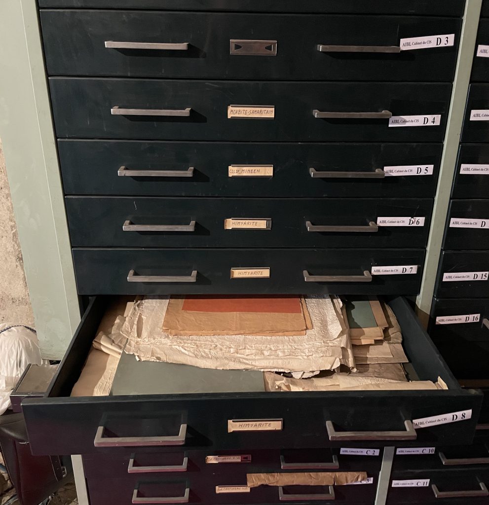
The Cabinet-CIS is known for publishing two monumental series through the late nineteenth and mid-twentieth centuries, the Corpus Inscriptionum Semiticarum and the Répertoire d’épigraphie sémitique. Those compiling these works were sent paper mâché squeezes of the inscriptions in those volumes and in some cases photographs along with detailed descriptions. The collection holds an estimated 10,000+ paper mâché squeezes of Semitic inscriptions from the Near East, North Africa, and the Mediterranean. In some cases these squeezes are of inscriptions which are now lost or inaccessible (due to their location in politically contested regions). Additionally, the collection holds hundreds of original objects and dozens of dossiers of many of the field’s most important figures, such as that of Charles Clermont-Ganneau. Unfortunately, the collection is only loosely organized into boxes and cupboards, for which a short inventory had been compiled.
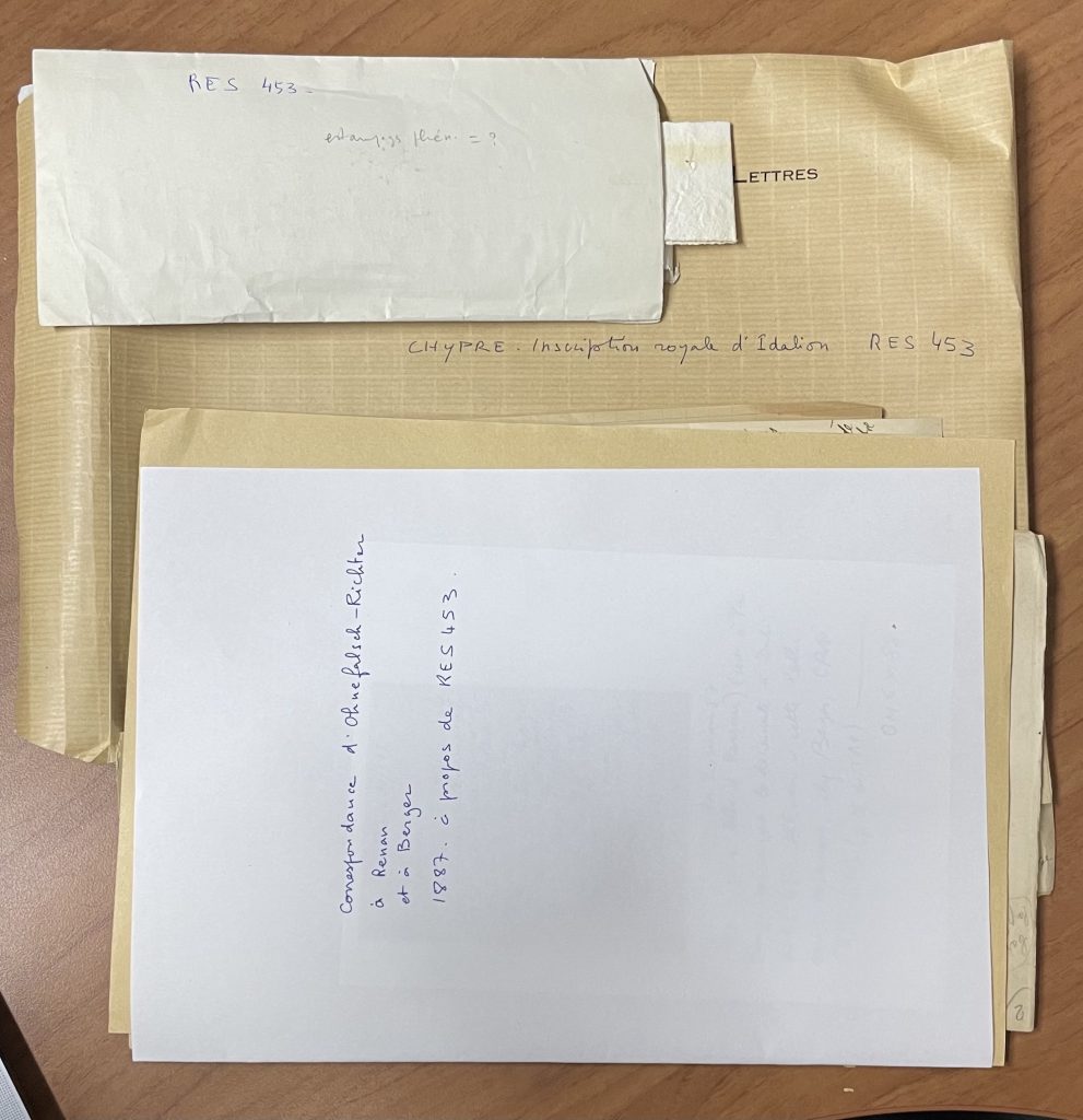
Example of archival materials with squeeze in AIBL-CIS Dossier 12, Chypre 1.
Credit: James D. Moore and Maria Gorea
Example of flat-file storage of Semitic squeezes.
Credit: James D. Moore and Maria Gorea
Although the work was hindered by continued difficulties traveling, due to residual effects of the COVID-19 pandemic, a mid-year trip to the Cabinet-CIS allowed me to assess the needs of the collection and survey its holdings. During that week I built a prototype SQL (PostgreSQL) database and local application which was tested by those working on the collection, specifically Maria Gorea’s students Noémie Carpentier and Narmin Sadykhova. Over the course of many months, I fine-tuned the prototypal database, and at the end of the year, during a second trip to the Cabinet-CIS, I rebuilt the database on the Huma-Num servers using the Heurist database management system, an Open Source information system builder and website publisher developed specifically for Humanities research data. The result is an easy to use inventory database for the Cabinet-CIS’s internal use (though the intention is to make the data accessible through a future website should continued funding be acquired). Here I must thank the Heurist team, in particular Ian Johnson and Michael Falk, for their support and advice along the way.
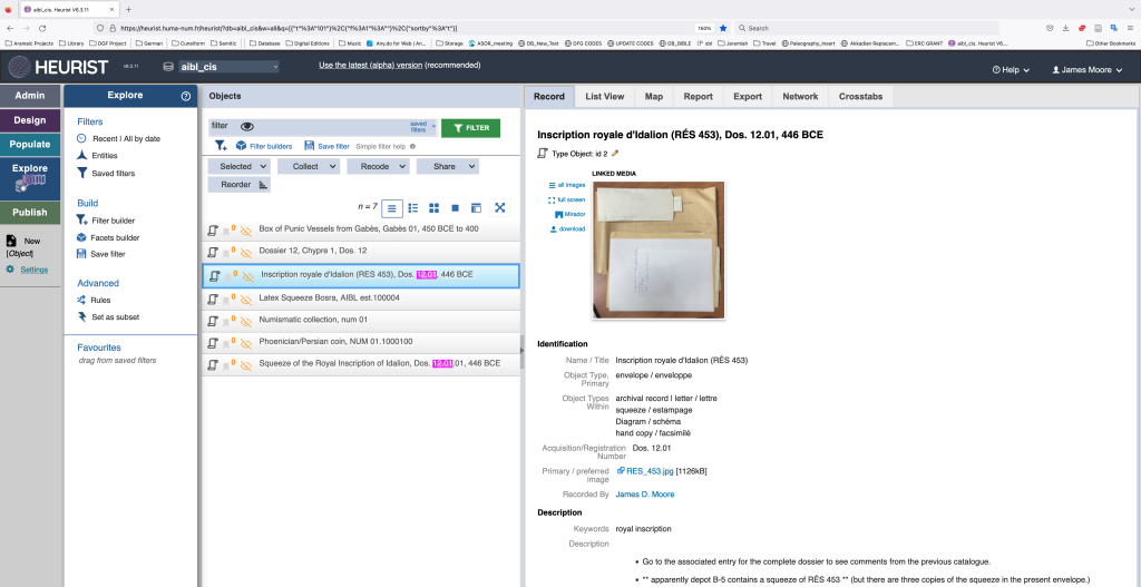
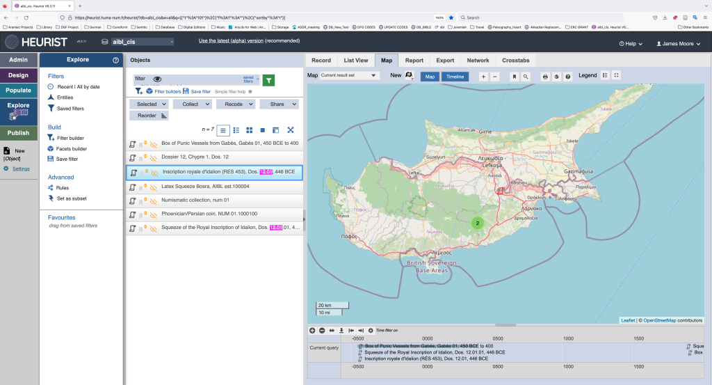
The database includes record entries where all necessary information about an object in the collection can be stored, including metadata, text, and translation. Each entry includes mapping a timeline features for the object along with additional media storage that can be linked to the object.
Example of a database entry’s “Record” for AIBL-CIS Dos. 12.01.
Example of entry’s “Map” (and timeline) for AIBL-CIS Dos. 12.01
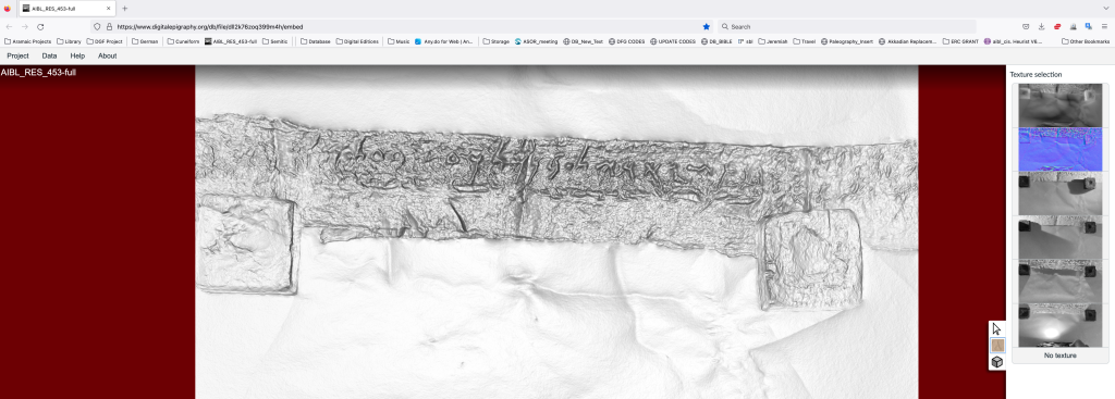
Linked media to the 3D rendering of squeeze AIBL-CIS Dos. 12.01 in the Digital Epigraphy User Interface (see below)
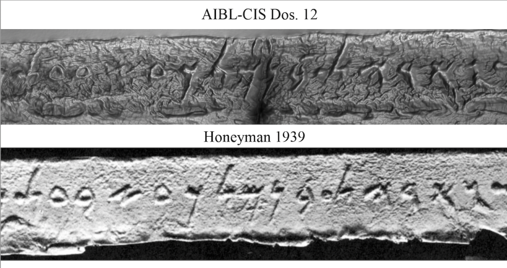
The ultimate objective was to initiate the process of digital preservation of the squeezes and other artifacts. To achieve this, I solicited the support of Angelos Barmpoutis of the Digital Worlds Institute and Eleni Bozia of the Classics Department at the University of Florida, whose Open Source Digital Epigraphy software proved to be an ideal application for our needs. By using scans from a flatbed scanner or raking light photographs one can easily render 3D scans of the squeezes. An example of AIBL-CIS Dos. 12.01.01 “Inscription royale d’Idalion” (446 BCE = RÉS 453; squeeze made in 1887) can be found here.
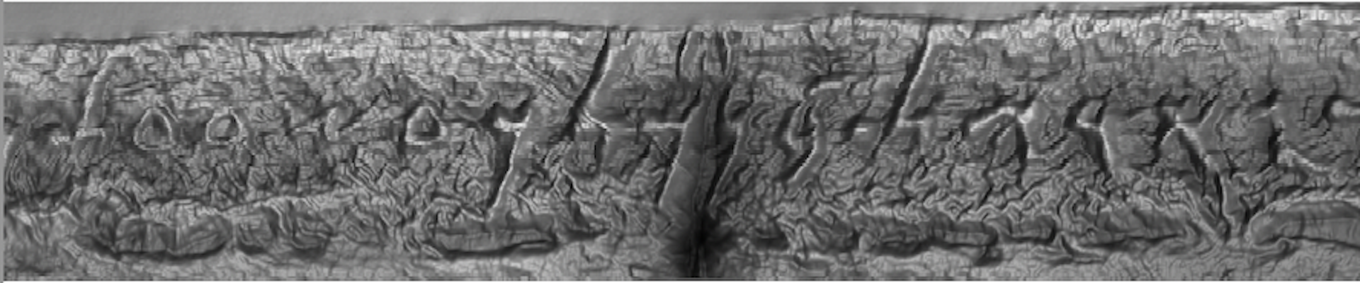
Manipulating the photograph using the Digital Epigraphy’s user interface produces the best known available photograph of the inscription. Compare the previously published photograph to that made during our cataloguing efforts.
Upper photograph of squeeze AIBL-CIS Dos. 12.01.01 made in 1887 depicts the contures of the inscription verses the lower photograph of a sqeeze made and published in 1939 by A. M. Honeyman, “The Phoenician Inscriptions of the Cyprus Museum,” Iraq 6: 104–8.
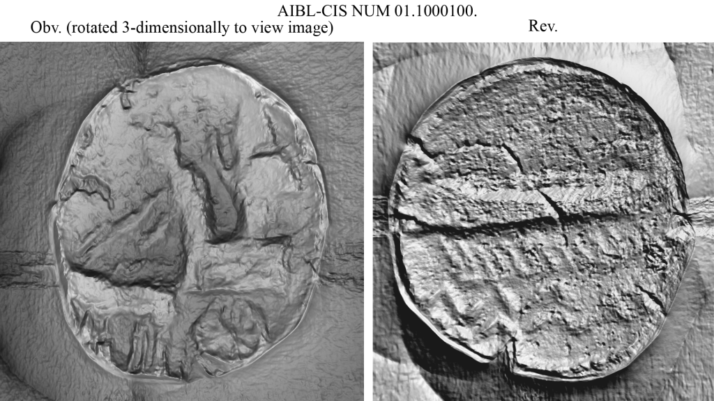
The Cabinet-CIS’s Heurist database and Digital Epigraphy software has far reaching applications for the collection. While one of Maria Gorea’s students, Noémie Carpentier, was working on the Cabinet-CIS’s numismatic collection, I trained her in how to use the software to produce 3D renderings of coins. We scanned the following example of a worn Phoenician (Tyrian) coin minted during the reign of Artaxerxes III (AIBL-CIS NUM 01.1000100), and the 3D rendering makes visible the coin’s features, which are invisible to the eye. You can view the coin using the Digital Epigraphy user interface here:
Credit: Original photographs by James D. Moore, Maria Gorea, Noémie Carpentier, and Narmin Sadykhova. Rendered and displayed using the Digital Epigraphy software.
The consorted efforts of all those mentioned above and the support from ASOR allowed us to achieve our objective of building a digital infrastructure for the Cabinet-CIS with which the digital preservation of its invaluable collection can begin.
Additional Notes The long days spent at the Cabinet-CIS also afforded me opportunities to further my own research. Maria Gorea and I have long teamed up to publish important manuscripts in the Cabinet-CIS, and we used time to finalize manuscripts for a number of publications on two new Phoenician papyri accounts which radiocarbon date to the Persian period, fragments of Aramaic papyri from Elephantine, and a new Aramaic religious text from Egypt radiocarbon dated between the 2nd and early 4th centuries CE.
“AIBL-CIS de Ricci no. 2: A New Jewish and Aramaic Religious Text from Egypt Dating between the 2nd and Early 4th Centuries CE” Dead Sea Discoveries, forthcoming
“New Persian Period Phoenician Papyri Accounts from Egypt in the Académie des Inscriptions et Belles-Lettres, Cabinet du Corpus Inscriptionum Semiticarum,” in Advances in Elephantine and Persian Period Research, eds. J. Moore and P. Schmidtkunz, Studies on Elephantine (forthcoming).
“Radiocarbon Dating an Aramaic Papyrus from Elephantine and a New Aramaic Fragment from the Académie des Inscriptions et Belles-Lettres, Cabinet du Corpus Inscriptionum Semiticarum,” in Advances in Elephantine and Persian Period Research, eds. J. Moore and P. Schmidtkunz, Studies on Elephantine (forthcoming).
“Papyri semitiques du Cabinet du CIS,” Comptes rendus des séances de l’Académie des Inscriptions et Belles-Lettres, Communication of the AIBL 16 April 2021.
J.D. Moore, New Aramaic Papyri from Elephantine in Berlin, Studies on Elephantine 1 (Leiden: Brill), 2022; Open Access: https://brill.com/view/title/61396. (pp. 16–17)
Andalusian Agriculture: A View from Medieval Menorca
Kathleen Forste, 2022 P.E. MacAllister Scholarship for Fieldwork Participation
Thanks to the ASOR Scholarship for Fieldwork Participation, I was able to join the Menorca Archaeology Project (MAP) in Spain to excavate a portion of the medieval settlement at the site of Torre d’en Galmés. This rural 13th century Islamic village, or alqueria, is built atop and abutting (and certainly borrowing from) the ruins of a large post-Talayotic (Iron Age) settlement, and by studying it we can better understanding what life was like during this period and how medieval lifeways have influenced later periods of life on Menorca.
I am the archaeobotanist on the team, meaning I study plant remains like wood charcoal, seeds, and plant parts. The analysis of these remains can help us answer questions about diet and foodways, the crops that people grew and the wild plants they collected, and the types of plant materials they used to build their houses and fuel their fires.
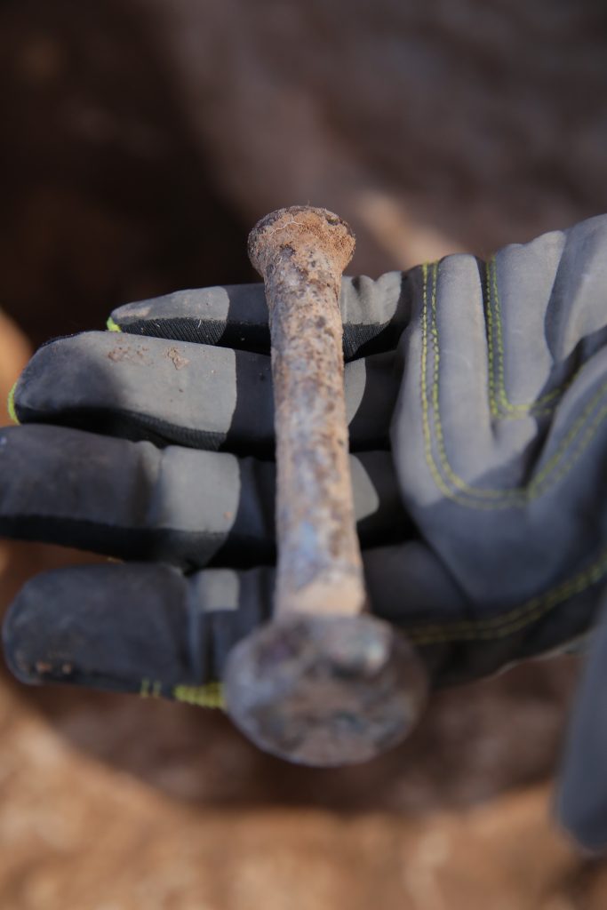
This season, our excavation focused on two houses, one of which was so well-preserved that the plaster on the interior walls and floor were still intact. These houses were built in the typical form of Muslim houses – multiple rooms formed an L that bordered 2 sides of a patio, which was enclosed by 2 other walls to create a private area for the family to relax and perform everyday tasks such as cooking and carding wool to make yarn. The room that was excavated we are interpreting to be a kitchen, based on the presence of hearths, grinding stones, cooking vessels, as well as parallels in construction to other excavated houses of this era. We also found bronze nails just inside the threshold, hinting at the wooden door that would have graced this entryway.
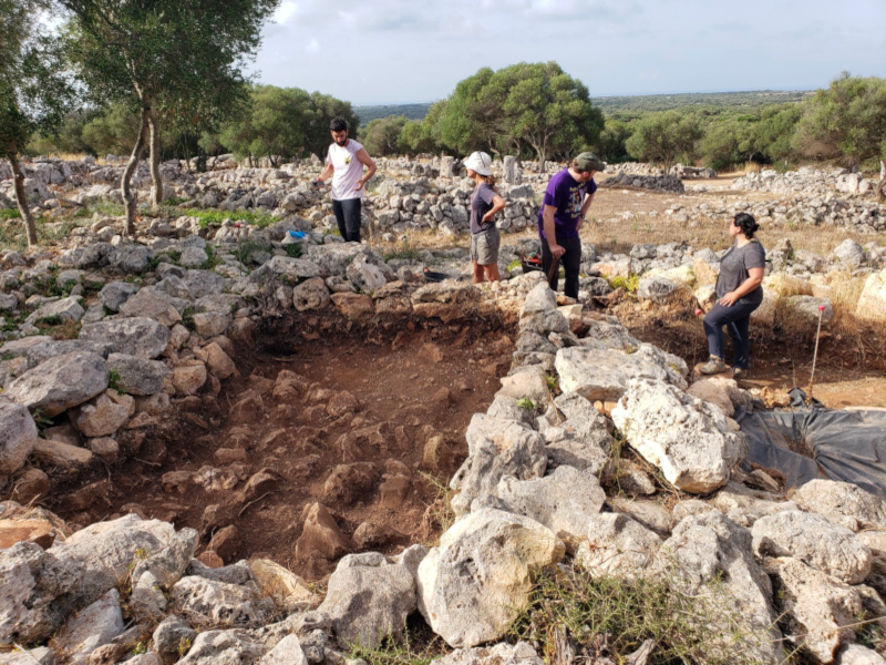
Beginning our excavation of a medieval Islamic house, surrounded by ruins of other medieval houses and post-Talayotic buildings.
Excavating the east wall of the kitchen. Note the white plaster to the right of the author (middle), and the partially-excavated patio in the background.
The kitchen looking east. Moving left to right you can see the plaster floor, inlaid grinding stone and hand-held grinder in situ, and the doorway (undergoing excavation) that led out to patio.
We recovered carbonized plant remains through flotation, a method of using water to separate carbonized plant remains and microartifacts from their surrounding soil matrix. I built a new flotation tank for the project, and trained team members in this method. I will begin analyzing the plant remains from this season during the academic year, and based on findings from the previous season, I expect to find barley (which is a hardy crop that grows well in hot rocky areas and requires a moderate amount of water) and pulses like lentils and chickpeas (which grow best in cooler temperatures and require moderate amounts of water). Based on the growing requirements of these crops, we can begin to hypothesize which types of habitats Menorcan farmers selected for their fields.
The kitchen looking north. The plaster floor is exposed in the eastern portion (R-hand side) beneath the compacted occupation debris and collapse (intact in the western portion, L-hand side).
Teaching MAP team members how to recover plant remains and microartifacts through flotation.
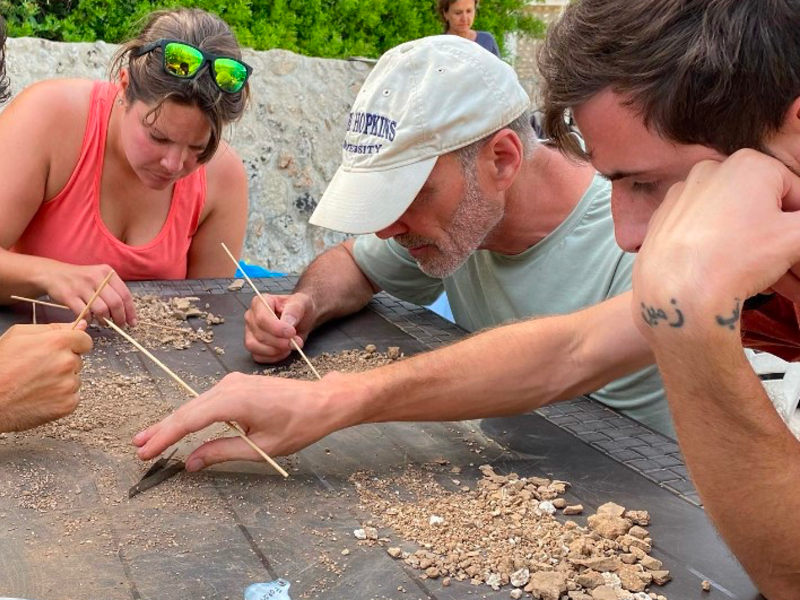
MAP team members sorting the heavy fraction to recover microartifacts like fish bones and small plaster fragments.
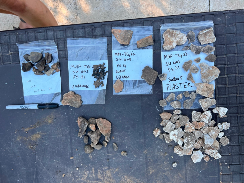
Artifacts recovered from flotation, including lots of wood charcoal (second bag from the left).
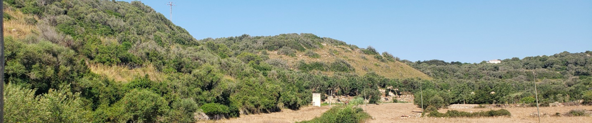
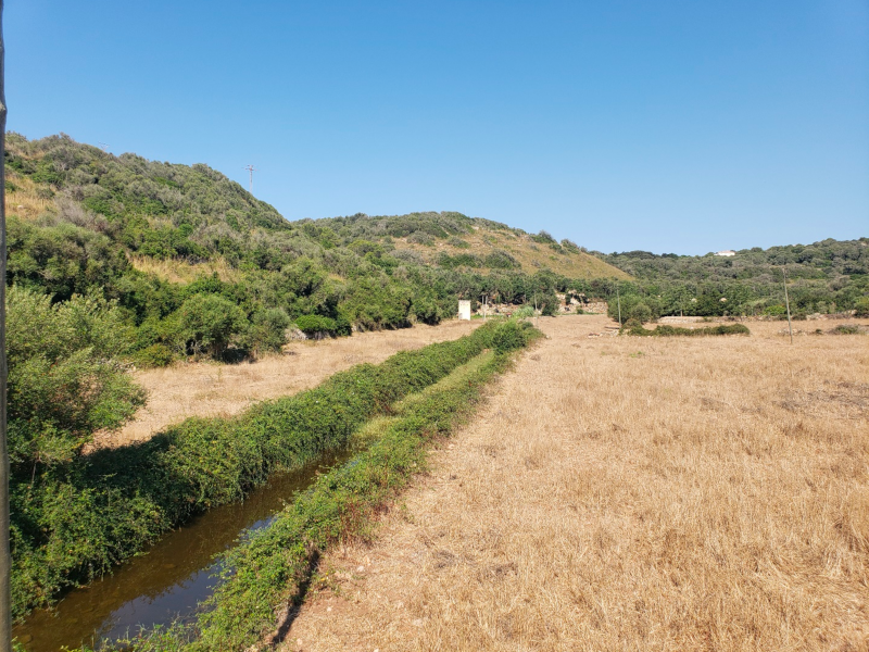
Some of the agricultural engineering of the medieval era is still functional today, like this irrigation canal in a barranco(valley) that waters orchards and fields, creating a direct line between ancient and modern land-use practices.
Flotation was one of the methods employed to understand the way in which the medieval inhabitants managed their surroundings, along with mapping and 3D modeling structures and open spaces linking them. Through this multidisciplinary research we will be able to reconstruct the rhythm of life of medieval Menorca, and the ways in which people cultivated and built their landscapes.
Check out more about our project on Instagram: @MAProject360
Kathleen Forste is an anthropological archaeologist who studies agricultural systems through the analysis of archaeological plant remains, historical sources, and environmental data. Her research focuses on how societies adapt their agricultural systems to various environmental and socioeconomic conditions during the Islamic period (7th through 13th centuries) in the Levant and Iberia. She earned her PhD in 2021 from Boston University, where she is currently a Lecturer of Archaeology.
Want to help more students and early career archaeologists get into the field? Donate to the cause today by selecting “Student Support” as your gift purpose!
ASOR is excited to announce that the 2023 ASOR Annual Meeting is going hybrid!
Instead of holding a separate virtual component in October, ASOR will hold a hybrid meeting with both virtual and in-person participation, November 15–18, at the Hilton Chicago. Feedback from members on the survey circulated by the ad hoc Committee on Climate Impact (Ad Hoc Climate Impact Committee Report) and discussion with many members at the Boston meeting led us to make this change for 2023.
What this means is that all sessions (and workshops, when feasible) will be able to include both in-person presentations in Chicago and virtual presentations online via Zoom. Virtual attendees will have the ability to view and listen to in-person and virtual speakers in real time. Virtual presenters will speak in real time when presenting; if they have a PowerPoint presentation, that will be projected by the session room’s ASOR facilitator to appear on the screen in the meeting room and online via Zoom (virtual presenters will be able to advance their own slides). All presenters (in-person and virtual) will be asked to send in their PowerPoint file (only slides, not a pre-recorded presentation) by Sunday, November 12. Sessions will be recorded and available online for a limited time after the meeting.
The meeting rooms in Chicago will not be set for a fully two-way hybrid experience, meaning that there will not be a view of the room/audience or synchronous discussion between virtual and in-person attendees. Virtual attendees will need to submit their post-presentation questions via the Zoom chat feature and the ASOR facilitator will read them to the presenter.
Program participants and meeting attendees have told us that scheduling time for ASOR two months in a row is difficult, but also that it is important to continue offering an option for virtual participation for those who can’t attend the meeting in person. We hope that offering a hybrid format will be an inclusive and welcomed option for all. If you have questions or concerns about the format, Arlene Press (meetings@asor.org) and Jared Koller (jaredkoller@asor.org) are here to help. You can also reach out to the Program Committee Co-Chairs, Allison Thomason and Kiersten Neumann (pc.chairs@asor.org), if you have questions pertaining to the academic program
With great excitement, all of us at ASOR look forward to seeing you in November online and/or in Chicago.
2022 William G. Dever Fellowship Report: Krysta Fauria
My first summer as a PhD student proved to be one of the most enriching summers I have had. I traveled to Israel for my first archaeological dig in May, and then spent a month at the W.F. Albright Institute of Archaeological Research in Jerusalem. These experiences were made possible through my funding from ASOR’s Dever Fellowship, which is designed for biblical scholars seeking to gain experience in archaeology. I did fully not comprehend the importance of studying material culture until I began my doctoral program in religion at the University of Southern California last year. As I began to recognize the need for scholars of Early Christianity to understand and, when possible, participate in archaeology, I sought ways to find funding to gain this experience. I discovered that Mark Letteney, a postdoctoral fellow at USC at the time, was on staff at the Jezreel Valley Regional Project. JVRP was leading an excavation in May through their Legio Project, which sought to uncover an amphitheater at the military base once occupied by the Roman VIth Ferrata Legion.
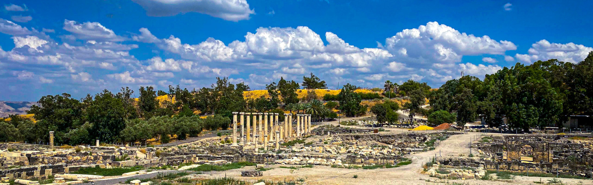
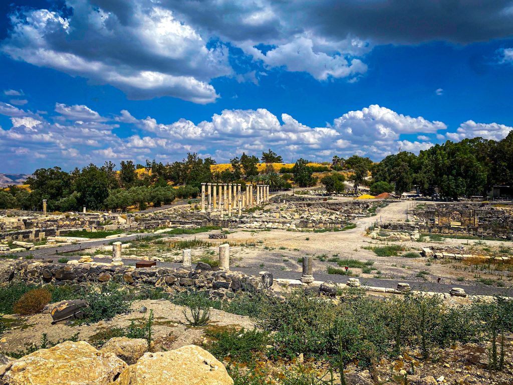
Beit She'an
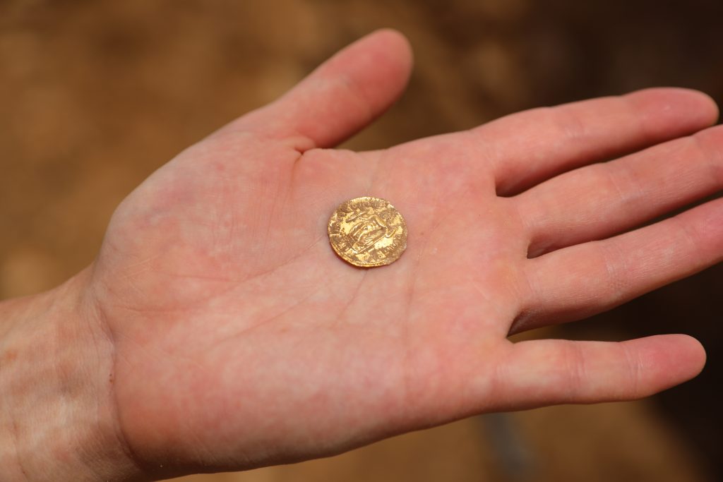
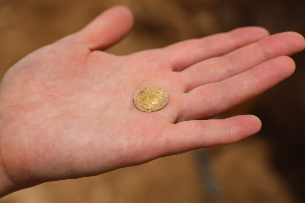
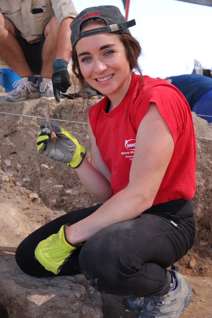
The dig was even more enriching than I anticipated. I gained a robust understanding of the methodology and tools used, as well as the post-excavation processing of artefacts. Moreover, I assisted the area directors with some of the more technical aspects of the excavation, including conducting photogrammetry and operating the total station. These experiences helped me gain a more thorough understanding of archaeological modeling and analysis. I personally uncovered a handful of significant finds, including an intact perfume vessel made from Roman glass, as well as a gold coin in near-perfect condition. The coin was minted under Diocletian in 295 CE and was the first dated item we found on the dig.
Coin found from 295 mentioned in the report (side 1)
Coin found from 295 mentioned in the report (side 2)
Krysta Fauria holding a Roman perfume vessel
Close up of the Roman perfume vessel
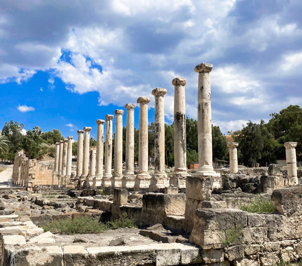
I also spent a significant amount of time visiting additional archaeological sites across the country and Palestine. Some of the sites that stood out as being particularly informative for my research were Megiddo, Beit She’an, Qumran, Herodion, and Caesarea, as well as the remains of the Second Temple and the City of David in Jerusalem.
It is difficult to overstate the ways in which my scholarship will benefit from this trip. For example, one way that studying the material remains informed my current understanding of the Second Temple and Roman Period is that it illustrated the ways in which the Judeans of this time were deeply entrenched in so-called Greco-Roman culture. While recent scholarship has had no shortage of critiques on conceptions of Hellenistic Judaism, I was able to comprehend this critique in new ways after seeing how Jewish people in antiquity co-existed with other Mediterranean inhabitants.
Herodion
This experience gave me an appreciation for the diverse areas of expertise needed to make an excavation possible. In a time when scholarship is seeking to become more collaborative and interdisciplinary, it seems prudent to look to the field of archaeology, which has long relied on scholars from a variety of disciplines and specializations. I hope to return to Israel and to hopefully go on another dig soon.
Beit She'an
Krysta Fauria is a second-year PhD student at the University of Southern California studying early Christianity and the Synoptic Gospels. Prior to beginning her program at USC, Krysta was a journalist covering politics and breaking news for The Associated Press in Washington, DC and Los Angeles.
Dig Cyprus: A Story of Cherishment, Craziness, and Cats
Noah Barton, Undergraduate University Student[/vc_column_text][mk_divider][vc_wp_text]
This summer I had the pleasure of attending an archaeological field school in Cyprus with North Carolina State University. The program – Cyprus Archaeological Field School – is directed by two of my past professors and has been occurring yearly since 2017. I arrived in Cyprus on May 20, 2022. The island is beautiful; every turn has a clear blue ocean, incredible mountains and hillsides, or luscious forests. A pleasant surprise was that Cyprus is loaded with wild cats – there are more cats on the island than humans, in fact – and most of them are friendly. The only downside is that it was very humid, but that’s to be expected for an island near the Middle-East in June.
The archaeological site I helped excavate is called Makounta-Voules, which appears to have been the home of a copper-mining group between 5000 and 7000 years ago. They used stone tools and had a large interest in picrolite – a bright green stone – which they sculpted into figurines and pendants. In addition to picrolite, our team also searched for evidence of stone tools and pieces of pottery (also known as sherds), bone (human and non-human), and shells that were used to create jewelry.[/vc_wp_text][vc_row_inner][vc_column_inner][vc_single_image image=”96093″ img_size=”full” add_caption=”yes” alignment=”center” onclick=”img_link_large” img_link_target=”_blank” css=”.vc_custom_1711651992536{padding-right: 10px !important;}”][/vc_column_inner][/vc_row_inner][mk_padding_divider][vc_wp_text]
Every morning, I woke up at 4:20 am and got on a bus with all the other students. We went straight to the site and started working right away. The entire team was divided into groups of four, with three students and one supervisor. The archaeological method of digging is very systematic; each group dug a hole that was square-shaped and 4 meters wide, known as a trench. We usually dug five centimeters down at a time across the entire surface of the trench before digging any farther. In each group, the students worked together to break up the compact dirt with a pickaxe, shovel up all the newly-made piles of loose dirt, and sift through that dirt to find artifacts. We also straightened out the walls of the trench, known as balk walls. After the team got back to the hotel and ate lunch, we spent an hour or two washing the artifacts that we dug up. This was done by scrubbing them with a toothbrush and soaking them in water. About three nights per week, we also had a lecture that was given by one of the supervisors. The topics ranged from the entire history of Cyprus to different processes and ethics in archaeology.
Every Friday we took a break from digging and went on field trips. During each trip, we visited at least one excavated archaeological site, one museum, and one local beach (except Nicosia). In Nea Paphos, we visited Kissonerga and Lemba, the Paphos museum, and Vardas beach. In Palaepaphos, we visited Prastio and Souskiou, Aphrodite’s temple, and Petra Tou Romeou beach, which is the legendary birthplace of Aphrodite. In Kourion we visited Kolossi, the Kourion museum, and Kourion beach. While in Nicosia we visited the Cyprus Museum, which was the most expansive museum of all.
Every Saturday was a free day for the students to do whatever they wanted. On the first free day, my friends and I went on a cruise, where we saw incredible views on the ocean and swam in the clear blue Mediterranean sea. On another free day, my friends and I hiked up Aphrodite’s trail, revealing the best views of the entire trip. I didn’t make any excursions on my fourth free day. Our fifth free day was spent in Nicosia, the country’s capital. My friends and I explored the city and later celebrated one friend’s birthday at bars and clubs.
On the final day, most students took a final exam; I did not as I didn’t need credit for an Anthropology major, and instead wrote two research essays to get credit for my History major. I left Cyprus on June 25, 2022, ending a wonderful five weeks of excavation and adventure.
Noah Barton is a senior at North Carolina State University, double-majoring in International Studies and History and minoring in Latin. He lives in Raleigh, North Carolina and enjoys history, music, and traveling.
[/vc_wp_text][mk_divider][vc_wp_text]Want to help more students and early career archaeologists get into the field? Donate to the cause today by selecting “Excavation Scholarships” as your gift purpose!
Erin Brantmayer, 2022 Stevan B. Dana Scholarship Recipient[/vc_column_text][mk_divider][vc_wp_text]The summer of 2022 saw my fifth year of archaeological work in Israel. A typical summer abroad for me is four to six weeks of very physical work excavating under the hot Levantine sun, but things were a bit different this time. At the Roman and Byzantine site of Birsama, an unexcavated fort and associated settlement area nestled into the region where the Mediterranean coastal plain meets the arid Negev Desert, I and four other sure-footed archaeologists spent two weeks walking around. Our walks, or transects, were along parallel lines about 700 meters long, north to south, covering an area about 250 meters wide east to west. Along these transects, we recorded pottery strewn on the ground’s surface and collected diagnostic sherds – broken pieces of handles, rims, and bases.
These activities were the meat of our preliminary survey. Surveys conducted before excavation are usually done to help archaeologists get a sense of the area they will be digging and to target areas of high interest. For us, high interest in this case meant the area of the fort and the space adjacent to the fort where people would have lived. Additionally, we located some areas with exposed and disturbed architectural elements, including some wall foundations churned up by agricultural vehicles associated with the nearby peanut farm and a few column fragments.
But fieldwalking wasn’t our only survey component – we also did extensive aerial mapping. My archaeological work applies GIS (geographic information science) and drone- and camera-based photography to ancient sites to better understand the spatial relationships that are often harder to see on the ground. This work is incredibly useful for surveying because it is sometimes easier to see features, like buildings, from the air.
[/vc_wp_text][vc_single_image image=”95994″ img_size=”full” add_caption=”yes” alignment=”center” onclick=”img_link_large” img_link_target=”_blank” css=”.vc_custom_1711554000085{padding-right: 10px !important;}”][mk_padding_divider][vc_wp_text]Using a drone equipped with an RTK module, I took over 2,500 pictures to create an orthomosaic of the nearly one square kilometer that comprises our study area. This is awesome because an RTK (real-time kinematic) DGPS is a type of global positioning system that is accurate at the sub-centimeter level – for reference, your phone is only accurate within five meters! So, a drone with RTK is about 1,000 times more accurate than your average GPS app. That accuracy is built into the orthomosaiced images – multiple overlapping photos that are stitched together to create one larger, continuous image. The result is pinpoint accuracy and incredible detail in a single map, from which features and points of interest can be marked and examined.[/vc_wp_text][vc_single_image image=”95995″ img_size=”full” add_caption=”yes” alignment=”center” onclick=”img_link_large” img_link_target=”_blank” css=”.vc_custom_1711554502413{padding-right: 10px !important;}”][mk_padding_divider][vc_wp_text]Our two weeks in the desert were not without their difficulties – survey can be a hard learning curve when you’re used to digging a square. Finding a program to track our fieldwalking was initially difficult, but I did eventually find an app that could track movements, worked on both Androids and iPhones, didn’t need an internet connection, and was free. I also struggled with learning a new system. That awesome RTK drone was one I’ve never used before. I spent eleven of our twelve days at Birsama trying to figure out how to get the system to work, battling through RTK connection errors, malfunctions, thousands of photos not writing to an SD card, and getting the car stuck at 8 PM in the desert four hours before driving to the airport. Everything was eventually unstuck, literally and metaphorically. Just took some perseverance and a crack team of five sure-footed archaeologists.[/vc_wp_text][vc_single_image image=”95996″ img_size=”full” add_caption=”yes” alignment=”center” onclick=”img_link_large” img_link_target=”_blank” css=”.vc_custom_1711554594647{padding-right: 10px !important;}”][mk_divider][vc_wp_text]Erin Brantmayer is currently a doctoral student at the University of Texas at Austin’s Department of Classics. Her research has two foci: exploring how past societies have understood and made use of their natural landscapes and applying digital tools and techniques to archaeological fieldwork. When Erin isn’t studying the ancient Mediterranean or fieldwalking, she can be found walking her dog, Juno, and cooking.
Project website: https://birsama.wordpress.com/[/vc_wp_text][mk_divider][vc_wp_text]Want to help more students and early career archaeologists get into the field? Donate to the cause today by selecting “Excavation Scholarships” as your gift purpose!
Andrew Bock, 2022 Stevan B. Dana Scholarship Recipient[/vc_column_text][mk_divider][vc_wp_text]As a master’s student applying to doctoral programs in Hebrew Bible, I was interested in applying to departments that housed a Levantine archaeologist in order to broaden my understanding of ancient Israelite society and religion beyond the textual evidence. As a doctoral student at UCLA, I have been able to accomplish this goal by participating in seminars on the Late Bronze Age, Iron Age I, Iron Age II, and Archaeology and Collective Identity. Before these courses, I had no exposure to archaeology or site reports and very little exposure to material culture remains. These classes provided a solid foundation for me to understand the types of data with which archaeologists work and the types of questions they ask. Archaeology and material culture, however, cannot be learned by merely reading articles, books, and site reports. Instead, one must get their hands dirty by moving buckets of dirt and creating balks, looking for changes in soil consistency and color, and washing and examining pottery to truly understand archaeology.
This summer I was afforded the opportunity to dig at Tel Dan and see how archaeologists operate in the field. Area B at Tel Dan was my “classroom” for four weeks. There I learned about archaeological methods, how to use different archaeological tools, the value of teamwork and collaboration in archaeology, and how to better understand how archaeologists reconstruct the spaces they are digging through the objects and architecture that is uncovered. While I could write at length about the different aspects of archaeology and material culture that I learned at Tel Dan, but could not have learned in a traditional classroom, I will narrow my description to three activities: taking elevations, flotation practices, and pottery washing and reading.
One of the first days we were at Tel Dan, Dr. David Ilan pulled me aside and showed me how to use the dumpy level. I had to learn how to calibrate the instrument, take the measurement using the level and pole, and how the numbers for the measurements worked to calculate the specific elevations. From that point on, I was tasked with setting up and calibrating the level each morning, determining the height of instrument for the day, taking the majority of the readings with the level, and teaching others in our area to use the level. Understanding how the dumpy level works and correctly operating the level are important skills on an archaeological dig. The dumpy level allowed us to establish the relative heights of objects and loci. These elevations are important because they help us to reconstruct the spatial dimensions of the area and to identify exactly where items were located and where they were found in relation to other objects.[/vc_wp_text][vc_row_inner][vc_column_inner][vc_single_image image=”95793″ img_size=”full” add_caption=”yes” alignment=”center” onclick=”img_link_large” img_link_target=”_blank” css=”.vc_custom_1711398119242{padding-right: 10px !important;}”][/vc_column_inner][/vc_row_inner][mk_padding_divider][vc_wp_text]During the third week of the dig, we began to perform flotations in order to recover tiny artifacts and plant remains from soil samples. One of the other volunteers was in charge of the flotation process because flotation analysis is a large part of his thesis, and he taught other volunteers, including myself, how the flotation process functions. Flotation begins by slowly pouring your dirt sample into a larger bucket and mixing it with water. One then slowly pours the water out of the bucket and through a fine netting in order to capture the smallest plant remains. The larger amount of sludge left in the bucket is then sifted more thoroughly by placing netting over a bucket that has the bottom removed in order to capture the larger plant remains. In order to sift these larger remains from the sludge, one must climb into the river that emanates from the spring at Tel Dan and use the force of the current to sift the sludge through the netting. The plant remains that we recovered were bagged and tagged so they can be analyzed by specialists in a laboratory in the coming months. The hope is that these seed remains will allow us to reconstruct the diet of the people who were living in this area of Tel Dan during the Late Bronze Age to Iron Age I transition. By understanding the diets of the people who lived in this area, we may be able to postulate about the collective identity of the group living in this area during this time period.[/vc_wp_text][vc_single_image image=”95794″ img_size=”full” add_caption=”yes” alignment=”center” onclick=”img_link_large” img_link_target=”_blank” css=”.vc_custom_1711398286718{padding-right: 10px !important;}”][mk_divider][vc_wp_text]Pottery sherds are the most commonly found object in an archaeological dig. Each dig season, volunteers procure buckets and buckets of pottery from each square. Thus, identifying and dating pottery is critical for dating the different stratigraphic levels and attempting to interpret the use of specific areas. The importance of pottery sherds means pottery washing and reading (the identification and dating of pottery sherds) is one of the most critical exercises of each dig day. This event happens in the afternoon after digging has concluded for the day and the volunteers and staff have eaten lunch. Everyone sits with a pottery bucket filled with water that has soaked overnight. With a scrub brush, one scrubs away the dirt from each piece of pottery so one is able to see the color of the pottery and any paint, decoration, or inscribed marking that may be left on the pottery. Each pottery bucket is then laid on trays to dry overnight so it can be read the next day. Pottery reading involves separating the diagnostic pieces or pieces that can help one identify what type of object from which the sherd comes (i.e., rims, bases, handles, decorated pieces) in each tray. Participating in pottery reading with archaeologists who are pottery experts helped me learn more about pottery typology and the production of pottery than any articles or books about pottery that I had previously read in seminars.
In sum, the hands-on learning at Tel Dan helped me better understand the concepts I learned in my archaeology seminars (especially pottery typology!), the tools and methods used on archaeological digs, and how archaeologists make decisions in real time about what they are finding. Overall, I learned many things about archaeology and archaeological methods while on the dig that I never could have learned in the classroom.
As a final note, I would like to thank the generous donations of Stevan B. Dana who made this extremely educational trip possible for me. With his support, I had the opportunity to excavate at Tel Dan for the 2022 dig season. I would also like to thank Professors Aaron Burke and David Ilan for being so patient with me as a first-time volunteer—your guidance and support this season was invaluable and immensely encouraging.[/vc_wp_text][vc_single_image image=”95795″ img_size=”full” add_caption=”yes” alignment=”center” onclick=”img_link_large” img_link_target=”_blank” css=”.vc_custom_1711398441077{padding-right: 10px !important;}”][mk_divider][vc_wp_text]
Andrew Bock is a doctoral student in the Near Eastern Languages and Cultures (NELC) department at the University of California, Los Angeles (UCLA) who specializes in the Hebrew Bible and Northwest Semitic inscriptions. His research interests include prophetic literature and phenomenon in the ancient Near East, scribal revision techniques in the Hebrew Bible and Akkadian literature, Ugarit, and the intersection of material culture and textual evidence.
[/vc_wp_text][mk_divider][vc_wp_text]Want to help more students and early career archaeologists get into the field? Donate to the cause today by selecting “Excavation Scholarships” as your gift purpose!
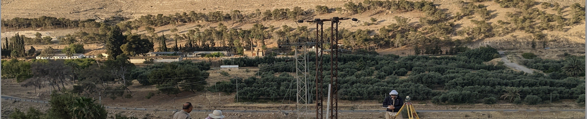
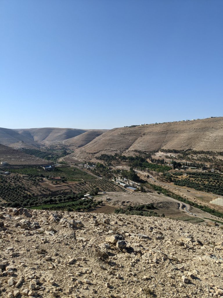
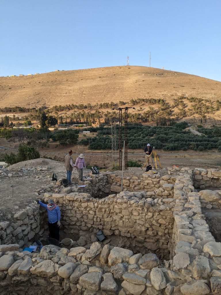
Driving south from the bustling town of Madaba, the sun rises over the rolling plains of the plateau. As we descend into the Wadi al-Wala canyon, the Khirbat Iskandar (KI) mound comes into view. Its position provides visual access east and west along the wadi and south to the slopes that lead into Dhiban. It is easy to see the importance of its position in the landscape. As we climb the gravely path to the site, the sun crests the hill to the east and the light slowly begins to illuminate the EB III and IV contexts in which we have been meticulously working this season.
Khirbat Iskandar and the Wadi al-Wala from above.
Excavations at KI have been ongoing since the 1980s, each season further revealing the site’s significance as an urban settlement during a time often marked by trends of ruralization in the southern Levant. The 2022 field season at KI shed new light on the pivotal Early Bronze III/IV nexus and provided new contexts that help expose the continuation of habitation at the site. We began the season with a clear set of goals divided between three excavation units. With a team of only 10, we were limited in what we could achieve in a set period of time. But with the experience at hand we were able to efficiently and effectively answer questions lingering from seasons before and build upon existing theories about KI’s role during the later EBA. The main objective was to continue to define the phasing for Area C, an excavation field in the southeastern corner of the tell. We aimed to do this by linking loci between trenches with known and new architectural and material phasing. In doing so, we could gain a more well-rounded picture of the associated phasing of the EB IV within Area C and in turn, the EB III/IV horizon.
We were successful in all our excavation goals, but archaeology is about more than just digging. My dissertation research focuses on micro and macro scales of the KI landscape and this field season provided the opportunity to not only develop my understanding of the EB III/IV at the site, but it also allowed me to garner a better appreciation of KI’s position in the greater region. KI’s setting along a possible route of travel is what initially inspired me to explore the connections between EBA sites in the Central Moab area. One of my personal goals this season was to take time to visit other regional sites and the spaces in between to better understand KI’s physical connections to neighboring locales. I was able to do so, moving at my own pace and experiencing these distances between sites, which caused me to think more about other aspects that impact movement and connections between spaces. A visit to the Chalcolithic and EB IA site of Murayghat was particularly impactful. Its position on a plateau surrounded on three sides with slopes covered in dolmens and the fourth side, a sweeping view into the valley below and hilltops beyond, provided a unique context by which to think about the relationships of spaces dedicated to both mortuary and domestic settings and how they could be perceived by visitors. A stop at Bab adh-Dhra’ was likewise a highlight and furthered my interest in the topic of the intersection of the living and dead spaces and how the various uses and perceptions of these spaces may have been communicated throughout the EBA. While I have studied these sites individually and tried to assess their spatial and social proximities digitally, I still lacked the ability to grasp what travel across some of these landforms and distances meant in reality. As I continue to develop my research on landscape-based approaches to the spatial and social connections in the southern Levant, field seasons like this greatly improve my ability to accurately contextualize and represent movement at the time.
Tucker Deady is currently a PhD student at the University of Toronto in the Department of Near and Middle Eastern Civilizations. Tucker’s areas of interest include landscape archaeology, GIS, and the Early Bronze Age of the Southern Levant.
Want to help more students and early career archaeologists get into the field? Donate to the cause today by selecting “Student Support” as your gift purpose!







 Tucker Deady is currently a PhD student at the University of Toronto in the Department of Near and Middle Eastern Civilizations. Tucker’s areas of interest include landscape archaeology, GIS, and the Early Bronze Age of the Southern Levant.