A Walk in Khirbat Iskandar: Securing a Future for the Heritage of the Past
Nicola Lanzaro, 2023 Katherine Barton Platt Fieldwork Scholarship Recipient
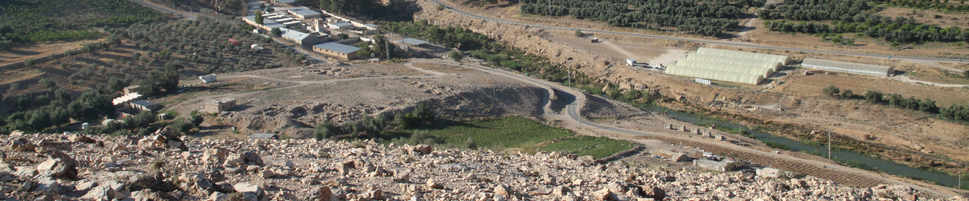
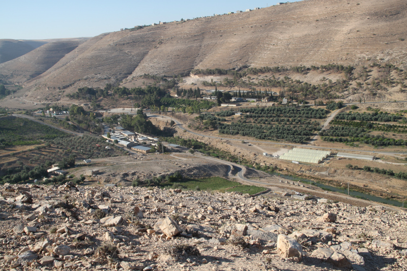
Khirbat Iskandar (translated as “ruins of Alexander”) is an archaeological site in the Madaba governorate, located on the northern bank of the Wadi al-Wala. Despite the name, the site has no proved connection with Alexander “the Great” because it is a 3ha fortified site whose occupation dates back to the Early Bronze Age (EBA). Even the term khirbat is questionable because the site is a true tell (an artificial mound in Arabic). The site is just 6 km north from Dhiban and it is located on a strategic crossing point where the slopes on the northern and southern bank of the wadi are not so steep and drop off gently until the waterway. For this reason, a modern road that connects Madaba and Dhiban runs near the site. The modern viability follows the same path of the Roman via Nova Traianathat was established on the ancient Iron Age road known as the King’s Highway.
The archaeological investigation of Khirbat Iskandar started in the 1980s, and each season produced important data about the settlement patterns and the human activities in this area of the Southern Levant where the EBA patterns of settlement are still subject to deeper investigation compared to Cisjordan. The 2023 field season at Khirbat Iskandar was different from a typical excavation season. In the current vision of archaeology, preservation and sustainable promotion of archaeological sites are added to the tasks that archaeologists must accomplish. In addition, a broader interest on the landscape surrounding the sites is another fixpoint of modern archaeological research. So, this year the team efforts were focused on the survey and conservation in three core areas: the southern and eastern roadcut sections of Khirbat Iskandar, the northern terrace along the wadi terrace to its south, and the hill of Umm el-Idham on the northwest.
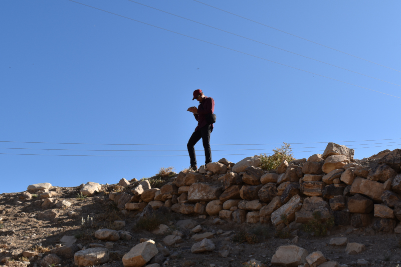
A part of the team worked at the roadcut where trimming activities were carried out on two exposed sections section to obtain new data from the stratigraphy, while conservation activities were implemented at the Early Bronze Ag fortifications at the south-east edge of the site. The same team carried out the survey of the wadi terrace nearby. The rest of the team carried out the survey and some probes on the top of the Umm el-Idam hill. As a young archaeologist specializing in landscape archaeology, this past season I was assigned a number of important tasks that required both technical skills and topographical expertise. My duties as survey leader assistant were related to organize the survey with the survey leader Tucker Deady, a PhD student at the University of Toronto, and manage the geodatabase that we had set up in the months before the fieldwork season. The organization of a complete and user friendly geodatabase is an important step for survey operations, so we dedicated a lot of time to it to prepare for the season. On the field, surveying was my main activity during a typical workday, and that is one the most interesting part of my work because it helps me to understand how archaeological features combine with the landscape.
 During this season, I was also in charge of producing the photogrammetric record of the probes and the road cut sections. Therefore, sometimes I also worked on the acquisition of the photographic dataset and measurements with a total station to produce a 3D model of the endangered southern and southeast sectors of the site of Khirbat Iskandar. On such days, I would join the survey team for the rest of the day after completing my work on photogrammetry. To take the photographic dataset as first operation in the morning is an important step because it allowed me to take advantage of the best light before the sun rises. In fact, direct sunlight provides uneven lighting around an object and casts hard shadows, this can lead to errors during the photo processing or produce a bad quality texture. So, it is necessary for us to take photo when the light is diffused, like cloudy days or during the sunset/sunrise.
Personally, I consider this task a necessary step of my work and I am proud of the results I obtained. The use of new technology as photogrammetry in the collection and elaboration of data is an important step, necessary in most of modern survey operations. All the 3D models we produced are scaled; this allows us to take remote measurements and have a three-dimensional point of view over the subject without being in the field and all in one file. In few words: scholars can virtually come back to the site whenever they want.
After the lunch break my work restarted in the afternoon. Usually in the second part of the day I worked on the processing of data we collected in the morning; this operation consists most of the time in the massive data entry into our geodatabase. Maybe this part of the work is a bit boring compared to the fieldwork but it is necessary and it so exciting to see the results of all our hard work summarized on maps that show us a big picture. When we took photographic data for photogrammetry, I used to work on the elaboration of the 3D model with appropriate software such as Metashape. Usually this process is mostly automatized except for the uploading of photos and coordinates collected with the total station. It can be time consuming just in case of problems, for example the presence of one or more bad photograms in the dataset, bad light or other technical issues that can be resolved with a bit of human work. When a 3D model was completed I produced some orthophotos, which will be necessary to generate floor plans or frontal elevations through the use of other software as Autocad.
The life of a young landscape archaeologist is exciting and the beauty of the Jordanian landscape makes it like a dream. Sometimes when I see the landscape of the Wadi el-Wala from the hill of Umm el-Idham, with a 360° view over Khirbat Iskandar, I feel like I’m in timeless place where the essence of the EBA is still alive in the air. Working there with this incredible international team was an amazing experience and I can’t wait to return to the site in the future to continue studying and living this astonishing place.
 Nicola Lanzaro obtained his BA degree in Eastern Archaeology at L’Orientale University of Naples. He is currently a MA student at the Sapienza University of Rome. He is currently member of two missions in Levant: the Lebanese-Italian Project in the Region of Tyre, Lebanon (from 2022) and the Archaeological Expedition to Khirbet Iskander, Jordan (from 2023). Nicola’s areas of interest include landscape archaeology, GIS, and the Early Bronze Age routes of the Southern Levant.
Want to help more students and early career archaeologists get into the field? Donate to the cause today by selecting “Student Support” as your gift purpose!

 During this season, I was also in charge of producing the photogrammetric record of the probes and the road cut sections. Therefore, sometimes I also worked on the acquisition of the photographic dataset and measurements with a total station to produce a 3D model of the endangered southern and southeast sectors of the site of Khirbat Iskandar. On such days, I would join the survey team for the rest of the day after completing my work on photogrammetry. To take the photographic dataset as first operation in the morning is an important step because it allowed me to take advantage of the best light before the sun rises. In fact, direct sunlight provides uneven lighting around an object and casts hard shadows, this can lead to errors during the photo processing or produce a bad quality texture. So, it is necessary for us to take photo when the light is diffused, like cloudy days or during the sunset/sunrise.
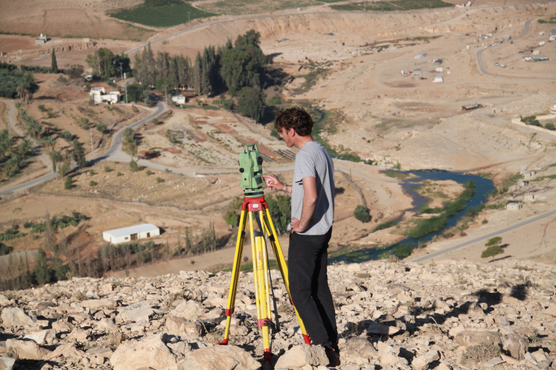
 Nicola Lanzaro obtained his BA degree in Eastern Archaeology at L’Orientale University of Naples. He is currently a MA student at the Sapienza University of Rome. He is currently member of two missions in Levant: the Lebanese-Italian Project in the Region of Tyre, Lebanon (from 2022) and the Archaeological Expedition to Khirbet Iskander, Jordan (from 2023). Nicola’s areas of interest include landscape archaeology, GIS, and the Early Bronze Age routes of the Southern Levant.