Fieldwork Report: Dominique Langis-Barsetti

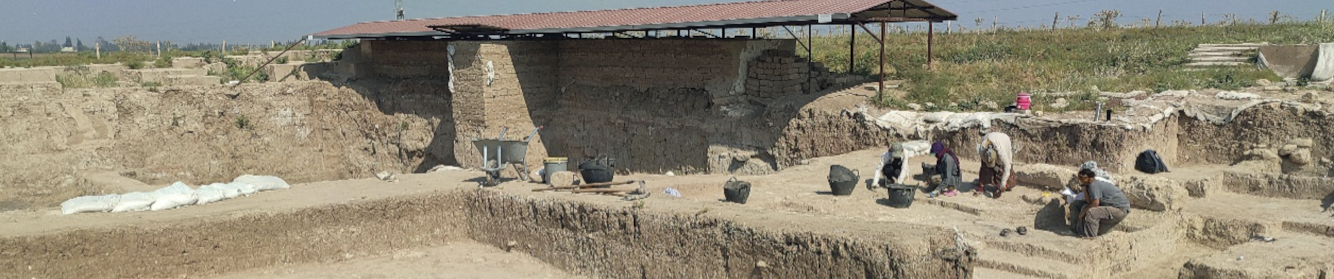
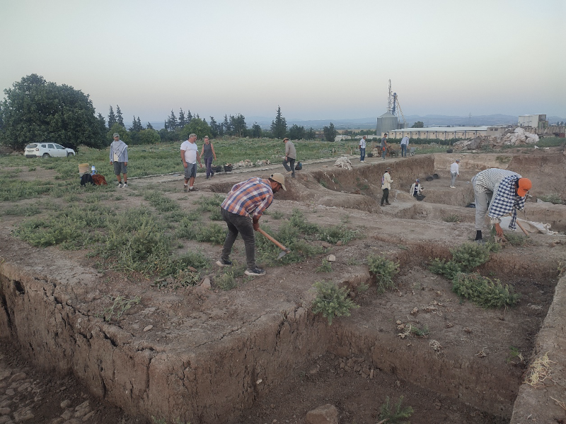
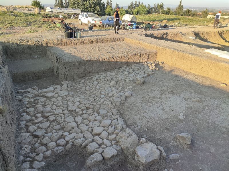
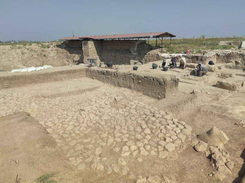
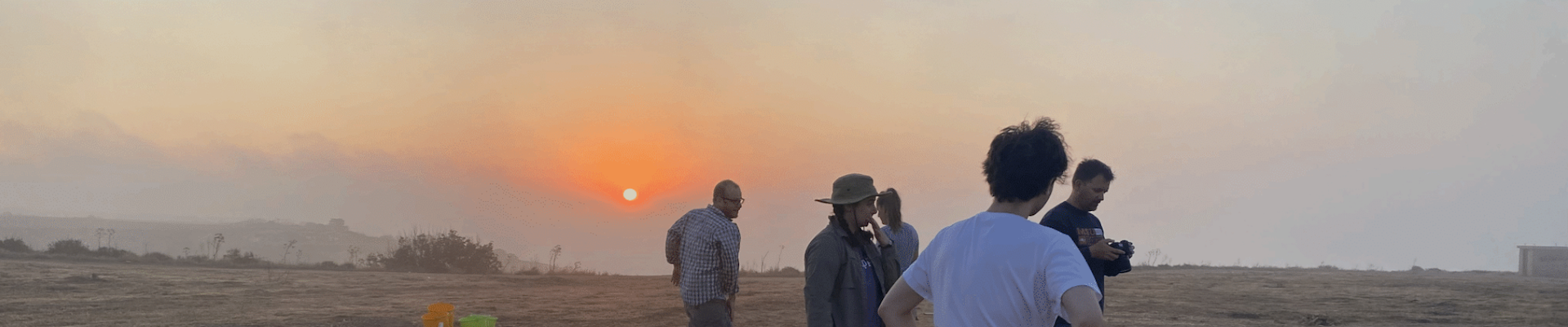
Banner Image for Dominique Langis-Barsetti Post

The Joys of Thinking on Your Feet

Dominique Langis-Barsetti, 2024 Katherine Barton Platt Fieldwork Scholarship

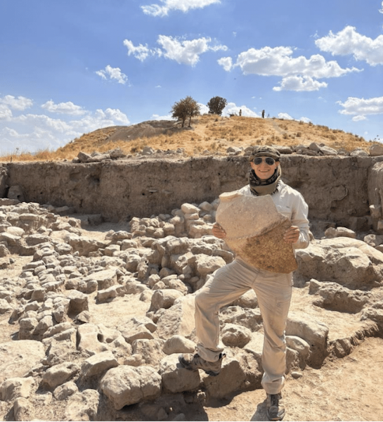
For many, archaeology is either an epic tale of breathtaking ruins, jaw-dropping finds, and exciting adventures in faraway lands, or a story of trowels, brushes, and dirt, and the delicate fragments of the past they reveal. For students coming to the field for the first time or joining a new project, the awe and wonderment associated with those visions of archaeology are very well in the cards. For those of us helping to run those projects and involved in making the archaeology happen, a field season is more often than not an exercise on thinking on your feet and embracing the chaos. A chaos that you must somehow harness, tame, control, and put to good use. This is all the more true when you work at one of the largest archaeological sites in Türkiye (fig.1), on a topographically-complex mountaintop, with a large team of local and international collaborators. But without the challenges, archaeology would not be nearly as much fun.
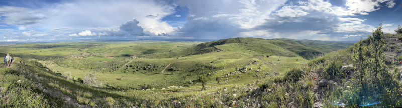
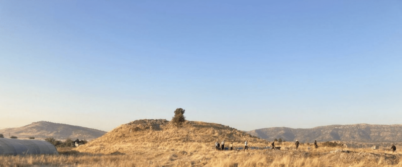
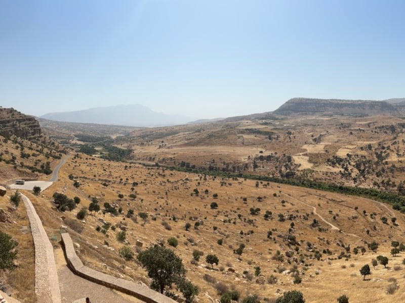
Fig. 1: Panoramic view of the southeastern section of the site, with the village of Şahmuratlı in the distance, on the left. Photo taken from the Kale, the Byzantine fortress built atop the most prominent point of the Iron Age city.

The 2024 season of the Kerkenes Project started with an eight-week delay, as we arrived in the field in mid-June. Despite this setback, we were determined to make as much of our time abroad as we could, both for the sake of our research agenda and for the field school students who had accompanied us. As the ground of our ancient 271-hectare city was now dry and sunbaked, we had to (mostly) put aside the extensive program of electrical resistance we usually carry out every year and jump straight into excavations.

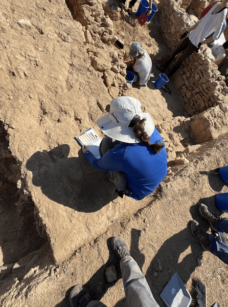
The original plan for the season involved dismantling a section of an unstable wall. Despite our best efforts to preserve it, the western wall of one of the city’s large columned halls had been crumbling away since it had first been exposed a decade ago. Unlike most walls at Kerkenes, which are composed of large facing stones holding in a core of rubble fill, this wall was part of a large room that had been built without facing stones. Originally, the stabilizing role of the missing facing stones had likely been fulfilled by wooden planks used a cladding, but with the wood now entirely gone, the rubble core was spilling out. The goal of the season’s excavations was thus to remove the rubble core down to the wall’s foundations (fig. 2). Documenting any evidence of construction techniques encountered in the process was a priority, particularly the placement and arrangement of wooden beams and posts incorporated into the structure. A small section of the same wall taken apart nearly a decade ago suggested that we might find the remains of large wooden posts at somewhat regular intervals within the fill. We were pleasantly surprised to discover that the wall’s structure was in fact much more complex. Since a portion of my doctoral research focuses on Iron Age construction techniques at the site, I was grinning much more widely than the students who had to spend several sweltering summer days carefully articulating the carbonized wooden remains. In the end, we discovered a series of half-round tie beams placed within the foundations of the wall, with pairs of posts placed atop them. Unfortunately, most of the wood had been reduced to ash by the devastating fire that destroyed the city over 2500 years ago, but some carbonized fragments are just large enough to let us hope for dendrochronological dates.
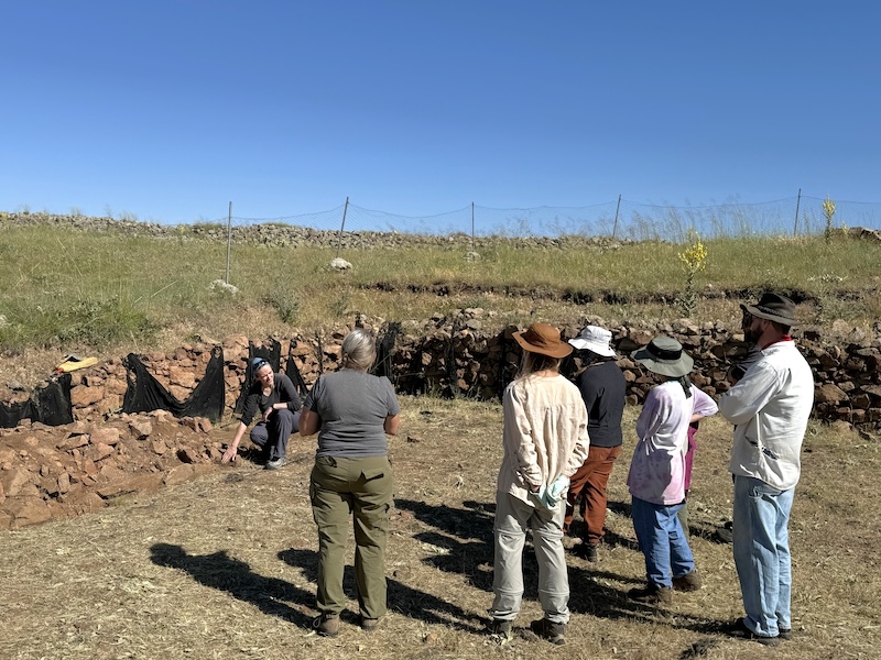
Fig. 2: Showing students and supervisors what to expect as they prepare to dismantle an unusual wall.

Amid one of the hottest summers on record, weeks after rains had stopped softening the soil of the central Anatolian plateau, we therefore had to come up with a plan to survey at least one 20 m by 20 m grid using electrical resistance. Although curtailed, the geophysical survey season could not be entirely cancelled since it represented an integral part of the field school. While in Türkiye, students learn about geophysical surveying, gain firsthand excavation experience, spend time with a variety of archaeological specialists, and are immersed in the life of a small central Anatolian village. With a much-shortened 2024 season, we had to come up with ways to make sure our students would still get the opportunity to learn the skills they had travelled halfway across the world to explore. This led to a rather intensive program, where lectures taking place during some of our off time replaced some of the hands-on experience that could not be accommodated. Despite the less-than-optimal conditions, students still spent two days learning geophysical survey techniques. After an intensive round of lectures, they gained practical experience through a survey of the excavation compound’s yard. In doing so, they learned about surveying in different environmental conditions, how to adapt to non-ideal ones, and what happens when equipment breaks. But surveying a small grid sandwiched between a dorm, a tractor, and a garden can only teach you so much. As the geophysical instructor, it was up to me to find a portion of the site where electrical resistance could still be carried out. We were now more than a month after the typical end of the geophysics season, at a time of the year when most of the clay-rich ground of the site is barely softer than the granite bedrock. Under those conditions, the logical solution was to survey a portion of the site that is normally too wet for electrical resistance. This meant driving around the site following the path of the ancient city’s water management system until I found a patch large enough and moist enough for a proper survey. In the spring, the different streams and reservoirs are usually too full of water to be surveyed. As we were now nearing the height of summer, much of those had dried up, revealing ground we usually could not access. To their credit, the students got through an entire grid by themselves, quickly learning the main aspects and challenges of geophysics as we collected new – and useable! – data (fig. 3).
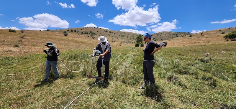
Fig. 3: Teaching field school students how to survey in one of the few remaining soft patches of ground.

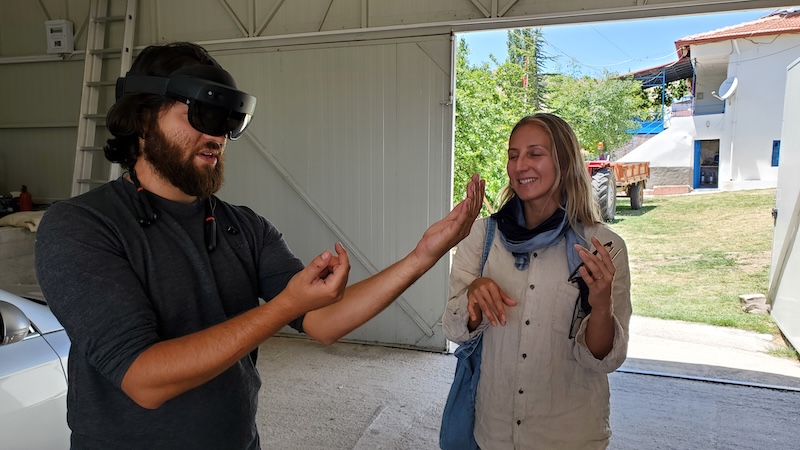
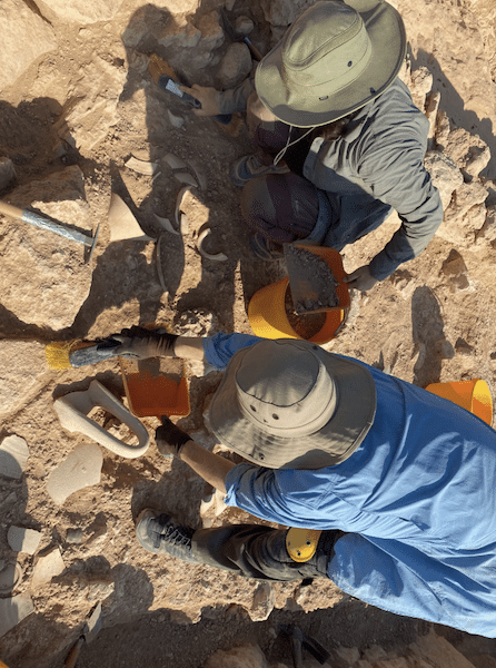
To make up for the absence of some of our specialists, the senior staff present in the field shared some of their own skills with the students in small workshops that do not normally take place. As the peculiarities of this season’s excavation plan meant very little osteological material was recovered, the students instead participated in the exhumation and preparation of new additions to our animal reference collection. Under the guidance of a specialist post-doctoral student, they excavated and cleaned modern remains, probably learning more than they wanted about cow and turtle anatomy and the decomposition process (fig. 4). To replace weeks and weeks of repetitive trench recording, the students were initiated to photogrammetry by making their own 3D model of a rubber duck and recorded artefacts with our handheld structured light scanner. They got a taste of the cutting-edge tendencies at Kerkenes when robots came for a test drive at the site, and everyone got to try the latest version of the DATCH heritage recording application for the HoloLens 2 mixed-reality headset (fig. 5).
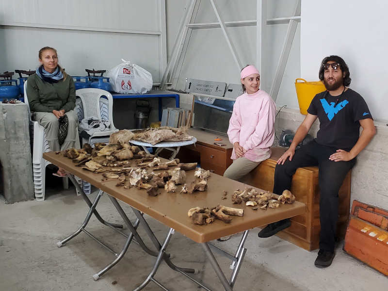
Fig. 4: The freshly excavated remains of a butchered cow and drowned turtle, used to familiarise students with animal anatomy.
Fig. 5: Students donning a HoloLens 2 mixed-reality headset to try out the DATCH heritage recording program designed by members and collaborators of the Kerkenes Project.

In addition to teaching activities within the team, the Kerkenes Project also partakes in several educational and outreach activities every year, teaching the local community and visitors to the site about the archaeology of Kerkenes. Less time in the field meant fewer chances to carry out those activities, so we got creative. Literally. In conjunction with the team from Uşaklı Höyük—a mounded site located 7 km from Kerkenes—we visited a women cooperative in the nearby town of Sorgun that paints ceramic vessels according to different decorative traditions. Archaeologists and ceramicists discussed ornamental techniques and motifs, comparing ancient and modern approaches. We introduced the participating cooperative members to decorative styles common in the region during the Iron Age, and they in return shared their knowledge of pigments and painting methods. We hope this leads to a revival and reinterpretation of ancient local motifs in the future (fig. 6).
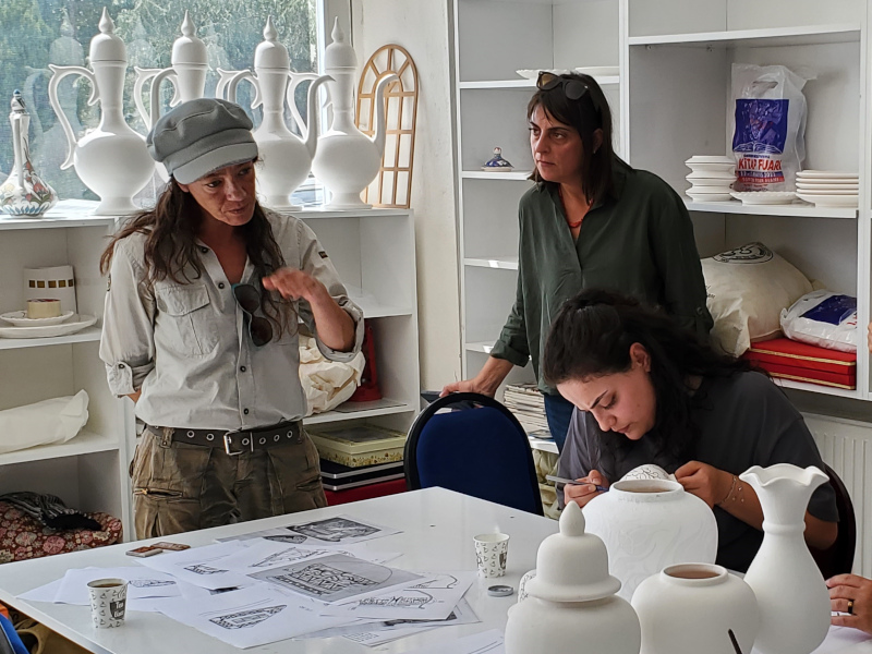
Fig. 6: Sharing knowledge at Sorgun’s women-led ceramic cooperative.

Another of Sorgun’s women-led cooperatives specializes in the crafting of glass beads and figurines. One of the artists at the heart of this initiative visited the Kerkenes dig house and shared with us their process, their techniques, the materials they use, and the crafting challenges they face. We participated in the discussion by sharing images of ancient beads recovered at the site and elsewhere in the area, discussed local glass traditions going back millennia, and offered to provide them with all our empty glass bottles next season, to be melted down and remade into recycled glass beads. The enthusiasm from all participants was energizing and we hope this discussion leads to further collaborations and a melding of local crafts and archaeology.

Arriving so late in the field also meant we had a few surprise visitors. Among them was a group of professional painters and mosaicists on a week-long stay in the region. The goal of their artistic sojourn was for them to each produce two new artworks inspired by the area. We only caught them at the end of their stay, but they kindly invited us to their pop-up exhibit. Further discussion during the event led to a preliminary artistic plan for next year. We hope this collaboration comes to fruition, especially since we strive to include more local interpretations and impressions of the site into the narrative surrounding Kerkenes, which is currently mostly focused on the archaeology.

Overall, the 2024 Kerkenes field season was a success, despite the many challenges we faced. As an associate director on the project, many of those challenges land squarely on my desk, often with very little notice. Solving them usually comes down to a happy marriage of archaeological knowledge, logistical creativity, out-of-the-box thinking, and an open mind. And just a touch of crazy. For flavour. Some days this means driving the steep slopes of the sites for an “adventure” with students who did not get to spend as much time exploring those slopes themselves while also being on the lookout for that darker green hue indicative of retained moisture and softer soil. Sometimes it means making make-shift lanterns so the team can have some fun playing boardgames while the storm that knocked out our power blows past. And sometimes it means converting excavation equipment into firefighting gear when the dead tree next door catches fire in the middle of the night. We do archaeology for a chance to learn about the past, solve ancient mysteries – however mundane – and explore the unknown, so we have to be ready – and willing – when the unknown finds us.


Dominique Langis-Barsetti is a doctoral graduate from the University of Toronto and a member of the Kerkenes Project since 2010. On top of her duties as Associate Director, she teaches geophysical surveying, photogrammetry, excavation techniques, and archaeological illustration to students on the Project.

Want to help more students and early career archaeologists get into the field? Donate to the cause today by selecting “Fieldwork Scholarships” as your gift purpose!

Fieldwork Report: Christos Theodorou

Ash the World Turns or How I Learned to Stop Worrying and Love the Heat in a Bronze Age Oven: Excavations at Kissonerga-Skalia, Cyprus

Christos Theodorou, 2024 Meyers/Wright Fieldwork Scholarship Recipient

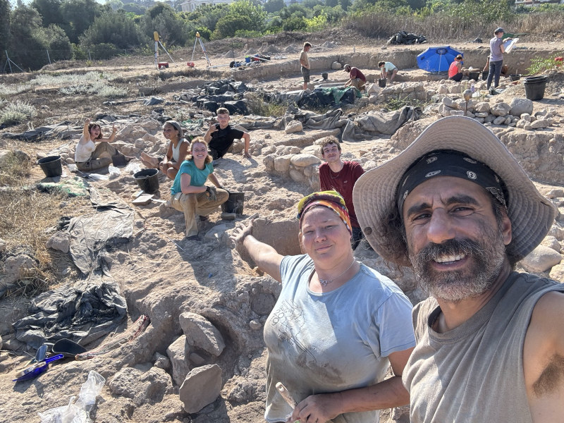
When exploring areas around the coastal southwestern Cypriot village of Kissonerga, one is struck by the abundance of prehistoric settlements in the region amidst the hotels, tavernas, and banana fields. A cursory look at the academic literature or a quick online search reveals even more ancient activity, from the Neolithic to the Late Bronze Age periods, that are obscured by modern development. It is in this setting that I had the privilege of returning this summer to continue my studies of Cypriot archaeology — back to the Bronze Age site of Kissonerga-Skalia for my second non-consecutive season.

I’m at the top left in the oven removing some charcoal

Skalia is wildly interesting, with Chalcolithic tombs and signs of settlement from the Early Cypriot period (c. 2400 BCE) to the beginning of the Late Cypriot period, after which the site was abandoned (c. 1600 BCE). About two generations before abandonment, a large complex was constructed over the older habitations. This features monumental walls (including a unique ‘S’ shaped wall), a considerable courtyard, numerous pyrotechnic installations, and areas with signs of intensive production. It is this complex from the final phase of occupation where the current excavations at Skalia are focused.

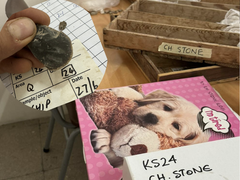
My tasks at Skalia in 2022 concentrated on excavating through the collapsed material of a plaster-lined oven (one of two in our trench), defining the extent of the oven and nearby basins, and identifying the surface level. Ultimately, it was discovered that the two pyrotechnic features were actually one massive four-meter-wide oven underlying the final phase floor. I would spend the 2024 excavation season on-site within this oven: hot, covered in ash, and contented. Additionally, I underwent supervisor training and managed the log of accumulated chipped stone on site.

The trench B2 gang

Work in the half-sectioned oven was relatively straightforward. The idea posited by our trench supervisor was that after the oven fell out of use, it was filled with debris during a dumping and leveling episode, and the final phase floor was constructed over the feature — placing the oven into a timeframe referred to as Early Final Phase. Amidst the infill of large stones, blocky chunks of oven material, crumbly orange and brown soil, thick layers of white lime plaster, and — ash, ash, ash — we found a bit of bronze (likely from tweezers), large chunks of really nice charcoal (a rarity on site, despite the number of pyrotechnic features. Also, significant for dating and identifying the type of fuel used in the oven), an abundance of discarded ground stone tools, and Skalia’s very first coprolite (!).

Charcoal and an intact juglet

All the removed fill from the oven was collected for floatation, and I eagerly anticipate what archaeobotanical remains turn up. Keep an eye out for the final report from this season to the Cypriot Department of Antiquities, as some novel features associated with our giant oven will undoubtedly be revealed, as well as thoughts on its possible functionality. In the end, it will be interesting to see how this Early Final Phase feature relates to the larger context of the nearby Late Final Phase courtyard, oven (identified as a malting kiln for beer production), and the unique adjoining room recognized for its deposition of modified bovid skulls located under one of the many benches which lined the walls (a potential foundation deposit).

Logging chipped stone

At its earliest levels, Kissonerga-Skalia will be integral in studying the changes on the island during the transition from the Chalcolithic into the Early Bronze Age. Additionally, current work in the commercial production complex that supplanted the older village settlement, investigations into its subsequent abandonment, and regional interconnectivity throughout Cyprus and abroad will bring many vexing questions to focus.

So, until next year…

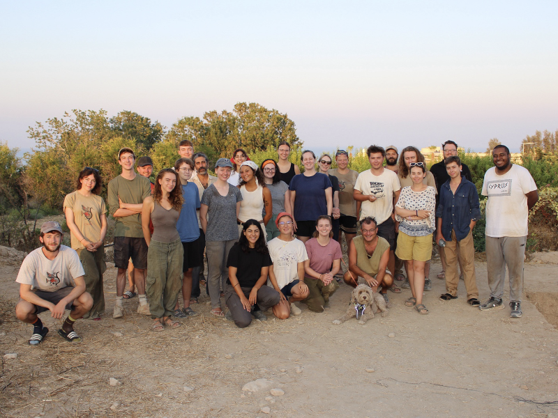
Most of the team that was on-site on the last day

I am indebted to Skalia’s director, Dr. Lindy Crewe (Cyprus American Archaeological Research Institute), Ian Hill (Heritage Archaeological Research Practice), our trench supervisor, Dr. Ellon Souter (είμαστε ντισκοτέκ), and the rest of the staff for their invaluable guidance. My sincerest thanks and appreciation go out to Drs. Carol and Eric Meyers, for their generosity in providing the financial resources that have enabled me to return and continue my studies in prehistoric Cypriot archaeology, and ASOR for providing generations of archaeologists with incalculable scholarships, grants, fellowships, and support.


Christos Theodorou is a dual citizen from New York living in his family’s village in Cyprus. He splits his time between tending to his grandfather’s fields, exploring the island, and pursuing a postgraduate degree in archaeology at the University of Cyprus. Though his academic interests span the pre- and proto-historic Cypriot periods, the Bronze Age seems to live rent-free in his head. He has yet to cut himself too severely trying to knap chert.

Want to help more students and early career archaeologists get into the field? Donate to the cause today by selecting “Fieldwork Scholarships” as your gift purpose!
Fieldwork Report: Ofelia Tychon

Banner Image for Ogelia Tychon Post

Getting to Know Rural Assyrians

Ofelia Tychon, 2024 Katherine Barton Platt Fieldwork Scholarship Recipient 

Photo of Ofelia Tychon on the RLIIM projec.

This spring, I got a chance to be part of the excavation team for the Rural Landscapes of Iron Age Imperial Mesopotamia (RLIIM) Project, now in its third season. The project, run by Prof. Petra Creamer of Emory University, brought together international scholars from Cambridge University, J.W. Goethe University-Frankfurt am Main, Johns Hopkins University, Montana State University, University of California, Los Angeles, University College London, University of Chicago, University of Pennsylvania, and Utah State University, in addition to the local professionals from the Directorate General of Antiquities and Heritage of the Kurdistan Region.

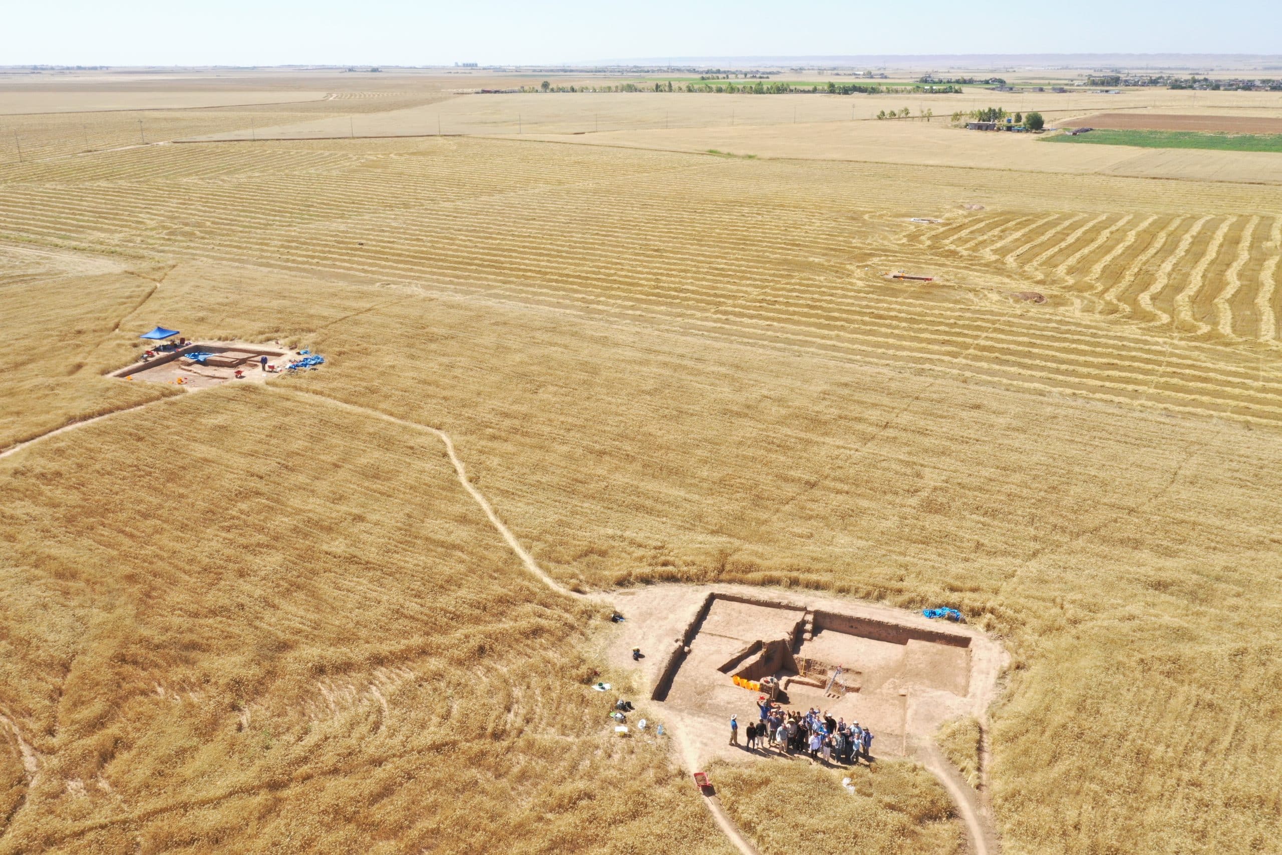
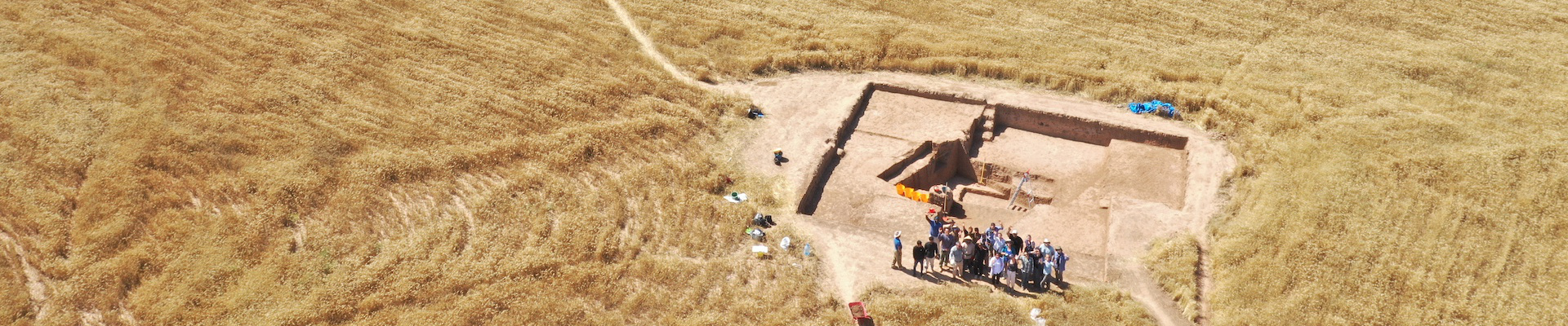
Drone Photo of RLIIM Site

The RLIIM site is located near Erbil, Iraqi Kurdistan, which is part of the area usually referred to as the ‘Assyrian Heartland’. The Neo-Assyrian Empire expanded from its heartland to reach from the Arabian Gulf to the Mediterranean, including Egypt, between the 9th and 7th centuries BCE, and is often seen primarily as an aggressively expansionist empire, fuelled by conquests and associated booty, tributes and deportations, which has driven the sort of scholarship that is produced about Assyria.

Historically, most excavations in the Iraqi Kurdistan, where the Assyrian heartland was located, have focused on major urban sites, and particularly monumental architecture, with even urban living quarters rarely excavated. While this is slowly changing, as surveys that uncover rural sites have been and still are being undertaken, excavations of small, rural Iron Age sites continue to be extremely rare, and RLIIM is proudly one of the few. RLIIM seeks to reconstruct how Imperial Assyria impacted rural landscapes and its rural populations, particularly why this site (and others like it) existed in a relatively marginal agricultural area, which populations settled in these rural areas and how they organized, as well determining the extent (or lack thereof) of continuity between the late Assyrian and post-Assyrian periods.

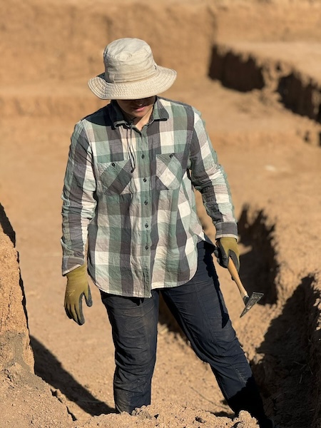
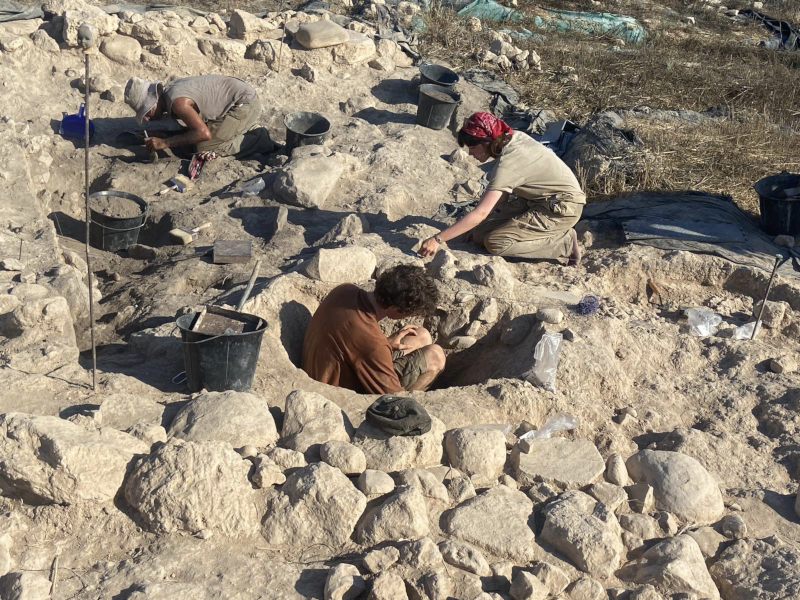
During the 7-week 2024 season, the RLIIM team was able to significantly expand its three existing trenches and opened up a fourth one. Trech A, where I spent most of my time during the season, houses a large mudbrick building with a courtyard. The nature of the soil in the area means that distinguishing mudbrick is a challenge and requires great concentration from the excavators (and perfect morning light!).

Photo of Ofelia in Trenches at RLIIM

The choice to expand and open up new trenches was greatly aided by magnetometry survey results from the first two seasons. Further magnetometry surveying was accomplished this season as well. I was personally able to participate in gathering magnetometry data and get “hands-on” magnetometry survey techniques instruction.

An important part of the RLIIM project is the analysis of the faunal and archaeobotanical remains. Numerous samples were collected and sent for analysis at the end of the season, and we eagerly await the results. As with most archaeological projects, pottery processing is an integral element of the efforts. Thousands of sherds were processed on site, and the analysis thereof is helping in creating an updated late Assyrian vs post-Assyrian pottery typology, something that is particularly helpful when analysing surface survey results, which are vital in order to understand the settlement pattern change that took place after the collapse of the Neo-Assyrian Empire.

Photo of Drawn Pottery

The team did not just spend their time at the site. We were able to travel to key locations in the region on our days off, including the Neo-Assyrian period Jerwan Aqueduct, Faida Canal, Khinis reliefs and Bastora Dam sites, as well as visiting the Cambridge University’s Shanidar Cave project famous for its Neanderthal remains.

Photo of Shanidar Cave

The 2024 season concluded just as the weather in Kurdistan was heating up well into the 100s, but the work continues on the analysis of the data gathered by the team. I look forward to coming back next spring armed with more knowledge acquired via this analysis.


Ofelia is a PhD candidate at the Institute of Archaeology, University College London. She holds a Master’s Degree in Ancient Near Eastern Studies from the University of Toronto. Her research interests lie within the economic and social aspects of history and archaeology of the Near East during the first millennium BCE, particularly the Neo-Assyrian and Neo-Babylonian Empires.

Twitter/X @ofeliatweets

RLIIM Project: https://rliim.weebly.com/

Want to help more students and early career archaeologists get into the field? Donate to the cause today by selecting “Fieldwork Scholarships” as your gift purpose!
Fieldwork Report: Rubar Yavuz

Tell Tayinat 2024: A Season in the Shadow of an Earthquake

Rubar Yavuz, 2024 Eric and Carol Meyers Fieldwork Scholarship Recipient

Tell Tayinat is a mound located 18 km west of Reyhanlı district in Hatay and 1.5 km east of the Orontes River. Southeastern Turkey experienced a major earthquake in 2023, which significantly impacted and damaged the Hatay province. Our excavation house was also severely damaged by the earthquake. This is why our excavation house consisted of containers and portables for the 2024 season.

Archaeology is not just about digging the soil. It is a space where human relationships are strengthened, where people come together to work towards a common research goal, and where individuals from different cultures meet. Even though this earthquake has caused major losses for people we know from the region, I still feel that we were able to reconnect, help each other while having a productive season.

The Iron Age layers have always fascinated me and have been an important focus of my thesis research. I would like to thank our excavation director for allowing me to excavate and study the Iron Age layers.

First day of excavations

The Tell Tayinat excavation site was identified in 1933 by a team from the Oriental Institute of the University of Chicago, led by Robert J. Braidwood. In 1999, the mound was re-examined by a team led by Timothy P. Harrison, and excavation began in 2004. During these excavations, Early Bronze Age and Iron Age layers were identified.

During the 2024 season, we woke up at 4:00 a.m., and the vehicle departed at 4:30. Of course, these times shifted based on the sunrise. I was excavating a square in the Iron Age layers, following a stone pavement that had already been exposed in the 2022 season. From the moment it was uncovered, this stone layer indicated the extent of its damage. The surface soil extended to a depth of approximately 0.35 m. I was aware that I was conducting an excavation of surface soil, yet I was still careful not to miss any artifacts. Over the course of about a month, ceramic and basalt fragments were uncovered.

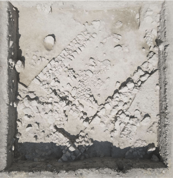
Iron Age Stone Pavement that has been disturbed

Our excavation used the locus-lot system, which meant we divided the area into square sections and excavated piece by piece. The main objective in the area I was working on was to follow a specific pavement. The most striking aspect for me was the artifacts located just above the floor. One seal, dated to the Assyrian period, was found directly on this stone pavement. After documenting the artifact, it was removed. Archaeology, in a sense, is about concealing all emotions, I managed to calm the excitement I felt inside though I was very happy that it was uncovered. After cleaning in the dig house it was confirmed to be an Assyrian seal with the image of a quadruped. There was some discussion of what animal it could be; many thought it was a lion, though some thought it was a type of composite animal. After this find, it was decided that expanding the excavation area further would be beneficial. While doing so, a bulla was found on this stone floor. This artifact was also dated to the Assyrian period.

End of season photo of my square

So, this floor was either built during the Assyrian period, or it predates them, with the Assyrians having walked on it. Despite the damage in the area I was excavating, this layer belonged to the Assyrians.

A gravelly layer made of hard soil and nari was encountered in the north of the area. This layer indicated that we had transitioned to a second phase. This gravelly layer extended beneath the stone floor. After documenting two stones from the stone pavement, they were removed, and a bronze armor scale was found beneath the stone floor. The Neo-Assyrian artifacts and related late Iron Age ceramics suggest that this layer was part of the Neo-Assyrian settlement in Tayinat, which was incredibly exciting to excavated and reveal.

Me while doing a section drawing

n conclusion, this season’s excavations were both enjoyable and tiring, but that is archaeology! I would like to express my gratitude to ASOR and Eric and Carol Meyers for providing this fellowship. Thanks to this fellowship, I was able to attend Tell Tayinat excavations, expand my research on the Iron Age, and make new friends.

For more information about the Tayinat Archaeological Field School visit here.

Working on a square plan

Rubar was born in 1995 in the province of Mersin. He completed his primary, secondary, and high school education in Mersin. In 2017, he enrolled in the Archaeology department at Van Yüzüncü Yıl University. He graduated with honors in 2021. He was accepted into a master’s program at the same university, where he is currently continuing his studies. He participated in 17 different excavations focused on the Iron Age. He has conducted research on burial traditions of the Iron Age and is writing his master’s thesis on these burial practices.

Want to help more students and early career archaeologists get into the field? Donate to the cause today by selecting “Fieldwork Scholarships” as your gift purpose!

Fieldwork Report: Brady Hill

Summer Days in Bazyan – My Involvement in the Kani Shaie Archaeological Project

Brady Hill, 2024 G. Ernest Wright Fieldwork Scholarship Recipient 

As a budding archaeologist researching ancient Mesopotamia, saying my opportunity to excavate in Iraqi Kurdistan was a ‘big deal’ is an understatement. Indeed, after being accepted for a Masters in Archaeology at Cambridge, I contacted my to-be supervisor Dr. Steve Renette to enquire about the university’s archaeology department and my potential dissertation topic. After discussing the discovery of Parthian period (2nd century BC – 2nd/3rd century AD) remains during his summer of 2023 excavations at Kani Shaie, Dr. Renette offered me the chance to work on this material during the project’s 2024 field work season. This was an offer I could not refuse given my strong interests in Parthian period Mesopotamia, so I quickly began applying for grants to enable my participation in the Kani Shaie Archaeological Project.

Fortunately, ASOR generously awarded me the G. Ernest Wright Fieldwork Scholarship, securing my opportunity to go to Iraqi Kurdistan. Their assistance supported my living expenses on the dig, allowing me to work at the site for the entirety of the 5-week season running from late August to late September.

After 4 months of eagerly waiting for the fieldwork season to begin, my daily fantasies of visiting and working in Iraqi Kurdistan were finally brought to fruition once we exited Erbil International Airport and were greeted by the blistering heat of the region’s morning sun. It felt as if my countless hours of studying and researching had led up to this moment, and as we began strolling to the project driver’s car and I heard the Kurdish people speaking their beautiful language, it hit me that I was finally in this fascinating land.

Given Kani Shaie is located in Sulaymaniyah Province in the eastern half of Iraqi Kurdistan, we had a 3-hour drive from Erbil to the village of Bazyan where our accommodation was located. Once we arrived, we had to prepare the house for the next 5 weeks and the rest of the project team joining us over the coming days. After completing our preliminary tasks, it was time to begin excavating.

Looking south towards Kani Shaie. The Lower Town trench can be seen in the foreground in front of the main settlement mound.

Now, despite its small size, Kani Shaie is no ordinary one or two period site but possesses a settlement history ranging from the 6th millennium BC to the Ottoman period. Therefore, the project team worked in two excavation trenches this season, one on the main settlement mound which focused upon the site’s Chalcolithic and Early Bronze Age (4th and 3rd millennium BC) occupations, and one in the ‘Lower Town’ focused on Kani Shaie’s later occupations (the Hellenistic, Parthian, and Islamic periods). With my aforementioned interests, I worked in the Lower Town and was given the task of processing and recording the plethora of ceramic finds from the trench.

Our schedule was intense but manageable, digging from 5 am to half past noon 6 days a week, and doing post – excavation processing for the rest of the day. This consisted of pottery washing, drawing and photography, recording the daily small finds (glass bracelets and sherds, grinding stones, miscellaneous metal pieces, etc.), making sure the contexts sheets were up to date, and a whole plethora of other tasks carried out by the project’s team members. I was very fortunate to learn many new skills related to pottery recording and analysis thanks to the patience of Dr. Renette and our ceramics specialist Dr. Mike Lewis (University of Coimbra). This included my introduction to drawing pottery profiles by hand, a necessary task for archaeological publications. Though quite difficult for me at first, this work was eventually highly rewarding once I gained sufficiency in the skill, transforming me into a proper ‘pot nerd’ by the end of the season.

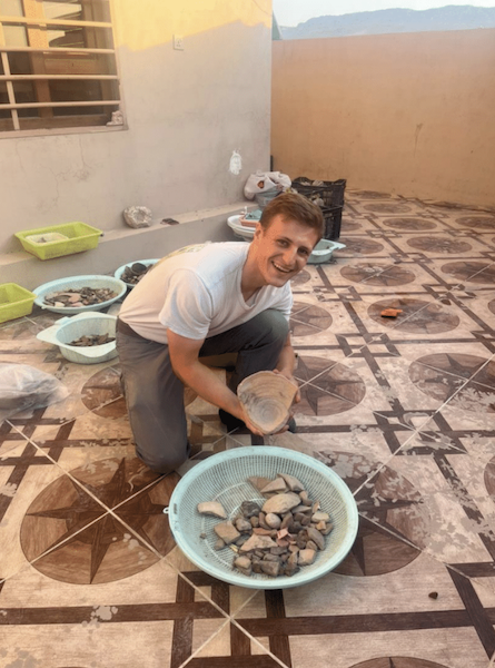
Posing with one of the washed pottery baskets. After being cleaned by the Kurdish students on the project team, it was my daily task to sort through these baskets of pottery, counting each sherd and keeping those that were diagnostic.

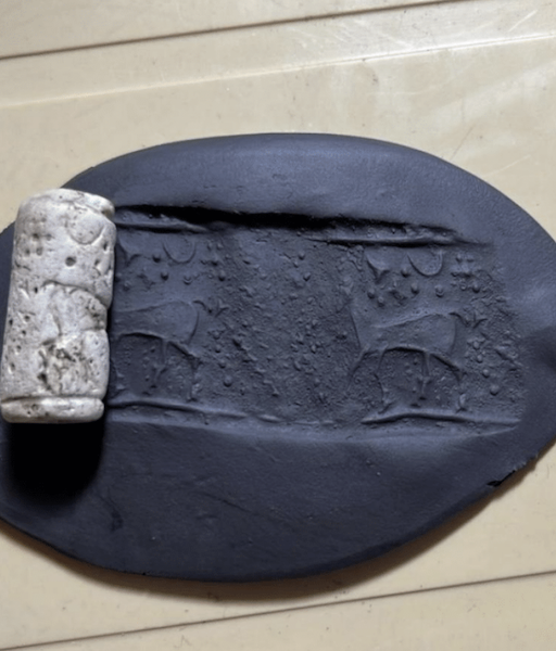
Nevertheless, some interest ing small finds emerged from these levels, including a Neo-Assyrian period (10th – 7th centuries BC) cylinder seal! Though its location within a Parthian and Islamic period context further attests to these occupation layers’ highly disturbed nature, the seal’s presence at Kani Shaie suggests a Neo-Assyrian period occupation remains to be discovered. Despite this amazing find, these initial weeks of our excavation were still rather disappointing due to the poor preservation of our trench’s archaeology, leading us to push onwards with the hope of finding more preserved Parthian period remains.

The Neo-Assyrian period cylinder seal found during our excavations in the Lower Town. It was spotted by Hawre, one of our dedicated Kurdish workmen helping us in the trench.

Eventually, we found something to write home about. Indeed, two linear parallel stone walls running southeast to northwest within the trench began to poke out of the ground as we dug downwards. With curiosity and great excitement, we meticulously exposed the walls, eventually revealing a substantial rectangular stone building. We had found a well-preserved pre-Islamic period level! However, there was something different about the pottery styles and shapes from the building’s associated layers, and after studying the finds in the afternoon it became apparent that this was likely not Parthian, but a Hellenistic period construction.

For those readers who are unaware, the Hellenistic period precedes the Parthian period and is characterized by the conquests of Alexander the Great between 333 BC and his death in 323 BC, and the subsequent establishment of the Seleucid Empire in Mesopotamia by one of the deceased king’s companions, Seleucus I Nicator. Along with the Parthian era, I have a great interest in Hellenistic period Mesopotamia and the Seleucid Empire, so you can imagine my excitement once we realized the building’s (rough) dating!

As typical with all field seasons, we had only a few days to excavate the structure before wrapping up the project for the year. Consequently, we were unable to fully excavate the building, but its discovery indicates a substantial Hellenistic period occupation remains to be uncovered in the coming seasons at Kani Shaie.

Drone photo of the Lower Town’s Hellenistic period stone building. Taken towards the end of the excavation season.

Outside of the excavation, we took team trips to archaeological sites and scenic areas of Sulaymaniyah Province during our days off, which for the most part was always a Friday. These included the Achaemenid rock cut tombs of Qizqapan and the beautiful Lake Dokan, the Paleolithic caves of Hazar Merd, and the Parthian period mountain fortress of Rabana-Merquly. Our visits served as an excellent way for the project team to relax and appreciate the lands in which we worked, finishing the afternoon with a wonderful Kurdish lunch consisting of a kebab, warm bread, and the fermented yogurt drink ‘dogh’. I particularly enjoyed the opportunities we had to immerse ourselves in Kurdish culture and their hospitality, learning new words through conversation and exploring their ways of living.

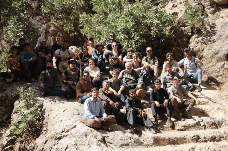
Group photo of the project team visiting the University of Heidelberg’s excavations at Rabana-Merquly. Led by Dr. Micheal Brown, the excavations focus upon the large-scale military fortifications at the site and its religious sanctuary.

Beyond this being a fantastic field work and learning experience for myself, the plethora of Hellenistic and Parthian period pottery recovered from Kani Shaie this year has provided me with a dissertation topic for my ongoing studies at Cambridge. These periods are historically under-researched within Mesopotamian studies, in particular their ceramic forms and styles. Therefore, with all of this material and the discovery of the stone building, the 2024 season presents an excellent case study for Hellenistic and Parthian period archaeology in Iraqi Kurdistan. My original intention when applying for the Ernest G. Wright fieldwork scholarship was to use the material found at Kani Shaie for my dissertation research, however archaeology is always full of surprises and therefore nothing is guaranteed once the trowel hits the dirt. So, I am beyond elated to research a dataset that I myself was involved in uncovering.

Posing with the largest pottery sherd I have yet to encounter on the last day of excavations. It came from a sunk storage jar in the northwest corner of the trench.

In conclusion, I would like to thank Dr. Steve Renette and the Kani Shaie Archaeological Project’s co-director André Tomé (University of Coimbra) for their generosity and leadership over the course of the 2024 excavation season, as well as Dr. Mike Lewis for his insights and encouragement as I stumbled through pottery recording, and Dr. Glynnis Maynard for her excellent supervision of the Lower Town trench. I would also like to thank the Slemani Antiquities and Heritage Directorate and the devoted service of our Kurdish supervisor Zana Abdullkarim Qadir. Lastly, I must emphasize again that it is with ASOR’s generosity that I was able to participate in this excavation without worrying about financial barriers, and it is through them that I and many other emerging archaeologists have been empowered to take those precious fieldwork opportunities offered to them.


Brady Hill is currently studying for a master’s degree in archaeology at the University of Cambridge. Born and raised in Dallas, Texas, his research interests have taken him ‘across the pond’ to study the archaeology of ancient Mesopotamia during both his undergraduate degree at Durham University and now in Cambridge. Alongside the region’s ancient past, he possesses a strong interest in modern Middle Eastern cultures, studying Arabic and Sorani Kurdish in his free time alongside his archaeology coursework.

Learn more about the Kani Shaie Archaeological Project through their instagram: @kani_shaie_arch_project 

Want to help more students and early career archaeologists get into the field? Donate to the cause today by selecting “Fieldwork Scholarships” as your gift purpose!
Fieldwork Report: Riley Stockton

Digging Dirt in Cyprus

Riley Stockton, 2024 P.E. MacAllister Fieldwork Scholarship Recipient

This summer, I had the opportunity to participate in the Vigla Archaeological Field School, a sub-project of the Pyla-Koutsopetria Archaeological Project, based in Pyla, Cyprus. These excavations help to gain information about the history and exchange between Cyprus and the Eastern Mediterranean. The site was a military fortification from the Hellenistic period. The main purpose of excavation in this site is to better understand the purpose of this fortification site and its structures during this period. From the previous findings, it has been determined as a fortification site, but more information is still to be found on the daily life and activities of Vigla, as well as the previous structures that existed there. This experience was my first archaeological dig which was a truly unforgettable experience that deepened my understanding of the field.

Before this dig, my mental image of archaeology was somewhat stereotypical, but now, pottery sherds and layers of soil are what immediately come to mind. I never imagined I’d find myself sweeping dirt off of dirt or using a Munsell book to precisely match shades of soil, yet these became daily routines.

Me using the Munsell book for the first time.

At the dig, along with two other students, I excavated a trench from start to finish, which gave me a comprehensive understanding of the archaeological process. This included the paperwork, the specific excavation techniques applied at different stages, and the importance of understanding the context of artifacts and their surrounding environment.

One of the techniques I learned was photogrammetry, a process that involves taking a series of photographs to create a detailed 3D model of the area. In the trench where I worked, we uncovered two distinct pottery deposits on separate floor surfaces. After carefully excavating around the artifacts, my peers and I meticulously cleared the surrounding area to ensure the best possible images could be captured. One of our project directors, Dr. Brandon Olson, then photographed the trench from every angle to build the 3D model.

My two trench mates, Mason Ross and Laila Maidenberg, cleaning up around the pottery deposit.

Photogrammetry presented its own set of challenges, particularly with lighting. We could only take the necessary photos early in the morning when we arrived at 5:30 a.m. or when the sun was directly overhead. On one occasion, we had to rush to complete the process before the British military began their exercises at 7:30 a.m., as the site is located within a British military base. With the clock ticking, we managed to finish just in time, pack up, and evacuate the area.

Another time, as we prepared for photogrammetry, we noticed a thick wall of fog rolling in. We scrambled to clean the trench and take the necessary photos before the fog obscured the area. It was a race against nature so we could keep on digging.

Very foggy morning, Dr. Brandon Olson getting the pictures done for the photogrammetry just in time.

All in all, we managed to capture the necessary photographs despite the challenges we faced along the way. My trench mates and I, all first-time diggers, began and completed our trench together in just one month. The early mornings and relentless heat were tough, but I’m incredibly proud of the work we accomplished and deeply grateful for the unforgettable experience. A special thanks to ASOR and its donors for providing me with the opportunity to participate in this dig—I couldn’t have done it without their support.

For more information about the Vigla Archaeological Field School visit here.

Me, Mason Ross, and Laila Maidenberg on the last day in our completed trench!

Riley Stockton is a junior at Reed College where she majors in Greek, Latin, and Ancient Mediterranean studies with a concentration in history and archaeology.

Read about other student experiences on the Vigla Archaeological Project here.

Want to help more students and early career archaeologists get into the field? Donate to the cause today by selecting “Fieldwork Scholarships” as your gift purpose!
Fieldwork Report: Sarah “Gigi” Konecki-Brazeal

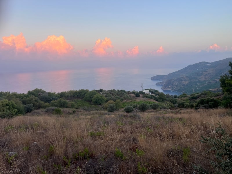
Clouds and the landscapes of Antiochia ad Cragum in Turkey

Archaeology: A Deeply Human Endeavor

Sarah “Gigi” Konecki-Brazeal, 2024 P.E. MacAllister Fieldwork Scholarship Recipient 

First surveyed in the 60s and left untouched for decades, Antiochia ad Cragum is a first-century Roman city founded by Antiochus IV of Commagene around 44 CE. Perched on the “cragus” roughly 300M above the Mediterranean, the city has yielded many great finds over the past 20 years, including two bathing complexes and a plethora of questions about the evolution of this city from a bustling polis to a site of extensive industry. At some point in this city’s lifespan, many of the buildings, including both bath complexes, were converted to industry. Evidence of wine and oil production, as well as ceramic, glass, and metal production, have been found throughout the site.

A view of the Mediterranean from Antiochia ad Cragum.

Excavations began on the Small Bath in 2018 and will continue for the foreseeable future. This type of bath is known as a hall bath and might be a bit unfamiliar to those already versed in Roman bathing complexes. The architecture of the bath situates a great hall with mosaiced floors through the center of the building with tepidaria (cold rooms) and caldaria (hot rooms) on either side. The hall leads to a large wading pool on the west end of the complex, and the building itself has one main entrance on the east end. To date, three frigidaria and one caldarium have been excavated. In addition, the cistern for the bathing complex was uncovered entirely during the 2023 and 2024 seasons. It is suspected that two more caldaria exist along the southern side of the complex, and there is the hope of locating the praefurnium there as well.

Me, perched on a rock digging in an area precariously peppered with finds. A great way to avoid artifact breakage!

In the summer of 2022, I came to Antiochia ad Cragum as an undergrad, looking to fulfill my field school requirement and find out if I had what it took to work in the field of archaeology. I was sent to the small bath to work under the direction of Dr. Leticia Rodriguez, and I had no idea what to expect. It was A LOT of digging, and A LOT of giant rocks, and A LOT of wheelbarrows. In the second week Dr. Rodriguez decided to open up Frigidarium 4 on the westside of the Small Bath and asked for volunteers. Frigidarium 4 was almost entirely full of fill that had washed down the mountainside and into the now roofless room. It looked like an impossible task, and nobody really wanted to start at the beginning again, especially when the trenches that had been opened the previous week were starting to look like something. So naturally, I volunteered. Again, it was nothing but dirt and large rocks which had fallen from the wall or ceiling. It was hot, it was dirty, my legs and arms felt like noodles at the end of the day…and I couldn’t wait to go back.

Frigidarium 4 at the end of the 2024 season

What should have taken a couple of weeks to clear and document has now taken us three seasons to uncover, with no sign of a floor at the end of the 2024 season. Since removing surface fill, Frigidarium 4 has yielded many spectacular finds owing to its conversion to a trash pit sometime (we think) in the fifth century. They say you can learn much about a man by going through his trash, and I agree. Everything these people were doing, using, making, participating in, and ultimately discarding have been found in my trench. We have learned so much about what these people were doing and what they found valuable by examining the findings from Frigidarium 4. Detritus from industry, personal items, evidence of what people ate, and the animals they raised – not only for food but for textile production – have all been found in Frigidarium 4, which still has more to tell us.

Digging a sondage in a last-ditch effort to locate the floor before covering Frigidarium 4 up for the off season.

The connection one feels to the people of the past when finding and carefully preserving their once-lost history isn’t easy to put into words, but it keeps me coming back year after year. Every season, we get a little closer to uncovering these peoples’ stories and piecing together the lives of those who were, up until now, forgotten. There is a beauty in unearthing something that once sat in the hands of a person over 1500 years ago, a strange intimacy with someone whose name you can never know and whose face you will never see. Additionally, there is an overwhelming sense of civic duty that comes with uncovering these items and sending them home to a conservation lab or museum where they will find new life. These things belonged to people once, and those people have been forgotten. But with our work in Antiochia ad Cragum, they live again, and the Turkish people reclaim a piece of their heritage that they may not have realized they’d lost.

Ultimately, archaeology is a profoundly human endeavor that contributes to a sense of connection: connection to our past and to each other. A connection that bridges borders, cultures, and time. A connection that I hope, brings us all closer to one another on the most fundamental of levels.

The humans of the Small Bath 2024.

Sarah “Gigi” Konecki-Brazeal is a graduate student at Arizona State University studying Art History, Archaeology, and Studio Art. She is a practicing artist who merges her artistic work with her academic research. In addition to being a trench supervisor and field assistant and Antiochia ad Cragum, Gigi also works as an illustrator and lithic analyst for the Bandafassi Regional Archeological Project. She plans to write her dissertation on ancient tattooing practices and go on to teach at the university level while continuing her fieldwork in Turkey and beyond.

Learn more about the Antiochia ad Cragum Archaeological Research Project here. 

Want to help more students and early career archaeologists get into the field? Donate to the cause today by selecting “Fieldwork Scholarships” as your gift purpose!

Fieldwork Report: Daniele Moscone

Studying Chipped Stones and Sampling Knappable Rocks Along the Zagros Hilly Flanks

Daniele Moscone, 2024 P.E. MacAllister Fieldwork Scholarship Recipient

The piedmont of northern Iraq’s Zagros Mountains has long fascinated scholars due to its remarkable archaeological potential and favorable conditions for ancient human settlement. Pioneering research by D. Garrod in 1928 and R.J. Braidwood in 1947 uncovered traces of the last hunther-gatherer societies and among the earliest evidence of sedentism and food production strategies in southwest Asia, through the excavation of sites of great importance, including Palegawra, Zarzi Cave, and Charmo.

Given the historical background, I was deeply excited when Prof. S. Renette invited me to join his team to study the chipped stone assemblages from previous excavation seasons in Kani Shaie (Sulaymaniyah, Kurdistan Region of Iraq). Since 2012, the Kani Shaie Archaeological Project (KSAP) has been investigating the well-preserved archaeological sequence at the homonymous mound which spans from the Late Neolithic (ca. 7000 BCE) to the Early Islamic (ca. 1200 CE). The ultimate goal is to understand the ancient inhabitants’ lifestyles, mobility, and sociocultural connections with both the Mesopotamian plain and mountains of this vast and diverse area across millennia. The current stage of this interdisciplinary research focuses on the 4th and 3rd millennia BCE, which were transformative periods distinguished by the establishment of social inequality, bureaucracy, monumental architecture, complex settlement patterns, long-distance trade and exchange, and ultimately the rise of the first urban societies.

The survey team while standing on the right bank of the Lesser Zab River.

With the generous support of the P.E. MacAllister Fieldwork Scholarship, I was finally able to engage in an archaeological project in the Sulaymaniyah Region for the first time, although having long worked in the macro-region. One of the most enriching aspects of working within the KSAP team was the chance to interact with a diverse and open-minded group composed by both experienced and young researchers. Through these interactions, I was able to exchange knowledge, ideas, and perspectives. Additionally, amidst the exciting discoveries and intensive work, I had the pleasure of forming new friendships.

An example of intermontane rocky landscape cut by a river.
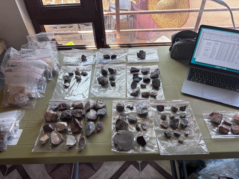
Recording observations on the collected geological samples and drawing sketch profiles of the geological formations interested by the sampling.

The first part of my work took place at the expedition house and was focused on the analysis of the chipped stone collections from key periods, including Ubaid, Late Chalcolithic, and Early Bronze Age. I conducted a technological analysis of the artifacts, addressing crucial questions: how the artifacts were produced? What techniques and methods were used? Which raw materials were chosen? Do we observe significant changes in these practices throughout different settlement phases?

Thanks to the Fieldwork Scholarship, the completion of the second phase of the intended work was also made possible. A small team was assembled for the purpose of conducting extensive surveys aimed at comprehending, for the first time, the regional availability of raw materials suitable for crafting stone tools. During a four-day survey, our team – consisting of an expert archaeologist from the Directorate of Antiquities of Sulaymaniyah and a driver – explored a diverse and fascinating landscape: this included the Bazyan plain with its alluvial and rocky hills, steep mountainsides with narrow valleys carved by small rivers, and limestone walls with many caves and rock shelters. Significant stretches of the two major river courses, the Lesser Zab and Tanjero River, potential sources of raw materials, were also explored. This stage resulted in the identification of multiple candidate geosites, which were then systematically sampled. The most significant sampled raw material was chert, a siliceous sedimentary rock extensively available on earth and
selected since early prehistory to produce stone tools due to its very good fracture qualities.

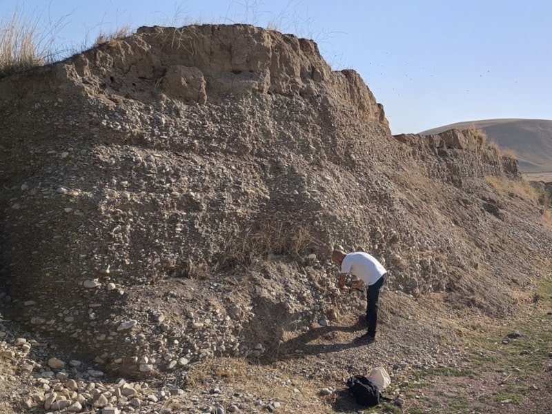
Sampling fluvial-transported chert pebbles along the ancient terraces of the Tanjero River. In the background it is possible to note the hilly morphology of the Tanjero Formation, from which the river erodes and transports part of the fragments.

Our field prospections preliminary results are exciting since we encountered many distinct varieties of chert, well mirroring the variability observed at the archaeological site of Kani Shaie. Future studies using scientific methods (e.g., macroscopic, petrographic, and geochemical analyses) will compare selected archaeological artifacts and geological samples to identify sources or procurement areas exploited by the prehistoric communities settled at Kani Shaie. As a result, I hope that my beneficial collaboration with the KSAP team will continue over time and contribute to their broader research questions. Another long-term goal is to create an open-access repository of these findings and welcome participation and inputs from colleagues and scholars interested in prehistoric lithic raw material procurement in the region.

For more information about the Kani Shaie Archaeological Project (KSAP) visit here.

Work in the KSAP expedition house: field data are stored in a database and the geological samples are cleaned, counted, labelled and packed.

Daniele Moscone is currently a postdoctoral researcher at the Institute of Prehistoric and Protohistoric Archaeology and ROOTS Cluster of Excellence (CAU Kiel), where he focuses on the prehistory of southwest Asia, in particular the Zagros Mountains. Previously a postdoctoral fellow at the Research Center for Anatolian Civilizations (ANAMED) of Koç University, he earned his PhD at Sapienza University of Rome, specializing on chipped stone artifacts and raw material analyses. You can find Daniele Moscone on Bluesky @mosdann.bsky.social

ASOR is now accepting applications for 2025 Fieldwork Participation Scholarships. Learn how to apply here.

Want to help more students and early career archaeologists get into the field? Donate to the cause today by selecting “Fieldwork Scholarships” as your gift purpose!
 

Fieldwork Report: Claire Hook

Living it up in the Archaeology Lab

Claire Hook, 2024 Katherine Barton Platt Fellowship Recipient

While working on the Brač Island Project on a beautiful island in Croatia, the team got to excavate our hillfort site, Gradina Rat. At the same time, we were learning about what was being excavated during the project because of our work in the lab to identify and document the artifacts being uncovered.

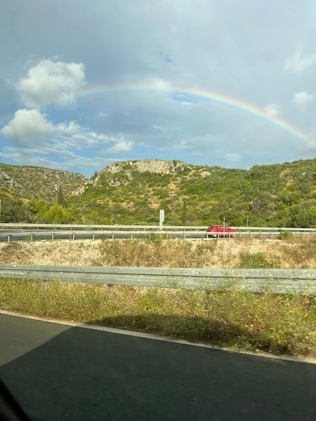
Our last drive to site featuring a rainbow perfectly over Gradina Rat where we were excavating.

Although a large part of archaeology is the excavation, understanding what was happening in the past at a site comes from identifying and analyzing the artifacts and doing additional research in the lab. My role this season was the lab assistant, so I was able to spend some days out on site, but a majority of my time was spent helping Dr. Sarah James in the lab working directly with the ceramic assemblage.

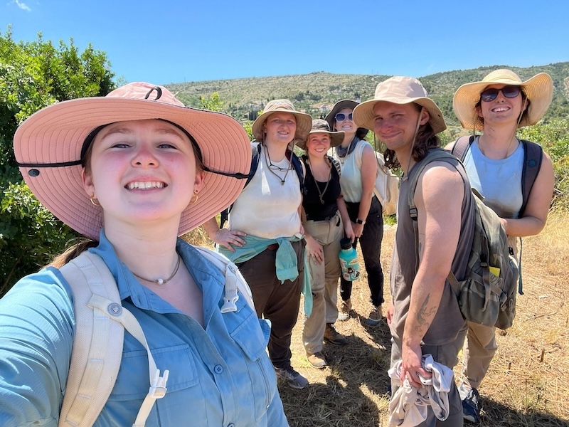
The excavation crew at site after our morning excavations. I am on the far right.

There were four main tasks that I helped to complete throughout the season to
keep everything running smoothly and figure out what was happening within each context of finds.

The first part of the lab work was pottery washing.

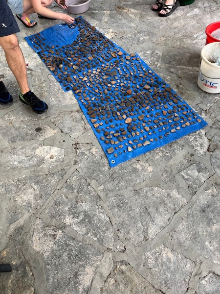
The ceramic assemblage from one context all laid out to dry after being washed.

Everyone who participated in the project helped with washing the ceramic finds so that any designs and colors could be more easily seen once the dirt was scrubbed away and so the artifacts remained clean. We washed the pottery that was brought down from the site every day—unless it was raining so badly that we couldn’t be outside—so that we could keep up with all the finds that were excavated.

The next step in lab work was artifact reading where we would record as much precursory information about the artifacts as possible. We recorded each artifact into the database alongside their context numbers to give a sense for the assemblage throughout the contexts. For the ceramic sherds, the team would partner with Dr. James and Dr. Barbarič to record the identifiable sherds from each context and give them a preliminary vessel shape and date range. I would also take counts and weights of the three main categories of ceramic vessels: table, cooking, and coarse ware. Knowing the types of ceramics being used on site was helpful for recognizing that this was not a domestic settlement and that something far more interesting was happening at this site.

After the ceramic pieces were read into the database, the pieces that required more research to identify or that could give new information about the assemblage were catalogued. A lot of my time in the lab was spent cataloguing pottery sherds. One goal we achieved for this season was to finish cataloguing the artifacts discovered in previous seasons and to work through as many sherds from this season as possible. Cataloguing included taking the dimension and weight of each sherd and describing the texture of the surface, the strength of the firing technique, the interior color and inclusions of the clay (also known as the fabric of a vessel), and any exterior decorations. After detailing the specific piece, I would research comparable shapes and decorations from other authors to help verify the classification of the shape, origins, and date of the original vessel. With this information, we were able to get a clearer sense of the activities and uses of the ceramics at Gradina Rat and how the people living on Brač were connecting with traders from other countries.

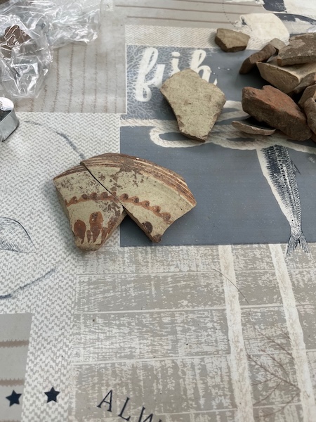
Two joining sherds of Italian Matt Painted Imported Ware from the 4th to 6th c. BCE.

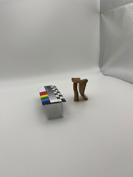
The last piece of lab work was photographing some of the especially important finds to have clear photos of special artifacts, the ranges of imported vessels, and the common local vessels. Having these photos will allow other scholars to work with the artifacts found at this site and will aid in visually accompanying any research written about this site. Our set up was simple yet effective. I only occasionally had to carefully hide clay supports to help get certain angles of the pieces.

Lab work in action to photograph one of the ceramic sherds.

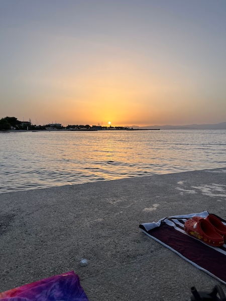
At the very end of the day, we would all gather down at the beach to watch the sunset after everyone finished their afternoon tasks, and sometimes we’d jump into the magical waters of the Adriatic and theorize about what exactly the ancient people were doing up on that hill.

Swimming at sunset after a hard day’s work in the field and in the lab.

Claire Hook just graduated with a Masters of Classical Art and Archaeology from the University of Colorado Boulder. Her research interests are in the responses and treatment of child mortality in Ancient Greece, and the ceramic assemblages that accompany them. 

ASOR is now accepting applications for 2025 Fieldwork Participation Scholarships. Learn how to apply here. 

Want to help more students and early career archaeologists get into the field? Donate to the cause today by selecting “Fieldwork Scholarships” as your gift purpose!
Collections Fellowship Report: Holly Winter

2024 Collections Fellowship Report: The Land Behind Aleppo: Urban Life and State Formation in Bronze Age Syria

Holly Winter, University of Sydney

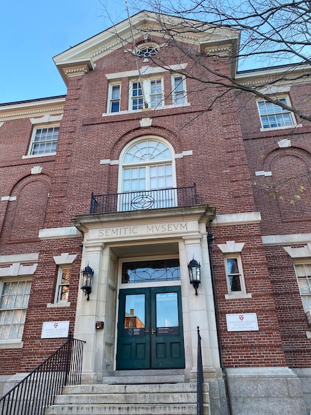
Thanks to an ASOR Study of Collections Fellowship, I was able to spend a week in Boston at the Harvard Museum of the Ancient Near East (HMANE), studying the ASOR Syrian Survey material. The focus of the research trip was to study the ceramic assemblage collected as part of the 1970s ASOR Syrian Survey (ASS) project by the late James Sauer. This research forms part of a larger project, the ‘Land Behind Aleppo’ (LBA) project, which aims to investigate the Bronze Age history of Aleppo, specifically during the time of the powerful Middle Bronze Age (MBA) kingdom of Yamkhad (Aleppo). It employs legacy ceramic assemblages collected by James Sauer, as part of his ASOR Syrian Survey. This will be combined with the late John Matthers’ River Qoueiq survey project materials, now housed at the Institute of Archaeology at University College London. The ‘Land Behind Aleppo’ project aims to investigate Aleppo’s Bronze Age history through a ceramic proxy study of the central city’s changing pattern of relationships with its hinterland settlements over the course of the Bronze and Iron Ages, aiming to bracket the period of greatest prominence (the MBA: 2000-1500 BCE) and evaluating the changing fortunes of Aleppo down the ages. As fieldwork in the region of Aleppo in the near future is unlikely, this research is a necessary precursor and eventual supplement to any future work on the central site and its region.

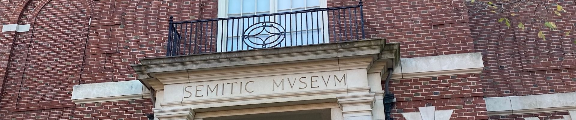
The Harvard Museum of the Ancient Near East building.

Analysing ceramics from a number of sites in the hinterland regions of Aleppo will aim to chart the development and changing pattern of interaction between the various settlements within the polity of Yamkhad over time. Key to this study is tracking the expansion and contraction of the central state’s economic ‘footprint’. A multi-proxy analytical programme using a combination of typological approaches and scientific techniques, drawn from geochemistry, petrography, and materials science, will target select ceramic forms, chosen because they potentially inform on different aspects of contact. These well-established methods can illuminate the production and distribution of storage/transport jars associated with bulk commodity transactions such as those involving grain and oil for trade/taxation, fine tablewares for elite consumption/emulation studies, and cooking/food preparation forms indicative of local production. Together these enable us to examine and hopefully contrast what is locally, sub-regionally, and centrally produced. The resulting data informs on trade, administration, and systems of production and distribution. The ‘reach’ of the central site, and thus arguably its politico-economic power projection, will be assessed over time. The ultimate aim is to chart the ebb and flow of influence/power, and whether this is primarily elite-interaction driven, or staple-economic in form.

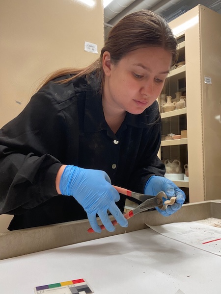
Holly sampling a selection of sherds from the ASS project.

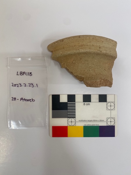
The numerous boxes of ceramics from the ASOR Syrian Survey (ASS) sites were made available for this study thanks to Dr. Adam Aja, Chief Curator at the HMANE. The ASOR Syrian Survey was conducted by James Sauer from 1977-79, and studied 83 sites across Syria. The collection is large and multi-period in scope, now stored in 24 boxes in the HMANE. Only sites with materials from the Bronze and Iron Ages were studied as part of this research project. The aim during this visit to the HMANE was to gather ceramics from the Aleppo Sector of the ASS collection, as time was limited. In total, I was able to sample 11 sites in three days, focussing on sites closest to Aleppo. Before sampling, each site assemblage was reviewed, and then a selection of sherds were chosen for sampling. The choice of which sherds to sample was based on a pre-established typology, although size of sherd and appropriateness for sampling were considerations. Each sherd was given a project number (LBA#), described and sketched before sampling. It was then photographed with site identifiers and a second time on both obverse and reverse surfaces, and occasionally the profile. Approximately a half cm size was snipped from the sherd at a location that would not impact future drawing of the sherd (mostly from the shortest profile side). A total of 175 sherds were sampled during this visit to the HMANE, and it is hoped that petrography and neutron-activation analysis will be able to be conducted on these samples in the near future.

Fragment of a Middle Bronze Age tall narrow-necked jar from the site of Atareb, sampled as LBA118.

The ASS material will offer insights into the social and economic history of a region where little is currently known, in the hope that results pertaining to the pre-eminent MBA kingdom of Yamkhad can be generalized across the Levant, and perhaps further afield. It also exploits an important legacy database that has been unstudied for nearly 50 years, giving promise of shedding light on one of the main drivers of Syrian urban life in the MBA and beyond–Aleppo.