Stipend Report: Lilly Hickox

Casting Light on Humayma’s Roman Town

Lilly Hickox, 2021 Eric and Carol Meyers Summer Stipend Recipient


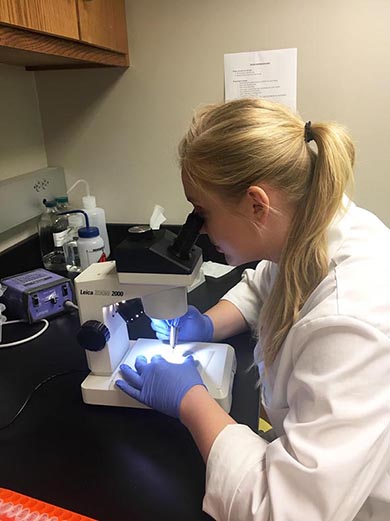
Hickox studying the lamps of Humayma’s vicus. (photo courtesy of M. Schwenteck)

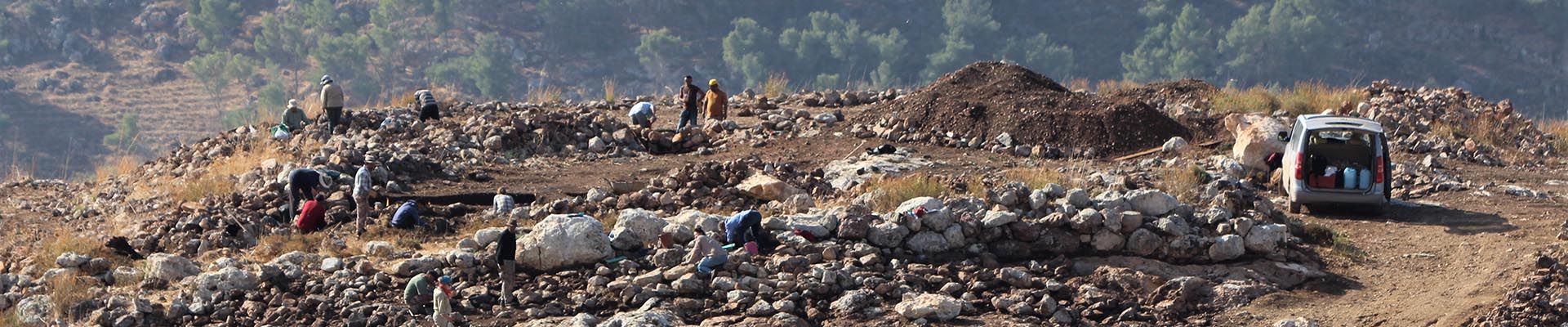
Humayma, located in the northwest corner of Jordan’s Hisma desert, is a site with a long history of permanent settlement with Nabataean, Roman, Byzantine, and early Islamic periods. Excavations at the Roman town (vicus) have been carried out since the 1990s under the direction of Dr. J.P. Oleson from 1991 to 2005 and Dr. M. Barbara Reeves from 2008 to present.

This summer, I researched the ceramic oil lamps and fragments from the vicus at Humayma remotely. The vicus emerged concurrently with the nearby Roman Fort, shortly after the conquest of the Nabataean Kingdom in 106 CE by Emperor Trajan. This research was made possible through ASOR’s Summer Stipend program and funding supported by the Eric and Carol Meyers Scholarship Fund.

The question driving my research was sparked by the findings from my 2020 undergraduate thesis project, Shedding Light on an Ancient Past: The Analysis of Ceramic Oil Lamps from the Roman Fort at Humayma. During this project, I identified a paucity of Roman-style lamps at the Roman Fort, while Nabataean and South Jordan lamps were prevalent. In order to understand why this was happening at the Fort and how the absence of Roman identity in the lamps relates to the activity of the overall settlement, I specifically looked at the corpus from the vicus this summer.
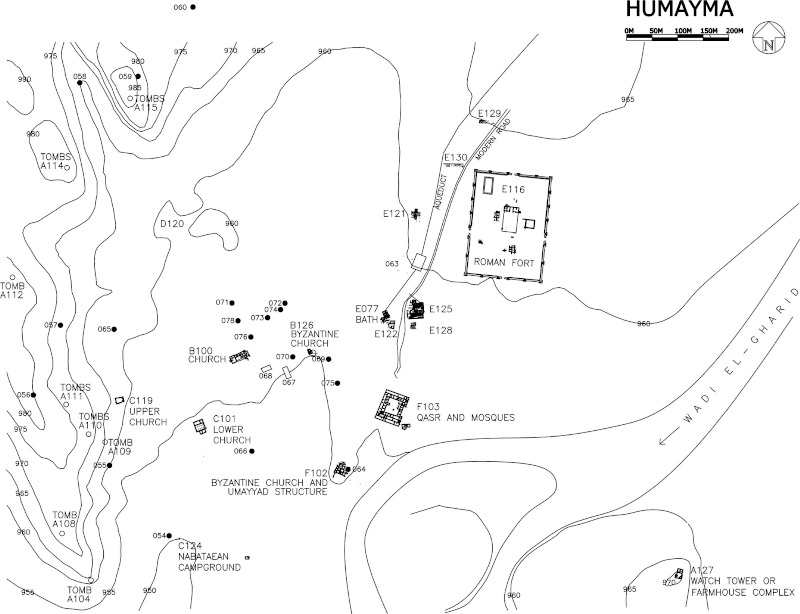
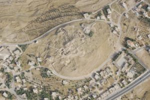
Map of Humayma. (adapted from Reeves 2019, 117 fig 2)

The methodology of this project involved visually examining photographs of lamps, lamp fragments, and mixed pottery fragments. Looking at attributes of shape, discus, shoulder pattern, nozzle, and filling hole, allowed me to identify and catalogue the lamps. These photographs and artefact descriptions were provided by Humayma’s excavators from the 1996, 1998, 2000, 2004, 2005, 2008, 2010, and 2012 field seasons. Neither a comprehensive catalogue nor analysis of the lamps had been carried out until now. This summer, I identified fourteen complete lamps and over 170 lamp fragments.

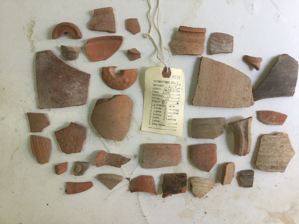
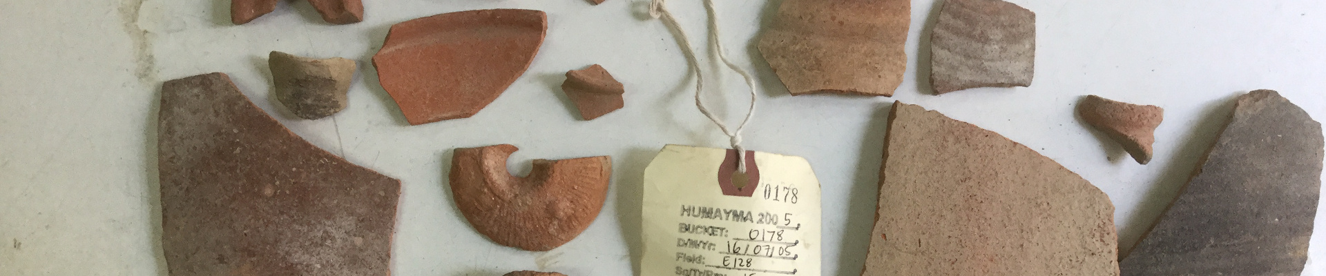
A sample of pottery from area E128. Can you spot a lamp fragment? (photo provided by Dr. M. Barbara Reeves, director of the Humayma Excavation Project)

A Nabataean rosette lamp, one of the most prolific types at the vicus. (photo provided by Dr. M. Barbara Reeves, director of the Humayma Excavation Project)

In this project, I investigated the ceramic oil lamps from three different areas of the vicus. The first area (E077) contained first century CE Nabataean structures that were built over by a bath-house in the Roman period. The Nabataean rosette lamp, dating to the first century CE, likely corresponds to the phase preceding the early second century destruction. Many early Byzantine lamps and some late Roman lamps signify the later occupation of the area.

The second area (E128), a Nabataean or Roman mudbrick structure, contained a majority of Nabataean-style lamps. This structure, made of eclectic materials, was built between the late first century and the middle of the second century. Remarkably, a figural lamp and a boot-shaped lamp were identified in this location, which are both rare for the corpus of the vicus. The boot-shape lamp may align with the later function of the structure in which the area was used as pottery dump until the sixth century CE.


A Roman discus lamp with a gladiatorial combat scene. (photo provided by Dr. M. Barbara Reeves, director of the Humayma Excavation Project)

The final area that I examined was E125, an area possessing a Nabataean-Roman shrine, and various domestic structures, such as a Roman insula. This area yielded the greatest number of lamp fragments, the vast majority being the Nabataean rosette lamp, while fewer were Roman in style. At least three figural lamps were identified, including a symplegma and gladiatorial combat scene. Overall, the lamps from the vicus show a strong parallel with those from Petra.

While this project did not constitute typical field work, it nevertheless presented its own unique challenges. For instance, I relied only on photographic media that was sometimes supplemented by artifact descriptions in order to make an assessment.


Lamp fragments from the E125 shrine. (photo provided by Dr. M. Barbara Reeves, director of the Humayma Excavation Project)

This project contributed to the understanding of the civilian activity at Humayma and may be used to help develop stratigraphic phasing for these areas in the vicus. My next steps will be to look more closely at several anomalous items in the corpus and their parallels. I presented a critical analysis of my findings, considering the corpus from the Fort, at the virtual component of ASOR’s Annual General Meeting in December 2021 (Click here to view the poster).

I would like to personally thank Dr. Reeves for her ongoing support, supervision, and expertise, as well as the Humayma Excavation team for their work, Carol and Eric Meyers for making this possible, and M. Schwenteck for assisting me in translations.

Lilly Hickox is an MA student of Classical and Near Eastern Archaeology at the University of British Columbia. She has been researching the ceramic oil lamps from various locations at Humayma since 2020.

References:

Reeves, M. B. 2019. “The Nabataean and Roman Towns at al-Ḥumayma: an Urban Design Perspective.” Studies in the History and Archaeology of Jordan 13: 115-127.
During the summer of 2021, ASOR supported 27 undergraduate and graduate students through the Summer Stipend Program. These students undertook non-fieldwork archaeological research projects led by ASOR-affiliated project directors. They also took part in monthly cohort group meetings hosted via zoom. Read a summary of these cohort meetings here.

Stay tuned for more updates from the 2021 Summer Stipend recipients!

Geraty Grant Report

Doing unto others as we would have others do unto ourselves: A Report on ASOR’s Lawrence T. Geraty Endowment for Community Archaeology

An inconvenient truth about most archaeological excavations is that more often than not, they do serious damage to the landscape and scenery in the areas where they work. In their wake, archaeological expeditions leave not only wall-sections of houses, barnyards, streets and fortifications, but also unsafe and unsightly excavation trenches and scatters of stones and spolia. This raises the question: Do organizers and sponsors of archaeological excavations have a duty to restore the landscape and scenery they impact with their excavations?

Summit of Tall Hisban. APAAME_20191024_DS-0007. (Photographer: Dana Salameen, courtesy of APAAME)

Back in the day, under the old expeditionary model, the default answer to this question—as it was rarely asked–was no. Under this, now obsolete orientalist mindset, the excavator’s duty was to dig and record well and publish results in peer-reviewed venues in a timely manner. This is where her responsibility ended. How things were left in the field was not a concern as the prevailing assumption was that responsibility for maintenance and preservation of abandoned sites was in the hands of local authorities[1]. After all, in many cases, funds were collected by local permitting authorities ostensibly for precisely this purpose. Such funds, collected at the end of each excavation season, are not a sustainable solution to long-term maintenance of archaeological sites (especially minor sites not associated to ticket-generated income).

As the previous century came to an end, a prominent casualty of this situation was Tall Hisban, located in Jordan along the road linking Amman and Madaba and widely assumed to be biblical Heshbon [2]. Visitors to the site would have found an ascent to its summit to be a most arduous undertaking, as it required stepping warily through clusters of camel shock, tumbled stones and spolia of all shapes and sizes. For all but the most persistent, an ascent to its summit was not an appealing prospect.

A major reason why a team from Andrews University decided to return to work at Tall Hisban in 1996 under my leadership was to find a remedy for this situation. By then, the site had been abandoned for over two decades, the original Heshbon Expedition having ran its course from 1968 to 1976. A second reason was my desire to deepen understanding of already well documented long-term cycles of food system intensification and abatement at the site. A third reason was a consensus among the original Heshbon Expedition leaders that the site’s Islamic archaeology and history deserved to be re-visited with someone on-board with state-of-the-art qualifications for the task at hand. To this end, Bethany Walker was recruited to join our team, and her studies and publications since have proven to be ground-breaking on many levels where Islamic archaeology in Jordan and beyond is concerned. I would note, for example, her editorship of the Oxford Handbook of Islamic Archaeology and a new Journal of Islamic Archaeology (Equinox Publishing).

Group photograph from 2018 field season at Tall Hisban including international team (20 different nationalities) and local workmen.

In the course of over two decades of the second phase of excavations at Tall Hisban—now renamed the Hisban Cultural Heritage Project–a new vision and model of archaeological fieldwork crystallized that today is becoming standard archaeological practice in Jordan and beyond, namely community archaeology. What led to this model emerging in our particular case were three factors: first, the already mentioned situation of neglect at the site; second, a long tradition of ethnographic inquiries in the local community; and last but not least, the friendships and sentiments of mutual trust and understanding already fostered during the original Heshbon Expedition that could be built on as our team returned.

The goal of community archaeology at Tall Hisban since its onset in 1996 has been to partner with the local community in transforming the site and the town into a place of pride and economic opportunity for its residents even as it also would develop into a destination for visitors from elsewhere in Jordan and beyond. Construction of footpaths and viewing platforms was begun in 1997, followed in subsequent seasons with over three dozen in-situ exhibits, each accompanied by explanatory signage. Partners in these endeavors included workmen and their families from the village, the office of the local mayor and his staff; and personnel from the local and national headquarters of the Department of Antiquities.

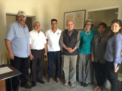
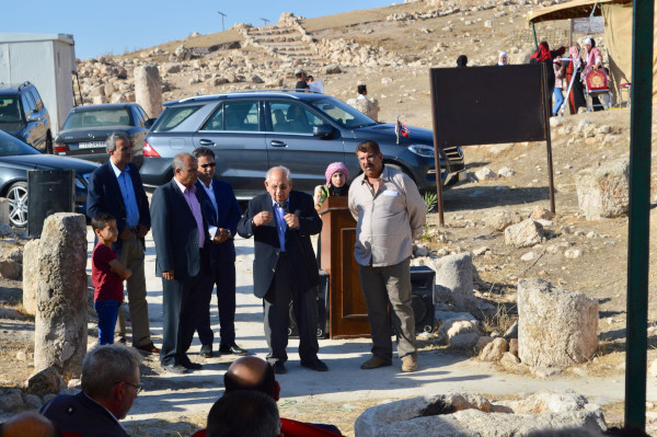
From the left to the right, Mansour Sheehan (Tall Hisban Cultural Association), Saoud Albarari (Tall Hisban Cultural Association), Amer Awawdeh (Tall Hisban Tourist Development Project), Øystein LaBianca (Andrews University), Maria Trogolo (USAID-SCHEP), Anna Kim and Noel Harris (Andrews University interns).
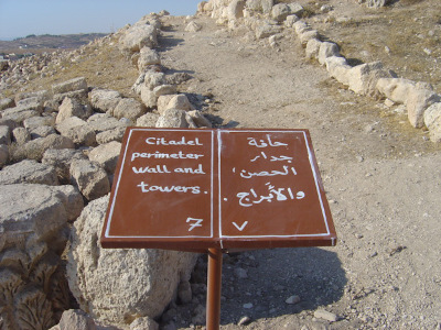
One of the signs painted by Amer Awawdeh, local school teacher.

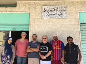
Sela’s founders with Øystein LaBianca. From left to right, Eman Abdassalam, Maria Elena Ronza, Ahmad Almousah, Øystein LaBianca, Shaker Alfuqara and Bassam Alfaqeer.

Maria Elena Ronza, a young archaeology student from Italy who joined our team in 2001, has been particularly responsible for the success of these undertakings. Having taken up residence in Jordan, she was in a good position to follow up on projects that could not be completed during our short field season. A good example is her work with local stakeholders to establish the Hisban Cultural Association as an official non-governmental organization, thus giving agency to local entrepreneurs from Hisban to develop Hisban into a touristic destination. Elena was subsequently hired by ACOR to assist with the Temple of the Winged Lion project [3]  to which she brought the community archaeology experience acquired at Hisban. She has since gone on to incubate together with Ahmad Almousah two all-Jordanian organizations aimed at building local capacity to benefit from protecting nearby cultural heritage sites. They are Sela for Vocational Training and Protection of Heritage (Sela Facebook Page) and Al Raqeem for Logistics & Training (Al Raqeem Facebook Page).

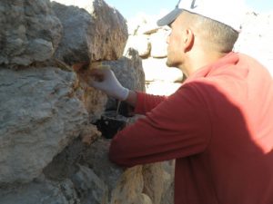
Ahmad Almousah at work in Hisban applying lime mortar.

The Lawrence T. Geraty Community Archaeology Endowment was launched in 2020, in cooperation with the American Society of Overseas Research (ASOR) as a fitting capstone to almost three decades of community outreach by our project. The purpose of this endowment is to support innovation and experimentation by archaeology teams such as ours to build toward sustainable local solutions for preserving and caring for archaeological sites. At the present writing, the fund stands at about $110,000, which has allowed a first distribution of interest earned to occur [4]. That first award was used this summer to leverage funds from antiquities authorities in Jordan to undertake a site-wide cleaning operation that has resulted in the site itself and all of its primary exhibits, signage and paths looking better than I have ever found on my many returns to Jordan. As important was discovering Yasmeen Al Ajarmah, an archaeology graduate from University of Jordan, who led this entire operation and whom I could offer a part-time job as a team-leader for site maintenance operations on an on-goingh basis. She, and a team of three local workmen, will also be assisted by Al Raqeem for Logistics and Training in working with the local community to develop various micro-enterprise activities that can generate income not only to pay for their own salaries, but also for other community entrepreneurs.

Among the micro-enterprises already underway that also generate funds to support protection of the site are a women’s cooperative providing locally made meals for our excavation teams, tour groups and other visitors; a program of educational activities for local school children that includes sale of a children’s book about Hisban in Arabic. Efforts are also underway to provide visitors with an on-line guided tour of the site which will include announcements of various micro-enterprises and an invitation to donate toward maintenance of the site.

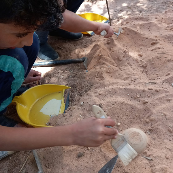
Sela implemented 4 archaeological themed days with hands-on activities for children thanks to support of the Geraty Fund and in cooperation with Princess Basma Center in Hisban.
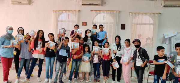
Book reading at Princess Basma Center in Hisban. In preparation for the launch of a children book about Hisban, the writer, Rasha Dababneh, standing in the middle wearing a mask, hosted a book reading for the children from the community. Children were invited to suggest ideas for the forthcoming children’s book.
On the occasion of the 50th anniversary of the project, Princess Basma Center in Hisban organized an on-site bazaar so women from the local community could showcase and sell their products.
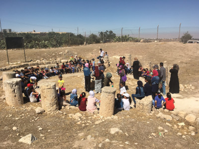
On the occasion of the 50th anniversary of the Hisban digs, school children and their teachers visited the site and participated in hands-on archaeology-themed activities.

Stanley Beikmann, a professor landscape design from Andrews University who served as a faculty member on our project, shared a vision of a botanical garden at Hisban with me some years ago. The Al Raqeem team, Yasmeen Ajarmah and her co-workers are helping this vision to be realized. Such a place includes well-tended and signed exhibits, interpretive paths and platforms, and places for groups of visitors to gather for purposes of orientation and education. An aspirational addition to this vision is a visitor center complete with rest-room facilities, a small shop/cafe, a physical model of the site and a small theatre for screening a short film about the site in different languages.[5]

Welcome event in the amphitheater at the entrance to Hisban.

My answer to the question posed about archaeologists’ responsibility at the beginning of this article is: We can no longer avoid responsibility for how sites are left once our fieldwork is ended. The community archaeology model developed at Hisban is obviously not appropriate for all excavations, but for larger projects involving multi-period tell sites, I believe our experience and approach has relevance [6] . For smaller projects involving only a few trenches or probes, the responsible solution is to simply fill in the excavated areas at the conclusion of the project. The days of the old expeditionary model are over. As archaeologists, we have a responsibility to do unto others as we would have others do unto ourselves.

-Øystein LaBianca, Andrews University

Women's Association Tent Bazaar.
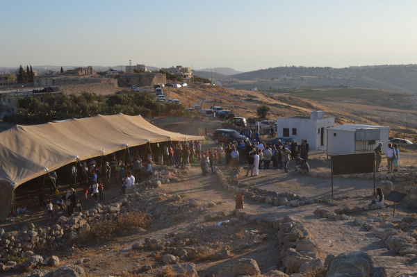
Speech by H.R.H. Prince Raad bin Zeid at the Hisban 50th Anniversary event.

[1] For local communities abandoned excavation sites often leave unanswered questions and expectations: Does this mean the team will be back to ‘look after’ their site? Does leaving it open mean they can expect tourism? Furthermore, abandoned sites mean no ‘closure’ for communities and are often unsatisfactory from their point of view – ugly scars in their landscapes which fill with trash and slowly decay, potentially souring positive relationships established with dig teams originally.
[2] For the record, it should be noted that when the first phase of excavation was finished in 1976, the expedition leadership did not altogether neglect the concerns addressed here. Larry Geraty, then director of the project, and Bert de Vries, project architect, teamed up to prepare a plan for visitors to the site, including viewing platforms along the path that circled the site, etc. Detailed maps and plans were left at the Department of Antiquities along with the portion of the dig fees that were to go to the implementation of the plan. What did not happen was the sort of follow-up with the local community and with the department that became an integral part of the second phase of work at the site.
[3] https://www.jordantimes.com/news/local/italian-jordanian-architect-pushes-community-archaeology
[4] Seed funding for the endowment was provided by Ronald and Sheila Geraty. Andrews University and La Sierra University each contributed $10,000. Other major contributors ($1000+) to the endowment fund include Lawrence and Gillian Geraty, Oystein and Asta LaBianca, Carolyn Waldron, Joy Fehr, Doug and Carmen Clark, Susan Ackerman, Tim Harrison and Andy Vaughn. Help the Grant grow by selecting “Geraty Endowment Fund” from the drop-down menu in the link.
[5] See for example https://www.youtube.com/watch?v=u2kUMkjmRF8\
[6] For more about the Hisban Community Archaeology model, see https://digitalcommons.andrews.edu/auss/vol55/iss1/4/

Stipend Report: Loren Clark

7000 Miles Away: Geoarchaeology and Landscape Research in the Middle of a Pandemic

Loren Clark,  2021 Eric & Carol Meyers Summer Stipend Recipient

It has been no small feat, as all of us in archaeology know, to continue archaeological research and collaboration during the COVID-19 pandemic. With the aim of keeping everyone safe and healthy, most fieldwork and travel has come to a halt. For those of us who work outside of our home countries, it has been even more difficult to plan for the future of our research. For those of us conducting research as part of the UC San Diego and the University of Haifa collaboration, this has meant shifting our focus to the archive of sediment cores that were shipped to our lab in San Diego from the other half of our team in Haifa. In-field collection and meetings became Zoom calls, and planning sessions were discussed with maps on a shared screen. The 10hr time difference had our breakfast coffees in San Diego shared with Israeli dinner. Through the hard work of our directors and each team member, we were able to continue a portion of the research that we were conducting pre-pandemic.

Fellow graduate researcher on this core, Kendall Mahoney, works in the lab amid COVID safety protocols to collect samples for Carbon-14 dating and stable isotope analysis.

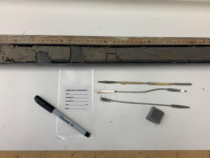
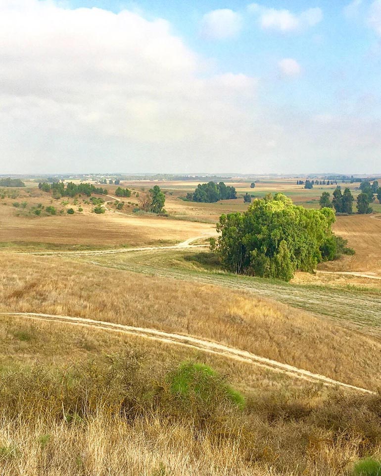
These sediment cores contain a high-resolution dataset of depositional processes and environmental change along the Carmel Coast during the Holocene. The specific core that was funded through this stipend is located in the northern part of the Kebara marsh in NW Israel. The analysis of the core in 2020 allowed for preliminary conclusions to be made about cycles of drying and wetting throughout the life of the wetland. Laminations of organic-rich layers juxtaposed against paleosol and sandy layers are present throughout the core, which have allowed us to posit questions related to regional and local climate change.

Core sections were sampled and labeled to be washed and sorted for various analyses.


Once washed and sieved, samples are picked and separated under a microscope to identify the makeup of each coarse fraction.

The goal this summer was to isolate specific proxies that serve as indicators of climate, environmental, and landscape change for the area between the Carmel Ridge and the coast. Specifically, we decided to focus on pyrite as it can be an indicator of changing salinity in waterlogged areas. Understanding the environmental change in the area is crucial in tracking the wetland as a resource for communities from the Neolithic – Iron Age. The Carmel Coast is known for the intense concentration of archaeological sites from various periods of prehistory, and the data that we have compiled will only add to the ever-growing picture of life along this critical landscape. The data from this project is still being analyzed by multiple researchers, including myself, and will be presented at the ASOR 2021 Virtual Annual Meeting in December. It has been an honor to work under this funding from ASOR to continue our research in this remote world. As safe travel opens up for international research, we plan to continue adding to and analyzing the existing datasets along the Carmel Coast.

Loren Clark is a 3rd year PhD student at the University of California, San Diego in the Levantine Archaeology Lab, directed by Dr. Thomas Levy. She is also a scientific diver for the Scripps Center for Marine Archaeology which focuses on submerged archaeology in the Eastern Mediterranean.
To keep up with this project (and many more) being conducted through the collaboration between UCSD and the University of Haifa and being funded by the Koret Foundation, please see our Facebook page: https://www.facebook.com/SCMAKoretProject

During the summer of 2021, ASOR supported 27 undergraduate and graduate students through the Summer Stipend Program. These students undertook non-fieldwork archaeological research projects led by ASOR-affiliated project directors. They also took part in monthly cohort group meetings hosted via zoom. Read a summary of these cohort meetings here.

Stay tuned for more updates from the 2021 Summer Stipend recipients!

Stipend Report: Shannon Burton

Stop, Collaborate and Listen!

Shannon Burton, 2021 Platt Summer Stipend Recipient


Drone shot of El-Kurru, showing both the archaeological site in the foreground and the village in the background. El-Kurru was the site of the royal pyramid cemetery of the kings and queens of ancient Kush, ca. 850-350 BCE. Image taken by Kate Rose, 2019.

Receiving a summer stipend from ASOR gave me the opportunity to work with Dr. Geoff Emberling on “Living in Nubia,” a community archaeology project centered around the Sudanese village of El-Kurru. Our project focuses on the ways in which we as archaeologists can work collaboratively with community members and Sudan as a whole to present El-Kurru and its heritage to audiences in both Arabic and English.

This work with El-Kurru village takes many forms, including a set of educational materials and worksheets for teachers that were completed earlier this year and will be workshopped in Sudanese schools this fall. Most of the work I did this summer, however, was on exhibit materials for the planned Community Heritage Center in El-Kurru. This heritage center will focus not only on the archaeological work done at El-Kurru, but also on the village’s local heritage and culture. Part of the materials I helped work through this summer were hundreds of photographs taken by El-Kurru residents. During the 2017, 2018, and 2019 seasons, the archaeological team ran a photo contest for the residents of El-Kurru, in which hundreds of photographs were submitted showcasing all aspects of life in the village. Part of our work this summer involved sorting through these photographs, choosing broader themes and categories for the exhibit, and then meeting virtually with our partners in El-Kurru, particularly our main contacts, Anwar Mahajoub and Sami Elamin, to decide which photos should be on display. These photos will be accompanied by captions written by the local photographers themselves. In addition to work on the heritage center, we also continued working on our plans for a children’s book and a short film about El-Kurru. We made significant progress this summer, and work will continue on all of these projects in the fall.

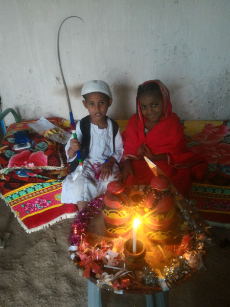
Two children at a wedding, taken by El-Kurru resident Marwa Mahajoob. One of the winning photos from the 2017 Photo Contest.

This deeply collaborative approach between archaeologists and El-Kurru residents is one of my favorite things about our project. All of the materials we are creating, from the heritage center to the children’s book, are things that the residents of El-Kurru themselves have requested, and we make sure that our local partners are consulted in every decision we make. My work with the “Living in Nubia” project has really shown me that archaeological research can and should be done in collaboration with, not just at the expense of, local communities, and this is something I will carry with me throughout the rest of my academic career.

Anwar Mahajoub (left), one of our main collaborators on the project, and Bakri Abdelmoneim, both from El-Kurru village, during filming of a short video at El-Kurru, 2019.

Shannon Burton is a recent graduate from the Classical Archaeology program at the University of Michigan. Her research interests include women in antiquity, archaeobotany, food production and cultivation practices, and community archaeology. She hopes to continue working with the “Living in Nubia” team, as well as go on her first excavation in Sudan in early 2022.

Project website link: https://sites.lsa.umich.edu/nubia/

During the summer of 2021, ASOR supported 27 undergraduate and graduate students through the Summer Stipend Program. These students undertook non-fieldwork archaeological research projects led by ASOR-affiliated project directors. They also took part in monthly cohort group meetings hosted via zoom. Read a summary of these cohort meetings here.

Stay tuned for more updates from the 2021 Summer Stipend recipients!

Fellowship Report: Jamie Fraser

THE ARCHAEOLOGY OF OLIVE OIL: EXCAVATING KHIRBET GHOZLAN IN JORDAN

Dr. Jamie Fraser, 2019 Harris Grant Recipient

On November 2, 2019, I drove up to a small knoll overlooking the stunning Wadi Rayyan in north Jordan, and started laying our trenches for the second field season of the Khirbet Ghozlan Excavation Project. Using funds generously awarded as a Harris Grant by ASOR, this project is asking new questions about the relationship between olive oil production and rural complexity in a period of urban recession known as the Early Bronze Age IV (EB IV, 2600-2000 BCE).


View to Khirbet Um al-Ghozlan in the Wadi Rayyan, Jordan. The monumental enclosure is visible running across the low saddle over which the site is accessed. Photo by Adam Carr.

Khirbet Um al-Ghozlan

Most archaeological surveys would classify the site of Khirbet Um al-Ghozlan (the “Ruins of the Mother of the Gazelles”) a farmstead, hamlet or village, as the site is a miniscule 0.4 ha in size. In this respect, Khirbet Ghozlan sits comfortably with our traditional understanding of the EB IV, which is described as a period of ruralization in which people abandoned large, fortified, mounded sites and dispersed into small, undefended villages.

However, Khirbet Ghozlan is remarkable for its monumental enclosure wall. Built partly as a double row of massive, megalithic slabs, this enclosure controlled access to the Ghozlan knoll. Why defend such a tiny site?


Excavations around part of the monumental enclosure wall. Note destruction by bulldozer (left). Orthophoto by Guy Hazell.

Olive oil and the EB IV

The answer probably lies in the site’s upland location. Khirbet Ghozlan is one of several EB IV enclosure sites, all located on the well-drained slopes of the Jordan Rift Valley escarpment. As these hills are well-suited to horticultural production, this project proposes that small enclosure sites served as specialized processing centers for upland tree crops such as olive (Olea europaea), and were defended to protect seasonally-produced stockpiles of high-value liquid commodities such as oil. In other words, could Khirbet Ghozlan be a 4,500 year-old olive oil factory and storehouse?

Excavating Khirbet Ghozlan

To test this model, a team from the British Museum and University of Sydney undertook excavations at Khirbet Ghozlan in March 2017 and November 2019.


Archaeologist Beau Spry excavating a broken-but-complete store jar in an EB IV storage compound. Photo by Adam Carr.

The results strongly support the olive hypothesis. Excavations uncovered a large architectural compound with several storage bins, and storage wares dominate the ceramic assemblage, including 26 partly-complete store jars and spouted decanting vats. Several long, notched Canaanean flint blades were possibly used as pruning saws, and four rock-cut olive presses were recorded nearby.

However, the most compelling data lies in the microscopic botanical remains. Using scanning electron microscopy, Dr Caroline Cartwright (Senior Research Scientist, British Museum), identified crushed olive stones and charred olive wood in the organic remains obtained through soil flotation. These data suggest that olive fruit was pressed for oil and olive wood was burned as fuel, likely stockpiled as orchard prunings.

Furthermore, the absence of other plant species such as domestic cereal grains and legumes suggests that people did not live at Khirbet Ghozlan permanently; rather, they probably visited the site seasonally to harvest and maintain their orchards. The single phase of unmodified architecture is consistent with limited occupation, and the paucity of domestic debris such as cooking pots and hearths suggests non-domestic activity.

Broken and complete Canaanean blades found during the 2019 excavation season. Photo by Adam Carr.
SEM image of a fragment of crushed olive stone (jift) by Dr Caroline Cartwright, © Trustees of the British Museum.
 

Modern and ancient olive mills


Removing crushed olive paste (jift) from fibrous mat at the Toubneh olive mill after the oil has been pressed. Photo by Annette Dukes.

It was particularly thrilling to dig our trenches through this ancient olive factory at the same time as farmers were picking olives in the orchards that surround the site. Olives are harvested in October-November, after the first autumn rains wash away the summer dust. The fruit is pressed in local olive mills. Locked up for most of the year, these factories come alive each autumn, when they turn the olive harvest into oil for domestic consumption or local trade.

We were lucky to accompany the Jordanian Minister for Agriculture on a visit to a traditional olive mill in the village of Toubneh in north Jordan. Although oil extraction is now mechanized, the stages of washing, crushing and pressing are unchanged. The Toubneh mill was a powerful analogy for interpreting our discoveries at Khirbet Ghozlan – two seasonal olive factories separated by 4,500 years.


Dr. Jamie Fraser is Senior Curator at the Nicholson Museum (University of Sydney), but will leave Australia to become Curator for the Ancient Levant and Anatolia at the British Museum in April 2020. His book Dolmens in the Levant was awarded the G. Ernest Wright Book Award at the 2018 ASOR Annual Meeting.


Additional links

Dr. Fraser presented a public lecture on this ASOR-funded project to ACOR in Amman on Oct 30, 2019. This lecture is available on-line at ACOR’s YouTube page here:

Olives and the apocalypse from Wendy John on Vimeo.

Fellowship Report: Terry Nichols

[vc_row fullwidth=”true” attached=”true” css=”.vc_custom_1496247803139{padding-top: 0px !important;padding-right: 0px !important;padding-bottom: 0px !important;padding-left: 0px !important;}”][vc_column][vc_single_image image=”58360″ img_size=”1920×400″ alignment=”center”][/vc_column][/vc_row][vc_row fullwidth=”true” css=”.vc_custom_1496682730308{padding-top: 10px !important;padding-right: 0px !important;padding-bottom: 0px !important;padding-left: 0px !important;}”][vc_column width=”1/12″ css=”.vc_custom_1496683820796{margin-right: 10px !important;}” offset=”vc_hidden-md vc_hidden-sm vc_hidden-xs”][vc_column_text]

 SHARE

[/vc_column_text][mk_image src=”http://www.asortest.org/wp-content/uploads/2017/01/social-fb-icon4.jpg” image_width=”42″ image_height=”42″ hover=”false” custom_url=”https://www.facebook.com/ASOResearch/” margin_bottom=”0″][mk_image src=”http://www.asortest.org/wp-content/uploads/2017/01/social-tw-icon4.jpg” image_width=”42″ image_height=”42″ hover=”false” custom_url=”https://twitter.com/ASOResearch?ref_src=twsrc%5Egoogle%7Ctwcamp%5Eserp%7Ctwgr%5Eauthor” margin_bottom=”0″][mk_image src=”http://www.asortest.org/wp-content/uploads/2017/01/social-in-icon4.jpg” image_width=”42″ image_height=”42″ hover=”false” custom_url=”https://www.linkedin.com/company/american-schools-of-oriental-research” margin_bottom=”0″][mk_image src=”http://www.asortest.org/wp-content/uploads/2017/01/social-ml-icon_7.jpg” image_width=”42″ image_height=”42″ hover=”false” custom_url=”mailto:info@asor.org” margin_bottom=”0″][mk_image src=”http://www.asortest.org/wp-content/uploads/2017/01/blog-icon3.jpg” image_width=”42″ image_height=”42″ hover=”false” custom_url=”http://asor.org/blog” margin_bottom=”0″][/vc_column][vc_column border_color=”rgba(255,255,255,0.01)” width=”1/6″ css=”.vc_custom_1496683923840{margin-right: 20px !important;border-left-width: 2px !important;padding-right: 20px !important;padding-left: 20px !important;border-left-color: #99422f !important;}”][mk_divider divider_color=”rgba(255,255,255,0.01)” thickness=”1″ margin_top=”3″ margin_bottom=”3″][vc_column_text]

NEWS@ASOR E-NEWSLETTER

ANCIENT NEAR EAST TODAY E-NEWSLETTER

PAST ASOR NEWS, MONTH BY MONTH

FY19 HONOR ROLL OF DONORS

ASOR ANNUAL MEETING

[/vc_column_text][/vc_column][vc_column border_color=”rgba(170,170,170,0.01)” width=”1/2″ css=”.vc_custom_1487276122024{margin-right: 10px !important;margin-bottom: 30px !important;border-right-width: 2px !important;border-bottom-width: 2px !important;padding-top: 30px !important;padding-right: 30px !important;padding-left: 20px !important;background-color: #ffffff !important;border-right-color: rgba(227,228,228,0.75) !important;border-bottom-color: rgba(227,228,228,0.75) !important;}”][vc_column_text responsive_align=”left”]

2019 P. E. MACALLISTER FELLOWSHIP FIELD REPORT: TERRY NICHOLS

[/vc_column_text][mk_divider][vc_column_text]

Archaeology: Above the Dirt

This past year, I was a recipient of the P.E. MacAllister Excavation Fellowship. This made it possible for me to participate in the Karnak Great Hypostyle Hall Project (KGHHP) at the Temple of Karnak in Luxor, Egypt in December 2019. I served as the lead student epigrapher for the Tandy Institute for Archaeology at Southwestern Baptist Theological Seminary in our portion of the project.

The Temple of Karnak is one of the largest religious structures ever built, spanning a massive 200+ acres. The focal point of the complex is the Temple of Amun, highlighted by the Great Hypostyle Hall. It is the largest hypostyle hall in the world, consisting of 134 columns of stone with the 12 central columns rising over 20 meters, or 70+ ft. For scale, I stand about 6’1”. [/vc_column_text][vc_row_inner][vc_column_inner width=”1/2″ css=”.vc_custom_1570457884703{padding-right: 10px !important;}”][vc_single_image image=”58362″ img_size=”full” alignment=”center”][/vc_column_inner][vc_column_inner width=”1/2″ css=”.vc_custom_1570458530117{padding-right: 10px !important;}”][vc_single_image image=”58363″ img_size=”full” alignment=”center”][/vc_column_inner][/vc_row_inner][mk_padding_divider size=”20″][vc_column_text]This was the third field season at the Karnak Temple by the Tandy Institute. The Tandy is performing an epigraphic survey of the inscriptions on the western exterior wall of the ‘Cour de la Cachette’, a side court of the Great Hypostyle Hall. The epigraphic survey of the Tandy is led by Dr. Mark Janzen and is a consortium member in the KGHHP with the University of Memphis led by Dr. Peter Brand and Dr. Jean Revez at the Université du Québec à Montréal. Properly, epigraphy is the scientific recordation of inscriptions and reliefs of a monument “so precise it could stand in the absence of the original monument” according to James Breasted. The importance of this project is to capture the scenes of the western wall due to exposure, weathering, and other natural sources of damage. The Tandy’s project records the reliefs and inscriptions of the pharaoh Merneptah, which include battle scenes from the land of Canaan. One of the main scenes on the wall is the Battle of Ashkelon, one of the few surviving places names remaining on the wall. The scientific preservation of these reliefs helps to connect the archaeological data from sites such as Ashkelon and Gezer.

As the lead student epigrapher, my work started before we arrived in the field. I acted as a digital/graphic artist and sketched all of the inscriptions and reliefs using orthomosaic photos created during the first field season.[/vc_column_text][vc_single_image image=”58365″ img_size=”full” add_caption=”yes” alignment=”center”][mk_padding_divider size=”20″][vc_column_text]
The full wall contains nearly 400 high-quality photographs stitched together using specialized software to create a single orthomosaic photograph. This photo is divided into scenes (such as the Ashkelon Battle scene shown) which serves as the base where I ‘trace’ the inscriptions digitally. Then all of the sketches of each scene are copied into a template, printed, bound into booklets where they were brought to the field where they are examined for accuracy.

Terry Nichols discussing the scene with Dr. Steven Ortiz.

Once in the field, these drawings were examined, then measured, edited, corrected, and updated by the rest of the team to be as scientifically accurate as possible. Every line, hieroglyph, and even damage was inspected. It is done best square and level with the inscriptions which requires scaffolding, some areas rising 4 stories high. I was responsible for directing the other student epigraphers, double-checking their work, and acting as intermediary between the project directors and student epigraphers.

The title of this report, “above the dirt”, refers to the fact that in the Tandy’s project at the Karnak Temple, we were above the dirt, sometimes 4 stories above it, rather than in the dirt as with many archaeological projects. Yet, working ‘above the dirt’ on Merneptah’s reliefs and inscriptions at Karnak demonstrated the connection to sites such as Ashkelon and Gezer that strengthen the authenticity of these attacks.


Terry Nichols is a Ph.D. student in Archaeology at Southwestern Baptist Theological Seminary in the Tandy Institute for Archaeology. He has worked with the Karnak Great Hypostyle Hall Project in Luxor, Egypt led by Dr. Peter Brand, as well as served on multiple archaeological excavation projects in Israel, notably at Tel Gezer under Dr. Steve Ortiz and Tel Burna with Dr. Itzick Shai. His research interests include the archaeology of the Southern Levant in the Late Bronze through Iron Age and its intersections with Egypt in the New Kingdom through the Third Intermediate Period. Terry is also a certified IT computer technician and uses that expertise in the intersection of archaeology and digital technology.

[/vc_column_text][mk_divider][vc_column_text]Want to help more students and early career archaeologists get into the field? Donate to the cause today by selecting “Student Support” as your gift purpose!

[/vc_column_text][/vc_column][vc_column border_color=”rgba(170,170,170,0.01)” width=”1/6″ css=”.vc_custom_1496684098866{margin-right: 5px !important;margin-bottom: 20px !important;border-right-width: 2px !important;border-bottom-width: 2px !important;padding-top: 30px !important;padding-right: 10px !important;padding-left: 10px !important;background-color: #ffffff !important;border-right-color: rgba(227,228,228,0.75) !important;border-bottom-color: rgba(227,228,228,0.75) !important;}”][vc_wp_posts title=”BROWSE THE NEWS ARCHIVE” number=”4″][/vc_column][vc_column border_color=”rgba(170,170,170,0.01)” width=”1/6″ css=”.vc_custom_1496684008271{margin-right: 10px !important;margin-bottom: 30px !important;border-right-width: 2px !important;border-bottom-width: 2px !important;padding-top: 30px !important;padding-right: 20px !important;padding-left: 20px !important;background-color: #ffffff !important;border-right-color: rgba(227,228,228,0.75) !important;border-bottom-color: rgba(227,228,228,0.75) !important;}”][vc_column_text] [/vc_column_text][/vc_column][/vc_row][vc_row][vc_column][vc_column_text]

[/vc_column_text][/vc_column][/vc_row][vc_row][/vc_row]

Fellowship Report: Kara Larson

2019 HARVA L. SHEELER FELLOWSHIP FIELD REPORT: KARA LARSON

Beyond Broken Bones and Dusty Teeth: Faunal Samples from the Khirbet Summeily Excavations

First, I would like to formally thank the Harva L. Sheeler Excavation Fellowship donors again for allowing me to excavate, research, and study in Israel. Tell el-Hesi, and the surrounding Greater Hesi region, are staples in the history of archaeological investigation in the Near East and having the opportunity to be a part of that legacy was incredibly rewarding. My master’s thesis would not have been feasible without this monumental award.

This fellowship gave me the excellent opportunity to become a staff member on the Khirbet Summeily excavation team for the 2019 survey field season, working under co-directors Dr. Jimmy Hardin (Mississippi State University) and Dr. Jeff Blakely (University of Wisconsin-Madison). While I have previously served in the role of a staff member, I found this position extremely rewarding because my thesis research is on the faunal material from this site. Khirbet Summeily was identified as a prime excavation site for answering important regional Iron Age questions when the Hesi Regional Survey Project visited the region between 2008 and 2010, as part of a large-scale pedestrian survey of the surrounding area. The co-directors identified the Khirbet Summeily site as an Iron Age domestic settlement based on the collected sherds from its surface. Our excavations have revealed a singular structure dating to the Iron Age IIA, along with four Iron age occupation phases, with the earliest occupation potentially dating to the late Iron Age I. The current goal of the excavation project is to understand the nature of the large building structure and how Khirbet Summeily interacted with rising political structures during the Iron Age.

View from atop Tell el-Hesi.

My master thesis focuses on the collection, analysis, and interpretation of the isotopic data from the Khirbet Summeily faunal remains concerning site functionality and intraregional connectivity across the Iron Age. During the summer of 2019, I traveled to Israel to participate in the Khirbet Summeily excavation project and conduct research on the Iron Age faunal remains. As part of the excavation staff, I was able to sort through a plethora of faunal remains and select teeth from identifiable Iron Age contexts that were suitable for isotopic analyses. I learned from our dig directors how to properly take artifact photos, apply for an export license from the Israel Antiquities Authority, and how to conduct fundamental analyses on the faunal remains in preparation for travel back to the Cobb Institute of Archaeology.


Outside the Albright Institute of Archaeological Research in Jerusalem.

After the Khirbet Summeily excavation season was complete, I had the opportunity to stay at the Albright Institute of Archaeological Research to expand my breadth of knowledge and research the collected finds from the Hesi Regional Survey Project. Applying the skill set I learned during my time with the Khirbet Summeily staff; I identified, analyzed, recorded, and stored the remaining survey artifacts for transportation back to the Cobb Institute of Archaeology. My personal favorite finds included a group of polished and cut astragali, a Roman bracelet, and a lithic blade/tool. It was also a fantastic experience to conduct research out in the courtyard of the Albright and chat with other scholars about various ongoing research across Israel. During my downtime, I had the opportunity to explore the streets of the Old City, partake in an evening light show, and visit several museums.


Selected finds from the Hesi Regional Survey Project.

Following my research-intensive time in Israel, I returned to the United States to sample and process the faunal molars recovered from the excavation and faunal boxes. While I had all the proper documentation and licenses for exporting faunal remains from Israel, I still received some puzzled facial expressions when airport security would inspect my carry-on and pull out a bag of animal teeth. Nonetheless, I safely made it back to the Cobb Institute to begin the post-field analyses required for my thesis. Currently, the Khirbet Summeily molar samples have been subjected to isotopic analyses, and I am presently interpreting the results for the completion of my thesis. Along with the critical research skill set I learned over the summer, I am most appreciative of being a first-hand witness to the journey of an artifact being recovered from the site to the post-field analyses, and finishing with the official write-up of the important archaeological discoveries made during the summer.

Sampling faunal molars for isotopic analyses back in the lab.
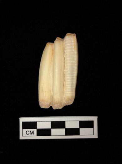
Sampled faunal molar from Khirbet Summeily.

Kara Larson is an M.A. student at Mississippi State University and the lead research assistant for the Near Eastern Archaeology Laboratory at the Cobb Institute of Archaeology. She is a staff member for the Khirbet Summeily Excavation Project and the Hesi Regional Survey project and specializes in zooarchaeology and isotopic analyses. Her research focus is on the use of multiproxy isotopic analyses geared towards answering questions of socioeconomic and political complexity.

Want to help more students and early career archaeologists get into the field? Donate to the cause today by selecting “Excavation Scholarships” as your gift purpose!

Fellowship Report: Amber Leenders

2019 PLATT FELLOWSHIP FIELD REPORT: AMBER LEENDERS

With the support of the Platt Excavation Fellowship, I was able to travel to the Kurdistan Region of Iraq in May of 2019 and join Dr. Lisa Cooper’s team from the University of British Columbia to excavate the fascinating, multi-period site of Bestansur. Our team also included Dr. Kate Kelley, Dr. Lynn Welton, and Dr. Jill Weber.

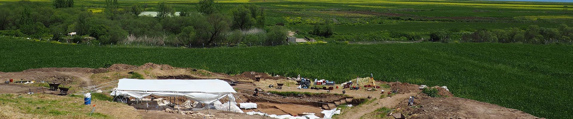
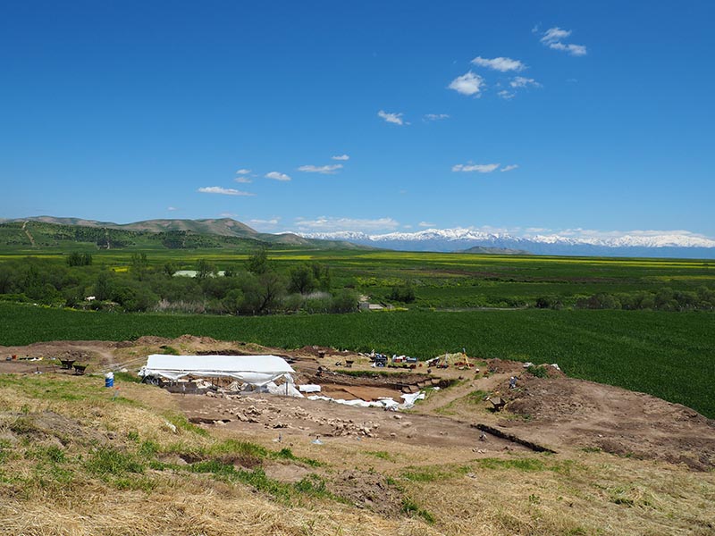
The town of Bestansur is located in the Kurdistan province of Sulaymaniyah, a mountainous area of northeastern Iraq. The landscape is stunningly beautiful, with the lush green fields of the Shahrizor plain, the rocky slopes of the Zagros mountain range, and tributary rivers such as the Sirwan, which eventually feed into the Diyala and Tigris Rivers to the south. Although I have been on digs before, this was my first trip to the Middle East, and I felt slightly out of my element and unsure of what to expect. When we arrived on site for the first early morning of work, however, and I saw the snow-capped peaks of the Zagros mountains rising out of the clouds, I knew that I would quickly grow to love Kurdistan and its history.

We were fortunate to join a team of British archaeologists from the University of Reading, who have been excavating the site since 2012 due to their interest in its unique evidence of Neolithic occupation. It is a remarkable site, with over ten thousand years of history that include well-preserved monumental Neolithic architecture, as well as an exceptional number of human remains. It provides the earliest evidence of settled village life in this region and in fact, some of the earliest in the world! The site continually reveals valuable details about the diet, lifestyle, trade, and ritual practices of the people who occupied the settlement. It was great to observe the Reading team carry out their excavations, and to learn from them about the meticulous excavation, sampling, and recording necessary to understand Neolithic habitation and culture.

So, where does the UBC team come into this? About seven thousand years later…

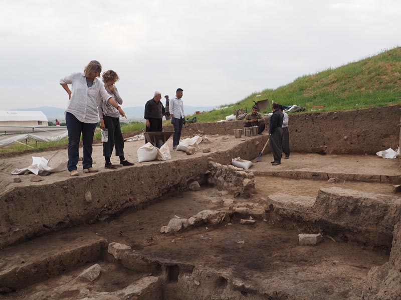
All phases of a site must be excavated with equal care, so on a large site such as this it is helpful to have multiple teams working on different phases to smooth the process. Dr. Lisa Cooper’s research has mainly focused on the Neo-Assyrian occupation at Bestansur, which is some of the most significant material that superimposes the Neolithic remains on the tell. The power of the Neo-Assyrian empire grew during the 10th-7th centuries BCE, and we are interested in the ways that this might have impacted the lives of people in the Kurdistan region—an important thoroughfare in northern Mesopotamia. Bestansur’s Trench 14, just south-east of the tell, revealed significant Neo-Assyrian stone architecture and in-situ pottery in the previous 2013 and 2017 seasons, and the 2019 season had many more surprises in store. New evidence of post-Neolithic burned stone and pisé buildings on the main mound meant that this year UBC’s teams decided to divide and conquer, excavating in both Trenches 10 North and 10 West.

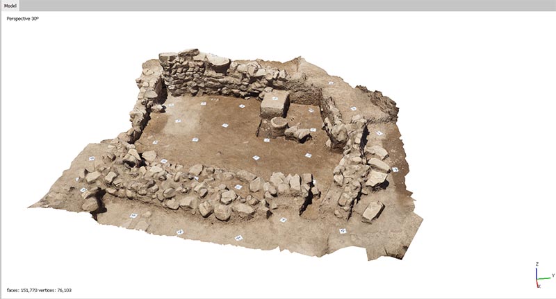
I excavated mainly in 10 West, but my main role on the UBC team was to map the site using our total station, and to document the trenches using photographs and photogrammetry models. Photogrammetry has become an essential part of archaeological recording; the process uses specialized software to transform a collection of photos of an object or space into a 3D model, which can then be studied further, and put in its geographical context. It’s an incredibly helpful tool for archaeology, which is a process that paradoxically destroys the things which it is studying! After archaeologists excavate an artifact or context, or dissemble architecture, photogrammetry makes it possible to study the site as it previously stood. Models the one below are especially helpful for examining things like the Sasanian/early Islamic period structures in Trench 10 West, which had to be fully excavated and removed in order to properly chronicle the history of occupation in the trench as a whole.

There were many phases of occupation on the tell. Work in Trench 10 North revealed a complex series of layers of a possible Neo-Assyrian burned building, along with features like tannour ovens and deposits of shells. In Trench 10 West, although scattered remains like tannours and hearths of the Ottoman period were encountered, features from the Sasanian/ early Islamic period were especially prevalent, these comprising curvilinear stone structures, pebbled surfaces and associated outdoor spaces. Exciting finds from this season, including intact ceramic vessels, a wide variety of animal bones, and various metal tools, can lead to more accurate knowledge about the region and the lifeways of its occupants during these often-understudied later periods.

The 2019 season expanded on the work of previous seasons, and opened up new discussions and debates about the significance of the site— during the Neo-Assyrian period, was it a valuable example of a rural agricultural community? Or could it have been an administrative center of the expanding empire? Did pastoral communities pass through or settle there in the Sasanian and Ottoman periods? Future research and excavations will clarify these and many more questions.

The incredibly warm welcome that we received from our host families and the rest of the local community was a highlight of our month; the people of Bestansur are generous, helpful, good-humoured, and fiercely competitive at soccer to boot (Team Archaeology put up a good fight, but suffered some serious losses against the local team). Many of the locals have years of experience working at this and other sites in the area, and the work of the UBC and Reading teams would not have been possible without their excellent work excavating, processing samples, washing pottery, cooking for our teams, and providing transportation and logistical support.

The experience of excavating and living in Iraqi Kurdistan was unforgettable, and has sparked my interest in this region, its people, and their culture. I am sincerely grateful to ASOR and the donors of the Platt Excavation Fellowship for this opportunity! Thank you to everyone on the team who worked so hard this season, and put the “Best” in Bestansur.

For more information about Bestansur, and the rest of the Central Zagros Archaeological Project, please visit https://www.czap.org/research/bestansur.


Amber Leenders is currently finishing her MA in Classical and Near Eastern Archaeology at the University of British Columbia. Her thesis focuses on using archival data to re-interpret the archaeology of the temples at the site of Dura-Europos, located in modern day Syria. After graduation, she hopes to continue to teach, research, and excavate in the field she loves.

Want to help more students and early career archaeologists get into the field? Donate to the cause today by selecting “Excavation Scholarships” as your gift purpose!

ASOR President’s Statement in Defense of Iranian Heritage

[vc_row fullwidth=”true” attached=”true” css=”.vc_custom_1496247803139{padding-top: 0px !important;padding-right: 0px !important;padding-bottom: 0px !important;padding-left: 0px !important;}”][vc_column][vc_single_image image=”56213″ img_size=”full” alignment=”center”][/vc_column][/vc_row][vc_row fullwidth=”true” css=”.vc_custom_1496682730308{padding-top: 10px !important;padding-right: 0px !important;padding-bottom: 0px !important;padding-left: 0px !important;}”][vc_column width=”1/12″ css=”.vc_custom_1496683820796{margin-right: 10px !important;}” offset=”vc_hidden-md vc_hidden-sm vc_hidden-xs”][vc_column_text]

 SHARE

[/vc_column_text][mk_image src=”http://www.asortest.org/wp-content/uploads/2017/01/social-fb-icon4.jpg” image_width=”42″ image_height=”42″ hover=”false” custom_url=”https://www.facebook.com/ASOResearch/” margin_bottom=”0″][mk_image src=”http://www.asortest.org/wp-content/uploads/2017/01/social-tw-icon4.jpg” image_width=”42″ image_height=”42″ hover=”false” custom_url=”https://twitter.com/ASOResearch?ref_src=twsrc%5Egoogle%7Ctwcamp%5Eserp%7Ctwgr%5Eauthor” margin_bottom=”0″][mk_image src=”http://www.asortest.org/wp-content/uploads/2017/01/social-in-icon4.jpg” image_width=”42″ image_height=”42″ hover=”false” custom_url=”https://www.linkedin.com/company/american-schools-of-oriental-research” margin_bottom=”0″][mk_image src=”http://www.asortest.org/wp-content/uploads/2017/01/social-ml-icon_7.jpg” image_width=”42″ image_height=”42″ hover=”false” custom_url=”mailto:info@asor.org” margin_bottom=”0″][mk_image src=”http://www.asortest.org/wp-content/uploads/2017/01/blog-icon3.jpg” image_width=”42″ image_height=”42″ hover=”false” custom_url=”http://asor.org/blog” margin_bottom=”0″][/vc_column][vc_column border_color=”rgba(255,255,255,0.01)” width=”1/6″ css=”.vc_custom_1496683923840{margin-right: 20px !important;border-left-width: 2px !important;padding-right: 20px !important;padding-left: 20px !important;border-left-color: #99422f !important;}”][mk_divider divider_color=”rgba(255,255,255,0.01)” thickness=”1″ margin_top=”3″ margin_bottom=”3″][vc_column_text]

NEWS@ASOR E-NEWSLETTER

ANCIENT NEAR EAST TODAY E-NEWSLETTER

PAST ASOR NEWS, MONTH BY MONTH

FY19 HONOR ROLL OF DONORS

ASOR ANNUAL MEETING

[/vc_column_text][/vc_column][vc_column border_color=”rgba(170,170,170,0.01)” width=”1/2″ css=”.vc_custom_1487276122024{margin-right: 10px !important;margin-bottom: 30px !important;border-right-width: 2px !important;border-bottom-width: 2px !important;padding-top: 30px !important;padding-right: 30px !important;padding-left: 20px !important;background-color: #ffffff !important;border-right-color: rgba(227,228,228,0.75) !important;border-bottom-color: rgba(227,228,228,0.75) !important;}”][vc_column_text responsive_align=”left”]

ASOR SPEAKS OUT IN DEFENSE OF IRAN’S CULTURAL HERITAGE

[/vc_column_text][mk_divider][vc_column_text]In light of President Trump’s recent threats to Iranian cultural sites, ASOR President Sharon Herbert has issued the following statement.  She has also signed on behalf of ASOR a letter to the New York Times deploring these threats.

In accord with ASOR’s mission to support efforts to protect, preserve, and present to the public the historic and cultural heritage of the Near East and the wider Mediterranean and to raise awareness of its degradation, ASOR strongly protests U.S. President Donald Trump’s threats to intentionally target  Iranian cultural heritage sites.

The 1954 Hague Convention for the Protection of Cultural Property in the Event of Armed Conflict, ratified by the USA in 2009, and the U.S. Department of Defense’s Law of War Manual (paragraph 5.18.5.1) both prohibit the intentional destruction of cultural heritage during armed conflict except in situations when targeting is imperative for a legitimate military goal.

ASOR calls upon President Trump and the U.S. Department of Defense to avoid harm to the cultural heritage of Iran.[/vc_column_text][mk_divider][/vc_column][vc_column border_color=”rgba(170,170,170,0.01)” width=”1/6″ css=”.vc_custom_1496684098866{margin-right: 5px !important;margin-bottom: 20px !important;border-right-width: 2px !important;border-bottom-width: 2px !important;padding-top: 30px !important;padding-right: 10px !important;padding-left: 10px !important;background-color: #ffffff !important;border-right-color: rgba(227,228,228,0.75) !important;border-bottom-color: rgba(227,228,228,0.75) !important;}”][vc_wp_posts title=”BROWSE THE NEWS ARCHIVE” number=”4″][/vc_column][vc_column border_color=”rgba(170,170,170,0.01)” width=”1/6″ css=”.vc_custom_1496684008271{margin-right: 10px !important;margin-bottom: 30px !important;border-right-width: 2px !important;border-bottom-width: 2px !important;padding-top: 30px !important;padding-right: 20px !important;padding-left: 20px !important;background-color: #ffffff !important;border-right-color: rgba(227,228,228,0.75) !important;border-bottom-color: rgba(227,228,228,0.75) !important;}”][vc_column_text] [/vc_column_text][/vc_column][/vc_row][vc_row][vc_column][vc_column_text]

[/vc_column_text][/vc_column][/vc_row][vc_row][/vc_row]

Fellowship Report: Jewel Trail

2019 STRANGE-MIDKIFF FELLOWSHIP FIELD REPORT: JEWEL TRAIL

I spent the first four weeks of my summer in the Galilean heat (which is considerably more bearable than the heat in the southeastern United States). Our dig site was on a hillside outside of Nazareth, Israel. Kefar Shikhin, also known as Asochis, is just outside Sepphoris. I immediately felt comfortable in the familiar scientific setting of diligent data collection taught at the Shikhin Excavation Project’s field school. Despite archaeology being one of the newest social sciences, recently developed methods mirror the accuracy and completeness of research methods in established natural science research.

The Shikhin Excavation Project utilizes stratigraphic excavation, which distinguishes itself from other methods by recognizing that each element of the site contains valuable data. Dr. James F. Strange used to say, “the dirt is evidence.” Stratigraphic excavation focuses on the unique characteristics of each strata and the data that can be obtained from individual loci. Just as a slight change in color, smell, viscosity, particle size, or any other empirical change is recorded in a chemistry research lab, analogous changes on an archaeological excavation are recorded in a square’s field book. Examples of these analogous changes are the all-important three Cs (color, compaction, and contents); elevations; daily and weekly top plans; and daily photographs and conclusions. Careful recording of all details reflects the gravity and responsibility that archaeologists take on when excavating a site.

From the beginning of the dig until publication, the individual steps of the entire excavation process correspond to the steps of the scientific method:

Step 1- Make an Observation: Archaeologists must make initial observations about where or what they want to excavate. When archaeologists are deciding where to dig, they look for solid clues that indicate a site is a strong candidate for excavation. In the case of Shikhin, Dr. James Riley Strange took into account the proximity to Sepphoris, textual evidence, and the physical remains in the topsoil when deciding to open an excavation at Shikhin.

Step 2- Formulate a Question: After looking at the available evidence, researchers decide what questions can be asked of an excavation site, and what insights could be gained from excavating there. Questions are developed from analyzing all relevant sources. Sources are often textual, but material evidence will also effect the specific questions asked.

Step 3- Develop a Hypothesis: Once the archaeologists have decided what questions they want to answer, they build a probable hypothesis based on their observations, textual evidence, and other cultural evidence. The hypothesis is designed to address all of the questions the archaeologists will ask of the site.

Jewel and her square-mate get a lesson on balk drawing from field director Dr. James Riley Strange during fruit break.

Step 4- Design the Experiment: Deciding how to lay out the excavation’s grid (or lack of a grid) is very similar to a natural scientist designing an experiment. In this step, the approach and operating procedures are brainstormed, perfected, and enacted. In archaeology, this includes: determining the location of fields, evaluating the relationship of the remains to the cardinal directions (e.g. structure walls need to cross perpendicular to baulks), using the traditional “square” or finding the most beneficial geometric shape, and optimizing the size of the “squares” (or other geometric shape of choice), among other considerations. The excavations at Shikhin utilized a north-south grid of 5 x 5m squares.

Step 5- Test the Hypothesis: This is arguably the most exciting part of the entire process. At this point you get out into the field and dig! While written records are a great resource for testing a historical hypothesis, the physical remains that a group of people leave behind are invaluable. For example, Shikhin is a Jewish village and likely had its own synagogue. Josephus, however, reports Christian activity taking place alongside the Jewish practices. If the archaeologists at Shikhin would like to explore this facet of life at this site, the only way to search for answers is to find the physical evidence.

Step 6- Make Modifications: Without fail, a dig will encounter obstacles along the way that require a change in the plan of action. These obstacles can result in abandoning a square that is not producing adequate data, changing a hypothesis mid-season, realizing that some element of the designed excavation method is not working, or deciding to open another field. Thus, modifications may be necessary mid-season or between seasons and must be based on and take into account all preliminary conclusions. The evidence that is uncovered is necessary to make the appropriate changes to the excavation method and hypothesis. In the field, balk drawings are an excellent way to evaluate what modifications need to be made to the original excavation plan. Balk drawings are crucial for analyzing the stratification of a square and relating loci to one another, and they combine a lot of information into one visual resource.

Teeth found in I.22.

Step 7- Tell Others: After the dig season is over, the final step of the archaeological scientific method begins. Before scholars can write the paper and have it published, the original hypothesis must be compared to the modified hypotheses and all data carefully considered. Preliminary conclusions are tested and forged into final conclusions during this step, specifically relying on resources built up over the course of the season. Meticulously kept field books with pictures of weekly excavation updates, daily notes, and descriptions of artifacts found are all key resources in analyzing every bit of data that is collected across an excavation’s history. What is found in the seventh season must be related to the findings of the third season, along with everything in between. Once all of this has been woven into the narrative of the site, a final paper can be written to share the archaeologist’s findings with the larger community.

Jewel Trail is a senior University Fellow at Samford University (AL) from Murfreesboro, TN. She is a Chemistry and Classics double major and has previously worked with Dr. Brian Gregory of the Chemistry and Biochemistry Department on “Compositional analyses of potsherds from an ancient Jewish pottery industrial site by inductively-coupled plasma optical emission spectrometry,” which is focused on pottery from Shikhin. This was her first time participating in an excavation.

More information about the Shikhin Excavation Project and its field school can be found at: https://shikhinexcavationproject.com/

Want to help more students and early career archaeologists get into the field? Donate to the cause today by selecting “Excavation Scholarships” as your gift purpose!