ARS 31: Humayma Excavation Project 3

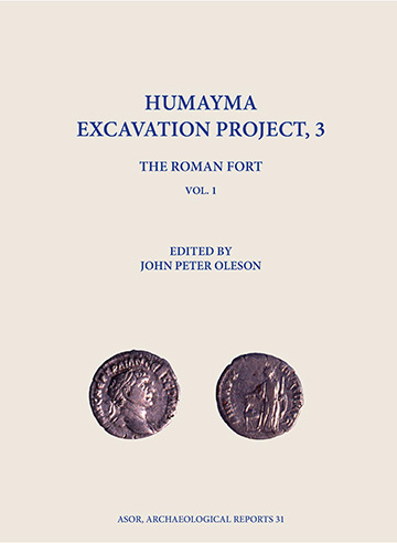
Archaeological Reports Series 31: Humayma Excavation Project, 3

Humayma Excavation Project, 3: The Roman Fort

ed. by John Peter Oleson

Authors:  John Peter Oleson, Erik De Bruijn, M. Barbara Reeves, Andrew N. Sherwood, Craig A. Harvey, Yvonne Gerber, and Milorad Nikolic with contributions from Gregory S. Baker, Emily Deeb, Lindsay Holman, Janet Jones, Derek Klapecki, Kelsey Koon, Jennifer Ramsay, Tiffany Rawlings, and David S. Reese.

This two-volume set of the third publication in the Humayma Excavation Project presents the most thorough excavation report and analysis of a Roman frontier fort yet published. Humayma, ancient Hawar or Hawara, began life as a small Nabataean settlement in the Hisma desert of Southern Jordan, 80 km south of Petra. Soon after the Roman conquest of the Nabataean kingdom in 106 CE, the town was incorporated into the new Provincia Arabia as Hauarra, and a fort was built on the slope above the original settlement. Hauarra flourished through the Byzantine period and in the late seventh century was purchased by the Abbasid family, which built an elaborately frescoed manor house and mosque. Henceforth known as al-Humayma, the town withered away after the Abbasids moved to Iraq in 749 and led the revolt against the Umayyad caliphate.

Oleson began excavation in the fort with a small probe in 1987, followed by 10 seasons of extensive excavation and geophysical survey between 1993 and 2005, and a follow-up campaign by Reeves in 2012. The excavations provided important new information about the process of the Trajanic conquest of the Nabataean kingdom, the development of Roman military fortification design, the organization of the southern portion of the Provincia Arabia and adjacent frontier of the empire, and relations between Nabataean town dwellers and their Roman occupiers from the second through the fifth centuries. 

ASOR Archaeological Reports, Volume 31, Series Editor Jennie Ebeling, December 2024, 2 volumes, 1080 pages (468 b/w figs, 16 tbls & 24 col pls.), ISBN 9780897571241, $169.95.

Special Offer for ASOR Members

ASOR members (with a mailing address in the USA) can purchase the 2-volume set of ARS 31 at the discounted price of $60.00 (70% discount + $10.00 US media mail shipping)while supplies last. Purchases are restricted to one volume per member. We are unable to offer this discount to members without a US mailing address due to international shipping costs, but you can purchase and ship a copy through the ISD link below. Please contact programs@asor.org with any questions. Click here to purchase your discounted copy in ASOR’s online store.

Available from ISD — Distributor of Scholarly Books
www.isdistribution.com

FOA Webinar: Megan Nutzman

FRIENDS OF ASOR WEBINARS

Amulets and their Critics: Jews, Christians, and Samaritans in Late Antique Palestine

Friends of ASOR present the next webinar of the 2024-2025 season on March 19, 2025, at 7:00 pm EDT, presented by Dr. Megan Nutzman. This webinar will be free and open to the public. Registration through Zoom (with a valid email address) is required. This webinar will be recorded and all registrants will be sent a recording link in the days following the webinar.

Medical treatments in the ancient Mediterranean world were rudimentary and often unsuccessful, and so individuals routinely looked for divine aid to cure their afflictions. This lecture considers one of the most common forms of ritual healing employed in Roman and late antique Palestine: amulets. A variety of amulets will be considered in this talk. For example, some amulets contained longer texts written on thin metal sheets or pieces of papyrus, which were then rolled and placed in a case that could be attached to a person’s body. Other amulets took the form of rings, bracelets, pendants, and gemstones, which typically had shorter texts, often accompanied by vivid illustrations.

With circumstances of close cultural contacts—such as prevailed in Palestine—the setting was ripe for Jews, Samaritans, and Christians to borrow forms of ritual healing that were perceived to be efficacious and to alter them to fit their own religious framework. This is particularly true for amulets, which employed similar techniques including the quotation of biblical passages and the use of magical symbols and names. As a result of these overlapping amulet traditions, it can be difficult in some cases even to be certain about the religious community to which the person who created the amulet or the person who wore the amulet belonged. The cultural and religious interactions revealed by amulets demonstrate the porousness of the boundaries that separated these communities, and made them the subject of polemical discourse among elite authors trying to police collective borders.

Megan Nutzman is Associate Professor of History at Old Dominion University. She received her PhD in Classics from the University of Chicago and holds an M.T.S. and a Th.M. from Holy Cross Greek Orthodox School of Theology. Her research focuses on the history and material culture of Greek and Roman cults, Jews, and Christians in the eastern Mediterranean, and especially on interactions among them. Her 2022 book, Contested Cures: Identity and Ritual Healing in Roman and Late Antique Palestine, received the Frank Moore Cross book award in 2023. It examines the various methods that people used to seek divine healing and the rhetoric of elite authors who used the acceptance or avoidance of certain healing rituals as markers of group identity. Some of her other publications have considered Jewish epitaphs from Rome, hot springs as sites of ritual healing, the relationship between amulets and tefillin, and the portrayal of Mary in the Protevangelium of James. She has received funding for her research from the Albright Institute for Archaeological Research in Jerusalem, from the Frankel Institute for Advanced Judaic Studies at the University of Michigan, from the American Council of Learned Societies, and from the National Endowment for the Humanities. At ODU, she teaches courses on ancient Greece and Rome and on early Christianity.

SPONSOR A WEBINAR!

Several levels of support from $50-$1,000 are available. Proceeds go towards membership scholarships and towards increasing ASOR’s virtual resources. Each sponsorship is tax-deductible and includes benefits! Sponsor a webinar here. 

WHY SPONSOR ONLY ONE?

Season Sponsorships are also available from the ASOR Online Store here!

Click here for more information on the benefits of becoming a season sponsor or sponsoring a single webinar.

Fieldwork Report: Daniele Moscone

Studying Chipped Stones and Sampling Knappable Rocks Along the Zagros Hilly Flanks

Daniele Moscone, 2024 P.E. MacAllister Fieldwork Scholarship Recipient

The piedmont of northern Iraq’s Zagros Mountains has long fascinated scholars due to its remarkable archaeological potential and favorable conditions for ancient human settlement. Pioneering research by D. Garrod in 1928 and R.J. Braidwood in 1947 uncovered traces of the last hunther-gatherer societies and among the earliest evidence of sedentism and food production strategies in southwest Asia, through the excavation of sites of great importance, including Palegawra, Zarzi Cave, and Charmo.

Given the historical background, I was deeply excited when Prof. S. Renette invited me to join his team to study the chipped stone assemblages from previous excavation seasons in Kani Shaie (Sulaymaniyah, Kurdistan Region of Iraq). Since 2012, the Kani Shaie Archaeological Project (KSAP) has been investigating the well-preserved archaeological sequence at the homonymous mound which spans from the Late Neolithic (ca. 7000 BCE) to the Early Islamic (ca. 1200 CE). The ultimate goal is to understand the ancient inhabitants’ lifestyles, mobility, and sociocultural connections with both the Mesopotamian plain and mountains of this vast and diverse area across millennia. The current stage of this interdisciplinary research focuses on the 4th and 3rd millennia BCE, which were transformative periods distinguished by the establishment of social inequality, bureaucracy, monumental architecture, complex settlement patterns, long-distance trade and exchange, and ultimately the rise of the first urban societies.

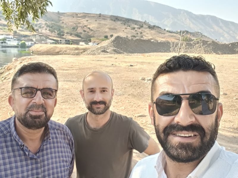
The survey team while standing on the right bank of the Lesser Zab River.

With the generous support of the P.E. MacAllister Fieldwork Scholarship, I was finally able to engage in an archaeological project in the Sulaymaniyah Region for the first time, although having long worked in the macro-region. One of the most enriching aspects of working within the KSAP team was the chance to interact with a diverse and open-minded group composed by both experienced and young researchers. Through these interactions, I was able to exchange knowledge, ideas, and perspectives. Additionally, amidst the exciting discoveries and intensive work, I had the pleasure of forming new friendships.

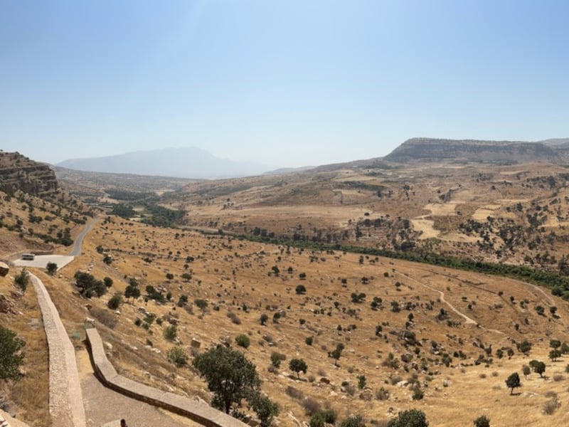
An example of intermontane rocky landscape cut by a river.
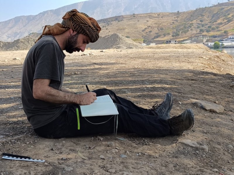
Recording observations on the collected geological samples and drawing sketch profiles of the geological formations interested by the sampling.

The first part of my work took place at the expedition house and was focused on the analysis of the chipped stone collections from key periods, including Ubaid, Late Chalcolithic, and Early Bronze Age. I conducted a technological analysis of the artifacts, addressing crucial questions: how the artifacts were produced? What techniques and methods were used? Which raw materials were chosen? Do we observe significant changes in these practices throughout different settlement phases?

Thanks to the Fieldwork Scholarship, the completion of the second phase of the intended work was also made possible. A small team was assembled for the purpose of conducting extensive surveys aimed at comprehending, for the first time, the regional availability of raw materials suitable for crafting stone tools. During a four-day survey, our team – consisting of an expert archaeologist from the Directorate of Antiquities of Sulaymaniyah and a driver – explored a diverse and fascinating landscape: this included the Bazyan plain with its alluvial and rocky hills, steep mountainsides with narrow valleys carved by small rivers, and limestone walls with many caves and rock shelters. Significant stretches of the two major river courses, the Lesser Zab and Tanjero River, potential sources of raw materials, were also explored. This stage resulted in the identification of multiple candidate geosites, which were then systematically sampled. The most significant sampled raw material was chert, a siliceous sedimentary rock extensively available on earth and
selected since early prehistory to produce stone tools due to its very good fracture qualities.

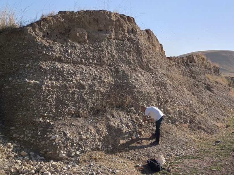
Sampling fluvial-transported chert pebbles along the ancient terraces of the Tanjero River. In the background it is possible to note the hilly morphology of the Tanjero Formation, from which the river erodes and transports part of the fragments.

Our field prospections preliminary results are exciting since we encountered many distinct varieties of chert, well mirroring the variability observed at the archaeological site of Kani Shaie. Future studies using scientific methods (e.g., macroscopic, petrographic, and geochemical analyses) will compare selected archaeological artifacts and geological samples to identify sources or procurement areas exploited by the prehistoric communities settled at Kani Shaie. As a result, I hope that my beneficial collaboration with the KSAP team will continue over time and contribute to their broader research questions. Another long-term goal is to create an open-access repository of these findings and welcome participation and inputs from colleagues and scholars interested in prehistoric lithic raw material procurement in the region.

For more information about the Kani Shaie Archaeological Project (KSAP) visit here.

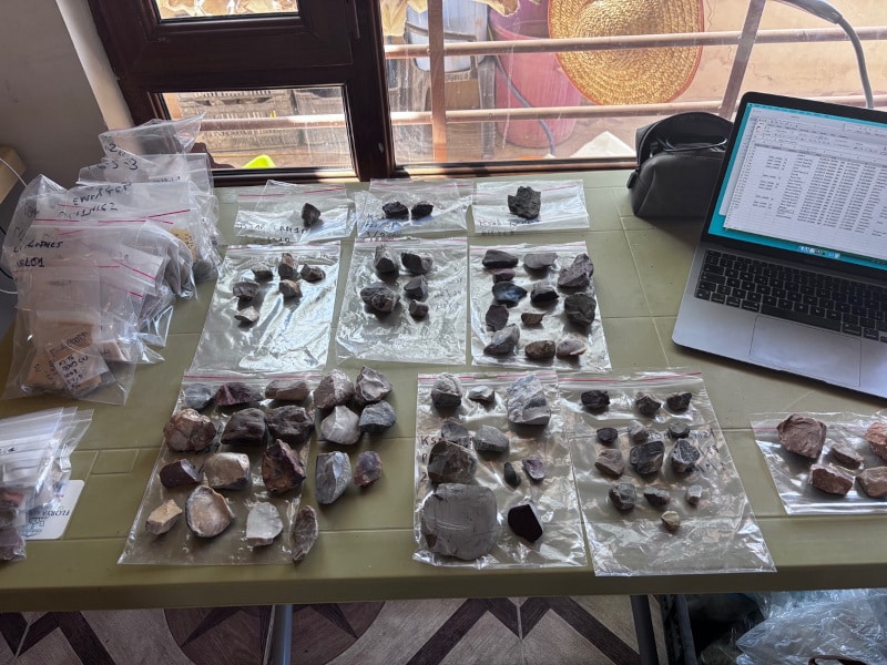
Work in the KSAP expedition house: field data are stored in a database and the geological samples are cleaned, counted, labelled and packed.

Daniele Moscone is currently a postdoctoral researcher at the Institute of Prehistoric and Protohistoric Archaeology and ROOTS Cluster of Excellence (CAU Kiel), where he focuses on the prehistory of southwest Asia, in particular the Zagros Mountains. Previously a postdoctoral fellow at the Research Center for Anatolian Civilizations (ANAMED) of Koç University, he earned his PhD at Sapienza University of Rome, specializing on chipped stone artifacts and raw material analyses. You can find Daniele Moscone on Bluesky @mosdann.bsky.social

ASOR is now accepting applications for 2025 Fieldwork Participation Scholarships. Learn how to apply here.

Want to help more students and early career archaeologists get into the field? Donate to the cause today by selecting “Fieldwork Scholarships” as your gift purpose!


Fieldwork Report: Claire Hook

Living it up in the Archaeology Lab

Claire Hook, 2024 Katherine Barton Platt Fellowship Recipient

While working on the Brač Island Project on a beautiful island in Croatia, the team got to excavate our hillfort site, Gradina Rat. At the same time, we were learning about what was being excavated during the project because of our work in the lab to identify and document the artifacts being uncovered.

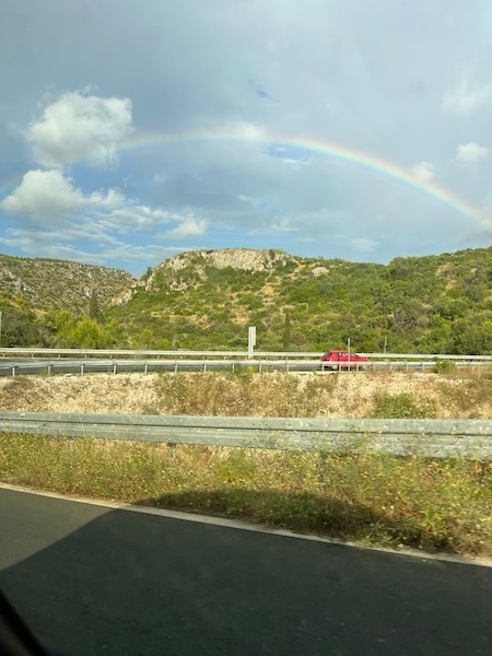
Our last drive to site featuring a rainbow perfectly over Gradina Rat where we were excavating.

Although a large part of archaeology is the excavation, understanding what was happening in the past at a site comes from identifying and analyzing the artifacts and doing additional research in the lab. My role this season was the lab assistant, so I was able to spend some days out on site, but a majority of my time was spent helping Dr. Sarah James in the lab working directly with the ceramic assemblage.

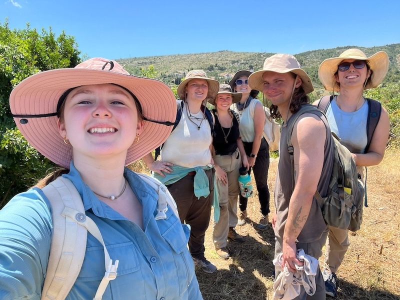
The excavation crew at site after our morning excavations. I am on the far right.

There were four main tasks that I helped to complete throughout the season to
keep everything running smoothly and figure out what was happening within each context of finds.

The first part of the lab work was pottery washing.

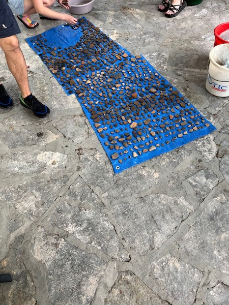
The ceramic assemblage from one context all laid out to dry after being washed.

Everyone who participated in the project helped with washing the ceramic finds so that any designs and colors could be more easily seen once the dirt was scrubbed away and so the artifacts remained clean. We washed the pottery that was brought down from the site every day—unless it was raining so badly that we couldn’t be outside—so that we could keep up with all the finds that were excavated.

The next step in lab work was artifact reading where we would record as much precursory information about the artifacts as possible. We recorded each artifact into the database alongside their context numbers to give a sense for the assemblage throughout the contexts. For the ceramic sherds, the team would partner with Dr. James and Dr. Barbarič to record the identifiable sherds from each context and give them a preliminary vessel shape and date range. I would also take counts and weights of the three main categories of ceramic vessels: table, cooking, and coarse ware. Knowing the types of ceramics being used on site was helpful for recognizing that this was not a domestic settlement and that something far more interesting was happening at this site.

After the ceramic pieces were read into the database, the pieces that required more research to identify or that could give new information about the assemblage were catalogued. A lot of my time in the lab was spent cataloguing pottery sherds. One goal we achieved for this season was to finish cataloguing the artifacts discovered in previous seasons and to work through as many sherds from this season as possible. Cataloguing included taking the dimension and weight of each sherd and describing the texture of the surface, the strength of the firing technique, the interior color and inclusions of the clay (also known as the fabric of a vessel), and any exterior decorations. After detailing the specific piece, I would research comparable shapes and decorations from other authors to help verify the classification of the shape, origins, and date of the original vessel. With this information, we were able to get a clearer sense of the activities and uses of the ceramics at Gradina Rat and how the people living on Brač were connecting with traders from other countries.

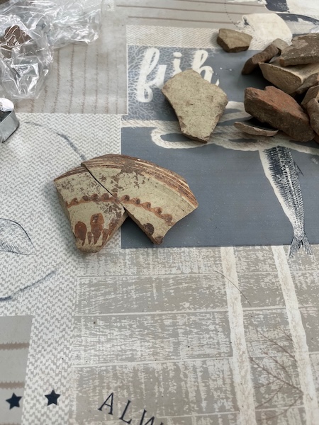
Two joining sherds of Italian Matt Painted Imported Ware from the 4th to 6th c. BCE.

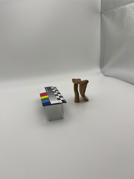
The last piece of lab work was photographing some of the especially important finds to have clear photos of special artifacts, the ranges of imported vessels, and the common local vessels. Having these photos will allow other scholars to work with the artifacts found at this site and will aid in visually accompanying any research written about this site. Our set up was simple yet effective. I only occasionally had to carefully hide clay supports to help get certain angles of the pieces.

Lab work in action to photograph one of the ceramic sherds.

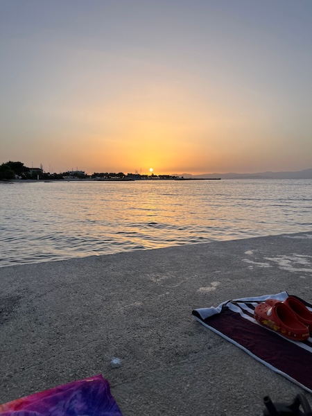
At the very end of the day, we would all gather down at the beach to watch the sunset after everyone finished their afternoon tasks, and sometimes we’d jump into the magical waters of the Adriatic and theorize about what exactly the ancient people were doing up on that hill.

Swimming at sunset after a hard day’s work in the field and in the lab.

Claire Hook just graduated with a Masters of Classical Art and Archaeology from the University of Colorado Boulder. Her research interests are in the responses and treatment of child mortality in Ancient Greece, and the ceramic assemblages that accompany them. 

ASOR is now accepting applications for 2025 Fieldwork Participation Scholarships. Learn how to apply here. 

Want to help more students and early career archaeologists get into the field? Donate to the cause today by selecting “Fieldwork Scholarships” as your gift purpose!

Collections Fellowship Report: Holly Winter

2024 Collections Fellowship Report: The Land Behind Aleppo: Urban Life and State Formation in Bronze Age Syria

Holly Winter, University of Sydney

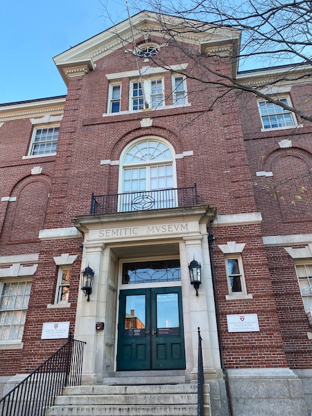
Thanks to an ASOR Study of Collections Fellowship, I was able to spend a week in Boston at the Harvard Museum of the Ancient Near East (HMANE), studying the ASOR Syrian Survey material. The focus of the research trip was to study the ceramic assemblage collected as part of the 1970s ASOR Syrian Survey (ASS) project by the late James Sauer. This research forms part of a larger project, the ‘Land Behind Aleppo’ (LBA) project, which aims to investigate the Bronze Age history of Aleppo, specifically during the time of the powerful Middle Bronze Age (MBA) kingdom of Yamkhad (Aleppo). It employs legacy ceramic assemblages collected by James Sauer, as part of his ASOR Syrian Survey. This will be combined with the late John Matthers’ River Qoueiq survey project materials, now housed at the Institute of Archaeology at University College London. The ‘Land Behind Aleppo’ project aims to investigate Aleppo’s Bronze Age history through a ceramic proxy study of the central city’s changing pattern of relationships with its hinterland settlements over the course of the Bronze and Iron Ages, aiming to bracket the period of greatest prominence (the MBA: 2000-1500 BCE) and evaluating the changing fortunes of Aleppo down the ages. As fieldwork in the region of Aleppo in the near future is unlikely, this research is a necessary precursor and eventual supplement to any future work on the central site and its region.

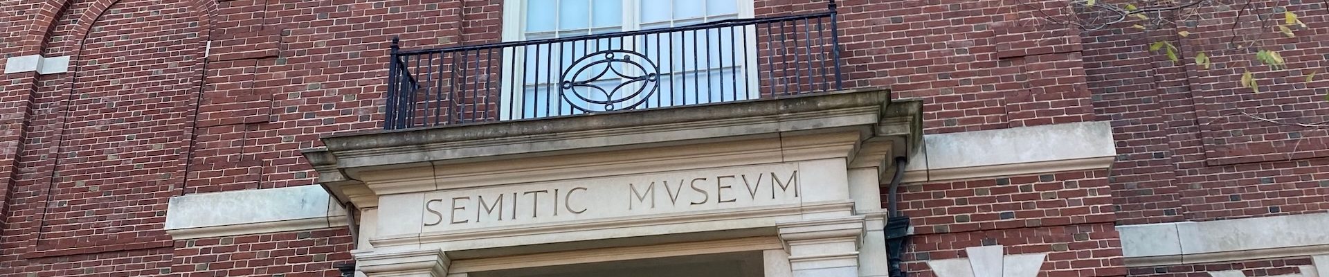
The Harvard Museum of the Ancient Near East building.

Analysing ceramics from a number of sites in the hinterland regions of Aleppo will aim to chart the development and changing pattern of interaction between the various settlements within the polity of Yamkhad over time. Key to this study is tracking the expansion and contraction of the central state’s economic ‘footprint’. A multi-proxy analytical programme using a combination of typological approaches and scientific techniques, drawn from geochemistry, petrography, and materials science, will target select ceramic forms, chosen because they potentially inform on different aspects of contact. These well-established methods can illuminate the production and distribution of storage/transport jars associated with bulk commodity transactions such as those involving grain and oil for trade/taxation, fine tablewares for elite consumption/emulation studies, and cooking/food preparation forms indicative of local production. Together these enable us to examine and hopefully contrast what is locally, sub-regionally, and centrally produced. The resulting data informs on trade, administration, and systems of production and distribution. The ‘reach’ of the central site, and thus arguably its politico-economic power projection, will be assessed over time. The ultimate aim is to chart the ebb and flow of influence/power, and whether this is primarily elite-interaction driven, or staple-economic in form.

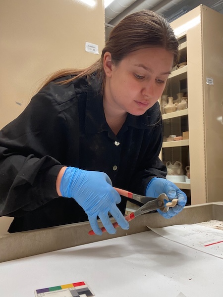
Holly sampling a selection of sherds from the ASS project.

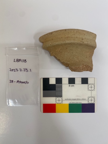
The numerous boxes of ceramics from the ASOR Syrian Survey (ASS) sites were made available for this study thanks to Dr. Adam Aja, Chief Curator at the HMANE. The ASOR Syrian Survey was conducted by James Sauer from 1977-79, and studied 83 sites across Syria. The collection is large and multi-period in scope, now stored in 24 boxes in the HMANE. Only sites with materials from the Bronze and Iron Ages were studied as part of this research project. The aim during this visit to the HMANE was to gather ceramics from the Aleppo Sector of the ASS collection, as time was limited. In total, I was able to sample 11 sites in three days, focussing on sites closest to Aleppo. Before sampling, each site assemblage was reviewed, and then a selection of sherds were chosen for sampling. The choice of which sherds to sample was based on a pre-established typology, although size of sherd and appropriateness for sampling were considerations. Each sherd was given a project number (LBA#), described and sketched before sampling. It was then photographed with site identifiers and a second time on both obverse and reverse surfaces, and occasionally the profile. Approximately a half cm size was snipped from the sherd at a location that would not impact future drawing of the sherd (mostly from the shortest profile side). A total of 175 sherds were sampled during this visit to the HMANE, and it is hoped that petrography and neutron-activation analysis will be able to be conducted on these samples in the near future.

Fragment of a Middle Bronze Age tall narrow-necked jar from the site of Atareb, sampled as LBA118.

The ASS material will offer insights into the social and economic history of a region where little is currently known, in the hope that results pertaining to the pre-eminent MBA kingdom of Yamkhad can be generalized across the Levant, and perhaps further afield. It also exploits an important legacy database that has been unstudied for nearly 50 years, giving promise of shedding light on one of the main drivers of Syrian urban life in the MBA and beyond–Aleppo.

Seger Grant Report: Survey at Tell ‘Arna

2024 Seger Grant Report: Paths to Urban Growth in the Nineveh Plain: Survey at Tell ‘Arna

Khaled Abu Jayyab, University of Toronto

The Paths to Urban Growth in the Nineveh Plain project (PUG) established in 2023 aims to understand proto-urban developments and population aggregation that took place in northern Iraq during late prehistory. The efforts of this project include exploring past assumptions about trajectories towards complexity through targeted excavations at Tepe Gawra and Tell ‘Arna, and carrying out a regional survey in collaboration with our partners at the State Board of Antiquities and Heritage (SBAH).

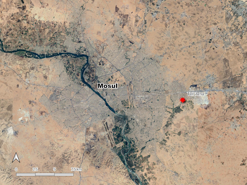
Work at Tell ‘Arna, facilitated in part by the generous contribution of ASOR’s Joe D. Seger Project Grant, allowed for a team from the University of Toronto led by Khaled Abu Jayyab in collaboration with the Mosul office of the State Board of Antiquities and Heritage (SBAH) to carry out a systematic survey of Tell ‘Arna located in the eastern Mosul Suburb of Gogjeli (Fig. 1).

Figure 1: Location of Tell Arna on the eastern edge of the city of Mosul, northern Iraq.

Survey work at the site proved to be an important step towards establishing an accurate periodization of the site and streamlining our approach to future excavations, protection, and conservation work at Tell ‘Arna.

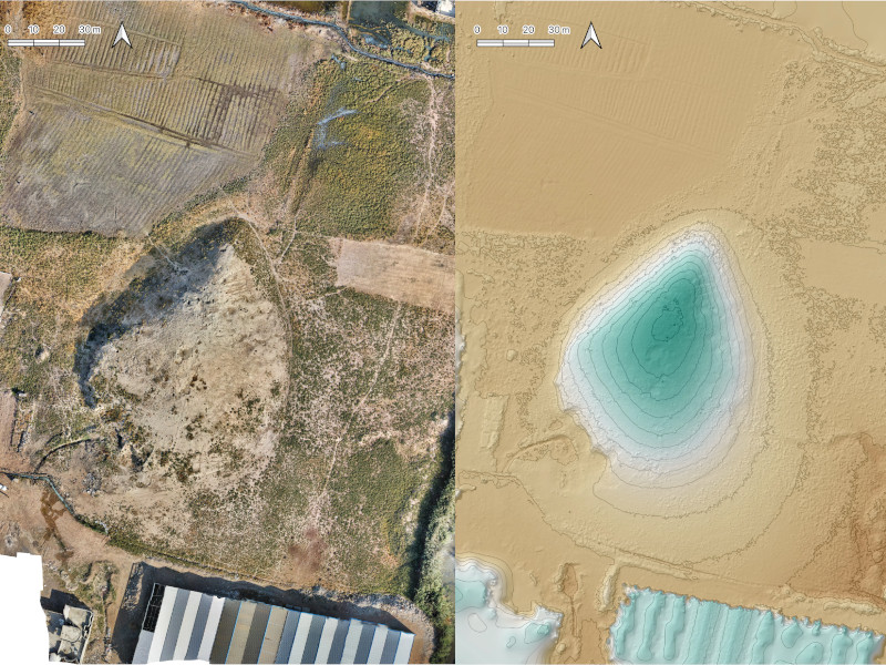
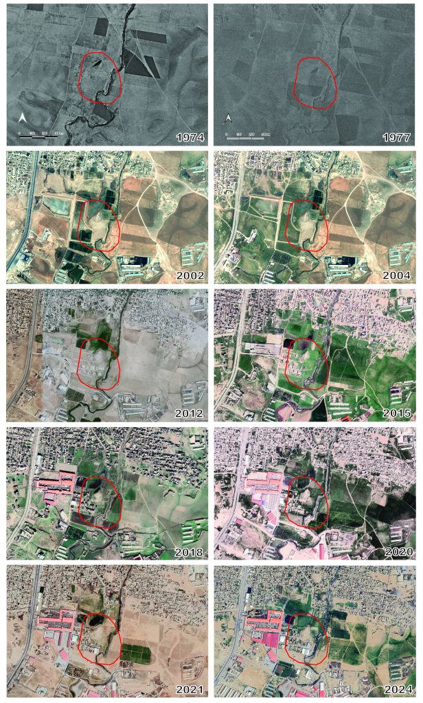
Our methodological approach consisted of combining remote sensing data with field walking in order to obtain a complete picture of the cultural and physical surroundings of the site. Prior to our work in the field, we explored the landscape around the site using satellite imagery (Corona, Hexagon, and Landsat) to document any changes that took place at the site between the late 1960’s and present day. In the field, we carried out a UAV (drone) survey of the site in order to obtain a high-resolution digital elevation model (DEM) and render a 3D model of the site and its surroundings (Fig. 2).

Figure 2: Orthophoto of Tell ‘Arna (left), DEM and contour map of the site (right).

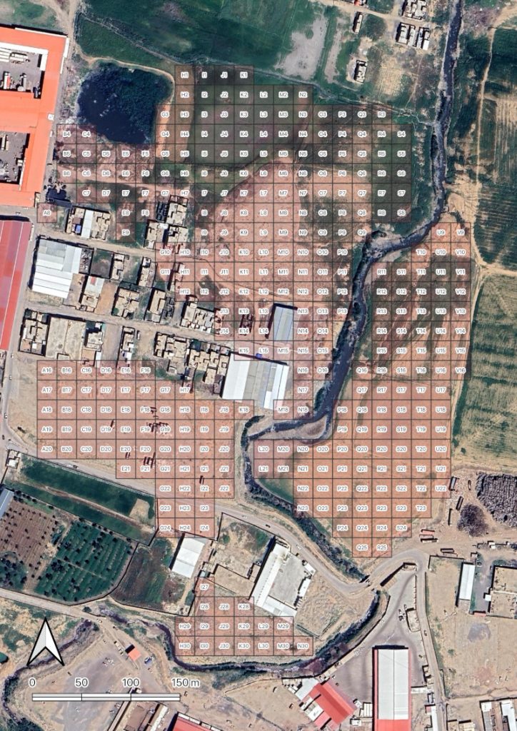
This was an important initial step that aimed to create an accurate plan of the site and to document its present condition, and assess any possible future conservation threats. Our second step was to establish a 20×20 m collection grid around the site as a guide for systematic surface collection that allowed us to explore the distribution of materials from each period as a proxy for settlement extent (Fig. 3).

Figure 3: Survey collection units at Tell ‘Arna.

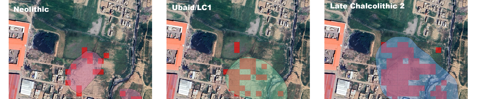
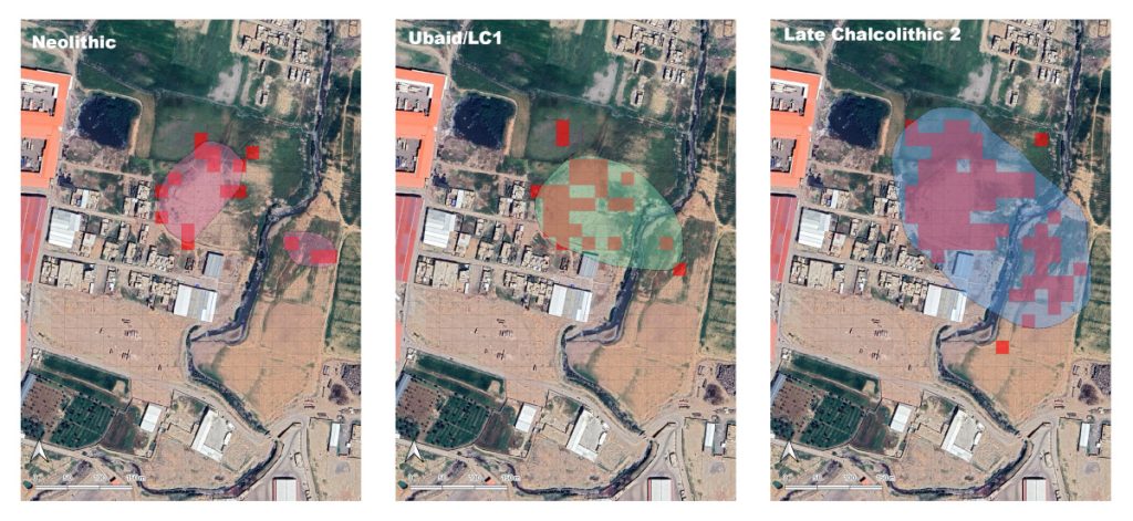
The survey work had two important aspects to it. First, from the overall scientific questions PUG has been trying to address, Tell ‘Arna produced an occupation sequence that complements that of our other site Tepe Gawra. Whereas the earliest occupation at Tepe Gawra seems to begin from the late Halaf period (5500 BC), occupation at Tell ‘Arna dates back as early as the Neolithic Hassuna period (6200-6000 BC) and continues into the Late Chalcolithic 2 (LC2) period (4200-3900 BC). Similar to what we see at Tepe Gawra (see Abu Jayyab et al. 2024), growth and expansion of Tell ‘Arna takes place during the LC2 where the settlement appears to have doubled in size (Fig. 4). This suggest that nucleation and the formation of aggregated settlements was not unique to Tepe Gawra, but was taking place across the Nineveh Plain, albeit at different scales. Through future excavations we can begin to address the actual scale of aggregation at these sites and how said aggregation may have engendered structural transformations at them.

Figure 4: distribution of materials (red squares) and estimated site size during the different periods of occupation of Tell ‘Arna.

While the mission was primarily meant to be a reconnaissance mission for determining future scientific excavation plans, a second more significant aspect of our documentation has led the PUG team to rethink its priorities. Tell ‘Arna falls in the area of Gogjeli which historically has been an area of open farmland and pasture. With the expansion of the city of Mosul over the past two decades the area here has been slowly engulfed by the city (Fig. 5).

Figure 5: Satellite imagery showing the stages of urban expansion in Gogjeli.

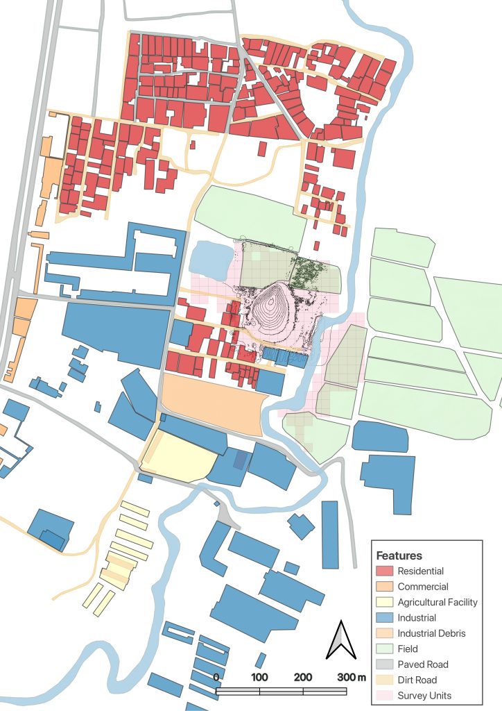
This process has accelerated since with the takeover of the city by ISIS and the subsequent state of disorder and population displacement. Today, as a result, Tell ‘Arna is located in an ever expanding slum where we see the intersection of farmland, factories, and illegal housing encroaching on the site (Fig. 6). Ironically, the project set out to explore the origins of urbanism in the Nineveh Plain and now we can observe rapid urban expansion in real time and its consequences, especially with regards to its impact on cultural heritage.

Figure 6: Digitized urban elements impacting the site of Tell ‘Arna.

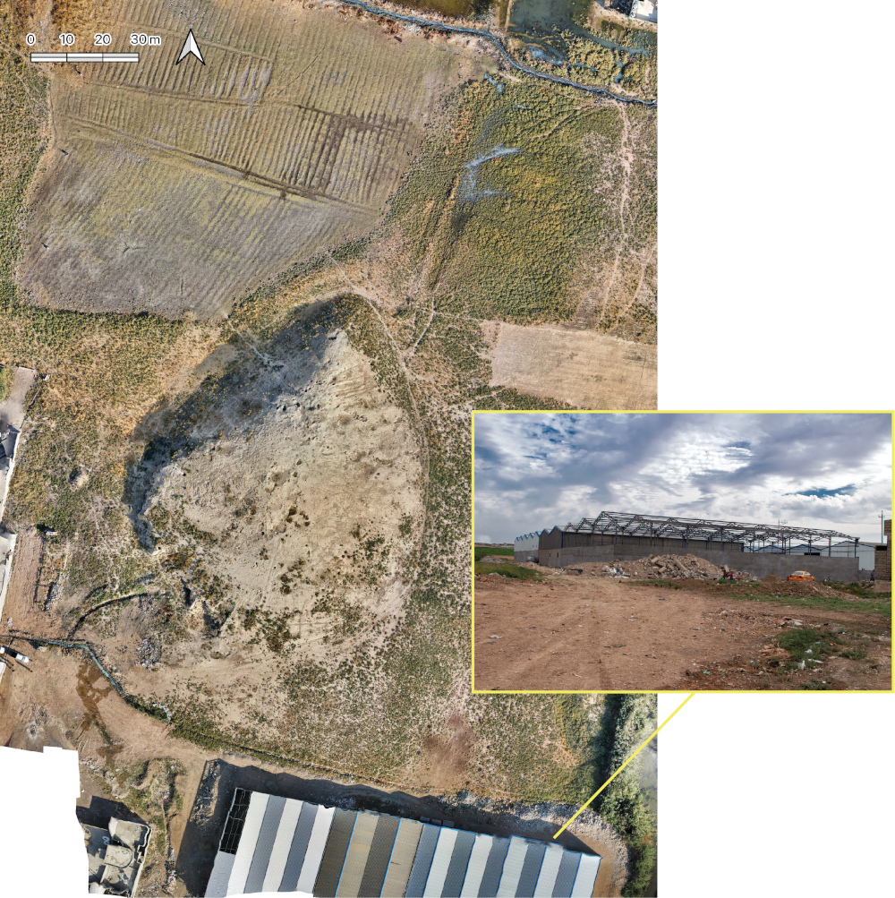
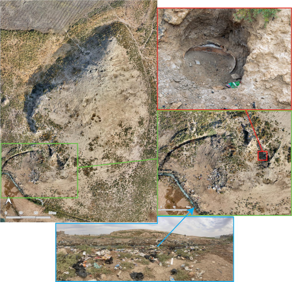
Slums could be defined as “an overcrowded residential urban area characterized by below standard housing, poor basic services and squalor” (Habitat for Humanity). The conditions around Tell ‘Arna fit that definition as the housing is not part of a zoning plan by the municipality where with the absence of services such as drainage and electricity (electricity is provided through private generators–a common business in Iraq due to the poor infrastructure). While construction of new illegal houses seemed to have stopped, the existing ones are increasingly being choked by industrial buildings and massive storage hangars, with more being built every day (Fig. 7). All these construction activities have been systematically damaging the site, bit by bit. The damage includes bulldozing portions of the site and exposing archaeological remains (Figs. 7-8), cutting a sewage canal through the site (Fig. 8), and increased dumping of household refuse on the site (Fig. 8).

Figure 7: An industrial hangar being constructed during our survey in October and November of 2024.
Figure 8: Photos from Tell ‘Arna documenting part of the damage at the site including bulldozing of the southwest corner of the site, refuse discard on the site, and cutting a sewage drain through the site.

On a more positive note, participation of two University of Toronto students in the work at Tell ‘Arna has opened up new opportunities for them to refine their skills in archaeological survey, material analysis, and leadership. Moreover, we also nurtured deeper collaborations with local stakeholders and members of the local SBAH office in Mosul, through collaboration on field work and opening up conversations with the local community.

Most significantly, work at Tell ‘Arna has shaped our future approach and allowed us to develop a tailored approach to the site in upcoming seasons. While this work started as an exploratory expedition, it has transformed into one that aims to address the threats to the cultural heritage as a point of departure.

Parallel to understanding trajectories towards complexity in the Nineveh Plain, we are developing an approach that preserves the site initially by constructing a fence that prevents the urban push onto the site. Of course, this is not enough as we see that cultural heritage should not alienate the local inhabitants, but on the contrary should, in our opinion, generate a sense of ownership and pride. Accordingly, we see the potential of weaving the site into the fabric of this emergent community of Gogjeli by establishing a park, around the site that includes walkways, educational signs, benches, playground, and a mini-football field to accommodate the local inhabitants of the neighborhood. Through these steps we aim to provide the local inhabitants with a sense of ownership of the space without creating the alienating impact that usually surrounds cultural heritage projects (see Isakhan and Meskell 2019). By converting the area into a usable and functional space for the inhabitants we hope that it would become a place that has value for them and one that they respect and take care of. We also hope it becomes a place that may stimulate their curiosity and one which they can engage with intellectually.

Figure 9: Members of the Tell 'Arna survey project Khaled Abu Jayyab, Clemens Reichel and Rasha Alendari at the Shamash Gate, Nineveh.

References cited

Abu Jayyab, K. Schwartz, I. Al-Hussainy, A. Batiuk, S. Glasser, A. & Hadi H. 2024 “The Tepe Gawra Lower Town Survey 2022, Iraq.” Bulletin of the American School of Overseas Research, Bulletin of the American Society for Overseas Research, BASOR vol. 392: 55-82.

Habitat for Humanity Urbanisation and the Rise of Slum Housing: https://www.habitatforhumanity.org.uk/blog/2018/09/urbanisation-slum-housing/

Isakhan, B. and Meskell, L. 2019 “UNESCO’s Project to ‘Revive the Spirit of Mosul’: Iraqi and Syrian Opinion on Heritage Reconstruction After the Islamic State.” International Journal of Heritage Studies: 1-16.
FOA Webinar: Jessica Nitschke

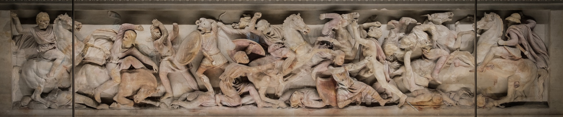
The Alexander Sarcophagus. © Jessica Nitschke

FRIENDS OF ASOR WEBINARS

Why is Alexander on the Alexander Sarcophagus? Rethinking a Funerary Monument from Sidon

Friends of ASOR present the next webinar of the 2024-2025 season on March 5, 2025, at 2:00 pm EST, presented by Dr. Jessica Nitschke. This webinar will be free and open to the public. Registration through Zoom (with a valid email address) is required. This webinar will be recorded and all registrants will be sent a recording link in the days following the webinar.

The Alexander Sarcophagus. © Jessica Nitschke

The Alexander Sarcophagus. © Jessica Nitschke


With its dazzling sculpted decoration, the so-called Alexander Sarcophagus from Sidon is one of the most celebrated works of art from antiquity. Created not long after Alexander’s death at the end of the 4th century BCE and buried in a deep underground tomb, the monument carries a relief of the conqueror battling Persians while wearing a lion-skin headdress. This divine attribute was closely associated with Herakles, whom both Greeks and Phoenicians identified with the Tyrian hero-god Melqart.

This talk will explore the sarcophagus and its relief decoration to better understand Alexander’s depiction, taking into consideration the monument’s archaeological context, contemporary historical events, and Phoenician funerary beliefs. Especially, it will examine the sarcophagus in light of the seven-month siege of Tyre — a conflict provoked by Alexander’s claims of kinship to Herakles/Melqart — and attempt to explain why the patron might have wanted to depict Alexander on his tomb in such a way that draws attention to this devastating event.

Jessica Nitschke is a Research Fellow and contract Lecturer in the Department of Ancient Studies at Stellenbosch University in South Africa; she is also the editor of ASOR’s outreach publication The Ancient Near East Today. Her research concerns the history and archaeology of the eastern Mediterranean in the first millennium BCE, especially interconnections between the Phoenicians, the Greek world, and Egypt. She co-edited Postcolonialism, Heritage, and the Built Environment: New Approaches to Architecture in Archaeology, published by Springer in 2020, and is currently working on a monograph on the Alexander Sarcophagus. She has carried out archaeological fieldwork at Tel Dor (Israel) and Tell Timai (Egypt), and currently excavates at el-Hibeh as part of the UC Berkeley project. She received her Ph.D. in Ancient History and Mediterranean Archaeology from the University of California, Berkeley, and her BA in Near Eastern Languages and Civilizations from the University of Chicago.
SPONSOR A WEBINAR!

Several levels of support from $50-$1,000 are available. Proceeds go towards membership scholarships and towards increasing ASOR’s virtual resources. Each sponsorship is tax-deductible and includes benefits! Sponsor a webinar here. 

WHY SPONSOR ONLY ONE?

Season Sponsorships are also available from the ASOR Online Store here!

Click here for more information on the benefits of becoming a season sponsor or sponsoring a single webinar.

Fieldwork Report: Luke Poutre

Heat Builds Character

Luke Poutre, 2024 Charles Steinmetz Fellowship Recipient 

It is 2:45 A.M. and a cascade of phone alarms begins to sound throughout the dig house. Members of the team get up from their floor mats and quickly prepare for the day. For those of us on the Geophysics team, this means that all of our cumbersome equipment must be staged in front of the house to be loaded onto the bus that takes us to the dig site. We find time to eat a handful of nuts or a banana before loading begins, and by 3:45 the bus is en route to Kurd Qaburstan. It is still dark as we drive to the site, and we see the fires from oil refineries lighting up the horizon as we drive along the highway to the village of Yedi Kizlar, the modern village where our project is located. Before we leave the outskirts of the city of Erbil, the bus stops at a bakery where we pick up a bag of Samoon bread, one of the most important components of our on-site meal which we referred to as ‘second breakfast’. After making the half-hour drive from our house in Erbil to Kurd Qaburstan, we finally arrive just before sunrise and meet up with our Kurdish dig team.

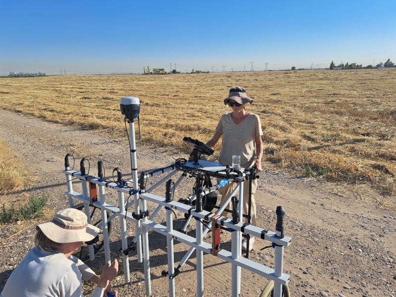
The geophysics team with the magnetometer. Andy Creekmore (L) and Nicole Temple (R).

At this point, the excavation team breaks off to their trenches while the members of the geophysics team begin setting up our equipment. This process involved putting together a SENSYS Multi-Channel Carrier Type F pushcart with MAGNETO MXV4 magnetometer system and setting up hectare or half hectare grids using GPS and tape measures throughout the center and periphery of the site. This piece of equipment is comprised of a GRP frame, a mounted EMLID GPS system, nine individual sensors set 0.25m apart, and a processing unit. The pushcart is used to take magnetometry readings of an area so as to gain an understanding of the potential architecture and economic activities of that location (i.e. ceramic or baked brick kilns). Once the equipment is set up, one of the members of the team straps on the battery-pack and begins collecting data. This is done by pushing the cart in straight lines back-and-forth within the pre-marked hectare, guided by other members of the team holding flags at each end of the grid. The terrain, however, made this process a bit more difficult. The site itself is located on a modern farm, with the main tell falling within the barley fields and one of our chief focuses of excavation being within the tomato patch. As such, the soil was rife with plow-furrows which were baked solid by the 116 °F heat, resulting in a tremendous effort not only to push the cart, but also to keep it straight. The resulting data consists of magnetometer readings that we process to compile into a two-dimensional map or magnetogram that can be viewed and interpreted by the entire team.

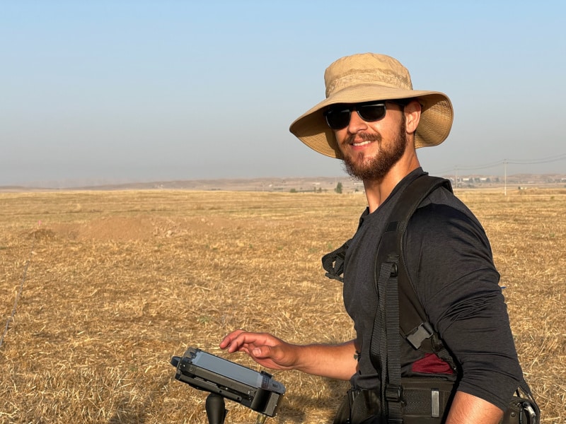
Luke operating the magnetometer.
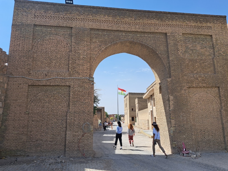
Photo by Luke Poutre of an archway
The citadel archway.
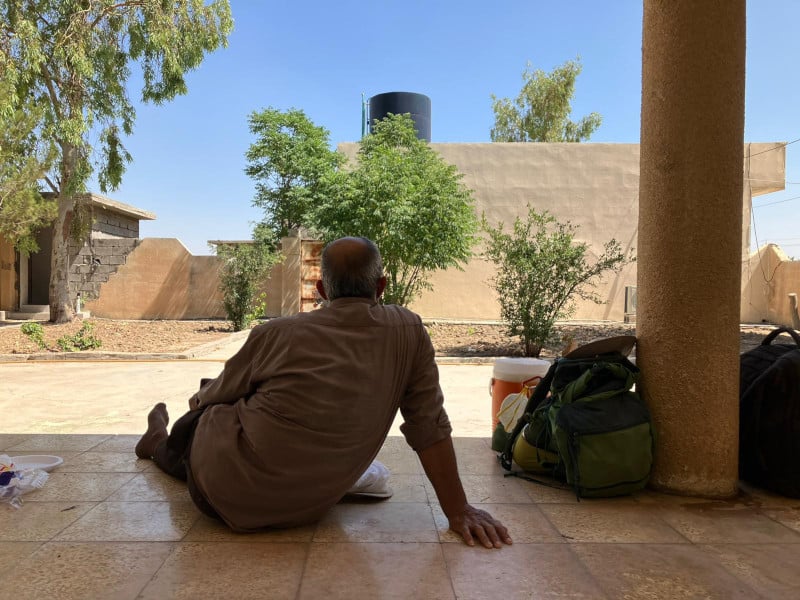
Daoud, a Syrian archaeologist who is part of the team.

Luke Poutre is a current student working towards his Masters degree in Near Eastern Archaeology at La Sierra University. Prior to his entrance into the field, Luke served in the U.S. Army before working in civil litigation and tort law. He hopes to continue his involvement with projects in the Near East, and eventually pursue a doctoral degree in archaeology.

Learn more about the Kurd Qaburstan Project here. 

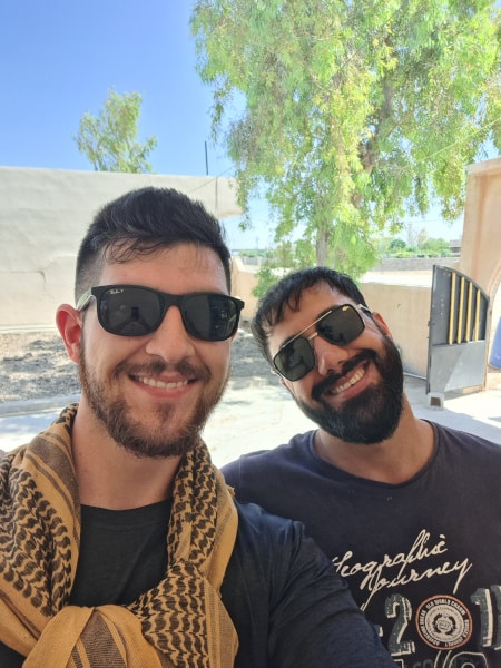
Luke with Didar, a Kurdish member of the team.

ASOR is now accepting applications for 2025 Fieldwork Participation Scholarships. Learn how to apply here. 

Want to help more students and early career archaeologists get into the field? Donate to the cause today by selecting “Fieldwork Scholarships” as your gift purpose!