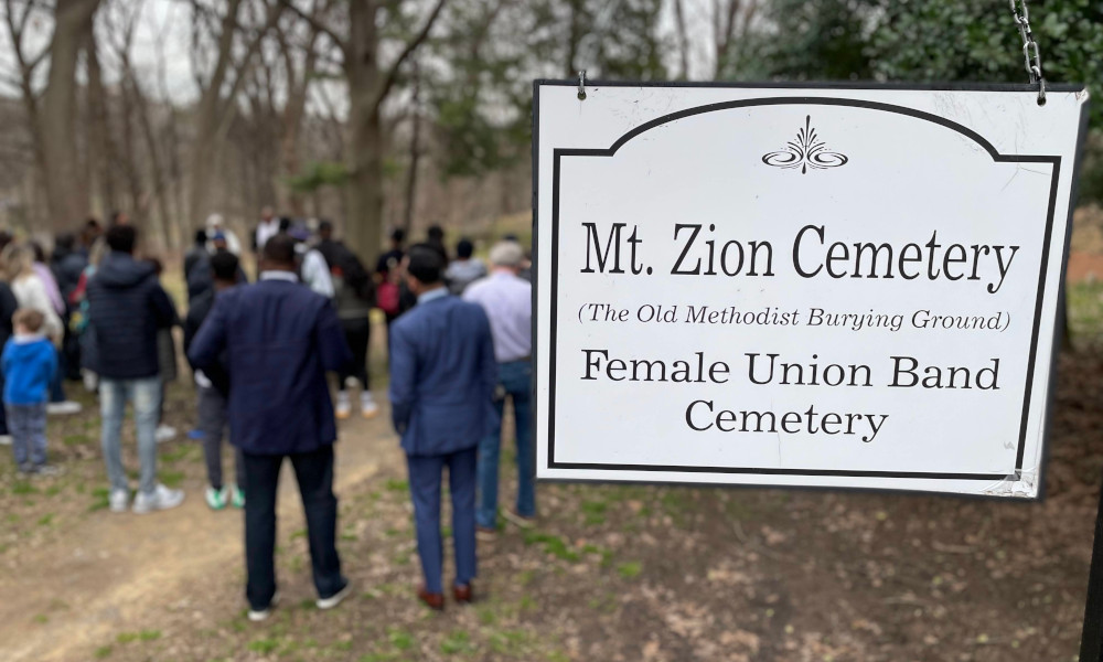
Mount Zion – Female Union Band Society Cemetery Documentation Event
Ever wanted to learn the art of preserving history? Curious about the stories etched in the stones of local cemeteries? Here’s your chance to dive into the fascinating world of cemetery documentation!
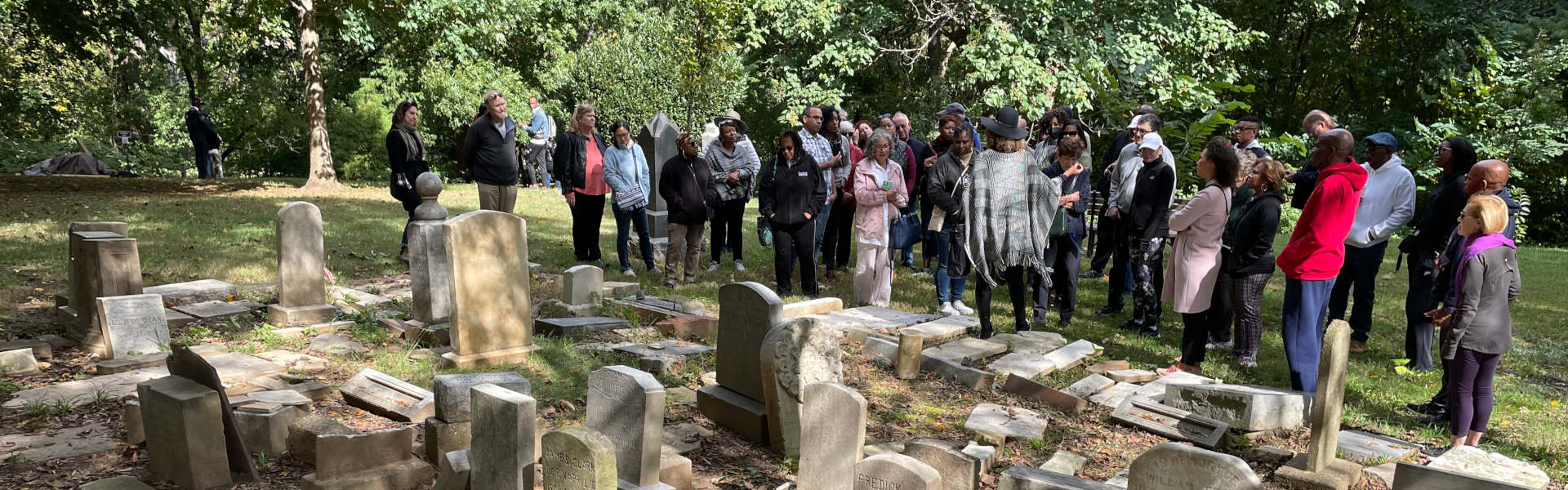
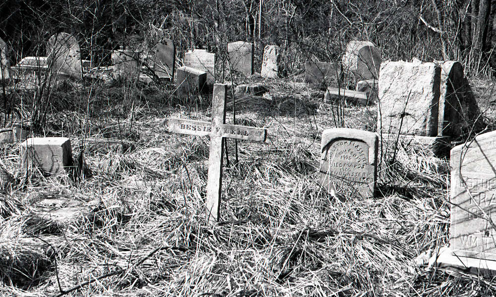
The Mount Zion – Female Union Band Society Cemetery is a historic cemetery located in the Georgetown neighborhood of Washington, D.C. The three-acre cemetery is composed of two roughly equal-sized halves, the Mount Zion Cemetery on the east and the Female Union Band Society Cemetery on the west, separated along a subtle north-south ridge in the center of the property.
Historically called the Old Methodist Burying Ground, the cemetery originated as a churchyard burial ground. It was established by the Montgomery Street Methodist Church in 1808, which gathered at the Montgomery Street Meeting House, formerly located on Twenty-Eighth Street between M and Olive Streets, N.W. (formerly Montgomery Street between Bridge and Olive Streets), approximately one-half mile southwest of the cemetery. The Montgomery Street Methodist Church was one of the few churches at the time that accepted white and black members, though on a segregated basis. Nearly half of the congregation consisted of former slaves and free blacks in the years leading up to 1816, when a group of 125 black members, dissatisfied with segregation, established their own congregation under the supervision of the parent church.
The congregation, now called the Mount Zion United Methodist Church and located at 1334 Twenty-Ninth Street, N.W., is thought to be the oldest black congregation in the District of Columbia, as well as the first black Methodist church in the area. The cemetery is the only remaining in D.C. used to inter a significant number of former slaves.
On October 19, 1842, a tract of land along the western border of the Old Methodist Burying Ground was sold for $250 to Joseph Mason in trust for the Female Union Band Society, a cooperative benevolent society founded in the same year by a group of free African American and Native American women. The Female Union Band Society purchased the western lot of Mount Zion to establish a secular burying ground for African Americans, which remained a prominent cemetery for the region’s African American community until 1950.
Continue reading the full history of the cemetery here.
📅 Dates: June 27, 29, & 30, 2024 📍 Location: Mount Zion – Female Union Band Society Cemetery, 2501 Mill Rd NW, Washington, D.C. 20007 & Via ZOOM
ℹ️ Open to the Public – No Prior Experience Needed! Familiarity with computers is recommended, but not required.
ℹ️ What to Expect:
Guided training sessions on cemetery documentation techniques
Hands-on experience in cataloging tombstones and historical markers
Insights into the rich history and cultural significance of Mount Zion – Female Union Band Society Cemetery
Opportunities to connect with fellow history enthusiasts and preservationists
Don’t miss out on this unique opportunity to contribute to the preservation of our heritage! Whether you’re a seasoned historian or simply curious about the past, all are welcome to join us.
Let’s come together to honor the past and pave the way for future generations to cherish and learn from the legacies of the Mount Zion – Female Union Band Society Cemetery!
Program Schedule
Click on the session links below to view the schedule for each day.
This training will introduce foundational concepts in heritage documentation for historic cemeteries:
Cemetery documentation fundamentals
Data collection: Kobotoolbox
Basics of Photogrammetry
KoBoToolbox is a free and open source software package for location and descriptive data collection. Information can be collected at heritage sites through tablets and phones using the KoBoCollect app or through the web browser interface, even when those devices are offline. Location and descriptive data recorded in the field can then be synched up with GIS software once an internet connection has been reestablished.
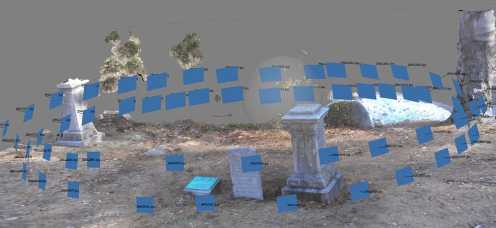
Photogrammetry is the use of two dimensional (2D) images to provide measurement data. Measurement data includes the creation of 3D models for heritage documentation and preservation. Processing heritage data through photogrammetry offers a transformative lens into the past. By meticulously capturing and analyzing images, we unveil hidden dimensions of cemeteries and tombs. This method not only preserves archaeological sites digitally but also facilitates precise measurements and reconstructions, fostering deeper insights into the legacies of African Americans in the Washington D.C. area.
On-site Training at Mount Zion – Female Union Band Society Cemetery
SATURDAY, June 29, 2024
10:00am – 4:00pm EDT (Attend for as long as you wish)
2501 Mill Rd NW, Washington D.C. 20007
We will convene on Saturday at the Mount Zion – Female Union Band Society Cemetery, located in the Georgetown neighborhood of Washington, D.C. (2501 Mill Rd NW, Washington, DC 20007). Attendees are welcome to join at any point between 10am and 4pm to gain practical experience in cemetery documentation techniques:
Insights into the rich history and cultural significance of Mount Zion – Female Union Band Society Cemetery
Hands-on experience in cataloging tombstones and historical markers using free online databases (Kobotoolbox)
Photographic strategies for heritage preservation
* AITC and ASOR will provide the equipment needed during the training.
Data Processing
SUNDAY, June 30, 2024
1:00 – 4:00pm EDT
Via Zoom
On the final day of training we will process and examine the data collected at Mount Zion – Female Union Band Society Cemetery. Attendees will learn how to edit and publish their data stored in Kobotoolbox. They will also have a chance to build 3D models through photogrammetry of gravestones and tombs located at the cemetery.
Please e-mail the Membership office if you have any questions.
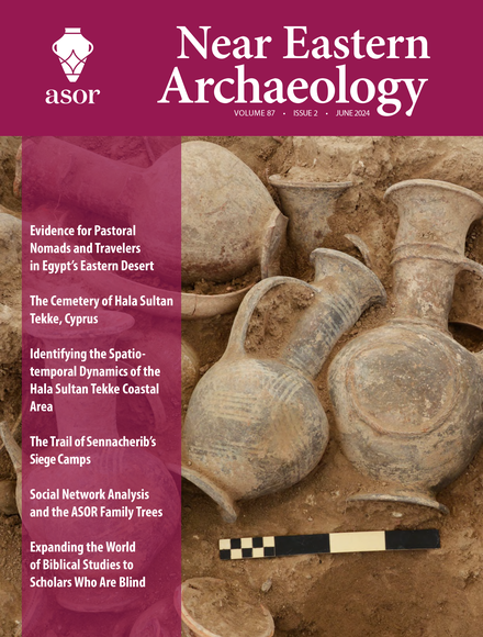
Pp. 64–72: “Evidence for Pastoral Nomads and Travelers in the Eastern Desert: Site 51 and Beyond at Wadi el-Hudi, Egypt,” by Kate Liszka
In the Egyptian Eastern Desert, southeast of Aswan, the Wadi el-Hudi Archaeological Expedition discovered extensive evidence of pastoral nomads living, working, and grazing animals at several archaeological sites. Site 51, newly discovered in January 2023, is a short-term domestic shelter with natural alcoves used by pastoral nomads for millennia. It includes over fifty newly discovered rock inscriptions of cows, ibexes, tally marks, and graffiti. Several grinding stones and nearly a hundred cupules demonstrate the nomads’ collection and processing of local plants while they tended their animals. Additionally, other travelers also sheltered at Site 51 throughout the millennia. This discovery adds to the increasing evidence that, in addition to being an ancient Egyptian site for the mining of amethyst and gold, Wadi el-Hudi was an important zone for pastoral nomads.
ASOR Members with online access: log into ASOR’s Online Portal here. Once logged in, click the JOURNALS tab in the top navigation bar. Tutorials for how to log in to the Online Portal as well as how to navigate to the Portal Journals page can be found here.
Pp. 74-99: “The Cemetery of Hala Sultan Tekke, Cyprus: Further Evidence of Interculturality and Burial Customs in the Late Bronze Age,” by Peter M. Fischer
This study deals with the results from the 2018–2023 fieldwork at the cemetery of Hala Sultan Tekke. The aim of the project is the safeguarding, excavation, recording, and study of tombs exposed to farming, erosion, and looting. The stratigraphy of the tombs that were used over generations represents an excellent complement to the sequence of occupation in the city. The mortuary gifts and personal belongings date mainly to the fifteenth to thirteenth centuries BCE and confirm far-reaching trade, further underlining the role of the city as a trading center in the Mediterranean economic system. The material evidence corroborates connections with societies of the Mycenaean, Minoan, Hittite, Levantine, and Egyptian spheres of culture as well as networks with regions as far away as Sardinia, the Baltic Sea, Mesopotamia, Afghanistan, and India. In addition, several find contexts provide valuable information about the complex mortuary customs of the Late Cypriot period.
ASOR Members with online access: log into ASOR’s Online Portal here. Once logged in, click the JOURNALS tab in the top navigation bar. Tutorials for how to log in to the Online Portal as well as how to navigate to the Portal Journals page can be found here.
Pp. 100-109: “As Time Goes by: Identifying the Spatiotemporal Dynamics of the Hala Sultan Tekke Coastal Area (Cyprus) by Means of Surface Surveying,” by Polte De Weirdt, Ralf Vandam, Jan Coenaerts, and Karin Nys
Contrary to the idiosyncratic “tell-type�? urban settlements that epitomize Late Bronze Age societies in the eastern Mediterranean and the Near East, a handful of major urban settlements on Cyprus, such as Hala Sultan Tekke and Maroni, embodied a completely different notion of urban engineering. Instead of dense urban city centers where numerous residents resided close to each other, these “atypical�? settlements were apparently organized with broad areas of open space between smaller occupational “clusters.�? By means of archaeological survey combined with a landscape archaeological approach, the Hala Sultan Tekke Hinterland Survey Project (HST-HASP) aims to (re)evaluate this unique type of spatial organization at the Late Bronze Age settlement at Dromolaxia-Vyzakia, as well as to reconstruct the long-term, multiperiod lifecycle of the settlement and its surrounding landscape. The project by the Vrije Universiteit Brussel aims to investigate the site’s hinterland and its relation and position within the broader Tremithos Valley region.
ASOR Members with online access: log into ASOR’s Online Portal here. Once logged in, click the JOURNALS tab in the top navigation bar. Tutorials for how to log in to the Online Portal as well as how to navigate to the Portal Journals page can be found here.
Pp. 110-120: “The Trail of Sennacherib’s Siege Camps,” by Stephen C. Compton
Images of military conquest on Sennacherib’s palace walls often featured his siege camps. By comparing the visual and textual references to these camps with the surroundings of the cities he besieged (on site and via aerial and satellite imagery, archaeological and historical data, and early maps and surveys), likely locations are proposed for Sennacherib’s royal camps. These sites are found to have all had the same name on early maps, Mudawwara, which, in Arabic in the Middle Ages, denoted the enormous tent that housed the sultan on military expeditions. (At times, this name was prefaced with Khirbet al, indicating the ancient stone ruins thereof.) Examining all occurrences of this toponym within Judah and Philistia reveals a distribution consistent with what is known of Sennacherib’s invasion route and of the cities besieged. It also resolves some long-standing questions and contributes to identifying the locations of the cities of Libnah and Nob.
ASOR Members with online access: log into ASOR’s Online Portal here. Once logged in, click the JOURNALS tab in the top navigation bar. Tutorials for how to log in to the Online Portal as well as how to navigate to the Portal Journals page can be found here.
Pp. 122-131: “Dawn and Descent: Social Network Analysis and the ASOR Family Trees,” by Diane Harris Cline, Eric H. Cline, and Rachel Hallote
The development of ancient Near Eastern archaeology, especially that of the southern Levant, is usually presented through several standard narratives. For American scholars it frequently begins with William F. Albright, who is often referred to as “the father of biblical archaeology.�? We undertook to test this narrative by surveying current scholars and using three separate metrics of social network analysis (SNA) on the resulting academic genealogies. Our preliminary results indicate that while a portion of active American archaeologists and biblicists do indeed trace their academic lineage back to Albright, an even larger portion, including Israeli archaeologists and various American Egyptologists and Assyriologists, are scholarly descendants of Albright’s academic cousins, all of whom can trace themselves back to the German Assyriologist Friedrich Delitzsch, who seems to have been the real father of the discipline, genealogically speaking. We also determined that academic lineage does not inhibit intellectual diversification.
ASOR Members with online access: log into ASOR’s Online Portal here. Once logged in, click the JOURNALS tab in the top navigation bar. Tutorials for how to log in to the Online Portal as well as how to navigate to the Portal Journals page can be found here.
Pp. 132-136: “Expanding the World of Biblical Studies to Scholars Who Are Blind: Creation and Implementation of a Coptic Braille System,” by Daniel Charles Smith and Sarah Blake LaRose
Until 2016, braille readers had little or no access to ancient languages beyond Hebrew, Greek, and Latin. Thus access to the study of ancient languages was difficult for blind students who needed braille texts. This article describes the history that led to the development of a braille system to represent the Coptic language. It also discusses the process of implementing the Coptic braille system in the translation of a textbook from print to braille and what was learned from the use of this braille system in the translation process. The information can provide guidance to other universities wishing to ensure access to ancient language texts for students who are blind and possible new directions for the study of this corpus.
ASOR Members with online access: log into ASOR’s Online Portal here. Once logged in, click the JOURNALS tab in the top navigation bar. Tutorials for how to log in to the Online Portal as well as how to navigate to the Portal Journals page can be found here.
A colossal basalt statue was uncovered through rescue excavation in downtown Amman, Jordan in 2010. Despite the statue’s Roman period find context, its form and motifs show it to be an Iron Age sculpture, and geoscientific testing indicates a regional quarry source. Comparison with an established corpus of Iron Age stone sculpture from Amman shows the Amman Theater Statue shares the distinct iconography of a series of Amman male statues portraying deities and human rulers. Broader art-historical comparisons from Egypt, the Levant, and Mesopotamia indicate that the statue dates ca. 850-825 B.C.E., that it belonged to an Ammonite royal ancestor cult, and that in that setting it portrayed a deified, deceased Ammonite king. Archaeological and epigraphic evidence accompanying those broader Near Eastern comparisons, especially those from Syro-Anatolian political capitals from Iron Age II, and archaeological evidence from Amman indicate that the Amman Theater Statue was incorporated into an architectural structure, either a building façade or monumental gate, on the Amman Citadel (Jabal al-Qal’a), along its southern ascent, or just beyond its southern slope.
With contributions by Romel Gharib and Don F. Parker.
Annual of ASOR, Volume 75, Series Editor William Caraher, December 2023, 220 pages, 15 b/w illustrations, 41 color illustrations, 6 tables. ISBN 9780897571197, $85.95.
Special Offer for ASOR Members
ASOR members (with a mailing address in the USA) can purchase a copy of AASOR 75 at the discounted price of $30.00 (65% discount + $5.00 US shipping) while supplies last. Purchases are restricted to one volume per member. We are unable to offer this discount to members without a US mailing address due to international shipping costs, but you can purchase and ship a copy through the ISD link below. Please contact programs@asor.org with any questions. Click here to purchase your discounted copy in ASOR’s online store.
ASOR ANNOUNCES REGAN BAKER AS NEW MEMBERSHIP COORDINATOR
ASOR is pleased to announce Regan Baker as ASOR’s new Membership Coordinator! Regan Baker graduated from The George Washington University with a Bachelor’s of Art in Archaeology in May 2023. In February, Regan accepted the role of Office Coordinator and has excelled in her position working with ASOR members and staff at the James F. Strange Center.
This announcement comes with news of Katherine Schmitt’s departure from ASOR as Membership Coordinator. Katherine will be leaving to travel the United States and will be replaced by Regan Baker as the new contact for all ASOR Membership inquiries on May 24, 2024.
It has been a joy to work for ASOR and Katherine would like to thank the ASOR community. She will greatly miss all of the amazing members and staff she was able to meet and work with during her past 2 years at ASOR.
As Membership Coordinator, Regan will be responsible for the growth of both the membership and Friends of ASOR programs, handling membership processing and fulfillment, supporting the Annual Meeting, and website maintenance. Regan looks forward to continuing to work with ASOR’s members and donors!
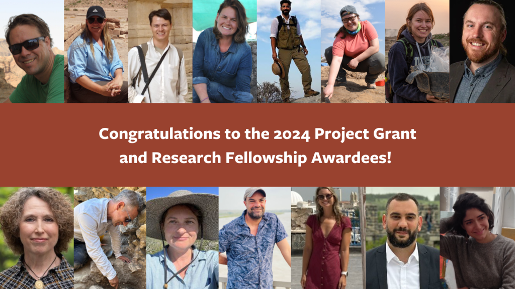
Jason T. Herrmann, University of Pennsylvania: Phoenician Roots in a Punic City (Sicily, Italy)
Sarah A. James, University of Colorado Boulder: The Brač Island Project (Croatia)
Jennifer Ramsay, SUNY-Brockport, Björn Anderson,University of Iowa, and Craig Harvey, University of Alberta: Exploring Continuity and Transition in Southern Jordan
Stevan B. Dana Project Grant for Israel
Bethany J. Walker, University of Bonn: Study of Cultivation Strategies at Khirbet Beit Loya (Israel)
Charles Harris Project Grants
Alexander J. Smith, SUNY-Brockport: Menorca Archaeological Project (Spain)
Joe D. Seger Project Grant
Khaled Abu Jayyab, University of Toronto: Paths to Urban Growth in the Nineveh Plain (Iraq)
Asil Yaman, University of Pennsylvania: Phoenix Archaeological Project (Turkey)
Shepard Urgent Action Grants
Gia Chilingarashvili, Ivane Javakhishvili Tbilisi State University: Rescue Excavation of a Chalcolithic Settlement in South-West Georgia
Caroline Angle Maguire, University of Maryland: Decolonizing Knowledge: Reclaiming Colonial Museums in Francophone North and West Africa (Tunisia)
Study of Collections Fellowships
Jennie Ebeling, University of Evansville: Analysis of Ground Stone Artifacts from Tell en-Nasbeh, Palestine at the Badè Museum of Biblical Archaeology
Holly Winter, University of Sydney: The Land Behind Aleppo: Urban Life and State Formation in Bronze Age Syria at the Harvard Museum of the Ancient Near East
Mesopotamian Fellowship
Elizabeth Gibbon, University of Toronto: The Halaf-Ubaid Transition at Tepe Gawra (Iraq)
Jeiran Jahani, Columbia University: Animal Art: Domesticating Wild Ecologies of the First Cities (Iraq)
This past summer afforded me the extraordinary privilege of participating in fieldwork at Tell el-Hesi, collaborating with University of Michigan PhD candidate Kara Larson in her research for her doctoral dissertation, as well as joining the Mississippi State University Field School to conclude excavations at Khirbet Summeily. During the initial phase of the field season, we broke ground with the first excavations at Tell el-Hesi since the 1970s, with plans for continued excavation over multiple seasons. This archaeological site had undergone extensive previous excavations, with projects dating back to 1890-1892 and another in 1970-1977 conducted by the Joint Archaeological Expedition to Tell el-Hesi with these prior endeavors primarily concentrated on the Tell and the upper city of the site; however, the 1970 expedition conducted a probe off the Tell in field IV, delving into the site’s broader stratigraphy to achieve a holistic understanding of the ancient city. It was the findings from this probe that influenced our selection of the excavation site for our work.
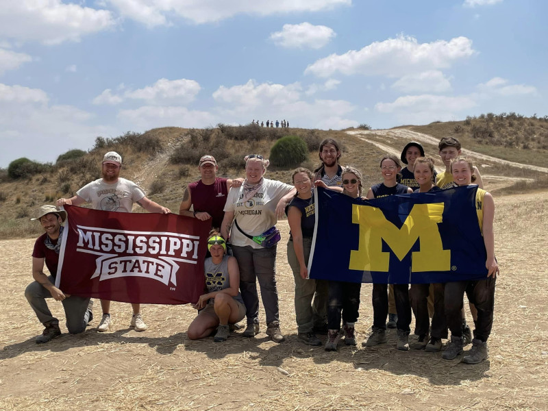
The Tell el-Hesi team!
In the latter part of my field season, I participated in excavations at Khirbet Summeily, an Iron Age administrative and trade outpost. Collaborating with the Mississippi State University crew provided not only invaluable archaeological experience but also the opportunity to establish meaningful connections within our shared field of study and a collective camaraderie forged beneath the blazing sun.
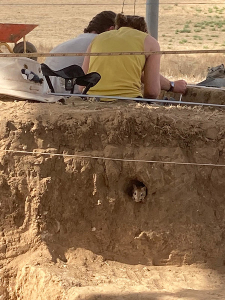
An unexpected excavation volunteer.
A typical field day began by aiming to beat the scorching heat. Ideally, we woke at 4 a.m., prepared breakfast, and ensured we had enough water before heading to the site by 5 a.m. More often than not, the allure of the snooze button prevailed, leading to a rush to get ready and make it to the vehicles on time. Upon arrival at the site, our initial tasks included setting up shade cloths, unloading tools, and beginning excavation. Throughout the day, we took short breaks for morning coffee, a mid-morning breakfast, and a refreshing fruit break toward the end, vital after long hours when it was beginning to heat up. Around 12:15 p.m., as the temperature climbed, we finished our excavation activities, cleaned up, and left the site by 12:30 p.m., eagerly returning for lunch and a much-needed shower. The midday break allowed for short naps which many of our crew took frequent advantage of. After this afternoon break, while most other students washed pottery, I had the privilege of illustrating notable sherds found during excavation. As an interdisciplinary art and archaeology student, this role allowed me to refine my skills and define my niche.
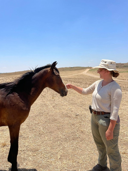
Saying hello to a visitor to the site.
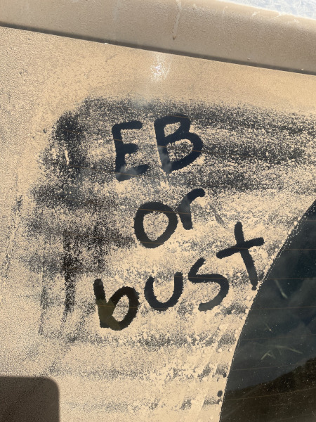
Words of motivation!
Weekends provided a welcome respite with trips to explore renowned archaeological sites, culturally significant locations, and the region’s must-see attractions. Among the memorable highlights were the experience of floating in the Dead Sea (a word of caution – avoid getting the water in your eyes, trust me, it’s not pleasant), visiting Masada, where some of our team braved climbing the snake path while others took in views from the gondola, swimming in the Mediterranean Sea, and my personal favorite was the opportunity to explore Jerusalem’s Old City.
In summary, my journey of working and learning at Tell el-Hesi and Khirbet Summeily during the summer has been profoundly transformative. The experiences, knowledge, and friendships I acquired have enriched both my academic and personal growth. As I reflect upon the early mornings, sweltering days, and the discoveries we unearthed together, I am deeply moved by the generosity of ASOR and the donors to the Katherine Barton Platt Fellowships for making this journey possible. The opportunity to collaborate with fellow scholars and engage in interdisciplinary research that fuses art and archaeology has solidified my love for this field. I am unwavering in my commitment to carry forward the knowledge and experiences from this fieldwork season in my academic pursuits, aspiring to make meaningful contributions to the field of archaeology. I extend my heartfelt gratitude once more for this extraordinary opportunity, which has unquestionably shaped my future aspirations and goals.
Danielle (Dani) Tutak is a senior pursuing dual degrees in art and design and anthropological archaeology at the University of Michigan. She is passionate about the potential of interdisciplinary research using insights and methods from diverse fields of study and experimenting with unexpected methods of science communication and documentation. Her upcoming projects and goals include finishing her anthropology honors thesis in archaeological research, completing her senior art thesis exploring historical and modern approaches to understanding the past, and graduating and moving on to the next adventure.
Want to help more students and early career archaeologists get into the field? Donate to the cause today by selecting “Excavation Scholarships” as your gift purpose!
ASOR WELCOMES MONI ISLAM AS NEW OFFICE COORDINATOR
Moni Islam joined ASOR on April 29 as the new Office Coordinator. He has a Master’s of Arts in Archaeology from Durham University in the United Kingdom, as well as a Bachelor’s of Arts in Anthropology and Global Affairs from George Mason University in Fairfax, Virginia. He has been familiar with ASOR for many years, including having won a 2021 ASOR Summer Stipend Award to work remotely on the Jezreel Expedition Publication Project where he helped organize the project’s open database, conduct research on a Palestinian village, and compile relevant photos and resources.
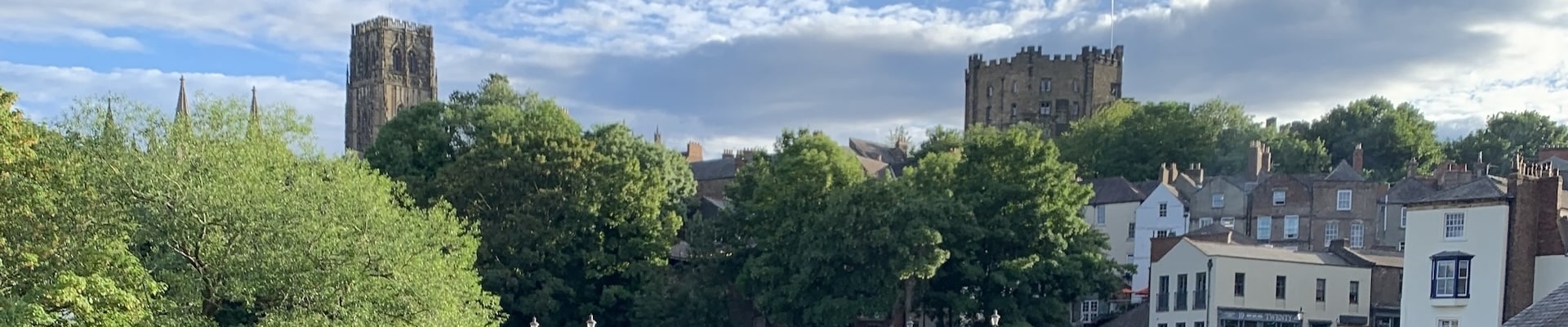
Moni participated in his first archaeological field school in 2019 in Jordan at Tell Dhiban, a site which was the capital of the Biblical kingdom of Moab from the Iron Age. While finishing up his undergrad at Mason, he also undertook archaeology internships at the Smithsonian’s National Museum of Natural History and Fairfax County Park Authority in 2019. Moni was grateful to be selected as a 2021-22 Fulbright-UK Postgraduate scholar to study his Master’s at Durham University. At Durham, his research focused on the settlement patterns of pre-Islamic Arabia from the 3rd to 7th centuries CE, including studying sites like Mada’in Salih, Qaryat al-Faw, Dumat al-Jandal, Mleiha, and Ma’rib.
Most recently, Moni was working as an Associate Archaeologist with Chronicle Heritage in the Kingdom of Saudi Arabia. In this role, he provided archaeological supervision on various heritage projects in Al ‘Ula and also participated in the first excavations of the historical district of Ghasibah in Diriyah, the origin of the Saudi royal family and the capital of the first Saudi dynasty from 1727 to 1818.
ASOR is pleased to welcome Moni as he begins the role of Office Coordinator where he will be responsible for assisting the office staff with all administrative tasks, website maintenance, and being the first point of contact for ASOR members. Moni looks forward to interacting with the entire ASOR community!
This announcement also comes with news of Katherine Schmitt’s departure from ASOR as Membership Coordinator. Katherine will be leaving to travel the United States and will be replaced by Regan Baker as the new contact for all ASOR Membership inquiries on May 24, 2024.
[/vc_column_text][mk_divider][vc_wp_text]Currently, 137 projects are affiliated with ASOR. This includes 108 field projects and 29 publication projects. Seven new projects have received ASOR affiliation since last summer. Read more about these new ASOR-affiliated projects below!
Paths to Urban Growth in the Nineveh Plain (PUG) explores the origins of early urbanism in Northern Iraq during the 5th and 4th millennia BC through excavations at the sites of Tepe Gawra and Tell ‘Arna/Gogjeli. Tepe Gawra has been the hallmark site for the development of complexity during the Ubaid and Late Chalcolithic periods in the ancient Near East. Past excavations at the site revealed a local development of a sophisticated infrastructure manifest in construction of temples, monumental architecture, and elaborate administrative technologies. Due to these features, Tepe Gawra has been characterized as an administrative centre atop of a regional polity. However, recent survey carried out by our team at Tepe Gawra has identified the presence of a lower town, potentially indicative of the presence of domestic occupation. Further, due to the lack of excavated sites of the same time period in the surrounding region, it is difficult to determine if the features identified at Tepe Gawra are unique, or if the features that characterize it are common at other sites in the Nineveh Plain, such as Tell ‘Arna/Gogjeli. Excavations at Tell ‘Arna/Gogjeli allow us to compare the processes occurring at the two sites, test regional assumptions on the centrality of Tepe Gawra, assess networks of interactions within the region, and build a more complete picture on the process of urban developments in northern Iraq.
A Clash of Kings — South-central Anatolian political geography between Phrygia and Assyria, Cappadocia, Turkey (Michele Massa)
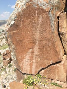
Carved depiction of Great King Hartapu, who ruled in the 8th century BCE in the Konya Plain.
This three-year project aims to reconstruct the political geography of the Tabalian confederation, a group of small kingdoms in south-central Anatolia (Türkiye) that existed during the late 9th-early 7th centuries BCE squeezed in between the two major powers of the time, Phrygia and Assyria. While we have extensive written sources (including Assyrian annals and local Luwian monumental inscriptions) and significant archaeological data (excavated and surveyed settlements and forts, landscape monuments) covering this period, very little interdisciplinary research has been done to synthesize them into a coherent picture.
Our goal is to reassess this varied evidence within an integrative analytical environment where we can combine conceptual frameworks and methods stemming from history, philology, landscape archaeology and digital archaeology. We plan in particular to (a) create high-resolution 3D and RTI models of key Luwian inscriptions; which in turn (b) provide improved translations of these monuments, particularly those shedding light on relations between different Tabalian rulers; and (c) integrate textual-borne evidence with a GIS-led analysis of human and natural landscapes to sketch the diachronically changing Tabalian power networks and map them onto real-world geographies.
Çadır Höyük is located on the north central Anatolian plateau. There has been continuous occupation at Çadır for at least 6,000 years (late 6th millennium BCE to the 13th century CE). Excavations commenced in 1994, continuing to the present time. Steadman is the fourth project director, preceded by Gorny (1994-2009), McMahon (with whom she co-directed, 2010-2019), and Şerifoğlu (2020-2021). Excavations include (trenches are 10 x 10 m): ten trenches exposing the Chalcolithic occupation (lower S slope); over ten trenches dedicated to Byzantine occupation (summit); six trenches focused on Hittite/Bronze Age occupation (N and E slope); four trenches dedicated to the Iron Age (various areas); previous excavations and a few current trenches having investigated the Classical/Hellenistic periods.
We have a housing/research compound which comfortably houses 30 people. A four room-lab provides ample research area. A newly-built conservation lab is separate. We have a two-room equipment storage facility, and a three-room storage depot for archaeological materials. A guard lives at this compound year-round.
Our senior research team has been with the project for a decade or more. Each year we train undergrad/grad students, from Türkiye and elsewhere, in field and lab methods. We have a strong and inclusive publication history.
[/vc_wp_text][mk_divider][vc_wp_text]
Horvat Midras Excavation Project, Israel (Orit Peleg-Barkat, Gregg E. Gardner)
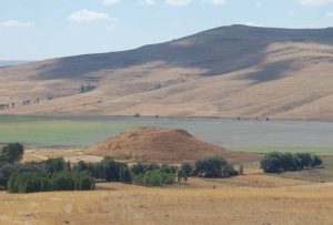
[/vc_wp_text][vc_row_inner][vc_column_inner width=”1/2″][vc_wp_text]This project aims to enhance our understanding of rural life in the Southern Levant by excavating Horvat Midras, Israel, the site of an ancient village with several phases of occupation over two millennia. We are especially interested in understanding the village’s social and religious character, how it changed, its daily life, and the impact of military conflicts, migration, and resettlement efforts. Located between Jerusalem and the Mediterranean coast, in the Shephelah or Judean Foothills region, Horvat Midras was inhabited by several different groups from the 4th century BCE to 16th century CE, including Idumeans, Jews, Roman polytheists, Byzantine Christians, and Muslims under the Umayyads, Mamluks, and Ottomans. Our initial surveys and excavations suggest that the site was profoundly transformed following the Roman suppression of the Second Jewish Revolt in 132-136 CE, which was followed by Roman resettlement of the village and construction projects that would have an enduring impact. This project began in 2015 with the Hebrew University of Jerusalem’s Institute of Archaeology and since 2018 has been a joint-venture together with the University of British Columbia (Canada).[/vc_wp_text][/vc_column_inner][vc_column_inner width=”1/2″][mk_padding_divider][vc_single_image image=”96589″ img_size=”medium” add_caption=”yes” alignment=”center”][mk_padding_divider size=”20″][vc_single_image image=”96590″ img_size=”medium” add_caption=”yes” alignment=”center”][/vc_column_inner][/vc_row_inner][mk_divider][vc_wp_text]
Exploring Continuity and Transition in Southern Jordan (Jennifer Ramsay, Bjorn Anderson, Craig Harvey)
The Exploring Continuity and Transition in Southern Jordan (CTSJ) project is a multi-disciplinary group of American and Canadian collaborators that plan to conduct a survey focusing on sites previously identified as having evidence of multiperiod occupation between Petra and Humayma in southern Jordan. The main aim of this survey is to investigate these archaeological sites for signs of continuity or shifts in cultural practices over time, specifically between the Iron Age and the Nabataean period. While several sites in the region have undergone preliminary surveys noting material culture from various periods, only a few have been extensively excavated. Many of the sites identified have very limited information and no chronological verification from excavations. Therefore, our primary interest lies in enhancing our understanding of Nabataean prehistory, particularly regarding cultural activities (ritual, funerary, agriculture, engineering) during the Iron Age and their continuity or transition into the Nabataean period. There is a significance gap in our understanding of this period (approx. 539-300 BCE) in the prehistory of Jordan, which needs to be addressed. A review of published archaeological findings in the area has revealed this gap in our comprehension of this period, which has prompted new research inquiries that can only be addressed initially through a survey of specific sites in the region.
Since 1977, the University of Palermo has led research at the site of ancient Motya, an island city in western Sicily founded by Phoenician colonists in the 8th century BCE that grew into a strategic Carthaginian center. This project made several noteworthy contributions to the scholarship of the Mediterranean in its early years, including the documentation of a large pottery workshop that features kilns of Levantine tradition and the revelation of the world-renowned “Youth of Motya” statue, a mid-5th century BCE masterpiece crafted of Parian marble. After 2013, the Palermo Archaeological Mission has grown to become a multinational project with active collaborations with the University of Pennsylvania and the University of Tübingen. Current research foci at Motya include the excavation of pre-Phoenician contexts to understand Bronze Age land use and settlement, excavation of Punic monumental buildings and public spaces, excavation of the archaic necropolis coupled with bio-archaeological and genetic research, and extensive geophysical prospection, surface survey, and test excavations to understand the development of Motya’s urban structure and changes in the ethnic identities of its residents over time. These ongoing research efforts are integrated with education including a field school where students from the University of Palermo and elsewhere come together to gain experience in all facets of archaeological fieldwork.
The Sebittu Project is a long-term study of the agrarian economies and environmental impacts of imperial expansion during the Iron Age of Iraqi Kurdistan. Centered on a cluster of seven villages, hamlets, and farmsteads in the Erbil Plain, the Sebittu Project looks at Neo-Assyrian imperial economy through a “bottom-up” perspective. The Sebittu Project focuses on the collection and intepretation of paleobotanical, zooarchaeological, and environmental data from primary contexts to address broad research questions regarding models of Assyrian imperial expansion, internal organization of agrarian settlements, regional economies, paleoenvironment conditions, and human impacts on the landscape.




 ASOR is pleased to announce Regan Baker as ASOR’s new Membership Coordinator! Regan Baker graduated from The George Washington University with a Bachelor’s of Art in Archaeology in May 2023. In February,
 Danielle (Dani) Tutak is a senior pursuing dual degrees in art and design and anthropological archaeology at the University of Michigan. She is passionate about the potential of interdisciplinary research using insights and methods from diverse fields of study and experimenting with unexpected methods of science communication and documentation. Her upcoming projects and goals include finishing her anthropology honors thesis in archaeological research, completing her senior art thesis exploring historical and modern approaches to understanding the past, and graduating and moving on to the next adventure.
 Moni Islam joined ASOR on April 29 as the new Office Coordinator. He has a Master’s of Arts in Archaeology from Durham University in the United Kingdom, as well as a Bachelor’s of Arts in Anthropology and Global Affairs from George Mason University in Fairfax, Virginia. He has been familiar with ASOR for many years, including having won a 2021 ASOR Summer Stipend Award to work remotely on the Jezreel Expedition Publication Project where he helped organize the project’s open database, conduct research on a Palestinian village, and compile relevant photos and resources.