
2023 FOA Seminar in Raleigh-Durham

2023 FRIENDS OF ASOR SEMINAR

October 20-22, Raleigh-Durham, NC

Register today for “Archaeology in the Mediterranean and Ancient Near East: Recent Discoveries and Retrospectives” a Friends of ASOR Weekend Seminar in Raleigh-Durham, NC at the Sheraton Imperial Hotel Raleigh-Durham Airport at Research Triangle Park.

Join us in Raleigh this October for a weekend full of interactive lectures, or register for a One-Day pass! Registration includes admission to presentations on Friday evening, all-day Saturday, and Sunday morning. There will be ample opportunities to engage informally with speakers and panelists. Registration also includes a discount on hotel room rates, dinner on 10/20, lunch on 10/21.

This FOA Seminar will include presentations from Eric Meyers, Carol Meyers, Jennie Ebeling, Kate Grossman, Tate Paulette, and Jack Sasson. Sharon Herbert and Andrew Vaughn will participate as panelists.


Register Now Button


Pricing

(Full weekend seminar with all events included is $200, individual events priced below)

 Friday Oct. 20Saturday Oct. 21Sunday Oct. 22
 Dinner and a private conversation with the seminar’s academic speakers: $75One-day Registration (includes 4 presentations, lunch, and dinner): $100One-day Registration: $50
  Saturday night dinner: $75
*Free for the first 30 local registrants
 
Full Weekend Registration ($200)All of the above includedAll of the above includedAll of the above included


Presentation Schedule

FRIDAY, OCTOBER 20


Dinner

Private conversation with the seminar’s academic speakers

SATURDAY, OCTOBER 21

Morning

Naboth’s Vineyard in Context: Excavating an Iron Age Winery at Jezreel
Jennie Ebeling

The beverage described most frequently in the Hebrew Bible/Old Testament, wine played a major role in the diet, economy, religion, and culture of ancient Israel. A well-preserved winery complex excavated at Jezreel in Israel’s Galilee offers insights into the technology of wine production during the Iron Age (ca. 1200-586 BCE) and provides context for the dramatic story of Naboth’s vineyard in 1 Kings 21.

Food, Gender, and Power in Israelite Households
Carol Meyers

Nothing is more fundamental to human existence than food, and in traditional societies like ancient Israel, growing crops and raising animals and then transforming them into edible form occupied a significant part of the daily life of most people. The latter step–the production of edible products, that is, food­­–was largely the task of women in biblical antiquity. This presentation will look at some of the archaeological materials that women used in making food. Then it will go a step further and look at the social, religious, and other aspects of women’s food-production tasks. In so doing, it will reveal otherwise unnoticed aspects, such as personal and social power, of women’s lives in Israelite households.

Lunch


Afternoon


Tales the Animals Tell: Zooarchaeology and the Multispecies Communities of the Ancient Near East
Kate Grossman

The cities, towns, and countryside of the Near East were populated not just by humans, but also by the animals that lived, worked, and died alongside them. While we tend to think of animals primarily as a source of food and labor, new approaches to the study of human-animal interactions are foregrounding the ways that animals influenced human action and contributed to social life in the ancient world. Drawing on 15+ years of studying animal bones from archaeological sites in Syria, Iraq, Jordan, Egypt, and Cyprus, I will show how the zooarchaeological record provides surprising new insights into the multispecies communities of the ancient Near East.

Beer and Brewing in Ancient Mesopotamia
Tate Paulette

In ancient Mesopotamia, beer was produced on a massive scale and was consumed on a daily basis by people across the socio-economic spectrum. Beer was a gift from the gods, a marker of civilization, a dietary staple, a social lubricant, a ritual necessity, and a reason for celebration. It was consumed at feasts, festivals, and ritual ceremonies, but also at home, on the job, and in neighborhood taverns. It was produced by brewers working for the powerful palace and temple institutions and also by local tavern keepers and homebrewers. This lecture explores the archaeological, artistic, and written evidence for beer and brewing in Mesopotamia, as well as recent efforts to recreate Mesopotamian beer.

Dinner

Plenary Panel


Cultural Heritage in the Age of Conflict: ASOR in North Africa – Andrew Vaughn, Sharon Herbert, Carol Meyers, Eric Meyers, Jack Sasson

SUNDAY, OCTOBER 22

Morning

Of Tombstones and Atlantis: Searching for a Lost Past in Tunis and Djerba
Jack Sasson

In Tunis and Djerba, Jack M. Sasson, a retired (UNC and Vanderbilt) Assyriologist and Biblical scholar, had glimpses of remnant communities that parallel those of his native Syria and Lebanon, alas now as submerged as Atlantis. In this informal talk, he will reflect on his personal experience of that world as evoked by his visit: Arab in culture, Jewish in religion, and French in outlook. Sasson will also report on a striking difference among those communities in their biographic use of tombstones.

Jesus in Galilee: An Archaeological Perspective
Eric Meyers

Recent archaeological discoveries in Galilee have shown beyond any shadow of a doubt that the region was overwhelmingly Jewish in the time of Jesus. There are only a handful of sites that may be identified as gentile or non-Jewish. In addition, the identification of many early synagogues from this period has allowed us to better understand that the multiple references in Josephus and the New Testament are to actually purpose-built structures, chief among them being Magdala. Together with the many stones vessels and ritual baths found, we may today conclude that most of these Jewish sites, which date to the early Roman period, indicate that Jews were practicing purity laws based on the Torah. Also, with little to no Greek attested in the epigraphic finds from this time, therefore, a much more nuanced and accurate picture of Jewish Galilee may be drawn in the most recent quest for the historical Jesus.

Questions about registration? Please contact membership@asor.org or call 703-789-9230.
Call for Trustee Nominations

CALL FOR TRUSTEE NOMINATIONS 2023

The Trustee Nominations Committee announces an open call for (self) nominations for the ASOR Board of Trustees (Class of 2026). There are three primary responsibilities of the members of the Board of Trustees:
  • Governance: Being aware of issues brought forward to the Board, attending two meetings per year (at your own expense), and bringing issues of concern to the Board.
  • Fundraising and financial management: Leading in development by thinking of new opportunities, leading in giving, and providing oversight on the audited financial statements. We ask that individual trustees aspire to contribute $500 or more annually.
  • Strategic planning and policy development: Leading especially in measures that accord with ASOR’s mission.

We anticipate two openings for Membership-Elected Trustees. Any full ASOR member may be considered for nomination as an Membership-Elected Trustee. If there is someone that you would like the committee to consider—including yourself—please send the person’s name and email address to Marta Ostovich in the ASOR office. Please check with the nominee as to whether they are interested in serving on the ASOR Board of Trustees before sending in their name. If you have any questions about the responsibilities and satisfactions of being a board member, please email Kathryn Grossman, Chair of the Trustee Nominations Committee.

The ASOR office, or a representative from the Nominations Committee, will contact all nominees to describe the responsibilities in greater detail, and to make sure that the nominee is willing to have his or her name discussed by the Trustee Nominations Committee. Please note that nominees will need to submit a brief biography and a mission (or vision) statement for what they would like to accomplish as a trustee to be considered by the Nominations Committee. A sample of these statements can be found in last year’s “Meet Your Board Nominees” webpage. Brief biographies and mission statements should be ca. 200 words each and submitted via e-mail to Marta Ostovich by noon EDT on September 25, 2023.

After the Committee selects individuals for nomination, the election will take place by electronic ballot during October. ASOR is once again conducting online voting to ensure that more of our members are able to participate in this important process. The ASOR office will work with any person who is not able to complete an electronic ballot to ensure that everyone is included.

In order to receive full consideration by the committee, nominations (including supporting documents) should be submitted to programs@asor.org by noon EDT on September 25, 2023.

Fall Internships at ASOR

[vc_row fullwidth=”true” attached=”true” css=”.vc_custom_1496247803139{padding-top: 0px !important;padding-right: 0px !important;padding-bottom: 0px !important;padding-left: 0px !important;}”][vc_column][vc_single_image image=”91124″ img_size=”full” alignment=”center”][/vc_column][/vc_row][vc_row fullwidth=”true” css=”.vc_custom_1496682730308{padding-top: 10px !important;padding-right: 0px !important;padding-bottom: 0px !important;padding-left: 0px !important;}”][vc_column width=”1/12″ css=”.vc_custom_1496683820796{margin-right: 10px !important;}” offset=”vc_hidden-md vc_hidden-sm vc_hidden-xs”][vc_column_text]

 SHARE

[/vc_column_text][mk_image src=”http://www.asortest.org/wp-content/uploads/2017/01/social-fb-icon4.jpg” image_width=”42″ image_height=”42″ hover=”false” custom_url=”https://www.facebook.com/ASOResearch/” margin_bottom=”0″][mk_image src=”http://www.asortest.org/wp-content/uploads/2017/01/social-tw-icon4.jpg” image_width=”42″ image_height=”42″ hover=”false” custom_url=”https://twitter.com/ASOResearch?ref_src=twsrc%5Egoogle%7Ctwcamp%5Eserp%7Ctwgr%5Eauthor” margin_bottom=”0″][mk_image src=”http://www.asortest.org/wp-content/uploads/2017/01/social-in-icon4.jpg” image_width=”42″ image_height=”42″ hover=”false” custom_url=”https://www.linkedin.com/company/american-schools-of-oriental-research” margin_bottom=”0″][mk_image src=”http://www.asortest.org/wp-content/uploads/2017/01/social-ml-icon_7.jpg” image_width=”42″ image_height=”42″ hover=”false” custom_url=”mailto:info@asor.org” margin_bottom=”0″][mk_image src=”http://www.asortest.org/wp-content/uploads/2017/01/blog-icon3.jpg” image_width=”42″ image_height=”42″ hover=”false” custom_url=”http://asor.org/blog” margin_bottom=”0″][/vc_column][vc_column border_color=”rgba(255,255,255,0.01)” width=”1/6″ css=”.vc_custom_1496683923840{margin-right: 20px !important;border-left-width: 2px !important;padding-right: 20px !important;padding-left: 20px !important;border-left-color: #99422f !important;}”][mk_divider divider_color=”rgba(255,255,255,0.01)” thickness=”1″ margin_top=”3″ margin_bottom=”3″][vc_widget_sidebar sidebar_id=”ca-sidebar-39801″][/vc_column][vc_column border_color=”rgba(170,170,170,0.01)” width=”1/2″ css=”.vc_custom_1487276122024{margin-right: 10px !important;margin-bottom: 30px !important;border-right-width: 2px !important;border-bottom-width: 2px !important;padding-top: 30px !important;padding-right: 30px !important;padding-left: 20px !important;background-color: #ffffff !important;border-right-color: rgba(227,228,228,0.75) !important;border-bottom-color: rgba(227,228,228,0.75) !important;}”][vc_column_text responsive_align=”left”]

FALL INTERNSHIPS AT ASOR

[/vc_column_text][mk_divider][vc_column_text responsive_align=”left”]August 29 Update: Thank you to all who applied for an ASOR internship this fall. At this time we are not accepting any new applications. Additional internship opportunities may be available for the Spring Semester.[/vc_column_text][mk_divider][vc_column_text]The American Society of Overseas Research (ASOR) seeks candidates for part-time internship positions to begin on or around September 5th. These compensated internships are for the fall semester (September-December) with the possibility of renewal for the spring semester. Interns are expect to work 10–15 hours per week at ASOR’s headquarters—The James F. Strange Center, 209 Commerce St., in historic Old Town Alexandria, VA. Hours and schedule are flexible depending on school or other commitments.

Founded in 1900, the ASOR is a 501(c)(3) non-profit whose mission is to initiate, encourage, and support research into, and public understanding of, the history and cultures of the Near East and wider Mediterranean world, from the earliest times. Please visit www.asor.org for more information.

Primary Responsibilities:

  • Maintain high-quality customer service for ASOR’s members and friends
  • Answer the general ASOR telephone and information e-mail account
  • Assist with ASOR’s Annual Meeting in Chicago (happening in November) by providing off-site administrative support including but not limited to, processing registration and exhibitor payments, answering attendee questions, and promoting the Annual Meeting on the ASOR website and social media platforms.
  • Provide general office support (e.g., scanning, copying, ordering supplies, and processing mail, orders, and bills)
  • Process membership dues, donations, and event registrations in organizational database
  • Assist with membership and donation mailings
  • Perform other office duties as assigned

Qualifications / Skills Desired:

  • General office management
  • Customer service
  • Microsoft Office
  • Database management
  • Familiarity with social media platforms (Instagram, Facebook, TikTok, and Twitter)
  • Graphic and image design and editing (Adobe Photoshop, Canva, etc.)
  • Website management (WordPress or similar)
  • Excellent communication and interpersonal skills
  • Attention to detail; ability to multitask and to prioritize

Compensation: $15/hr

How To Apply: E-mail your resume and a brief statement of interest to Marta Ostovich at programs@asor.org. Please include your name and “ASOR Internship” in the subject line.

Review of applications will begin immediately and continue until the positions are filled.


ASOR is an equal opportunity employer and all qualified applicants will receive consideration for employment without regard to race, color, gender, religion, national origin, disability, veteran status, age, marital status, sexual orientation, gender identity, genetic information, or any other class protected by federal or state law (EEO/AA).[/vc_column_text][/vc_column][vc_column border_color=”rgba(170,170,170,0.01)” width=”1/6″ css=”.vc_custom_1496684098866{margin-right: 5px !important;margin-bottom: 20px !important;border-right-width: 2px !important;border-bottom-width: 2px !important;padding-top: 30px !important;padding-right: 10px !important;padding-left: 10px !important;background-color: #ffffff !important;border-right-color: rgba(227,228,228,0.75) !important;border-bottom-color: rgba(227,228,228,0.75) !important;}”][vc_wp_posts title=”BROWSE THE NEWS ARCHIVE” number=”4″][/vc_column][vc_column border_color=”rgba(170,170,170,0.01)” width=”1/6″ css=”.vc_custom_1496684008271{margin-right: 10px !important;margin-bottom: 30px !important;border-right-width: 2px !important;border-bottom-width: 2px !important;padding-top: 30px !important;padding-right: 20px !important;padding-left: 20px !important;background-color: #ffffff !important;border-right-color: rgba(227,228,228,0.75) !important;border-bottom-color: rgba(227,228,228,0.75) !important;}”][vc_column_text] [/vc_column_text][/vc_column][/vc_row]

2023 Fieldwork Updates

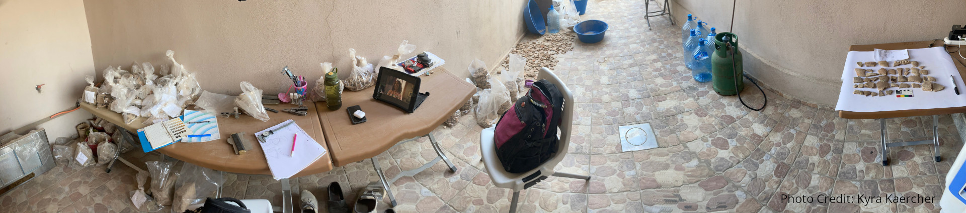
pottery yard photo by Kyra Kaercher

ASOR IN THE FIELD: 2023 FIELDWORK UPDATES

Virtual Archaeology Initiative: @ASOR_Research is now on TikTok

Thanks to the Membership & Outreach Committee, ASOR launched the Virtual Archaeology Initiative this summer. One of the purposes of this initiative is to allow people who cannot or would not be able to participate in actual excavations to feel as if they are still can. The goal is to create digital assets that illustrate or teach various steps involved in the archaeological process. Students who received 2023 fieldwork scholarships have volunteered to document their experiences in the field. These videos will be appearing over the next couple of month’s on ASOR’s newly created TikTok and also eventually on ASOR’s YouTube channel. If you are interested in contributing to the Virtual Archaeology Initiative and having your fieldwork videos on ASOR’s TikTok, please email Marta Ostovich.

Updates from ASOR-Affiliated Projects

Check out the latest updates from the field on the social media pages of these ASOR-affiliated projects and see what ASOR members and students have been up to this summer. If you’d like to include updates from your ASOR-affiliated project on this page, please email Marta Ostovich. Interested in affiliating your project with ASOR? Learn more here. 

Stay tuned in the upcoming months for updates in News@ASOR from students who participated on these projects. 

Shepard Urgent Action Grant Report: Cham Pashaya II

Overview

2023 SHEPARD URGENT ACTION GRANT: RESCUE OPERATIONS AT THE SITE OF CHAM PASHAYA II, DUHOK PROVINCE, KURDISTAN REGION OF IRAQ

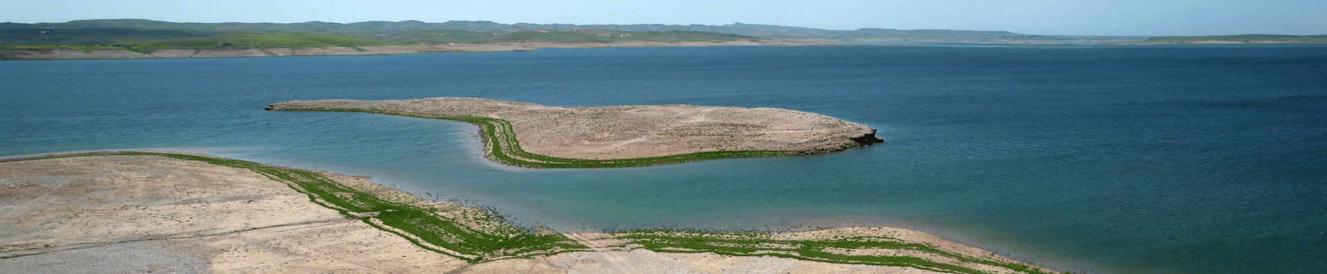
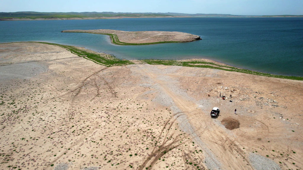
Along with natural catastrophes and destruction during conflict, artificial dam construction and the consequent water impact are primary causes of the loss of archaeological heritage. Once submerged, most flooded sites do not re-emerge. Others periodically resurface due to the reservoir’s exceptional or cyclical water fluctuation processes, and once again reveal the evidence of their past. One such site is Cham Pashaya II, located in the Kurdistan Region of Iraq on the shore of the Mosul Dam reservoir (Fig. 1).

Cham Pashaya
Fig. 1: View of Cham Pashaya with the Mosul Lake in the background.

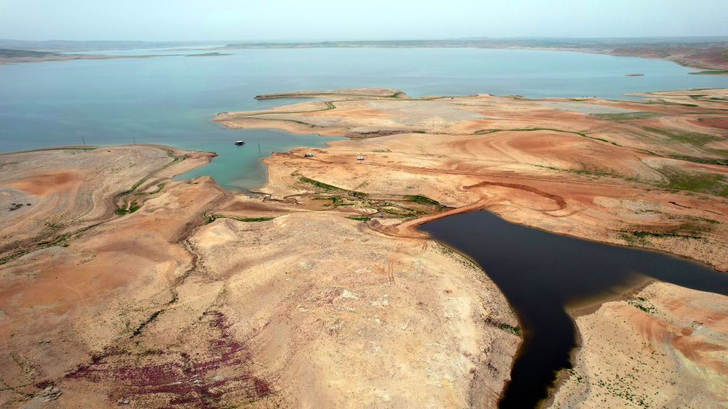
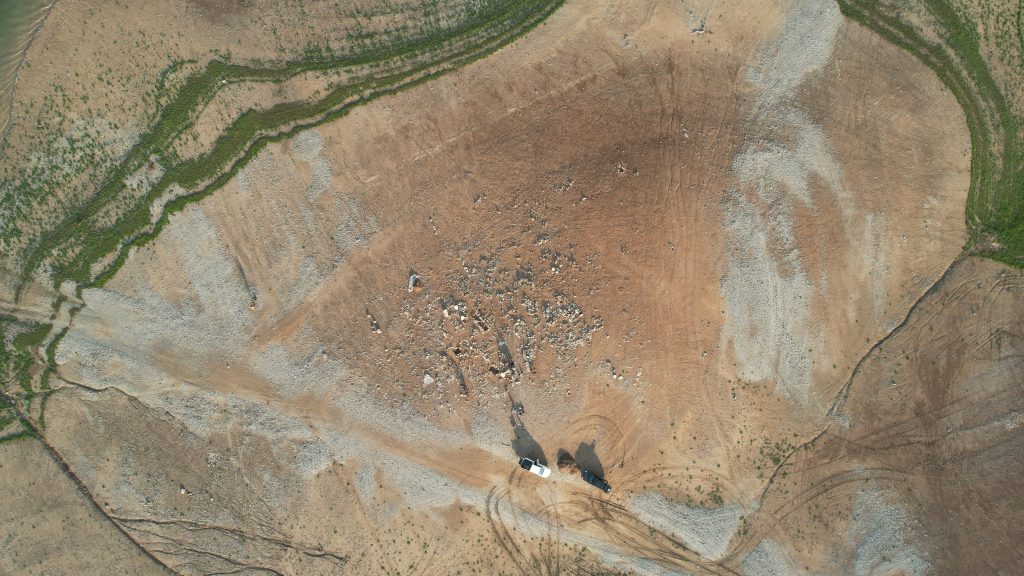
Cham Pashaya II is a large cemetery (ca. 2 ha) that extends across two adjacent hillocks (Fig. 2). The site contains over 50 visible cist graves that are threatened by destruction, looting, and vandalism when the water levels of the lake drop and the site is accessible. Since the closing of the dam in 1988, the site has remained mostly underwater, resurfacing only twice: once in 2018 and again in winter 2022.

Water level in the dam area is affected by a number of connected factors including normal dam management, increasing population pressure, the region’s aridification which is driven by global climate change, as well as political strife between countries for control of the dammed basins.

Fig. 2A: Aerial view of the site with visible graves.
View of Cham Pashaya with the Mosul Lake in the background.
Fig. 2B: View of the cemetery Cham Pashaya with the main tell already partially submerged in the background

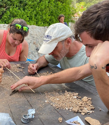
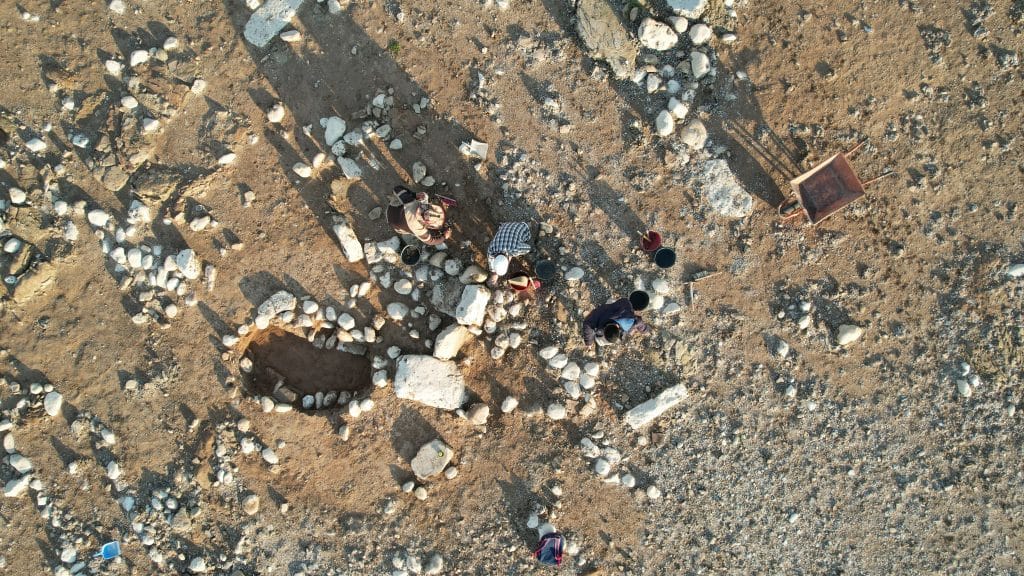
Thanks to a Shepard Urgent Action Grant, a three-week salvage mission was carried out at the site in April 2023 by a Kurdish-Italian team led by the University of Palermo in cooperation with the Duhok Directorate of Antiquities and Heritage (Fig. 3). This was a multi-disciplinary mission that included salvage excavations, archaeological survey, high-resolution documentation of the site’s state of preservation, and monitoring of damage and looting to the cultural resources.

People at work
Fig 3: The team at work.

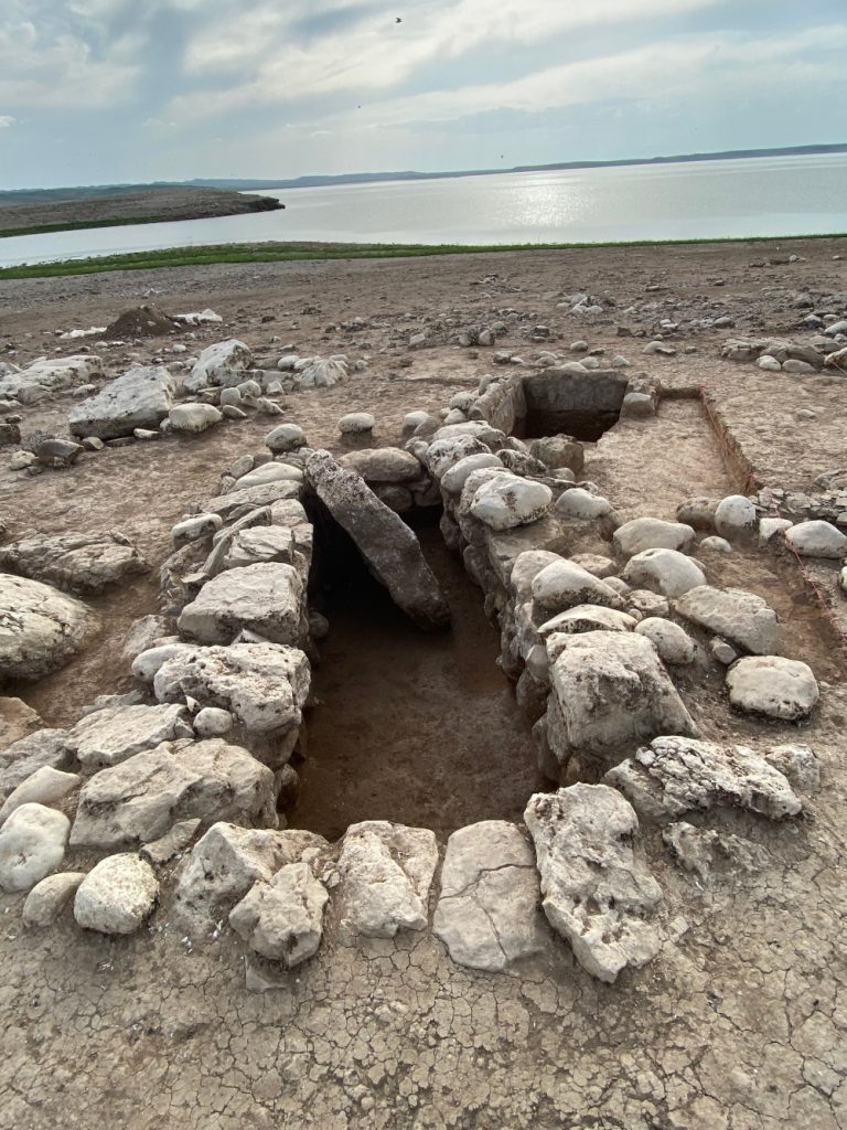
An area of 150 square meters was cleared and 25 graves were exposed to investigate the spatial relationships between them. These graves are primarily stone cists of different sizes ranging from over 3 m in length to only 40 cm in diameter. The majority of the graves are rectangular (Fig. 4), but there are also oval and round graves. The team determined that the Cham Pashaya II cemetery has graves from multiple phases based on their spatial relationships. The variety of sizes and forms also supports this interpretation.

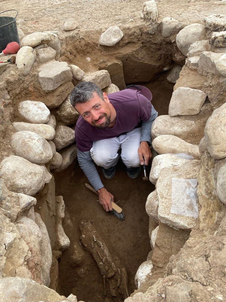
We decided to further investigate and fully excavate 5 graves, choosing a selection of the different typologies and sizes (Fig. 5).

Despite widespread ancient and modern looting and the very poor state of preservation of the bone material due to the water-logged environment, we found that it was still possible to reconstruct some of the funerary practices and to establish a chronological framework for the cemetery. Graves were meant to host one or more individuals. The larger ones were apparently used for longer periods, and had evidence to show that they were re-opened many times.

One of the largest graves.
Fig. 4: One of the largest graves.
Our anthropologist at work
Fig. 5: Our anthropologist at work.

Our current interpretation is that Cham Pashaya II was a burial ground for the community living at the adjacent multi-period mound of Cham Pashaya I during the first half of the third millennium BC. This was a critical time that saw the establishment of the first “urban model” in Upper Mesopotamia—a focal point of research on the archaeology of Southwest Asia in recent decades.

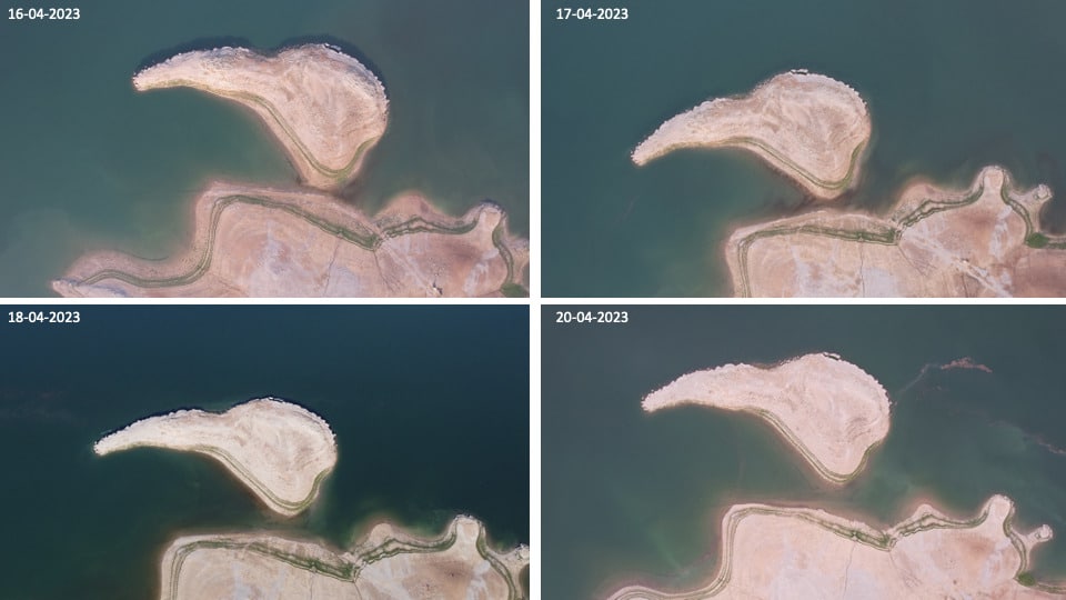
Cham Pashaya II disappeared again under the lake water a few days after the end of our fieldwork (Fig. 6). It is hard to predict if and when it will re-emerge.

Rising of the water level in the days before our departure.
Fig. 6: Rising of the water level in the days before our departure.
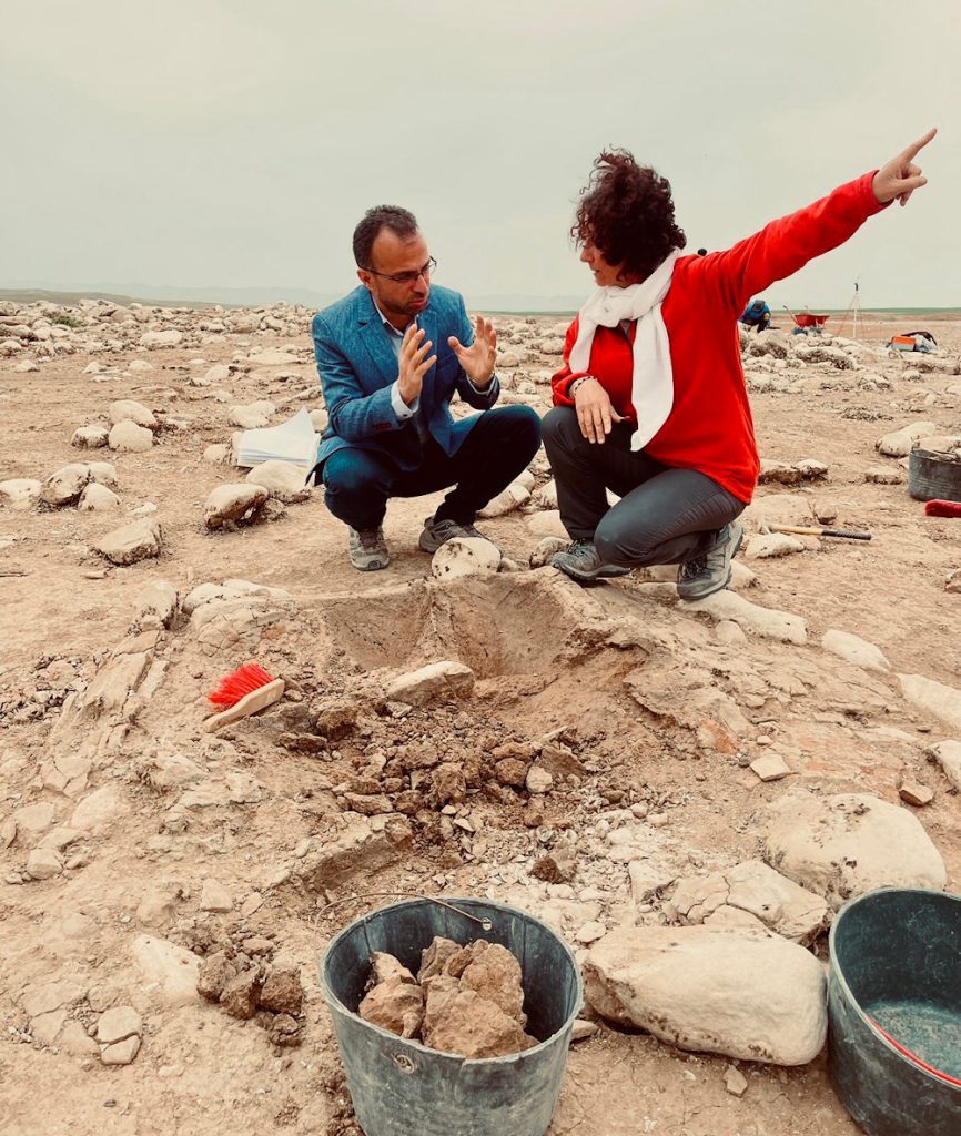
Dr. Sconzo consults with a one of the project's partners from the Duhok Directorate of Antiquities and Heritage.
Dr. Sconzo consults with the project's partner, Dr. Bekas Jamaluddin Hasan Al-Brifkany, from the Duhok Directorate of Antiquities and Heritage.


-Dr. Paola Sconzo, University of Palermo

The Cham Pashaya salvage excavation is part of a larger monitoring, survey, and rescue activities project called ReLand (Resurfacing Landscapes: Mosul Dam Archaeological Project).

Established in 2020 with annual contributions, the Shepard Urgent Action Grants program was created to support emergency and rapid response activities on archaeological sites in the greater Mediterranean region. Shepard Grants have provided $59,625 in support of projects with urgent need since the program began. While preference is given to projects and teams with current ASOR affiliation, applications will be considered from all projects. All 2023 grant funds have been awarded, and ASOR plans to resume accepting applications for Shepard Grants in 2024. Read more about the grant program here.

Fieldwork Report: Sarah Foster

My Expectations of Desert Fieldwork vs. the Reality

Sarah Foster, 2022 Platt Scholarship

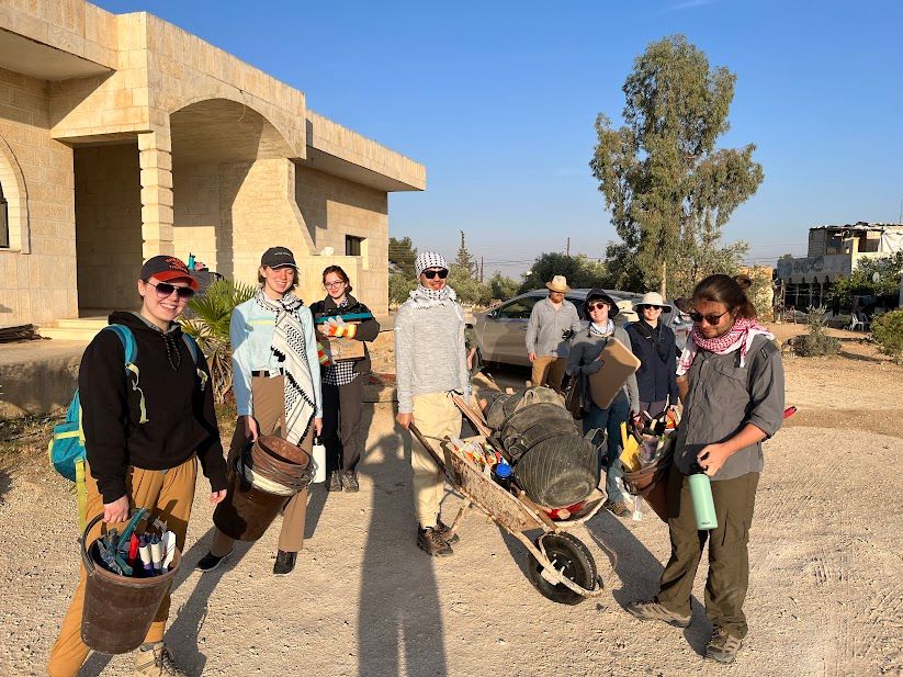
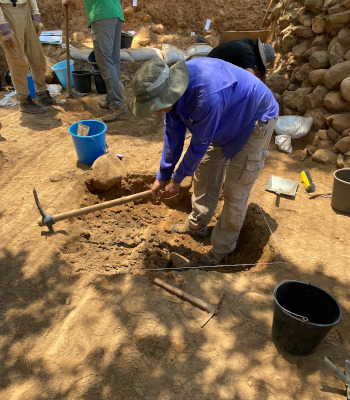
In May of 2022 I had the fortunate opportunity to be able to participate in fieldwork under the Umm al-Jimal Archaeological Project, taking part in excavations at their West Church. I shared this experience with fellow Calvin University undergraduate students, most of whom had little to no knowledge of the realities of archaeological fieldwork in a desert environment. Although I was passionate to finally do archaeology instead of reading about it. Yet, the classes I took in preparation led me to expect our work to look and be entirely different from what it actually was.

For instance, I was under the notion that the trench would be a perfect rectangle with no obstacles inhibiting my ability to trowel through the contexts and collect artifacts. We worked alongside the North end of the West Church, just outside the area of the apse in locations that were suspected to be rooms that were added later on in the church’s life. Before we had arrived, a local team had worked to clear these “rooms” of large rubble and stones that had been part of the infrastructure. Even when we started our fieldwork, we had to work around large stones that had been buried by sand over the ages since the building’s collapse. Our trench was therefore not a perfect square but instead a rubble-filled rectangle with areas that were never even excavated. From this I learned that while ideally, we’d like to dig up the entire area of the rooms to get a solid understanding of their layout and purpose, it just wasn’t physically possible. Instead, we strived to make the best of our trench by troweling in areas that were assumed to be most significant and drawing a top plan of the inaccessible parts to aide us in answering our research questions. 

Additionally, I had not expected fieldwork to take much of a toll on my body besides the typical soreness from physical labor. I discovered that while working in a desert environment, if you are not used to it, can worsen your allergies and the dust can cause irritation in your eyes, nose, and throat. As a result, many of us started taking allergy medicine, opted to use masks to ward off as much dust as possible, and drank a lot of tea to soothe our throats. Ideally, we would have been able to put in 100% effort of work each day, but due to our body’s response to the environment, there were those of us that had to sit out for a day to allow our bodies to recover. This taught me that when conducting fieldwork in the desert, I cannot expect my body to function as it normal does in the environment I live in. Therefore, before going anywhere, it is just as important to research the environment and its potential effects as it is to do background research on the history. 

Overall, conducting fieldwork at the West Church in Umm al-Jimal was a formative experience for me. I got to discover how archaeology is conducted in the field which I found was in practice a lot different than my expectations. This realization allowed me to comprehend that not only should archaeologists strive to achieve the ideals that are taught, but that they should in turn never expect them. Our rubble-filled trench in the deserts of northern Jordan provided difficulties, as do all other environments and sites when conducting fieldwork. The ideals that exist are expected in a perfect world that we will never find. Thus, it is important to have courage that you can overcome aspects of the obstacles of your environment but it is also important to take heart and embrace the differentness of your setting to reach the histories that lie within. 

Sarah Foster is a recent graduate of Calvin University, located in Grand Rapids, Michigan. She graduated magna cum laude, earning her B.A. degree in history alongside a minor in archaeology. 
Want to help more students and early career archaeologists get into the field? Donate to the cause today by selecting “Student Support” as your gift purpose!

Fieldwork Report: Anna Luurtsema

A Day in the Life on an Archaeological Survey Project

Anna Luurtsema, 2022 Shirlee Meyers-G. Ernest Wright Scholarship Recipient

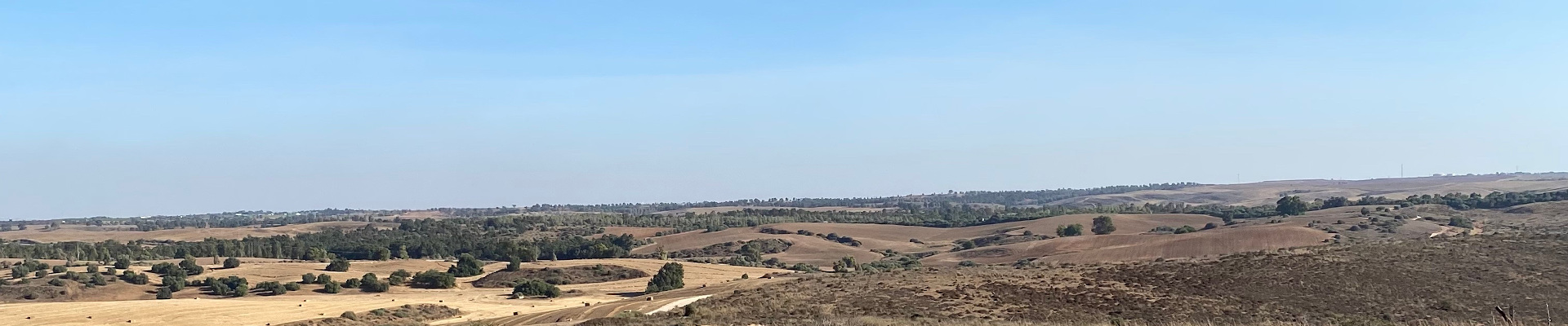
This summer, I was the recipient of the Shirlee Meyers-G. Ernest Wright Scholarship for Fieldwork Participation. This scholarship made it possible for me to participate in an archaeological survey project called “A Multi-Survey Exploration of Residences near Tell el-Hesi, Israel.” The project utilized GPR, magnetometry, and pedestrian survey to better understand where people were living in the Bronze Age town surrounding Tell el-Hesi; our results will help inform the locations of our excavations next season. I primarily helped with the pedestrian survey. In the area surrounding the tell, we created a grid of five-by-five meter squares in order to systematically measure the densities of potsherds, lithics, and other artifacts. We had five minutes in each square to pick up as many artifacts as we could. Our findings were then recorded and photographed before being placed back in the square. Over the course of three weeks, we surveyed 600 squares. 

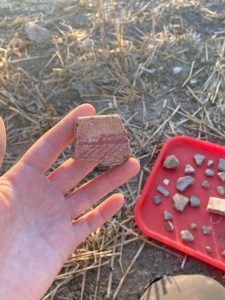
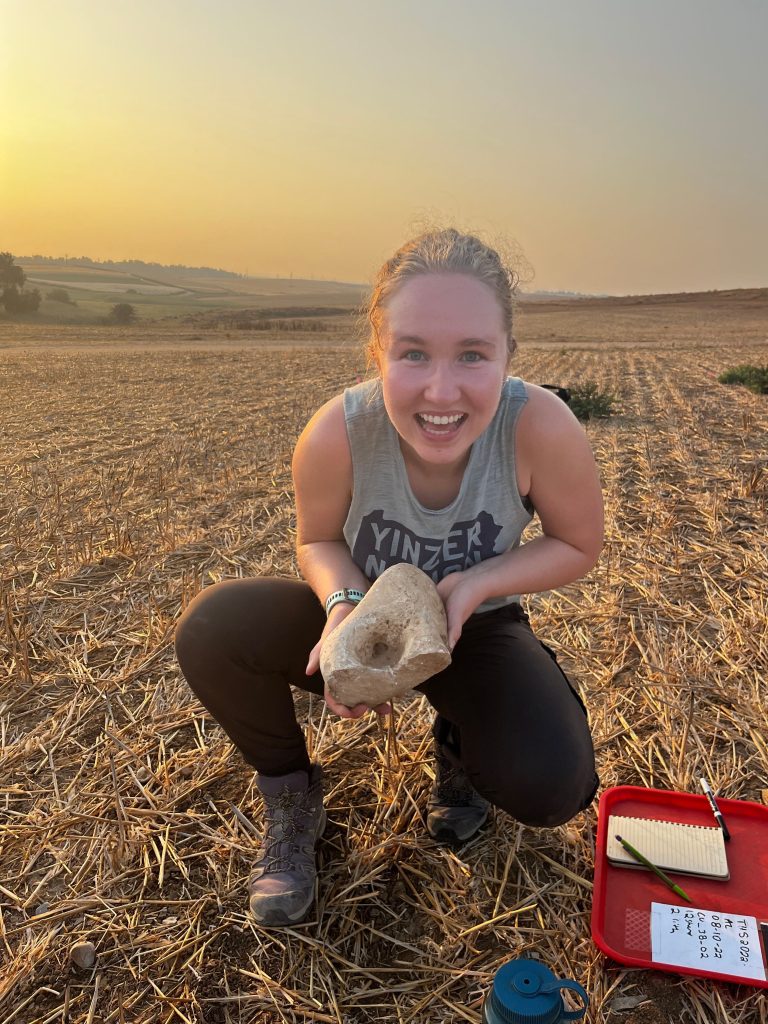
One of my coolest finds--a Bronze Age socket that held up the lintel in a door frame.

Upon arriving in Israel, we quickly fell into a routine. We stayed at a kibbutz, which is sort of like a gated community complete with a grocery store and a school. We woke up at 5:30 every morning as it was essential to get an early start to the day in order to beat the heat. For breakfast, I would usually have a pita and an apple with a mug of instant coffee. Then we piled into our trusty rental car we endearingly named Sandy—by the end of the project, the rear window was covered with dust. It was about a twenty minute drive from the kibbutz to the site on dirt roads; everyday, it seemed that we discovered new craters and bumps in the winding path. 

At the site, we started our survey. The three of us undergraduates took our positions in our own squares, which were marked by pink tape, while our supervisor timed us and documented our findings. For five minutes, we picked up potsherds, lithics, and other miscellaneous objects—glass, bone, coral. Sometimes I collected upwards of thirty sherds in a square, while other times I was lucky to find three. After each five-minute interval, in addition to showing our supervisor, we also recorded in our own notebooks the proportion of Bronze Age pottery and noted any other unusual finds, such as sickle blade fragments. 

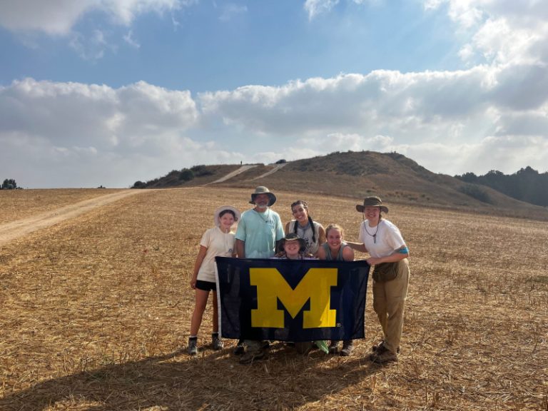
Our survey team, with Tell el-Hesi in the background.
A beautiful piece of Bronze Age pottery.

For the first hour or so, the tell blocked the sun from directly shining on us, so the air was almost cool. Gradually, it started to heat up, and eventually the black flies made their appearance. We kept surveying, swapping stories and playing music to distract ourselves from the heat and the perpetual buzzing of flies in our ears. It was sometimes difficult to stay motivated in the heat, but it helped me to look forward to the next milestone—200 squares, 300 squares, 400 squares—and to remember how much progress we had already made. 

Around 9 am, we took a break in the comfort of our air conditioned car to have a snack and reapply sunscreen. Then we continued for another three hours, or until we hit our quota of squares for the day. Our work day was finished by lunchtime, at which point the heat was almost unbearable. We always felt accomplished with our work as we drove back to the kibbutz. 

The landscape around Tell el-Hesi.

For lunch, we usually had pita bread and a variety of vegetables—cucumber, carrots, bell peppers—dipped in hummus. We made almost daily trips to the kibbutz grocery store for fruit; the peaches were the best I’ve ever had. In the afternoons, I helped organize boxes of artifacts from previous excavations at the site. Tell el-Hesi has been periodically excavated since the 19th century, though the boxes we were working with were from the 1970s and later. Some of the boxes were falling apart, so we moved the bags of artifacts to new ones; sometimes, the plastic bags were deteriorating as well. This task made me realize the importance of curation; it’s critical that we preserve artifacts for future generations. 

After boxing artifacts and hanging out around the kibbutz in the afternoon, one of our favorite spots to go for dinner was McDonald’s, funny enough. McDonald’s in Israel is very different from the US as it’s not really considered fast food. Our first time there, I ordered a hamburger and was shocked to discover that it was almost the size of my face. I really enjoyed our time outside the kibbutz, both at night and on the weekends, when we took trips to places like Masada, the Dead Sea, and Jerusalem. I loved experiencing the culture of Israel as I learned firsthand about its archaeology.

I look forward to continuing this project next summer, when we begin excavations. I’m sure it will be very exciting and rewarding to participate in an archaeological field project from the initial survey phase all the way through the excavation. Of course, I wouldn’t have been able to participate in this project without the help of the Shirlee Meyers-G. Ernest Wright Scholarship, and I am sincerely grateful for this experience.

Anna Luurtsema is a senior at the University of Michigan studying anthropological archaeology with a minor in Middle East Studies. Her research interests include zooarchaeology, human mobility, and the origin of agriculture, and she plans to apply to graduate school this fall.

Want to help more students and early career archaeologists get into the field? Donate to the cause today by selecting “Student Support” as your gift purpose!

Fieldwork Report: Krysten Cruz

Studying the Ancient Inhabitants of the Ayioi Omoloyites Tombs

Krysten Cruz, 2022 Shirlee Meyers-G. Ernest Wright Fellowship Recipient

Scattered throughout the island of Cyprus are tombs both excavated and yet to be discovered.

In 2006, three rock-cut tombs were excavated by the Department of Antiquities in a salvage effort in the Ayioi Omoloyites neighborhood in Nicosia, Cyprus. Tombs 47 and 48 are smaller and date to the Hellenistic period, while Tomb 49 is much larger and dates to the Early Christian period and was likely used as an ossuary. This summer I worked with the Ayioi Omoloyites Bioarchaeological Project to analyze some of the skeletal material removed as part of that salvage effort. With our analyses, we are hoping to understand some aspects of the lives of these people.

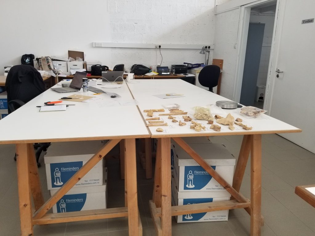
While in Nicosia for this research I stayed at the Cyprus American Archaeological Research Institute. Each day we would leave to work at a lab space provided by the Department of Antiquities where over 60 boxes of skeletal material for this project were stored.

Lab space provided by the Department of Antiquities


Analysis of skeletal material

I helped continue our search for answers by working through more of the commingled skeletal material from Tomb 49. Commingling occurs when the skeletons of two or more individuals are mixed, and currently in Tomb 49 there are over 250 individuals present. Due to the fact that there were no articulated individuals and all of this material is commingled and fragmentary, I would start an analysis by laying out the skeletal elements that were part of a specific context sorting them by the type of bone, what side of the body that element was from, and then which part of the bone it is. I would then conduct an inventory and basic analysis of this material by documenting various standard osteological observations, which also included taking measurements when possible as well as describing any trauma and diseases that may have manifested on the bones. Often there are indicators of stress or disease that can help us understand the health or habitual activities of these individuals when they were alive. We commonly see arthritis in the joints as well as pathologies of the vertebrae which can indicate that someone was likely participating in manual labor.

Although I participated in these general analyses, my main goal of the summer was to conduct research of my own by observing specific areas of the humerus (arm) and femur (thigh). I was looking for skeletal lesions that look like porous areas or spongy bone. There is substantial discussion in the literature about where these lesions are specifically located and what they are supposed to look like in order to be considered evidence of disease or just an indicator of a particular lifestyle, so I tried to take notes and detailed photos. I am attempting to assess whether these lesions are related to a common disease found on the island, or whether they are actually a sign that these individuals were participating in specific activities. This research would help us understand more about the populations during these two different time periods.

Even though we spent a lot of time in the lab working, we still had the opportunity to travel around the island and visit other archaeological sites and museums. It was great to see occupations across different periods in time, and I was particularly excited to go to the Archaeological Museum of the Larnaka District as it has been closed in previous years and contained material from some of the sites we had previously seen.

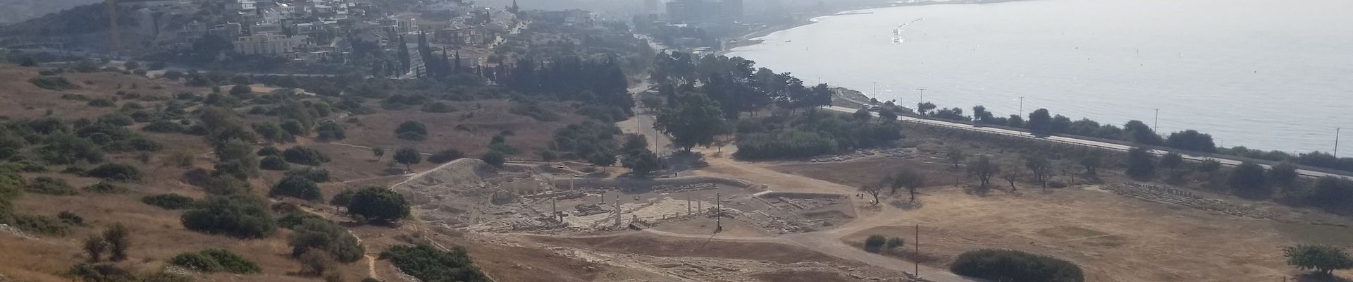
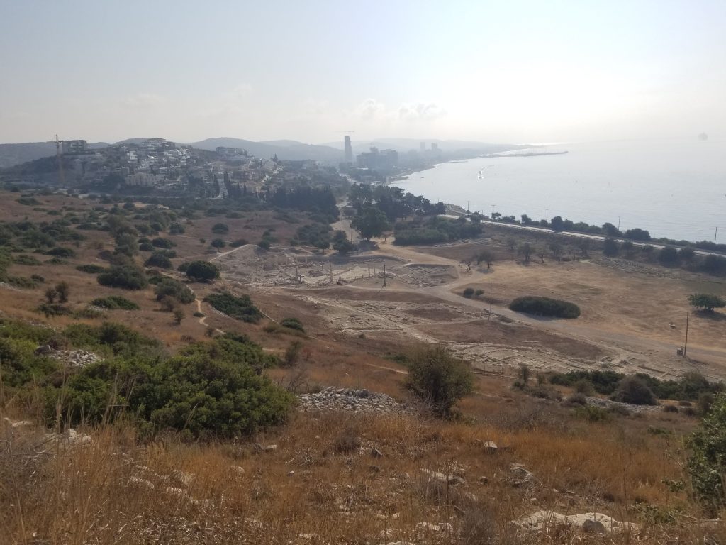
View of the coast from the archaeological site of Amathous

I am very grateful to ASOR and the scholarship’s donors who made these opportunities for research and learning possible. I would also like to thank Dr. Despina Pilides, Archaeologist Yiannis Violaris, and Dr. Nicholas Herrmann for allowing me the opportunity to participate in the Ayioi Omoloyites Bioarchaeological Project, as well as CAARI and the Department of Antiquities for hosting us and our studies.

Krysten Cruz is a PhD student in the Applied Anthropology doctoral program at Texas State University in San Marcos, Texas. Her research interests include forensic anthropology and eastern Mediterranean bioarchaeology.
Want to help more students and early career archaeologists get into the field? Donate to the cause today by selecting “Student Support” as your gift purpose!

2023 Grant & Fellowship Awardees

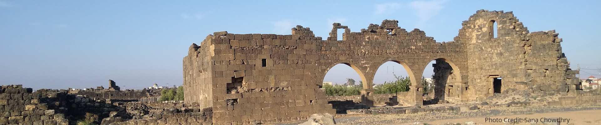
A shot of the Western Church where the 2022 UJAP excavation took place

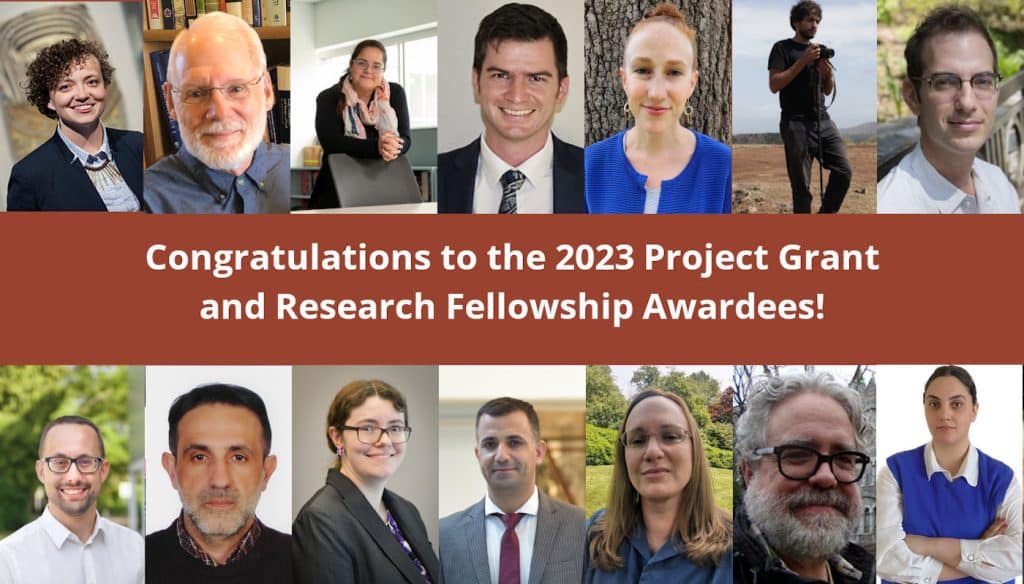
2023 PROJECT GRANT AND RESEARCH FELLOWSHIP AWARDEES

Grants and Fellowships Update

Grants for Archaeological Projects

Stevan B. Dana Project Grants
  • Anne Austin, University of Missouri—St. Louis: Bioarchaeology of Deir el-Medina Research Project (Egypt)
  • Hamza Benattia, University of Barcelona: Unveiling the Farming-Herding Communities of III-I Millennium B.C. Mediterranean Western Maghreb (Morocco)
Stevan B. Dana Project Grant for Israel
  • A. Asa Eger, University of North Carolina at Greensboro: The Caesarea Coastal Archaeological Project (Israel)
Lawrence T. Geraty Community Archaeology Grant
  • Douglas Clark, La Sierra University: Madaba Regional Archaeological Museum Project (Jordan)
Charles Harris Project Grants
  • Andrew Danielson, University of British Columbia: Khirbat al-Mukhayyat Archaeological Project (Jordan)
  • Müge Durusu-Tanriover, Temple University: Polatlı Landscape Archaeology and Survey Project (Turkey)
Joe D. Seger Project Grant
  • Mara Horowitz, Purchase College-SUNY: Kalavasos-Laroumena and Arkhangelos Archaeological Research Project (Cyprus)
Shepard Urgent Action Grants
  • Murat Akar, Hatay Mustafa Kemal University: Post-earthquake Action at Tell Atchana/Alalakh (Hatay, Turkey)
  • Mariam Eloshvili, Ilia State University: Emergency Excavation for Data Collection from the Late Neolithic Settlement at Khramis Didi Gora (Georgia)
  • Paola Sconzo, University of Palermo: Rescue Operations at the Site of Cham Pashaya, II (Kurdistan region of Iraq)

Research Fellowships

Dar Ben Gacem Tunisian Research Fellowship
  • Brien Garnand, Netherlands Instituut voor het Nabije Oosten: ASOR Punic Project—3D Modelling of Stelae and Cippi from Carthage (Tunisia)
Study of Collections Fellowships
  • Helen Dixon, East Carolina University: Study of Punic inscribed stelae with maritime iconography in the collection of the Carthage National Museum (Tunisia)
  • Jon Paul Heyne, University of Dallas: Social Mobility of Religious Minorities in the Medieval Mediterranean: The Case of the Franciscans of the Holy Land Custody (Israel)
William G. Dever Fellowship
  • Kathryn Medill, University of Washington: Lautenschläger Azekah Expedition (Israel)
Mesopotamian Fellowship
  • Jaafar Jotheri, University of Al-Qadisiyah: An Archaeological Survey for the Western Iraqi desert (Iraq)
  • Agnese Vacca, University of Milan: Crafting Complexity. Pottery Production and Consumption at Helawa (Erbil Plain) between the Ubaid and Late Chalcolithic Periods (Iraq)

Mesopotamian Fellowship Report: Khaled Abu Jayyab

2022/2023 Mesopotamian Fellowship Report: Preliminary Report on the Tepe Gawra Lower Town Survey

Khaled Abu Jayyab, University of Toronto

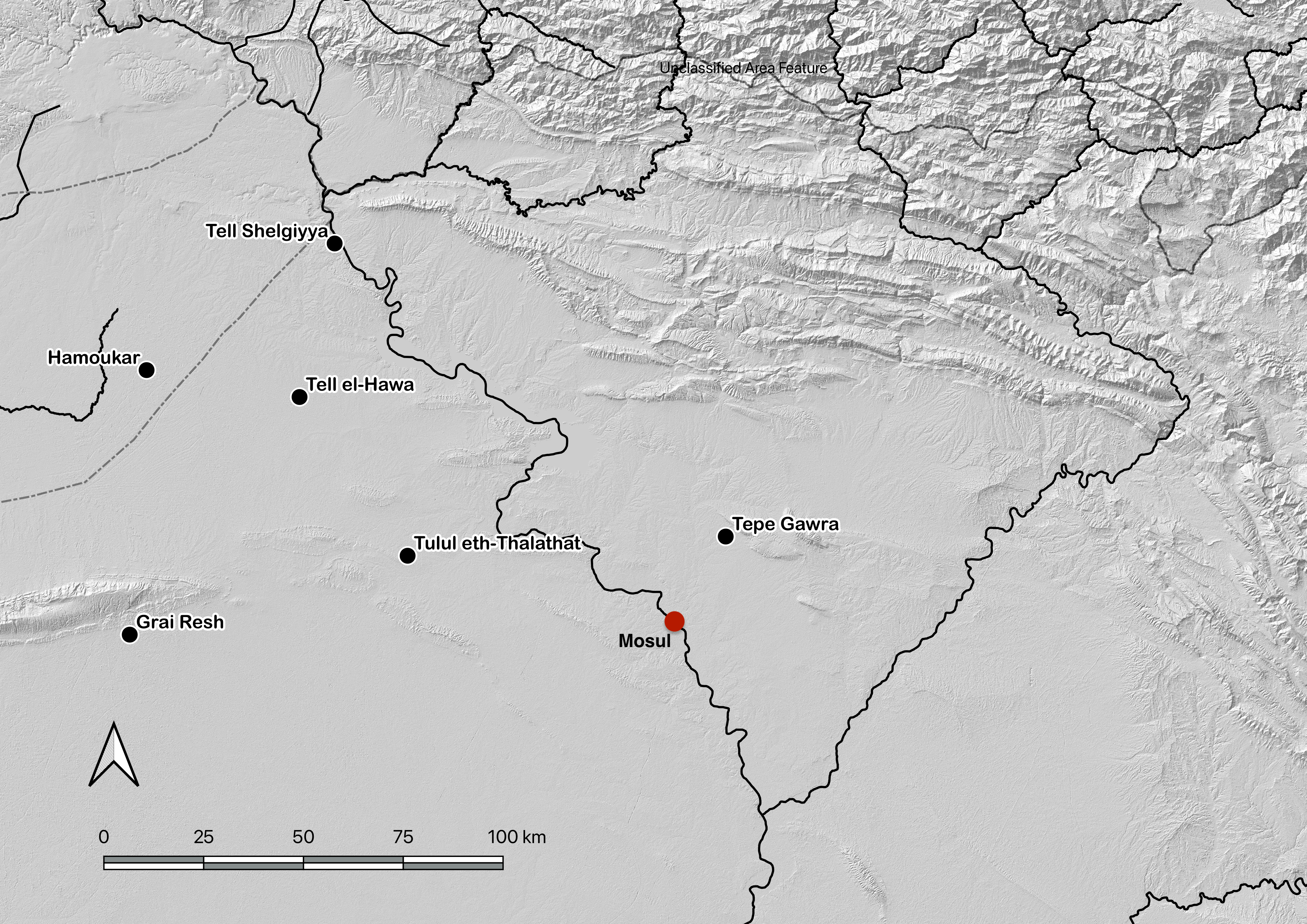
Based on the kind letter of support by the General Directorate of the State Board of Antiquities and Heritage (SBAH), Baghdad, we began the systematic survey of the lower town of Tepe Gawra (344197.14 m E, 4040351.85 m N) in the Ninawa Governate (fig.1) on the 9th of October 2022. Fieldwork at the site was concluded on the 20th of October 2022, with analysis of the recovered materials carried out in the expedition house in the Muthana neighborhood in Mosul. The work at Tepe Gawra was conducted by a Canadian research team from the University of Toronto in partnership with the SBAH office in Mosul.

Figure 1: Location of Tepe Gawra

Location of Tepe Gawra
The site of Tepe Gawra is located in the in the Ninawa Plain in the piedmont of the Zagros Mountains. The site is roughly a kilometer and a half to the south of the town of Fadiliyah, and about the same distance from the ancient Assyrian city of Dur Šarukin (Khorsabad) to its east. Tepe Gawra is located in a well-watered plain with several spring fed streams running through the site or near it. This condition encouraged settlement across time resulting in a long sequence of occupation at the site. Today most of the springs that were near Fadiliyah are dry as a result of tapping into the water table with deep wells and pumps.

History of Work at the site and its Significance
Tepe Gawra has long been seen as an essential site for late prehistoric and early historic periods, not only in Iraq but for the region in its entirety. Despite the significance of Tepe Gawra, there hasn’t been work carried out at the site since the 1930’s. The work conducted at the site by Speiser (1935) and Tobler (1950) has revealed a long occupational sequence dating from the Halaf period to the mid second millennium BC. The sequence has very few short-lived gaps in occupation and as such has become a chronological anchor for the region, especially for late prehistory (Halaf, Ubaid, and Uruk/LC). Analytical work carried out by Abu al-Soof (1974), and more recently, Rothman (2002), has expanded our understanding of the Northern Uruk period and has been key to developing the modern Late Chalcolithic (LC1-LC5) chronological scheme (Rothman ed. 2001; Schwartz 2001).

Despite its small size (roughly 2-3 ha. at its base extent), Tepe Gawra has been the hallmark site for the development of complexity during the Ubaid and Late Chalcolithic periods in the ancient Near East. Excavations at the site revealed a local development of a sophisticated infrastructure manifest in construction of temples, monumental architecture, and elaborate administrative practices. The site throughout its occupation shows an involvement in far flung networks connecting it with Highland Anatolia and the Zagros mountains, with connections as far afield as Afghanistan. These connections were seen in the high concentration of objects made of exotic materials such as obsidian, lapis lazuli, carnelian, copper, gold, and silver (Rothman 2002: 8), in addition to the presence of imported utilitarian and luxury ceramics (Abu Jayyab 2019; Rothman and Blackman 2003). The households at Tepe Gawra were also shown to be involved in multiple craft activities such as woodwork, textile production, elaborate administration, stone tool manufacture, and the production of high-end ceramic wares (see Rothman 2002; Rothman and Blackman 2003).

All together the main mound of the site has furnished evidence of highly specialized activities (administration, exchange, and craft production) with very little evidence of agricultural implements and farming practices. This phenomenon is unique as this degree of specialization was only attested at larger contemporary sites that combined specialized activities with extensive farming practices (e.g. Tell Brak reaches over 100 ha during this period). This situation necessitated that the inhabitants of Tepe Gawra relied on an external source for food. Rothman suggested that a functional segregation between sites existed in the piedmont or the foothills during this time (Rothman 2002: 5). He saw that the site of Tepe Gawra was a ‘center’ at the top of a specialized hierarchical network. Within this network Gawra served as an administrative, religious, and craft hub (Rothman 2002: 5-6). In support of the notion of a center, Frangipane argues that the landscape played a role in limiting urbanism in the piedmont around Tepe Gawra where the terrain may have restricted the expansion of agriculture beyond its natural limit restricting the region from producing enough agricultural surpluses to support a large conglomeration (Frangipane 2009: 135).

Research Aims
There is no doubt as to the significance of Tepe Gawra within the region but was the site truly interdependent as part of a large regional network for subsistence? That is, was the site serving a special function that excluded it from food production? There remains a debate as to whether or not there was a lower Chalcolithic period town around Tepe Gawra. Algaze notes (1993: 71-72) – based on personal communication with Gibson – that the mound was surrounded by a lower town. If this was true then the high mound would have been the acropolis of a larger town that still remains systematically unexplored. Rothman did not reject the idea of the presence of a lower town, however he remained skeptical with the absence of empirical data (Rothman 2002: 19).


The absence of a lower town in the narrative histories of Tepe Gawra coupled with the complexity exhibited at the site has prompted scholars to challenge unilinear models of complexity focused on urbanism. Indeed, the presence or absence of a lower town is central to the notion that Gawra was a regional center dependent on its intra and interregional networks rather than the mobilization of an internal workforce.


Figure 2: Olive orchard around the mound of Tepe Gawra (in the background).

With the kind permission of the SBAH office in Mosul, we had the chance to visit the site on October 1st 2021. The question heading to the site was whether or not the site had a lower town. we were extremely excited to discover a dense scatter of sherds at the lower town, and from what could be observed, many seemed to date to the Late Chalcolithic period. This realization prompted us to apply for the permit to conduct surface survey around the main mound of Tepe Gawra.

The aim of this work at Tepe Gawra was, first, to document and record the full expanse of the settlement beyond the mounded tell area, and to develop a detailed understanding of the occupation history of the lower town. Second, with the expanse of olive orchards around the main mound (fig.2), field investigation of the lower town is an essential undertaking at such an important heritage site in Iraq.

Method
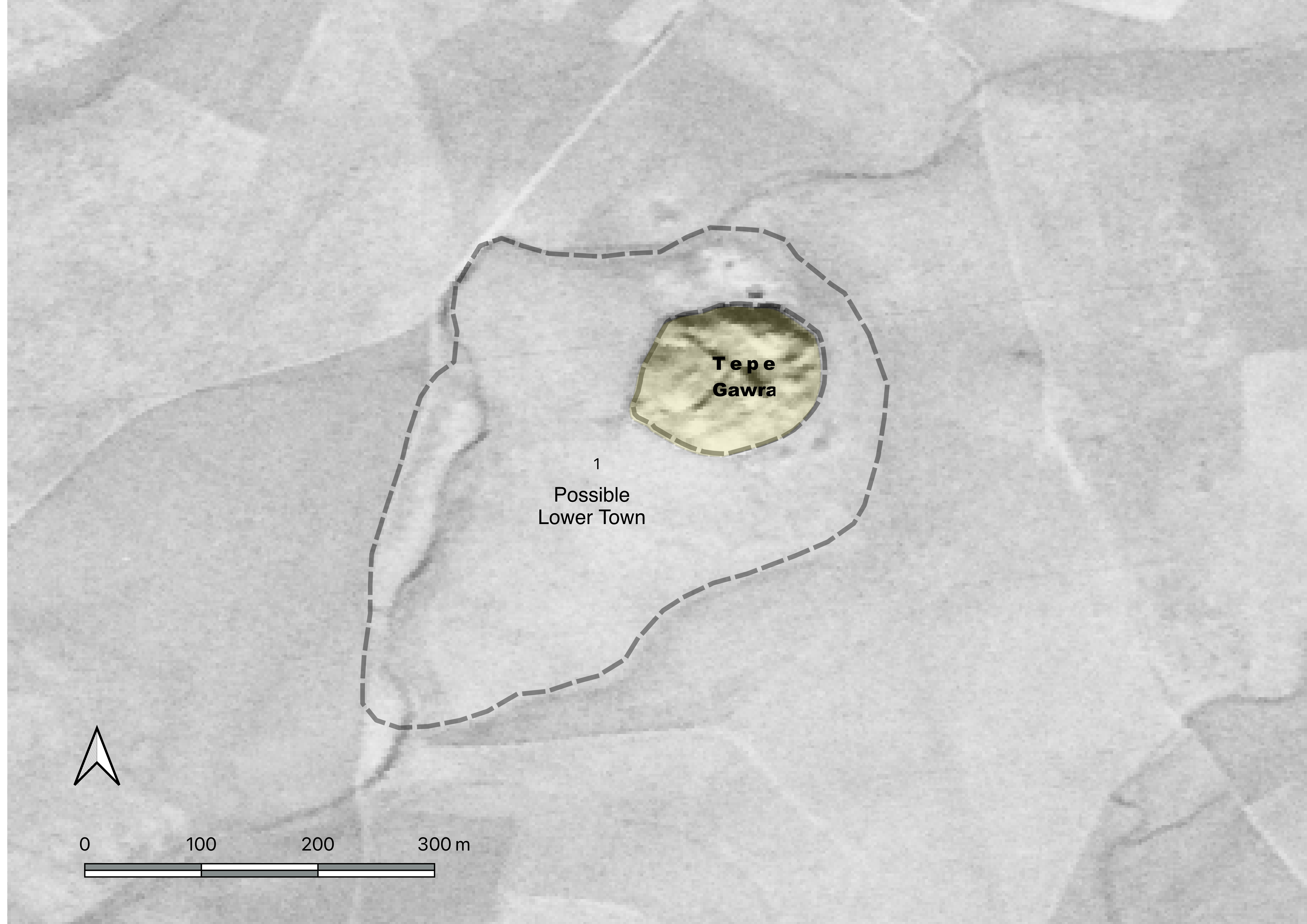
Our approach consisted of combining remote sensing data with field walking to obtain a clearer picture on the cultural and physical surroundings of the site and to document its current state of preservation. Prior to our work in the field, we explored the landscape around the site using satellite imagery (Corona, Keyhole, and Landsat) for two main goals. First, examining corona satellite imagery, has the potential to reveal the presence of anthropogenic soils and, in turn, the extent of human occupation around the site (fig.3). Second, exploring the changes that took place at the site between the late 1960’s and present day.

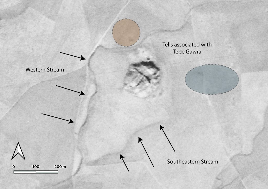
From the legacy satellite imagery, we were able to define a number of features that were otherwise invisible both on the ground and in more recent satellite imagery. From corona imagery, we were able to identify two smaller tells adjacent to the main mound of Tepe Gawra; A first northern tell (fig.4) that was separated from the main mound by a stream. This tell was already indicated in one of Speiser’s early topographic maps of the area (Speiser 1927: fig.2). A second feature was an eastern mound faintly visible only in the corona imagery. There was also a trace of a stream running east of the mound. This stream separated the main mound of Tepe Gawra from the above-mentioned eastern mound (fig.4). Corona and keyhole imagery allowed us to identify, based on soil color and relief, what we believed was the extent of the lower town, and which in turn guided our selection of survey zones (fig.3).

Figure 3: Possible extent of lower town at Tepe Gawra based on soil discoloration (Corona satellite imagery, December 1969).
Figure 4: Traces of Streams and Sites Around Tepe Gawra, Note the Southeastern Stream is no longer visible


Figure 5: DEM of Tepe Gawra

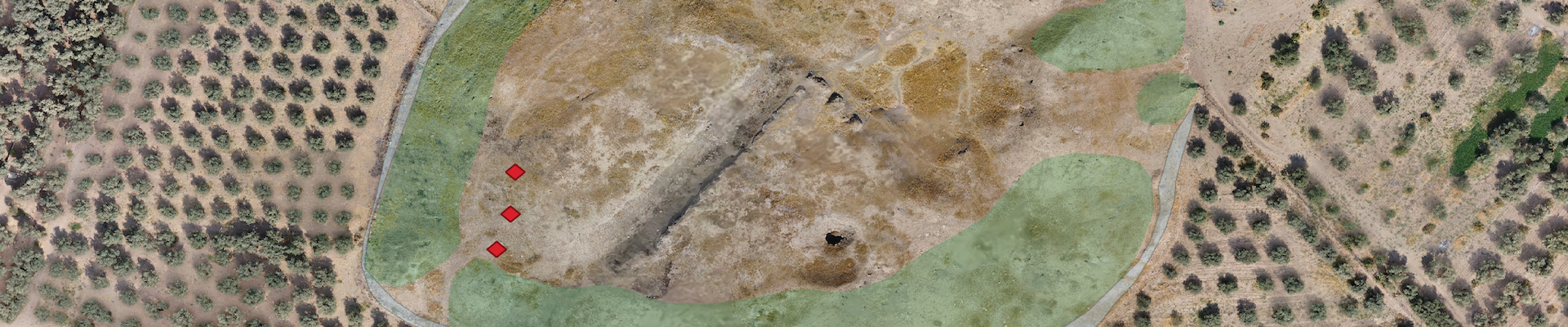
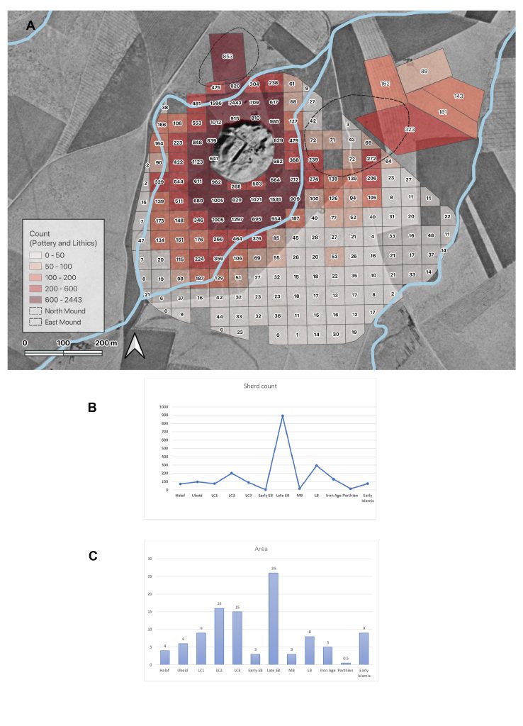
In the field, we conducted a UAV (drone) survey of the site in order to obtain a high-resolution digital elevation model (DEM) and render a 3D model of the Tell and its surroundings (fig.5). This was an important initial step that aims to create an accurate plan of the site and to document its present condition, and assess any possible future threats to it. Our second step was to lay out a collection grid around the site as a precursor to our systematic surface collection of the lower town. The grid contained collection units spaced at regular intervals (50 m) immediately around the tell (fig.6).

All diagnostic artifacts within the units were collected and taken to the expedition house for processing. Processing consists of washing the artifacts, recording and drawing them, with the aim of carrying out a typo-technological study. The typo-technological analysis entails studying the finds (e.g. ceramic sherds, stone tools) with the aim of identifying the relative age of the artifacts and the technological steps taken to produce them (another avenue that may possibly help us determine periodization). We also analyzed the obsidian stone tools with a portable x-ray florescence analyzer (PXRF). The PXRF will allow us to determine the source/s of obsidian artifacts found at the site and begin to explore new network connections that the site was involved in. The information gathered through the material studies will later be connected to the spatial data through a GIS. Through a period-by-period artifact count from each unit we were able to see the extent of occupation in the area surrounding the tell and detect changes in this occupation from one period to the next.

Figure 6: A) Grid and collection units at the in the lower town of Tepe Gawra with full artifact counts. B) Sherd count for each period, C) Estimated area occupied during each period.

Preliminary Results

1-Damage Assessment


Figure 7: Arial photo showing damages to Tepe Gawra.

Both the main mound and the lower town at Tepe Gawra have been subject to anthropogenic disturbances. Chronologically, the initial impact on the settlement resulted from the excavations carried out in the 1930’s (Speiser 1935). The site is believed to be at least 7m higher than its current elevation with several levels completely removed (Levels I-IX). After Level X the site was divided into two parts with excavations focusing exclusively on the northeastern portion of the tell. As such, piles of dirt from the excavations were dumped along the slopes of the mound causing an artificial swelling along the edges and slopes of the mound. We were able to document these dumping piles along the different slopes of the mound (fig.7).


Figure 8: The Dirt Embankment Around the Base of the Mound.

The main mound of Tepe Gawra in addition to the lower town were also impacted by farming activities. Farming activities consisted primarily of the planting of olive orchards around the site (fig.2). According to local farmers the orchard was planted roughly 30 years ago, this coincides with the destabilization of the country and the weakening of the central authorities during the first Gulf War. The olive groves and the infrastructural developments related to them have certainly damaged the lower town extensively. First, clear bulldozing took place at the foot of the main mound in order to level that area and prepare it for agriculture. The majority of the dirt was pushed towards the mound forming a low embankment along the majority of the mound’s circumference (fig.8). Second, the act of planting the trees, and plowing the land, in addition to the irrigation systems associated with them (including lines of watering tubes buried in the ground and running between the trees) churned up large swaths of the lower town at Tepe Gawra. Finally, the construction of a number of farm houses, rest areas, and water collection basins with the orchard impacted the lower town significantly (empty squares in figure 6 were not surveyed primarily due to the presence of such features). All these factors make excavations of the lower town near impossible making this survey all the more important. A further complication to studying the lower town and its surrounding is the construction of a road between Khorsabad and Bashiqa that ran through the eastern mound, leading to its complete removal.

The most recent damage to the site was caused through its use by members of ISIS. The militant group dug an intricate network of tunnels within the mound (fig.9). These tunnels may impact the integrity of the mound and cause collapses in the near future. Besides the structural issues these tunnels caused, due to their size, the impact on the archaeological remains is equally devastating if not more.


Figure 9: ISIS Tunnel Along the Southwestern Slope of the Mound

2-Lower Town Remains
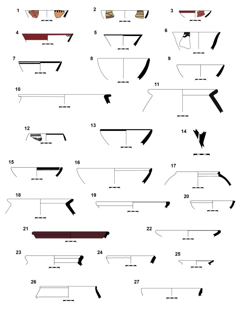
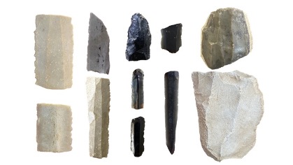
In total, we surveyed 187 50x50m units, in addition to 5 large external units (see fig.6). within these units we counted 43895 sherds (fig.10), and a total of 904 chipped stone artifacts (fig.11). Almost 40% of the materials were made from clear obsidian with a greenish hue, while 55% were made from flint. Of note, we documented a total of 6 Canaanean looking blades on our survey. Their distribution seems to be confined to the northeast area of the survey region, including Zone 3 East and the squares (M5, M6, and M7) adjacent to it. This is of note since Canaanean blades made from lever pressure are characteristic of Late Chalcolithic lithic assemblages and ours were all found in conjunction with Late Chalcolithic pottery.

Figure 10: examples of ceramics collected from Tepe Gawra Lower Town Survey.
Figure 11: collection of stone tools from the Tepe Gawra Lower Town Survey.

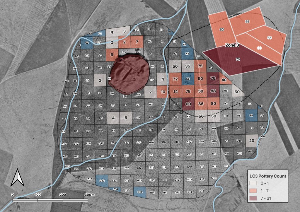
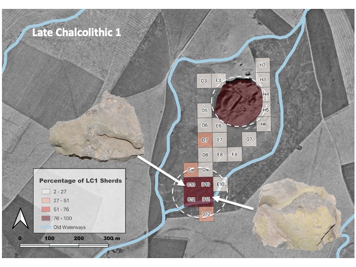
In terms of occupational history, the team was able to document the stages of development at the site where a clear expansion from the main mound clearly began during the Late Chalcolithic 1 period (4600-4200 BC) and continued through to the Late Chalcolithic 3 period (3900-3600 BC) to at which point the site was abandoned until the Ninevite 5 period (3100-2800 BC). During the late Chalcolithic the site expands from roughly 4 ha. (Ubaid Middle Chalcolithic period, 5300-4600 BC) to 9 ha. during the LC1, and later, to 15 ha. during the LC2 and 3 (fig.12). Further, the team was able to isolate a number of distinct activity areas (e.g. pottery making) dating to these periods (fig.13). All this implied that rather than being an isolated small center exclusively reliant on far-flung inter and intraregional networks, Tepe Gawra was going through similar processes of urban expansion, social differentiation, and economic specialization that were occurring at other sites in the region, albeit within its own local trajectory.

Figure 12: LC3 settlement located east of the main mound of Tepe Gawra. Note that the number in the collection unit is the percentage of late EB sherds relative to other sherds collected in the unit.
Figure 13: Extent of Late Chalcolithic 1 (LC1) settlement at Tepe Gawra. Initially the LC 1 occupation was believed to be restricted to the main mound, top dashed circle (3 ha. in extent), however, after survey we now see that the occupation was 3 times the size initially believed (9 ha.). The lower dashed circle points to an LC1 ceramic working area. This was discerned based on the heavy presence of wasters (objects in the image) and pottery slag, which are by-products of ceramic manufacture.

Occupation at the site reached its zenith during the latter part of the 3rd millennium or the Late Early Bronze Age (Akkadian/post Akkadian periods). During this period, we see the largest extent of the site reaching approximately 23 ha., or possibly 36 if we take into consideration units with a low density of sherds (fig.14). The site declines during the Middle Bronze Age, and eventually shifts slightly to the north during the Late Bronze Age and the Iron Age, where the mound of Tepe Gawra itself becomes too narrow at the summit to sustain a village. The Final occupation in the environs of the site occurs during the late Sassanian/Early Islamic period where settlement shifts to the southern edges of the survey zone.


Figure 14: Extent of the late third millennium settlement. Note that the number in the collection unit is the percentage of late EB sherds relative to other sherds collected in the unit.

3-Outreach

Figure 15: Workshop carried out at Qadisiya University by members of the Tepe Gawra Survey Project (From left): Khaled Abu Jayyab, Arno Glasser, Abbas al-Hussainy, and Ira Schwartz.

Another important aspect of the project was to foster close cooperation with local institutes and members of the community. This approach is taken as part of the steps in reforming and decolonizing excavation and survey in Iraq as outlined by Jotheri (2022). Accordingly, the project emphasized the training of members of the SBAH involved. Moreover, following the season members of the project held a workshop at Qadisiya University in Diwaniya, organized by Prof. Abbas al-Hussainy, pertaining to the work at Tepe Gawra, and analytical work on ceramics, lithics, and survey methodology. The workshop was open to faculty, students, and members of the public alike (fig.15).

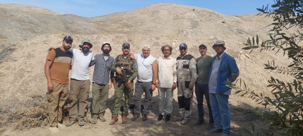
The season’s work at Tepe Gawra was a resounding success despite the tight schedule. This would not have been possible without the financial support provided by the ASOR Mesopotamia Fellowship, and the CRANE project (University of Toronto), In addition to the guidance, motivation, and logistical support provided by Prof. Timothy Harrison (NMC) and Prof. Abbas Al-Hussainy (Qadisiya University). Finally, the work would not have been possible without the monumental efforts of the Tepe Gawra survey team (fig.16), Dr. Stephen Batiuk (NMC, University of Toronto), Dr. Abbas al-Hussainy (Ira Schwartz, Arno Glasser (both U of T, Anthropology, University of Toronto), Hossam Hadi, Abdul Ghani Jbori, and Ahmad Najar (SBAH), whom all put in extra shifts to ensure the data was processed on time and in a scientific manner. The success of this work would not have been possible without them.

Figure 16: Members of the Tepe Gawra Survey team (from left to right): Hossam Hadi, Khaled Abu Jayyab, Ira Schwartz, Hikmet al-Jbouri, Stephen Batiuk, Abbas al-Hussainy, Ahmad Najar, Arno Glasser, and Abdul Ghani Jbori

Bibliography

Abu al-Soof, B. (1974). “Prehistoric Pottery from Nineveh, Gawra, and the Neighboring Sites.” Sumer 30: 1-10.

Abu Jayyab, K. (2012). “A Ceramic Chronology from Hamoukar’s Southern Extension.” In Catherine Marro (ed.) “After the Ubaid: Interpreting Change from the Caucuses to Mesopotamia at the Dawn of Urban Civilization (4500-3500 BC).” 87-128. Varia Anatolica XXVII.

Abu Jayyab, K. (2019). “Nomads in Late Chalcolithic Northern Mesopotamia: Mobility and Social Change in the 5th and 4th Millennium BC.” Unpublished PhD. Thesis, University of Toronto.

Algaze, G. (1993). “The Uruk World System: the Dynamics of Expansion of Early Mesopotamian Civilization.” University of Chicago Press.

Al-Quntar, S. & Abu Jayyab, K. (2014). “The Political Economy of the Upper Khabur in the Late Chalcolithic 1-2: Ceramic Mass-production, Standardization and Specialization.” In McMahon, A. & Crawford, H. (eds.) “Preludes to Urbanism: The Late Chalcolithic of Mesopotamia.” 89-108. McDonald Institute Monographs. Cambridge.

Frangipane, M. (2009). “Non-urban Hierarchical Patterns of Territorial and Political Organization in in Northern Regions of Greater Mesopotamia: Tepe Gawra and Arslantepe.” Subartu XXIII: 135-148.

Jotheri, J. (2022). “Reforming (and Decolonizing) Excavations and Survey in Iraq.” ANE Today X: 12.

Rothman, M. ed. (2001). “Uruk Mesopotamia and Its Neighbors: Cross-cultural Interactions in the Era of State Formation.” School of American Research Press.

Rothman, M. (2002).  “Tepe Gawra: The Evolution of a Small Prehistoric Center in Northern Iraq.” Philadelphia, University of Pennsylvania, Museum of Archaeology and Anthropology Press.

Rothman, M. & Blackman, J. (2003). “Late Fifth and Early Fourth Millennium Exchange Systems in Northern Mesopotamia: Chemical Characterization of Sprig and Impressed Wares.” Al-Rafidan 24: 1-21.

Schwartz, G. (2001). “Syria and the Uruk Expansion.” In Ed. Rothman. M. “Uruk Mesopotamia and Its Neighbors: Cross-cultural Interactions in the Era of State Formation.” 233-264. School of American Research Press.

Speiser, E. (1927). “Preliminary excavations at Tepe Gawra.” Annual of the American Schools of Oriental Research 9: 57-94.

Speiser, E. (1935). “Excavations at Tepe Gawra, I.” Philadelphia: University of Pennsylvania Press.

Tobler, A. J. (1950). “Excavations at Tepe Gawra II.” Philadelphia: University of Pennsylvania Press.