ASOR Cultural Heritage Programs Manager Opening

ASOR CULTURAL HERITAGE PROGRAMS MANAGER OPENING

The American Society of Overseas Research (ASOR) is a non-profit organization whose mission is to initiate, encourage, and support research into, and public understanding of, the history and cultures of the Near East and wider Mediterranean world, from the earliest times. Founded in 1900, ASOR has 54 consortium institutions, more than 2,200 individual members, and over 16,500 Friends. When the tangible remains of history and cultures are lost due to theft, war, climate change, and other catastrophes, ASOR’s ability to fulfill its mission is diminished. Therefore, ASOR developed the Cultural Heritage Initiatives (ASOR CHI) to protect, preserve, and present to the public the historic and cultural heritage and to raise awareness of its degradation. Through cooperative agreements with the U.S. Department of State, and generous support of non-federal organizations and donors, current ASOR CHI projects include education and stewardship programs in North Africa and the Middle East.

ASOR is looking to strengthen and expand its efforts by hiring a Cultural Heritage Programs Manager to work with the two co-directors of ASOR CHI in overseeing and administering the grants process, including identifying, developing, and writing new grant proposals. ASOR currently has 9 full-time and 7 part-time team members, who contribute to but do not work exclusively on cultural heritage projects.

The ASOR Cultural Heritage Programs Manager will ensure the successful implementation of ASOR’s program to protect, preserve, and present to the public the cultural heritage of the Near East and wider Mediterranean. The successful candidate will perform a wide variety of duties necessary for grants development and for proper program implementation, management, and monitoring, in coordination with ASOR leadership and ASOR’s Cultural Heritage Committee.

Review of applications will begin on January 8, 2024, and continue until the position is filled. To apply, send an e-mail with a letter of interest and CV or resume to programs@asor.org. Please put “CH Programs Manager application” in the e-mail subject line.

Responsibilities

  • Identify and research new funding opportunities (especially federal grants)
  • Help develop and write grant proposals
  • Aid in planning and implementing grant-supported projects and activities
  • Monitor project expenditures and results (under direction of ASOR’s Finance Manager)
  • Manage documents and deadlines
  • Work with ASOR’s Finance Manager and ASOR CHI Co-Directors to produce and communicate project financial reports, results, and other data requested from funders
  • Assist in annual and strategic planning and budget preparation for the ASOR CHI program
  • Other duties and responsibilities as assigned

Qualifications/Preferred Skills

  • Degree in non-profit or cultural heritage management or business administration or the equivalent experience
  • Strong writing skills
  • Ability to work creatively with others to identify and develop new grant proposals in a deadline-driven work environment
  • Budget and accounting skills; preference for experience with U. S. federal grant compliance
  • Preference for 5 years’ experience in grant acquisition and oversight
  • Strategic thinking and analytical skills
  • Program management skills
  • Organizational and communication skills
  • Ability to represent the ASOR CHI program to funders and project directors
  • Fluency in Arabic desirable but not required
  • Work authorization in the U.S. and a valid passport from a country that permits travel to countries where ASOR conducts work

Job Specifics

  • Full-time, exempt; normally 40 hours/week
  • In-person at the James Strange Center (ASOR’s headquarters in Old Town Alexandria, VA); some remote work negotiable
  • Anticipate salary of $55,000 to $75,000, depending on experience
  • Benefits (relocation expenses not included)
Fieldwork Report: Sarah Harrington

Excavating at the Crossroads: A Mosaic of History

Sarah Harrington, 2023 Stevan B. Dana Scholarship Recipient

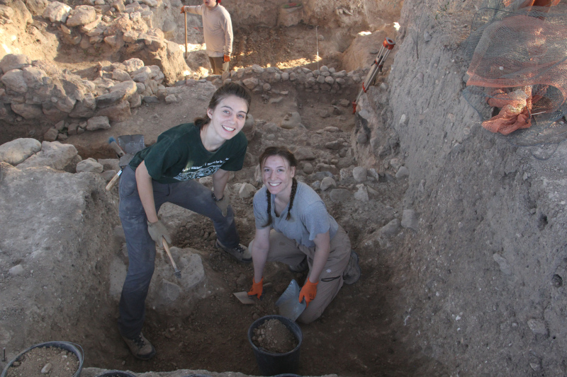
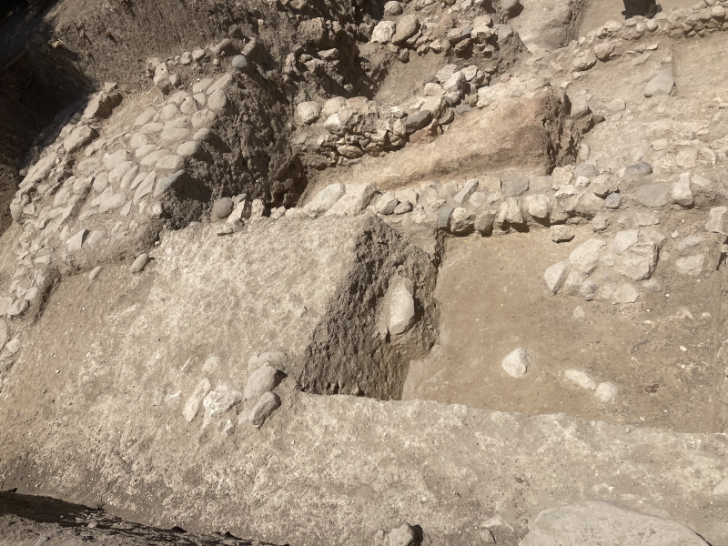
The “At the Crossroads: Arameans, Phoenicians and Israelites” project at Tel Abel Beth-Maacah is located in Northern Israel, just south of the Lebanese border. Like today, in ancient times, the Tel was located at an intersection of cultures. Abel Beth-Maacah, or ABM as it is affectionately called by its excavators sits at the Northern extent of the Kingdom of Ancient Israel, and seems at various periods to have been controlled by Israelites and Arameans, with clear Phoenician influences. Textual evidence at this site is limited, but in conjunction with material culture, particularly in the forms of art and pottery, the excavators are able to piece together an understanding of the systems of trade, influence, and interaction that this region of Northern Israel was experiencing in various periods.

Sarah (left) and a volunteer excavating a probe.

While written evidence for Abel Beth-Maacah is limited, it is not non-existent. The Hebrew Bible mentions the site in a story from the Davidic period. A “wise woman” tells Joab, one of David’s generals, that “long ago they used to say, ‘Get your answer at Abel,’ and that settled it” (1 Samuel 20:18) hinting at some sort of divinatory cult at the site. In support of this idea, the archaeological material has turned up a hoard of 406 knuckle bones, or astragali bones, which were commonly used in divination rituals, from the Iron IIA (Reference). The woman also refers to Abel Beth-Maacah as a “mother in Israel”, tying the city to the Israelite Kingdom (2 Sam. 20:19). Later, the Aramean king Ben-Hadad I would conquer the northern border states of Israel, including ABM and neighboring Tel Dan, a conquest confirmed by the discovery of the Tel Dan stele erected by Ben-Hadad after his victory (1 Kings 15:20). A final piece of textual evidence comes from the site itself, where a theophoric name (a personal name which includes the name of a deity) was found on a jar in a massive storage building. Theophoric names rose to prominence in the Iron II in the Southern Levant. For ancient Israel, these are called “Yahwistic names” as they include the name of the god Yahweh. The presence of such a name suggests an Israelite presence at the site during this period.

While evidence such as names and material culture can give insight into who lives at a site during a given period, archaeologists still must proceed with caution. The Iron Age Levant was interconnected. As discussed above, political boundaries shifted, especially near borders. It was not uncommon for things like personal names or pottery styles to shift in order to give the owner a social or economic advantage. To the west, Phoenicians on the Levantine coast were trading widely in the Mediterranean during the Iron II.

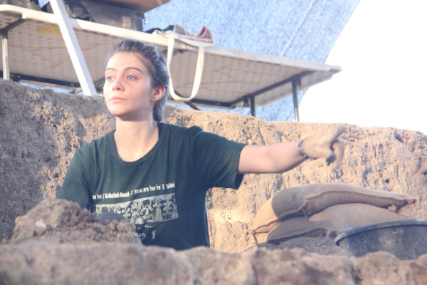
Sarah excavating in Area A Downtown

At Abel Beth-Maacah, evidence for Phoenician trade is seen in the Phoenican style pottery, such as a Phoenician Bi-chrome jar, as well as a seal bearing the impression of a Phoenician ship. The seal could have been used practically, but may have also been a prestige item. It is shaped like a lotus flower, a distinctly Egyptianizing art feature, again pointing to the interconnectedness of art and trade in this period. Phoenician material culture at the site is a good example of how archaeologists must be careful when interpreting data. While it is not unlikely that some Phoneincians did reside at ABM, the presence of Phoenincian pottery does not have to mean the owners were “Phoenician,” especially when knowledge of Phoenician trade patterns is considered. People and materials were moving widely through the Levant and the Ancient Near East, and it is not surprising that the material culture reflects this.

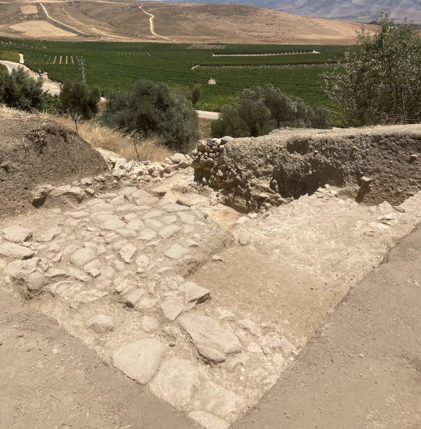
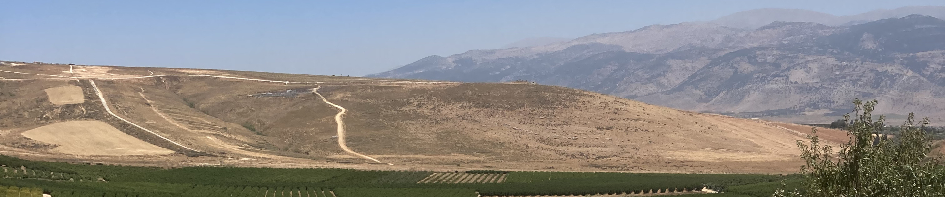
My squares (T15/A15) with the Lebanese hills in the background.

These issues are particularly relevant for a border site like Abel Beth-Maacah. Because the ancient world was interconnected and fluid, archaeologists must connect together evidence from texts, archaeology, and art, from their own excavations and others, to piece together an understanding of the past.

For more information, please visit our website: www.abel-beth-maacah.org

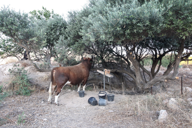
A cow decided to help us sift one morning!

Sarah Harrington is a Ph.D. Student in Levantine Archaeology at UCLA. She is researching rituals of the Ancient Near East and the archaeological material associated with them. This summer she was an Assistant Area Supervisor in Area A Downtown at Tel Abel Beth-Maacah.

Want to help more students and early career archaeologists get into the field? Donate to the cause today by selecting “Student Support” as your gift purpose!

Seger Grant Report: Chipped Stone Tools Excavated from Tel Beth-Shemesh

2022 Joe D. Seger Project Grant Report: Final Analysis of the Chipped Stone Tools Excavated from Tel Beth-Shemesh (2003-2019)

Lorem ipsum dolor sit amet, consectetur adipiscing elit. Ut elit tellus, luctus nec ullamcorper mattis, pulvinar dapibus leo.

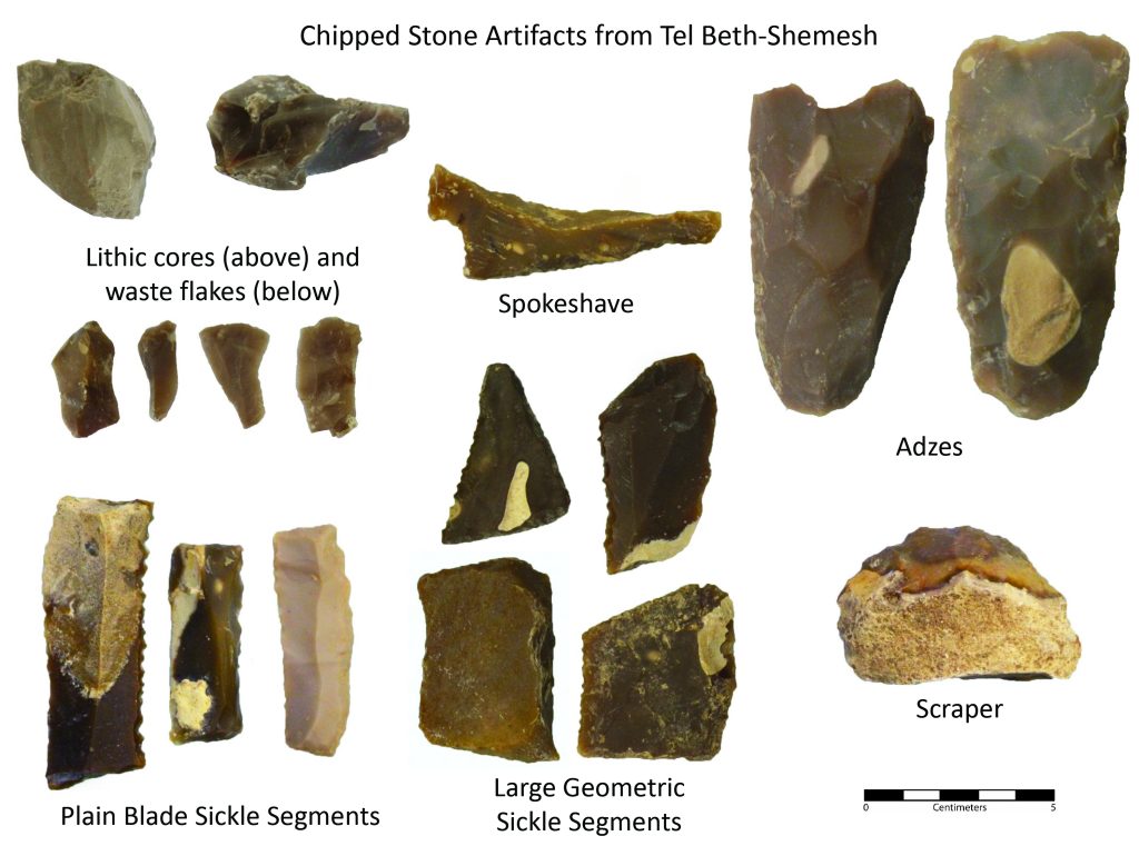
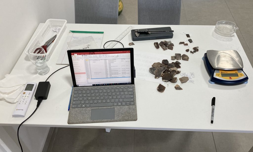
Selection of chipped stone artifacts excavated from Tel Beth-Shemesh (figure by S. Bubel.)
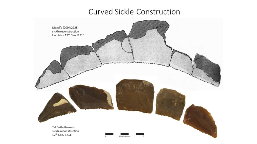
Large geometric sickle segments arranged in a curved sickle (figure by S. Bubel).

Tel Beth Shemesh was occupied from the Middle Bronze II Period through to the Assyrian conquest of the region. Excavations directed by Shlomo Bunimovitz and Zvi Lederman (Tel Aviv University) since 1990 have focused on refining the occupation phases of the site and establishing its role as a border community in the Shephelah region during the Iron Age.

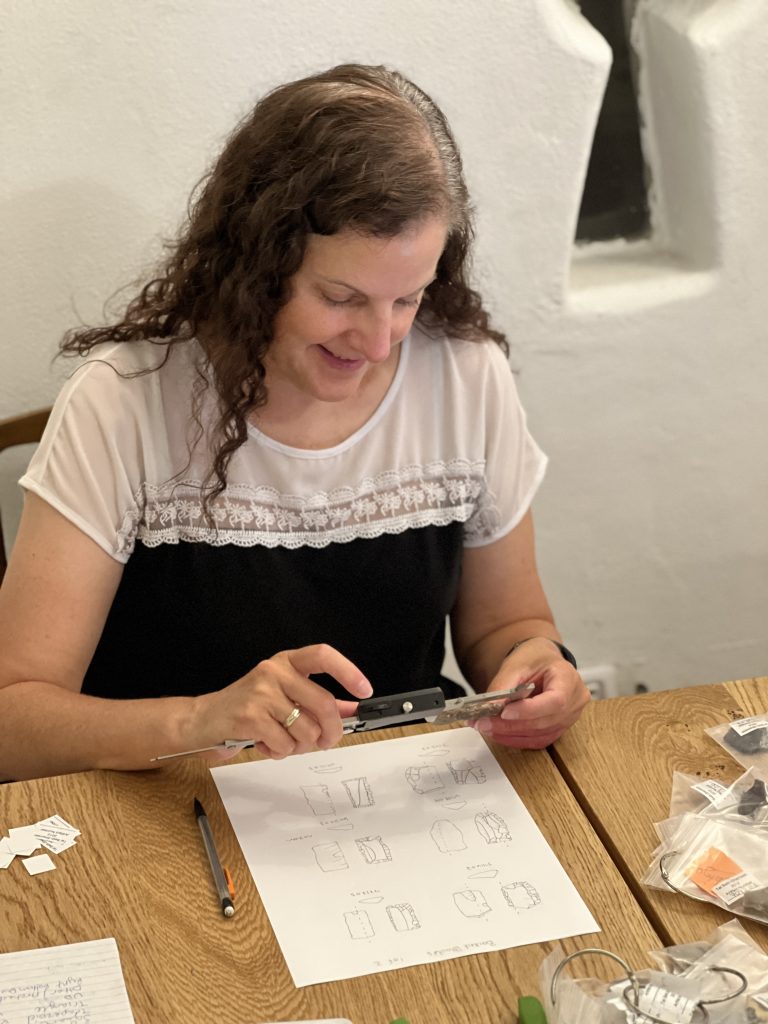
Drawings of selected chipped stone artifacts from Tel Beth-Shemesh (photo by S. Bubel).

I joined the project in 2003 and for almost 20 years I have brought students to Israel so they could learn how to carry out archaeological field work. My colleagues and I have trained more than 500 undergraduate and graduate students through the Tel Beth-Shemesh field school. As a Canadian scholar bringing large groups of students to Israel, my summers focused on student learning. Concentrating on the educational components of the project meant that during the short periods of time I spent in Israel, I had less time for the specialized analysis work required to examine the chipped stone tools. Because of the Joe D. Seger Project Grant, I was able to fulfill these research goals during a non-excavation season.

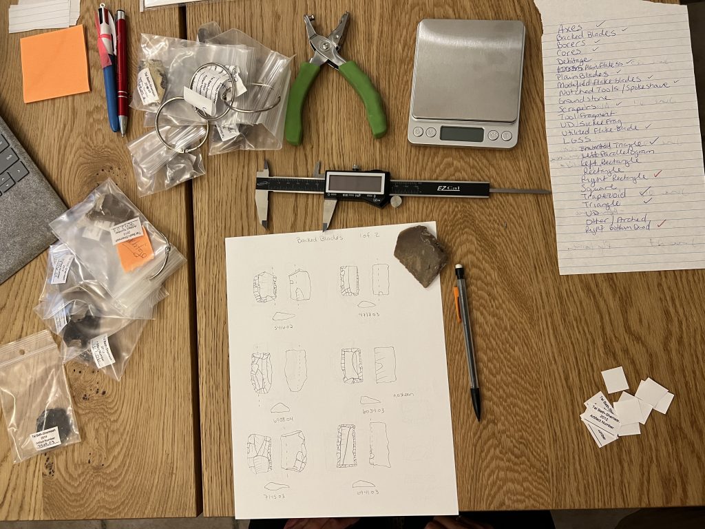
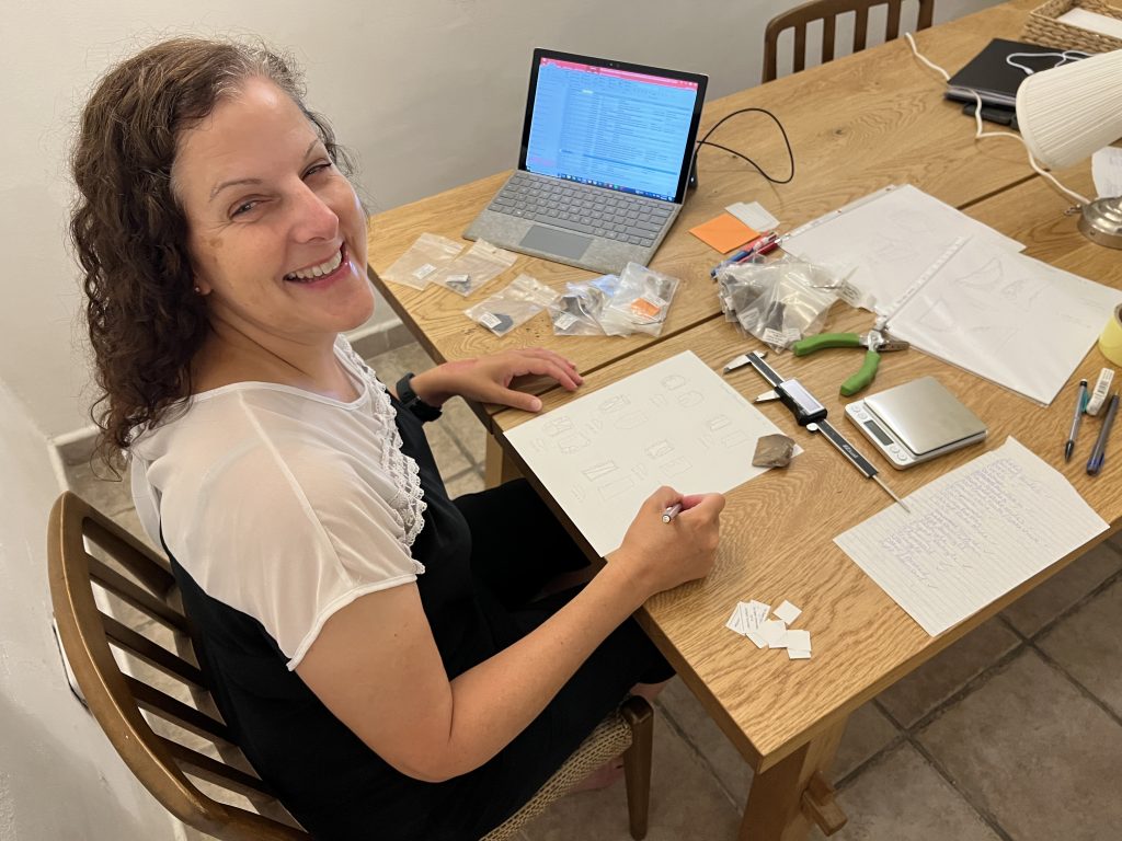
Analysis of chipped stone artifacts from Tel Beth-Shemesh (photo by S. Bubel).
Shawn Bubel analyzing chipped stone artifacts excavated from Tel Beth-Shemesh.

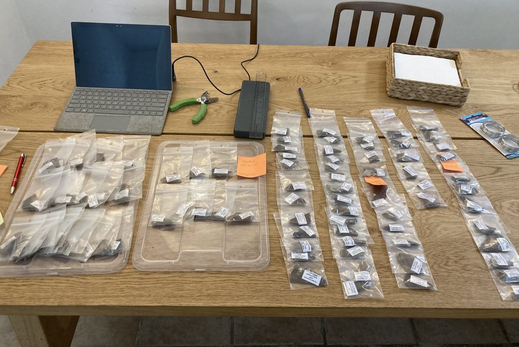
We have excavated more than 2700 diagnostic chipped stone artifacts at Tel Beth-Shemesh, making it one of the largest lithic assemblages amassed from a historic period site in the Levant. These specimens include cores and waste flakes (debitage) from tool production, tool blanks or preforms, and finished tools. Thousands more non-diagnostic chips and chunks of high-quality chert were also collected and examined. It was quickly clear that at least some lithic tool production was taking place on site, but a detailed study of the artifacts was needed to understand the manufacturing process and determine if certain tools were locally manufactured and others acquired through trade. Moreover, the chipped stone artifacts came from Middle Bronze II to Iron II contexts, which allowed me to study diachronic change in the chipped stone industry. This was especially exciting because Tel Beth-Shemesh is one of only a handful of sites that was continually occupied through these periods.

My analysis of the chipped stone artifacts involved a rigorous metric and qualitative assessment of the attributes of each piece. I now have a comprehensive dataset to work with and a catalogue that can be submitted the IAA and shared with other researchers. I was also able to photograph and draw select pieces for publication. With these steps complete, I can now tie my results to the larger study of cultural continuity and change from the Middle Bronze Age through to the Iron Age.

Shawn Bubel drawing chipped stone artifacts excavated from Tel Beth-Shemesh.
Subsample of the Large Geometric Sickle Segments excavated from Tel Beth-Shemesh (photo by S. Bubel).

I am very grateful to have received the Joe D. Seger Project Grant. Funding like this allows researchers from North America, like myself, to complete analyses on excavated materials.

-Shawn Bubel, Professor of Archaeology at the University of Lethbridge

ASOR plans to award two Seger Project Grants of $2,500 each during 2024. Apply by February 26, 2024 for consideration.

Fieldwork Report: Marc Marín Webb

Remote Sensing Techniques to Reveal Ancient Mesopotamian Urbanism

Marc Marín Webb, 2023 Strange-Midkiff Fieldwork Scholarship Recipient

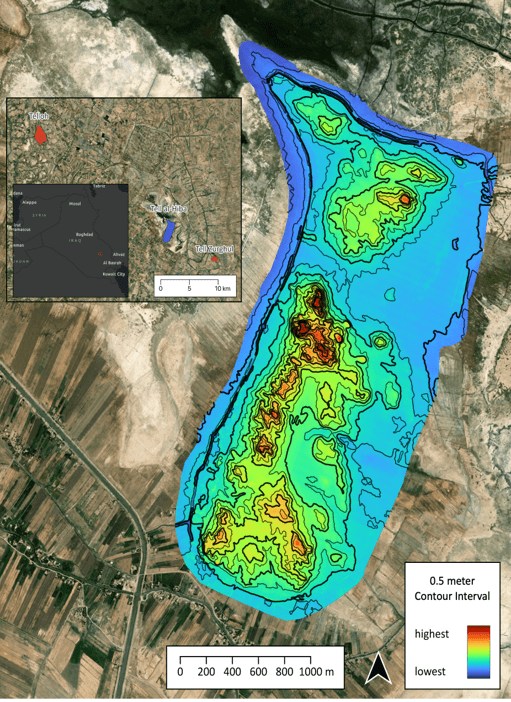
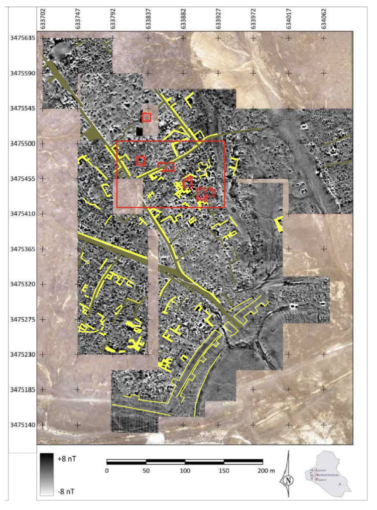
The archaeological site of al-Hiba, ancient Lagash, stands as one of the most extensive third-millennium sites in Southern Mesopotamia, situated approximately 22 km east of the modern town of Ash-Shatra in Iraq (Figure 1). Its initial exploration, spanning from 1968 to 1978, was conducted by Vaughn Emerson Crawford and Donald Hansen. In 2019, archaeological activities were resumed through the efforts of the Lagash Archaeological Project (LAP), under the direction of Professor Holly Pittman from the University of Pennsylvania. Over recent years, LAP has delved into the investigation of craft production within households and workshops across the neighborhoods of ancient Lagash, focusing on the Mesopotamian Early Dynastic Period (circa 2,900-2,350 BCE). In the coming years, LAP intends to delve deeper into the socio-economic aspects of craftspeople by analyzing the variability of utilitarian products, production debris, and their respective activity areas.

The exceptional preservation conditions at this sprawling 400-plus hectare site, primarily dating to the EDIIIb period, favor a multifaceted approach encompassing both aerial (walking surveys and remote sensing techniques like UAV photogrammetry and thermography) and subsurface methods (surface scraping, excavation, and geophysics including magnetic gradiometry and electrical resistivity tomography). Through these methods, LAP seeks to address craft production at four socio-spatial scales: the household, the neighborhood, the city, and the city-state.

Figure 1: Contour plan for Lagash obtained through QGIS processing rectified orthomosaics, made by Paul Zimmermann. Lagash Archaeological Project.

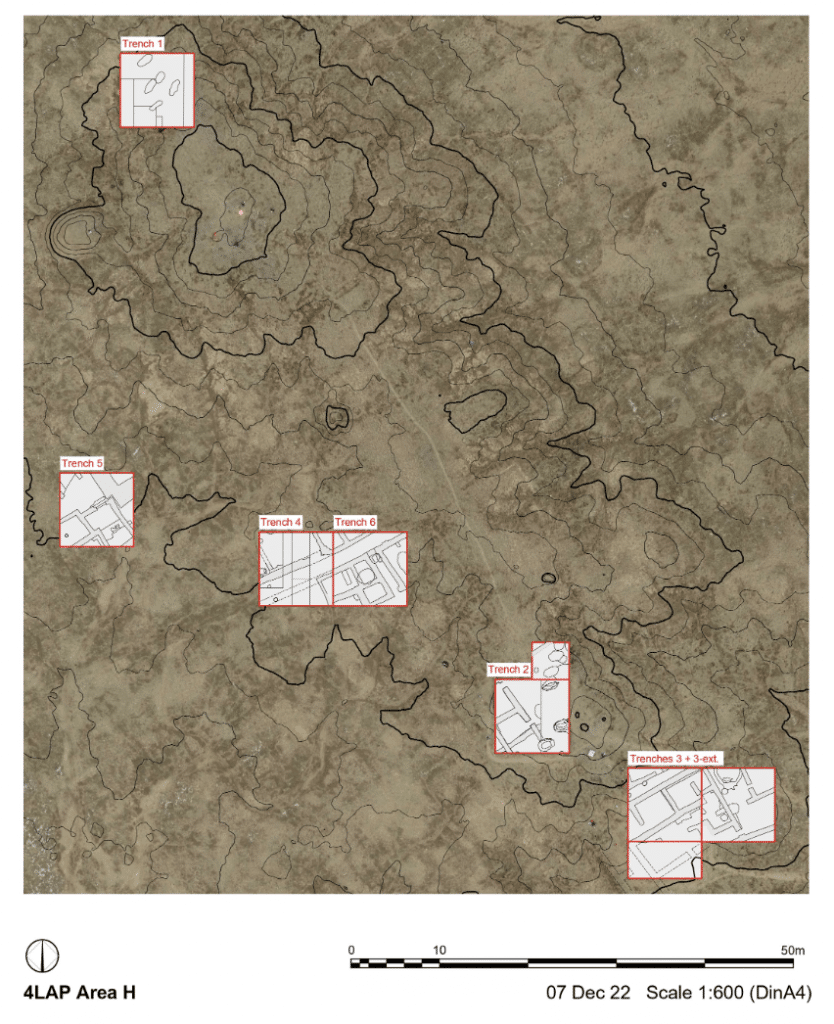
The remarkably preserved surface and subsurface architecture at Lagash, as evidenced by initial drone flights from 2019 to 2023 over Area H (Figure 2), offers a unique opportunity to test remote sensing techniques for reconstructing the urban layout of the city during the Early Dynastic period. In this project, my responsibilities include tracing this architecture through carefully planned flightpaths over selected regions of the site, leading to the creation of orthomosaic images. These flight photographs are subsequently uploaded to the DroneDeploy website for processing. The rectified orthomosaics are then downloaded into QGIS for merging into a single image and processing into the new contour plan for Lagash.

Figure 2: Tell Al-Hiba Area H. Lagash Archaeological Project

Orthomosaic images generated through DroneDeploy are compared to select those that provide clearer depictions of architectural features. We conduct regular aerial surveys on a daily basis to identify optimal weather conditions for revealing these features. Flights immediately following rainfall prove especially useful for detecting surface and subsurface walls, as differences in soil density quickly become apparent in the aerial photographs. Additionally, drone flights at different times of the day reveal distinct features.Subsequently, orthomosaics are digitized into AutoCAD and QGIS to create vector shapes and poly lines representing identified surface-level architectural elements such as walls, streets, kilns, and drains (Figure3).

Surface-level architectural features are frequently discernible in Tell al-Hiba, both through walking surveys and aerial and satellite imagery. These distinctions arise from variations in soil density, triggering differences in moisture retention levels and salt efflorescences. These variations are prominently visible in the 2022-23 aerial surveys of Area H, where surface and subsurface walls appear as darker shades of brown, and white concentrations of salt.

Figure 3: Digitized surface and subsurface architecture at Tell Al-Hiba Area H. Lagash Archaeological Project

Since 2019, we have identified hundreds of features of similar scale and orientation, yielding significant insights into the density and organization of the urban fabric. This includes the orientation of streets and buildings, room sizes, wall thickness, and types of brickwork. Among these structures, we’ve encountered both small-scale buildings and substantial constructions, including segments of the city wall and building complexes of notable size.


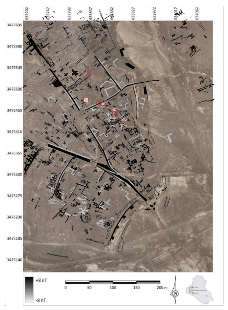
The combined use of geomagnetic surveys and aerial surveys conducted over the past four years provides a snapshot of the urban fabric in Area H (Figure 4). While the precise dating of most of these structures remains uncertain, we can begin to draw certain conclusions from the data obtained. This area of the site appears to have been densely populated, featuring both small-scale and monumental architecture, as indicated by walls of varying widths and the differing scales of rooms and courtyards between them. Most sub-surface architectural traces identified in the aerial survey consist of scattered structures, preventing the reconstruction of entire buildings. Nevertheless, they are primarily aligned and oriented in accordance with the neighborhood’s main streets.

Figure 4: Combined use of geomagnetic surveys and aerial surveys. Lagash Archaeological Project

Previous surface surveys in Tell Al-Hiba have suggested that the majority of surface remains likely belong to a single period, the Early Dynastic III B (Carter 1985, 1989-90; Goodman et al. In press). Our objective for the 2023 and upcoming seasons is to cross-reference datasets from remote sensing with excavation findings to confirm the dating of these structures. This will help determine whether they are indeed mostly contemporaneous or if we are dealing with a complex layering of structures from multiple periods, spanning broadly from the Early Dynastic I to the end of the Early Dynastic III.

For more information, please visit our website: https://web.sas.upenn.edu/lagash/

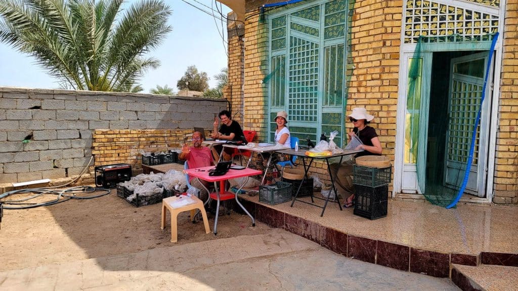
Post-excavation processing at the excavation house. Lagash Archaeological Project.

Marc Marín Webb is an architect and PhD candidate in Middle Eastern archaeology and history at the University of Pennsylvania. He has participated in archaeological and cultural heritage preservation projects in Syria, Iraqi Kurdistan, and southern Iraq. He has been collaborating in the LAP for two years now, contributing to the architectural analysis and aerial survey of the site.


Want to help more students and early career archaeologists get into the field? Donate to the cause today by selecting “Student Support” as your gift purpose!


2023 ASOR Honors & Awards

2023 ASOR HONORS & AWARDS


Each year at the Annual Meeting, ASOR recognizes individuals who have performed outstanding service for the organization, those who have published exceptional academic work, and those who made significant contributions to our field. The following award recipients were honored at the 2023 Annual Meeting in Chicago and during the Members’ Meeting on November 17th. Awards were presented by Lynn Welton, Chair of ASOR’s Honors and Awards Committee.

Community Engagement and Public Outreach Award. This award recognizes individuals, teams, and organizations who have initiated outstanding educational, informational, or practical projects (including but not limited to classes, programs, exhibits, resources, events, and platforms) with the goal of making subjects and information about the ancient world accessible to wider (particularly non-academic) audiences.

Awarded to Marilyn Lundberg Melzian, Archive and Imaging Research Specialist, University of Southern California, for her work with the West Semitic Research Project and Inscriptifact.

The Charles U. Harris Service Award. This award is given in recognition of long-term and/or special service as an ASOR officer or Trustee (one award is given annually).

Awarded to Paul Flesher, Professor of Religious Studies and Director of the American Heritage Center, University of Wyoming for his work with the ASOR Archives.

The P. E. MacAllister Field Archaeology Award. This award honors an archaeologist who, during his/her/their career, has made outstanding contributions to ancient Near Eastern and eastern Mediterranean archaeology (one award is given annually).

Awarded to Bethany Walker, Professor Doctor, Universität Bonn.

ASOR Membership Service Award. This award recognizes individuals who have made special contributions on behalf of the ASOR membership, through committee, editorial, or office services.

Awarded to: Leigh Anne Lieberman (Open Context/Alexandria Archive Institute), Tiffany Earley-Spadoni (University of Central Florida), and Melissa Cradic (Open Context/Alexandria Archive Institute) for their design and implementation of the program, Digging Up Data, to aid ASOR members in the development of public-facing digital projects.


Piotr Michałowski receives an ASOR Membership Service AwardAwarded to Piotr Michalowski, George G. Cameron Professor Emeritus, University of Michigan, for his 32 years of service as editor of the Journal of Cuneiform Studies, the Baghdad Committee, and ASOR.


Awarded to Beth Alpert Nakhai, Professor of Anthropology (Judaic Studies), University of Arizona, for her work in with ASOR’s Initiative on the Status of Women.

The G. Ernest Wright Award. This award is given to the editor/author of the most substantial volume(s) dealing with archaeological material, excavation reports and material culture from the ancient Near East and eastern Mediterranean. This work must be the result of original research published within the past two years (one award is given annually).

Awarded to James Osborne, Associate Professor, University of Chicago, for The Syro-Anatolian City States: An Iron Age Culture, Oxford University Press.

The Frank Moore Cross Award. This award is presented to the author/editor of the most substantial volume(s) related to the history and/or religion of the ancient Near East and Eastern Mediterranean. Primary consideration will be given to historical, epigraphic, textual, and comparative literary studies; or to works that advance and/or evaluate new methodological approaches to the literary record(s). This work must be the result of original research published during the past two years (one award is given annually).

Awarded to Megan Nutzman, Associate Professor, Old Dominion University for Contested Cures: Identity and Ritual Healing in Roman and Late Antique Palestine, Edinburgh University Press.

Amanda Podany received the Nancy Lapp Book AwardThe Nancy Lapp Popular Book Award. This award is presented to the author/editor of a book published in the last two years that offers a new synthesis of archaeological or textual evidence intended to reach an audience of scholars as well as students and the broader public (one award is given annually).

Awarded to Amanda H. Podany, Professor Emeritus, California State Polytechnic University, for Weavers, Scribes, and Kings: A New History of the Ancient Near East, Oxford University Press.

Joy Ungerleider poster awardee Efrat NakashThe Joy Ungerleider Poster Award. This award is conferred upon the author(s) of the poster presenting the results of a study about ancient Near Eastern societies in a clear, legible fashion using original graphic content. Subject matter may be based in archaeological sciences, history, anthropology, epigraphy, ethnography, heritage or other scholarly approaches to understanding ancient people in the areas covered by ASOR (one award is given annually).

Awarded to Efrat Nakash, Tel Aviv University, for the poster: “Copper circulation in the southern Levant during the EBIIIA: Tell el-Hesi as a case study.”

Student Paper Award. This award is conferred upon the author(s) of a paper presented during the Annual Meeting that conveys the results of a study about ancient Near Eastern and wider Mediterranean societies in a clear, understandable, and convincing fashion. The first author and presenter of the paper must be a registered student at the time of presentation in order to be eligible for consideration for this award.
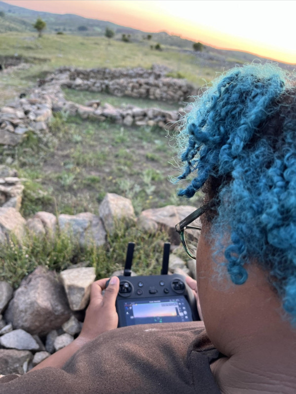
Awarded to Morganne Ottobre, Johns Hopkins University, for the paper “Between Two Cultures: Translation and Multimodality in the Tell Fekheriyeh Inscription.”

Fieldwork Report: Mireya Smith

The Secret Life of an Archaeologist at Kerkenes

Mireya Smith, 2023 BIPOC Fieldwork Scholarship Recipient

In May of this year, I graduated from the University of Central Florida with a Bachelor of Arts degree in Anthropology and an undergraduate certificate in Geographic Information Systems. My hope was to become an archaeologist after realizing that it was something that genuinely made me happy in life. I decided to apply for the UCF in Turkey program as a beginning step to this new chapter of my life. My dreams were coming true when I found out I got accepted to the program.

Kerkenes is an ancient Iron Age site in Anatolia that has a unique past. It stood for only about 60 years before being burnt down by either the Lydian or Phrygian King. Luckily archaeological evidence shows that almost everyone made it out before the burning, and that it was burned to show dominance after taking over the area. Kerkenes stands on a mountain at anout 1500 meters high. It is surrounded by granite and bedrock, but under the surface, the 2500-year-old structures are waiting to be discovered by future archaeologists.

This year, four UCF students joined the Kerkenes Project on May 18th, 2023. We started by conducting an electrical resistance survey where probes eject an electrical current into the ground and record the amount of time it takes for the current to come back. The change in time helps to create a picture of what is underground. In order to establish where to do electrical resistance survey, we also conducted a total station survey to map the above-ground areas.

A few weeks later, we commenced excavation in Trench 45. This trench has been open for some time, and last year’s excavations revealed a building (Structure B) that could potentially be an ivory workshop. This was what we were excavating this year but in order to begin, we had to get rid of all the flora that grew on top of the geotextile (a fabric that protects what was exposed) and backfill. After a few days of this, we were able to see the walls that had been previously excavated, and we learned what collapsed architecture looks like. After getting the go ahead, these walls were removed down to the first course. Once we knew what we were working with, we were able to follow the walls to reveal the entire structure. When this was revealed, things took a very non-traditional turn (at least as far as what I have been taught in my classes).

The area to be excavated was split into 32 squares with multiple people digging with pickaxes. My previous experience had taught me that traditional archaeology calls for excavating in 10cm increments while keeping the surface level, then collecting and dry sieving the dirt that comes out of the trenches. Since the sediments at Kerkenes are comprised of clay and become solid when dry, so the team excavated with pickaxes, collected the dirt in plastic bags, recorded the elevations with the total station, and then wet sieved the dirt using Hydra. This process entailed getting a bag of the collected dirt, placing it in a mesh crate, and washing away the small dirt particles, leaving behind any ivory, bone, or ceramic that were missed during the excavation process.

Things collected include bone, ivory, ceramic, and building materials with impressions on them. Ceramics were washed, labeled, and categorized by the students and volunteers while the other materials went to the registrar and conservator to be assigned ID numbers. After this, the items were photographed, conserved, 3D scanned, and put on shelves for later reference by specialists or the museum.

Some other other methods we used included 3D scanning and photogrammetry of the area, along with some of the artifacts. Photogrammetry meant going to site when the sun was not as bright and taking back-to-back photos of the installation, walls, and the trench itself. These photos will be uploaded to a program that turns them into a 3D image. The 3D scanning of the area works similarly except it is done in real time as opposed to having to wait to upload the images.

As the excavation season came to an end, we closed the unit and compiled all the materials and data. Some of the team went to the site to clean and backfill while others processed the ceramics, bone, ivory, etc. The season ended with a workers’ dinner, where we celebrated their efforts before everyone went on their way for new adventures.

The fun part of excavations is not limited to the skills we learn and apply, however. There is so much that happens behind the scenes that affects not only the people, but the flow of the project itself. Being away from home for two months with strangers is hard enough, but being away from home in another country is even harder. The long workdays make it harder to keep in contact with loved ones on a consistent basis. While we all hope to get along, there are struggles and disagreements here and there. What I think is great about this experience is that it not only solidifies the relationship with your support group at home, but also challenges you as a person to make and keep up friendships while on the project. With people coming and going, there are so many opportunities to make friends and connections. We really do function like a family and share many great memories—like the workers singing and dancing, our six-minute rendition of Bohemian Rhapsody when the bosses were away (sorry you had to find out this way), bonfires, enjoying the scenery while eating meals, cookin, and baking for everyone, tears, talking about and resolving conflicts, trying new fruit, and just spending time with the new friends we’ve made.

I came to this project wanting to gain experience in archaeology and GIS and came out with so much more. I accomplished my goals and even was offered a job at two different CRM companies with many other interviews. I also made new friends that I believe will last a lifetime. My favorite part of this whole project was having the opportunity to meet all the students, volunteers, senior staff, and professors. Our backgrounds are so diverse, but Kerkenes bonds us all. I’m going to miss them so much! I hope to come back and make more memories with everyone!

Mireya Smith graduated in May of 2023 with a BA in Anthropology and an undergraduate certificate in GIS from the University of Central Florida. She was originally on a pre-med track until after Covid when she realized she wanted to do something she loved instead of something to make others happy. After studying abroad in Türkiye, she has been working in CRM. Mireya has completed projects in Mississippi, Texas, and Florida. She is so thankful for the grant! Without it, she would not have gained the archaeological experience and then in turn work opportunities.

Want to help more students and early career archaeologists get into the field? Donate to the cause today by selecting “Student Support” as your gift purpose!

Collections Fellowship Report: Helen Dixon

2023 Collections Fellowship Report: Exploring Punic Religious and Social Life in Coastal Tunisia

Helen Dixon, Assistant Professor of History at East Carolina University

In the early centuries of the first millennium BCE, some Phoenicians left their homes along the Levantine coast, selected sites on nearly every Mediterranean island and coastline, and made a new life for themselves. They learned from local populations, adapting their religious and cultural practices to new environments. Carthage would become the most famous Phoenician diaspora community, but it was one of many Punic settlement sites in modern Tunisia. Thanks to the ASOR Collections Fellowship, I conducted research in archaeological collections from Utica, Carthage, Kerkouane, and Sousse that tells the stories of Levantine Phoenicians (and Sidonians in particular) as they joined existing regional networks and made their mark on coastal Tunisia.

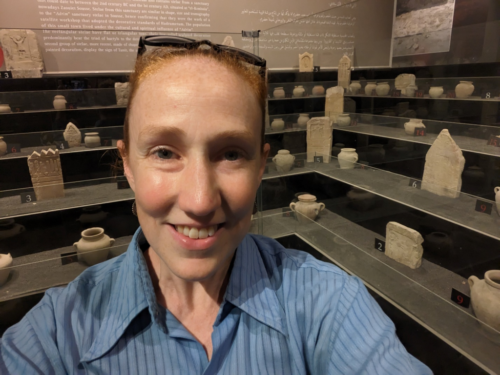
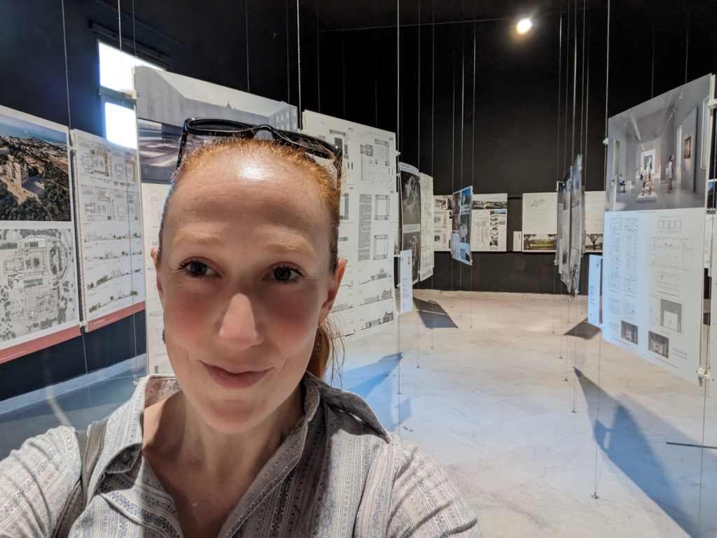
The author at the Sousse Archaeological Museum, featuring votive stelae and ceramic urns from the “Baal Hammon sanctuary” at Sousse (photo by H. Dixon).
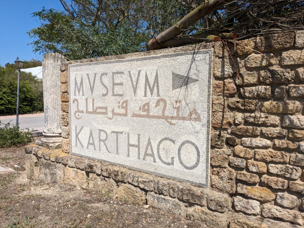
The mosaic sign at the base of the driveway to the Carthage National Museum (photo by H. Dixon).
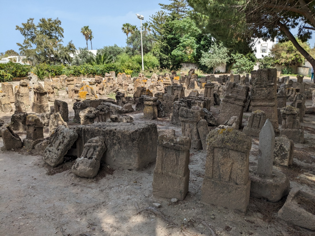
Votive stelae removed from excavations at the “Precinct of Tanit” in Carthage, currently on view at the archaeological site (photo by H. Dixon).

I had planned to explore two research projects during my ten days in residence in Tunis: first, to investigate ca. 70 Carthaginian votive stelae featuring images of ships known from the infant cremation site often referred to as a “tophet.” I was also on the lookout for contemporaneous maritime images from other religious or funerary contexts to better understand these votive images. The second project was for my current book manuscript, Death in Sidon: a study of nine Carthaginian funerary stelae commissioned by men and women “of Sidon” – settlers who still identified with their Levantine city of origin. Many (but not all!) of the stelae from both projects were published in Latin in the Corpus Inscriptionum Semiticarum (1881-1962), but the tiny thumbnail images were not sufficient to clearly make out the details of the iconography, and I was excited to see what traces of paint might remain.

Previewing proposed plans for the reinstalled, renovated Carthage National Museum to be completed in 2026 (photo by H. Dixon).
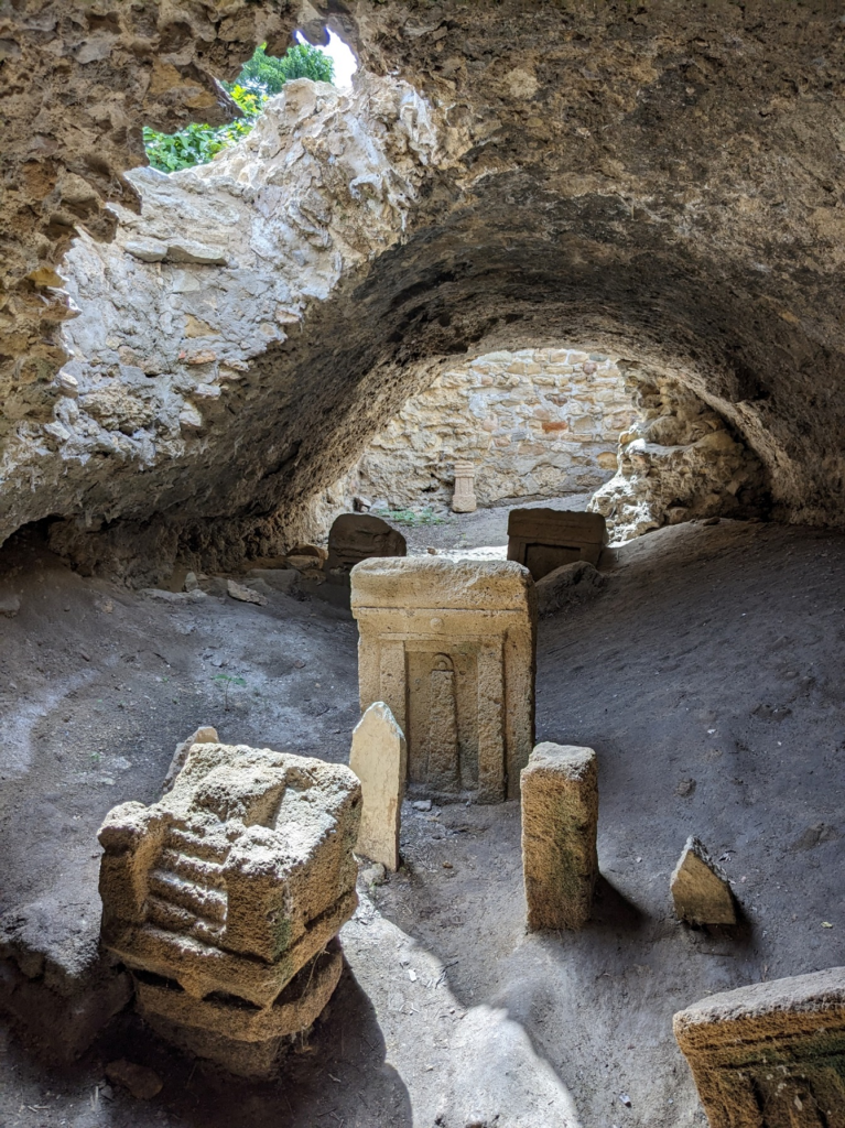
Votive stelae and a miniature stone throne from the “Precinct of Tanit” at Carthage, covered over by a Roman aqueduct channel (photo by H. Dixon).

When I arrived at the Institut National du Patrimoine (INP) offices in Tunis, I learned that the Carthage National Museum had just undertaken a new collections inventory, which would lead to improved photographs and perhaps a searchable catalogue in the future. Unfortunately for me, this meant specific research requests like the one I had made could not be accommodated, as the museum was mostly closed and staff time redirected. With the guidance and generosity of Dr. Imed Ben Jerbania, I was able to rethink my research plans. I focused on understanding 7th-4th c. BCE life in the Punic settlements along the Tunisian coast, visiting ongoing excavations at Utica and Carthage, archaeological parks throughout Carthage, Sousse, and Kerkouane (including both the Punic town and the necropolis), and archaeological collections in the Utica, Sousse, and Kerkouane Museums. This will allow me to offer a nuanced picture of these communities’ values, self-representation, and maritime orientation in future publications, while awaiting the reinstallation of the Carthage National Museum in 2026. I am grateful to the INP for the hospitality and assistance I received and to ASOR and East Carolina University for making these connections possible.

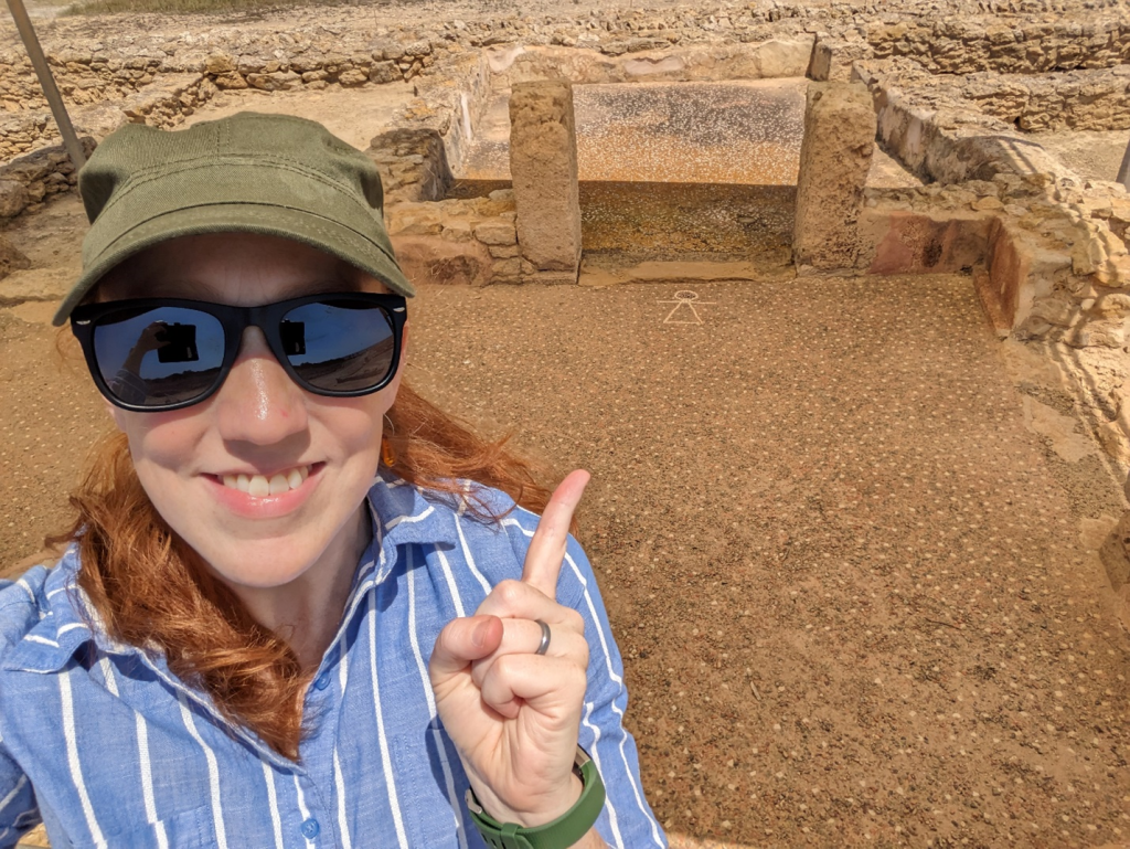
A visit to the mosaic “Sign of Tanit” in the floor of a private home (ca. 250 BCE), preserved at the incredible Kerkouane archaeological site (photo by H. Dixon).

Dana Grant Report: Brač Island, Croatia

[vc_row fullwidth=”true” attached=”true” css=”.vc_custom_1496247803139{padding-top: 0px !important;padding-right: 0px !important;padding-bottom: 0px !important;padding-left: 0px !important;}”][vc_column][vc_single_image image=”99920″ img_size=”full” alignment=”center”][/vc_column][/vc_row][vc_row fullwidth=”true” css=”.vc_custom_1496682730308{padding-top: 10px !important;padding-right: 0px !important;padding-bottom: 0px !important;padding-left: 0px !important;}”][vc_column width=”1/12″ css=”.vc_custom_1496683820796{margin-right: 10px !important;}” offset=”vc_hidden-md vc_hidden-sm vc_hidden-xs”][vc_column_text]

 SHARE

[/vc_column_text][mk_image src=”http://www.asortest.org/wp-content/uploads/2017/01/social-fb-icon4.jpg” image_width=”42″ image_height=”42″ hover=”false” custom_url=”https://www.facebook.com/ASOResearch/” margin_bottom=”0″][mk_image src=”http://www.asortest.org/wp-content/uploads/2017/01/social-tw-icon4.jpg” image_width=”42″ image_height=”42″ hover=”false” custom_url=”https://twitter.com/ASOResearch?ref_src=twsrc%5Egoogle%7Ctwcamp%5Eserp%7Ctwgr%5Eauthor” margin_bottom=”0″][mk_image src=”http://www.asortest.org/wp-content/uploads/2017/01/social-in-icon4.jpg” image_width=”42″ image_height=”42″ hover=”false” custom_url=”https://www.linkedin.com/company/american-schools-of-oriental-research” margin_bottom=”0″][mk_image src=”http://www.asortest.org/wp-content/uploads/2017/01/social-ml-icon_7.jpg” image_width=”42″ image_height=”42″ hover=”false” custom_url=”mailto:info@asor.org” margin_bottom=”0″][mk_image src=”http://www.asortest.org/wp-content/uploads/2017/01/blog-icon3.jpg” image_width=”42″ image_height=”42″ hover=”false” custom_url=”http://asor.org/blog” margin_bottom=”0″][/vc_column][vc_column border_color=”rgba(255,255,255,0.01)” width=”1/6″ css=”.vc_custom_1496683923840{margin-right: 20px !important;border-left-width: 2px !important;padding-right: 20px !important;padding-left: 20px !important;border-left-color: #99422f !important;}”][mk_divider divider_color=”rgba(255,255,255,0.01)” thickness=”1″ margin_top=”3″ margin_bottom=”3″][vc_widget_sidebar sidebar_id=”ca-sidebar-39801″][/vc_column][vc_column border_color=”rgba(170,170,170,0.01)” width=”1/2″ css=”.vc_custom_1487276122024{margin-right: 10px !important;margin-bottom: 30px !important;border-right-width: 2px !important;border-bottom-width: 2px !important;padding-top: 30px !important;padding-right: 30px !important;padding-left: 20px !important;background-color: #ffffff !important;border-right-color: rgba(227,228,228,0.75) !important;border-bottom-color: rgba(227,228,228,0.75) !important;}”][vc_column_text responsive_align=”left”]

2024 Dana Grant Report: Brač Island, Croatia

Sarah James, University of  Colorado, Boulder [/vc_column_text][mk_divider][vc_wp_text]This season of the Brač Island Project was incredibly fruitful and went well beyond our expectations based on last year’s excavations. We excavated on the site of Gradina Rat for five weeks from May 27 to June 28. The team consisted of myself, animal bone specialist Eden Franz, field directors Hannah Hungerford and Andrew Rivadeneira, and 10 graduate student volunteers. Three of these students, Tanner Frick, Claire Hook, and Louis Mainwaring Foster were generously supported by ASOR fieldwork grants.[/vc_wp_text][vc_single_image image=”99916″ img_size=”full” add_caption=”yes” alignment=”center” onclick=”img_link_large” img_link_target=”_blank” css=”.vc_custom_1729107103420{padding-right: 10px !important;}”][mk_padding_divider][vc_wp_text]We excavated this season in three areas: on the southern slope, adjacent to the 2023 trench, and at the northeastern corner of the plateau. Our goal this season was to gain more evidence to talk about the Late Bronze and Iron Ages at this site. Thanks to our previous seasons’ work, we knew how the natural bedrock impacted depositional processes at the site. For instance, we placed a 5x7m trench on the southern slope closer to the plateau than in 2022 and because we had learned that the bedrock dropped creating large pockets of undisturbed erosional fills. For this trench, we were able not only to unearth deep deposits that were radiocarbon dated to the 5th century BCE, but also locate a stretch of the original circuit wall of the hillfort(tentatively dated to the 10thc. BCE). This is an incredible discovery! Although hillforts are relatively common in the Dalmatian islands, archaeological evidence for their construction and use is definitely not. Local authorities immediately recognized its value and are working to conserve this 4m section of wall for future visitors to the site. The other two trenches on the site yielded more evidence of Bronze and Iron Age activities[/vc_wp_text][vc_single_image image=”99917″ img_size=”full” add_caption=”yes” alignment=”center” onclick=”img_link_large” img_link_target=”_blank” css=”.vc_custom_1729107153841{padding-right: 10px !important;}”][mk_padding_divider][vc_wp_text]Artifacts from the deposits above this terrace wall produced a truly remarkable range of imported Italian and Greek pottery dating from the 9th c. BCE to 1st c. CE, which suggests that this site has the longest occupational period of any hillfort in Dalmatia. It was therefore a busy season in the lab, assisted by Claire Hook, as we documented and catalogued hundreds of fragments of imported pottery. The local Bronze and Iron Age ceramics are being studied by Dr. Vedran Barbarić (University of Split)[/vc_wp_text][vc_single_image image=”99918″ img_size=”full” add_caption=”yes” alignment=”center” onclick=”img_link_large” img_link_target=”_blank” css=”.vc_custom_1729107269444{padding-right: 10px !important;}”][mk_padding_divider][vc_single_image image=”99919″ img_size=”full” add_caption=”yes” alignment=”center” css=”.vc_custom_1729107312088{padding-right: 10px !important;}”][mk_padding_divider][vc_wp_text]

We began presenting the results of these excavations in August 2024 at the annual meeting of the EAA (European Association of Archaeologists) and will spend part of next season preparing preliminary reports about the site. This grant will be warmly thanked as a supporter of this research which assisted with travel expenses and the analysis of C14 samples.

[/vc_wp_text][mk_padding_divider][/vc_column][vc_column border_color=”rgba(170,170,170,0.01)” width=”1/6″ css=”.vc_custom_1496684098866{margin-right: 5px !important;margin-bottom: 20px !important;border-right-width: 2px !important;border-bottom-width: 2px !important;padding-top: 30px !important;padding-right: 10px !important;padding-left: 10px !important;background-color: #ffffff !important;border-right-color: rgba(227,228,228,0.75) !important;border-bottom-color: rgba(227,228,228,0.75) !important;}”][vc_wp_posts title=”BROWSE THE NEWS ARCHIVE” number=”4″][/vc_column][vc_column border_color=”rgba(170,170,170,0.01)” width=”1/6″ css=”.vc_custom_1496684008271{margin-right: 10px !important;margin-bottom: 30px !important;border-right-width: 2px !important;border-bottom-width: 2px !important;padding-top: 30px !important;padding-right: 20px !important;padding-left: 20px !important;background-color: #ffffff !important;border-right-color: rgba(227,228,228,0.75) !important;border-bottom-color: rgba(227,228,228,0.75) !important;}”][vc_column_text] [/vc_column_text][/vc_column][/vc_row]

Fieldwork Report: Sophie Vo

Geophysics in the Erbil Plain

Sophie Vo, 2023 Eric and Carol Meyers Fellowship Recipient
 

Thank you to ASOR and Dr. Eric Meyers and Dr. Carol Meyers for allowing me this opportunity to participate in my first excavation! Without the Fellowship, I would not have been able to excavate in the Kurdistan Region of Iraq.


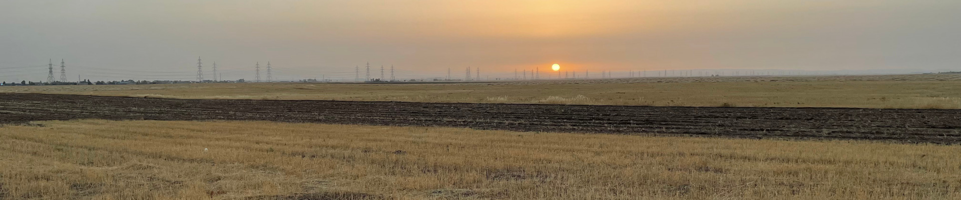
Fig. 1: Qach Rresh at sunrise. The slight outline of the mountains are visible in the distance. Photo courtesy of Sophie Vo.

My mornings started at 3:30 am—I would wake up an hour before we departed to pack lunch for the team’s second breakfast or drink coffee and slowly transition into consciousness. At 4:30am, we would pile into our driver Bapir’s van. As the sun rose, we drove east from Ankawa, the Christian district of Erbil. Typically, we arrived at our site, Qach Rresh, at 5:30am. The sun was poking through the clouds and the air was still cool. Qach Rresh, located 14 km south of Erbil and 2 km north of Trpa Spiyan, is a site which is estimated to date to the 7th-4th centuries BCE (Iron Age II and III). This includes the height of the Assyrian Empire and its subsequent collapse, including periods during which the Erbil Plain might have been under Neo-Babylonian or Median control in the 6th century and Achaemenid Persian control thereafter. Later, the administrative buildings at Qach Rresh were apparently used as trash dumping grounds after the fall of the Assyrian Empire, giving us a huge amount of data about the 6th-4th centuries that is otherwise rare on the Erbil Plain.


Fig. 2: Image of the Emlid R2 GPS system

Upon arriving at Qach Rresh, I would help Glynnis, the project registrar, set up the Emlid R2 GPS system and lay lines for magnetometry. Magnetometry is an archaeological survey method that measures the Earth’s geomagnetic field at the nanotesla (nT) level with two sensors spaced 1 meter apart. Archaeology does not solely involve digging and excavating on site. We would excavate in the mornings and perform data analysis, ceramic cataloging, and zooarchaeological analysis in the afternoons.

To record points in X-Y space, Glynnis and I set up the Emlid R2 GPS system, one of two Reach R2 systems (Figure 2). This allowed us to measure points with sub 2cm accuracy. The base RS2 sits stationary while the rover RS2 is moved to mark points. We marked points using this rover so that we could lay transect ropes every two meters for the magnetometer machine reading spaced every 50 cm (Figure 3). Figure 3 demonstrates the typical set up for surveying Qach Rresh using magnetometry.


Fig. 3: Example of the magnetometry survey setup, with transect ropes set up every two meters for machine readings spaced every 50cm.

Afterward, Dr. Creamer showed me how to conduct magnetometry by carrying the Bartington 601-2 Gradiometer suspended from our backpack straps ~20cm from the ground surface. The left and right vertical sensors needed to be held parallel to each other and perpendicular to the ground. Transects were laid out at intervals of 2m in 20x20m squares (with machine readings at every 50cm),with corner stakes laid in by GPS (Emlid Reach R2). The machine took eight measurements at a pace of one meter per second walking speed. By the end of the day, we were all walking at a cadence of one meter per second and measuring distances by counting our steps. Each square took roughly 15-20 minutes to survey with the Bartington. On average, 5,600m2 (or, roughly half a hectare) was surveyed with the Bartington per day. In the lab, geophysics results were analyzed with the open source computer applicationArchaeoFusion. Magnetometry of the site revealed important features of the rural administrative center of the Neo-Assyrian Empire, such as an animal pen and other potential buildings for future field seasons.

One of my favorite aspects of the Rural Landscapes of Imperial Iron Age Mesopotamia project was the ability to get my feet wet in the various sub-specialties of archaeology. I worked with Laurel Poolman, a zooarchaeology student, who taught me how to analyze and identify unearthed animal remains from our site. I also was able to work with the Kurdish workers, Hallo and Tayib, who taught me how to quickly and efficiently dig trenches. It was extremely valuable learning numerous archaeological methods, from learning the basics—like writing lot numbers—to interpreting animal remains and discussing magnetometer readings. As my first excavation, I gained valuable archaeology and professional experience both in and out of the field. I was also afforded the opportunity to explore my research interests and make lifelong friends on the project. I am extremely grateful to have met everyone in Kurdistan and I can’t wait to return next season!

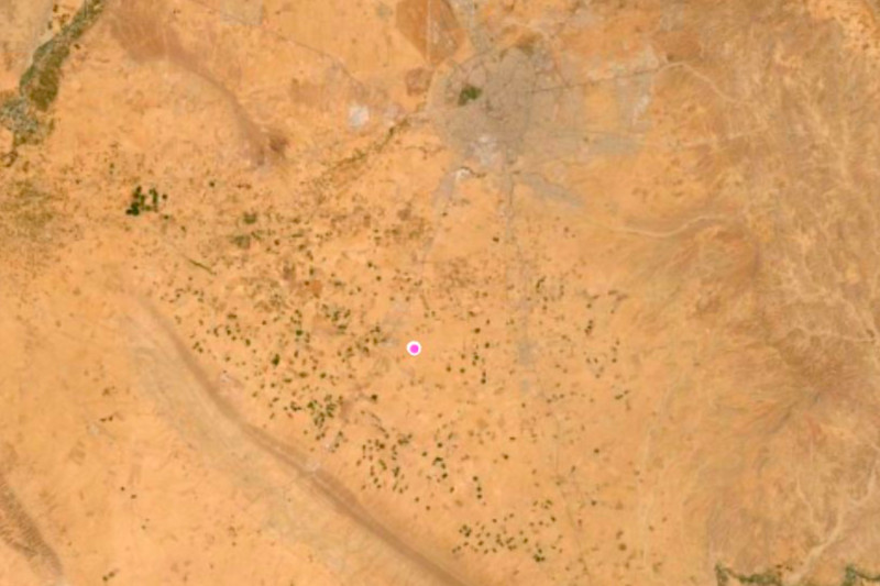
Figure 4: The location of Qach Rresh on the Erbil Plain.

Sophie Vo recently graduated Emory University in May 2023 with a BS in Biology and a BA in Ancient Mediterranean Studies. Having never excavated before, she was eager to learn about the animal remains on the site and learn alongside the project’s zooarchaeologist. Afterward, Sophie continued to explore her interest in archaeology at the Brooklyn Museum in Egyptian, Classical, and Near Eastern Art. There, she utilized her excavation experience to research and examine Egyptian archaeology reports for the objects housed in the collection
 

Want to learn more? Visit the Project’s Website or ASOR’s TikTok and Youtube to hear about Sophie Vo’s field experience!

Want to help more students and early career archaeologists get into the field? Donate to the cause today by selecting “Student Support” as your gift purpose!

ASOR’s Response to October 7 Events

ASOR’S RESPONSE TO OCTOBER 7 EVENTS

ASOR, the American Society for Overseas Research, condemns in the strongest possible terms Hamas’ vicious massacre of more than a thousand innocent non-combatant Israelis on Saturday, October 7, 2023.

ASOR is an organization that fosters a community of scholars across borders. Our mission is to initiate, encourage, and support research into, and public understanding of, the history and cultures of the Near East and wider Mediterranean world. ASOR is apolitical and has no religious affiliation. ASOR has a large and diverse membership that does not speak with one voice about world politics.

We believe strongly that recent attacks by Hamas on Israeli civilians are not politics, but evil acts of terrorism. We agree and reaffirm with the President of the United States that Israel has the right and duty to protect its citizens. We also concur with a recent statement by President Biden that “the extreme elements of Hamas don’t represent all the Palestinian people.”

We grieve deeply with our Israeli colleagues. We also recognize that there is great suffering in Gaza and among the Palestinian people. We are deeply concerned for the well-being of civilians on all sides of the crisis. It is our hope that all of us will recognize and respect our common humanity.