SHARE
[/vc_column_text][mk_image src=”http://www.asortest.org/wp-content/uploads/2017/01/social-fb-icon4.jpg” image_width=”42″ image_height=”42″ hover=”false” custom_url=”https://www.facebook.com/ASOResearch/” margin_bottom=”0″][mk_image src=”http://www.asortest.org/wp-content/uploads/2017/01/social-tw-icon4.jpg” image_width=”42″ image_height=”42″ hover=”false” custom_url=”https://twitter.com/ASOResearch?ref_src=twsrc%5Egoogle%7Ctwcamp%5Eserp%7Ctwgr%5Eauthor” margin_bottom=”0″][mk_image src=”http://www.asortest.org/wp-content/uploads/2017/01/social-in-icon4.jpg” image_width=”42″ image_height=”42″ hover=”false” custom_url=”https://www.linkedin.com/company/american-schools-of-oriental-research” margin_bottom=”0″][mk_image src=”http://www.asortest.org/wp-content/uploads/2017/01/social-ml-icon_7.jpg” image_width=”42″ image_height=”42″ hover=”false” custom_url=”mailto:asor@bu.edu” margin_bottom=”0″][mk_image src=”http://www.asortest.org/wp-content/uploads/2017/01/blog-icon3.jpg” image_width=”42″ image_height=”42″ hover=”false” custom_url=”http://asorblog.org/” margin_bottom=”0″][/vc_column][vc_column border_color=”rgba(255,255,255,0.01)” width=”1/6″ css=”.vc_custom_1493004112151{margin-right: 20px !important;border-left-width: 2px !important;padding-right: 20px !important;padding-left: 20px !important;border-left-color: #99422f !important;}”][mk_divider divider_color=”rgba(255,255,255,0.01)” thickness=”1″ margin_top=”3″ margin_bottom=”3″][vc_widget_sidebar sidebar_id=”sidebar-16″ el_class=”.widget { overflow: hidden; margin-bottom: 0; }”][/vc_column][vc_column border_color=”rgba(170,170,170,0.01)” width=”8/12″ css=”.vc_custom_1487276122024{margin-right: 10px !important;margin-bottom: 30px !important;border-right-width: 2px !important;border-bottom-width: 2px !important;padding-top: 30px !important;padding-right: 30px !important;padding-left: 20px !important;background-color: #ffffff !important;border-right-color: rgba(227,228,228,0.75) !important;border-bottom-color: rgba(227,228,228,0.75) !important;}”][vc_row_inner][vc_column_inner width=”1/3″ css=”.vc_custom_1515089047502{padding-right: 20px !important;}”][mk_image src=”http://www.asor.org/wp-content/uploads/2017/12/foa-reduced-100.png” image_width=”190″ image_height=”100″ crop=”false” hover=”false”][/vc_column_inner][vc_column_inner width=”2/3″][vc_column_text responsive_align=”left”]September 2013
Vol. I, No. 6
[/vc_column_text][/vc_column_inner][/vc_row_inner][mk_divider thickness=”1″ margin_top=”10″][vc_row_inner][vc_column_inner][vc_column_text]
Hazor in the Ninth and Eighth Centuries BCE: From Omri to the Assyrian Destruction
By: Débora Sandhaus
David and Solomon are controversial historical figures, but their successors, especially the Israelite dynasty of Omri, are not. Hazor was a thriving center of the northern kingdom of Israel. Its extensive remains illustrate the life of Iron Age cities as they fell under the shadow of the Assyrian onslaught.
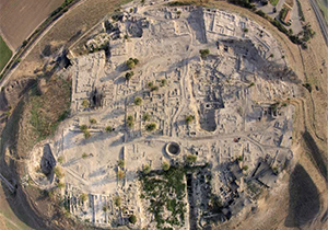
Edited and abridged from NEA 76.2 (2013): 110-117[/vc_column_text][/vc_column_inner][/vc_row_inner][vc_row_inner][vc_column_inner css=”.vc_custom_1548468589825{padding-right: 10px !important;}”][vc_single_image image=”45745″ img_size=”full” add_caption=”yes” alignment=”center” onclick=”img_link_large”][/vc_column_inner][/vc_row_inner][vc_row_inner][vc_column_inner][vc_column_text]The renewed excavations at Hazor concentrated on two areas in the Upper City: Area A in the center of the tell, and Area M on its northern edge. Dense Iron Age habitation was uncovered in both, dating from the earliest phases of the Iron Age, until the Assyrian conquest of 732 BCE. The rich architectural and material remains from the various strata of the Israelite city shed important light on aspects of the life of Hazor’s population during the ninth and eighth centuries BCE.[/vc_column_text][/vc_column_inner][/vc_row_inner][vc_row_inner][vc_column_inner css=”.vc_custom_1548468589825{padding-right: 10px !important;}”][vc_single_image image=”45746″ img_size=”full” add_caption=”yes” alignment=”center” onclick=”img_link_large”][/vc_column_inner][/vc_row_inner][vc_row_inner][vc_column_inner][vc_column_text]
The Ninth Century BCE (Stratum VIII)
The architecture and plan of Hazor reflects dramatic changes between the tenth century BCE to the ninth century BCE.[/vc_column_text][/vc_column_inner][/vc_row_inner][vc_row_inner][vc_column_inner css=”.vc_custom_1548468589825{padding-right: 10px !important;}”][vc_single_image image=”45747″ img_size=”full” add_caption=”yes” alignment=”center” onclick=”img_link_large”][/vc_column_inner][/vc_row_inner][vc_row_inner][vc_column_inner][vc_column_text]The city plan can now be divided into three sections: an area devoted to large-scale storage of agricultural produce, buildings of an administrative nature, and residential buildings. With its impressive defense system, which included the city gate and walls, the citadel, and water reservoir, the city provided security to its inhabitants. The high quality of construction of some of these buildings reflects the existence of a wealthy ruling class.
The earlier city, which was fortified by a casemate wall and a six-chambered gate, was more than doubled in size and expanded toward the east beyond the line of earlier fortifications. The fortifications of the new city, attributed to the dynasty of Omri, consisted of a solid wall that partly utilized the filled-in casemate wall of the tenth century. Yadin’s excavations also uncovered a citadel on the western edge of the tell and a huge water system on the east. These three components—a solid wall, citadel, and water system—provided the city with a defensive system strong enough to withstand a prolonged siege.
The only feature that existed unchanged from the earliest Israelite city (Strata X–IX) until its very end (Stratum V) was the “mound of ruins” in the center of the Upper City: the remains of the Late Bronze Age Ceremonial Palace, destroyed by a conflagration. The Israelite city developed around these ruins but always avoided building on top of them, perhaps as a result of a taboo about the location.
Large new buildings were constructed on top of the earlier Iron Age domestic houses in Area A. Administrative structures were located in the south (see Figure 3, Buildings 12–13), while storage facilities were located in the north of the area.[/vc_column_text][/vc_column_inner][/vc_row_inner][vc_row_inner][vc_column_inner css=”.vc_custom_1548468589825{padding-right: 10px !important;}”][vc_single_image image=”45749″ img_size=”full” add_caption=”yes” alignment=”center” onclick=”img_link_large”][vc_single_image image=”45750″ img_size=”full” add_caption=”yes” alignment=”center” onclick=”img_link_large”][vc_single_image image=”45751″ img_size=”full” add_caption=”yes” alignment=”center” onclick=”img_link_large”][/vc_column_inner][/vc_row_inner][vc_row_inner][vc_column_inner][vc_column_text]Of these storage facilities, two are tripartite and two are large public granaries.
Three buildings of the “four-room house” type were also constructed between the storage facilities complex and the administrative quarter. These were apparently were part of the city’s administrative system. Additional storehouses further attest to Hazor’s role as a central administrative city during the ninth century BCE.
During this phase, a residential quarter also developed to the west of the mound of ruins (see Figure 3, Buildings 14–15). These houses are small and poorly constructed compared to the large administrative structures.
[/vc_column_text][/vc_column_inner][/vc_row_inner][vc_row_inner][vc_column_inner css=”.vc_custom_1548468589825{padding-right: 10px !important;}”][vc_single_image image=”45753″ img_size=”full” add_caption=”yes” alignment=”center” onclick=”img_link_large”][/vc_column_inner][/vc_row_inner][vc_row_inner][vc_column_inner][vc_column_text]Once the plan of Hazor was fixed during the ninth century (Stratum VIII), no significant changes were noted either during that century (Stratum VII) or at the beginning of the eighth century BCE (Stratum VI).Ninth Century BCE (Stratum VII)
The city plan established in earlier in the ninth century BCE (Stratum VIII) retained its overall characteristics and layout in the next stratum (VII).[/vc_column_text][/vc_column_inner][/vc_row_inner][vc_row_inner][vc_column_inner css=”.vc_custom_1548468589825{padding-right: 10px !important;}”][vc_single_image image=”45754″ img_size=”full” add_caption=”yes” alignment=”center” onclick=”img_link_large”][/vc_column_inner][/vc_row_inner][vc_row_inner][vc_column_inner][vc_column_text]Three new buildings (see Figure 8, Buildings 16–18) were constructed next to earlier storehouses, two of which are of the four-room house type). Apart from minor alterations, previously built structures remained in use.[/vc_column_text][/vc_column_inner][/vc_row_inner][vc_row_inner][vc_column_inner css=”.vc_custom_1548468589825{padding-right: 10px !important;}”][vc_single_image image=”45755″ img_size=”full” add_caption=”yes” alignment=”center” onclick=”img_link_large”][vc_single_image image=”45756″ img_size=”full” add_caption=”yes” alignment=”center” onclick=”img_link_large”][/vc_column_inner][/vc_row_inner][vc_row_inner][vc_column_inner][vc_column_text]
Eighth Century BCE (Stratum VI)
The earlier eighth century (Stratum VI) marks the transition from the well-planned city of the ninth century (Stratum VIII) to the haphazardly organized city of the later eighth century (Stratum V). The city’s general layout was maintained, along with the main buildings. But there was significant building activity in the southeastern part of the city that anticipated major changes to come. New structures were constructed on and around the casemate wall (see Figure 10, Building 18). Several administrative buildings continued to be used but their floors were raised and new walls added.
The storehouse and granary area was also reorganized. While some of the storage facilities continued in use with minor changes, the rest were demolished, and several domestic buildings (see Figure 10, Buildings 4–5, 15) were built on top of them. An olive press and associated installations were found in one of these buildings. Although the purpose of these buildings is unknown, their high standard of construction implies that they were part of the administrative network, perhaps the offices of high officials. But buildings of relatively poor quality (see Figure 10, Buildings 16, 17, 18) were found in the northeastern part of the area. These units may have served as a shopping district, as Yadin suggested. Remains in the southern part of the area also suggest the beginning of a new domestic quarter.
[/vc_column_text][/vc_column_inner][/vc_row_inner][vc_row_inner][vc_column_inner css=”.vc_custom_1548468589825{padding-right: 10px !important;}”][vc_single_image image=”45758″ img_size=”full” add_caption=”yes” alignment=”center” onclick=”img_link_large”][vc_single_image image=”45759″ img_size=”full” add_caption=”yes” alignment=”center” onclick=”img_link_large”][/vc_column_inner][/vc_row_inner][vc_row_inner][vc_column_inner][vc_column_text]Eighth Century (Stratum V)
Later in the eighth century (Stratum V) the city plan was completely changed.
Many of the earlier buildings were removed and new buildings were erected but the new city layout seems careless, as is the quality of construction and design.
The city now expanded to the east beyond the limits of the casemate wall. This area now became a densely populated domestic quarter with asymmetrical structures. Before construction it was necessary to fill and level the area, since remains of a monumental Middle Bronze Age subterranean storage facility were still partially preserved.
A large architectural complex (see Figure 12, Building 3), consisting of a structure with thick walls, a large courtyard, and a small structure attached to its southern side, was erected above the oil-press house and the nearby structure of the previous stratum. The southern administrative building (see Figure 12, Building 4) continued to exist with a poorly constructed addition on its west side. In Area M storehouses were replaced by small buildings of the four-room house type and by two round granaries that were filled with charred wheat kernels.[/vc_column_text][/vc_column_inner][/vc_row_inner][vc_row_inner][vc_column_inner css=”.vc_custom_1548468589825{padding-right: 10px !important;}”][vc_single_image image=”45760″ img_size=”full” add_caption=”yes” alignment=”center” onclick=”img_link_large”][/vc_column_inner][/vc_row_inner][vc_row_inner][vc_column_inner][vc_column_text]A wall (see Figure 12, number 5) surrounded the mound of ruins (the remnants of the Late Bronze Age Ceremonial Palace). That these ruins still occupied a position in the heart of the city, almost five hundred years after their destruction, is noteworthy.
In the last phase, on the eve of the Assyrian conquest, the citadel on the western edge of the city, excavated previously by Yadin’s expedition, was strengthened by an offset-inset wall. Hazor was still a dynamic city with impressive buildings, and its remains included a large and varied ceramic assemblage as well as elaborate small objects. But the end was soon upon the city.
[/vc_column_text][/vc_column_inner][/vc_row_inner][vc_row_inner][vc_column_inner css=”.vc_custom_1548468589825{padding-right: 10px !important;}”][vc_single_image image=”45761″ img_size=”full” add_caption=”yes” alignment=”center” onclick=”img_link_large”][vc_single_image image=”45762″ img_size=”full” add_caption=”yes” alignment=”center” onclick=”img_link_large”][vc_single_image image=”45763″ img_size=”full” add_caption=”yes” alignment=”center” onclick=”img_link_large”][/vc_column_inner][/vc_row_inner][vc_row_inner][vc_column_inner][vc_column_text]The End of Hazor and the Kingdom of Israel
Hazor was destroyed in 732 BCE during the Assyrian military campaign led by Tiglath-pileser III. Signs of destruction and devastation were encountered throughout most of the city. In some of the buildings, complete vessels were found on the floors.
[/vc_column_text][/vc_column_inner][/vc_row_inner][vc_row_inner][vc_column_inner css=”.vc_custom_1548468589825{padding-right: 10px !important;}”][vc_single_image image=”45765″ img_size=”full” add_caption=”yes” alignment=”center” onclick=”img_link_large”][/vc_column_inner][/vc_row_inner][vc_row_inner][vc_column_inner][vc_column_text]In others, floors were devoid of finds, suggesting that the inhabitants had abandoned the city before its destruction. After a short gap, Hazor was partly resettled: poorly constructed buildings characterized by flimsy walls, pits, and in one area, the remains of a paved courtyard are evidence of a post-destruction phase that likely represents an attempt by the previous settlers to return and reoccupy the city. This marked the end of the once magnificent city, and with the destruction of the capitol city Samaria, the downfall of the northern kingdom of Israel.* The Editorial is written by the ANE Today Editorial Team and not by Débora Sandhaus.
For further reading on this subject check out these great resources.
Israel Finkelstein, Stages in the Territorial Expansion of the Northern Kingdom
Photo Gallery: Here’s a gallery of all the images that appear in Near Eastern Archaeology 76.2 (2013) for Hazor in the ninth and eighth centuries B.C.E. Smaller versions of some of the images also appear in the text above to illustrate the abridged version of the article found on the ASOR Blog / ANE Today.
[/vc_column_text][/vc_column_inner][/vc_row_inner][/vc_column][/vc_row]