Erin Brantmayer, 2022 Stevan B. Dana Scholarship Recipient[/vc_column_text][mk_divider][vc_wp_text]The summer of 2022 saw my fifth year of archaeological work in Israel. A typical summer abroad for me is four to six weeks of very physical work excavating under the hot Levantine sun, but things were a bit different this time. At the Roman and Byzantine site of Birsama, an unexcavated fort and associated settlement area nestled into the region where the Mediterranean coastal plain meets the arid Negev Desert, I and four other sure-footed archaeologists spent two weeks walking around. Our walks, or transects, were along parallel lines about 700 meters long, north to south, covering an area about 250 meters wide east to west. Along these transects, we recorded pottery strewn on the ground’s surface and collected diagnostic sherds – broken pieces of handles, rims, and bases.
These activities were the meat of our preliminary survey. Surveys conducted before excavation are usually done to help archaeologists get a sense of the area they will be digging and to target areas of high interest. For us, high interest in this case meant the area of the fort and the space adjacent to the fort where people would have lived. Additionally, we located some areas with exposed and disturbed architectural elements, including some wall foundations churned up by agricultural vehicles associated with the nearby peanut farm and a few column fragments.
But fieldwalking wasn’t our only survey component – we also did extensive aerial mapping. My archaeological work applies GIS (geographic information science) and drone- and camera-based photography to ancient sites to better understand the spatial relationships that are often harder to see on the ground. This work is incredibly useful for surveying because it is sometimes easier to see features, like buildings, from the air.
[/vc_wp_text][vc_single_image image=”95994″ img_size=”full” add_caption=”yes” alignment=”center” onclick=”img_link_large” img_link_target=”_blank” css=”.vc_custom_1711554000085{padding-right: 10px !important;}”][mk_padding_divider][vc_wp_text]Using a drone equipped with an RTK module, I took over 2,500 pictures to create an orthomosaic of the nearly one square kilometer that comprises our study area. This is awesome because an RTK (real-time kinematic) DGPS is a type of global positioning system that is accurate at the sub-centimeter level – for reference, your phone is only accurate within five meters! So, a drone with RTK is about 1,000 times more accurate than your average GPS app. That accuracy is built into the orthomosaiced images – multiple overlapping photos that are stitched together to create one larger, continuous image. The result is pinpoint accuracy and incredible detail in a single map, from which features and points of interest can be marked and examined.[/vc_wp_text][vc_single_image image=”95995″ img_size=”full” add_caption=”yes” alignment=”center” onclick=”img_link_large” img_link_target=”_blank” css=”.vc_custom_1711554502413{padding-right: 10px !important;}”][mk_padding_divider][vc_wp_text]Our two weeks in the desert were not without their difficulties – survey can be a hard learning curve when you’re used to digging a square. Finding a program to track our fieldwalking was initially difficult, but I did eventually find an app that could track movements, worked on both Androids and iPhones, didn’t need an internet connection, and was free. I also struggled with learning a new system. That awesome RTK drone was one I’ve never used before. I spent eleven of our twelve days at Birsama trying to figure out how to get the system to work, battling through RTK connection errors, malfunctions, thousands of photos not writing to an SD card, and getting the car stuck at 8 PM in the desert four hours before driving to the airport. Everything was eventually unstuck, literally and metaphorically. Just took some perseverance and a crack team of five sure-footed archaeologists.[/vc_wp_text][vc_single_image image=”95996″ img_size=”full” add_caption=”yes” alignment=”center” onclick=”img_link_large” img_link_target=”_blank” css=”.vc_custom_1711554594647{padding-right: 10px !important;}”][mk_divider][vc_wp_text]Erin Brantmayer is currently a doctoral student at the University of Texas at Austin’s Department of Classics. Her research has two foci: exploring how past societies have understood and made use of their natural landscapes and applying digital tools and techniques to archaeological fieldwork. When Erin isn’t studying the ancient Mediterranean or fieldwalking, she can be found walking her dog, Juno, and cooking.
Project website: https://birsama.wordpress.com/[/vc_wp_text][mk_divider][vc_wp_text]Want to help more students and early career archaeologists get into the field? Donate to the cause today by selecting “Excavation Scholarships” as your gift purpose!

Andrew Bock, 2022 Stevan B. Dana Scholarship Recipient[/vc_column_text][mk_divider][vc_wp_text]As a master’s student applying to doctoral programs in Hebrew Bible, I was interested in applying to departments that housed a Levantine archaeologist in order to broaden my understanding of ancient Israelite society and religion beyond the textual evidence. As a doctoral student at UCLA, I have been able to accomplish this goal by participating in seminars on the Late Bronze Age, Iron Age I, Iron Age II, and Archaeology and Collective Identity. Before these courses, I had no exposure to archaeology or site reports and very little exposure to material culture remains. These classes provided a solid foundation for me to understand the types of data with which archaeologists work and the types of questions they ask. Archaeology and material culture, however, cannot be learned by merely reading articles, books, and site reports. Instead, one must get their hands dirty by moving buckets of dirt and creating balks, looking for changes in soil consistency and color, and washing and examining pottery to truly understand archaeology.
This summer I was afforded the opportunity to dig at Tel Dan and see how archaeologists operate in the field. Area B at Tel Dan was my “classroom” for four weeks. There I learned about archaeological methods, how to use different archaeological tools, the value of teamwork and collaboration in archaeology, and how to better understand how archaeologists reconstruct the spaces they are digging through the objects and architecture that is uncovered. While I could write at length about the different aspects of archaeology and material culture that I learned at Tel Dan, but could not have learned in a traditional classroom, I will narrow my description to three activities: taking elevations, flotation practices, and pottery washing and reading.
One of the first days we were at Tel Dan, Dr. David Ilan pulled me aside and showed me how to use the dumpy level. I had to learn how to calibrate the instrument, take the measurement using the level and pole, and how the numbers for the measurements worked to calculate the specific elevations. From that point on, I was tasked with setting up and calibrating the level each morning, determining the height of instrument for the day, taking the majority of the readings with the level, and teaching others in our area to use the level. Understanding how the dumpy level works and correctly operating the level are important skills on an archaeological dig. The dumpy level allowed us to establish the relative heights of objects and loci. These elevations are important because they help us to reconstruct the spatial dimensions of the area and to identify exactly where items were located and where they were found in relation to other objects.[/vc_wp_text][vc_row_inner][vc_column_inner][vc_single_image image=”95793″ img_size=”full” add_caption=”yes” alignment=”center” onclick=”img_link_large” img_link_target=”_blank” css=”.vc_custom_1711398119242{padding-right: 10px !important;}”][/vc_column_inner][/vc_row_inner][mk_padding_divider][vc_wp_text]During the third week of the dig, we began to perform flotations in order to recover tiny artifacts and plant remains from soil samples. One of the other volunteers was in charge of the flotation process because flotation analysis is a large part of his thesis, and he taught other volunteers, including myself, how the flotation process functions. Flotation begins by slowly pouring your dirt sample into a larger bucket and mixing it with water. One then slowly pours the water out of the bucket and through a fine netting in order to capture the smallest plant remains. The larger amount of sludge left in the bucket is then sifted more thoroughly by placing netting over a bucket that has the bottom removed in order to capture the larger plant remains. In order to sift these larger remains from the sludge, one must climb into the river that emanates from the spring at Tel Dan and use the force of the current to sift the sludge through the netting. The plant remains that we recovered were bagged and tagged so they can be analyzed by specialists in a laboratory in the coming months. The hope is that these seed remains will allow us to reconstruct the diet of the people who were living in this area of Tel Dan during the Late Bronze Age to Iron Age I transition. By understanding the diets of the people who lived in this area, we may be able to postulate about the collective identity of the group living in this area during this time period.[/vc_wp_text][vc_single_image image=”95794″ img_size=”full” add_caption=”yes” alignment=”center” onclick=”img_link_large” img_link_target=”_blank” css=”.vc_custom_1711398286718{padding-right: 10px !important;}”][mk_divider][vc_wp_text]Pottery sherds are the most commonly found object in an archaeological dig. Each dig season, volunteers procure buckets and buckets of pottery from each square. Thus, identifying and dating pottery is critical for dating the different stratigraphic levels and attempting to interpret the use of specific areas. The importance of pottery sherds means pottery washing and reading (the identification and dating of pottery sherds) is one of the most critical exercises of each dig day. This event happens in the afternoon after digging has concluded for the day and the volunteers and staff have eaten lunch. Everyone sits with a pottery bucket filled with water that has soaked overnight. With a scrub brush, one scrubs away the dirt from each piece of pottery so one is able to see the color of the pottery and any paint, decoration, or inscribed marking that may be left on the pottery. Each pottery bucket is then laid on trays to dry overnight so it can be read the next day. Pottery reading involves separating the diagnostic pieces or pieces that can help one identify what type of object from which the sherd comes (i.e., rims, bases, handles, decorated pieces) in each tray. Participating in pottery reading with archaeologists who are pottery experts helped me learn more about pottery typology and the production of pottery than any articles or books about pottery that I had previously read in seminars.
In sum, the hands-on learning at Tel Dan helped me better understand the concepts I learned in my archaeology seminars (especially pottery typology!), the tools and methods used on archaeological digs, and how archaeologists make decisions in real time about what they are finding. Overall, I learned many things about archaeology and archaeological methods while on the dig that I never could have learned in the classroom.
As a final note, I would like to thank the generous donations of Stevan B. Dana who made this extremely educational trip possible for me. With his support, I had the opportunity to excavate at Tel Dan for the 2022 dig season. I would also like to thank Professors Aaron Burke and David Ilan for being so patient with me as a first-time volunteer—your guidance and support this season was invaluable and immensely encouraging.[/vc_wp_text][vc_single_image image=”95795″ img_size=”full” add_caption=”yes” alignment=”center” onclick=”img_link_large” img_link_target=”_blank” css=”.vc_custom_1711398441077{padding-right: 10px !important;}”][mk_divider][vc_wp_text]
Andrew Bock is a doctoral student in the Near Eastern Languages and Cultures (NELC) department at the University of California, Los Angeles (UCLA) who specializes in the Hebrew Bible and Northwest Semitic inscriptions. His research interests include prophetic literature and phenomenon in the ancient Near East, scribal revision techniques in the Hebrew Bible and Akkadian literature, Ugarit, and the intersection of material culture and textual evidence.
[/vc_wp_text][mk_divider][vc_wp_text]Want to help more students and early career archaeologists get into the field? Donate to the cause today by selecting “Excavation Scholarships” as your gift purpose!
The Honors and Awards Committee seeks nominations to serve on the G. Ernest Wright Book Award and Frank Moore Cross Book Award sub-committees. ASOR invites nominations, including self-nominations, from ASOR members who are interested in being considered by the committee for these openings. Committee members will serve a three-year term with the possibility of two consecutive terms. Nominees must fill out the online form by February 17, 2023. The Honors and Awards Committee takes responsibility for determining the awardees for the three book awards, the field archaeology award, the “best poster” award, and the multiple membership service awards that ASOR gives annually; conducting the awards ceremony during the Members’ Meeting at the ASOR Annual Meeting; and discussing and advising the ASOR Board of Trustees about ASOR’s awards, including recommending to the Board the creation of new awards as deemed appropriate.
One candidate is sought for the Frank Moore Cross Award sub-committee. This award is presented to the author/editor of the most substantial volume(s) related to the history and/or religion of the ancient Near East and Eastern Mediterranean. Primary consideration will be given to historical, epigraphic, textual, and comparative literary studies; or to works that advance and/or evaluate new methodological approaches to the literary record(s). This work must be the result of original research published during the past two years. (One award is given annually.)
One candidate is sought for the G. Ernest Wright Award sub-committee. This award is given to the author/editor of the most substantial volume(s) dealing with archaeological material, excavation reports and material culture from the ancient Near East and Eastern Mediterranean. This work must be the result of original research published within the past two years. (One award is given annually.)
In order to receive full consideration by the committee the online form must be submitted by noon EST on February 17, 2023. For questions and concerns, please contact Marta Ostovich (programs@asor.org)
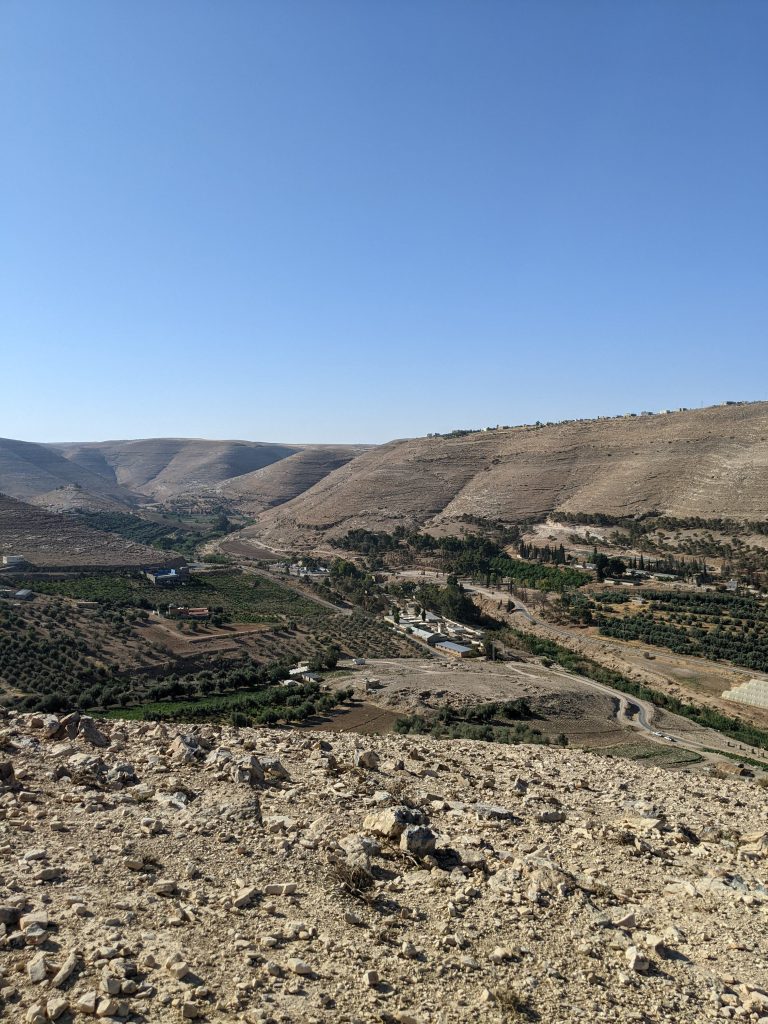
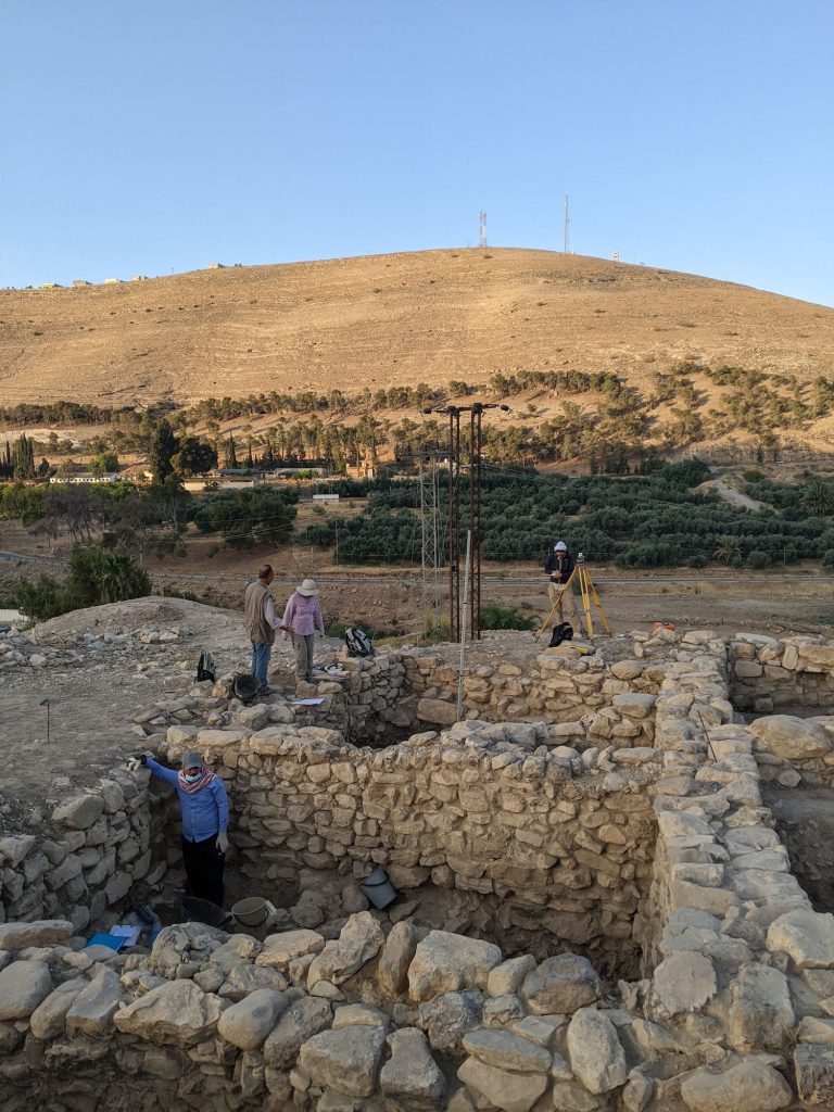
Driving south from the bustling town of Madaba, the sun rises over the rolling plains of the plateau. As we descend into the Wadi al-Wala canyon, the Khirbat Iskandar (KI) mound comes into view. Its position provides visual access east and west along the wadi and south to the slopes that lead into Dhiban. It is easy to see the importance of its position in the landscape. As we climb the gravely path to the site, the sun crests the hill to the east and the light slowly begins to illuminate the EB III and IV contexts in which we have been meticulously working this season.
Khirbat Iskandar and the Wadi al-Wala from above.
Excavations at KI have been ongoing since the 1980s, each season further revealing the site’s significance as an urban settlement during a time often marked by trends of ruralization in the southern Levant. The 2022 field season at KI shed new light on the pivotal Early Bronze III/IV nexus and provided new contexts that help expose the continuation of habitation at the site. We began the season with a clear set of goals divided between three excavation units. With a team of only 10, we were limited in what we could achieve in a set period of time. But with the experience at hand we were able to efficiently and effectively answer questions lingering from seasons before and build upon existing theories about KI’s role during the later EBA. The main objective was to continue to define the phasing for Area C, an excavation field in the southeastern corner of the tell. We aimed to do this by linking loci between trenches with known and new architectural and material phasing. In doing so, we could gain a more well-rounded picture of the associated phasing of the EB IV within Area C and in turn, the EB III/IV horizon.
We were successful in all our excavation goals, but archaeology is about more than just digging. My dissertation research focuses on micro and macro scales of the KI landscape and this field season provided the opportunity to not only develop my understanding of the EB III/IV at the site, but it also allowed me to garner a better appreciation of KI’s position in the greater region. KI’s setting along a possible route of travel is what initially inspired me to explore the connections between EBA sites in the Central Moab area. One of my personal goals this season was to take time to visit other regional sites and the spaces in between to better understand KI’s physical connections to neighboring locales. I was able to do so, moving at my own pace and experiencing these distances between sites, which caused me to think more about other aspects that impact movement and connections between spaces. A visit to the Chalcolithic and EB IA site of Murayghat was particularly impactful. Its position on a plateau surrounded on three sides with slopes covered in dolmens and the fourth side, a sweeping view into the valley below and hilltops beyond, provided a unique context by which to think about the relationships of spaces dedicated to both mortuary and domestic settings and how they could be perceived by visitors. A stop at Bab adh-Dhra’ was likewise a highlight and furthered my interest in the topic of the intersection of the living and dead spaces and how the various uses and perceptions of these spaces may have been communicated throughout the EBA. While I have studied these sites individually and tried to assess their spatial and social proximities digitally, I still lacked the ability to grasp what travel across some of these landforms and distances meant in reality. As I continue to develop my research on landscape-based approaches to the spatial and social connections in the southern Levant, field seasons like this greatly improve my ability to accurately contextualize and represent movement at the time.
Tucker Deady is currently a PhD student at the University of Toronto in the Department of Near and Middle Eastern Civilizations. Tucker’s areas of interest include landscape archaeology, GIS, and the Early Bronze Age of the Southern Levant.
Want to help more students and early career archaeologists get into the field? Donate to the cause today by selecting “Student Support” as your gift purpose!
Dig Cyprus: A Story of Cherishment, Craziness, and Cats
Noah Barton, Undergraduate University Student[/vc_column_text][mk_divider][vc_wp_text]This summer I had the pleasure of attending an archaeological field school in Cyprus with North Carolina State University. The program – Cyprus Archaeological Field School – is directed by two of my past professors and has been occurring yearly since 2017. I arrived in Cyprus on May 20, 2022. The island is beautiful; every turn has a clear blue ocean, incredible mountains and hillsides, or luscious forests. A pleasant surprise was that Cyprus is loaded with wild cats – there are more cats on the island than humans, in fact – and most of them are friendly. The only downside is that it was very humid, but that’s to be expected for an island near the Middle-East in June. The archaeological site I helped excavate is called Makounta-Voules, which appears to have been the home of a copper-mining group between 5000 and 7000 years ago. They used stone tools and had a large interest in picrolite – a bright green stone – which they sculpted into figurines and pendants. In addition to picrolite, our team also searched for evidence of stone tools and pieces of pottery (also known as sherds), bone (human and non-human), and shells that were used to create jewelry.
Every morning, I woke up at 4:20 am and got on a bus with all the other students. We went straight to the site and started working right away. The entire team was divided into groups of four, with three students and one supervisor. The archaeological method of digging is very systematic; each group dug a hole that was square-shaped and 4 meters wide, known as a trench. We usually dug five centimeters down at a time across the entire surface of the trench before digging any farther. In each group, the students worked together to break up the compact dirt with a pickaxe, shovel up all the newly-made piles of loose dirt, and sift through that dirt to find artifacts. We also straightened out the walls of the trench, known as balk walls. After the team got back to the hotel and ate lunch, we spent an hour or two washing the artifacts that we dug up. This was done by scrubbing them with a toothbrush and soaking them in water. About three nights per week, we also had a lecture that was given by one of the supervisors. The topics ranged from the entire history of Cyprus to different processes and ethics in archaeology.[/vc_wp_text][vc_row_inner][vc_column_inner][vc_single_image image=”95649″ img_size=”full” add_caption=”yes” alignment=”center” onclick=”img_link_large” img_link_target=”_blank” css=”.vc_custom_1710779963494{padding-right: 10px !important;}”][vc_single_image image=”95650″ img_size=”full” add_caption=”yes” alignment=”center” onclick=”img_link_large” img_link_target=”_blank” css=”.vc_custom_1710780038183{padding-right: 10px !important;}”][/vc_column_inner][/vc_row_inner][mk_padding_divider][vc_wp_text]
Every Friday we took a break from digging and went on field trips. During each trip, we visited at least one excavated archaeological site, one museum, and one local beach (except Nicosia). In Nea Paphos, we visited Kissonerga and Lemba, the Paphos museum, and Vardas beach. In Palaepaphos, we visited Prastio and Souskiou, Aphrodite’s temple, and Petra Tou Romeou beach, which is the legendary birthplace of Aphrodite. In Kourion we visited Kolossi, the Kourion museum, and Kourion beach. While in Nicosia we visited the Cyprus Museum, which was the most expansive museum of all.
Every Saturday was a free day for the students to do whatever they wanted. On the first free day, my friends and I went on a cruise, where we saw incredible views on the ocean and swam in the clear blue Mediterranean sea. On another free day, my friends and I hiked up Aphrodite’s trail, revealing the best views of the entire trip. I didn’t make any excursions on my fourth free day. Our fifth free day was spent in Nicosia, the country’s capital. My friends and I explored the city and later celebrated one friend’s birthday at bars and clubs.
On the final day, most students took a final exam; I did not as I didn’t need credit for an Anthropology major, and instead wrote two research essays to get credit for my History major. I left Cyprus on June 25, 2022, ending a wonderful five weeks of excavation and adventure.[/vc_wp_text][vc_single_image image=”95651″ img_size=”full” add_caption=”yes” alignment=”center” onclick=”img_link_large” img_link_target=”_blank” css=”.vc_custom_1710780131829{padding-right: 10px !important;}”][vc_single_image image=”95652″ img_size=”full” add_caption=”yes” alignment=”center” onclick=”img_link_large” img_link_target=”_blank” css=”.vc_custom_1710780182039{padding-right: 10px !important;}”][mk_padding_divider][vc_wp_text]Noah Barton is a senior at North Carolina State University, double-majoring in International Studies and History and minoring in Latin. He lives in Raleigh, North Carolina and enjoys history, music, and traveling.
The Archaeological Project’s Facebook Page: https://www.facebook.com/makountavoules/[/vc_wp_text][mk_divider][vc_wp_text]Want to help more students and early career archaeologists get into the field? Donate to the cause today by selecting “Excavation Scholarships” as your gift purpose!
Why is excavating in Hazor such an amazing experience?
Pauline Allaire, 2022 Stevan B. Dana Scholarship for Fieldwork Participation[/vc_column_text][mk_divider][vc_wp_text]Archaeological excavations are always a significant step in the training of an archaeologist. I already had the opportunity to participate in several excavation campaigns but only in France, that’s why I was very elated to be able to participate in this excavation campaign in Israel, on the famous site of Hazor. This experience was rich and exotic in many ways.
At the beginning of the trip, the first step was to take the plane. It was the first time I had to make a trip with a stopover, it was stressful, but once this step was over, the adventure could really begin. As soon as I arrived in Israel, I chose to observe as much of my surroundings as possible to make the most of my memories. The airport was full of people looking for their loved ones, with huge welcome balloons and various posters of all kinds. The last step of my journey was to get to the kibbutz, the place where we were staying during the search. I had to take the train and the bus for almost three hours. Despite some difficulties in finding my way around, I finally arrived at the place thanks to the help of some very nice Israelis, who really did their best to help me. It was so nice![/vc_wp_text][vc_row_inner][vc_column_inner][vc_single_image image=”95641″ img_size=”full” add_caption=”yes” alignment=”center” onclick=”img_link_large” img_link_target=”_blank” css=”.vc_custom_1710776738379{padding-right: 10px !important;}”][mk_divider][/vc_column_inner][/vc_row_inner][mk_padding_divider][vc_wp_text]
Once I arrived at the port, I discovered my living space for the next three weeks. It’s quite different from what you can find in France. The kibbutz is Israeli farming communities where mutual aid is at the heart of life. For example, people who work in the community are housed and fed. The residents can eat together in a large hall. The landscape also surprised me. There are innumerable small hills with evenly spaced trees. Many fruit trees are present, as well as prickly pears. The overall atmosphere is rather desert-like, and it is very hot. Being from the north of France, this was completely different from what I was used to seeing. The animals were also surprising. If I was lucky enough to meet few scorpions and snakes, the countless lizards never ceased to make me smile, climbing trees, running around and sometimes even fighting.
Finally, of course, the archaeological site of Hazor filled my eyes with stars. This is a very special archaeological site. It is one of the largest sites in Israel. It is located north of Lake Tiberias. It can be divided into an “upper city” which is on a tell, a kind of hill, and a “lower city” which is much larger, as is often the case in the Near East, with a total area of about 80 hectares. There are temples, palaces, and administrative buildings. It is an important site essentially for the Bronze and Iron Ages, from 2600 BC to its destruction by the Assyrians in 732 BC. It was identified in 1875. It has been inscribed on the UNESCO World Heritage List since 2005. And today it is also a national park.[/vc_wp_text][vc_single_image image=”95642″ img_size=”full” add_caption=”yes” alignment=”center” onclick=”img_link_large” img_link_target=”_blank” css=”.vc_custom_1710776429463{padding-right: 10px !important;}”][mk_divider][vc_single_image image=”95643″ img_size=”full” add_caption=”yes” alignment=”center” onclick=”img_link_large” img_link_target=”_blank” css=”.vc_custom_1710776465463{padding-right: 10px !important;}”][mk_divider][vc_row_inner][vc_column_inner][vc_wp_text]It is also a biblical site and is mentioned several times (eighteen times). One of the strata is said to have been built during the reign of Solomon, the prophet and king of Israel in the Bible. The excavation campaign was led by Professor Amnon Ben-Tor, assisted by Igor Kreimerman and Deborah (Deby) Sandhaus. The focus this year was on Area M, which was the supposed entrance to the Bronze Age palace and storage areas. The aim was also to find the stairs of the palace. Although I was used to digging and already knew some of the excavation methods, it was still a learning session. I learned to understand the layering of stratigraphic layers. For example, learning which pavement above which pavement or which walls are from the same period. The best moment to teach my eye to recognise archaeological remains was certainly the reading of ceramics. In the evening, at about 5 p.m., we would meet up with the other excavators from our area, M69 for me, to analyse the ceramics that we had washed in the morning. We had to understand the damaged fragments of pottery to find the type of container and to give a date. The pieces that interested us were the characteristic pieces such as the lips and the hooves if they had seals or marks. The next step was to define the orientation of the lip to find the opening of the container and thus to define its type: jar, crater, cooking pot, etc. Finally, it was necessary to establish a dating, essentially Bronze Age or Iron Age depending on the decoration or the material. This is something that I found very interesting because it allowed us to use our knowledge concretely, and we had to adapt to each little piece that was in front of us. This site was impressive because of the size of the archaeological site, but also because of the discoveries, each one more interesting than the other. I can’t wait for all this to be published.[/vc_wp_text][vc_single_image image=”95644″ img_size=”full” add_caption=”yes” alignment=”center” onclick=”img_link_large” img_link_target=”_blank” css=”.vc_custom_1710776634696{padding-right: 10px !important;}”][mk_divider][vc_wp_text]Finally, one of the last elements that makes this workcamp a rich experience is its international aspect. Indeed, although the workcamp is under the supervision of the Hebrew University of Jerusalem, there are students and volunteers of all nationalities. For example, this year I was able to meet American, Swedish, Spanish, and of course Israeli students. This great diversity of cultures is for me one of the strong points of this workcamp. It allows us to compare points of view, to understand each other’s visions and ways of learning. But also, to laugh at each other’s clichés and to learn about new cultures.
It is for all this that I am very grateful to have been able to participate in this experience thanks to the ASOR association and my benefactor Mr. Stevan B. Dana. I would also like to thank my various colleagues on the dig for their good atmosphere and their motivation, as well as the people in charge of the dig for their transmission of knowledge and their patience.[/vc_wp_text][/vc_column_inner][/vc_row_inner][mk_divider][vc_wp_text]Pauline Allaire completed her undergraduate degree at the Ecole du Louvre in Paris and is currently studying for a master’s degree in the history and archaeology of the ancient worlds, specialising in Egyptology, at the Université Paul Valery Montpellier 3 (France).
Website: http://www.hazor-excavations.org/[/vc_wp_text][mk_divider][vc_wp_text]Want to help more students and early career archaeologists get into the field? Donate to the cause today by selecting “Excavation Scholarships” as your gift purpose!
2022 Study of Collections Fellowship Report: The Unpublished Materials of Charles Clermont-Ganneau
Matthew J. Suriano, University of Maryland
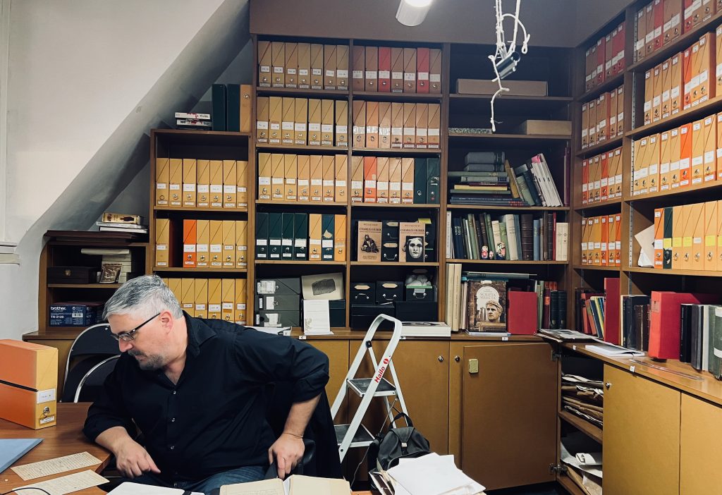
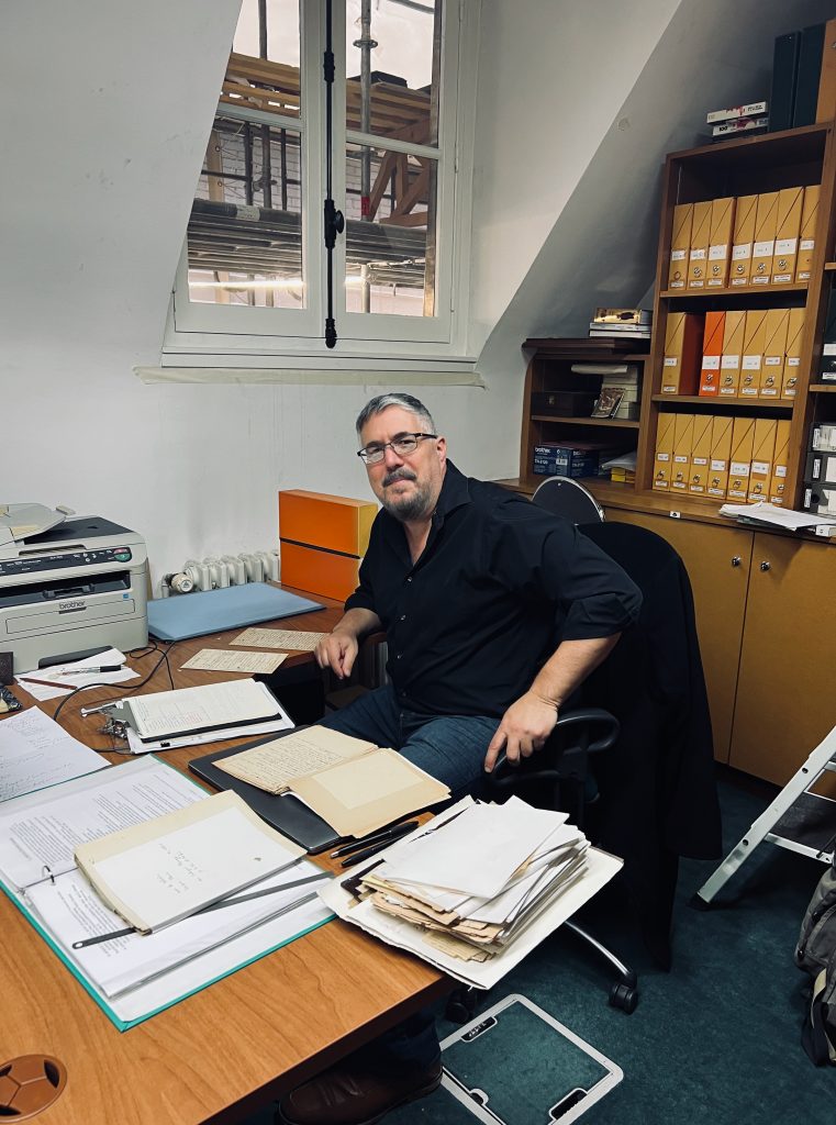
Through the support of the Collections Fellowship I was able to spend several days in Paris working at the Institut de France in the Académie des inscriptions et belles-lettres (AIBL). There, I studied the unpublished materials of Charles Clermont-Ganneau that are in the Cabinet du Corpus Inscriptionum Semiticarum (CIS). Access to this collection was granted by the kind permission of Christian Robin, the AIBL’s director. In Paris, I worked with Maria Gorea, the director of the Cabinet du CIS, where I benefited from her knowledge of Clermont-Ganneau and her ability to decipher his difficult handwriting. Dr. Gorea and her student Noémie Carpentier also were of great assistance with French technical terms that I came across in Clermont-Ganneau’s writings.
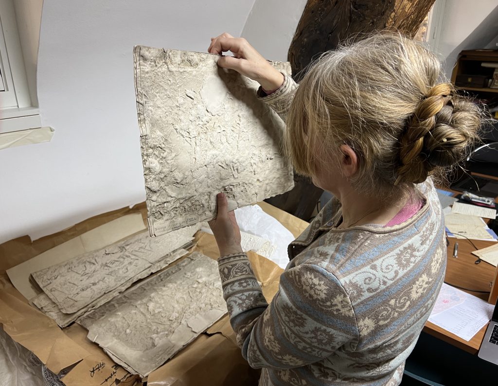
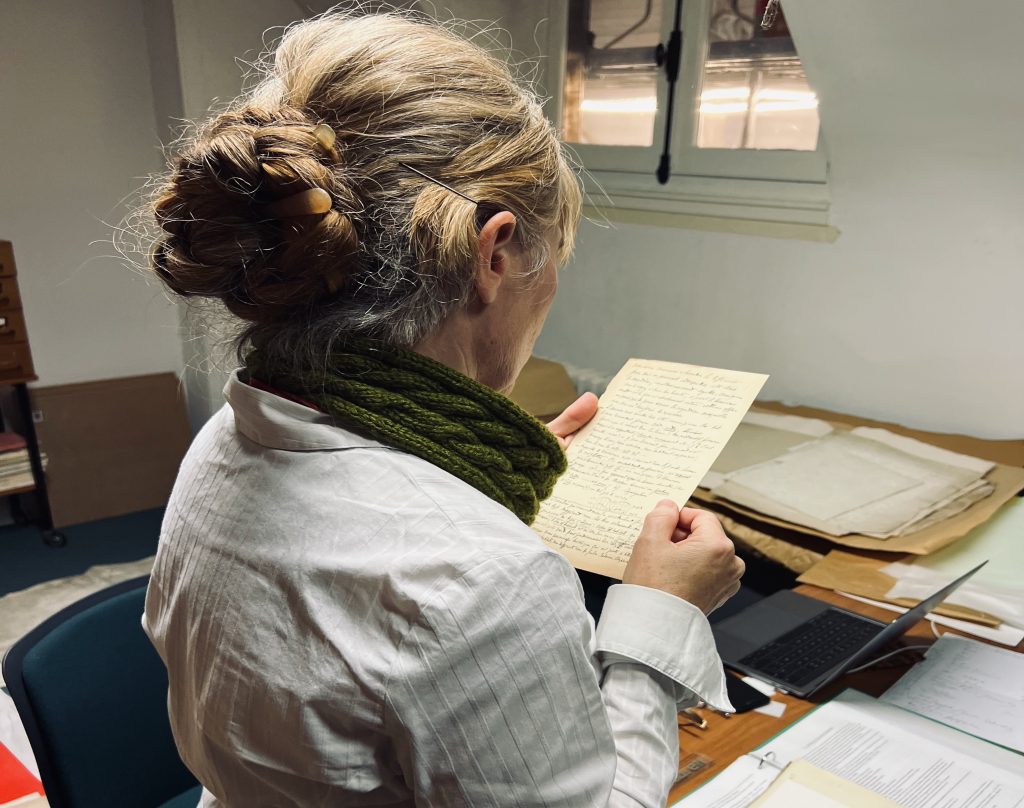
The research is part of my larger project on the Hebrew funerary inscriptions from Silwan, which include the Royal Steward Inscription. That inscription together with a shorter inscription were first documented by Clermont-Ganneau in Silwan in 1870. He eventually purchased them for the British Museum, where they reside today. This summer in London I was able to study Clermont-Ganneau’s correspondence with the British Museum in the museum’s archives. My work in Paris, supported by the ASOR Collections Fellowship, continued my investigation into the acquisition of the artifacts. Clermont-Ganneau’s papers in the Cabinet du CIS shed important light on two aspects involving the Hebrew epigraphic sources. First his papers describe the French diplomat / archaeologist’s efforts to buy the inscriptions from the Arab homeowner in Silwan, including details on how the inscriptions were extracted. Much of this information was left out of his 1899 published account of his discovery. Second, his notes, drawings, squeezes and casts (plaster and papier-mâché) reveal the extent of his work to translate the inscriptions, as well as his plans –ultimately unfilled– plans to publish them.
Access to Clermont-Ganneau’s papers was critical for my project, which seeks to publish the first comprehensive edition of the funerary inscriptions from Silwan. My collections study in Paris will allow me to write a chapter on the history of research that provides insight into the events that led to the acquisition of a famous Hebrew artifact from Jerusalem that is today prominently displayed in the British Museum.
Interested in applying for a 2023 Study of Collections Fellowship? The deadline is February 28.
Find One — Fund One: 2023 ASOR Scholarships and Grants
ASOR plans to celebrate our 123rd year (2023) by awarding more than $223,000 in fellowships, scholarships, and grants! This extraordinary commitment to our members has been made possible by you, our members and donors, who have established endowments or made annual contributions to these programs.
2022 William G. Dever Fellow, Krysta Fauria, at Legio, Israel.
We invite you to FIND ONE (a scholarship, fellowship, or grant) or to help FUND ONE (designated gifts to enable us to award even more, or unrestricted gifts to help with the costs of administering and distributing the awards).
The deadline to apply for fieldwork scholarships and grants is a little over a month away (February 15 for scholarships, February 28 for grants). We invite you to apply and to share the word through your social media and other networks (please share this post).
Scholarship recipient Kathleen Forste teaches Menorca Archaeological Project (Spain) team members how to recover plant remains and microartifacts through flotation.
ASOR is able to provide these scholarships with the partnership of you, our many members and donors. You are enabling ASOR to establish new scholarships and grants through endowed funds, but your annual support (i.e., gifts this year) will allow ASOR to send more eager students and early-career scholars into the field. Please support archaeology’s next generation by making a gift today.
Because of the ongoing pandemic, your gifts are especially needed this year (2023) to fund membership and annual meeting scholarships. Your gifts to the Annual Fund (unrestricted) help defray the costs of administering and distributing the growing number of scholarships and grants. You may also make a designated gift by choosing any category from the drop-down menu on the donations module.
Please spread the word and don’t hesitate to contact us if you have any questions (e-mail or call [703-789-9233]).
In the fall of 2021 ASOR President Sharon Herbert formed an Ad Hoc Committee on the Climate Impact of ASOR activities with particular attention to the Annual Meeting. That committee presented its report to the Board of Trustees at its 2022 November meeting in Boston. The committee outlined various alternatives for reducing ASOR’s carbon footprint. ASOR’s standing committees will be studying the report over next three months and recommending actions to the Board at its April 2023 meeting. We would welcome comments from our members. Please email your comments to info@asor.org.
Kissonerga-Skalia: Denise L. Gold Grant Report 2022
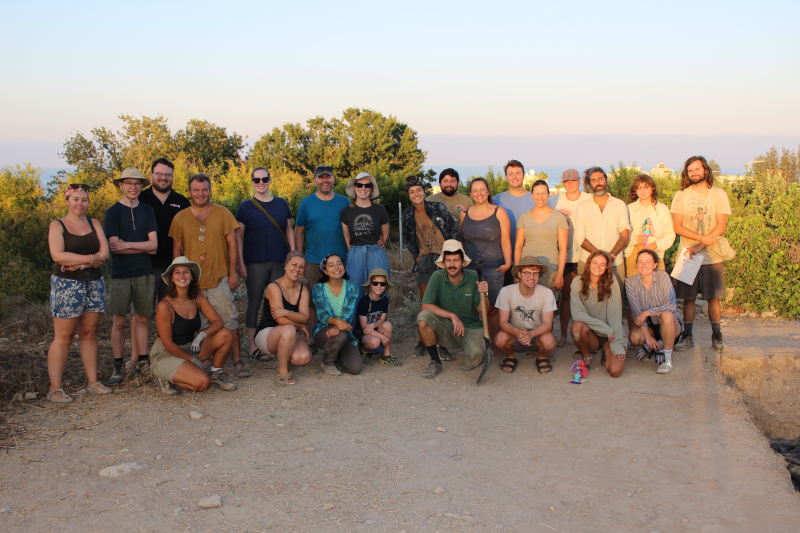
2022 marked a return to excavation at Kissonerga-Skalia in western Cyprus after a hiatus of three years due to the pandemic. As you can see in the team photo (figure 1), we were all extremely excited to be back in the field. Many of our student excavators had gone through nearly their entire degrees without having the opportunity to gain practical experience in the field and were keen to learn and take part. We are very grateful to have received a 2022 Denise L. Gold Project Grant to assist with the expenses in the field and to put towards the costs of obtaining radiocarbon dates.
Figure 1: The end of season photo of the Kissonerga-Skalia team.
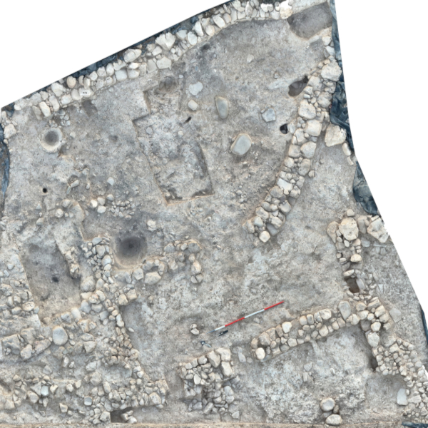
Kissonerga-Skalia is a Bronze Age settlement located near the coast 10km north of Paphos. It lies adjacent to the Neolithic–Chalcolithic settlement of Kissonerga-Mosphilia, excavated and published by Prof. Eddie Peltenburg in the 1980s–1990s. It appears that during a key period of social transformation between the Chalcolithic and Early Cypriot Bronze Age (c. 2500 BC) the people of Kissonerga abandoned their roundhouses and moved 500m down towards the sea, to establish their village in new fields, along with a new style of rectilinear architecture. The settlement prospered for around 800 years until around the end of the Middle Cypriot Bronze Age (c. 1750 BC) when the domestic structures were built over with a large industrial complex that comprises working areas for grinding, processing and heating materials (including the production of beer), along with wide open spaces with trampled mud plaster floors, partially enclosed by a large curvilinear wall. One area of these industrial facilities is shown in Figure 2, where you can see large grinding stones for processing material and circular pits for holding large storage vessels. This final phase was only in use for a short time before the site was completely abandoned, around 1650 BC, at another key period, the transition to the Late Bronze Age. At this time Cyprus saw another islandwide settlement shift connected to the rise of seaborne trade in the Mediterranean, with new sites established that would eventually become the Late Cypriot towns. This abandonment gives us the opportunity to examine the time during which Cypriot settlements begin to diversify and the first ‘monumental’ structures were created.
Figure 2: View of industrial area P/B2 with grinding installations in top right.
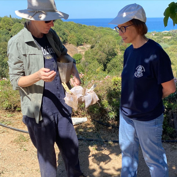
Figure 3: Project archaeobotanist Dr Leilani Lucas showing US Ambassador to Cyprus, Judith Garber, the flotation process during a visit to the site.
Cypriot archaeological sites are notoriously poor in archaeobotanical material, leading to the situation where the transition from the Middle–Late Cypriot Bronze Age is still dated only through relative chronologies. Therefore, one of our aims this season was to retrieve short-lived carbonised remains such as nuts and seeds from secure contexts for radiocarbon dating. We were fortunate that our archaeobotanist, Dr Leillani Lucas (shown in Figure 3), was able to retrieve a lentil and a grape seed! Part of the Denise L. Gold grant funds will be used to date these finds, along with samples retrieved in previous seasons, to help us to pin down the timing of this exciting and dynamic period.