Shepard Urgent Action Grant Report: Umm Al-Qurun on the Darb Zubaydah

2024 Shepard Urgent Action Grant: The Rest-stop and Minara of Umm Al-Qurun on the Darb Zubaydah

Rajwan Al-Maiyali (University of Al-Qadisiyah), Richard Wilding (Eye on Heritage)

The Darb Zubaydah

For centuries before the advent of modern air travel, pilgrims travelled long distances by land and sea. In addition to their religious function, pilgrimage routes also served as important arteries for commercial and cultural exchange. The hajj (the annual Islamic pilgrimage) routes followed pre-Islamic trade pathways but gradually evolved to accommodate the specific needs of Islamic pilgrimage. Various routes emerged and flourished during different historical eras, adapting to the rise and fall of successive Islamic empires

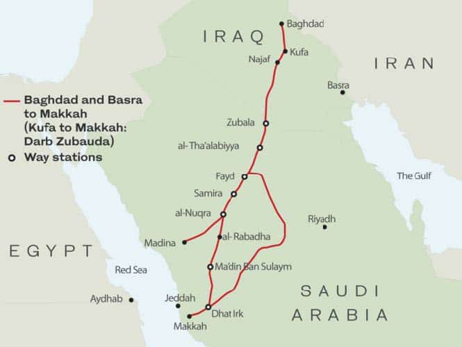
The route connecting the Iraqi cities of Kufa and Baghdad to Makkah was known as the Darb Zubaydah. It grew in importance during the first hundred years of the Abbasid Caliphate from 750 to 850 CE, a period renowned as a golden age of Muslim civilisation. The flourishing Abbasid economy greatly increased the numbers of pilgrims able to undertake the journey to Makkah, exerting greater pressure on the limited water and food resources available in a 1,300 km stretch of desert with no permanent lakes or rivers.

The Darb Zubaydah was named in honour of Zubaydah bint Jafar, wife of the Abbasid Caliph Harun Al-Rashid, recognising enhancements made to infrastructure along the route under her patronage. Zubaydah had witnessed the hardships endured by pilgrims when undertaking the hajj in 792 CE and dedicated her considerable power and resources to improving pilgrims’ safety and comfort.

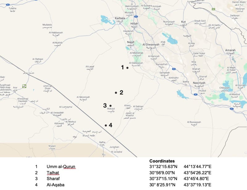
The route of Darb Zubaydah and its waystations.

The Abbasids originally constructed a series of 27 stations between Kufa and Makkah at intervals suited to the travelling speed of donkeys, horses and camels. They were built at regular distances calculated in barid, a unit of measurement also meaning “postal service”, reflecting the postal and intelligence network that developed alongside the pilgrimage trail to help the Abbasid Caliphs maintain communication and control across their wide empire.

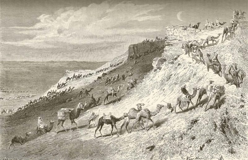
An additional 27 intermediate stations were later added to cater for the increasing number of pedestrian pilgrims, while improvements were also made to the original 27 main stations. The new and enhanced infrastructure included a system of wells, cisterns and dams to provide water for travellers and their animals. Caravanserais, palaces and forts were constructed to improve the pilgrims’ safety and comfort, and some stretches of the route were paved. A series of milestones and markers were installed, with the addition of lighthouses to guide pilgrims who often travelled at night to avoid the daytime heat.

Camel caravan travelling at night, depicted in an engraving by Gaston Vuillier to illustrate the story “A Pilgrimage to Nejd, the Cradle of the Arab Race”, by Lady Anna Blunt, 1878-1879.

In the 10th century, a break in relations between Iraq and Makkah affected the ability of Iraqi and Persian Muslims to undertake the pilgrimage, leading to the progressive decline of the Darb Zubaydah. It was partially revitalised in the 11th century, but never recovered the status of its heyday in the 8th century.

The final organized pilgrimage was carried out in 1243 CE during the reign of Al-Musta’sim, the 37th and last Abbasid caliph ruling from Baghdad. In the following centuries, the trail was almost completely abandoned by pilgrims who forged new routes to Makkah. The last two centuries have seen even more dramatic changes to hajj travel, with the emergence of European maritime companies, the opening of the Suez Canal, the Ottoman Hijaz railway, and finally the arrival of air transport from the mid-20th century.

UNESCO Nomination

The Darb Zubaydah is a transnational nomination for UNESCO World Heritage Site status, jointly submitted by the Republic of Iraq and the Kingdom of Saudi Arabia. It comprises a series of key stations dating from the Abbasid period on the route between Kufa and Makkah. This nomination is part of a long-term programme that also aims to inscribe other hajj pilgrimage routes including the Egyptian and Syrian hajj roads.

The section of the Darb Zubaydah located in present-day Iraq covers approximately 1/5th of the total length of the route, while the other 4/5th is located in present-day Saudi Arabia. The nomination includes 13 sites, four in Iraq and nine in Saudi Arabia. The four sites in Iraq, from north to south, are the stations at Umm al-Qurun, Talhat, Sharaf and Al-Aqaba.

Umm Al-Qurun

The pilgrim station of Umm Al-Qurun lies 56 km south of Kufa in the Wadi Al-Seba’. It is the first surviving rest-stop on the Darb Zubaydah heading south from Kufa towards Makkah, and the northernmost site of the UNESCO transnational nomination.

The site comprises a pilgrim station complex equipped with water and residential facilities, and a unique surviving example of a manara, or lighthouse, built to guide pilgrims travelling by night.

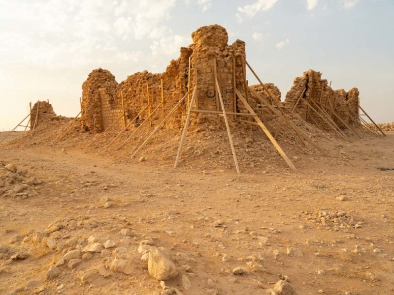
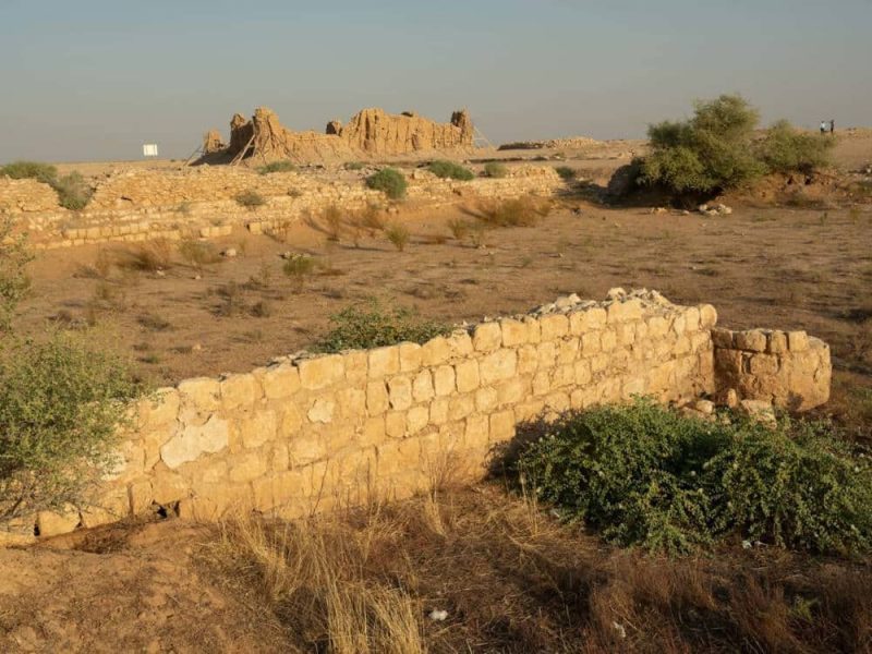
South and East sides of rest house (qsar), September 2024.

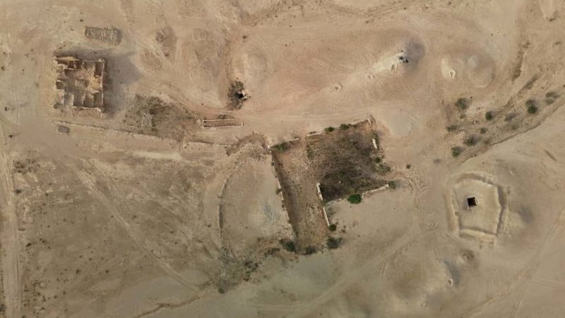
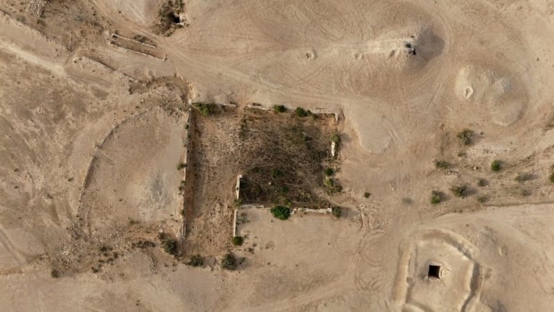
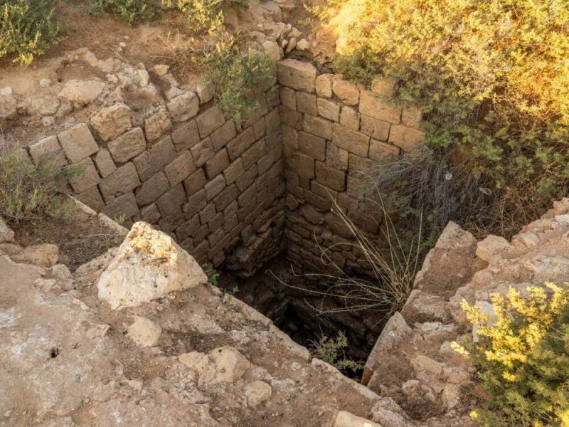
The station complex includes a square-shaped rest house (qsar), two basins (birkat) and two square wells. Although largely filled with sand, the basins are covered with a sparse wild vegetation that indicates more humid soil in contrast to the surrounding desert.

Aerial view of station complex showing rest house (top left), basins (centre) and wells (right and upper centre), September 2024.

The lighthouse of Umm Al-Qurun stands alone in the desert 1.35 km from the station. Its separate location was possibly due to the need for siting on higher ground, whereas the station complex needed to be located at a lower elevation for water collection and wells.

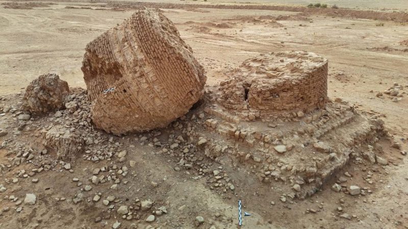
The lighthouse tower has collapsed at an undefined date. The remains of the fallen tower reveal an interior made of fired bricks that likely contained a staircase to access the roof. The cylindrical tower, decorated externally with geometrical patterns, was built over a two-meter- high stone square substructure, and probably reached a total height of 12 metres.

View of manara showing the collapsed cylindrical section and the foundation section, September 2024.

Contemporary developments

Being the closest surviving station on the Darb Zubaydah to the city of Najaf, the surviving architecture at Umm Al-Qurun, especially the lighthouse (manara) and rest house (qsar), has been vulnerable to intentional and unintentional damage. Both structures are now in an extremely vulnerable state and in need of greater protection and stabilisation.

One particularly concerning development is the construction of a modern tarmacked road from Najaf along the route of the Darb Zubaydah. In addition to potentially disrupting important archaeology relating to the hajj route, the road passes extremely close to the site of Umm Al- Qurun, even passing between the station complex and manara.

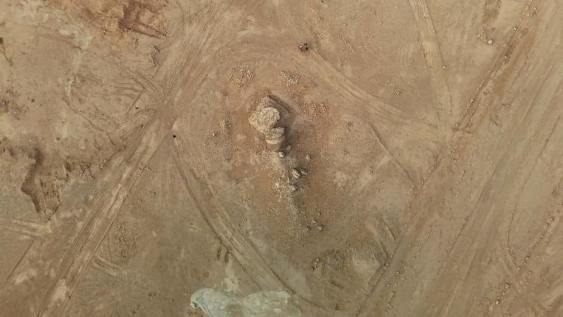
Groundworks associated with the road building have resulted in the digging of numerous ditches close to the manara, and tracks left by bulldozers demonstrate how easily damage could be inflected, even unintentionally, to this unique historical structure. The road will also improve access to the site by private and commercial traffic from Najaf, increasing the risk to these unprotected sites.

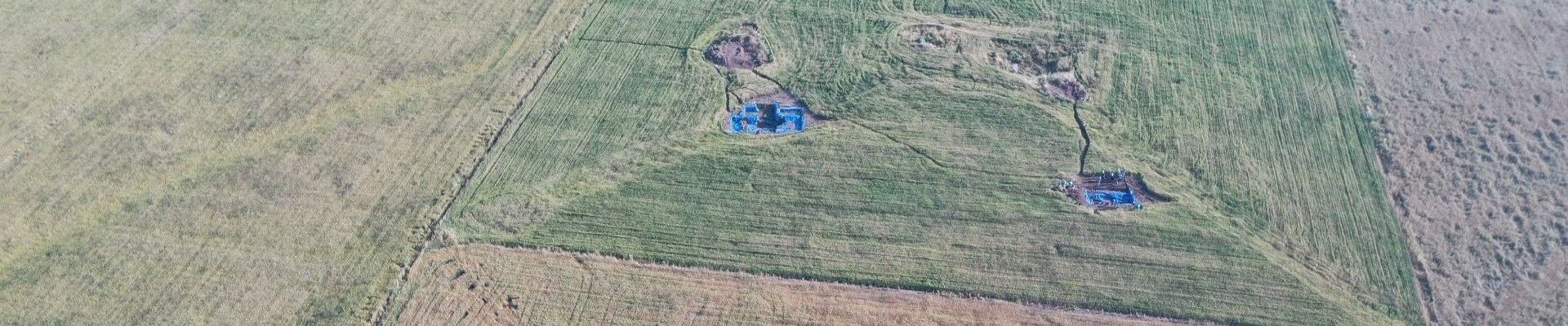
Aerial view of collapsed manara at Umm Al-Qurun showing tracks and ditches, September 2024.

Project Outcomes

Funding from ASOR has allowed the project team led by Rajwan Al-Maiyali from the University of Al-Qadisiyah and heritage consultant and photographer Richard Wilding to complete the following measures:

    1. Emergency protection measures around the manara including the erection of a protective fence and covering of the manara
    2. Documentation through photography and drone filming of all structures at Umm Al- Qurun in their current state of preservation.
    3. Community engagement with local stakeholders to increase awareness of the site’s importance and need for greater protection
 

Emergency protection measures

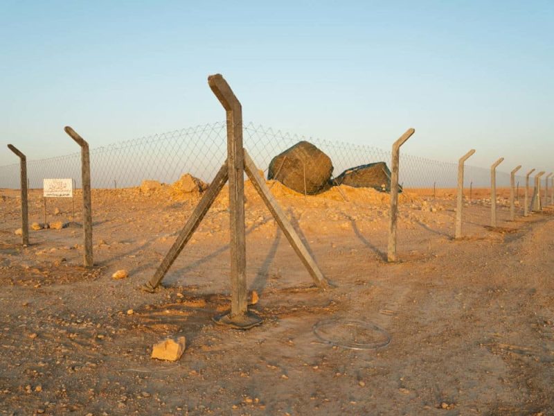
The most urgent undertaking has been to erect a fence around the manara, which was undertaken in early September. This emphasizes the historical importance of the structure and prevents any unintentional damage to the site through bulldozing or other groundworks.

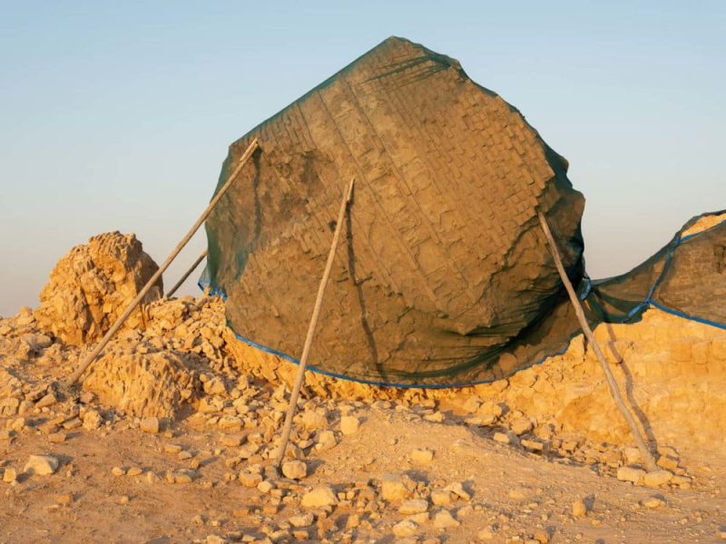
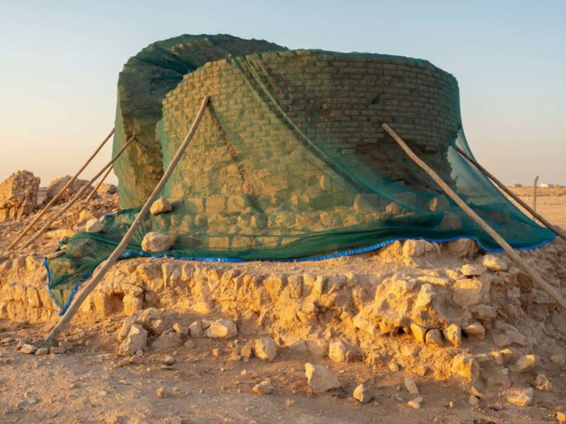
Additionally, the two main sections of the collapsed manara have been covered with protective netting to prevent erosion.

Fencing installed around manara site, September 2024.
Protective netting installed over cylindrical section of manara, September 2024.
Protective netting installed over foundation section of manara, September 2024.

Photographic Documentation

In addition to photographing the manara before and after the emergency protection measures, the team has also undertaken photography and drone filming of the other structures at Umm Al-Qurun, including the rest house (qsar), basins (birkat) and wells.

Aerial view of cisterns showing vegetation, September 2024.
Cistern walls with qsar in distance, September 2024.
Small well, September 2024.

Community Engagement

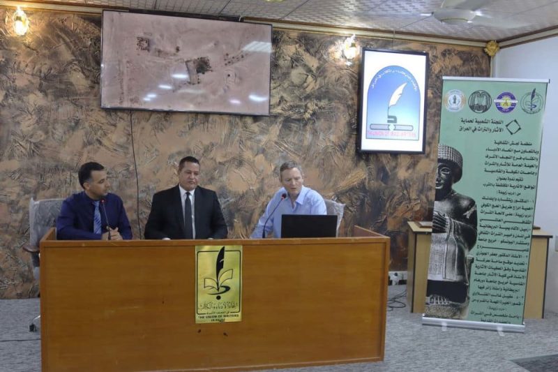
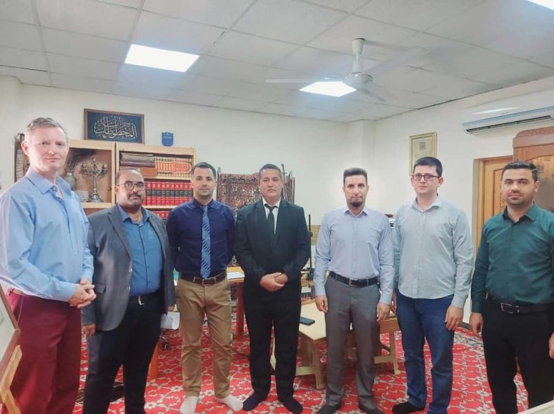
On 14 September 2024, as part of the project’s public outreach and engagement efforts, Rajwan Al-Maiyali and Richard Wilding gave presentations about Umm Al-Qurun and the Darb Zubaydah in a seminar hosted by the Association of Literature and Writers in Najaf. Following the presentations, the team answered questions posed by the audience. The event was subsequently broadcast by two national television stations in Iraq.

Further outreach work is being undertaken through visits to elders at the Great Mosque of Kufa and a forthcoming workshop being organised with the Karbala Holy Shrines Endowment.

Seminar hosted by the Association of Literature and Writers in Najaf, 14 September 2024.
Team visit to the Great Mosque of Kufa, 14 September 2024.

President-elect Jane DeRose Evans’s Vision Statement

PRESIDENT-ELECT JANE DEROSE EVANS’S VISION STATEMENT

Jane DeRose Evans was elected as ASOR’s next President by the Board of Trustees during the Annual Meeting in November 2024. Jane will serve as the President-elect during 2025 as current President Sharon Herbert finishes her term. Below is her vision statement for ASOR:

ASOR is in a very healthy place overall – we have an active annual meeting where important information is shared and discussed; we produce excellent publications; we provide support for fieldwork of different kinds; and we have strong support in terms of development from a host of members. Because of ASOR’s health and size, we have been able to shift out of crisis mode and into long-range planning mode. I suggest that this long-term planning would include broadening ASOR’s audience for its programs, publications, and outreach. This includes scholars of ancient history, archaeology, Biblical studies, cultural heritage, digital humanities, and philology, as well as serious laypersons who are interested in these same topics. We can ensure the long-term viability of ASOR by bringing younger members into positions of responsibility, making sure that they have a voice in the future of ASOR, and that we readily acknowledge their contributions of time, thought, and work to the organization. We do not need to, nor should we, replicate other learned societies, but we need to provide programming and member opportunities to learn about and work in regions or areas of specialty that are specific and of interest to the membership.
2024 Dana Grant Report: Modeling Punic Space at Motya

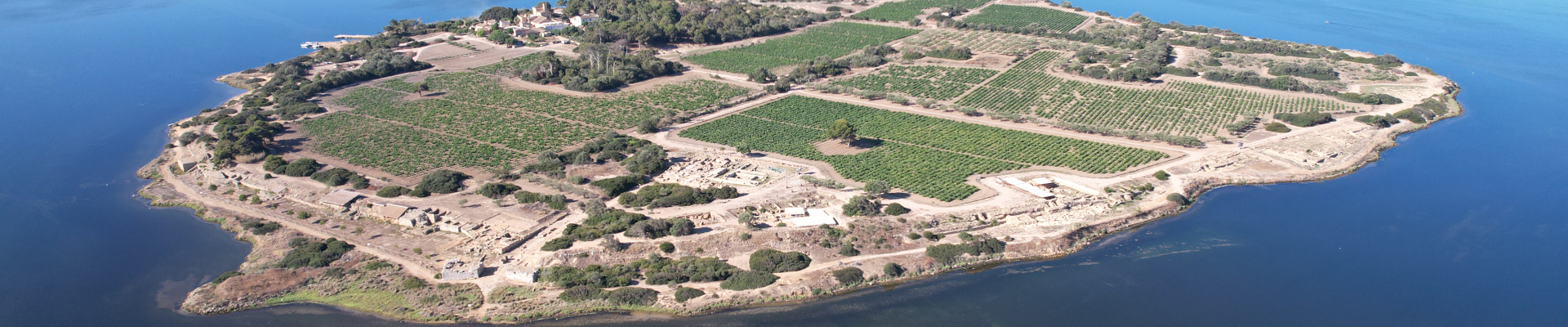
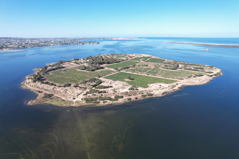
Aerial view of the island of Motya, Sicily, Italy.

2024 Dana Grant Report: Modeling Punic Space at Motya

Jason Herrmann, University of Pennsylvania and Paola Sconzo, University of Palermo

Ancient Motya (modern Isola San Pantaleo, Sicily, Italy), founded in the late 8th century BCE by Phoenician wayfarers, was a significant hub in the central Mediterranean, serving as a crucial point of contact between Carthage and Sicily at the city’s height in the 5th century BCE. Unlike many other Phoenician-Punic urban centers, Motya has remained largely undisturbed by subsequent occupations, offering archaeologists a rare and valuable opportunity to study Punic urban planning in its original context.

Since 2017, we have been conducting comprehensive geophysical surveys on the island for the Space and Identity at Ancient Motya project. Our goal is to map the layout of the city’s structures and to use their configuration to interpret Motya’s social organization and expressions of ethnic identity. This project is a collaboration between the University of Palermo and the Penn Museum and operates as a subproject under the University of Palermo Archaeological Mission to Motya, with the support of the Superintendency for Cultural and Environmental Heritage of Trapani.

View of Motya
Fig. 1. Motya was situated on an island in the Marsala Stagnone in western Sicily. By the 5th century BCE, the fortified city of Motya covered the entire island and was connected to the Sicilian mainland by a causeway, now submerged and visible in the foreground of the above image.
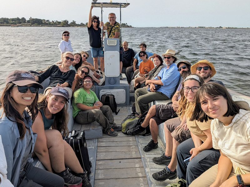
Students and team members on the boat to site.
Fig. 2. Many students and team members were housed on the Sicilian mainland and traveled by boat to and from Motya daily for fieldwork.

Thanks to the support of the ASOR Stevan B. Dana Grant, our multidisciplinary project was able to continue with the assistance of an international team of eleven students from the University of Palermo and the University of Pennsylvania. These students contributed to both the geophysical survey and the ongoing excavations carried out toward two primary objectives. The first was to expand the geophysical survey coverage beyond the areas that were accessible for magnetic gradiometry in previous years. To this end, ground-penetrating radar (GPR) and electrical soil resistance helped to document subsurface features where vegetation or other surface conditions made magnetic gradiometry unfeasible.

Our second goal was to further investigate ambiguous features observed in the magnetic gradiometry that required additional clarification. One area of particular interest was a depression in the northeast sector of the island where magnetic data were inconclusive. Here we employed GPR, a technique that measures how radio waves are reflected off changes in the textures of buried materials. Preliminary results show that, unlike the rest of the island, this area was not covered with streets and houses during Motya’s urban expansion, suggesting that it was reserved for some special purpose.

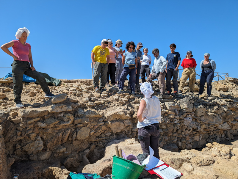
Excavation of Motya's fortification wall.
Fig. 3. Excavation continued in protected contexts adjacent to the Motya’s fortification wall where early 6th and 7th century contexts are preserved.
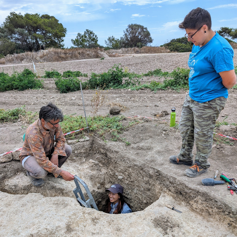
Team members in pit revealed by magnetic gradiometry data.
Fig. 4. Features observed in the geophysical data from previous seasons were verified through test excavations, including a deep pit that was visible in the magnetic gradiometry data and seemed to date to the early 6th and 7th centuries BCE. From left: Prof. Giuseppe Minunno, Helen Wong and Sarah Maria Messina.

We were also interested in determining the depths of key features across the island to aid the development of a digital reconstruction of the ancient city and landscape. For this, we combined GPR with electrical soil resistance, a method that measures the ease with which an electrical current travels in sediments, to measure the depth of streets that had been previously mapped in the magnetic data. Unlike magnetic gradiometry, GPR and electrical resistance data allow for precise estimation of the depths of the observed features, providing critical information for reconstructing the ancient city’s layout.

We thank ASOR and the Stevan B. Dana project grant for enabling broad student participation in our 2024 field season. Because of this support, we have been able to come closer to a complete map of Motya’s ancient urban plan with geophysical survey and have been able to verify some of the features we observed in the geophysical data through excavation. This information, supported by data from aerial surveys, surface collection, and legacy excavations is enabling us to develop detailed interpretations of the use of space for multiple phases of the life of ancient Motya, and establish a strong foundation for future work on this island site.

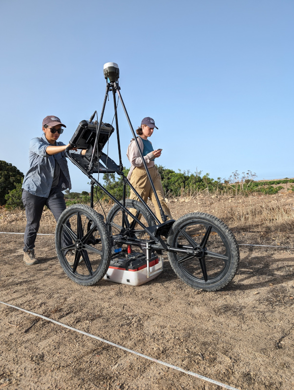
Conducting ground-penetrating radar survey
Fig. 5. Ground-penetrating radar surveys were carried out on areas where we wanted to confirm our interpretations of the magnetic data or where other geophysical surveys would not be effective because of the surface conditions. From left: Helen Wong and Mary Elizabeth Alexander.

Learn more on the project’s website.

Follow the Mozia Project and UPenn’s Center for the Analysis of Archaeological Materials on Instagram.

Fieldwork Report: Nate Welch

A Short Month in Iraq

Nate Welch, 2024 Steinmetz Fellowship Recipient

The project I was able to join this season is titled “Rural Landscapes of Iron Age Imperial Mesopotamia” or RLIIM for short. The project was spearheaded and directed by Dr. Petra Creamer with the assistant director and my professor being Dr. Kyra Kaercher. These very talented women have been on this project for several seasons prior to my arrival and have an impressive systematic approach to excavating the several trenches held within the site.

I am not an archaeologist but a biologist, however I did learn the importance of proper technique. An example that comes to mind is the pickaxe. The pointed end is preferred as damage will be minimal compared to the blunt crushing end. Archaeology is destructive in nature and cannot easily be undone. That statement rung in my ears the entire time I was in Iraq and knowing that helped me cope with the meticulous digging taking place day in and day out.

What broke up the monotony of digging was the discovery of ceramic sherds, bone, spindle whorls and various other items. The ceramics were coming up by the bucketful with over 10,000 pieces by the end of the short season. These sherds were then painstakingly cleaned, analyzed and categorized by the team. This was how the majority of the days were spent however my true calling came when the farmers harvested their grain. With the fields cut down we were now able to collect magnetometry data.

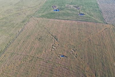
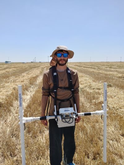
I had learned of the process from my professor in my first archaeology course, however I had no hands-on experience until now. Walking with the contraption strapped to a backpack felt almost natural after the first day however I know those who were able to watch from a distance would argue otherwise. The idea was simple, walk back and forth in 20-meter increments for hours while keeping the instrument as steady as possible. The practice was a little more difficult with uneven terrain and spiky vegetation stabbing into your feet and legs all while trying to stay in step with the timer which beeped every time you should have gone one meter exactly. I haven’t even mentioned the fact that there was no shade, and temperatures would be near the 100-degree Fahrenheit mark. With all this in mind the director did an excellent job ensuring nobody would become a casualty of heat illness.

It is appropriate now to confess that I loved every day I got to spend there and all the work that went into the project. My back and knees aching were small prices to pay, and I would gladly do it again. I personally love the busy work that the ceramics and tedious digging provided because physical labor is what I do best. By nature, I am somewhat of an introvert and this opportunity allowed me to step out of my comfort zone and interact with people from all over the world.

I have done this before when I joined the Marines, however I had never been to Iraq, and I can say that my presumptions of the area were entirely incorrect. The people were very friendly, the food was great and there was so much to do and explore such as Shanidar Cave which we were able to tour. I understand I kept this report rather vague, but it sums up the journey quite well and I am the type of person that doesn’t like to disclose too much because it is not my project, and the truly exciting things should come from the director when she publishes her reports.

I’ve always been interested in history and tied in with that is archeology which made this experience all the better. I hope more opportunities like this will arise for me, but I fear my dog won’t let me leave so easily next time.

Want to help more students and early career archaeologists get into the field? Donate to the cause today by selecting “Fieldwork Scholarships” as your gift purpose!

2024—Impact of ASOR Fellowships and Grants

Banner showing images of students doing archaeological fieldwork.

2024—IMPACT OF ASOR FELLOWSHIPS AND GRANTS

See how ASOR supported our members in the field in 2024 with more than $250,000 in scholarships, fellowships, and grants. ASOR provided $30,000 in membership and annual meeting scholarships, and $220,000 in fieldwork participation scholarships, research fellowships, and project grants.

Click on the PDFs below to read about how each ASOR fund impacted the research of students and scholars in 2024.

Scholarships for Fieldwork Participation:

BIPOC Fieldwork Scholarships (PDF)
Eric and Carol Meyers Fieldwork Scholarships (PDF)
Shirlee Meyers/G. Ernest Wright Fieldwork Scholarships (PDF)
Harva L. Sheeler Fieldwork Scholarships (PDF)
Steinmetz Fieldwork Scholarships (PDF)
Stevan B. Dana Fieldwork and AM Scholarships (PDF)
Strange-Midkiff Fieldwork Scholarships (PDF)

Grants for Archaeological Projects:

Joe D. Seger Project Grants (PDF)
Stevan B. Dana Project Grants (PDF)
Shepard Urgent Actions Grants (PDF)


Research Fellowships for Members:

Study of Collections Fellowships (PDF)

Thank you, ASOR donors, for continuing to support ASOR members’ research and for encouraging young scholars in the field.
2024 ASOR Honors & Awards

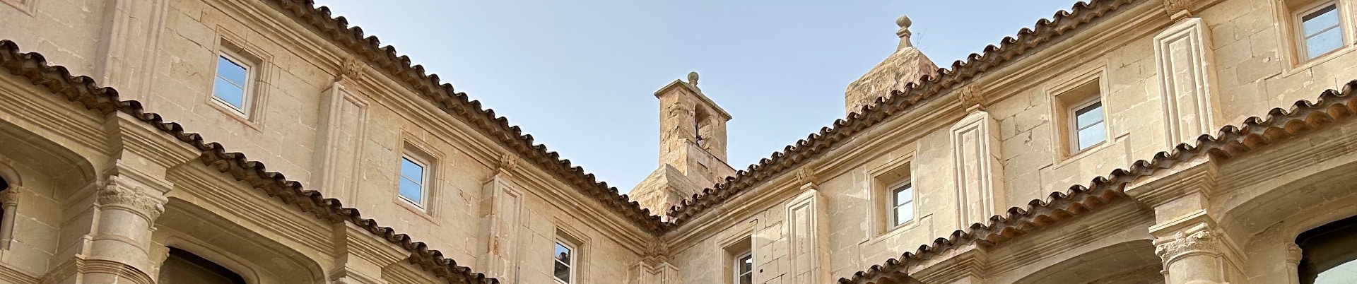
Interior courtyard of the Museum of Menorca, Spain.

2024 ASOR HONORS & AWARDS

Each year at the Annual Meeting, ASOR recognizes individuals who have performed outstanding service for the organization, those who have published exceptional academic work, and those who made significant contributions to our field. The following award recipients were honored at the 2024 Annual Meeting in Boston and during the Members’ Meeting on November 22nd. Awards were presented by Lynn Welton, co-chair of ASOR’s Honors and Awards Committee.

The Richard J. Scheuer Medal. This award honors an individual who has provided truly outstanding, long-term support and service contributions to ASOR (this medal is awarded when such an individual is identified).

Awarded posthumously to Carolyn Midkiff Strange and James F. Strange, for their exceptional contributions and service to ASOR over many decades (presented to James R. Strange).

The Charles U. Harris Service Award. This award is given in recognition of long-term and/or special service as an ASOR officer or Trustee (one award is given annually).

Awarded to Ann-Marie Knoblauch, Associate Professor of Art History and Director of the School of Visual Arts, Virginia Tech, for her work as ASOR Secretary, as well as her previous years of Board service.

The P. E. MacAllister Field Archaeology Award. This award honors an archaeologist who, during his/her/their career, has made outstanding contributions to ancient Near Eastern and eastern Mediterranean archaeology (one award is given annually).

Awarded to Sturt W. Manning, Distinguished Professor of Arts and Sciences in Classics, Cornell University, for his impactful contributions to the archaeology of Cyprus and the wider Near East and Eastern Mediterranean.

Community Engagement and Public Outreach Award. This award recognizes individuals, teams, and organizations who have initiated outstanding educational, informational, or practical projects (including but not limited to classes, programs, exhibits, resources, events, and platforms) with the goal of making subjects and information about the ancient world accessible to wider (particularly non-academic) audiences.

Awarded to the ELRAP (Edom Lowlands Regional Archaeology Project) Jordan Sketchfab Team, including Matthew D. Howland, Brady Liss, Ian W.N. Jones, Anthony Tamberino, Mohammad Najjar, and Thomas E. Levy, for their development of pioneering digital resources and platforms intended to present the archaeology of the Faynan region of Jordan to the general public.

ASOR Membership Service Award. This award recognizes individuals who have made special contributions on behalf of the ASOR membership, through committee, editorial, or office services.

Awarded to: Kevin McGeough, Professor of Archaeology, University of Lethbridge, for his work as Chair of the Publications Committee.


Awarded to Jane DeRose Evans, Professor of Roman Art and Archaeology and Chair of Art History, Temple University, for her work as Chair of the Cultural Heritage Committee.


Awarded to Tiffany Earley-Spadoni, Associate Professor of History, University of Central Florida, for her work as co-chair of the Early Career Scholars Committee.

The W. F. Albright Service Award. This award honors an individual who has shown special support or made outstanding service contributions to one of the overseas centers (AIAR, CAARI), or to one of the overseas committees – the Baghdad Committee and the Damascus Committee. This award is given when such an individual is identified.

Awarded to Nadia Bandak, Finance Manager at AIAR, Hisham M’Farreh, Chef and Kitchen Manager at AIAR, and Photoulla Christodoulou, Housekeeper at CAARI. Nadia and Hisham are celebrating 30 years of service at AIAR, and Photoulla is retiring next year after nearly 40 years of service at CAARI.

The G. Ernest Wright Award. This award is given to the editor/author of the most substantial volume(s) dealing with archaeological material, excavation reports and material culture from the ancient Near East and eastern Mediterranean. This work must be the result of original research published within the past two years (one award is given annually).

Awarded to Glenn M. Schwartz, Whiting Professor of Archaeology, Johns Hopkins University, for Animals, Ancestors, and Ritual in Early Bronze Age Syria: An Elite Mortuary Complex from Umm el-Marra, from Cotsen Institute of Archaeology Press.

The Frank Moore Cross Award. This award is presented to the author/editor of the most substantial volume(s) related to the history and/or religion of the ancient Near East and Eastern Mediterranean. Primary consideration will be given to historical, epigraphic, textual, and comparative literary studies; or to works that advance and/or evaluate new methodological approaches to the literary record(s). This work must be the result of original research published during the past two years (one award is given annually).

Awarded to Karen Radner (Alexander von Humboldt Chair of Ancient History of the Near and Middle East, Ludwig-Maximilians-Universität München), Nadine Moeller (Professor of Egyptian Archaeology, Yale University), and D.T. Potts (Professor of Ancient Near Eastern Archaeology and History, ISAW, New York University), for editing the five-volume The Oxford History of the Ancient Near East, from Oxford University Press.

The Nancy Lapp Popular Book Award. This award is presented to the author/editor of a book published in the last two years that offers a new synthesis of archaeological or textual evidence intended to reach an audience of scholars as well as students and the broader public (one award is given annually).

Awarded to Eckart Frahm, John M. Musser Professor of Assyriology, Yale University, for Assyria: The Rise and Fall of the World’s First Empire, from Basic Books.

The Joy Ungerleider Poster Award. This award is conferred upon the author(s) of the poster presenting the results of a study about ancient Near Eastern societies in a clear, legible fashion using original graphic content. Subject matter may be based in archaeological sciences, history, anthropology, epigraphy, ethnography, heritage or other scholarly approaches to understanding ancient people in the areas covered by ASOR (one award is given annually).

Awarded to Helen C. Wong, University of Pennsylvania, and Erin M. Brantmayer, University of Texas, Austin, for the poster: “The Boundaries of Death: Outlining Mortuary Landscapes at Jebel Khalid.”

Student Paper Award. This award is conferred upon the author(s) of a paper presented during the Annual Meeting that conveys the results of a study about ancient Near Eastern and wider Mediterranean societies in a clear, understandable, and convincing fashion. The first author and presenter of the paper must be a registered student at the time of presentation in order to be eligible for consideration for this award.

Awarded to Nicole Constantine, Stanford University, for her paper “Materializing Ptolemaic Power: Ruler Cult and Festival in the Hellenistic Mediterranean”.
Collections Fellowship Report: Jennie Ebeling

2024 Study of Collections Fellowship Report

Jennie Ebeling, University of Evansville

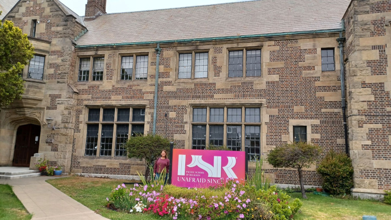
Fig 1: Outside the Pacific School of Religion in Berkeley, CA.

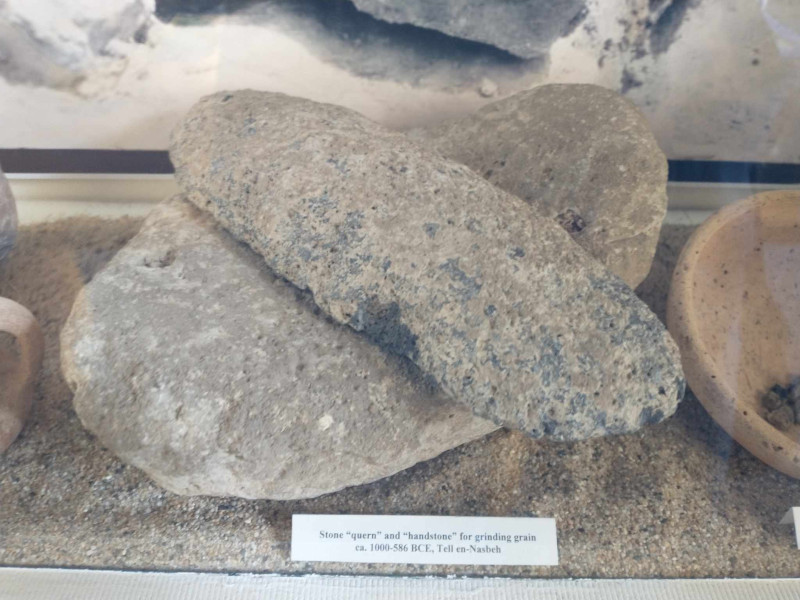
In recent decades, many archaeologists who research Bronze and Iron Age sites in the southern Levant have shifted their focus from investigating historical questions to asking more anthropological ones. Household archaeology approaches can be applied not only to ongoing excavation projects, but also to legacy collections, as has been demonstrated by studies that have utilized the rich artifact assemblages from Iron Age Tell en-Nasbeh (biblical Mizpah). William Frederic Badè of the Pacific School of Religion (PSR) in Berkeley, CA directed excavations at Tell en-Nasbeh, Palestine for five seasons between 1926 and 1935 on behalf of PSR and ASOR and brought some of the excavated artifacts to Berkeley through partage in the 1930s. While many of the artifacts in the collection have been published or made available through Open Context, some 150 ground stone artifacts in the Badè Museum of Biblical Archaeology at PSR have never been assessed by a stone artifact specialist and published. In summer 2024, I was awarded an ASOR Collections Fellowship to study the mortars, stone vessels, handstones, pestles, grinders, scrapers, weights, sling stones, and other stone artifacts in the collection to learn how this these artifacts can contribute to our understanding of daily life activities at Tell en-Nasbeh in the first half of the first millennium BCE.

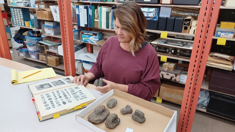
Fig 2: Studying the collection of scoria scrapers in the storeroom.

During a ten-day research period in June 2024, I examined all of the ground stone artifacts kept in the Badè Museum storeroom. In addition to assessing, measuring, sketching,and photographing each object, I searched the publications, photographs, and original field ledgers and artifact cards for all available documentation of them. While the collection primarily comprises small, complete objects –most of them handheld processors made of limestone, flint, and other materials available locally –several fragments of large and more specialized objects are among the assemblage along with artifacts made of basalt that were probably brought from Galilee or farther north. Particularly interesting is a small collection of tools made of scoria, a highly vesicular volcanic rock. While similar artifacts are known from other Iron Age sites in the region, their functions are not completely understood. One object was described as a “foot scraper” in McCown’s Tell en-Nasbeh I apparently on the basis of ethnographic information: they “are supposed to have been used to rub the thick and sometimes painful callouses from the soles of the peasant’s feet” (1947: 250). Other artifacts were likely used in food processing and other activities. Ongoing research of this material will offer more insights into the function of household spaces at Tell en-Nasbeh during the Iron Age. I would like to thank Aaron Brody, Director of the Badè Museum of Biblical Archaeology, for his help and encouragement and ASOR for making this research possible.

Fig 3: A handstone and grinding slab set on display in the Badè Museum of Biblical Archaeology.

Fieldwork Report: Evelyn Patterson

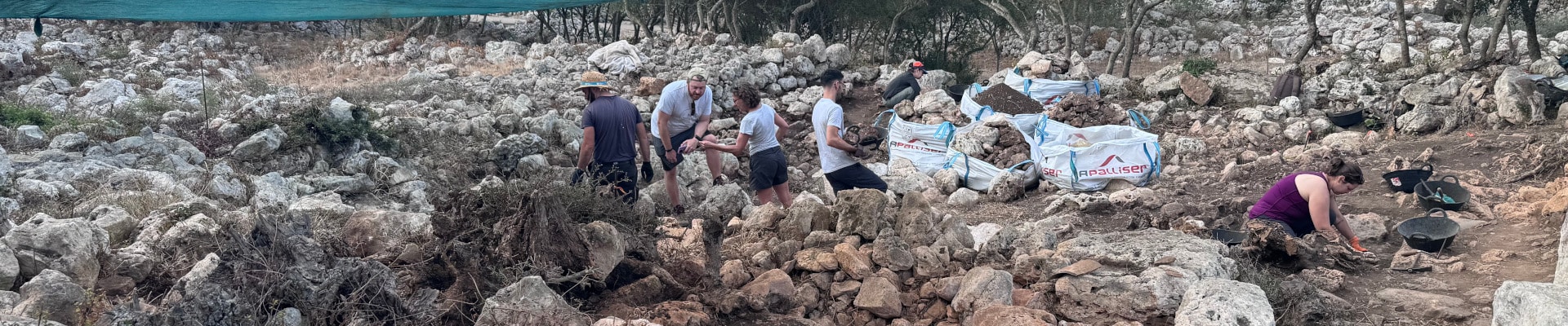
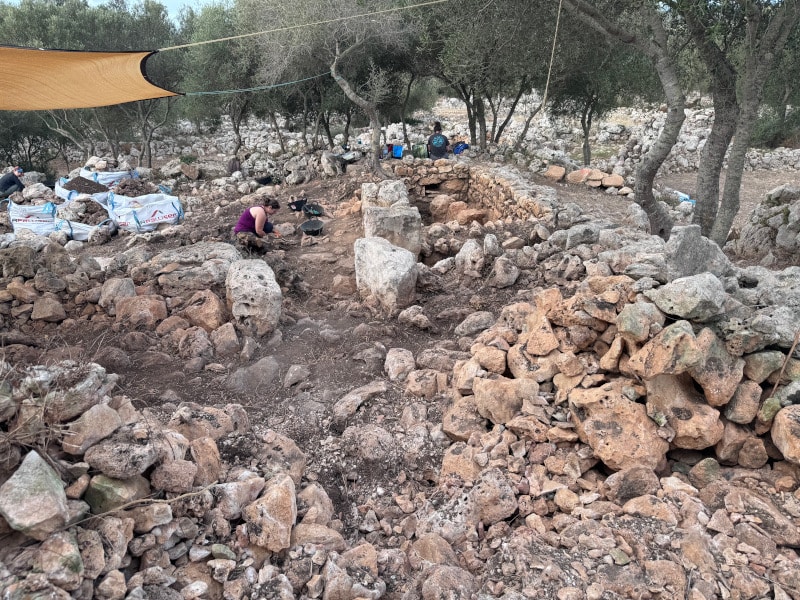
MAP team members excavating in SPU 7. Looking to the south.

Multi-Temporal Excavation with the Menorca Archaeological Project at the Site of Torre d’en Galmés, Menorca, Spain

Evelyn Patterson, 2024 Strange-Midkiff Scholarship Recipient

With the generous award of the Strange–Midkiff Fieldwork Scholarship from ASOR this summer, I was able to return for a second year of excavation with the Menorca Archaeological Project (MAP) at Torre d’en Galmés, Menorca, Spain. The MAP project is directed by Dr. Amalia Pérez-Juez (Boston University), Dr. Alexander Smith (SUNY Brockport), and Dr. Kathleen Forste (Boston University), and involves the work of a team of truly spectacular people. Last summer, I received a Summer Undergraduate Research grant from SUNY Brockport to travel to Menorca and work with the MAP team for one month from June 15th to July 15th. During the following fall and spring semesters, I did independent research for an Honors College thesis based on an object found by the MAP team in 2021. I was thrilled to be invited back to excavate for another month this summer, and this fieldwork scholarship made that possible.

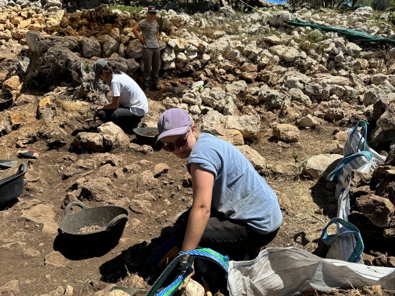
Image 1: Evelyn excavating in the patio of SPU 7. Photo by A. Smith.

The Menorca Archaeological Project is primarily concerned with the investigation of the multi-temporal remains of Torre d’en Galmés, the largest preserved prehistoric site in the Spanish Balearic Islands. This site displays evidence of multiple periods of occupation and interaction, with an array of megalithic indigenous domestic structures dating to the Post-Talayotic or Late Iron Age (550-123 B.C.E.) and a series of later structures built during the Medieval Islamic period of occupation in the 12th and 13th centuries C.E. The stark contrast and interactions of the structures is fascinating and raises an interest in understanding the use and re-use of spaces and materials over time, and the shifting social structures of the populations that used them, both within the communities of Menorca itself and within the greater Mediterranean context.

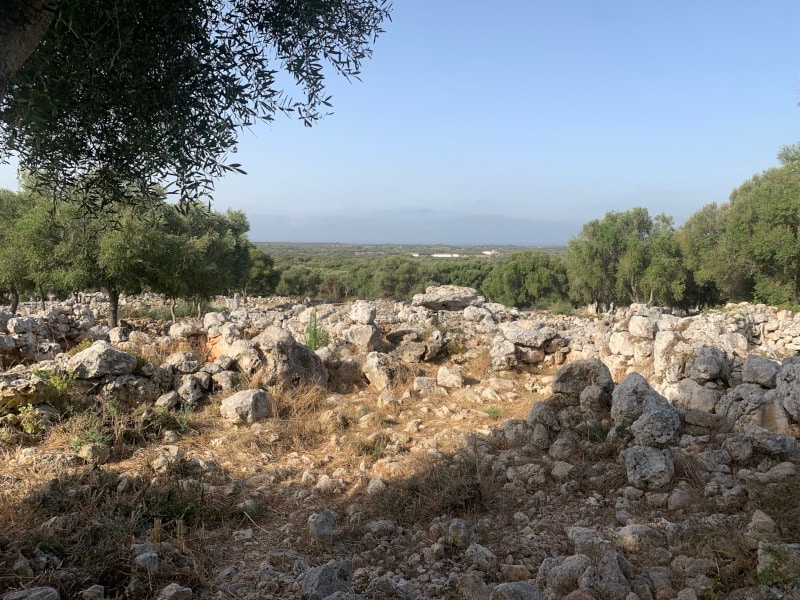
Image 2: View of the site of Torre d’en Galmés. Looking to the south of SPU 7.

Torre d’en Galmés, along with other sites around Menorca, is absolutely covered with the remains of limestone rubble from collapsed structures. This was the primary building material of the megalithic domestic and ritual spaces of the Bronze and Iron Age, and in the Medieval Period. The presence of all this stone means that excavation involves an incredible amount of rock-moving and trained eyes to see the remains of walls or features. This summer, the MAP team focused heavily on the task of clearing up the central patio and surrounding walls of Spatial Unit 7, a series of later Medieval period rooms which were constructed with the incorporation of rubble and remaining megalithic limestone rocks used in an earlier Post-Talayotic structure.

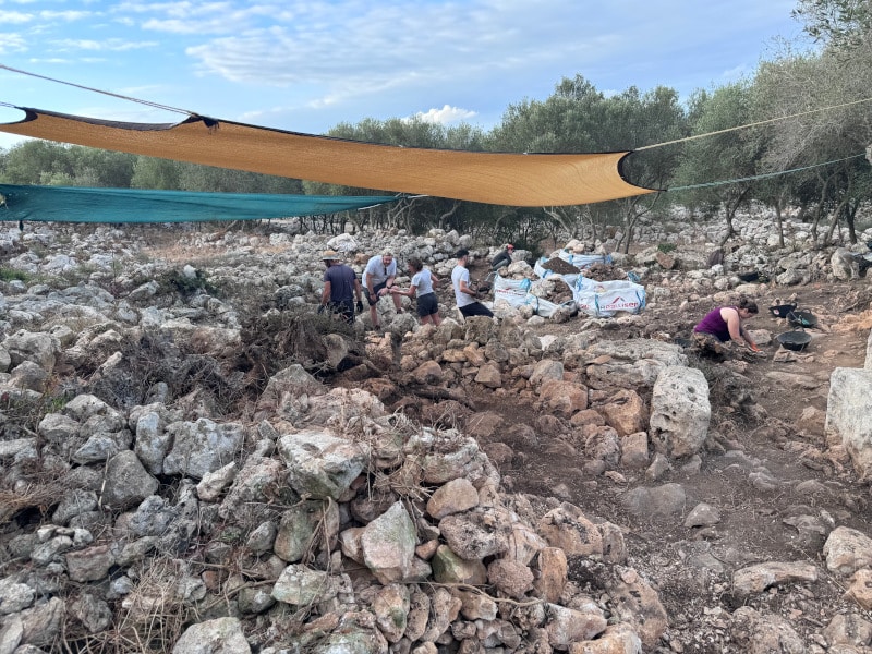
Image 3A
MAP team members excavating in SPU 7. Looking to the south.

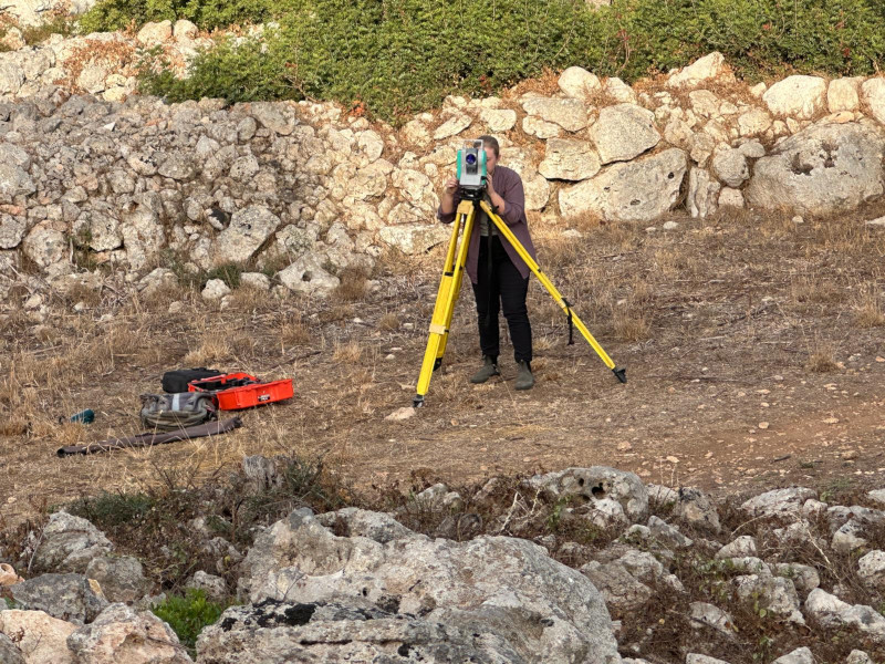
Even with a focus on defining the architecture, plenty of ceramic sherds were found as well, a substantial portion of which consisted of the remains of ceramic roof tiles, with some areas of preserved tile-falls and mortar. Other ceramic sherds appeared as repio, the fill used in the construction of the stone walls, and consisted of a mix of Post-Talayotic, Roman, Punic, Islamic, and other typologies of ceramics. In addition to excavation, our work this summer was concerned with lab work and data collection. I practiced taking spatial data points using a total station to outline features and interesting in situ finds, mark spots for phytolith and archaeobotanical sampling, set up new areas to excavate, and track the depth of our excavations. This is a skill I continued to use at another project, the Frost Town Archaeology field school, later in the summer, where I got to supervise students and teach them about archaeological techniques and collecting data. We also used this season to organize all the old finds from past seasons and input the information into an updated database. This was an insight into the reality of the meticulous process of documenting and photographing the collection to decide what needs to be kept physically, and what only needs to be kept digitally.

Image 4: Evelyn taking points of SPU 7 at the total station.

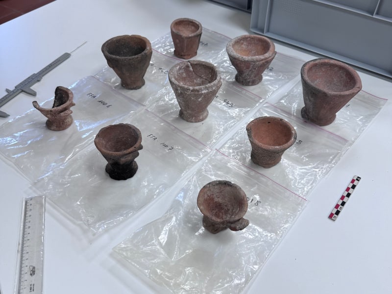
Returning to Menorca this summer also gave me a chance to revisit the basis of my thesis that I wrote for the SUNY Brockport Honors College, which was advised by Dr. Alexander Smith. Last summer in 2023, I was incredibly lucky to have left Menorca with an idea for my thesis, investigating interpretations of indigenous Post-Talayotic ritual objects. I spent both semesters of my senior year preparing my research and I was proudly able to present it at SUNY Brockport’s’ Scholars Day on April 15th and at the Summer Undergraduate Research Conference at Suffolk Community College on April 26th. This summer I went back to the Museu de Menorca with clearer goals in mind of what objects and documents I wanted to see in order to further expand on my research in the future.

Image 5: Array of Post-Talayotic ceramic “high-bottomed cups” from the Museu de Menorca.

My involvement with the MAP team these past two summers has given me numerous insights and hands-on opportunities to explore my interests in the field. I am so grateful to the team for welcoming me and helping me to build my professional network in the field. I look forward to continuing my work with the team in future excavation seasons, and to exploring other projects. I extend my thanks to Mrs. Carolyn Midkiff-Strange and the Midkiff-Strange Fieldwork Scholarship, ASOR, the entire Menorca Archaeological Project team, the Museu de Menorca, and SUNY Brockport.


Evelyn Patterson graduated in May of 2024 from SUNY Brockport with a BS in Anthropology and a minor in Museum Studies and Public History. In addition to working with the Menorca Archaeological Project in Spain, Evelyn has also excavated with the Frost Town Archaeology Project in the Finger Lakes region of New York. She has assisted in laboratory research internships, created project signage and academic posters, and has presented a completed independent research thesis.

Want to help more students and early career archaeologists get into the field? Donate to the cause today by selecting “Fieldwork Scholarships” as your gift purpose!

Fieldwork Report: Liza Davis

A Day in the Life at the East Church, Antiochia ad Cragum

Liza Davis, 2024 Member-Supported Fellowship Recipient

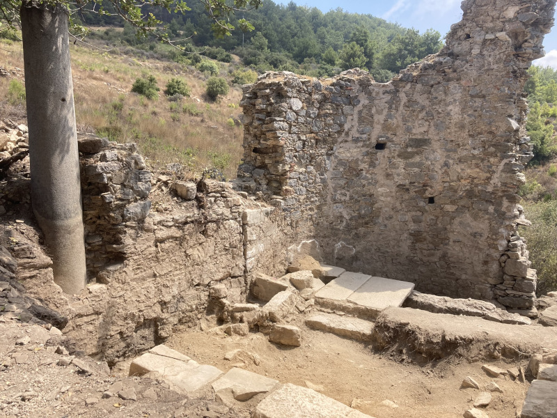
This summer, I had the privilege of working as a trench supervisor at Antiochia ad Cragum, a Roman city located outside of Gazipaşa, Türkiye. Antiochia was an important regional hub and boasted a large colonnaded street lined with shops, multiple baths, areas for the production of olive oil and wine, monumental tombs, and several early Christian churches. In the 2024 season, excavation began on an east-facing apsidal building located on the road approaching the city’s Main Gate from the east. This building has been described as a church by earlier researchers, and so we decided to creatively title this new area of excavation the East Church.

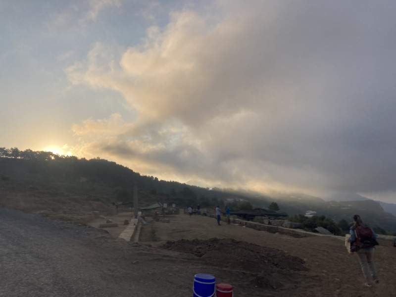
Daily life as an excavator at Antiochia quickly fell into a pleasant routine. We left Gazipaşa around 5:30 and arrived at site by 6:00 AM, early enough to see the sun rising and watch flocks of swallows soaring high overhead. Breakfast is served on site by Ayşe, a woman from the nearby village of Güney and the wife of Rahmi the site guard. For the uninitiated, Turkish breakfast is quite the spread: tomatoes, cucumbers, olives, a variety of cheeses, jams and jellies, and bottomless ekmek (bread). Sometimes there would be hard-boiled eggs, borek (a savory pastry made from phyllo dough, cheese, and parsley), or potatoes with scrambled eggs. And, of course, strong Turkish çay (tea) served in the ubiquitous glass cups and sweetened with as many cubes of sugar as you desire.

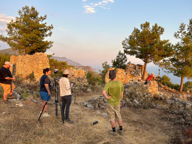
After such a feast, it could be difficult to get motivated to go to work, but the sun rose quickly and the relative cool of the morning soon dissipated. It was about a ten-minute trek to the East Church, laden with our field packs, cameras, iPads for digital trench recording, and RTKs (Real-Time Kinematic devices, a kind of super-powered GPS that allows for centimeter-level accuracy). We divided into our two trenches and got to work. One trench was just outside of the building, in what has been deemed the church’s narthex, and the other (my trench) was in the apse of the building. We began each day by going over our daily goals and cueing up the all-important dig playlist. Somehow, our trench anthem ended up being “Paradise by the Dashboard Light” by Meat Loaf… do not ask me why, because I don’t know. But I can tell you that those opening chords will forever remind me of dusty days in the East Church.

We took a çay break at 10:00, huddling in the shade cast by some standing walls south of the church. Twice a week, there would be pişi, fluffy discs of fried bread—delicious and filling. After the break, we would return to work for a few more hours, reassessing our progress toward our daily goals and adjusting as necessary. At the end of the day, my trench mates would clean up our tools as I took some final notes in our iPad-based recording software (called Kiosk) and took closing photos of the trench for the day. Around 12:50, we would begin the walk out, which always felt much longer in the heat of the afternoon than it did at 6:45 AM. Lunch was served at 1:00 and was a veritable feast of Turkish home cooking: stuffed peppers, eggplant and potatoes stewed in a spicy tomato sauce, cacık (a cold yogurt and cucumber soup—very refreshing), bulgur and rice pilaf, and once a week a delicious semolina and peanut cake soaked in honey. Lunch was always a fun, social time, spent discussing the day’s progress with people working in other areas at site.

The four weeks I spent at Antiochia this summer were such an incredible opportunity for me. My dissertation research focuses on early Christian experience in the eastern Mediterranean, so the chance to excavate an early Christian church was so important for me. This fall back at Brown, I will be working on my dissertation, greatly enriched and informed by the days spent at Antiochia this summer.

Liza Davis is a sixth-year doctoral candidate at the Joukowsky Institute for Archaeology and the Ancient World at Brown University. Her research focuses on the lived religious experience of non-elite and rural people in Late Antique Asia Minor.

Want to help more students and early career archaeologists get into the field? Donate to the cause today by selecting “Fieldwork Scholarships” as your gift purpose!

Fieldwork Report: Victoria Wilson

On the Street Where You Lived: Household Archaeology at Kurd Qaburstan

Victoria Wilson, 2024 Strange-Midkiff Fieldwork Scholarship Recipient

I spent my summer in a hole in a barley field in Iraq.

First, some background on the project that brought me to said field: Kurd Qaburstan is a fortified urban site located in the Kurdistan Region of Iraq and suspected of being the ancient site of Qabra, a regional capital on the Erbil Plain during the Middle Bronze Age.

Excavations began in 2013 and as the project progressed multiple monumental buildings have been detected through magnetometry and explored through excavation: most notably being a temple and palace. In 2014, magnetometry identified a concentration of agglutinated architecture in the northwest sector of the site.

With the layout displaying similarities to other domestic areas in the ancient Near East, this sector became known as the Northwest Neighborhoods. Magnetometry data could further show the streets that divided the blocks of architecture, and one of these city blocks has become the focus of my dissertation.

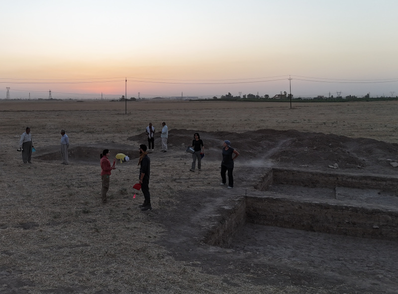
Northwest Neighborhood at sunrise

Now we can go back to the holes in the barley field. Or to describe my scholarly efforts less glibly: I spent this field season supervising three trenches in the Northwest Neighborhoods, investigating domestic contexts to better our understanding of the lifeways of these ancient urbanites. While my goal for the season had been to practice household archaeology in the most literal sense –peering into the interior of a house –two of the trenches missed the mark slightly and had us examining a domestic exterior space: a expansive pebble surface that was likely part of a courtyard.

Near the tail-end of the season we reexamined the magnetometry data and opened a new trench just north of the initial two trenches that would place us within the walls of the structure. Right at the end of the season one of those walls was found and so the 2025 season will see us explore the structure further.

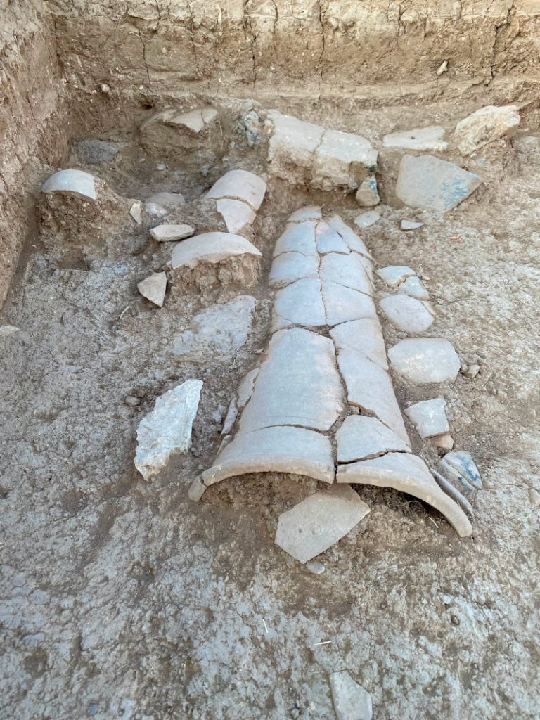
Ceramic drain - view facing south

While in the trenches one can easily lose sight of the larger goals of a project: in the blazing Middle Eastern heat, the stress of juggling paperwork and strategizing data collection, the macro goals of investigating neighborhood dynamics and city planning can melt away. But as they say: it’s the little things in life –and in this case it was a little ceramic fish that helped me refocus on the human aspect of my investigations.

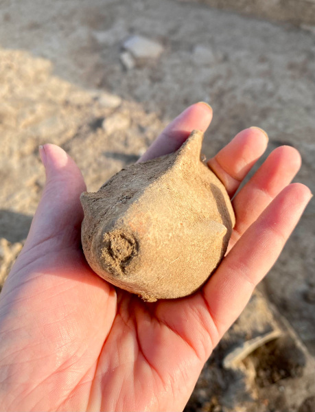
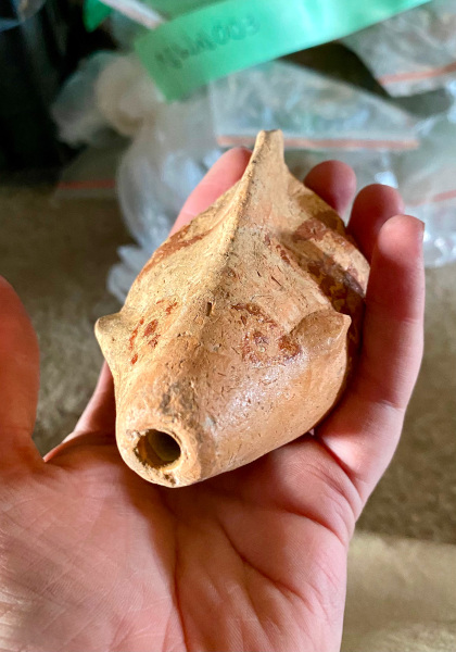
When it was pulled from what was known informally as the “pottery volcano” (which could be an upper floor collapse or trash deposition – the jury is still out on the most likely interpretation) it was just an oddly shaped hollow ceramic object. Personally, I thought it might be a pig when I first held it due to the “snout.” The local museum conservator, Nihayat, could immediately tell there was paint underneath the encrusted dirt. After the object was cleaned and conserved it was revealed to be part of a fish-shaped juglet.

This is an object that had been created with a personal touch over 3,000 years ago. Found among a large utilitarian domestic assemblage that needed to be recorded and quantified, the fish juglet reminded me that this collection had once been more than a data point for a dissertation buthad once belonged to people who had crafteditand kept it in their homes until its eventual deposition. Where now there were holes in a modern barley field, there had once been a courtyard nestled in a neighborhood, which was itself part of the urban landscape that was ancient Qabra.

Ceramic fish at moment of discovery
Ceramic fish after cleaning and conservation
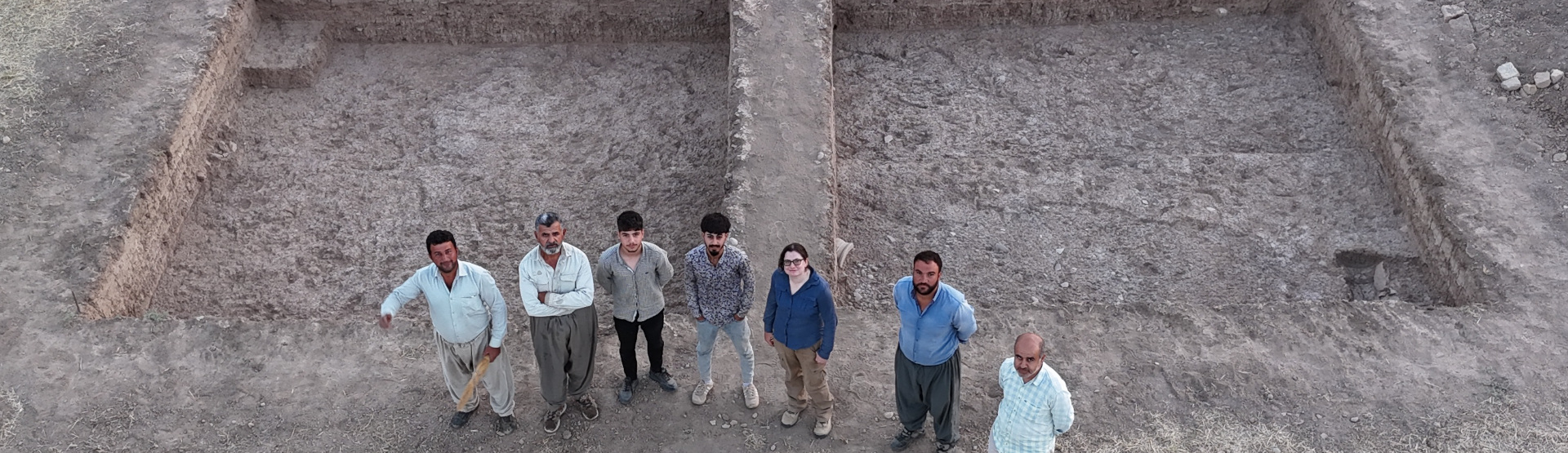
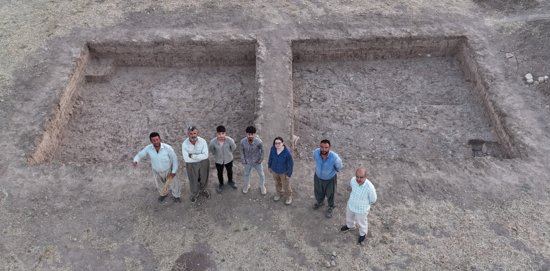
Group photo by the trenches. (Photo courtesy of The Kurd Qaburstan Project).

Victoria Wilson is a PhD candidate in the Department Near Eastern Studies at the Johns Hopkins University studying Mesopotamian Archaeology. Victoria’s research interests include urbanism and household archaeology.

To learn more, see the Kurd Qaburstan Project (KQP) website. The KQP thanks the Directorate-General of Antiquities of the Kurdistan Regional Government, Director-General Kak Kaify Mustafa Ali, and our colleagues in the Erbil Department of Antiquities, Director Kak Nader Babakr.

Want to help more students and early career archaeologists get into the field? Donate to the cause today by selecting “Fieldwork Scholarships” as your gift purpose!