Remote Sensing Techniques to Reveal Ancient Mesopotamian Urbanism
Marc Marín Webb, 2023 Strange-Midkiff Fieldwork Scholarship Recipient
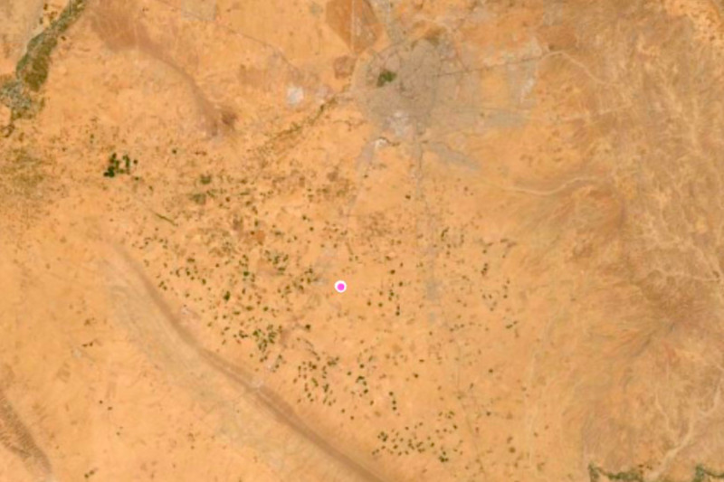
The archaeological site of al-Hiba, ancient Lagash, stands as one of the most extensive third-millennium sites in Southern Mesopotamia, situated approximately 22 km east of the modern town of Ash-Shatra in Iraq (Figure 1). Its initial exploration, spanning from 1968 to 1978, was conducted by Vaughn Emerson Crawford and Donald Hansen. In 2019, archaeological activities were resumed through the efforts of the Lagash Archaeological Project (LAP), under the direction of Professor Holly Pittman from the University of Pennsylvania. Over recent years, LAP has delved into the investigation of craft production within households and workshops across the neighborhoods of ancient Lagash, focusing on the Mesopotamian Early Dynastic Period (circa 2,900-2,350 BCE). In the coming years, LAP intends to delve deeper into the socio-economic aspects of craftspeople by analyzing the variability of utilitarian products, production debris, and their respective activity areas.
The exceptional preservation conditions at this sprawling 400-plus hectare site, primarily dating to the EDIIIb period, favor a multifaceted approach encompassing both aerial (walking surveys and remote sensing techniques like UAV photogrammetry and thermography) and subsurface methods (surface scraping, excavation, and geophysics including magnetic gradiometry and electrical resistivity tomography). Through these methods, LAP seeks to address craft production at four socio-spatial scales: the household, the neighborhood, the city, and the city-state.
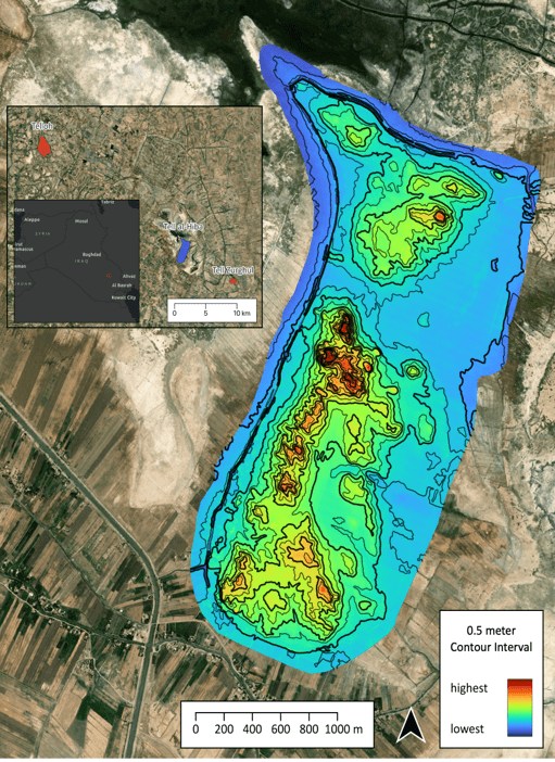
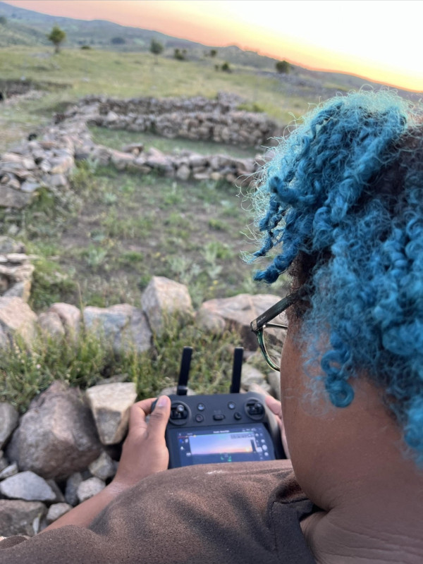
The remarkably preserved surface and subsurface architecture at Lagash, as evidenced by initial drone flights from 2019 to 2023 over Area H (Figure 2), offers a unique opportunity to test remote sensing techniques for reconstructing the urban layout of the city during the Early Dynastic period. In this project, my responsibilities include tracing this architecture through carefully planned flightpaths over selected regions of the site, leading to the creation of orthomosaic images. These flight photographs are subsequently uploaded to the DroneDeploy website for processing. The rectified orthomosaics are then downloaded into QGIS for merging into a single image and processing into the new contour plan for Lagash.
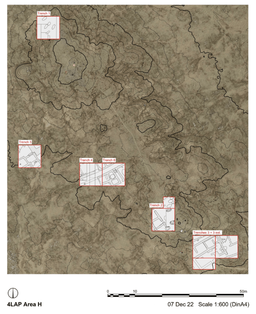
Orthomosaic images generated through DroneDeploy are compared to select those that provide clearer depictions of architectural features. We conduct regular aerial surveys on a daily basis to identify optimal weather conditions for revealing these features. Flights immediately following rainfall prove especially useful for detecting surface and subsurface walls, as differences in soil density quickly become apparent in the aerial photographs. Additionally, drone flights at different times of the day reveal distinct features.Subsequently, orthomosaics are digitized into AutoCAD and QGIS to create vector shapes and poly lines representing identified surface-level architectural elements such as walls, streets, kilns, and drains (Figure3).
Surface-level architectural features are frequently discernible in Tell al-Hiba, both through walking surveys and aerial and satellite imagery. These distinctions arise from variations in soil density, triggering differences in moisture retention levels and salt efflorescences. These variations are prominently visible in the 2022-23 aerial surveys of Area H, where surface and subsurface walls appear as darker shades of brown, and white concentrations of salt.
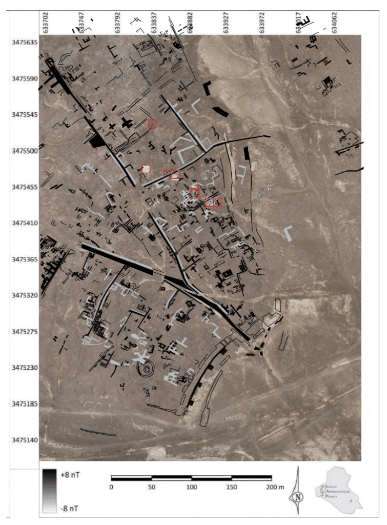
Since 2019, we have identified hundreds of features of similar scale and orientation, yielding significant insights into the density and organization of the urban fabric. This includes the orientation of streets and buildings, room sizes, wall thickness, and types of brickwork. Among these structures, we’ve encountered both small-scale buildings and substantial constructions, including segments of the city wall and building complexes of notable size.
The combined use of geomagnetic surveys and aerial surveys conducted over the past four years provides a snapshot of the urban fabric in Area H (Figure 4). While the precise dating of most of these structures remains uncertain, we can begin to draw certain conclusions from the data obtained. This area of the site appears to have been densely populated, featuring both small-scale and monumental architecture, as indicated by walls of varying widths and the differing scales of rooms and courtyards between them. Most sub-surface architectural traces identified in the aerial survey consist of scattered structures, preventing the reconstruction of entire buildings. Nevertheless, they are primarily aligned and oriented in accordance with the neighborhood’s main streets.
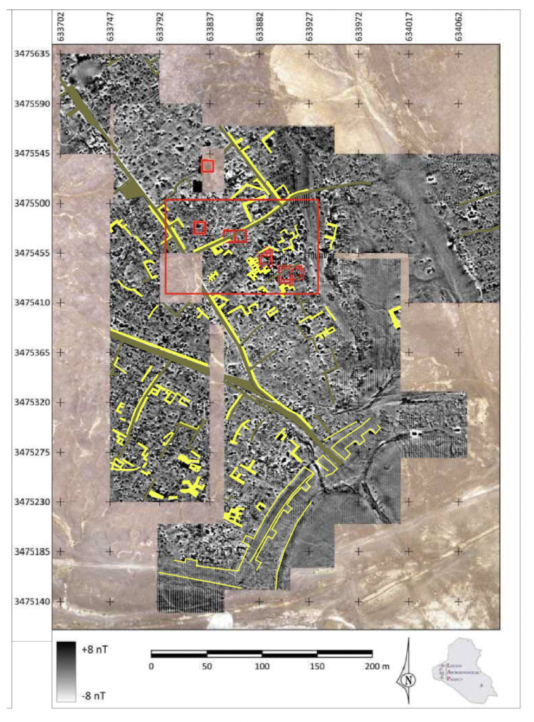
Previous surface surveys in Tell Al-Hiba have suggested that the majority of surface remains likely belong to a single period, the Early Dynastic III B (Carter 1985, 1989-90; Goodman et al. In press). Our objective for the 2023 and upcoming seasons is to cross-reference datasets from remote sensing with excavation findings to confirm the dating of these structures. This will help determine whether they are indeed mostly contemporaneous or if we are dealing with a complex layering of structures from multiple periods, spanning broadly from the Early Dynastic I to the end of the Early Dynastic III.
For more information, please visit our website: https://web.sas.upenn.edu/lagash/
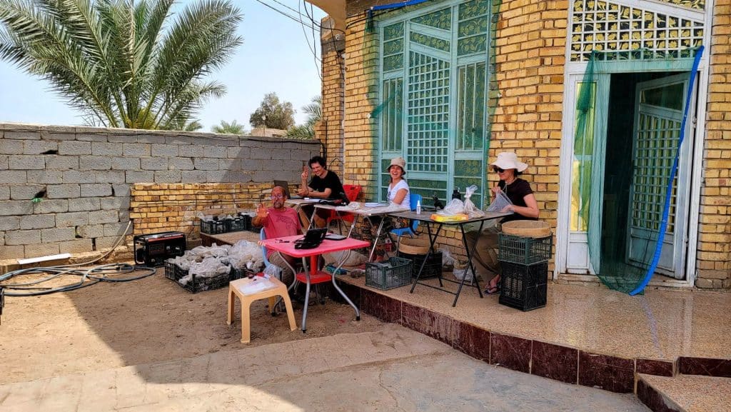
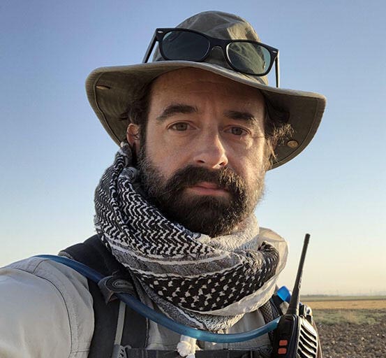
Marc Marín Webb is an architect and PhD candidate in Middle Eastern archaeology and history at the University of Pennsylvania. He has participated in archaeological and cultural heritage preservation projects in Syria, Iraqi Kurdistan, and southern Iraq. He has been collaborating in the LAP for two years now, contributing to the architectural analysis and aerial survey of the site.
Want to help more students and early career archaeologists get into the field? Donate to the cause today by selecting “Student Support” as your gift purpose!
 Community Engagement and Public Outreach Award. This award recognizes individuals, teams, and organizations who have initiated outstanding educational, informational, or practical projects (including but not limited to classes, programs, exhibits, resources, events, and platforms) with the goal of making subjects and information about the ancient world accessible to wider (particularly non-academic) audiences.
 The Charles U. Harris Service Award. This award is given in recognition of long-term and/or special service as an ASOR officer or Trustee (one award is given annually).
 The P. E. MacAllister Field Archaeology Award. This award honors an archaeologist who, during his/her/their career, has made outstanding contributions to ancient Near Eastern and eastern Mediterranean archaeology (one award is given annually).
 Awarded to: Leigh Anne Lieberman (Open Context/Alexandria Archive Institute), Tiffany Earley-Spadoni (University of Central Florida), and Melissa Cradic (Open Context/Alexandria Archive Institute) for their design and implementation of the program,
  Awarded to Piotr Michalowski, George G. Cameron Professor Emeritus, University of Michigan, for his 32 years of service as editor of the Journal of Cuneiform Studies, the Baghdad Committee, and ASOR.


 The Nancy Lapp Popular Book Award. This award is presented to the author/editor of a book published in the last two years that offers a new synthesis of archaeological or textual evidence intended to reach an audience of scholars as well as students and the broader public (one award is given annually).
 The Joy Ungerleider Poster Award. This award is conferred upon the author(s) of the poster presenting the results of a study about ancient Near Eastern societies in a clear, legible fashion using original graphic content. Subject matter may be based in archaeological sciences, history, anthropology, epigraphy, ethnography, heritage or other scholarly approaches to understanding ancient people in the areas covered by ASOR (one award is given annually).
 Student Paper Award. This award is conferred upon the author(s) of a paper presented during the Annual Meeting that conveys the results of a study about ancient Near Eastern and wider Mediterranean societies in a clear, understandable, and convincing fashion. The first author and presenter of the paper must be a registered student at the time of presentation in order to be eligible for consideration for this award.
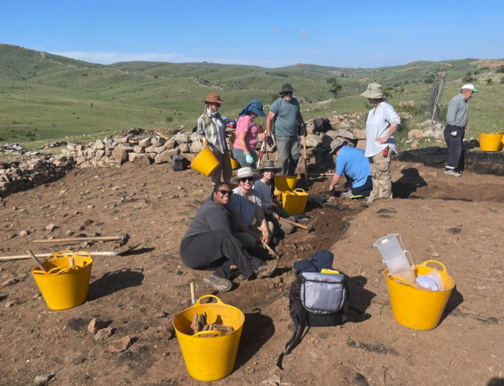


 Sophie Vo recently graduated Emory University in May 2023 with a BS in Biology and a BA in Ancient Mediterranean Studies. Having never excavated before, she was eager to learn about the animal remains on the site and learn alongside the project’s zooarchaeologist. Afterward, Sophie continued to explore her interest in archaeology at the Brooklyn Museum in Egyptian, Classical, and Near Eastern Art. There, she utilized her excavation experience to research and examine Egyptian archaeology reports for the objects housed in the collection
 ASOR, the American Society for Overseas Research, condemns in the strongest possible terms Hamas’ vicious massacre of more than a thousand innocent non-combatant Israelis on Saturday, October 7, 2023.
 Trustee Nominations Committee has selected seven highly qualified members to stand for election for four open positions on the Board of Trustees. The Board sets the direction for ASOR and provides oversight for our organization. Among other responsibilities, members of the Board agree to attend two meetings each year, to participate thoughtfully in the governance process, and to contribute financially to ASOR.