Shepard Urgent Action Grant Report: The Al Haniyah Emergency Documentation Project

2025 Shepard Urgent Action Grant: The Al Haniyah Emergency Documentation Project

Julia Nikolaus (Ulster University), Nick Ray (Ulster University), Ahmad Emrage (University of Benghazi)

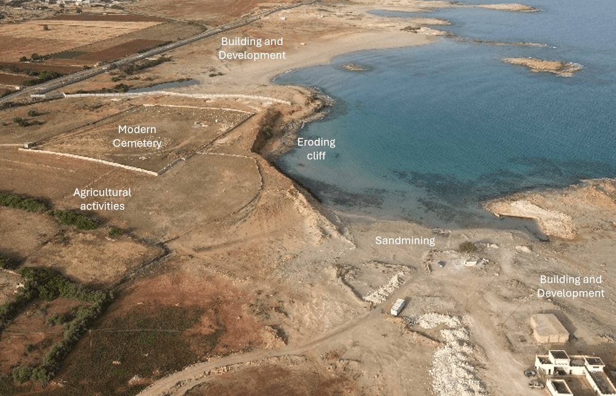
In 2025, with the support of the Shepard Urgent Action Grant, an international team of archaeologists completed a critical emergency documentation project at the endangered site of Al Haniyah (ancient Aptouchus), on the Cyrenaican coast of Libya. This urgent initiative responded to escalating threats from coastal erosion, unregulated agricultural development, and expanding infrastructure—pressures that have already caused widespread and irreversible damage to the site (Figure 1).

Figure 1: Drone image of Aptouchus showing threats and damages to the site.

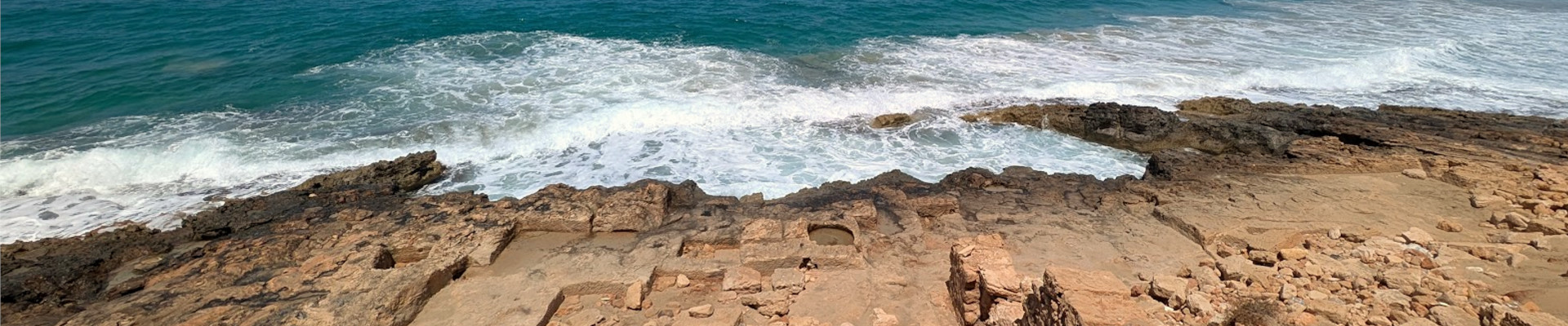
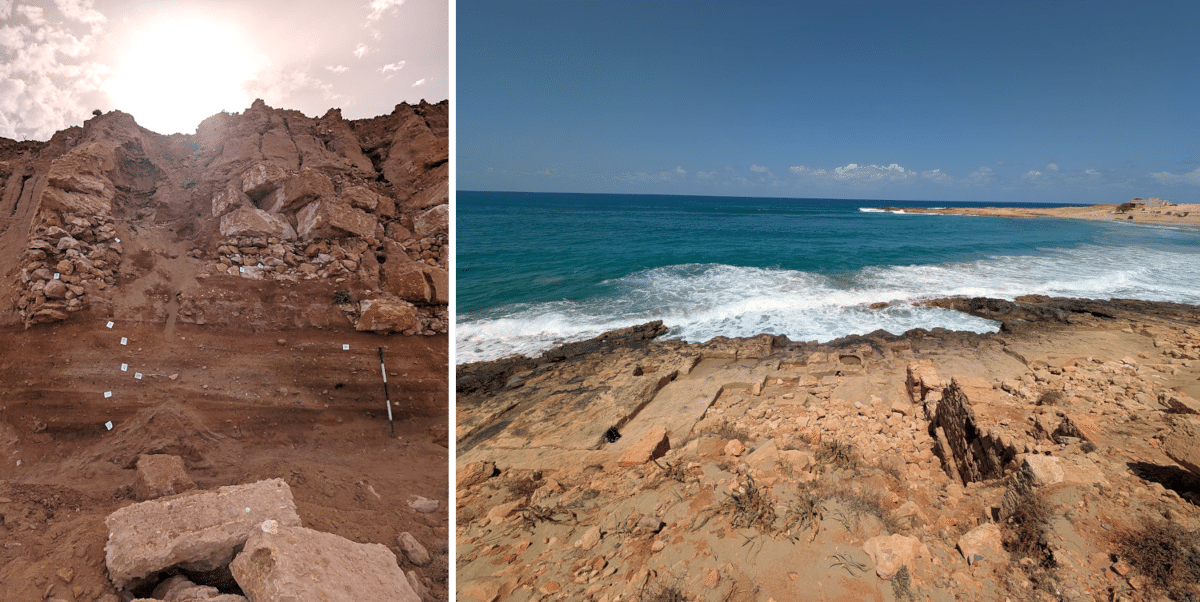
Aptouchus is a coastal harbour settlement dating to the Greek,Roman, and Late Antique periods. Though modest in size, covering approximately four hectares, the site played an important role in regional maritime activity and trade. Archaeological remains include Roman-period industrial features such as vats, tanks, and large building foundations, as well as domestic structures with plastered walls and finely worked stone masonry. These are now visible along an actively eroding cliff edge (Figure 2). Ceramic finds, including fragments of black-glazed pottery, point to activity as early as the Archaic period. In antiquity, the harbour was naturally sheltered by a rocky outcrop connected to a central islet, creating a protected anchorage for vessels. Today, parts of the ancient settlement lie beneath modern buildings and an Islamic cemetery, adding further complexity to the site’s preservation.

Figure 2: Left - walls protruding from the eroding cliff face; Right - industrial installations and buildings.

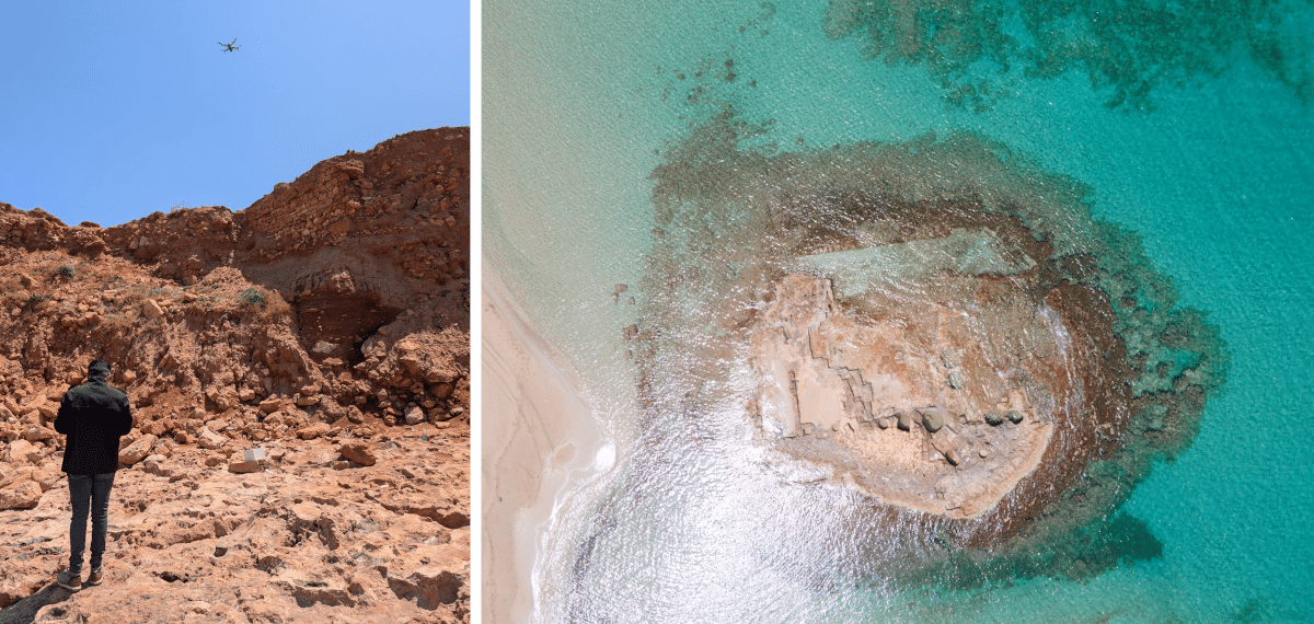
During the 2025 field season, a team of specialists from Ulster University (UK), the University of Benghazi (Libya), the Libyan Department of Antiquities, and the Alexandria Centre for Maritime Archaeology & Underwater Cultural Heritage (Egypt),undertook a multi-faceted programme of recording and documentation. The team began with a detailed site survey, identifying and mapping architectural features as well as recently disturbed areas. High-resolution drone photography was used to create 3D digital models of the site and surrounding terrain, including the vulnerable cliff face (Figure 3). These models will serve both as an archival record and as a baseline for monitoring ongoing change.

Figure 3: Left - our drone pilot at work; Right: drone shot of one of the islets with industrial features that formed part of the harbour.

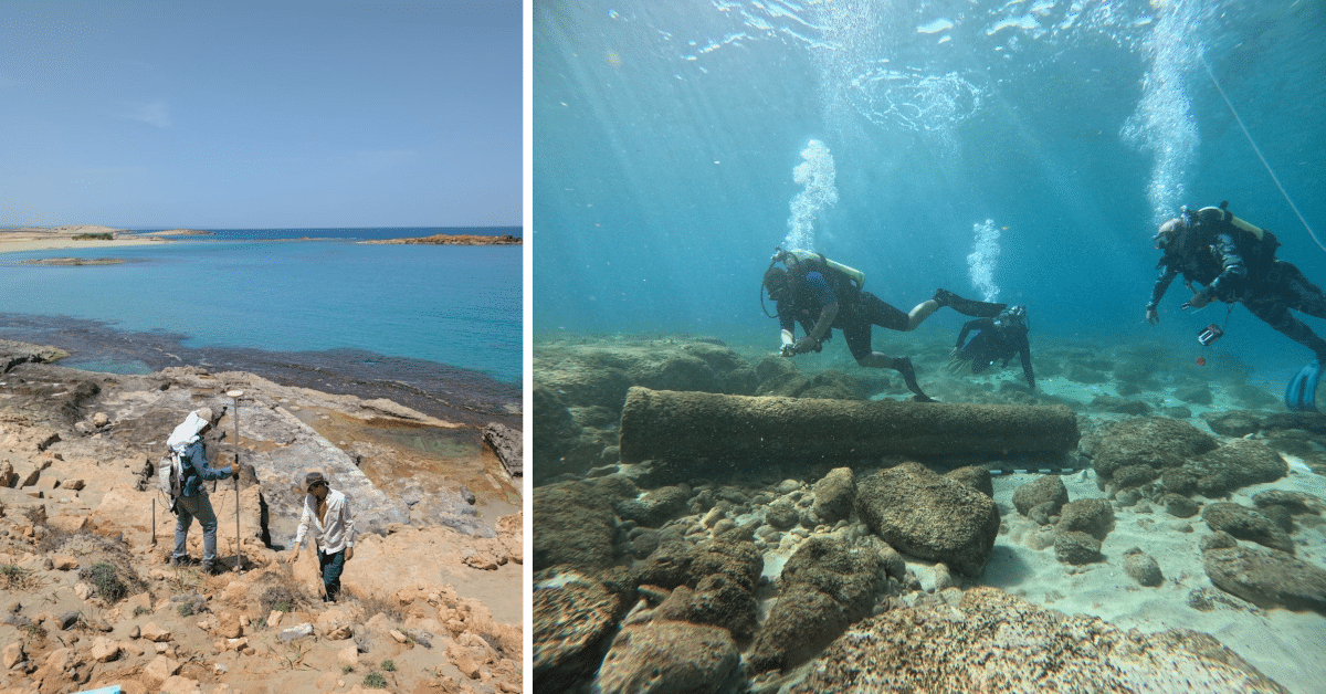
Terrestrial documentation focused on areas under the most immediate threat, especially where bulldozing had exposed ancient structures. These were recorded using differential GPS and photogrammetry, ensuring accurate spatial documentation. In parallel, a preliminary underwater survey examined submerged archaeological features of the harbour(Figure 4). Several stone blocks and cut features were identified, consistent with ancient maritime use.

Figure 4: Left - DGPS recording of visible architectural features; Right - Underwater survey of harbour area with submerged broken granite column.

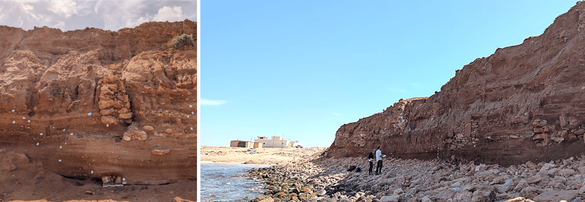
A key component of the work involved recording the exposed stratigraphy of the eroding cliff. Here, archaeological layers are visibly collapsing into the sea at an alarming rate. Detailed photographic and written records were made of these sections before they are lost (Figure 5). Pottery recovered from these layers will contribute to establishing a more precise understanding of the site’s chronology.

Figure 5: Recording the visible stratigraphic layer of the 120 m long cliff face.

This emergency project represents a crucial step in preserving the cultural heritage of Aptouchus. It has produced a lasting record of a site under immediate threat and drawn attention to the broader challenges facing Libya’s coastal archaeology. The documentation gathered will not only support future research into the economic and social dynamics of smaller ancient harbours but also underline the importance of protecting vulnerable heritage landscapes across the region.

Fieldwork Report: Aayush Umesh

Banner Image for Aayush Umesh 2025 Fieldwork Report

Finding My Path

Aayush Umesh, 2025 Eric and Carol Meyers Fieldwork Scholarship Recipient 

A year ago today, I had no idea that I would become an Islamic archaeologist. My path has been full of twists and turns. In the last four years at the University of Georgia, I have completed a bachelor’s degree with double majors in theatre and communication studies and a minor in Arabic. I entered college with ambitions to attend law school. Eventually, however, I found archaeology, and tried my hand at excavation last summer at Antiochia ad Cragum, Türkiye. I fell in love and attended both the ASOR and AIA Annual Meetings in 2024 and 2025, respectively. At the ASOR Annual Meeting, I met Professor Bethany Walker, the head of the Islamic Archaeology Research Unit at the University of Bonn. Upon meeting her and listening to the work of her graduate students, the next segment of my path had been illuminated. I decided to pursue the MA in Islamic Archaeology at the University of Bonn and to accompany the university for fieldwork at Tall Hisban, Jordan, from May 18-29, 2025.

Photo of Aayush Umesh in Tall Hisban
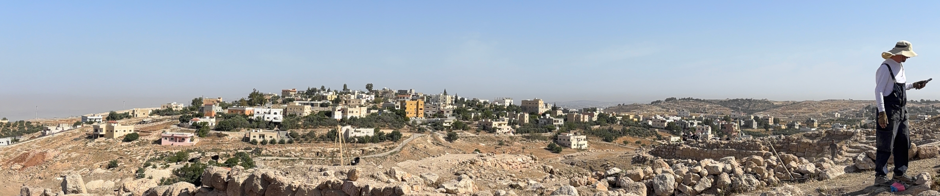
A panoramic view from Tall Hisban.
Photo from Aayush Umesh in Tall Hisban
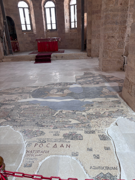
Madaba Map on the floor of the St. George Greek Orthodox Church.

Tall Hisban is around a 30-minute drive from Madaba, the “City of Mosaics” that houses the Madaba Map (the oldest surviving cartographic depiction of the Holy Land as a large floor mosaic on the floor of the St. George Greek Orthodox Church). Madaba today is a vibrant city boasting harmonious Christian and Muslim communities, spectacular archaeology, delicious Jordanian cuisine, talented mosaic artisans, and proximity to the capital city of Amman (which is less than an hour’s drive). Our team stayed at Salome Hotel, a gorgeous accommodation for guests in Madaba with simple yet beautiful amenities and a kind, hospitable staff.

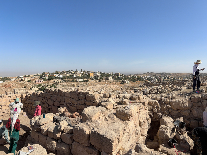
Tall Hisban is a breathtaking site with millennia of occupation, with excavated material culture representing periods from Paleolithic to Late Islamic. A stroll through the site takes one up Roman stairs to Byzantine houses, through Islamic bathhouses reusing Christian baptismal basins to the entrances of previously settled underground cave systems. Old and new are engaged in a remarkable dance at Tall Hisban, best captured by the abundant spolia utilized in its diverse features’ constructions as well as in the tell’s modern residential surroundings.

Photo from Aayush Umesh in Tall Hisban
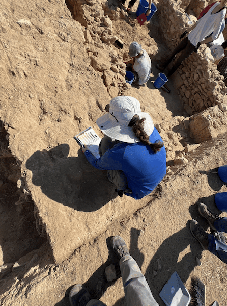
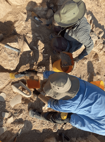
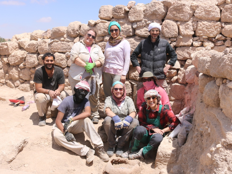
Me and some teammates in our square.

I was assigned to a square which had been identified in a previous season as an Ayyubid-era kitchen. Our goal was to continue excavating this square, passing the Ayyubid layer and investigating those beneath to determine the usage of the space in earlier Islamic eras. Our objective this excavation season was to gain a better understanding of the dietary practices of the inhabitants of Tall Hisban by comparing data procured at the tell to data procured at a nearby wadi (valley) that had been historically used for agricultural purposes. As such, many soil samples were taken during excavation for botanical analysis, particularly in areas high in charcoal or surrounding excavated cookwares. Some of the most outstanding discoveries were tabuns, or traditional clay ovens, which contain a multitude of data.

Photo from Aayush Umesh in Tall Hisban
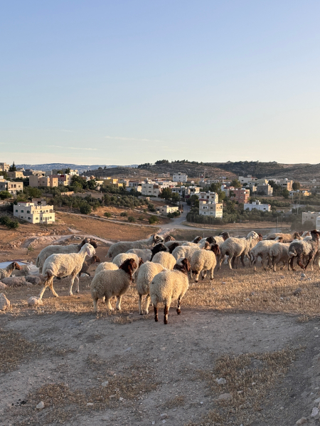
Sheep would greet us each morning at the site.

Upon returning to the hotel each afternoon, the group would reconvene for pottery washing and counting after a nap. It was inspiring watching Prof. Walker identify the period or region of any given sherd in seconds! Pottery washing was a great educational experience because I was able to acquaint myself with many types and periods of wares including Byzantine, Umayyad, Abbasid, Ayyubid, Mamluk, and Fatimid.


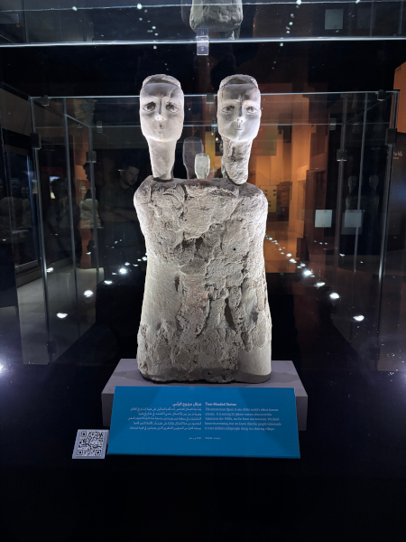
Having completed a minor in Arabic at UGA, I was thrilled to have this opportunity to develop my skills in spoken Arabic, particularly in the Jordanian dialect. I learned many helpful field vocabulary words from Jordanian workmen onsite including the words for trowel, pottery, shovel, dustpan, glass, pickaxe, and more! The team had one free weekend, and while most used this time to visit Petra, I decided to visit Amman instead with Prof. Walker and another teammate. We spent some time at the Jordan Museum, where I was able to stand just inches away from both the Dead Sea Scrolls and the Ain Ghazal statues. We then visited the Amman Citadel as well. The Jordan Archaeological Museum is located on the citadel, and features excavated artefacts from Tall Hisban and many other sites in Jordan.

Photo from Aayush Umesh in Tall Hisban
The Ain Ghazal statues at the Jordan Museum.

My time at Tall Hisban was nothing short of life-changing. Through this experience, I made over a dozen friends at the University of Bonn, which will make my transition far easier as I relocate to Germany this fall. I am thrilled that I have found my path—Islamic archaeology—and have been given the opportunity to study with one of the world’s leading Islamic archaeologists. I look forward to returning to Tall Hisban in future excavation seasons and continuing the work that we did this summer.

Photo from Aayush Umesh in Tall Hisban
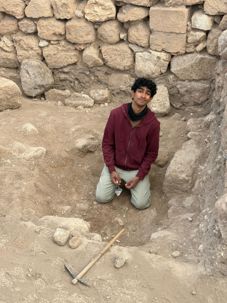
Me in the field!

Aayush Umesh is a recent graduate of the University of Georgia with a Bachelor of Arts in Theatre and Communication Studies. He hopes to become a professor in Islamic archaeology at a major research university, focusing in the Levant and/or South Asia. He will soon begin a Master of Arts degree in Islamic Archaeology at the University of Bonn, supervised by Prof. Bethany Walker.

Want to help more students and early career archaeologists get into the field? Donate to the cause today by selecting “Fieldwork Scholarships” as your gift purpose!

2025 Fieldwork Updates

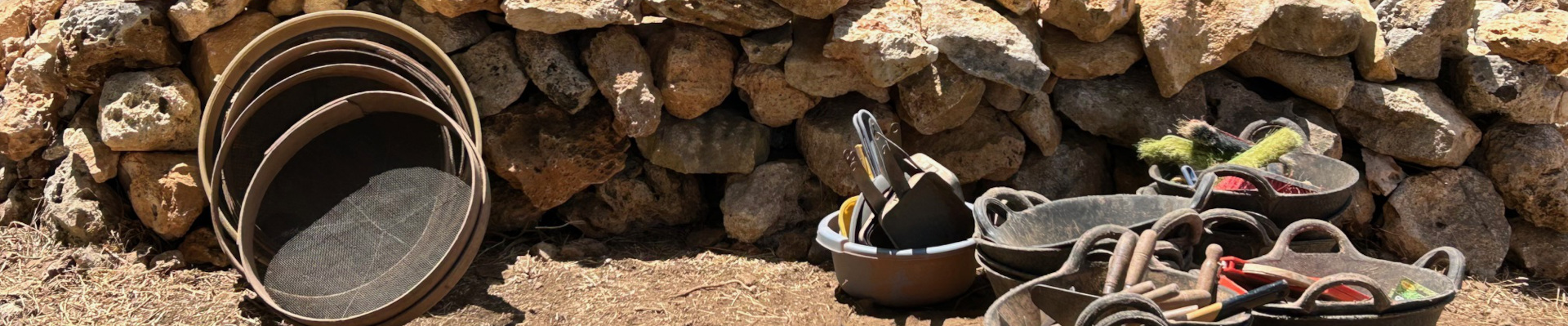
image of sifters, buckets, and other tools on the Menorca Archaeological Project

2025 UPDATES FROM THE FIELD

It is a busy and exciting time of year for many ASOR-affiliated projects. Below are some links to updates and stories from the field on social media. Click to read the latest edge-of-the-trowel news from the field. Survey, excavation, processing artifacts, conservation, visiting other sites, talking to the public, hosting outreach events—these accounts offer a slice-of-life picture of archaeology in action.

Photo from Aayush Umesh in Tall Hisban
Aayush Umesh, 2025 Eric and Carol Meyers fieldwork scholarship recipient, and team members excavating at Tall Hisban, Jordan.

Projects with Upcoming Fieldwork

Stay tuned from more news from students and researchers later this summer and fall both on the ASOR website and social media.

If you’d like to include updates from your ASOR-affiliated project on this list, email Marta Ostovich at programs@asor.org.

Interested in affiliating your project with ASOR? Learn more here.  

Fieldwork Report: Gabbi Graber

Photo of Tel Burna, Israel

Memorized Movement

Gabbi Graber, 2024 Stevan B. Dana Fieldwork Scholarship Recipient

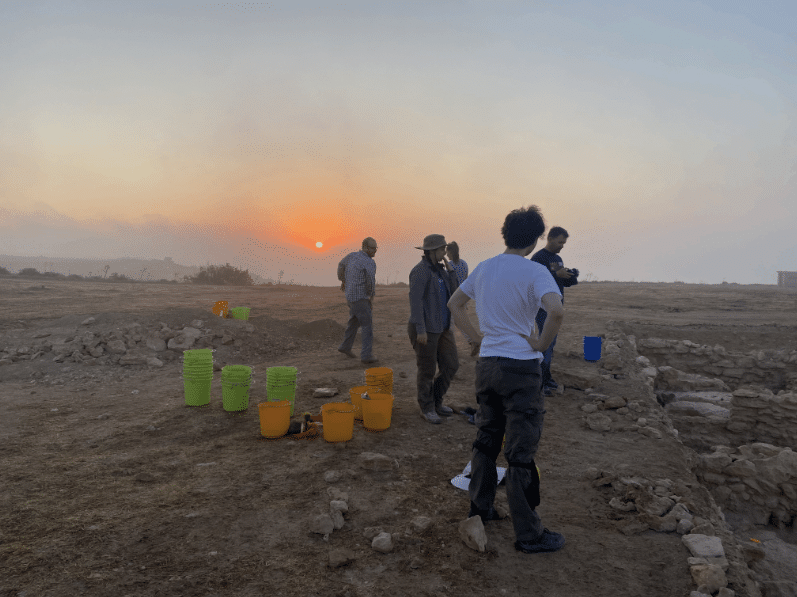
My alarm goes off at 4:50 a.m. and in a blur of confusion it takes a moment to remember that I am not in my bed in Alabama but instead am in a kibbutz in Israel. It’s day four and I have learned and practiced the exact time I need to make sure my bag is packed, coffee is made, and my water bottles are filled. In this flurry of well-practiced movement, everyone silently packs into the same car we’ve ridden in all week to arrive at Tel Burna before 6:00. The Shephelah hills roll around us as we listen to a dramatic Disney soundtrack calling forth nostalgia and lyrics long since memorized. We make the final ascent up to the site as the sun rises behind Tel Burna.

Photo of Tel Burna, Israel

It feels almost instinctual that the first order of business, before the sun even begins to beat down, is to lift and place shade cloths over the open squares. People begin to scatter to their respective spaces as the area supervisor, makes the necessary adjustments for the day and communicates with the square supervisors. Seamless rotations of who is picking and who is cleaning allow for needed water breaks as the level of ground slowly lowers. As we dig, our eyes become better at spotting the indicative sherds from the body sherds. A sharp jar goes up my elbow as I hit the stone that will be the first evidence of a wall cutting straight through our square. A loud voice breaks us from the focus, and everyone grabs their preferred breakfast items knowing what will sit well with still four more hours of digging. As I work with a patishe, I listen to the conversation of the Dig Director, area supervisor, and my square supervisor about the pattern of the walls and where we will need to open a new square. I check my watch and with not much time left to dig in the day I swiftly switch to sweeping the square starting in a corner to move cohesively with the others in my unit. What I thought was bedrock on day one I now know to be the packed dirt we will remove tomorrow. Many hands make the end of the day move faster as we organize tools, lower shade cloths, and pack up the cars. The drive back to the kibbutz involves more singing of childhood songs, laughing at inside jokes, and wistful longings of a post-dig ice cream.

Photo of Tel Burna, Israel

We each grab a brush and bucket of pottery, and I am always drawn to a bucket that was from the square I dug. Pottery washing clumps us back together as we recall different sherds and the squares they came from. Every ear is bent towards the main table where the experts sit examining and reading pottery as the square supervisors talk through their square. They casually lift a sherd and quickly place it in its period. This leaves volunteers and students alike astounded at the practiced eye of a well-seasoned archaeologist able to date a sherd by touch and sight alone.

Photo of Tel Burna, Israel

Dirt washed down the drain and feeling slightly more human, we again hop in the cars and hike up a new tell with new site lines that help explain the importance of the geographical placement of Tel Burna within its valley system. The day has been long and full, and dinner can switch quickly between laughter and silent, tired camaraderie. Dirt mustaches, sweat stains, repeat outfits, and tired conversations bond a group that is half repeat diggers and brand-new strangers.

Photo of Tel Burna, Israel

To think that I knew none of this a mere four days ago is astounding. There is still much to learn and as I heard well-experienced archaeologists in the field say “we’ve never seen this before” or I think about potentially being a square supervisor in the future. A mere four days ago I did not know what a tag was, and now I have the license number memorized. And while the pick does not feel comfortable in my hand it feels more natural that it did on Monday. I knew as soon as my first day in the field was over that I wanted to spend more days, months, summers, and years becoming seasoned and trained in this profession, for each day on site becomes a day of new discoveries in the art of what becomes practiced and perfected memorized movement.

Photo of Tel Burna, Israel

Gabbi Graber is a recent M.A. graduate from Jerusalem University College studying Biblical History and Geography and will begin her Ph.D. in Ancient Near Eastern Archaeology at Lipscomb University this fall.

Want to help more students and early career archaeologists get into the field? Donate to the cause today by selecting “Fieldwork Scholarships” as your gift purpose!
Message from ASOR’s Board Chair

Message from ASOR’s Board Chair

Dear ASOR friends:

In about 6 weeks, we will conclude another successful ASOR fiscal year (June 30). This year, by working together, we have made substantial progress in increasing ASOR’s capacity to fulfill our mission in the face of unexpected headwinds.

You, as an ASOR member and friend, support our solid foundation—strong publications, an engaging annual meeting, enhanced support for fieldwork, and careful stewardship of funds. Conflicts around the world continue to impact our annual meeting attendance and will affect summer fieldwork opportunities. Nevertheless, your membership and gifts advance our shared goals.

This year, 2025, marks the conclusion of one major initiative and the beginning of another.

On Saturday evening of the Annual Meeting in Boston, we will celebrate ASOR’s 125th anniversary and the successful completion of the $5 million ASOR 2025 campaign. So far, you have helped us raise $4.6 million. We’re nearly there! Your support of this fundraising initiative enables ASOR to thrive and innovate despite challenges to the humanities and threats to cultural heritage around the world. Discounted tickets for the anniversary celebration are available, and we encourage all friends, members and supporters to join us.

As the ASOR 2025 fundraising effort winds down, we have already begun another key initiative: to update our strategic plan for the years 2026 – 2030. Our President, Sharon Herbert, and President-Elect, Jane DeRose Evans, are leading a task force to consult members, develop the plan, and send it to the Board of Trustees.

As we near the end of the fiscal year (June 30), I ask you to consider an unrestricted gift to ASOR. We are currently about $40,000 short of our Annual Fund goal of $140,000. The Annual Fund allows ASOR to deliver its programs effectively. Changes to federal grants impact staff support and our cultural heritage work, so your participation is even more important this year.

If you have already contributed this fiscal year, thank you. If you haven’t yet made a gift (or if you have contributed but can make another gift to help at this challenging time), I hope you will join me in giving before June 30. I deeply appreciate your support.

Best regards,


Sheldon M. Fox
Chairman, Board of Trustees


Fieldwork Report: Ofelia Tychon

Banner Image for Ogelia Tychon Post

Getting to Know Rural Assyrians

Ofelia Tychon, 2024 Katherine Barton Platt Fieldwork Scholarship Recipient 

Photo of Ofelia Tychon on the RLIIM projec.

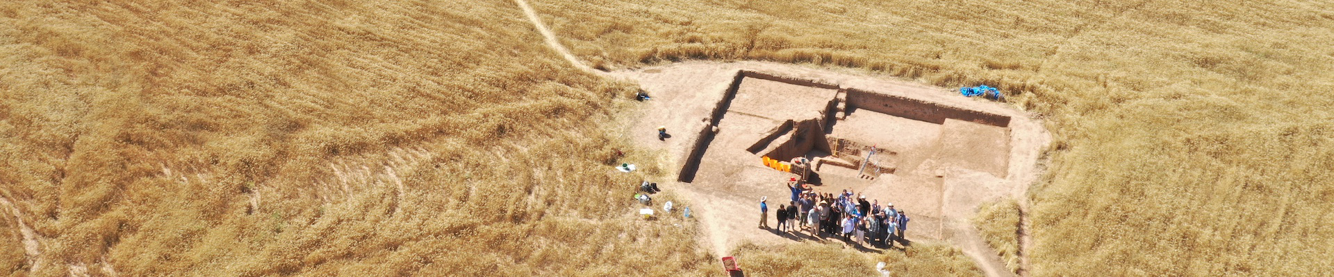
This spring, I got a chance to be part of the excavation team for the Rural Landscapes of Iron Age Imperial Mesopotamia (RLIIM) Project, now in its third season. The project, run by Prof. Petra Creamer of Emory University, brought together international scholars from Cambridge University, J.W. Goethe University-Frankfurt am Main, Johns Hopkins University, Montana State University, University of California, Los Angeles, University College London, University of Chicago, University of Pennsylvania, and Utah State University, in addition to the local professionals from the Directorate General of Antiquities and Heritage of the Kurdistan Region.

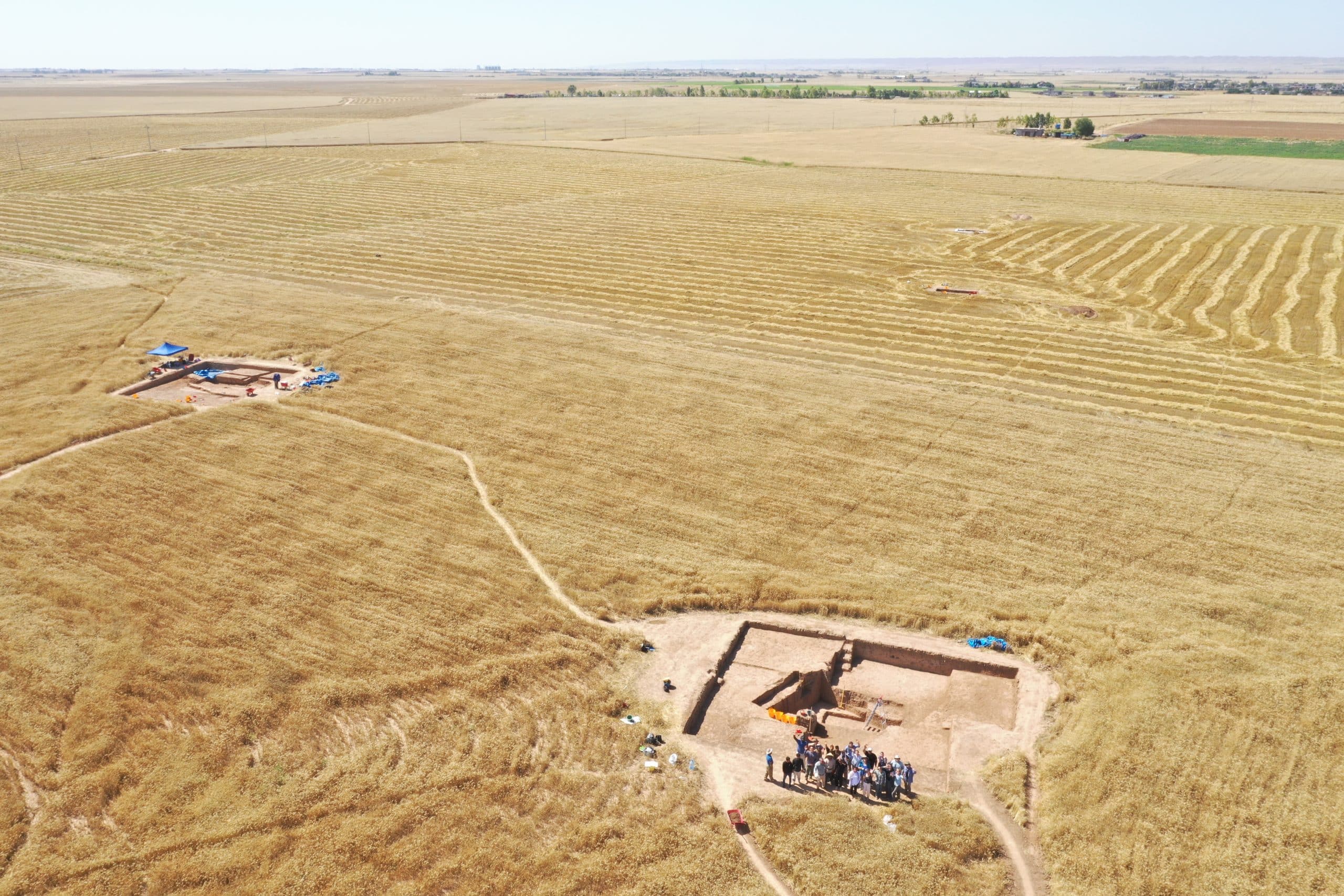
Drone Photo of RLIIM Site

The RLIIM site is located near Erbil, Iraqi Kurdistan, which is part of the area usually referred to as the ‘Assyrian Heartland’. The Neo-Assyrian Empire expanded from its heartland to reach from the Arabian Gulf to the Mediterranean, including Egypt, between the 9th and 7th centuries BCE, and is often seen primarily as an aggressively expansionist empire, fuelled by conquests and associated booty, tributes and deportations, which has driven the sort of scholarship that is produced about Assyria.

Historically, most excavations in the Iraqi Kurdistan, where the Assyrian heartland was located, have focused on major urban sites, and particularly monumental architecture, with even urban living quarters rarely excavated. While this is slowly changing, as surveys that uncover rural sites have been and still are being undertaken, excavations of small, rural Iron Age sites continue to be extremely rare, and RLIIM is proudly one of the few. RLIIM seeks to reconstruct how Imperial Assyria impacted rural landscapes and its rural populations, particularly why this site (and others like it) existed in a relatively marginal agricultural area, which populations settled in these rural areas and how they organized, as well determining the extent (or lack thereof) of continuity between the late Assyrian and post-Assyrian periods.

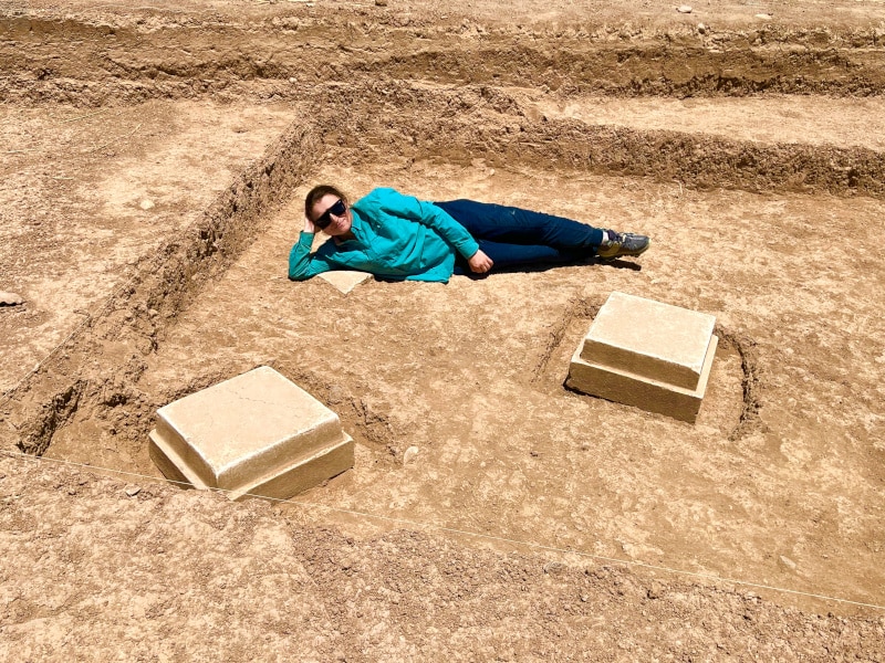
During the 7-week 2024 season, the RLIIM team was able to significantly expand its three existing trenches and opened up a fourth one. Trech A, where I spent most of my time during the season, houses a large mudbrick building with a courtyard. The nature of the soil in the area means that distinguishing mudbrick is a challenge and requires great concentration from the excavators (and perfect morning light!).

Photo of Ofelia in Trenches at RLIIM

The choice to expand and open up new trenches was greatly aided by magnetometry survey results from the first two seasons. Further magnetometry surveying was accomplished this season as well. I was personally able to participate in gathering magnetometry data and get “hands-on” magnetometry survey techniques instruction.

An important part of the RLIIM project is the analysis of the faunal and archaeobotanical remains. Numerous samples were collected and sent for analysis at the end of the season, and we eagerly await the results. As with most archaeological projects, pottery processing is an integral element of the efforts. Thousands of sherds were processed on site, and the analysis thereof is helping in creating an updated late Assyrian vs post-Assyrian pottery typology, something that is particularly helpful when analysing surface survey results, which are vital in order to understand the settlement pattern change that took place after the collapse of the Neo-Assyrian Empire.

Photo of Drawn Pottery

The team did not just spend their time at the site. We were able to travel to key locations in the region on our days off, including the Neo-Assyrian period Jerwan Aqueduct, Faida Canal, Khinis reliefs and Bastora Dam sites, as well as visiting the Cambridge University’s Shanidar Cave project famous for its Neanderthal remains.

Photo of Shanidar Cave

The 2024 season concluded just as the weather in Kurdistan was heating up well into the 100s, but the work continues on the analysis of the data gathered by the team. I look forward to coming back next spring armed with more knowledge acquired via this analysis.


Ofelia is a PhD candidate at the Institute of Archaeology, University College London. She holds a Master’s Degree in Ancient Near Eastern Studies from the University of Toronto. Her research interests lie within the economic and social aspects of history and archaeology of the Near East during the first millennium BCE, particularly the Neo-Assyrian and Neo-Babylonian Empires.

Twitter/X @ofeliatweets

RLIIM Project: https://rliim.weebly.com/

Want to help more students and early career archaeologists get into the field? Donate to the cause today by selecting “Fieldwork Scholarships” as your gift purpose!
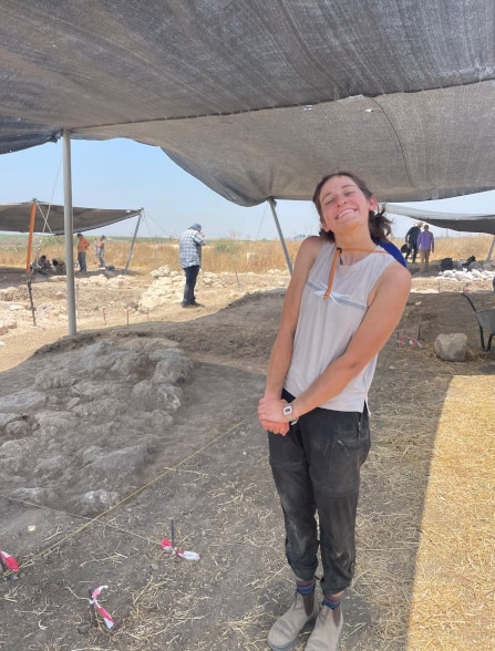
Fieldwork Report: Rubar Yavuz

Tell Tayinat 2024: A Season in the Shadow of an Earthquake

Rubar Yavuz, 2024 Eric and Carol Meyers Fieldwork Scholarship Recipient

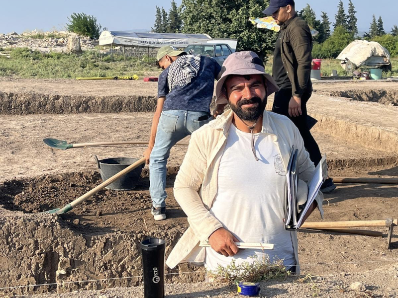
Tell Tayinat is a mound located 18 km west of Reyhanlı district in Hatay and 1.5 km east of the Orontes River. Southeastern Turkey experienced a major earthquake in 2023, which significantly impacted and damaged the Hatay province. Our excavation house was also severely damaged by the earthquake. This is why our excavation house consisted of containers and portables for the 2024 season.

Archaeology is not just about digging the soil. It is a space where human relationships are strengthened, where people come together to work towards a common research goal, and where individuals from different cultures meet. Even though this earthquake has caused major losses for people we know from the region, I still feel that we were able to reconnect, help each other while having a productive season.

The Iron Age layers have always fascinated me and have been an important focus of my thesis research. I would like to thank our excavation director for allowing me to excavate and study the Iron Age layers.

First day of excavations

The Tell Tayinat excavation site was identified in 1933 by a team from the Oriental Institute of the University of Chicago, led by Robert J. Braidwood. In 1999, the mound was re-examined by a team led by Timothy P. Harrison, and excavation began in 2004. During these excavations, Early Bronze Age and Iron Age layers were identified.

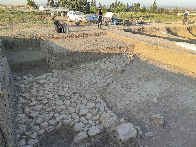
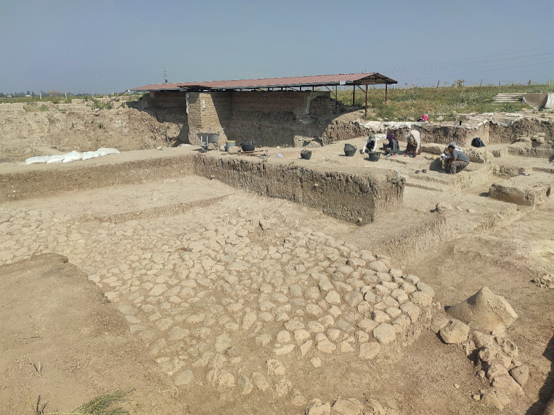
During the 2024 season, we woke up at 4:00 a.m., and the vehicle departed at 4:30. Of course, these times shifted based on the sunrise. I was excavating a square in the Iron Age layers, following a stone pavement that had already been exposed in the 2022 season. From the moment it was uncovered, this stone layer indicated the extent of its damage. The surface soil extended to a depth of approximately 0.35 m. I was aware that I was conducting an excavation of surface soil, yet I was still careful not to miss any artifacts. Over the course of about a month, ceramic and basalt fragments were uncovered.

Iron Age Stone Pavement that has been disturbed

Our excavation used the locus-lot system, which meant we divided the area into square sections and excavated piece by piece. The main objective in the area I was working on was to follow a specific pavement. The most striking aspect for me was the artifacts located just above the floor. One seal, dated to the Assyrian period, was found directly on this stone pavement. After documenting the artifact, it was removed. Archaeology, in a sense, is about concealing all emotions, I managed to calm the excitement I felt inside though I was very happy that it was uncovered. After cleaning in the dig house it was confirmed to be an Assyrian seal with the image of a quadruped. There was some discussion of what animal it could be; many thought it was a lion, though some thought it was a type of composite animal. After this find, it was decided that expanding the excavation area further would be beneficial. While doing so, a bulla was found on this stone floor. This artifact was also dated to the Assyrian period.

End of season photo of my square

So, this floor was either built during the Assyrian period, or it predates them, with the Assyrians having walked on it. Despite the damage in the area I was excavating, this layer belonged to the Assyrians.

A gravelly layer made of hard soil and nari was encountered in the north of the area. This layer indicated that we had transitioned to a second phase. This gravelly layer extended beneath the stone floor. After documenting two stones from the stone pavement, they were removed, and a bronze armor scale was found beneath the stone floor. The Neo-Assyrian artifacts and related late Iron Age ceramics suggest that this layer was part of the Neo-Assyrian settlement in Tayinat, which was incredibly exciting to excavated and reveal.

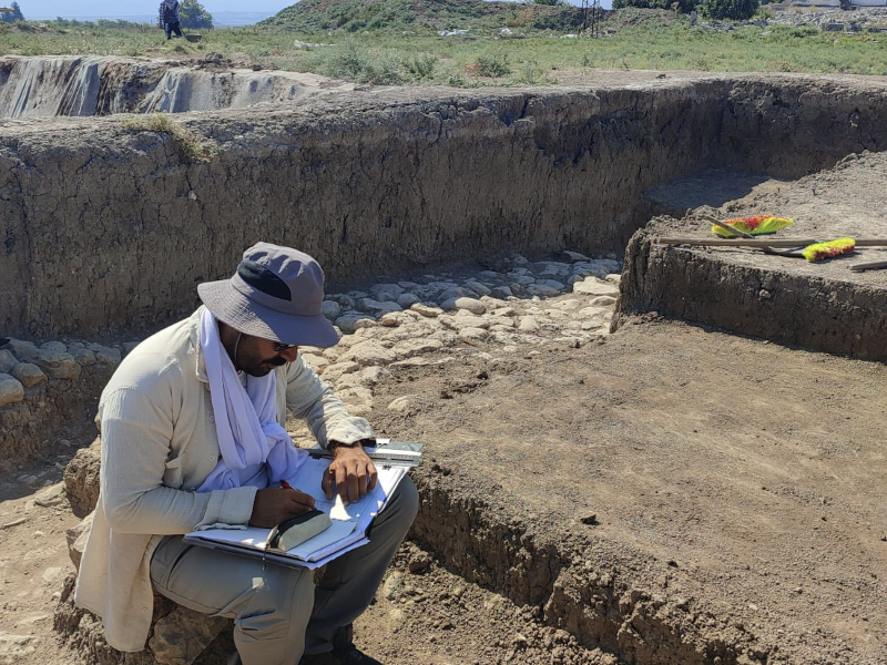
Me while doing a section drawing

n conclusion, this season’s excavations were both enjoyable and tiring, but that is archaeology! I would like to express my gratitude to ASOR and Eric and Carol Meyers for providing this fellowship. Thanks to this fellowship, I was able to attend Tell Tayinat excavations, expand my research on the Iron Age, and make new friends.

For more information about the Tayinat Archaeological Field School visit here.

Working on a square plan

Rubar was born in 1995 in the province of Mersin. He completed his primary, secondary, and high school education in Mersin. In 2017, he enrolled in the Archaeology department at Van Yüzüncü Yıl University. He graduated with honors in 2021. He was accepted into a master’s program at the same university, where he is currently continuing his studies. He participated in 17 different excavations focused on the Iron Age. He has conducted research on burial traditions of the Iron Age and is writing his master’s thesis on these burial practices.

Want to help more students and early career archaeologists get into the field? Donate to the cause today by selecting “Fieldwork Scholarships” as your gift purpose!
Fieldwork Report: Brady Hill

Summer Days in Bazyan – My Involvement in the Kani Shaie Archaeological Project

Brady Hill, 2024 G. Ernest Wright Fieldwork Scholarship Recipient 

As a budding archaeologist researching ancient Mesopotamia, saying my opportunity to excavate in Iraqi Kurdistan was a ‘big deal’ is an understatement. Indeed, after being accepted for a Masters in Archaeology at Cambridge, I contacted my to-be supervisor Dr. Steve Renette to enquire about the university’s archaeology department and my potential dissertation topic. After discussing the discovery of Parthian period (2nd century BC – 2nd/3rd century AD) remains during his summer of 2023 excavations at Kani Shaie, Dr. Renette offered me the chance to work on this material during the project’s 2024 field work season. This was an offer I could not refuse given my strong interests in Parthian period Mesopotamia, so I quickly began applying for grants to enable my participation in the Kani Shaie Archaeological Project.

Fortunately, ASOR generously awarded me the G. Ernest Wright Fieldwork Scholarship, securing my opportunity to go to Iraqi Kurdistan. Their assistance supported my living expenses on the dig, allowing me to work at the site for the entirety of the 5-week season running from late August to late September.

After 4 months of eagerly waiting for the fieldwork season to begin, my daily fantasies of visiting and working in Iraqi Kurdistan were finally brought to fruition once we exited Erbil International Airport and were greeted by the blistering heat of the region’s morning sun. It felt as if my countless hours of studying and researching had led up to this moment, and as we began strolling to the project driver’s car and I heard the Kurdish people speaking their beautiful language, it hit me that I was finally in this fascinating land.

Given Kani Shaie is located in Sulaymaniyah Province in the eastern half of Iraqi Kurdistan, we had a 3-hour drive from Erbil to the village of Bazyan where our accommodation was located. Once we arrived, we had to prepare the house for the next 5 weeks and the rest of the project team joining us over the coming days. After completing our preliminary tasks, it was time to begin excavating.

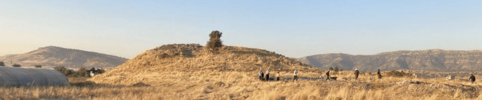
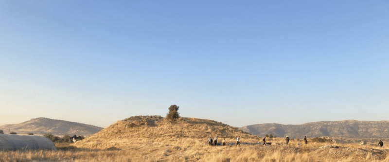
Looking south towards Kani Shaie. The Lower Town trench can be seen in the foreground in front of the main settlement mound.

Now, despite its small size, Kani Shaie is no ordinary one or two period site but possesses a settlement history ranging from the 6th millennium BC to the Ottoman period. Therefore, the project team worked in two excavation trenches this season, one on the main settlement mound which focused upon the site’s Chalcolithic and Early Bronze Age (4th and 3rd millennium BC) occupations, and one in the ‘Lower Town’ focused on Kani Shaie’s later occupations (the Hellenistic, Parthian, and Islamic periods). With my aforementioned interests, I worked in the Lower Town and was given the task of processing and recording the plethora of ceramic finds from the trench.

Our schedule was intense but manageable, digging from 5 am to half past noon 6 days a week, and doing post – excavation processing for the rest of the day. This consisted of pottery washing, drawing and photography, recording the daily small finds (glass bracelets and sherds, grinding stones, miscellaneous metal pieces, etc.), making sure the contexts sheets were up to date, and a whole plethora of other tasks carried out by the project’s team members. I was very fortunate to learn many new skills related to pottery recording and analysis thanks to the patience of Dr. Renette and our ceramics specialist Dr. Mike Lewis (University of Coimbra). This included my introduction to drawing pottery profiles by hand, a necessary task for archaeological publications. Though quite difficult for me at first, this work was eventually highly rewarding once I gained sufficiency in the skill, transforming me into a proper ‘pot nerd’ by the end of the season.

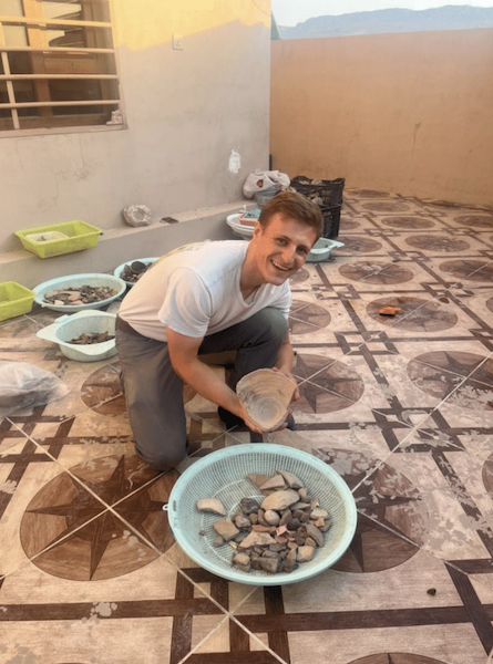
Posing with one of the washed pottery baskets. After being cleaned by the Kurdish students on the project team, it was my daily task to sort through these baskets of pottery, counting each sherd and keeping those that were diagnostic.

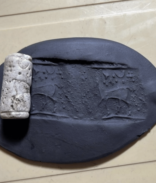
Nevertheless, some interest ing small finds emerged from these levels, including a Neo-Assyrian period (10th – 7th centuries BC) cylinder seal! Though its location within a Parthian and Islamic period context further attests to these occupation layers’ highly disturbed nature, the seal’s presence at Kani Shaie suggests a Neo-Assyrian period occupation remains to be discovered. Despite this amazing find, these initial weeks of our excavation were still rather disappointing due to the poor preservation of our trench’s archaeology, leading us to push onwards with the hope of finding more preserved Parthian period remains.

The Neo-Assyrian period cylinder seal found during our excavations in the Lower Town. It was spotted by Hawre, one of our dedicated Kurdish workmen helping us in the trench.

Eventually, we found something to write home about. Indeed, two linear parallel stone walls running southeast to northwest within the trench began to poke out of the ground as we dug downwards. With curiosity and great excitement, we meticulously exposed the walls, eventually revealing a substantial rectangular stone building. We had found a well-preserved pre-Islamic period level! However, there was something different about the pottery styles and shapes from the building’s associated layers, and after studying the finds in the afternoon it became apparent that this was likely not Parthian, but a Hellenistic period construction.

For those readers who are unaware, the Hellenistic period precedes the Parthian period and is characterized by the conquests of Alexander the Great between 333 BC and his death in 323 BC, and the subsequent establishment of the Seleucid Empire in Mesopotamia by one of the deceased king’s companions, Seleucus I Nicator. Along with the Parthian era, I have a great interest in Hellenistic period Mesopotamia and the Seleucid Empire, so you can imagine my excitement once we realized the building’s (rough) dating!

As typical with all field seasons, we had only a few days to excavate the structure before wrapping up the project for the year. Consequently, we were unable to fully excavate the building, but its discovery indicates a substantial Hellenistic period occupation remains to be uncovered in the coming seasons at Kani Shaie.

Drone photo of the Lower Town’s Hellenistic period stone building. Taken towards the end of the excavation season.

Outside of the excavation, we took team trips to archaeological sites and scenic areas of Sulaymaniyah Province during our days off, which for the most part was always a Friday. These included the Achaemenid rock cut tombs of Qizqapan and the beautiful Lake Dokan, the Paleolithic caves of Hazar Merd, and the Parthian period mountain fortress of Rabana-Merquly. Our visits served as an excellent way for the project team to relax and appreciate the lands in which we worked, finishing the afternoon with a wonderful Kurdish lunch consisting of a kebab, warm bread, and the fermented yogurt drink ‘dogh’. I particularly enjoyed the opportunities we had to immerse ourselves in Kurdish culture and their hospitality, learning new words through conversation and exploring their ways of living.

Group photo of the project team visiting the University of Heidelberg’s excavations at Rabana-Merquly. Led by Dr. Micheal Brown, the excavations focus upon the large-scale military fortifications at the site and its religious sanctuary.

Beyond this being a fantastic field work and learning experience for myself, the plethora of Hellenistic and Parthian period pottery recovered from Kani Shaie this year has provided me with a dissertation topic for my ongoing studies at Cambridge. These periods are historically under-researched within Mesopotamian studies, in particular their ceramic forms and styles. Therefore, with all of this material and the discovery of the stone building, the 2024 season presents an excellent case study for Hellenistic and Parthian period archaeology in Iraqi Kurdistan. My original intention when applying for the Ernest G. Wright fieldwork scholarship was to use the material found at Kani Shaie for my dissertation research, however archaeology is always full of surprises and therefore nothing is guaranteed once the trowel hits the dirt. So, I am beyond elated to research a dataset that I myself was involved in uncovering.

Posing with the largest pottery sherd I have yet to encounter on the last day of excavations. It came from a sunk storage jar in the northwest corner of the trench.

In conclusion, I would like to thank Dr. Steve Renette and the Kani Shaie Archaeological Project’s co-director André Tomé (University of Coimbra) for their generosity and leadership over the course of the 2024 excavation season, as well as Dr. Mike Lewis for his insights and encouragement as I stumbled through pottery recording, and Dr. Glynnis Maynard for her excellent supervision of the Lower Town trench. I would also like to thank the Slemani Antiquities and Heritage Directorate and the devoted service of our Kurdish supervisor Zana Abdullkarim Qadir. Lastly, I must emphasize again that it is with ASOR’s generosity that I was able to participate in this excavation without worrying about financial barriers, and it is through them that I and many other emerging archaeologists have been empowered to take those precious fieldwork opportunities offered to them.


Brady Hill is currently studying for a master’s degree in archaeology at the University of Cambridge. Born and raised in Dallas, Texas, his research interests have taken him ‘across the pond’ to study the archaeology of ancient Mesopotamia during both his undergraduate degree at Durham University and now in Cambridge. Alongside the region’s ancient past, he possesses a strong interest in modern Middle Eastern cultures, studying Arabic and Sorani Kurdish in his free time alongside his archaeology coursework.

Learn more about the Kani Shaie Archaeological Project through their instagram: @kani_shaie_arch_project 

Want to help more students and early career archaeologists get into the field? Donate to the cause today by selecting “Fieldwork Scholarships” as your gift purpose!
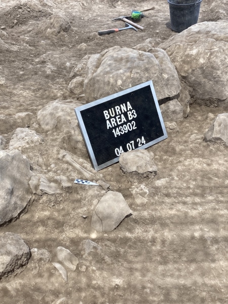
Fieldwork Report: Riley Stockton

Digging Dirt in Cyprus

Riley Stockton, 2024 P.E. MacAllister Fieldwork Scholarship Recipient

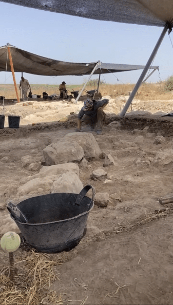
This summer, I had the opportunity to participate in the Vigla Archaeological Field School, a sub-project of the Pyla-Koutsopetria Archaeological Project, based in Pyla, Cyprus. These excavations help to gain information about the history and exchange between Cyprus and the Eastern Mediterranean. The site was a military fortification from the Hellenistic period. The main purpose of excavation in this site is to better understand the purpose of this fortification site and its structures during this period. From the previous findings, it has been determined as a fortification site, but more information is still to be found on the daily life and activities of Vigla, as well as the previous structures that existed there. This experience was my first archaeological dig which was a truly unforgettable experience that deepened my understanding of the field.

Before this dig, my mental image of archaeology was somewhat stereotypical, but now, pottery sherds and layers of soil are what immediately come to mind. I never imagined I’d find myself sweeping dirt off of dirt or using a Munsell book to precisely match shades of soil, yet these became daily routines.

Me using the Munsell book for the first time.

At the dig, along with two other students, I excavated a trench from start to finish, which gave me a comprehensive understanding of the archaeological process. This included the paperwork, the specific excavation techniques applied at different stages, and the importance of understanding the context of artifacts and their surrounding environment.

One of the techniques I learned was photogrammetry, a process that involves taking a series of photographs to create a detailed 3D model of the area. In the trench where I worked, we uncovered two distinct pottery deposits on separate floor surfaces. After carefully excavating around the artifacts, my peers and I meticulously cleared the surrounding area to ensure the best possible images could be captured. One of our project directors, Dr. Brandon Olson, then photographed the trench from every angle to build the 3D model.

My two trench mates, Mason Ross and Laila Maidenberg, cleaning up around the pottery deposit.

Photogrammetry presented its own set of challenges, particularly with lighting. We could only take the necessary photos early in the morning when we arrived at 5:30 a.m. or when the sun was directly overhead. On one occasion, we had to rush to complete the process before the British military began their exercises at 7:30 a.m., as the site is located within a British military base. With the clock ticking, we managed to finish just in time, pack up, and evacuate the area.

Another time, as we prepared for photogrammetry, we noticed a thick wall of fog rolling in. We scrambled to clean the trench and take the necessary photos before the fog obscured the area. It was a race against nature so we could keep on digging.

Very foggy morning, Dr. Brandon Olson getting the pictures done for the photogrammetry just in time.

All in all, we managed to capture the necessary photographs despite the challenges we faced along the way. My trench mates and I, all first-time diggers, began and completed our trench together in just one month. The early mornings and relentless heat were tough, but I’m incredibly proud of the work we accomplished and deeply grateful for the unforgettable experience. A special thanks to ASOR and its donors for providing me with the opportunity to participate in this dig—I couldn’t have done it without their support.

For more information about the Vigla Archaeological Field School visit here.

Me, Mason Ross, and Laila Maidenberg on the last day in our completed trench!

Riley Stockton is a junior at Reed College where she majors in Greek, Latin, and Ancient Mediterranean studies with a concentration in history and archaeology.

Read about other student experiences on the Vigla Archaeological Project here.

Want to help more students and early career archaeologists get into the field? Donate to the cause today by selecting “Fieldwork Scholarships” as your gift purpose!
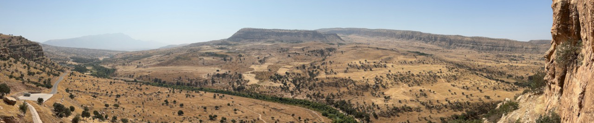
Fieldwork Report: Sarah “Gigi” Konecki-Brazeal

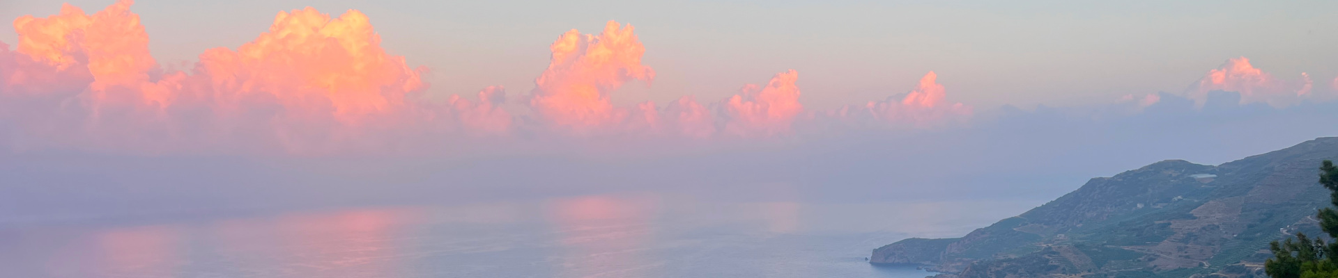
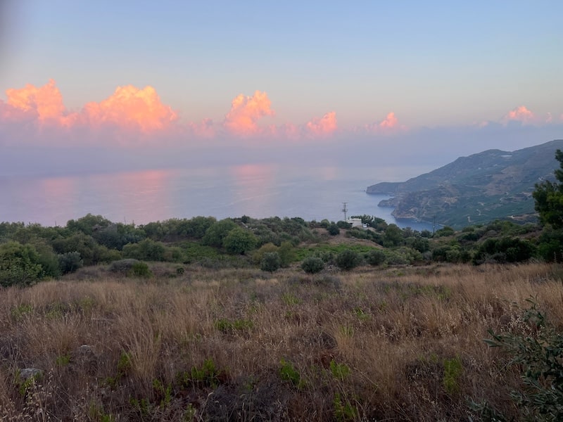
Clouds and the landscapes of Antiochia ad Cragum in Turkey

Archaeology: A Deeply Human Endeavor

Sarah “Gigi” Konecki-Brazeal, 2024 P.E. MacAllister Fieldwork Scholarship Recipient 

First surveyed in the 60s and left untouched for decades, Antiochia ad Cragum is a first-century Roman city founded by Antiochus IV of Commagene around 44 CE. Perched on the “cragus” roughly 300M above the Mediterranean, the city has yielded many great finds over the past 20 years, including two bathing complexes and a plethora of questions about the evolution of this city from a bustling polis to a site of extensive industry. At some point in this city’s lifespan, many of the buildings, including both bath complexes, were converted to industry. Evidence of wine and oil production, as well as ceramic, glass, and metal production, have been found throughout the site.

A view of the Mediterranean from Antiochia ad Cragum.

Excavations began on the Small Bath in 2018 and will continue for the foreseeable future. This type of bath is known as a hall bath and might be a bit unfamiliar to those already versed in Roman bathing complexes. The architecture of the bath situates a great hall with mosaiced floors through the center of the building with tepidaria (cold rooms) and caldaria (hot rooms) on either side. The hall leads to a large wading pool on the west end of the complex, and the building itself has one main entrance on the east end. To date, three frigidaria and one caldarium have been excavated. In addition, the cistern for the bathing complex was uncovered entirely during the 2023 and 2024 seasons. It is suspected that two more caldaria exist along the southern side of the complex, and there is the hope of locating the praefurnium there as well.

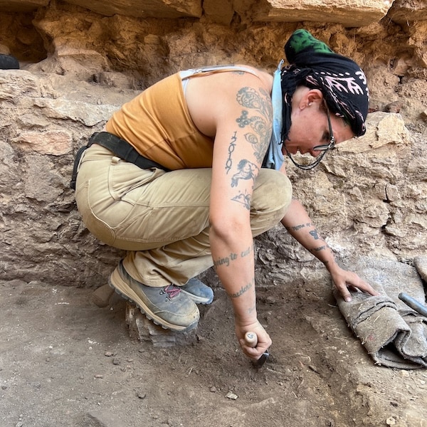
Me, perched on a rock digging in an area precariously peppered with finds. A great way to avoid artifact breakage!

In the summer of 2022, I came to Antiochia ad Cragum as an undergrad, looking to fulfill my field school requirement and find out if I had what it took to work in the field of archaeology. I was sent to the small bath to work under the direction of Dr. Leticia Rodriguez, and I had no idea what to expect. It was A LOT of digging, and A LOT of giant rocks, and A LOT of wheelbarrows. In the second week Dr. Rodriguez decided to open up Frigidarium 4 on the westside of the Small Bath and asked for volunteers. Frigidarium 4 was almost entirely full of fill that had washed down the mountainside and into the now roofless room. It looked like an impossible task, and nobody really wanted to start at the beginning again, especially when the trenches that had been opened the previous week were starting to look like something. So naturally, I volunteered. Again, it was nothing but dirt and large rocks which had fallen from the wall or ceiling. It was hot, it was dirty, my legs and arms felt like noodles at the end of the day…and I couldn’t wait to go back.

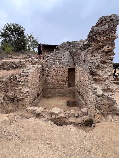
Frigidarium 4 at the end of the 2024 season

What should have taken a couple of weeks to clear and document has now taken us three seasons to uncover, with no sign of a floor at the end of the 2024 season. Since removing surface fill, Frigidarium 4 has yielded many spectacular finds owing to its conversion to a trash pit sometime (we think) in the fifth century. They say you can learn much about a man by going through his trash, and I agree. Everything these people were doing, using, making, participating in, and ultimately discarding have been found in my trench. We have learned so much about what these people were doing and what they found valuable by examining the findings from Frigidarium 4. Detritus from industry, personal items, evidence of what people ate, and the animals they raised – not only for food but for textile production – have all been found in Frigidarium 4, which still has more to tell us.

Digging a sondage in a last-ditch effort to locate the floor before covering Frigidarium 4 up for the off season.

The connection one feels to the people of the past when finding and carefully preserving their once-lost history isn’t easy to put into words, but it keeps me coming back year after year. Every season, we get a little closer to uncovering these peoples’ stories and piecing together the lives of those who were, up until now, forgotten. There is a beauty in unearthing something that once sat in the hands of a person over 1500 years ago, a strange intimacy with someone whose name you can never know and whose face you will never see. Additionally, there is an overwhelming sense of civic duty that comes with uncovering these items and sending them home to a conservation lab or museum where they will find new life. These things belonged to people once, and those people have been forgotten. But with our work in Antiochia ad Cragum, they live again, and the Turkish people reclaim a piece of their heritage that they may not have realized they’d lost.

Ultimately, archaeology is a profoundly human endeavor that contributes to a sense of connection: connection to our past and to each other. A connection that bridges borders, cultures, and time. A connection that I hope, brings us all closer to one another on the most fundamental of levels.

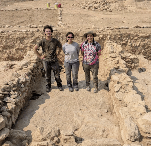
The humans of the Small Bath 2024.

Sarah “Gigi” Konecki-Brazeal is a graduate student at Arizona State University studying Art History, Archaeology, and Studio Art. She is a practicing artist who merges her artistic work with her academic research. In addition to being a trench supervisor and field assistant and Antiochia ad Cragum, Gigi also works as an illustrator and lithic analyst for the Bandafassi Regional Archeological Project. She plans to write her dissertation on ancient tattooing practices and go on to teach at the university level while continuing her fieldwork in Turkey and beyond.

Learn more about the Antiochia ad Cragum Archaeological Research Project here. 

Want to help more students and early career archaeologists get into the field? Donate to the cause today by selecting “Fieldwork Scholarships” as your gift purpose!