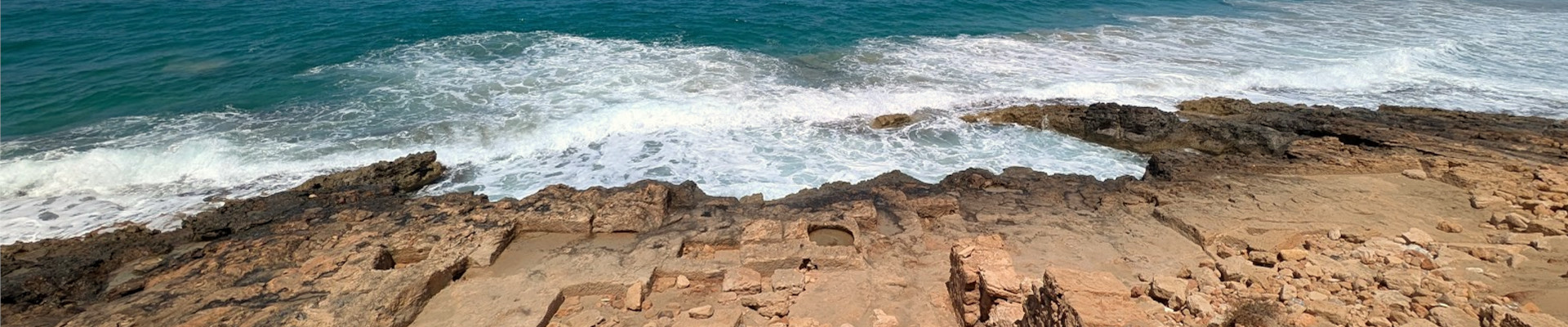
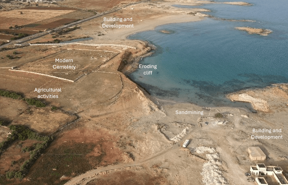
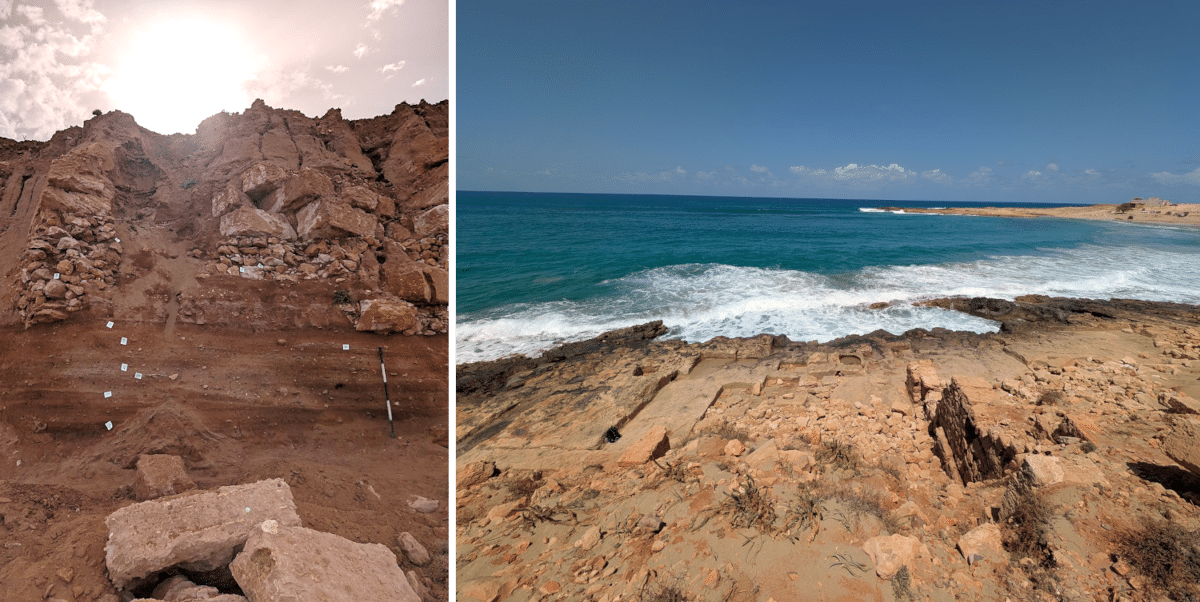
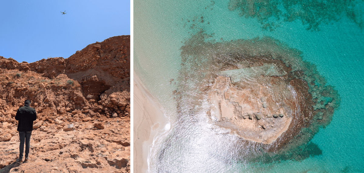
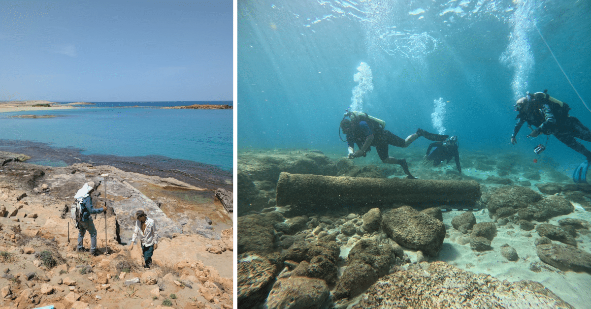
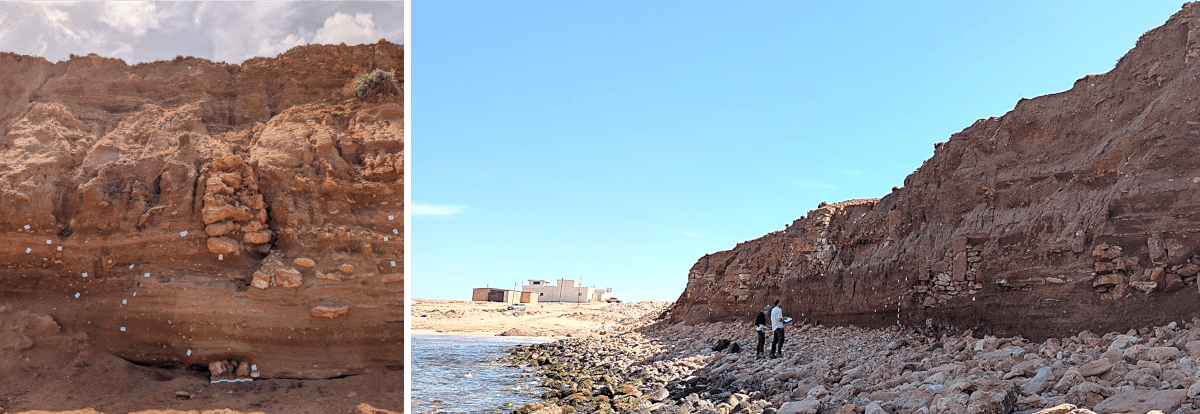
2025 Shepard Urgent Action Grant: The Al Haniyah Emergency Documentation Project
Julia Nikolaus (Ulster University), Nick Ray (Ulster University), Ahmad Emrage (University of Benghazi)
In 2025, with the support of the Shepard Urgent Action Grant, an international team of archaeologists completed a critical emergency documentation project at the endangered site of Al Haniyah (ancient Aptouchus), on the Cyrenaican coast of Libya. This urgent initiative responded to escalating threats from coastal erosion, unregulated agricultural development, and expanding infrastructure—pressures that have already caused widespread and irreversible damage to the site(Figure 1).
Figure 1: Drone image of Aptouchus showing threats and damages to the site.
Aptouchus is a coastal harboursettlement dating to the Greek, Roman, and Late Antique periods. Though modest in size, covering approximately four hectares, the site played an important role in regional maritime activity and trade. Archaeological remains include Roman-period industrial features such as vats, tanks, and large building foundations, as well as domestic structures with plastered walls and finely worked stone masonry. These are now visible along an actively eroding cliff edge (Figure 2). Ceramic finds, including fragments of black-glazed pottery, point to activity as early as the Archaic period. In antiquity, the harbour was naturally sheltered by a rocky outcrop connected to a central islet, creating a protected anchorage for vessels. Today, parts of the ancient settlement lie beneath modern buildings and an Islamic cemetery, adding further complexity to the site’s preservation.
Figure 2: Left - walls protruding from the eroding cliff face; Right - industrial installations and buildings.
During the 2025 field season, a team of specialists from Ulster University (UK), the University of Benghazi (Libya), the Libyan Department of Antiquities, and the Alexandria Centre for Maritime Archaeology & Underwater Cultural Heritage (Egypt), undertook a multi-faceted programme of recording and documentation. The team began with a detailed site survey, identifying and mapping architectural features as well as recently disturbedareas. High-resolution drone photography was used to create 3D digital models of the site and surrounding terrain, including the vulnerable cliff face (Figure 3). These models will serve both as an archival record and as a baseline for monitoring ongoing change.
Figure 3: Left - our drone pilot at work; Right: drone shot of one of the islets with industrial features that formed part of the harbour.
Terrestrial documentationfocused on areas under the most immediate threat, especially where bulldozing had exposed ancient structures. These were recorded using differential GPS and photogrammetry, ensuring accurate spatial documentation. In parallel, a preliminary underwater survey examined submerged archaeological features of the harbour (Figure 4). Several stone blocks and cut features were identified, consistent with ancient maritime use.
Figure 4: Left - DGPS recording of visible architectural features; Right - Underwater survey of harbour area with submerged broken granite column.
A key component of the work involved recording the exposed stratigraphy of the eroding cliff. Here, archaeological layers are visibly collapsing into the sea at an alarming rate. Detailed photographic and written records were made of these sections before they are lost (Figure 5). Pottery recovered from these layers will contribute to establishinga more precise understanding of the site’s chronology.
Figure 5: Recording the visible stratigraphic layer of the 120 m long cliff face.
This emergency project represents a crucial step in preserving the cultural heritage of Aptouchus. It has produced a lasting record of a site under immediate threat and drawn attention to the broader challenges facing Libya’s coastal archaeology. The documentation gathered will not only support future research into the economic and social dynamics of smaller ancient harbours but also underline the importance of protecting vulnerable heritage landscapes across the region.