
INCIDENT REPORT FEATURE: TELL QARQUR
U. S. DEPT. COOPERATION AGREEMENT NUMBER: S-IZ-100-17-CA021
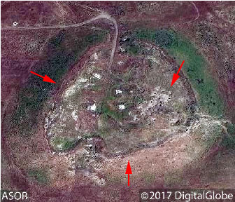
Satellite imagery provides evidence of militarization at Tell Qarqur.
* This report is based on research conducted by the “Safeguarding the Heritage of the Near East Initiative,” funded by the US Department of State. Monthly reports reflect reporting from a variety of sources and may contain unverified material. As such, they should be treated as preliminary and subject to change.

(BBC News – Museum of Lost Objects; March 2, 2016)
One of the most prominent sites in the lower Orontes Valley, Tell Qarqur consists of two mounds (Tell Qarqur al-Kabir and Tell Qarqur al-Seghir), located approximately 500 meters from the modern village of Qarqur. Unique in the region, the site has an almost continuous archaeological record of settlement from the Pre-Pottery Neolithic era (ca. 7500 BCE) through the Mamluk period (ca. 1450 CE) [1]. The first significant period of occupation at the site occurred between approximately 2400–1800 BCE. Structures on the higher mound dating to this period include a temple, an administrative building, and a food processing area. These structures were largely destroyed around 1150.
New occupation during the Iron Age led to another building campaign, including a stone gateway, a fortification system, and domestic structures dating to Iron Age II period (ca. 1000–500) through the Hellenistic era. Later remains include a Late Roman monastery and cemetery on the low mound, a Crusader-period town and fort, and a Mamluk village at the southern base of the mound [2].
In part because of the site’s historic significance, Tell Qarqur was initially targeted for excavations by the American Schools of Oriental Research (ASOR) in the early 1980s. Rudolph Dornemann (ASOR) later directed excavations from 1993–2009, with Jesse Casana (Dartmouth College) directing survey, geophysics, and excavations from 2005–2010. The project is currently jointly sponsored by ASOR and the University of Arkansas. Finds from the site were displayed at the Hama Museum in Hama, Syria, in a new gallery dedicated to the site, funded in part by a grant from the U.S. Department of State.
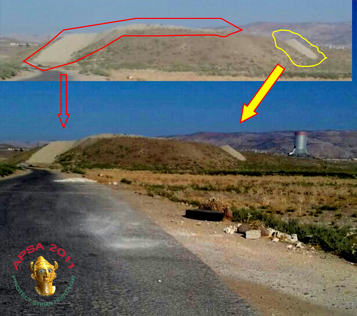
Tell Qarqur al-Seghir was originally militarized in July 2011, reportedly by Syrian regime forces.Evidence of this military occupation, including large bunkers and bulldozer scars, is visible in an image of the mound from September 11, 2012 [3].
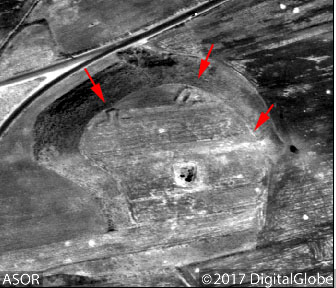
Evidence of bulldozing and bunkers on Tell Qarqur al-Seghir in an image from September 11, 2012.
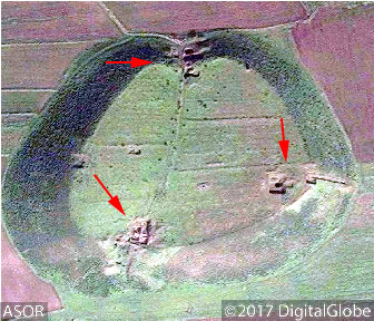
Military installations on Tell Qarqur al-Kabir (January 16, 2013)
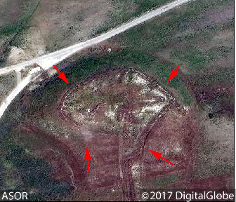
Military installations on Tell Qarqur al-Seghir (April 29, 2016)
