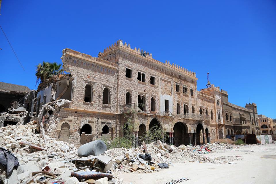


UPDATE: THE OLD CITY OF BENGHAZI
U. S. DEPT. COOPERATION AGREEMENT NUMBER: S-IZ-100-17-CA021
BY Will Raynolds
* This report is based on research conducted by the “Safeguarding the Heritage of the Near East Initiative,” funded by the US Department of State. Monthly reports reflect reporting from a variety of sources and may contain unverified material. As such, they should be treated as preliminary and subject to change.
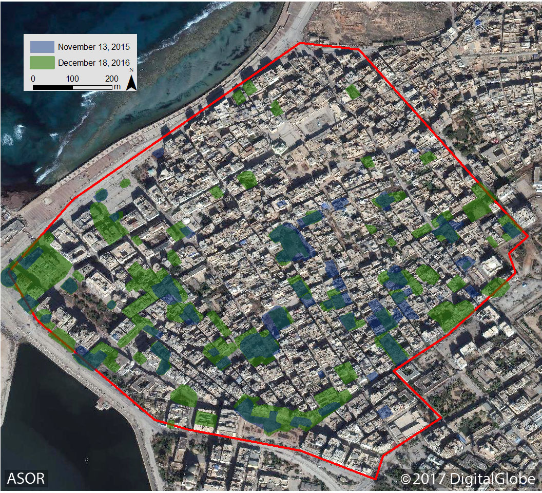
A satellite image displaying areas of damage in the Old City of Benghazi in 2015 and 2016 (DigitalGlobe NextView; November 13, 2015 and December 18, 2016)
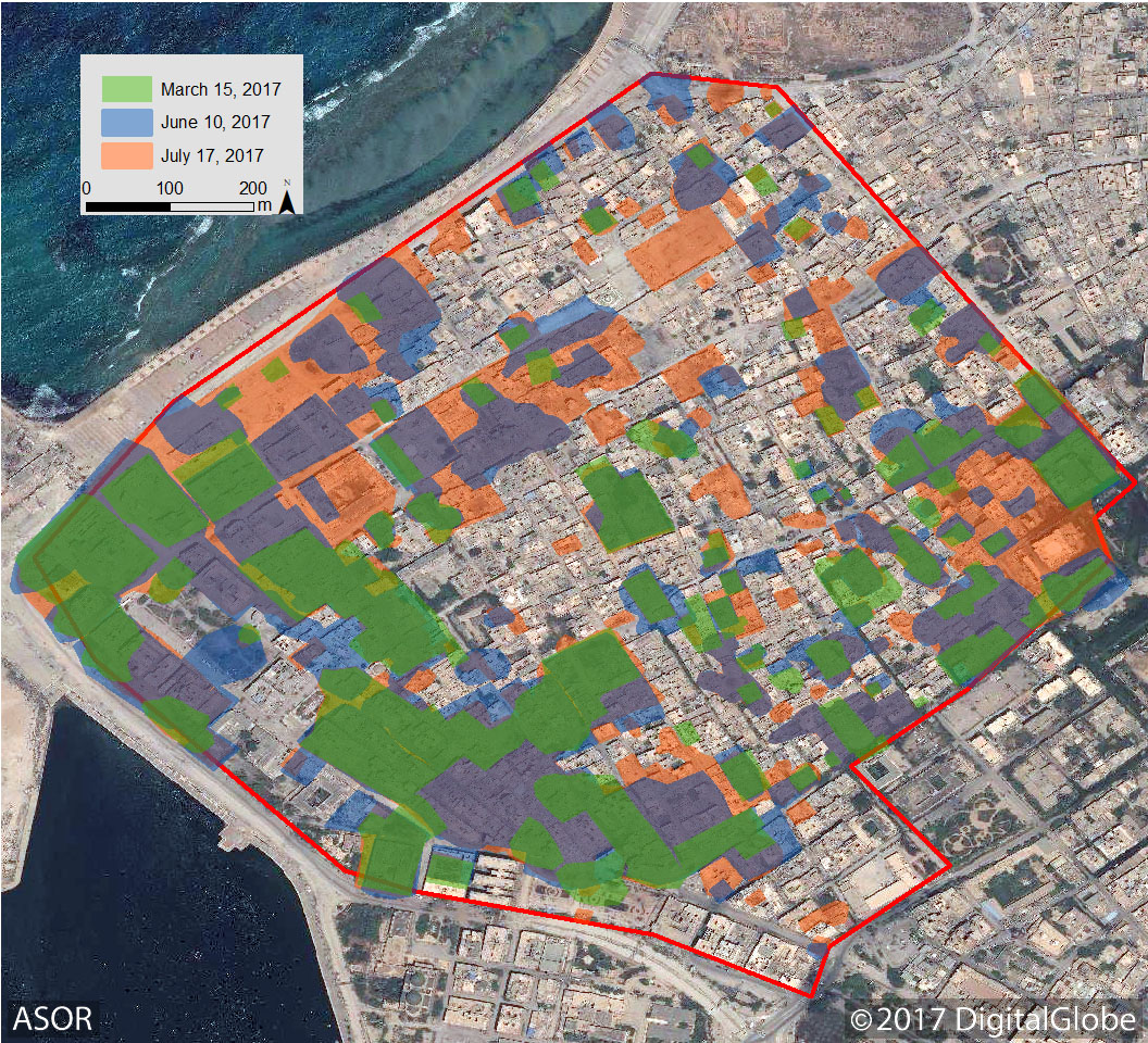
A satellite image displaying increases in infrastructural damage to the Old City of Benghazi between March and July of 2017 (DigitalGlobe NextView; March 15, 2017, June 10, 2017 and July 17, 2017)
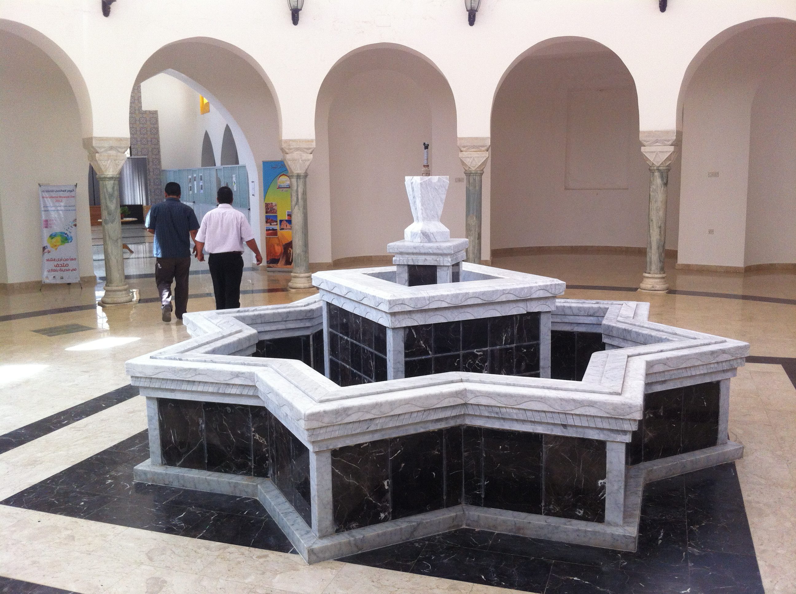
View from inside of the DoA Benghazi headquarters in summer 2013, shortly after the Historic Cities Authority had restored this souq building and turned it over to DoA for their use (Photo: Will Raynolds)
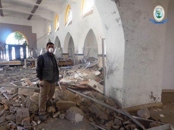
View on July 20, 2017 from the same arched doorway being approached by the two figures in the first photo (Photo: Abdel Hafid al Massalati)
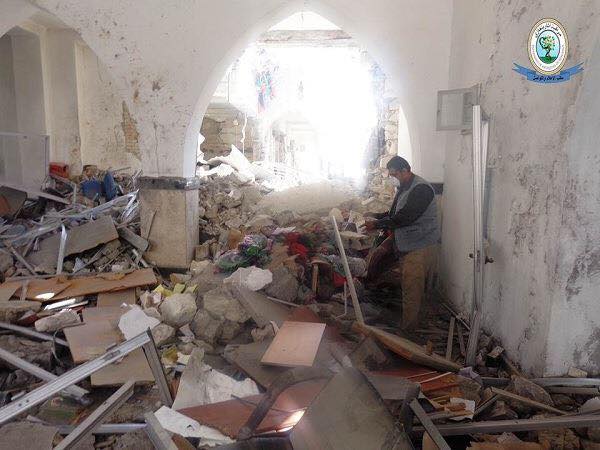
Additional view of the damage to the DoA Benghazi headquarters (Photo: Abdel Hafid al Massalati)
Members of DoA Benghazi were also able to document damage to one of the most important landmarks in the Old City, the Ottoman Municipal Building. It was built in 1872 and later expanded in 1914, during the Italian colonial period.
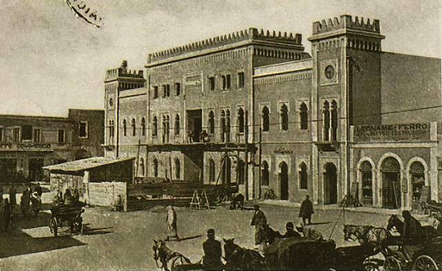
Ottoman Municipal Building in approximately 1914 (Photo: Mohammed Abd al Aziz)
